Heat Warning in effect for Montreal and Ottawa.
An area of showers and strong thunderstorms swept across portions of southern Ontario and Quebec overnight. This was the same system that produced deadly tornadoes over parts of the upper Midwest and northern plains on Friday. The worst of the weather passed to the west of Montreal and into upstate New York overnight. Montreal managed a few millimetres of much needed rainfall, along with plenty of thunder and lightning.
This now sets the stage for our first heatwave of the season, that will likely see high temperatures pushing into the middle 30s for many locations, and combined with elevated humidity levels, will push humidex (real feel) temperatures well over 40C (104F).
An expanding heat dome will produce dangerous heat form the central and southern plains, across the Great Lakes and into Quebec and Ontario. The heat will be dangerous. Highs in Montreal will be close to 30C (86F) Sunday and Wednesday, while Monday and Tuesday will likely be the hottest, with highs of 32C to 35C (90-95F). Overnight lows will provide very little relief, remaining in the middle 20s, perhaps above 27C (80F) in downtown Montreal.
Widespread heat warnings and advisories are posted for the eastern two thirds of North America. Take precautions and avoid strenuous outdoor activity during the most intense heat of the day. Stay hydrated, remain in air conditioned spaces if you can. Check on the elderly and the very young, keep your pets indoors, Remember to be extra careful with pets and children in automobiles, which can become unbearably hot in minutes.
Relief will arrive in the form of a cold front late Wednesday, with showers and thunderstorms and cooler weather by Thursday.
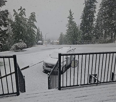
Meanwhile while we swelter in the east, a strong storm produced heavy rain and mountain snow in British Columbia and Alberta. Gusty winds and cold temperatures produced several centimetres of snow across the the highest elevations of the Rockies in southeastern B.C.


No comments:
Post a Comment