Happy New Year....
Snow and more snow! It is no surprise that the month of December will end with a flurry, pardon the term; of snow. The month has seen record snowfall totals for many cities in the east including Ottawa and Montreal - records that were established during the fierce winters of the early 1970's. Ottawa has recorded over 110cm of snow with another 18 hours or so to go.
On that note, Winter Storm Watches and Special Weather Statements have been posted for the region. This mornings snow will taper off shortly after depositing around 5-8cm on the area. A more potent storm is expected to cross the lower lakes tonight and redevelop along the New England Coast Tuesday. Snow at times heavy will develop across all regions tonight and end late Tuesday. A good 10-15cm is forecast with a possibility of more south of the area into New York. Windy weather will cause blowing snow and usher in frigid temperatures by Wednesday morning. The watches may be upgraded to warnings so check the links at the left often today and listen to local radio or TV if you are planning to travel tonight or Tuesday.
Monday, December 31, 2007
Sunday, December 30, 2007

Parade of Storms
to our east
Happy New Year....
A steady supply of winter storms will continue to affect the east coast of Canada and the US with heavy precipitation. Some parts of Newfoundland will have close to 100cm by Wednesday night. Kemptville and the St. Lawrence Valley will remain on the western edge of the storm track with 10-15cm expected in two shots between tonight and New Years night Tuesday. The first shot of snow will develop tonight and taper to flurries before noon Monday. The second batch will start early Tuesday and taper to flurries late in the day.
Snow Advisories have been posted for New England and New York, but our snow totals should remain below warning criteria. Temperatures will turn much colder from the middle to late part of the week. The cold will be short lived but I will save that news for another post.
The important thing to remember when travelling the next several days will be the very changeable weather. Expect snow covered roads and some reduced visibility in heavier bursts of snow, especially along the 401 and southeast into the US.
Friday, December 28, 2007
More snow tonight
Another round of steady wet snow and rain is on tap for Friday night across Ontario and into western Quebec. The snow should begin in eastern Ontario late today and dump between 5-15cm. The heavier amounts will occur across higher elevations and towards the Ottawa Valley. Low pressure is expected to slide from the lower Mississippi Valley into the Great Lakes and eventually Quebec by noon Saturday. Last nights storm put down between 5-10cm of snow on the region.
The precipitation will be followed by a mild Saturday and Sunday before more snow moves in for Monday and New Years Day. Some rain may mix with tonight's snow along the 401 corridor. This will lower snow totals greatly.
Canada's Top ten weather Stories of 2007 are out
by Environment Canada. You can find them at
Thursday, December 27, 2007
 Fast moving weather pattern
A series of fast moving but somewhat potent weather systems is poised to affect the area for the next several days leading up to New Years Eve. The first is crossing our region today with a period of steady snow. From 5-15cm is expected across the Ottawa Valley and eastern Ontario till midnight or so. The snow is falling now and roads have become slippery and snow covered in most cases. Patchy freezing rain is also occurring along the 401 corridor.
The next system will arrive late in the day Friday and deposit another 10-15cm of snow in our region. The final system in the trio will arrive Monday just in time for New Years Eve. This one may have a little more energy associated with it and we will have to watch it closely.
Sunday, December 23, 2007
Flash Freeze Warning
After a very mild day across Ontario and Quebec a powerful cold front is crossing the area. Temperatures are plummeting and are expected to fall to -4C by morning from highs of plus 5 to 7C. Roadways across southern Ontario are freezing up. Accompanying the drop is strong winds from the SW at 50-80km/h. A gust to 90km/h was recorded at Port Colborne in the last hour. Kemptville is plus 5 while Kingston is -2 and snowing at 9pm.
High Wind Warnings are posted for the entire region with Flash Freeze Warnings for Ontario. Travel with great care tonight or delay till tomorrow.
Friday, December 21, 2007

Here comes the rain
While I believe our white Christmas is not in jeopardy plenty of rain and warmth is on the way for this weekend. A warm front will lift north of the area on Saturday setting the stage for strong southerly winds and some showers. Temperatures are expected to soar to the plus 5 to 9C range across the area by mid-morning Sunday. After that a strong cold front will push through the area late Sunday with a rapid temperature drop and heavy rain along the front. Any leftover precipitation will change to snow Sunday night and then taper to flurries. Icing of roads is possible Sunday night. Winds along and ahead of the front Sunday will be very strong out of the southwest up to 70km/h possible.
We can expect between 15-30mm of rain across our area with the potential for rapid snowmelt. I like to call it the Hair Dryer effect when strong south winds are blowing ahead of a cold front. Needless to say it is important that you clear rain gutters and sewers and perhaps take any snow SAFELY off your roof.
Beyond that Christmas looks seasonable with flurries, highs will be around -3 or -5C. Around the Great Lakes, on both sides of the border, there is the chance of lake effect snow Sunday night and Monday. Keep this in mind in your travels.
Thank you so much for reading this Blog all year long. I have had over 300 hits in the last week alone and it means so much to me. Be safe and have a Merry Christmas. And please be good to each other and slow down!
Wednesday, December 19, 2007
A change in the weather patterns
We are about to see some major changes in the weather pattern across eastern North America. It will become milder into the start of the New Year. First however we are in store for more snow. A clipper system moving from the central Great Lakes will bring 5-10cm of snow to most of the region with closer to 12cm east of Cornwall. Snow Advisories are in place for northern Vermont and NY. On the weekend another storm system will approach the lakes again and this time move west of our area. This will place our region in the warm sector eventually. Any snow or freezing rain will begin late Saturday and change to rain into Sunday.
It will be very mild from 4-6C on the weekend. It will cool again for Christmas with some flurries. I will post updates as the forecast becomes more clear.
Monday, December 17, 2007
Record Storm moves east
The massive winter storm that moved through Ontario yesterday is well east of our area this morning. It dumped an incredible 24 hour snowfall on the area including 50cm at Cornwall, 40cm at Kemptville and 37cm at Ottawa. Montreal had 30cm but it is still snowing and Toronto 18-25cm. Numerous flights are cancelled at Ottawa Airport still and school buses in the city are cancelled as well. There is no place to park downtown so leave your car at home if you can. Be safe on narrow streets as well.
One final note on the storm, it was well forecasted from start to end. That being said we may have another one planned for next weekend, but dig yourself out of this one first.
Once again praise to the crews that are working 24/7 to ensure our safety. In a month that has recorded almost 100cm of snow or more in some cases, that has been no easy task.
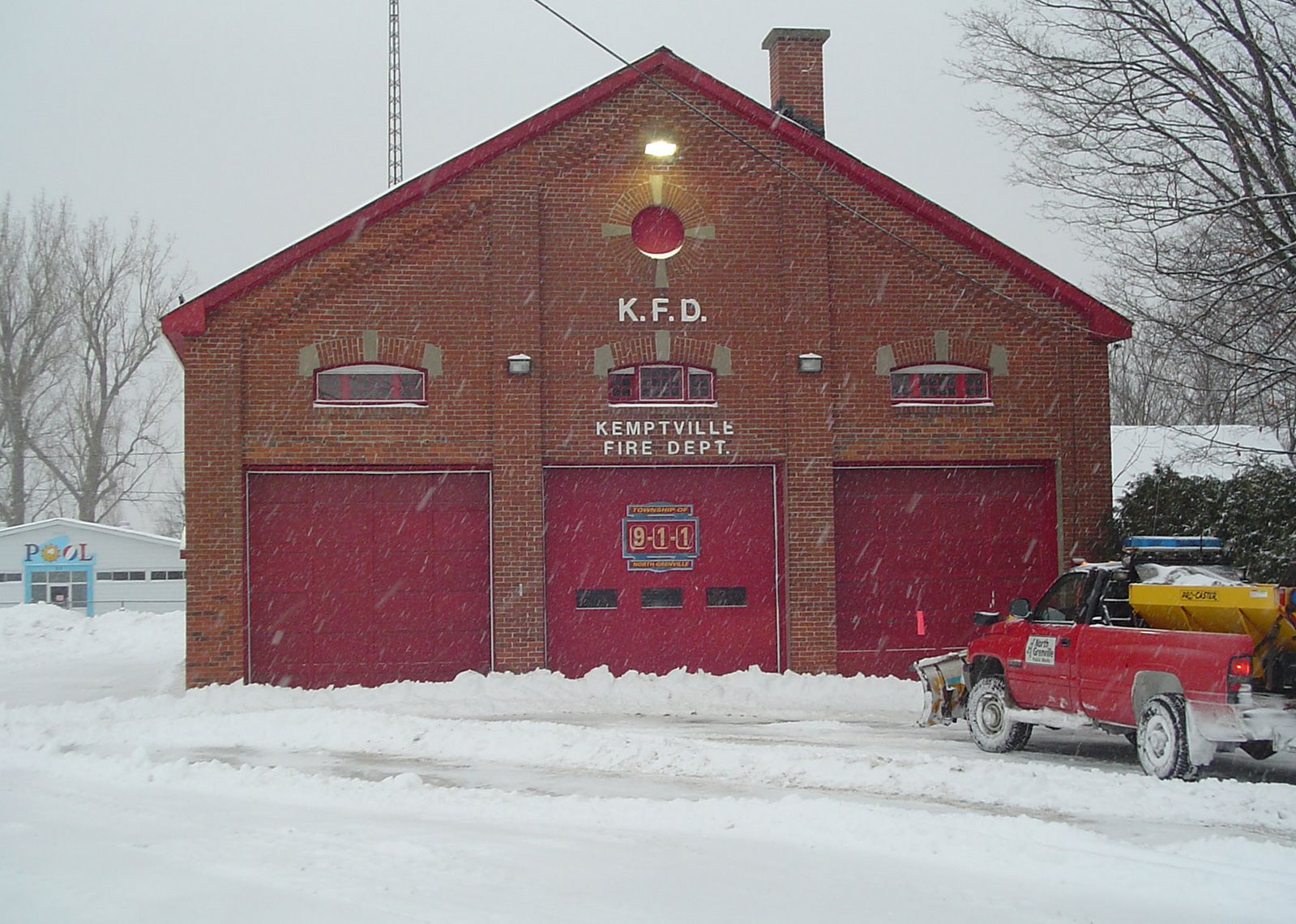
Sunday, December 16, 2007
 4pm in Kemptville, ON.
33cm and counting...
Heavy snow and near zero visibility continues across the National Capital Region and North Grenville as a fierce winter storm hammers the area. 29cm has fallen in Ottawa, 32cm in Cornwall and 26cm in Toronto, strong winds continue to blow it all around and temperatures have been very cold with windchills approaching -25C. The snow is expected to continue for another 6 hours or so with 10-15cm more expected. Winds will be in the 40-60km/h range.
Travel is slow, but the plows continue to stay ahead of the storm. Some thunder and lightning has also been observed with the storm. Winter Storm Warnings remain posted for all areas for tonight. Only emergency travel is advised. 6000 customers in the Winchester area were without power but Hydro One had since restored service.

20cm and counting
Kemptville 1:30PM
We have surpassed 20cm in Kemptville at this hour and it continues to snow heavily with another 15cm expected. Winds are gusting to 35km/h in Kemptville and up close to 60km/h in Ottawa. Travel is not recommended on the 43, 416, 417 or 401. The OPP have reported near zero visibility on area highways, and travel is very poor.
The heavy snow has been accompanied by thunder and lightning in many areas including Montreal. Low pressure over Ohio will slide to the Atlantic coast today while intensifying. The snow and blowing snow will continue into the evening before diminishing. Total snowfall will be around 40cm.
This is Montreal Trudeau International...
http://www.admtl.com/passager/services_aeriens/flightInformation.aspx most flights are delayed or cancelled at this hour.

Kudos to the North Grenville public works....
8:45AM Update....
Very heavy snow is falling in Kemptville at the moment with visibility less than 1km. Winds are gusting to 30km/h causing blowing and drifting snow. Plowing operations are underway but with the heavy snow it may be difficult to keep up with the storm.
A few indicators are suggesting a little less in the final snowfall totals. This is typical with major storms where "dry slots" can work into the center of the system and lower totals. I still feel our area will have the heaviest accumulations in the 30-50cm range but surrounding areas may be lower. We will have to let the storm play itself out today. Needless to say it is a nasty to impossible travel day in the area.
 Kemptville at 7am...
Storm begins
The snow has started across all regions this morning with the heaviest snow just working its way into Kemptville. The snow will become very heavy with bursts of between 2-5cm per hour expected. Thunder has been reported in southwestern Ontario and Michigan so it is not out of the question. Several centimetres has already fallen here and winds are gusting to 30km/h blowing it around and making the -15C seem much colder. Visibilities are down already to 2km at Montreal, 1km at Ottawa and 0.8km at Toronto. Travel is not advised today by the OPP. There is a statement from Environment Canada at this link, that says it all
http://www.weatheroffice.gc.ca/warnings/report_e.html?onrm90
The snow should remain quite intense through mid afternoon with visibilities often down to less than 1km in heavy snow and blowing snow. Winds will increase to 40-60km/h and gust to 80km/h along the St Lawrence River. Total snow amounts by the end of the storm I believe will be between 30-50cm.
Saturday, December 15, 2007
Snow moves in overnight
OPP advise not to travel 401 as 60cm possible
A massive winter storm is on our doorstep at this hour. The snow will begin in Kemptville and eastern Ontario close to daybreak Sunday and spread north and east. It will rapidly become heavy and a record breaking snowfall is forecast. Environment Canada and the National Weather Service forecasters are calling for 40-60cm of snow in our area. It will fall fast and be blown around by very strong winds up to 80km/h. ALL travel should be avoided tomorrow.
It is possible that thunder will accompany the heavy bursts of snow at times. The entire area on both sides of the border is under a Winter Storm Warning. There are no easy places to travel tomorrow and I expect air travel will be greatly affected in most eastern cities from Chicago to New York to Montreal, Ottawa and Toronto. If this storm occurs as forecast it will be the most snow I have seen since the Blizzard of 1971 in Montreal that dropped 47cm in 24 hours. Stay tuned as this historic weather event continues to unfold. The links on the left are active and contain up to the minute conditions, warnings and radar.
Remember do not travel Sunday.
Storm could be historic in places
Winter Storm Warnings Posted...
Catchy title, it should be. Numerous indicators are suggesting one of the biggest storms in recent years. Computer models are showing between 30-50cm of snow for eastern Ontario and Western Quebec. Winds will be a factor as well gusting between 40-70km/h and even as high as 80km/h along the north shore of Lake Ontario. The snow will nudge into Eastern Ontario overnight tonight and last till late Sunday. It will be a very dry snow and easily blown around. There are even some suggestions that a lightning strike or rumble of thunder is not out of the question in the heaviest snow bands.
It is essential that you cancel travel plans tomorrow across Ontario, Quebec and New York/New England on Sunday. The most recent forecast path has the storm moving across southern New England, and introducing a little warm air in places along the St. Lawrence River with some sleet mixing in. Sleet could lower the snow totals.
I will post the next update close to 5pm and again around 11pm tonight
Friday, December 14, 2007
BIG Winter storm on the way
Winter Storm Watches and Warnings are flying across the entire region tonight as a potent storm takes place over Texas. The storm is expected to move towards Lake Ontario and spawn a second low pressure area along the Atlantic coast. With all the parameters in place including a powerful jet stream, it appears we are in for a doozie of a storm. Snow totals are forecast to be in the 25-50cm range across the entire area with 25 plus cm in Kemptville. In addition to the snow, winds are expected to gust between 40-70km/h on Sunday night. Temperatures will be very cold during the event and the snow will be dry and easily blown around.
Numerous agencies on both sides of the border are not recommending any travel Sunday and Sunday night. The snow is expected to begin in the pre-dawn hours Sunday.
Tonight gusty northwest winds have iced up roads, caused blowing snow and dropped the temperature in Kemptville from plus 1C at 2pm to -11C at 7pm.

Major storm for
Ontario & Quebec this weekend
Making plans this weekend? Have them completed by Saturday night because Sunday will be a stay at home day. A major winter storm is taking shape in the southern US plains with all the ingredients present for a powerful east coast storm. The low pressure will develop today over Texas and move to Pittsburgh by midday Saturday. A secondary low will develop along the middle Atlantic coast and become a strong Nor'Easter on Sunday. The combination of these two low pressure areas will produce heavy snow across all of eastern Ontario and Quebec, New England and New York and Atlantic Canada. Current indications suggest 25cm or 10 inches for all areas. Maybe even more here in the east. With the snow will be cold temperatures and gusty winds over 30km/h.
Winter Storm Watches are already in place for New York State and parts of Ontario. I expect these to be extended into our area by tonight or early Saturday.
Again tomorrow is the day for travel....Sunday will be a NO TRAVEL day.
Wednesday, December 12, 2007
 Active weather pattern
 The very active weather of the past week will continue into the weekend. A frontal system just south of the Great Lakes has been the axis for several winter storms. The latest storm dumped about 12cm of wet snow on Kemptville overnight. We now have around 20cm on the ground from the storms of the last three weeks. Another shot of light snow is possible tomorrow afternoon.
We then have to turn our attention to a potential major storm for the weekend. Low pressure is expected to take shape over Texas on the weekend and race towards the middle Atlantic sates. it will then move up the eastern seaboard towards Atlantic Canada and become very intense. It is way out there in weather world, but it could affect eastern Ontario. If it does, we would be on the extreme western edge of the storm and could expect no more than 15cm. But it is too far out to get into details. Stay tuned.
A couple of parting notes:
• Post Tropical Storm Olga is affecting the Caribbean and is expected to cross Cuba with heavy rains.
• The ice storm in the Midwest US had now been blamed for 24 deaths. Hard hit Oklahoma still has 600,000 residents without power.
Tuesday, December 11, 2007
10-15cm for North Grenville
The snow has started over eastern Ontario at 2pm and should continue until about midnight. We can expect between 10-15cm of snow in Kemptville. While Environment Canada has not issued any warnings, the driving should still be nasty. Roads are already snow covered and slippery. To the southwest over Lake Ontario, some rain and freezing rain is mixing in as well. Winter Weather Advisories are in effect for upstate New York and a Special Weather Statement has been issued for our region.
http://www.weatheroffice.gc.ca/warnings/SWS_bulletins_e.html?prov=on
Monday, December 10, 2007
 AP photo of ice storm across the US Midwest yesterday. 6 deaths were reported with hundreds of flights cancelled at airports in Chicago.
More snow!
It will be a very unsettled week in the region with snow Tuesday afternoon till midnight from an Alberta Clipper and then again on Thursday. The system on Tuesday will bring 5-10cm to the valleys with as much as 15cm over higher terrain. The system later in the week may be a little more intense, but it will also have warmer air with it so freezing precipitation is possible. I will post updates on that later.
Our first concern is the 5-10cm falling tomorrow between 1pm and midnight in the region.
Plan your travel accordingly.
Thursday, December 06, 2007


Wednesday, December 05, 2007
Snow everywhere!


The snow finally stopped this morning in Kemptville
after about 36 hours or so. Around 27cm fell in all.
The roads are improving today thanks to the
hard work of North Grenville Township and
Leeds & Grenville County employees.
As you can see by the bottom picture of our work truck, which
I have to clean out, there is still mounds of it left.
Monday, December 03, 2007
 The North Grenville Public Works Department were kept busy today.
Storm Update...
Snow continues to fall across North Grenville and east into Montreal. The snow should taper off overnight with just a few more centimetres expected in our area.
Here are some preliminary totals:
Kemptville: 20cm
Ottawa: 25cm
Montreal: 30cm
I will have more totals and an update tomorrow morning.
The main storm center has slid into western Quebec. A very low barometric pressure reading of 993 millibars was recorded in Kemptville at 8am today when the center of the low was just south of us in Upstate New York. It began to loose strength shortly after that. Roads remain snow covered and slippery, and 30km/h northwest winds are causing some blowing snow.
Sleet and snow dump 10cm on Kemptville so far
ALL Buses cancelled for Lanark, Leeds & Grenville
The snow and sleet started in Kemptville around 10pm last night. As I expected the heavy compacting sleet kept snow totals down, but we have an impressive 10cm on the ground. It would be more in the 15cm range had the sleet not occurred. Most weather offices on both sides of the border are scaling back on the forecast snow amounts as the main low begins to transition its energy to a developing storm on the east coast. A good bet is 15-25cm by the end of the day for all areas.
Blah bah blah what this all means is that the heaviest snow for Kemptville is past for the moment. It will remain quite heavy in Ottawa and Montreal for several hours still. Another swath of snow will accompany the back side of the storm as it moves through later today. The winds will also become a factor increasing from the northwest and gusting to 50km/h.
In addition snow squalls will develop around the lakes and some of these could affect eastern Ontario with brief bursts of heavy snow. To summarize it is not the end of the world, but it will be a nasty day on the roads, with gusty winds, varying degrees of snow falling from Kemptville in all directions and snow covered roads.
ALL school buses have been cancelled for Lanark, Leeds & Grenville, Ottawa and SD&G.
Sunday, December 02, 2007
7pm Storm Update...
Winter Storm Warnings remain posted for Eastern Ontario, including Lanark, Leeds & Grenville, the Ottawa Capital District and Stormont Dundas & Glengarry counties. Warnings are also in effect for southern Quebec. Heavy snow and blowing snow is on our doorstep as the bulk of the low pressure area begins to slide east across upstate NY. Areas along the north shore of Lake Ontario and Erie will expect freezing rain and rain tonight before changing back to flurries Monday.
In Kemptville today we have had only flurries north of the warm front extending from the main storm center. Snowfall amounts by the end of the storm will be close to 35cm in Montreal and Ottawa with less - around 20cm in Kemptville and along the Seaway due to mixing of freezing rain. In all areas winds will be 30-50km/h out of the east tonight and then back around to the northwest 30-60km/h on Monday.
Travel will be very poor Monday so allow extra time in all our forecast regions OR delay your plans to Tuesday when conditions should improve greatly.
The next update will be later this evening followed by a complete update by 6am Monday morning...
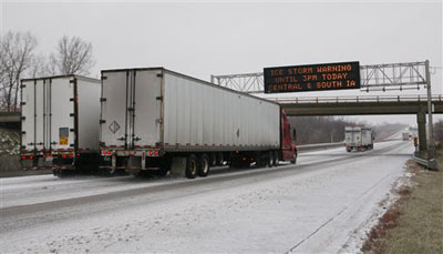 Iowa interstate on Saturday
Travel very poor in Ontario
The winter storm has now begun over most of southern and eastern Ontario and will slide into Quebec later today. It is not snowing yet in Kemptville at this hour. Winter Storm Warnings are in effect for all of Eastern Ontario, Southern Quebec and upstate New York. Forecast amounts through Sunday night will be in the 5-10cm range in our area with 20-30cm by evening Monday. I believe the amount in Kemptville will be around 20cm with several hours of sleet mixing in to bring down the snow totals.
Winds will be a factor as well gusting between 30-50km/h first from the east and then backing to the northwest on Monday. They may even gust to 70km/h along the Great Lakes and Seaway on Monday.
Needless to say all this will make for very slow and poor travel today and Monday. If you can do so delay travel plans in eastern Ontario and southern Quebec today. The storm has already slowed travel across the US Midwest from Nebraska north into Minnesota and east across Michigan and into Southern Ontario. The snow will change to rain south of a line from Kingston to Windsor today.
Saturday, December 01, 2007
Winter Storm Warning
A major winter storm is on tap for our area on Sunday and Monday. A strong low pressure area will move from Kansas towards the Great Lakes tonight and east across New York State on Sunday. This system will result in heavy snow overspreading the area Sunday from west to east. Some mixing of sleet or freezing rain may occur late Sunday. By the time precipitation ends on Monday close to 30cm of snow and sleet is expected in Montreal, Ottawa and close to 25cm in Kemptville.
Winter Storm Watches have been posted for Kemptville, with a Heavy Snow Warning for Montreal. All areas of New York and Vermont are under warnings as is southern and western Ontario. Travel is not recommended tomorrow afternoon and night along the 401 and 416 corridors as well as southwest Quebec highways.
Next update by 8am Sunday....
The much talked about winter storm is on our radar this Saturday morning. Today is a great day to get everything done you need to do. Tomorrow will be a very different story across Ontario and New York and into Quebec by Monday. A Colorado low is developing and is expected to move towards Toronto by late Sunday. Very cold air is in place across Eastern Ontario and Quebec this morning. This cold air will not be displaced easily. It appears that precipitation from the storm will begin overrunning the area after lunch on Sunday. The snow will become heavy and last into Monday. While 10cm is the official forecast, 25cm or 10 inches is not out of the question for Kemptville and Montreal.Winter Storm Update
Issued 8AM Saturday December 1
Winter Storm Watches are in effect for southern Ontario and all of New York and Vermont. They will be extended later today into eastern Ontario as the track of the storm becomes more defined.
The next update will be around 4pm today....The links at the left are always active. If the link is red or "severe" a warning is in place, click on the link to read the warning.
Friday, November 30, 2007
 Prescott Street in Kemptville this afternoon at about 2pm.
Snow and more snow....
Icy roads today have led to several accidents in the area. Kemptville Fire Department has responded to at least 2 roll overs and roads remain icy. We had a snow squall move through about one hour ago and it dumped several centimetres of snow.
The next system is expected to move in late Saturday. Winter Storm Watches have been posted for southwestern Ontario, and I expect them to be extended eastward into our area tomorrow. The snow will be steady Sunday with over 10cm expected.

BIG Snowstorm on tap for Sunday
Deepening low pressure is expected to develop in the US southwest and head for Toronto by late Sunday. Very cold air will remain in place in Ottawa and Montreal and set the stage for steady snow and some freezing rain Sunday into Monday morning. While it is very early in the forecast we can expect at least 10cm of snow and maybe as much as 20cm.
Today an Arctic front will sweep the region ushering in cold air with strong gusty winds and around 5cm of snow. Wind warnings are in place for NY State as well as the shores of Lake Erie and Ontario.
Last night isolated squalls produced only flurries in Kemptville but dumped a band of over 5cm of fluffy snow from Merrickville south. The photo above is plowing in Merrickville this morning.
I will update the storm situation at around 4pm today and again often this weekend so visit us again soon and as always the links along the left side of the page are current.
Thursday, November 29, 2007
Weekend Update
I was hoping the weekend forecast would be a simple one. It looked like the storm that was poised to sweep the area was going to be a cold weather event with snow and nothing else. As more computer models are run, warm air is being introduced to the storm. This always complicates the forecast by developing a snow/rain line usually very close to Kemptville and the Seaway.
So...here goes. First today. Windy, in a word. A cold front is moving through the area with gusty winds from 50-70km/h and some snow today. I don't expect more than a cm or 2 at best. Another front will sweep the area late Friday with more flurries and gusty winds. Saturday is fair, the ideal go out and shop day. Sunday will see snow developing and mixing with freezing rain. That is far as I will go today. More updates soon. Plan on poor weather Sunday.
Be kind to each other today!
Wednesday, November 28, 2007
Fast changing weather pattern
Expect many changes over the next few days in Kemptville and the Ontario/Quebec region. A series of fast moving storms and fronts will provide a range of precipitation from snow to rain and everything in between. Most of today will be dry. Snow will begin late tonight and mix with rain by morning. A few centimetres is expected. Tomorrow we can expect the showers to turn back to flurries late in the day as a cold front moves through the area again. Keep in mind regardless of the precipitation type, roads will be slick. The ground is now in the process of freezing and ices up quickly.
Beyond that a major storm may affect us late in the weekend, Sunday into Monday. I will post updates on this as we move closer to the event.
Yesterday's front dropped about 3cm on Kemptville. Southwest of us in the Toronto area and north along the 400, squalls created white out conditions resulting in two fatal accidents. Winds gusted from 70-100km/h along the front in that area. Remember that at this time of year and indeed all winter, the weather changes quickly around the lakes. Be ready for these rapid changes in road conditions.
Tuesday, November 27, 2007
Special weather statement issued for regions of southern Saskatchewan by Environment Canada at 8:51 AM CST Tuesday 27 November 2007.
Special weather statement issued for: City of Regina - Fort Qu'Appelle - Indian Head - Lumsden - Pilot Butte - Moosomin - Grenfell - Kipling - Wawota - Carlyle - Oxbow - Carnduff - Bienfait - Stoughton - Estevan - Weyburn - Radville - Milestone - Outlook - Watrous - Hanley - Imperial - Dinsmore - Moose Jaw - Pense - Central Butte - Craik - Assiniboia - Gravelbourg - Coronach - Swift Current - Herbert - Cabri - Kyle - Lucky Lake - Leader - Gull Lake - Shaunavon - Maple Creek - Val Marie - Cypress Hills.
An intense low pressure system will move across southern Saskatchewan today bringing 5 to 10 cm of snow with it. Gusty southeast winds ahead of this system will produce extensive blowing snow causing poor visibilities in open areas. Winds will become strong northwesterly over southwestern portions of the province later this afternoon producing more extensive blowing snow and reduced visibilities.The combination of cold temperatures and brisk winds will produce wind chills near minus 30. Conditions are expected to improve this evening.
Monday, November 26, 2007
 Icy road sign near Lacolle, Quebec this weekend as
 Thursday's freezing rain begins to melt.
More snow tonight
More winter weather is on our doorstep courtesy of a storm system over the Ohio Valley. Steady rain will change to wet snow after midnight tonight and accumulate 5-10cm across eastern Ontario and Upstate NY. The highest amounts will be over higher terrain. Roads will be icy late tonight. Temperatures will cool on gusty winds tomorrow dropping below freezing with more snow expected.
On the Prairies an arctic outbreak is underway with temperatures in the -20's across Saskatchewan and Alberta with flurries and blowing snow. Travel is poor along the Trans Canada Highway through both provinces.
Friday, November 23, 2007
Storm Totals
Here is list of the storm totals from yesterday's first snow. All in all it was a respectable storm for the first of the season. About 1 inch of precipitation fell in varying forms from heavy rain along the Great Lakes to heavy snow in the Ottawa valley and everything else in between. Winds were gusty in the afternoon and it turned much colder. This weekend will warm up with flurries, before more interesting weather in the middle part of next week. Stay tuned!
Franktown, ON 25cm
Lachute, QC 20cm
Cornwall 20cm
Pembroke 20cm
Morrisburg 18cm
Montreal 17cm
Kemptville 15cm (two day total close to 25cm)
Ottawa 11cm
Thursday, November 22, 2007

Over 10cm in Kemptville
Still snowing...
Snow and ice pellets continue across eastern Ontario, west Quebec and upstate New York this morning. About 10cm has fallen in Kemptville with at least another 10cm today. Radar this morning backs this up with more bands of precipitation to our south and west moving into our area. Winds will not be a big factor in Kemptville, but will be along the 401 and in Montreal where they will gust to 50km/h.
The plows have been rolling all night in Kemptville, but roads remain slippery due to the falling precipitation. It will be cold today with temperatures staying below freezing. Care is advised on the roads.
Storm totals will be in the 15-25cm range when all is said and done. All in all an impressive storm for the first one of the season. I will post photos later this morning.
Wednesday, November 21, 2007
Heavy Snow Warning issued for
Kemptville and Eastern Ontario
http://www.weatheroffice.gc.ca/warnings/report_e.html?onrm90
The bulk of the precipitation will begin this evening and become heavy overnight into Thursday morning in our area and spread east into Quebec. Snow and gusty winds causing blowing snow are expected along with dropping temperatures.


About 5cm of snow fell overnight in Kemptville
First Snow of season
Plows are out in and around Kemptville as about 5cm of wet snow fell overnight out in advance of the main storm system. The forecast has changed little from last night. It appears the low will slide south of the region by early Thursday. Light precipitation today will increase in coverage and intensity tonight. It is expected to snow through most of Thursday. Accumulations are expected to be 4-8cm along the St. Lawrence River, 5-10cm in Ottawa and Montreal and 15-30cm in the hills north of Montreal across the Laurentians. Winter Storm Warnings have been posted for those areas. Travel is already slippery this morning, and expect it to remain so into Friday morning.
Tuesday, November 20, 2007
First SNOW alert
The first widespread snow event of the season is expected over eastern Ontario and western Quebec Wednesday night into Thursday. Indications now are that rain and freezing rain during the afternoon late tomorrow night will change over to snow into Thursday morning on gusty northwest winds. Temperatures will fall Thursday and it will be windy with snow. It looks like 5-15cm (2-6 inches) can be expected throughout our area. This forecast will need tweaking as the rain snow line will be very close to the 401 corridor. Travel will be difficult late Wednesday through Friday morning. I will update this blog early tomorrow morning with any watches or warnings for the region. Keep in mind it is Thanksgiving in the US and a very busy travel time.
A special weather statement has been issued at: http://www.weatheroffice.gc.ca/warnings/SWS_bulletins_e.html?prov=on
 Sorry but I have to put my faith behind the green for
 Sunday's 96th Grey Cup. I was part of the
Green Nation for three years...they deserve it!
Storm on tap for Ontario
It looks like the first major snow event of the season is upon us. It is a difficult forecast with indications of a snow rain mix to start. The first storm will move through the area tomorrow with light rain. It will be chilly with highs no more than 4 or 5C. A cold front will sweep through the area late Wednesday with a second storm forming along that front. As the second batch of precipitation moves into the area on Thursday, it should be cold enough to support snow. The amounts are tricky to determine and will depend on the exact time of the changeover. Count on several centimetres of wet snow Thursday in the St. Lawrence and Ottawa Valleys. Travel will be poor. The wind will be very gusty as well.
I will post another update between 5-6pm tonight.
Thursday, November 15, 2007
Snowstorm for Eastern Townships,
Adirondacks and Green Mountains
Prepare for Winter driving....
A fast moving low pressure area and cold front are bringing rain to Eastern Ontario this morning. As the storm reaches the east coast it will intensify tonight. Cold air wrapping around the back edge of the Storm will change rain to snow in all areas tonight. While only flurries are expected in our area, heavy wet snow is expected across higher elevations of New York and Quebec. Up to 30cm of snow may fall by Friday night. In Ontario Lake Effect Snow will occur off Lake Huron and Georgian Bay with over 15cm expected there. If you are travelling in both provinces or New England/New York today expect wet, breezy and changeable weather with dropping temperatures in all area.
Winter Storm Warnings are in effect for the northern Green Mountains and Adirondacks with Snow Advisories across Northern New York. Heavy Snow Warnings are in effect for the Beauce and Townships regions of southern Quebec.
Tuesday, November 13, 2007
High winds sweep Saskatchewan
Low pressure moving across central Saskatchewan has produced an impressive windstorm in the Prairies. The wind in Swift Current, SK has been blowing between 60-100km/h since mid day yesterday and continues! A peak gust of 104km/h was recorded in the last hour there. 100km/h winds were also reported at Moose Jaw and Lucky Lake. Winds will continue to howl from Alberta to Manitoba tonight as the storm slides east. Wind Warnings have been posted. They should diminish from west to east tomorrow.
Low pressure moving across central Saskatchewan has produced an impressive windstorm in the Prairies. The wind in Swift Current, SK has been blowing between 60-100km/h since mid day yesterday and continues! A peak gust of 104km/h was recorded in the last hour there. 100km/h winds were also reported at Moose Jaw and Lucky Lake. Winds will continue to howl from Alberta to Manitoba tonight as the storm slides east. Wind Warnings have been posted. They should diminish from west to east tomorrow.
Monday, November 12, 2007
SNOW hits east coast
I missed the forecast for our area...oops!
I must admit I am often surprised by how accurate I can be at times. It is actually scary. But boy did I miss the forecast for this past weekend and this week. I was expecting cool, breezy and even snowy weather in Ontario and Quebec. The coastal storm that struck the Maritimes and Gaspe just missed us. It meant sunny and very pleasant weather for Montreal and Ottawa. The snow, over 20cm in places, fell well east of our area. It included 21cm at Metro Halifax Airport. There were winds of 75-100km/h for the second weekend in a row. Power outages and dangerous roads were the rule. It looks like this weeks cold and white weather for Ontario will be delayed. But make no mistake it is on the way. I think next week we will see some action. Stay tuned.....
On the west coast, BC is being hammered today by a fierce storm with heavy rain on the coast, snow in the interior and 70-100km/h winds. Power is out to thousands of homes at this hour.
Tuesday, November 06, 2007
Lake Effect snow underway
Bands of Lake Effect snow with thunder and lightning are affecting Georgian Bay, and southern Ontario along with Western New York south of Buffalo. Lake Effect Snow Warnings have been issued for the counties of NY with a Special Weather Statement for Ontario. This afternoon winds are gusting to 80km/h along the north shores of Lake Erie and Ontario at Port Colborne and Point Pelee. Warnings are in effect for those areas.
A cold rain with mixed wet snow and gusty winds will develop tonight along Lake Ontario and in the St. Lawrence Valley and may work its way into North Grenville. It is the time of year that if it is wet treat it like ice...be safe.
Monday, November 05, 2007
 Pounding surf from Noel on Ocracoke Island, North Carolina.
Noel worst Storm this season!
In an ironic twist in what was supposed to be a terrible hurricane season along the east coast, Hurricane Noel, possibly the last of 2007 - became the worst. What makes it ironic was that the storm was seemingly a weak and disorganized system from its onset. And yet the storm managed to kill 168 across the Caribbean, more than his predecessors and then blossom into a powerful extratropical storm that hammered the eastern seaboard from Florida to Newfoundland. Over the weekend the storm sent high seas and 100mph winds along the New England and Maritime coasts. At the height of the storm over 250,000 people were without power in those areas. The coasts were hit hard by storm surge flooding and damage was evident up and down the Nova Scotia coast. In addition to the wind, over 100mm of rain fell in areas and even snow fell on the western flank of the system, as much as 20cm in Northern Maine and western New Brunswick.
Tuesday, October 30, 2007
 Happy Halloween
It looks like Halloween is going to be dry and mild in our area. We are forecasting temperatures around 10C with any wet weather holding off till well after midnight. Be safe and have fun!!!!
Tropical storm Noel is a 40mph storm over northern Cuba today. It is forecast to go through the Bahamas and approach the southeast coast of Florida briefly with heavy rain and seas before racing off to the northeast. Indications are that Nova Scotia and Newfoundland could be affected by a very strong Extratropical storm by the weekend.
Monday, October 29, 2007


Wednesday, October 24, 2007
 Winds ease in California
The fierce Santa Ana winds that have been blowing at hurricane force for the last several days, eased slightly today allowing firefighters to gain a little ground. Wild fires have been burning hundreds of thousands of acres across both San Diego and LA Counties of southern California. Both areas have been declared Federal Disaster areas. Over 9000 firefighters have been fighting a loosing battle, with hundreds of homes and businesses destroyed. Two people have died and over 75 injured. Temperatures in the 90's, no rain for months and the Santa Ana winds created the "perfect storm" for the fires.
Smoke from the fires can be seen below drifting off the California coast

Friday, October 19, 2007
Thunderstorms on the way
Record Highs in Ontario
The mercury has soared to 24C in Kemptville at 11AM this morning and we may approach 27C before the thunderstorms move in. Already storms are developing along the 401 corridor and they will move into our area. The potent low pressure area has a history of severe weather with over 100 tornadoes in the US in the last 48 hours and numerous reports of wind damage.
Watch the sky this afternoon in eastern Ontario and western Quebec and use the links at the left for WARNINGS or WATCHES or tune into local radio.
Thursday, October 18, 2007

Tornado over southern Missouri yeaterday afternoon
Severe Thunderstorms over
Midwest & Gulf Coast
Storms to affect Ontario
A strong Colorado Low is slowly spinning into the Great Lakes at this hour with Heavy rain and fog causing travel delays in Ontario. Heavy rain is expected across Superior, and the Nickel Belt east into the Ottawa Valley. The trailing cold front has been producing a line of severe thunderstorms and tornadoes from Chicago to the Gulf Coast. Yesterday over 250 incidents of severe weather were reported along with two fatalities. Already today heavy thunderstorms produced tornadoes along the Florida Gulf Coast. Hardest hit so far was Pensacola, Fla. where a direct hit by a tornado was observed on a shopping mall and daycare facility. No word on injuries at this time from Sherrifs in Escambia County.
As the cold front slides east it will remain very mild ahead of the front in Ontario and Quebec. Heavy rain and thunderstorms will develop by daybreak Friday and spread east. Some storms may become locally severe in our area with wind and hail being the main threat. Watch for warnings and watches.

Tuesday, October 16, 2007

Frosty start in Kemptville
It was a frosty start to the day in Kemptville and across eastern Ontario. Clear skies allowed the mercury to dip to -1C in Kemptville. I took my traditional first frost photo above. While there has been scattered frost already this season, this was the first time I had to scrape the car. Last year the photo was taken Oct 6. We had a much warmer first week or two this October.
The other photo is the pumpkin patch behind my house. I was waiting for the Great Pumpkin to show, no such luck! Cloud cover and shower activity will keep the threat of frost away for the next several nights.
Monday, October 15, 2007
I'm back!
Greetings readers, sorry for the long absence. I was away in North Carolina for two weeks visiting the beautiful Outer Banks. We had very warm and humid weather for the duration of our trip, more like July. On our way home we even encountered summer like thunderstorms around Albany, NY.
All that went away quickly this weekend in Ontario, as a very fall type air mass took over. It was grey and cool with some showers and even some freezing drizzle in the Ottawa Valley. Frost occured on both Saturday and Sunday mornings. The weather this week will be uneventful. We are expecting fair weather tomorrow with seasonable temperatures followed by a milder but wet period Wednesday through Saturday.
I will post some new weather photos and vacation photos shortly.
Wednesday, September 19, 2007
 Cape Hatteras Light, North Carolina
Awesome late Summer early Fall weather
I love September I really do! This stretch of weather we have now - leading up to the first day of fall, which arrives Sunday, September 23 at 5:55 in the morning will be spectacular. We are expecting temperatures to be in the mid to upper 20's with sunshine right into next week across Ontario, Quebec and New York. Enjoy it!
We are watching with interest a low pressure area off the Florida coast that is producing rough surf and heavy rain from the Carolina's southward. The storm is expected to cross Florida and move into the Gulf of Mexico tomorrow night. Afterwards - most models expect the system to become Tropical Storm Jerry and threaten the Texas and Louisiana coasts by the weekend. Sound familiar?It should, this is eerily similar to Hurricane Humberto last week.
I will be offline for a couple of weeks.....while I will not be writing this blog, the links at the left will remain active for your weather information. Check back often for current weather and watch for any warnings which appear in RED in the forecast boxes.
Thanks for reading, I appreciate your support - slow down and be safe!!!!
Friday, September 14, 2007

Humberto's flooding in Texas
Fall vs Summer
Lots to talk about in the weather...First and foremost I am back among the cyber living. My 7 week ordeal without the Internet at home is over. A big thanks to Cogeco for hooking me up.....I would recommend them highly compared with that other B company that kept me waiting for 6 weeks!
Now the weather......Hurricane Humberto surprised everyone when he rapidly intensified over a 12 hour period from nothing to a Category 1 hurricane. The storm caused severe flooding and wind damage along the upper Texas coast and into Louisiana. It was a very serious situation and showed us just how lethal these storms can be and how quickly they can develop.
Tropical storm Ingrid is way out in the Atlantic with no signs of strengthening, however when we say watch these things we mean watch them.
As we talk about a very summer-like scenario think about the Prairies. It was very cold in southern Saskatchewan this morning with record lows set in Regina at-7.9C (-5.0 1949), Weyburn at -6.6C (-6.0 1993), Moose Jaw -5.5C (-2.4 1999) and Assiniboia -4.2C ( -4.0 1993). Coronach in the southern part of the province was -9.7 the coldest in the province. It was the earliest freeze since 1993. There was also snow flying in the air, enough to measure in Manitoba and northwest Ontario.
Meanwhile the leading edge of that Arctic airmass is moving into southern Ontario and Quebec tonight. Ahead of the system very warm temperatures near 27C are occurring. It will turn windy and colder tonight with showers and thunderstorms. The weekend will be chilly with scattered frost before a warm up next week.
Wednesday, September 12, 2007
 Gabrielle whips sand across NC 12 on the Outer Banks Sunday. AP Photo
Humberto forms in Gulf Of Mexico
TD #9 forms in Atlantic
Tropical storm warnings are flying tonight along the Texas and Louisiana Gulf Coasts as tropical storm Humberto has formed about 70 miles southeast of Galveston Island. The storm is expected to come onshore tonight with gusty winds to 50mph and heavy flooding rains over 10 inches in places. The area has had a soggy summer and unlike North Carolina, does not need anymore rain.
Meanwhile Tropical Depression#9 is expected to strengthen into a tropical storm Ingrid later tonight about 1130 miles east of the Lesser Antilles in the open waters of the Atlantic Ocean. This storm will be closely watched over the next day or two.
Tuesday, September 11, 2007

Sunday, September 09, 2007
Gabrielle on the Carolina coast
Looking a bit disorganized, Tropical Storm Gabrielle has moved inland over extreme eastern North Carolina near Cape Lookout with pounding surf and heavy rains. The weather seems to be confined to the eastern part of the state and along the Outer Banks. A tropical storm warning is in effect from Wilmington northward to Cape Charles, Va. The area is expected to feel the effects of the storm till tomorrow morning. The storm is expected to dump up to 4 inches of rain on the parched state. Most of the heavy thunderstorms are confined to the southeast quadrant of the system. Recently wind gusts to 49 mph were reported in Ocracoke and 45 mph at Cape Hatteras.
I know the area very well and will be down there in a few weeks, maybe chasing storms. Gabrielle should be swept out to sea tomorrow as a cold front moves south and east.
Thursday, September 06, 2007
 Riders of the Storm
Hurricane Hunter aircraft in the eye of Felix
You need to check out this awesome video of a flight by the Hurricane Hunter Aircraft into the eye of Hurricane Felix as a Category 5 before it made landfall in Mexico. http://www.airshowbuzz.com/videos/view.php?v=9f061057
Another worthy note from Hurricane Felix, the flight just prior to the one above was in a NOAA P-3 Orion Hurricane Hunter airplane N42RF (AKA "The Princess"). It had a wild ride in Hurricane Felix on September 2 as it intensified into a Category 5 storm. The airplane hit what the Hurricane Hunters fear most, a powerful updraft followed a few seconds later by an equally powerful downdraft. The resulting extreme turbulence and wind shear likely made the aircraft impossible to control. This very likely pushed the aircraft to its limits. The aircraft commander wisely aborted the mission and returned safely to their base in St. Croix, US Virgin Islands.The airplane was out of commission for the next day, however, the aircraft later passed a detailed six-hour inspection to look for damage, and has been cleared to fly again.
• A Smog Advisory has been issued for Leeds/Grenville in eastern Ontario. Southwest winds are bringing hot, humid and polluted latent air into our area. It was over 30C today with humidex readings well into the 30's. Tomorrow will be evn warmer before a cool down on Friday.
Storm on east coast slow to develop
Surprise nocturnal thunderstorms in North Grenville
The low pressure area southwest of Bermuda this morning has been very slow to develop. Interests along the east coast should continue to be aware of this threat. It is still expected to approach the coast of the Carolina's by Sunday night. In what form is yet to be determined, but expect windy rainy weather from the Outer Banks northward towards Long Island by the end of the weekend.
In local weather- a line of thunderstorms formed unexpectedly overnight. Thunder & lightning and around 5-10mm of rain occurred in Kemptville. We are expecting warm and humid weather today and Friday with highs around 30C (86F).
Wednesday, September 05, 2007
Possible tropical threat for eastern seaboard
A Hurricane Hunter Recon flight is currently underway along the east coast of Florida about 350 miles out at sea. A an area of low pressure is expected to become TD7 and possibly Tropical Storm Gabrielle within the next 24 hours. The storm is then likely to retrograde back towards the coast as high pressure to the northeast blocks its movement. We could be seeing a tropical system moving along the coast from the Outer Banks northeastward towards New England by the weekend. There is still much uncertainty among computer models with many different scenarios as to the track of this potential storm. I will keep a close eye on the system and update the blog tomorrow morning.
A Hurricane Hunter Recon flight is currently underway along the east coast of Florida about 350 miles out at sea. A an area of low pressure is expected to become TD7 and possibly Tropical Storm Gabrielle within the next 24 hours. The storm is then likely to retrograde back towards the coast as high pressure to the northeast blocks its movement. We could be seeing a tropical system moving along the coast from the Outer Banks northeastward towards New England by the weekend. There is still much uncertainty among computer models with many different scenarios as to the track of this potential storm. I will keep a close eye on the system and update the blog tomorrow morning.
Tuesday, September 04, 2007
 Hurricane Felix at Landfall this morning in Central America.
Bits and Bites and a little complaining
Ah where to begin. First and foremost my battle with Bell continues. I have been waiting over a month for delivery of a modem promised to me in one to two business days from Bell Sympatico Internet Service. That was August 6. So far nothing so I am switching to Cogeco, I will let you know how that goes. So my entries have been limited, I apologize.
We have just witnessed a second Category 5 storm of the 2007 season to hit Central America. This is very far south for these storms, they are record breakers. Hurricane Felix followed Dean's path for awhile, but then moved a little more south into Honduras, Nicaragua and Belize. Winds gusted over 165mph as the storm roared inland with a 15-20 foot wall of water. The rain will be a big problem in the mountainous areas - with up to 20 inches of rain possible. Hurricane Mitch in 1998 hit this area with over 10,000 deaths reported mostly from flooding and mudslides. No deaths at this point.
Frost - you heard right frost is expected in the Adirondacks and Green Mountains tonight with lows around 32-37F expected. It will rebound into the 80 plus temperature range by Wednesday. You have to love fall in the north country. It should remain above freezing with no frost in North Grenville and the Seaway tonight.
What a Labour Day Weekend in The Seaway.
This is St. Lawrence Park in Brockville, Ontario this past Sunday.

Wednesday, August 29, 2007
Lines of Severe Thunderstorms hit area
Severe Thunderstorms are moving through Eastern Ontario tonight. Warnings and Watches have been posted for all areas. It was a very muggy day in the province with temperatures in the low thirties and very humid. A cold front is slicing into the muggy air with the result being several waves of storms. I was in west end Ottawa tonight experiencing one of the storms. It was fairly tame with the exception of the lightning, which was amazing. Several cells on radar in the upper Ottawa Valley are approaching severe limits - so more weather is on the way tonight.
Severe Thunderstorms are moving through Eastern Ontario tonight. Warnings and Watches have been posted for all areas. It was a very muggy day in the province with temperatures in the low thirties and very humid. A cold front is slicing into the muggy air with the result being several waves of storms. I was in west end Ottawa tonight experiencing one of the storms. It was fairly tame with the exception of the lightning, which was amazing. Several cells on radar in the upper Ottawa Valley are approaching severe limits - so more weather is on the way tonight.
Wednesday, August 22, 2007

Dean crossing the coast as a Cat 5 yesterday
Dean weakens to Tropical Storm
The remains of Hurricane Dean will ring itself out over the mountains of central Mexico tonight which as much as 20 inches of rain. The rain will produce life threatening mudslides and flooding in the area. The Storm moved onshore for the final time today near Veracruz, Mexico. Meanwhile the Yucatan is recovering and slowly cleaning up from yesterday's brush with the Category 5 storm. Remarkably no deaths were reported so far in Mexico. Jamaica's south coast is cleaning up also with total destruction is some cases. 13 deaths occurred there and also in the Lesser Antilles.
The storm behaved well and was exceptionally forecast by the National Hurricane Center. That, and a quick response by authorities along the track of Dean, prevented a far greater catastrophe. It also helped that the storm skirted islands and made landfall in an area of the Yucatan with little population. Sadly it still managed to destroy many home in and just north of Chetumel, Mexico.
Monday, August 20, 2007
Dean getting stronger
Hurricane Dean is just shy of Category 5 status at this hour. The storm is located about 330 miles east of Belize City in the western Caribbean Sea heading slightly due north of west. The storm is expected to make landfall overnight tonight on the Yucatan south of Cozumel. The storm is then expected to cross the peninsula and emerge into the Gulf of Mexico before approaching Tampico on the Gulf Coast of Mexico Wednesday- possibly as a Category three hurricane. What all this means is that massive evacuations were expected along both coastlines as Dean approaches. Thousands of tourists were boarding planes away from the Yucatan yesterday and today.
It appears that the damage was extensive along the south coast of Jamaica but not as bad as feared. Ten deaths have been blamed on the storm so far. Residents in extreme south Texas near Brownsville were being asked to leave the low lying coastal areas prior to landfall in Mexico as a precaution.
Subscribe to:
Posts (Atom)