Monday, March 30, 2015

Slow start to spring in Montreal & southern Quebec

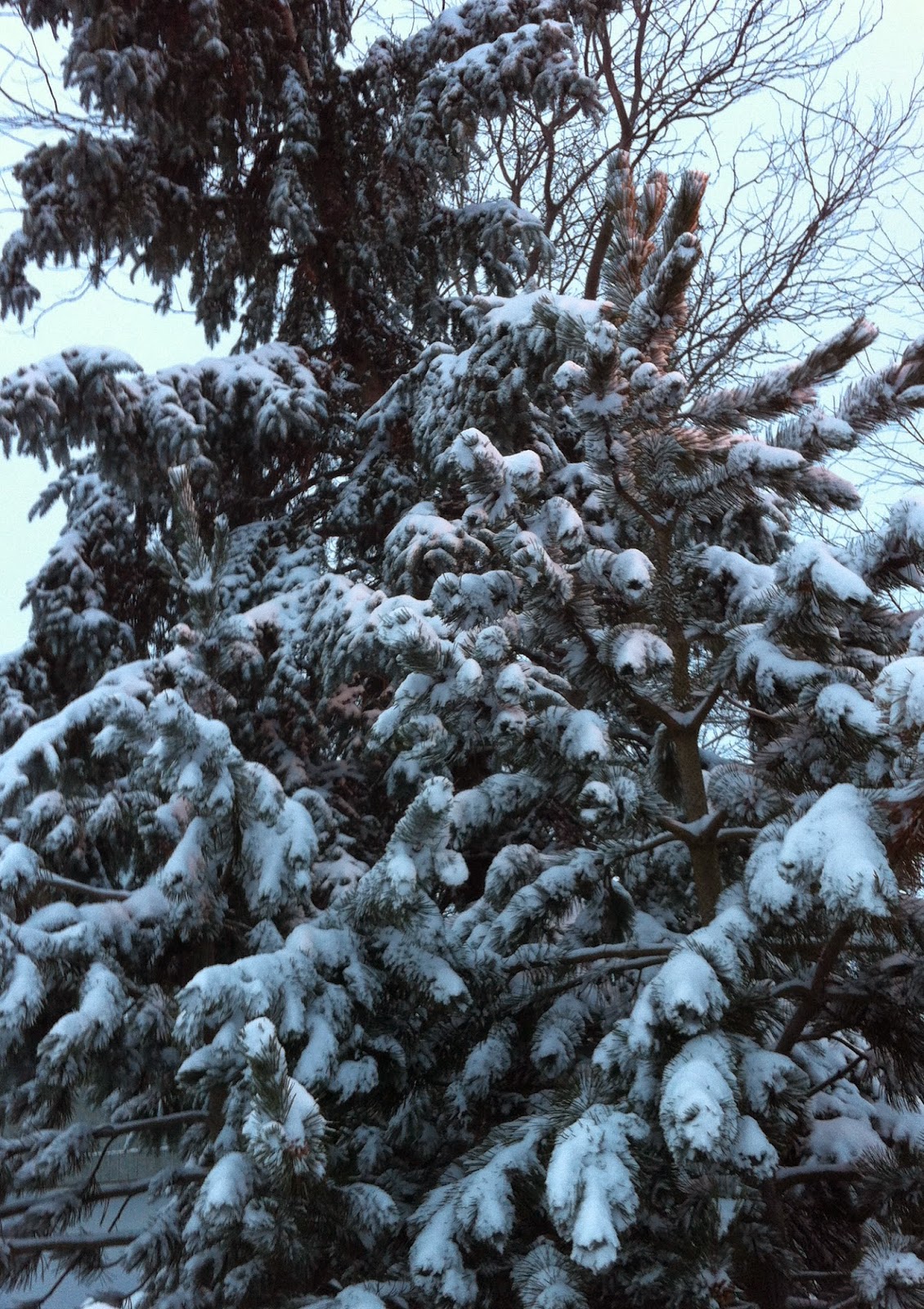
Despite the calender saying spring, more snow fell in Montreal on Monday morning. It just won't warm up this year, leaving us still with piles of dirty snow and ice. (ValleyWX)
 If you think it has been a rather sluggish start to the spring season this year in Montreal, you would be right. Through March 29th, the average temperature at Trudeau Airport has been -5.1C (22F), the normal should be -2C (29F). Our average overnight low has been -10.1C (14F), very cold as compared to the normal low of -6.5C (20F). We have had 15 daily highs remain below the freezing point and 12 overnight lows dropped below -10C (14F) including several days below -20C (-4C). The one high note has been the lack of any major snowstorms, a trend that was established early on in 2015. As I'm writing, Montreal has had close to 30cm of snow for the month, below the normal of 36.2cm. Officially as of this past Sunday there is no snow left on the ground at Trudeau Airport, normally there should be 3-8cm. But unofficially most neighborhoods, especially off island, still have piles of dirty snow around.

So what does the immediate future hold? With the exception of this coming Friday, when we could see a high of plus 10C (50F), it looks like temperatures will remain at or below normal. We have some cold nights ahead of us including tonight when the low should be -7C (19F) with gusty northwest winds to 50km/h. Another round of snow or flurries occurred this morning and we can expect another chance for snow by Saturday. In between, high pressure will build into southern Quebec for a couple of sunny days Tuesday and Wednesday. Temperatures will try to warm up but remain colder that we want for early April heading into Easter weekend.

Friday, March 27, 2015

Earth Hour 2015 - quiet weather weekend


The 2015 edition of Earth Hour is upon us this Saturday, March 28th. The event, organized by the World Wildlife Federation, was first held as a "lights off" event in Sydney, Australia in 2007. Since then Earth Hour has grown to include over 7000 towns and cities around the world including many in southern Quebec. The idea behind the event is to raise awareness to the fragility of the planet. For one hour between 8:30 and 9:30pm local time where you live, you are asked to turn off all non-essential lights as a symbol of your commitment to the planet. Outside of the 1 hour, there are many more ways you can help all year long. For more information visit www.earthhour.org. Earth Hour is held in late March to coincide with the changing of the seasons in the Northern and Southern Hemispheres.

Weekend Weather
The forecast for the upcoming few days in Montreal looks rather tranquil. Clouds and flurries today will linger into the overnight across southern Quebec with perhaps a dusting to 1cm in places. Temperatures will remain below normal for the weekend with highs at the freezing point Saturday, and cold overnight lows around -10C (14F). On Sunday high pressure will briefly clear skies out for a sunny day with the mercury responding and reaching 4C (39F). By Monday another cold front and weak area of low pressure will produce showers or flurries with a high of 7C (45F).

Tornado on March 25, west of Tulsa, Oklahoma. (Twitter Photo @TwistedSkyMedia)

Tornadoes
March had been a record quiet month for severe weather across the US. As a matter of fact the extreme cold this winter had limited severe thunderstorm development this year with no tornado fatalities reported through March 25. That all changed Thursday as several storms swept across the southern plains including Oklahoma with large hail, strong winds and tornadoes. Once again Moore, Oklahoma was hard hit with widespread damage in several neighborhoods. Two fatalities were reported in Oklahoma with the Moore tornado estimated to be an EF-2 by the National Weather Service.

Tuesday, March 24, 2015

Spring warmth & rain for a day

More cold air will surge into eastern North America this weekend. This pattern has been all too familiar to residents since early January. (AccuWeather)
We finally managed to climb up to the freezing point Tuesday afternoon in Montreal. With bright sunshine, it felt very nice outdoors. The wind finally diminished after another breezy and cold start to the day. Low temperatures around the region Tuesday morning ranged form -13C (9F) at Trudeau Airport to as cold as -21C (-6F) in St Jovite and Sherbrooke.

Tonight will be much milder with southwest winds beginning to increase as high pressure moves east of the region. On Wednesday clouds will increase from the west as low pressure and a warm front move from southern Ontario into southern Quebec. Light rain will develop during the day in Ontario and spread into Montreal by late evening. Freezing rain is possible in portions of southwest Ontario early Wednesday morning, warnings are in place there. Some mixed snow is possible well north of Montreal but it should be above freezing in the city by the time the precipitation arrives. The mild southwest winds will help the temperature to rise to plus 6C (43F) on Wednesday in Montreal, and 8C (47F) on Thursday. Temperatures will remain above the freezing point Wednesday night in southern Quebec keeping any precipitation in the liquid form.

On Thursday a trough associated with this low as well as a strong cold front will move across southern Quebec with rain falling most of the day. A decent soaking is likely in Montreal with perhaps as much as 15mm. It will turn much colder Thursday night into Friday, with some mixed wet snow and rain showers possible. Temperatures will fall through the day Friday from plus 1C (34F) down to -11C (12F) by Saturday morning. It will be similar to last weekend with arctic high pressure over the region, but not nearly as cold.

Monday, March 23, 2015

Wicked cold Sunday in Montreal

Montreal Mayor Denis Coderre braved the cold along with thousands of others on Sunday for the 192nd Annual Montreal St. Patrick's Day Parade. 
(United Irish Society of Montreal Photo)
Despite the fact the calendar says spring, the season has yet to arrive. Sunday was another of oh so many cold days in Montreal these last few months. The temperature struggled to make it to -10C (14F), a full 15 degrees below the normal high for the date. If that was not enough, cold northwest winds over 50km/h put a dangerous windchill in the air. It was not enough to stop thousands from participating and watching the 192nd Annual Montreal St. Patrick's Day Parade. They bundled up and endured near record cold. The low Sunday morning was -16C (3F), just shy of the record of -16.7 (2F) set in 1959. This morning we are no better off, again at -16C (3F), and once again just shy of the record low of -17.2C (1F) set in 1997. Today will be windy and cold again with a high of -6C (21F). There is some good news, this arctic high pressure will drift east and allow a warm front to move into southern Quebec and Ontario by Wednesday. The result will be a high of 0C (32F) on Tuesday, and all the way up to 7C (45F) by Wednesday. Sunshine today and Tuesday followed by thickening clouds Wednesday with the chance of light rain by the afternoon.

We also managed snow over the weekend in Montreal with around 5cm on Saturday. Eastern Quebec had the brunt of the latest storm as it has most of the season. Up to 20cm fell across the Gaspe and Lower North Shore with strong winds and blowing snow. With only one full week left in March, the snow pack is very deep across the eastern third of the country. While Montreal has between 5 and 10cm of snow on the ground officially at Trudeau Airport, more in the suburbs, Halifax has 92cm and Charlottetown, PEI a whopping 146cm. We may have snow around until the end of April this year!

Friday, March 20, 2015

Spring arrives at 6:45pm

A spectacular view of the total eclipse of the sun taking place today across parts of far northern Europe and Asia. This photo was taken in Svalbard, Norway. (AP)
You made it through another winter in Montreal! The Vernal Equinox is at 6:45pm EDT today across North America heralding the arrival of spring. It is just part of a celestial show being put on by mother nature today. At the same time that spring arrives, we have a super moon and a total eclipse of the sun, visible across the North Atlantic and portions of extreme northern Europe and Asia. By all accounts it has been spectacular.

The weather will eventually catch up to the season but sadly not this weekend. Low pressure moving through the middle Atlantic states this morning will ride up the eastern seaboard and give more snow to winter weary New England and Atlantic Canada this weekend. The snow and strong winds will reach as far west as the Gaspe region. Here in southern Quebec we can expect a sunny, milder Friday with temperatures above freezing to plus 3C (38F). Tonight weak low pressure will arrive from western Canada along with a strong cold front. Light snow will develop tonight and mix with rain on Saturday. Saturday will be mild again at 2C (36F). That cold front will slice across Ontario and Quebec on Saturday night with gusty northwest winds and periods of snow and blowing snow. Snowfall will be light, 2-4cm for Montreal. The big news will be the rapidly dropping temperatures behind the arctic front, down to -16 to -20C (3 to -4F) by Sunday morning and only climbing to around -9C (16F) during the daylight hours Sunday. It will feel even colder than that with a strong northwest wind all day. It will turn milder next week.

Thursday, March 19, 2015

Cold better than snow?

Halifax on Wednesday morning. Over 60cm of snow and strong winds turned the city into a wintry ghost town. (Metro News)
Cold better than snow, a question or a statement, depending on which weather you prefer. The fact is all the cold weather Montreal and southern Quebec has been experiencing since late December has in fact kept our snow totals down. Montreal has not recorded one single snow event over 20cm this winter, and we have only had 22cm this month. Halifax had that much snow in just a few hours on Wednesday. The arctic high pressure that has been so dominant in our area has deflected the storms further south and east. A difference of as little as 160km has saved us from being buried.

Such was the case again this week as two more storms skirted the east coast with heavy snow across the Maritimes and eastern New England. Charlottetown, PEI has broken a seasonal record with over 463cm of snow so far, more than Whistler, B.C. On Wednesday the brunt of the most recent storm hit Halifax, Nova Scotia, shutting down the city. Over 60cm of snow fell in less than 24 hours, blown around by 70km/h winds. Another coastal storm is forecast for this upcoming weekend. That storm will pass south and east of Montreal bringing snow to places like New York and Boston Saturday and into Atlantic Canada Sunday.

Meanwhile arctic high pressure will remain in control in Montreal with sunny and cold weather today. A series of fronts will bring milder air Friday and Saturday but with some light snow expected. A strong cold front will cross the city Saturday night with snow squalls, strong winds and dropping temperatures. The high on Friday and Saturday will be above freezing at 2C (36F) but drop to a high of only -5C (23F) for Sunday, well below the normal high of 4C (39F).

Tuesday, March 17, 2015

Cold week ahead for Montreal

The relentless winter in eastern Canada continued Monday with a fierce blizzard bringing travel to a standstill in Newfoundland. (CBC News)
Happy St Patrick's Day, I wish I had better weather news. It looks like a period of below normal temperatures is upon us yet again lasting into next weekend. It is the same old story across North America, record warmth in portions of the west and southwestern US with biting cold and snowstorms in the east. This morning we have a potent cold front moving across southeastern Ontario and southern Quebec. Light snow is falling in Montreal as we have dropped to the freezing point. The snow is mixed with rain in other parts of the region. The precipitation will taper off by noon with about 5cm in most locations. Winds will increase out of the northwest 30-60km/h shortly and temperatures will drop all day to -3C (27F) by evening. Skies will clear out this evening with a cold overnight low of -12C (10F). Wednesday will be sunny but cold for middle March reaching only -4C (25F). The normal high should be 3C (38F). By the weekend the coldest air in North America will be located over Quebec and New England.

On Monday the biggest snowstorm of the year dumped nearly 40cm of snow on Newfoundland with winds in excess of 100km/h. The snow closed most roads and stranded numerous motorists. The same storm had hit the Maritimes hard on Sunday with blizzard conditions. Meanwhile another couple of inches of snow in Boston has pushed them over the 1995 record to 108.5" of snow, the snowiest winter on record. As all this was going on in the east, portions of the northern plains and Midwest had record high temperatures in the 70's and 80's. Even normally cold and snowy Winnipeg managed a high of 14C (56F) on Sunday with no snow on the ground to speak of.

Sunday, March 15, 2015

Spring on hold in southern Quebec & Atlantic Canada

Above & Below: Snowy late winter morning on L'Ile Perrot, Quebec. (ValleyWX Photos)
Nobody would blame you for staying in bed in eastern Canada this morning. A rather robust upper level low spinning over southern Quebec has been responsible for a wintry mix of precipitation over the last 24 hours. Rain, freezing rain and wet snow Saturday transitioned to a heavy wet snow overnight with 8-25cm falling across southern and eastern Quebec. I measured 9cm (3.5 inches) on my driveway here on L'Ile Perrot at 8am this morning. Sorel, Quebec reported 22cm of snow, Thetford Mines in the Townships 24cm and St Agathe 22cm. It is still snowing lightly with an increasing northwest wind. Roads have been plowed but are very icy with a temperature at -3C (27F).


The low will continue to produce snow today from Montreal east into Atlantic Canada. A second area of low pressure developing off the Atlantic coast will deepen rapidly and become the main system, blasting New Brunswick and Nova Scotia today. Blizzard conditions are expected with winds increasing to 50-80km/h from Quebec City east into Nova Scotia. They will gust in Montreal today as well, up to 60km/h producing blowing snow. We can expect a high near 1C (33F) today in Montreal. Skies will clear briefly tonight before clouds increase on Monday, the low will be -9C (16F). A series of cold fronts this week will bring us lots of flurries with windy and much colder weather by Wednesday. Temperatures will remain below freezing for highs and drop down to the minus teens for lows, well below the normal high/low of plus 3C and -6C.

Friday, March 13, 2015

Snowy weekend for Montreal


Welcome to the wild weather world known as the month of March. This month swings between record warmth and snowstorms, sometimes within a 48 hour period. Just this week, after such a cold six weeks, Montreal almost squeezed out a record high on Tuesday. The mercury soared to plus 8C (48F), short of the 10.3C record set in 1977. That was at Trudeau Airport, other locations in southern Quebec including L'Ile Perrot and St. Anicet actually went above the record high reaching 11C (52F). But, just 36 hours later here we are shivering again at -12C (10F) with a gusty wind.

WEEKEND SNOW
We can expect a partly cloudy Friday with temperatures warming to -3C (27F). Clouds will thicken this afternoon as a slow moving weak area of low pressure moves east from northwest Ontario. This system will bring very light snow or freezing drizzle overnight to eastern Ontario and southern Quebec. On Saturday, deeper moisture will stream northward from developing low pressure in the Mississippi Valley. This will likely produce a period of wet snow mixed with rain. The precipitation will change over to all snow by the evening and overnight hours Saturday. Montreal and points north of the city can expect 5-10cm of wet snow. South and east of Montreal across the Townships and into Maine closer to 20cm could fall. On Sunday precipitation will taper off to a few flurries or sprinkles. Temperatures throughout the weekend will be mild with highs just above freezing at plus 2 or 3C and lows near 0 or -1C. This same storm will intensify and bring the winter weary Maritimes more snow and strong winds on Sunday. Taking a quick look at the rest of March, it appears temperatures will remain below normal for Montreal with the likelihood of more snow.

Of note on this day in 1993, a massive storm hammered the east coast from Florida to Quebec. Take a look at it HERE.

Tuesday, March 10, 2015

Spring warmth feels so good

A byproduct of the snowy cold winter in Boston has been lots of ice tumbling off roofs. In the last week several cars have been crushed by falling snow. Thankfully no injuries have been reported. The trend will only continue as milder air moves north. Photo: Burlington, Massachusetts Fire Department.
The temperature soared to 10.9C (52F) Tuesday afternoon at my home on L'Ile Perrot. The water is running in the streets with the beautiful sound of melting snow. It is a wonderful break from the cold of February and a strong indication that we have turned the page as far as winter goes. That being said, I have lived in Montreal long enough to know what the rest of March and even early April can bring in terms of snowfall. As I have mentioned in the past, some of our biggest storms have occurred in March.

A spectacular image taken from a YouTube video posted by corbou2000. It was taken with a drone at the Berry Hills Road snow dump outside Moncton, New Brunswick. Snow from the more than 400cm that has fallen on that cities roads is trucked to this location. The snow pile towers high into the sky and may be there until the start of next winter! (TWN)

We can expect one more day of above normal temperatures before a cold front drops us down to near normal for Thursday and Friday. The overnight low will remain above freezing tonight leveling off at 3C (38F) before a high Wednesday of 6C (43F). Gusty southwest winds of 30-60km/h will develop and last into Wednesday along with increasing clouds and perhaps some light showers. Skies will clear out late Wednesday with colder weather and a low into Thursday morning of -8C (18F). Thursday and Friday will be fair with cooler highs near 0C (32F).

MARCH SNOWSTORM?
By Saturday morning, models are starting to come into agreement in bringing two low pressure areas, one from the southern US and another from the Great Lakes, northeast into New England. A surge of moisture along with mild air should arrive in southern Quebec and Ontario by Saturday. It may be just cold enough in Montreal and the St. Lawrence Valley for snow on Saturday. I am watching the different scenarios closely and hope to get a better handle on the weekend forecast within the next 24 hours. If the precipitation falls as all snow, amounts could be more than 10cm (4 inches). Some rain  may be possible as well. Skies will clear by midday Sunday with a return to sunshine and milder weather.

Monday, March 09, 2015

Spring weather this week for Quebec & Ontario

Finally a break in the action for tired snowplow operators this winter. The warming March sun is starting to melt the big piles of dirty snow like this one in Plattsburgh, NY on Saturday. (ValleyWX)
The clocks bounced ahead one hour over the weekend, a practice that dates back to World War I in order to save energy. The thought is simple, take the hour of daylight from the morning when we are less likely to need it and move it to the evening. I just wish they would do it at 4pm on Friday afternoon!

In any event it is a sign of spring and there will be others this week. The March sun is increasing in angle and strength and beginning to melt some of the massive piles of snow around. The temperature has responded in the last few days rising to the freezing point and making for some pleasant afternoons. We managed a little light snow Sunday and early this morning with 1-3cm across the region, bringing the monthly total up to 9cm at Trudeau Airport. Looking ahead to this week in Ontario and Quebec, we can expect very mild temperatures, the warmest so far this year. Highs today will rise above freezing to plus 2 or 3C (36 to 39F). Skies will be partly cloudy today and overnight with lows down to -4C (26F). Partly to mostly cloudy skies can be expected Tuesday and Wednesday with perhaps a shower, but with very mild highs of plus 5 to 7C (40 to 45F) in Montreal and eastern Ontario both days. That will feel almost summer like after the last 6 weeks. Cooler weather arrives Thursday, but only a couple of degrees below freezing at -2C (29F). No major storms are on the horizon at this time.

Friday, March 06, 2015

Warmer weather on the horizon for Montreal

AP Photo of Delta Flight 1086 from Atlanta, Georgia that slid off the runway at La Guardia Airport in New York City on Thursday morning. 
A break from the brutal cold is on the horizon, one that will hopefully last longer than a few hours. We managed 2C (36F) on Wednesday, the temperature making it above freezing in Montreal for the first time in 44 days. Sadly that was followed by an overnight low this morning of -21C (-6F), the 26th time since January 1st that we have surpassed the -20C threshold.

This winter has been brutal in eastern Canada and the US and this week has been no different. The storm track remains to our south as it has been all winter. Heavy snow on Thursday fell in a swath from north Texas into southern New England. One of the hardest hit states was Kentucky where 1 to 2 feet of snow fell. The snow stranded thousands of motorists on interstates forcing the State Police and National Guard to rescue many. Some drivers were in their cars for over 20 hours. The weather also played a role in Delta Flight 1086 from Atlanta skidding off an icy runway at La Guardia Airport in New York on Thursday morning. The McDonnall Douglas MD-88 nearly ended up in  Jamaica Bay. Only minor injuries were reported among the 132 passengers and crew. It was snowing at the time with rapidly dropping temperatures.

MONTREAL
So that brings us back to Montreal and our forecast gradual warming trend. Today will be sunny and cold with a gusty southwest wind up to 60km/h and a high of only -6C (21F). Weak low pressure will produce light snow or flurries on Saturday into early Sunday with highs both days near -3C (27F). We are not expecting much in the way of accumulations, perhaps 1-3cm for the day. Monday will see a little more snow but with temperatures warming above freezing to 2C (36F). We may see plus 4 or 5C (41F) by next Wednesday, which would break the 40F mark for the first time since December.
Looking beyond Wednesday, no major storms are in sight, however don't expect to get very warm either. The normal high for this time of year is 0C (32F) and it looks like we should be close to that or slightly below for the balance of March.

Tuesday, March 03, 2015

Quick shot of moderate snow for Montreal

AccuWeather.com
 We all want spring by now, and so I have been told by many to keep the bad news to myself. I am, and continue to be just the messenger, if I had more power, I would be making considerably more money. That being said, it is cold again this morning across southern Quebec. After yesterdays brief flirting with the freezing point, we had a few snow squalls and then clearing skies. The clear skies allowed the mercury to fall rapidly at sunset, down to -17C (2F) this morning at Trudeau Airport and -19C (-2F) on L'Ile Perrot. The temperature is rapidly turning the other way today and will rise up to plus 2C (36F) by midday Wednesday. That is the good news.

Here is the bad news, low pressure will move from the central plains into the Great Lakes tonight and east of Montreal Wednesday. Warm air overrunning the cold air at the surface will produce a quick moderate snowfall for southern Quebec. The snow will mix with freezing rain and rain in southern Ontario. Expect snow to start in Montreal around 6pm Tuesday and taper off early Wednesday morning. A good 10cm (4 inches) is forecast for the Montreal area into eastern Ontario with perhaps a little more along the US border. Gusty southwest winds up to 60km/h may cause blowing snow early Wednesday. Skies will clear Wednesday, and it should be the mildest day in over 6 weeks with a forecast high above freezing. Weather warnings for freezing rain and snow stretch from the lower Great Lakes and Ontario into New England but not metro Montreal at this time.

The warmth will be short lived as colder weather is expected by Thursday morning with lows back down to -12C (10F) and highs of -7C (19F) for Montreal.

Sunday, March 01, 2015

Welcome to meteorological Spring

From WBZ news Boston, the collapsed roof of the Metropolis Skating Rink in Canton, Massachusetts. It, along with scores of other buildings in coastal New Hampshire and Massachusetts, have lost there roofs after record snowfall and cold in February. This roof collapsed Saturday morning, thankfully with no injuries.
Welcome to what meteorologists like to call the start of spring. True spring does not arrive until March 20 this year and actual spring weather may even be later than that, as we have become accustomed to in southern Quebec.

By all accounts we just survived the coldest February ever in Montreal. The data goes back about 115 years for the city, and I have looked back as far as the 1960's. The numbers still have to be crunched by Environment Canada but the monthly average will fall either side of -15C (4F) for Montreal. I recorded -14.8C here on  L'Ile Perrot. The 30 year average for the city is -7.7C, so we were cold to say the least! As far as duration goes, we are now starting our 41st consecutive day in a row of below freezing temperatures, a stretch that has included 18 days below -20C for nightly lows. There is an end in sight, but as I have overstated this past week, it will be very gradual. Already warmer air is trying to move northward. The warm air is being slowed by deep snow pack and lots of ice on area lakes and rivers. The result will be temperatures getting away from the minus 20's, but remaining below normal through middle March.

In the short term we are looking at two snowfalls this upcoming week with perhaps an end to our below freezing streak this coming Wednesday. Low pressure will pass south of Quebec today and bring a general 2-5cm snowfall tonight into early Monday. That will be followed by colder air once again along with gusty winds into Tuesday. Temperatures will be a mild today, -4C (25F) and -5C (23F) on Monday. By Tuesday stronger low pressure will approach southern Quebec from the midwest US and move down the St. Lawrence Valley. Snow will start late in the day Tuesday and mix with freezing rain early Wednesday before ending. Montreal can expect as much as 10cm of snow. There is a risk of some flurries or sprinkles Wednesday with the mercury perhaps making it up to 2C (36F). That would be welcome. Colder weather and clearing skies return for Thursday.