Thursday, March 01, 2007


Winter Storm on our doorstep

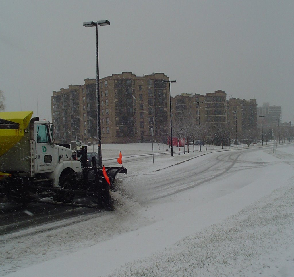
The much talked about Winter Storm in as far east as Kingston at 3pm. Snow, sleet and Freezing rain has been falling across all of southwest Ontario with icing problems occurring. The snow will begin in Kemptville by about 9pm and into Montreal close to midnight. By morning amounts in the 10cm range could be on the ground with another 10cm on Friday. Winds will be a factor out of the east at 40-60kn/h and gusting over 70km/h in Montreal. Expect travel to be difficult on Friday. North/South roads like highway 13 and 15 will be difficult as will be the 401 between the Ontario border and Belleville.

Avoid travel if at all possible on Friday. It is always difficult to predict how much snow will fall in Kemptville, as we saw with the last storm. Best bets are that the heaviest snow will fall over Eastern Ontario and Western Quebec between Montreal, Ottawa and Cornwall. Checking with area weather offices the consensus seems to be for 15-25cm storm totals by Saturday morning.

Click on this link for updated warnings...Winter Storm Warnings are posted for all of our areas around the two provinces and upstate New York.

Wednesday, February 28, 2007

Major Storm for Valley

A Winter Storm Watch is now in effect for the entire area. Snow will overspread the region on Thursday from a developing low pressure area over the Midwest. It appears the heaviest snow will fall along the St. Lawrence Valley in Ontario, Quebec and New York with over 20cm expected. Gusty east winds will cause blowing snow. Temperatures will be mild so the snow will be wet and heavy. There is a risk of some sleet and freezing rain as well.

Travel will be very poor on Friday. Plan accordingly. More updates to follow....use the links along the side as well.

Tuesday, February 27, 2007

Storm by weeks end for
Ontario & Quebec

Low pressure developing over the US Midwest is expected to track towards the Ohio Valley and Great Lakes by Thursday and Friday. Snow, sleet and freezing rain in important quantities can be expected in the Seaway Valley, Ottawa and Montreal. A Special Weather Statement has been posted.

The storms exact track is still in question, but plan for poor travel in New England, New York, Ontario and southwest Quebec Thursday through Saturday morning. I will update this weather early Wednesday morning.

Monday, February 26, 2007


This is what 20 inches of snow looks like!
I took this in the border town of
Champlain, NY on Saturday.

Tuesday, February 20, 2007

Blame it on Alberta or thank them....

A series of Alberta Clippers and a flattened jet stream is calming the weather picture and moderating the temperatures in Ontario and Quebec. Much milder air is streaming northward in advance of the clippers - warming temperatures by as much as 20 degrees since yesterday morning. It is the first mild air in almost a month. A little light precipitation is occurring, patchy at best. A stronger clipper will dump 5-10cm of snow across the area Thursday.

The weekend will be excellent but a storm is moving in for late Sunday and Monday...more on that later.

Thursday, February 15, 2007

Avalanche Risk High

You do not usually associate this with the Adirondacks, Green Mountains or the Townships, but this is good advice for anyone venturing into those areas this weekend...

937 AM EST THU FEB 15 2007...RISK FOR AVALANCHES IN THE NORTH COUNTRY...YESTERDAYS RECORD SNOWFALL HAS CREATED THE POTENTIAL FOR AVALANCHES IN THE BACK COUNTRY OF THE GREEN MOUNTAINS IN VERMONT AND THE ADIRONDACKS IN NORTHERN NEW YORK...ACCORDING TO STOWE MOUNTAIN RESCUE OFFICIALS. OUTDOOR ENTHUSIASTS HEADING INTO THE BACK COUNTRY THROUGH THE WEEKEND NEED TO BE AWARE OF THE AVALANCHE DANGER...AND RISKS INVOLVED. STEEP...OPEN SLOPES WILL HAVE THE HIGHEST AVALANCHE RISK. THE CONDITIONS CREATING THE AVALANCHE POTENTIAL WILL CONTINUE INTO EARLY NEXT WEEK. IF YOU GO INTO THE ADIRONDACKS OR GREEN MOUNTAINS TO SNOWSHOE...SKI...OR ICE CLIMB...BE AWARE OF THE AVALANCHE DANGER...AND TAKE APPROPRIATE PRECAUTIONS.
Waterbury, Vermont-from my weather pal Jesse at AccuWeather.com


Weather bubble holds
Storm blasts some areas...not us

Well what can I say, once again the Kemptville weather bubble held. While areas all around us received heavy snow, we had the typical angel dust all day. Check out Waterbury/Stowe Vermont above....love that place! May move there one day!


The following is a partial preliminary list of amounts so far.

Kemptville 5cm at MNR building -
but this is too low I recorded at least double that around 10cm and another 2 or so overnight.
Montreal 15cm
Ottawa 12-17cm
Cornwall 25cm
Quebec City 25-40cm
Hamilton, ON 46cm
Sherbrooke, QC 50cm
Waterbury, Vermont 60cm


Winds will remain gusty today all areas with blowing snow. Travel slowly roads are still snow covered and icy.

Wednesday, February 14, 2007


Storm contiues....

Here is the latest.....

Blizzard Warning for all of New England and northern New York except the St. Lawrence Valley which is under a Winter Storm Warning, as is Eastern Ontario and southern Quebec.

Snow and blowing snow will continue till midnight with the heaviest snow south and east of Kemptville. Warnings were extended to Ottawa and Smiths Falls this afternoon. For all these regions close to 20cm will be on the ground.

For Cornwall and Montreal the snow will be more in the 30cm range.

For the Eastern Townships, Adirondacks, Green Mountains and Champlain Valley 40-60cm

Travel is not advised here where blizzard conditions are occurring.
Of Note Logan in Boston, La Guardia, JFK and Midway are closed according to FAA.COM - Elsewhere flights have been canceled in Toronto and Montreal, call ahead first.


Storm digs in

The big winter storm is reorganizing rapidly off the New Jersey coast this afternoon. Snow has been falling lightly in Kemptville all day, with winds slowly increasing. This trend will continue all afternoon. I am happy with the 15-20cm prediction for our area. Amounts and winds will increase rapidly as you head south and east. Montreal can expect at least 30cm of snow.
Radar returns are showing snow along I-87 and I-89 at 5-10cm per hour! Forecasters have a Blizzard Warnings posted and travel is not advised.
Burlington was down to a 1/4 mile visibility in heavy snow at noon. This will continue well into the overnight period with winds increasing to 30-60km/h an higher.

Travel with great care today roads through out the region are snow covered.
All Buses Cancelled in Leeds/Grenville
Valentines Day Storm

The snow began in Kemptville in the pre-dawn hours and is expected to last all day. The culprit is low pressure near Kentucky this morning and a secondary powerful storm developing off Cape Hatteras. As the second storm moves north the snow will become heavy over New England, New York and the St. Lawrence Valley.

At present over 20cm is expected in Kemptville and Montreal. This amount will easily be reached in Montreal and even more to the south. In New England 1-2 feet is forecast with travel not recommended.

Winter Storm Warnings are posted for all areas except metro Ottawa.
Blizzard Warnings are posted for all of New England and northern New York

Be very safe and travel wisely today......

Tuesday, February 13, 2007

Warnings Extended to Montreal and Kemptville
Major Storm heads for area

A powerful winter storm from the US Midwest will slide south of the area tomorrow and deepen rapidly off the Atlantic Coast. The storm will interact with the arctic air over our area and produce a wide swath of heavy snow. Heavy Snow and blowing snow warnings are now in effect for all of Upstate New York, Northern New England and southern Quebec and Ontario, including Kemptville, the Seaway Valley and Montreal.
The snow will begin after midnight tonight in our area and taper off late Wednesday. During the entire event it will remain bitterly cold with strong northeast winds over 50km/h. Near blizzard conditions will occur in may areas. Storm totals will be from 15-30cm in Ontario and Quebec and 30-60cm in New England and New York.
Avoid all unnecessary travel tomorrow along the 401/20 corridor.....stay tuned.
Heavy Snow Ontario-Quebec-New York

The winter storm sweeping into Ontario from the Midwest US will arrive in our area tonight. Snow accompanied by gusty winds and very cold temperatures will develop by evening and continue into Wednesday. The heaviest snow will fall along and south of the St. Lawrence River. Ottawa is expecting 10cm with Kemptville and Montreal around 15cm. Over 20cm will fall in New York State with as much as 40cm in the Adirondacks. This will be a very cold storm with winds of 30-50km/h and very cold wind chills. Travel will be difficult in many areas beginning tonight. The storm will arrive today in southwest Ontario so travel there will be bad today.

Heavy Snow Warning: New York/Vermont
Winter Storm Warning: South Shore of Montreal and Eastern Townships

Monday, February 12, 2007


Above: Over 10 feet!!! of snow has fallen in Mexico, NY in Oswego County.
More is on the way!
BIG Storm for
Great Lakes and St. Lawrence

Winter Storm Watches are flying over parts of Ontario and New York and will be extended into Eastern Ontario and Quebec tomorrow. The culprit is a major storm developing along the southern jet stream that will collide with this arctic air mass over our area. The result will be snow spreading from west to east across Ontario on Tuesday. It will continue into Wednesday combined with blustery east winds and biting cold. A general 15-30cm could fall across the watch area by Wednesday night. As the forecast track becomes more clear, the watches may be upgraded. Travel along the 401 corridor and south into the US will be very difficult tomorrow and Wednesday. The snow will taper off late Wednesday in Ontario.

• Yesterday strong southwest winds gusted over 60km/h and created blowing snow across area roads. Several accidents were reported.
The picture below is SD&G County Road 1.

Thursday, February 08, 2007


State of Emergency
Declared in Oswego County

  • In response to the more than 6 feet of snow that has buried Oswego, New York, the county has declared a State of Emergency at 9:15 this morning. The snow has been relentless since the weekend and another 1-2 feet is expected by late Friday. The snow has closed schools, businesses and roads. The declaration will allow for help to pour into the area to help with the clean up and aftermath.
  • The snow and cold is a result of strong winds passing over the warmer Lake Ontario waters. The same is occurring north of the border off Lake Huron in places like Wiarton and Owen Sound.
  • Elsewhere flurries and gusty winds are creating dangerous wind chills. The snow has been blamed on 16 deaths south of the border. On its closest approach to the Seaway and Kemptville, the snow reached only from Brockville to southern St. Lawrence County and the western Adirondacks, but no further north and east this week.

Tuesday, February 06, 2007

More squalls for
Upstate New York and Ontario

A heavy snowsquall this afternoon is brushing Prince Edward County with 15-25cm of snow. Travel is difficult in that area and along the adjacent 401. Snowy cold weather will continue in these areas. Elsewhere cold, and blustery weather with a few flurries will occur across eastern Ontario and Quebec.

If you are travelling south of the border down Interstate 81, keep in mind that travel in that area is difficult as well. A persistent snow band about 10 miles wide is moving north again into Jefferson County. It may affect Watertown again. Watertown received almost 30 inches of snow Friday through Sunday. Portions of I-81 were closed stranding travellers at the Salmon Run Mall. The same can be expected tonight. Go inland around this area if you can.

This pattern is expected to continue into the weekend. Stay tuned for more information - but travel with great care around any of the Great Lakes for the next few days.

Friday, February 02, 2007


No Shadow for Phil or Willie

Despite the snow squalls, biting cold and blizzards this week, both Phil and Willie expect an early spring. I on the other hand disagree, but what do I know!


Greetings from Punxsutawney!
Phil Says Spring is Right Around the Corner!
Phil's official forecast as read 2/2/07 at 7:28 a.m. at Gobbler's Knob:
El Nino has caused high winds, heavy snow,
ice and freezing temperatures in the west.
Here in the East with much mild winter weather we have been blessed.
Global warming has caused a great debate.
This mild winter makes it seem just great.
On this Groundhog Day we think of one thing.
Will we have winter or will we have spring?
On Gobbler's Knob I see no shadow today.
I predict that early spring is on the way.


There was no shadow on the ground
Which means that spring will come around.
Flowers will bloom and life will begin
The waters will warm then we can jump in.
Children will laugh as they learn to ride
Boaters will rise and fall with the tide
The golfers appear out on the greens
People line up to taste new ice creams.
A warm breeze will brush on your cheek
The waters will rise on some of the creeks
Farmers will plant their first set of crops
Windows and doors will open on shops
The Town of South Bruce Peninsula is worth driving to
If your looking for springtime activities to do.
Ride a horse, catch a fish, hike the trails, if you can.
So many things to do you might need a plan.
If you don’t have time to enjoy everything.
Feel free to visit again in the spring.
There’s plenty to do throughout the whole year.
Especially now that spring time is near!

C. Wyonch

Thursday, February 01, 2007

Downtown Kemptville at 9am today


Warnings issued for Merrickville & Kemptville
Squalls affecting Kemptville and 401


A series of snow squalls riding on moist southwest winds off Lake Ontario is currently affecting Leeds and Grenville Counties. A Snow Squall Warning has been posted for the counties bordering Lakes Ontario & Erie as far east as the 416 and north as Kemptville. All highways in the area are snow covered and visibility is poor in blowing snow. The squalls should last most of the day and will accumulate 10-15cm locally. This will be followed by another system giving another 5-8cm of snow on Friday. More cold arctic air will plunge south over the weekend and into next week.

Friday, January 26, 2007

Keep your pets warm as well this weekend!

Serious Cold over Ontario & Quebec

A biting northwest wind is bringing the coldest air of the season across from the far north, over the Great Lakes and into the St. Lawrence Valley. Currently it is -20C with a windchill of -29C in Kemptville. It will "warm" a few degrees this afternoon but the wind will see that it remains dangerously cold. Windchill Warnings remain in effect for the St. Lawrence Valley today. Some flurry activity occurred as well. This created black ice on many roads.

Yesterday, squalls to the lee side of Lake Erie created a massive pile up on I-90 near Erie, PA. killing one.

Tomorrow- a clipper type system will move through our area with 2-5cm of snow and gusty winds. Behind the storm more cold air will be drawn south. The changeable winds will also cause more snow squalls along the Great Lakes. Travel with great care this weekend and make certain you have warm clothing in case your car breaks down. The cold air will last well into next week.

Tuesday, January 23, 2007

Polar Vortex set to move south

Sounds scary doesn't it. It should! The coldest air of the season is set to move into Ontario and New York this week. It is already having an effect on our weather as snow squalls developed in the southwest flow ahead of the polar front. 5-10cm of snow fell quickly in a stretch along the 401 from Belleville to Brockville today. Roads are slick and cars are in the ditch.

Further south in New York State, Lake Effect Snow advisories have been posted for St. Lawrence, Franklin and Jefferson Counties. 10-15cm of snow may fall in those locations. Gusty winds and dropping temperatures will occur as well. As the front approaches our area overnight, a shot of 5cm or so of snow may occur in Kemptville and the 416 corridor. Once the front passes very cold arctic air will surge south with temperatures dropping to -25 to -30C on Thursday and Friday mornings.

Thursday, January 18, 2007

Winter weather woes


Above: AP Photo of Snow in Southern California. It fell for the first time since 1962. It is spreading east tonight into Texas and the deep South.


Meanwhile AP Photo of ice accumulation on trees and power lines, that has caused scores of power grids to fail across the Midwest US and now the Southeast. Over 60 deaths have now been blamed on the storms. Snow will spread into New England, Eastern Quebec and the Maritimes tonight and Friday.

Wednesday, January 17, 2007


Bitter Cold in Kemptville
More Winter Weather on the way

The snow of this week will be around for some time to come. Kemptville received about 10cm from Monday's storm with Ottawa 10cm and Montreal and The Seaway closer to 20cm.

The snow was followed by brisk winds and biting cold. This morning Kemptville bottomed out at -27C for our coldest morning in nearly two years. The extended forecast will see more cold air dive south for the weekend. Temperatures will warm slightly with flurries tomorrow and Friday. A general 5cm of snow may accumulate in our regions (Montreal/Ottawa/Kingston) with more across higher terrain and near the snowbelts of Lakes Erie and Huron. As the snow tapers late Friday more arctic air on strong northwest winds will develop. A departing coastal storm that is providing lots of ice across the deep south today will move into the Maratimes this weekend. Heavy snow will fall in New Brunswick and Eastern Quebec.

Next week several clipper systems will bring more light snow, wind and cold to the Great Lakes and Quebec. Winter is here for a little while longer!

Monday, January 15, 2007

Stormy day in Ontario & Quebec

The first snowstorm of the season is upon us. Snow began falling in Kemptville about 5am this morning and will spread east into Quebec as the day progresses. A general 10-15cm snowfall is expected with closer to 20cm along the US border. Freezing Rain and sleet is not out of the question in places. The 401 corridor is not recommended for travel today. If you can delay; tomorrow will be great. Winter Storm Warnings are in effect for the St. Lawrence Valley on both sides of the border and for southwest Quebec. Warnings are also posted for New York & Vermont.

The coldest air of the season will pour in behind the storm with temperatures down to minus 25C by Wednesday morning. More snow is expected later in the week.

The same storm has produced an ice storm from north central Texas into Illinois with power outages reported. In Ohio and Pennsylvania major flooding has occurred.

Sunday, January 14, 2007

Winter Storm Watch

A Winter Storm Watch has been posted for the entire St. Lawrence Valley.
Low pressure organizing in the Midwest US will slide along a frontal boundary south of our area Monday. Snow will begin in Kemptville overnight and taper to flurries late Monday. Amounts are tricky as we will be on the fringe of the storm. Ottawa can expect 5-10cm while Kemptville south to the US frontier about 10-15cm.

On the US side watches have already been upgraded to warnings with 10-25cm of snow forecast. It will be a cold snow, unlike what we have had so far this year. Winds will be only about 30km/h throughout the storm. Roads will be icy and slippery. Plan your travel accordingly. Stay tuned for updates....

Friday, January 12, 2007

Potential Northeast
Snowstorm Sunday

As you go about your weekend routine keep and eye on the latest forecast. The front that is expected to slide through Ontario, Quebec and New England will stall south of our area tomorrow. Low pressure will develop in the Ohio Valley and intensify as it moves to the Atlantic Coast. At this time the potential exists for 15 or more cm (6 inches) of snow Sunday into Monday in Eastern Ontario, Ottawa and Montreal. Winds may produce blowing snow as well. It will be very cold - not like recent snow events. Stay tuned for further updates as the forecast becomes more clear.

Wednesday, January 10, 2007

Blizzard intensifies in
Saskatoon area

The Blizzard affecting central Saskatchewan has Saskatoon and area roads closed. Visibility at the airport has been zero for the last 7 hours with winds over 80km/h and moderate snow.

The following roads are closed according to Sask Highways:

TRAVEL NOT RECCOMENDED west of Yorkton towards Saskatoon, nor for highways north of Yorkton and east towards the Manitoba Border
HIGHWAYS IN WYNYARD AREA ARE TEMPORARILY CLOSED The following highways in the Saskatoon area are temporarily CLOSED due to zero visibility, blowing and drifting snow, and travel not recommended.Hwy 5, 41, 16, 11, 12, 7, 14, 219, 27, 2, 312, 20, 225, 320. North Battleford Area highways are temporarily closed due to zero visibility, blowing and drifting snow, and travel not recommended.
TRAVEL NOT RECOMMENDED In Unity, Kerrobert, Kindersley, Eston and Rosetown areas. #3 Highway East and West of Melfort is CLOSED due to Zero Visibility, Loose Snow, Snow Drifts, Swirling Snow, Drifting Snow, Travel is not recommended in the Tisdale, Nipawin, Melfort and Cumberland House areas.
TRAVEL NOT RECCOMENDED throughout the Prince Albert AreaMeadow Lake Area Highways are temporarily CLOSED due to zero visibility, blowing and drifting snow. Hwy 905 Points North Landing to Black Lake - water across road at km 21...
Blizzard across Saskatchewan
Colder in the east

Could it be that the much anticipated winter of 2006/2007 is finally upon us. The mild weather has had everyone and their sister speculating that Global Warming had reached us finally. This may be the case, too soon to tell, but I have a feeling this particular mild spell is more dramatic and short term in duration then Global Warming will be. Blame this warm spell and wild weather on El Nino.

We enjoyed double digit record highs last weekend, and even though it is -11C in Kemptville today, it really is not as cold as it should be. That is about to change and has already for some parts of the country. A fierce blizzard has closed highways and schools in Alberta and Saskcatchewan today. It will spread east into Manitoba. Meanwhile a storm system is expected to gather strenght in the US southwest and combined with cold air over our area, may provide us with freezing rain and snow into next week. It will definately turn colder next week and stay that way for awhile. Temperatures in Alberta will plummet into the -30C range with some of that cold air spreading east.

Prepare yourself for a shock now by getting out your boots and making sure your car is ready in Ontario and Quebec. It is on the way!!

Wednesday, January 03, 2007


Photo above is the little snow that fell over the
holiday period, about 12cm on Boxing Day.


Happy New Year everyone.....
Different year, Same weather!

The New Year has arrived with more incredible warmth here in Ontario and Quebec. It is 5C today or about 10-15 degrees above normal. We have had a run of 20-25 days above normal in Eastern Ontario, Northern New York and Southwest Quebec. Temperatures have been well above normal, and will continue that way into this weekend. As a matter of fact forecast highs in the teens Celsius may break all time records for Montreal over the weekend. No cold air or snowstorms are expected for the near future. A slight cool down will occur by Sunday.

Snowmobiles continue to sit idle and the Rideau Canal in Ottawa has no ice on it. We may be looking at an ice free year on the canal if we do not get some cold weather soon.

Black ice may be a problem on roads as evening temperatures sit just near 0C and frost occurs on elevated and shaded surfaces. Several cars hit the ditch this morning.

Friday, December 22, 2006


Christmas Greetings everyone....
After a long break from any type of severe weather a potent storm, that gave the major blizzard to the high plains, is moving towards Ontario. The storm will past well west of our area and bring more mild air with it. Before that happens freezing rain will develop in the St. Lawrence and Ottawa Valley this afternoon and tonight. Freezing Rain Warnings have been posted for those areas. With holiday travel and shopping on deck, you are advised to proceed with caution today.

After this storm Christmas will be quiet, our attention will turn to Boxing Day and a potential east coast snowstorm. Early indications are that this storm may move close enough to the coast to dump heavy snow on the Ohio Valley, interior New England and eastern Ontario & west Quebec. It is still early but in any event plan for winter weather driving, something we have not had in some time.

Again Merry Christmas and Be Safe!

Monday, December 04, 2006

Tree damage in Kemptville

250,000 without power
at height of Storm
What an introduction to winter and the mont of December. The powerful winter storm that swept in from the southern US dumped all kinds of precipitation on Ontario and Quebec. A major ice storm in the Ottawa and Rideau Valley's cut power to almost 250,000 homes in Ontario and Quebec. The ice, in some case nearly 25mm of it, downed scores of trees across the area and east into Montreal. The damage was quite extensive with downed power lines and snapped poles. Just a walk around my property revealed tremendous tree damages.

Roads were icy from Kemptville north with many cars in the ditch Friday and Saturday morning. I even witnessed thunder and lightning in the Seaway. The two day rain total for Kemptville was over 50mm.

Power was restored to most areas by Sunday morning. We had to close down work early Friday as a result of the storm knocking out power. If that were not enough, the ice laden trees were whipped by 70-90km/h per hour winds overnight into Saturday morning.

Further west it was heavy snow across the upper Midwest and northern plains. Cold air in the back side of the storm and flurries invaded the region yesterday and today.

Ice in Kemptville Friday...

Friday, December 01, 2006

Storm Update...

The winter storm affecting portions of Ontario and Quebec today is reaching far west and south. At 12 NOON today it is at the freezing point in Kemptville with moderate rain. It is currently snowing in Renfrew and Freezing Rain in Montreal, Cornwall and Ottawa. Road surfaces in our area appear to be ice free.

To the south severe thunderstorms with some tornadic activity have sprouted up in the warm sector of the storm across Ohio and Pennsylvania. Meanwhile Blizzard conditions prevail across the upper Midwest in Michigan and Wisconsin.

The back edge of the precipitation is moving into southwest Ontario. By the supper hour the precip should begin to taper off in Kemptville and Leeds Grenville. It will last longer in Montreal. Winds will become gusty in the St. Lawrence Valley and along Lake Ontario shoreline.

Thursday, November 30, 2006

Major Storm for
Ontario/Quebec

The first wide spread winter storm is heading for the St Lawrence and Ottawa Valley's. A major storm will slide north from Mississippi to lie near Massena, NY tomorrow night. In the wake of today's cold front - arctic air is pushing into the valley's. As the warmer air with tomorrow's system overrides the cold air, freezing rain will develop. A Freezing Rain Warning is in effect for Kemptville, The National Capital District and most of the Ottawa Valley. Over 20mm of ice is possible with this storm. Further north, snow 10-20cm will fall with rain to the south. In all areas winds will be very strong. There is even the risk of thunderstorms along the St. Lawrence Valley.

Flooding will be possible along the Lake Shores of Erie and Ontario at the east ends of both lakes. Waves will be as high as 17 feet on the lake front.

This is a dangerous weather situation developing in our area. Stay tuned.....

Wednesday, November 29, 2006

Record Highs East...
Record Cold West...

The roller coaster that is Canadian weather rolls on. We are currently between plus 16 & 18C in Eastern Ontario, Upstate NY and Quebec. Many areas have surpassed the record high for today. The same will occur tomorrow before a strong cold front and developing storm over the lower Mississippi Valley deliver us a wicked change. Rain will begin tomorrow in Ontario and spread into Quebec. As cold air moves into the area the rain will change to wet snow from north to south on Friday. Winds will increase from the northwest and temperatures will drop. There is even the risk of thunderstorms along the front.

Meanwhile in the west, mid-winter conditions prevail. Parts of BC are getting more snow today. This comes only hours after BC Hydro finished restoring power from last weekends storm that dumped 45cm in places. Temperatures across the prairies are frigid. Edmonton was -37C today beating a record that had stood since 1964. Numerous other minimum records fell across Alberta and Saskatchewan. In Saskatchewan the blizzard that raged in the southern part of the province closing many highways will lessen today. The cold will remain.

Stay tuned for more updates and any Ontario or Quebec warnings......

Wednesday, November 22, 2006


Coastal Storm produces
major flooding

A powerful coastal storm off of the North Carolina Outer Banks is pounding the shore northward into New England. Warnings are out for the entire coastlines as 15-20 foot seas cause flooding and beach erosion. The waves are building in northeast winds that have gusted over 65mph. Many roads have had overwash along the immediate coast including Cedar Island and Oriental, NC

Accompanying the wind has been between 100-200mm of rain. The storm is expected to remain just offshore as it moves north towards the Canadian Maratimes. A brief period of freezing rain is expected tonight and early tomorrow across southern interior New England. Any persons traveling for the Thanksgiving holiday should listen for the most recent forecasts. It takes only a little freezing rain to make any untreated roads very dangerous. We have had little snow or ice in most of the east so far this year, so it will take a little getting used to.

Thursday, November 16, 2006

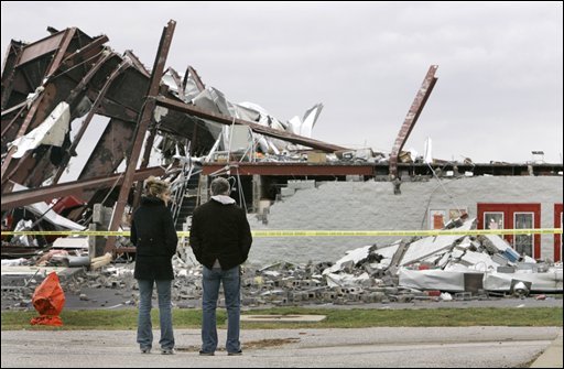
North Carolina Twister damage


Wicked weather across country

A series of fall storms has been pounding both coasts for much of the last 24 hours. The BC coast has had wind gusts over 100km/h with rainfall amounts of over 100mm. Flooding and wind damage is widespread with over 200,000 customers without hydro.

In the east it has been unseasonable thunderstorms and tornadoes. Seven people were killed from storms in North Carolina last night. Heavy rain and strong winds stretch from the Carolinas to Ontario and Quebec. Tonight heavy rain warnings are in effect for our area, Leds & Grenville Counties as we add to the over 325mm that has fallen in Kemptville since September 1.

In addition severe thunderstorms are racing across St. Lawrence County NY. To the west of the system cold air flooding south across Michigan and western Ontario is producing snow and freezing rain.

Serious flooding is occurring in New York State and Pennsylvania as the moisture latent storm continues to move northeast into Quebec tonight.

Friday, October 27, 2006

Colorado storm heads
for Ontario & Quebec

A big fall storm is heading for our area. Today is sunny and mild im most of the province, but that will not last. Strong low pressure organizing in the Midwest will deepen into a major storm as it moves down the St. Lawrence Valley. A wide range pf precipitation is expected over the weekend. Travel will be slow if not dangerous around the Great Lakes and across the Ottawa Valley and Laurentians.

In the lower elevations it will be mainly a rain event with between 50-75mm expected with precipitation begining tonight and spreading northeast towards Montreal by Saturday morning. Warnings may be posted. In the regions to the west, north and upper elevations, a slushy mix of rain and snow and eventually all snow by late Saturday could result in over 15cm of wet snow by early Sunday. On the backside of the strengthening storm winds will gust from 50-80km/h on Sunday with snow squalls and blowing snow. Be advised this will hamper travel in Ontario, Quebec, New York and Vermont.

Warnings will likely be issued later today......

Friday, October 20, 2006

Snow falls in Kemptville, Ontario today.


SNOW!!!
A strong storm moving up the Eastern Seaboard dumped heavy rain across Ontario, New York and Quebec today. On the back side of the system this afternoon cold air is filtering into the St. Lawrence Valley and Adirondacks. Snow began to fall in Kemptville at 2pm and a slushy centimetre or two is on the ground.
The snow should accumulate up to 5cm in Kemptville and up to 15cm in the Adirondacks where a Snow Advisory is in place.

Friday, October 13, 2006


Buffalo hammered
Lake Effect snow spawned by an intense Great Lakes storm has virtually shut down the Niagara and Buffalo areas. A record that has stood for 88 years tumbled in Buffalo as more than 50cm of snow fell. The same is true in Fort Erie, Ontario where over 30cm is down. The heavy wet snow has brought down power lines and trees. Travel has been suspended in parts of Western NY with schools and business closed. The are affected is very narrow including 3 counties and the area along Lake Erie from Niagara to Long Point. In addtion some squalls have moved inland over Prince Edward, Leeds and Grenville Counties in Eastern Ontario.

Warnings remain in place for the hardest hit areas of Western New York and the Lake Erie Shore on the Ontario side.

In eastern Ontario and Kemptville, flurries are in the air, only days after we were in the 20's. We had 25mm of rain in the last 24 hours. It will be windy and cool today.

Tuesday, October 10, 2006

First Winter Storm of season
A strong Arctic cold front will blast the western Great Lakes this week with big changes in store for all of Ontario. The front will spawn a low pressure area over the upper part of Michigan that will become a potent fall storm. It is an early "November Witch". The storm will become intense with howling winds and heavy precipitation.

So far a Winter Storm Warning is in effect for parts of Northwest Ontario with Winter Storm Watches for the U.P. of Michigan and northern Minnesota and Wisconsin. Heavy lake effect snows are expected with close to 10 inches possible. Winds will howl over 40mph.

Windy wet weather will affect Eastern Ontario into Thursday with a cold rain and gale force winds. Over 25mm of rain will fall with dropping temperatures.

Friday, October 06, 2006

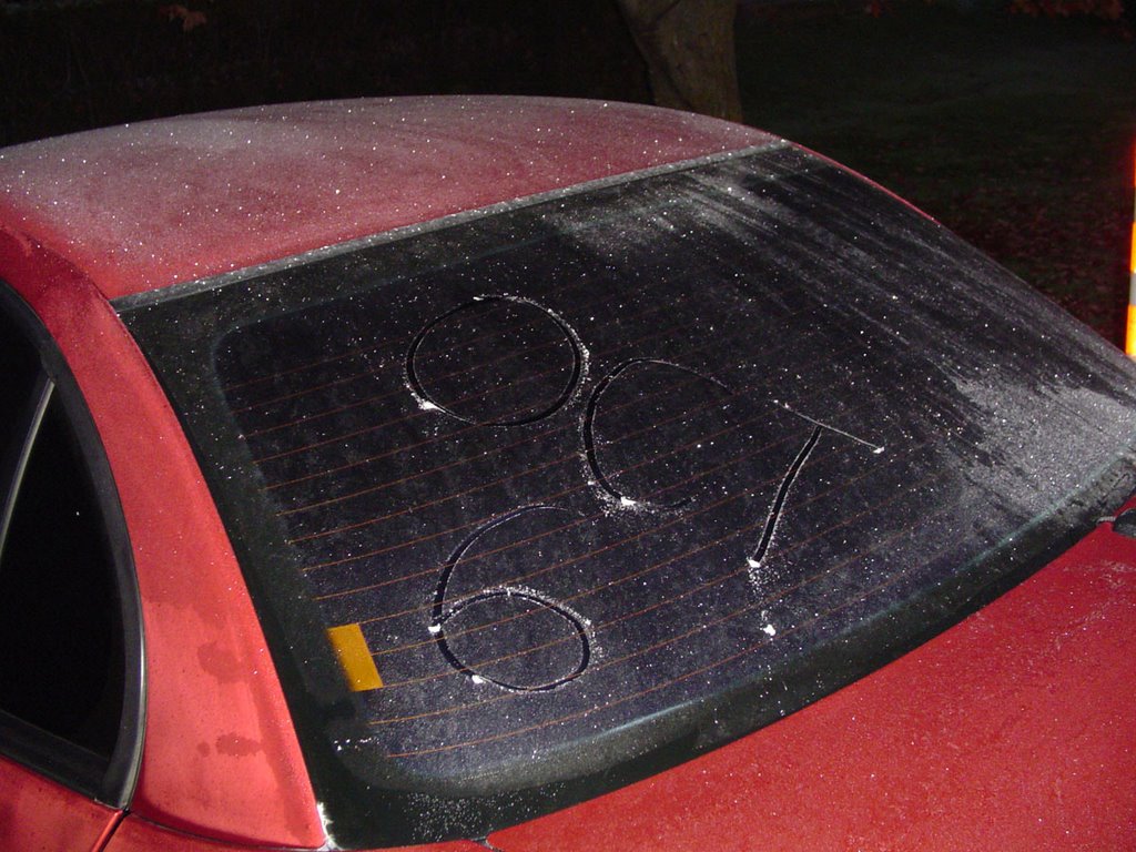
The picture says it all!!!
Beat last year by 5 days in Kemptville.

A Frost Advisory is out for upstate New York and
Southern Quebec tonight. Ontario does not issue frost warnings.

Tuesday, October 03, 2006


Thunderstorms in Ontario
A unseasonably warm airmass moving across the US Midwest and Ontario has produced thunderstorms. A bunch of them crossed the 416 corridor today with heavy rain and frequent lightning. More heavy rain is expected tomorrow from low pressure as it slides down the St. Lawrence Valley. Winds will gust 30-60km/h and 20-30mm of rain is expected in Ottawa, Kemptville and the Seaway.

Fog has been a problem the last couple of nights. Above is a picture of it burning off in Kemptville this past weekend.

Thursday, September 28, 2006


Windy weather in the east

Hi everyone, sorry for the lack of entries lately. Struggling a little with writing time. Pic above is last Sunday in Montreal. Peak gust was 76km/h.

It has been a very windy week in Ontario and Quebec. A strong front last weekend produced 70-100km/h winds in both provinces. Tree and power lines were knocked down cutting power to over 250,000 customers. While most have been connected, Hydro One is still struggling with some in the Bracebridge and Barrie area.

To make matters worse another series of fronts yesterday and today is producing some severe weather adding to the outages. Over 30mm of rain is expected from the slow moving front as it crosses the 416 corridor today and tonight.

In the Atlantic, Tropical Storm Isaac has formed. He is not threat to land at this point, but interests in the Maratimes should monitor the storm.

Monday, September 18, 2006

Thoughts of Dawson College
Helene to remain out at Sea
Hurricane Helene is now a category three storm and is expected to follow much the same path as Gordon before her. This will keep the storm largely at sea with just large swells hitting Bermuda and the east coast. It appears that the storms are on a rail right now riding around a big ridge in the Atlantic and being blocked by weather systems along the east coast of North America.

• Snow fell this past weekend in Saskatchewan & Alberta. Heavy snow fell from Banff to Jasper while 5-10cm fell in southwest Saskatchewan including Swift Current. Ah so much for summer.... and fall for that matter!

• It reached 27C today in many parts of Eastern Ontario. This warm air will be short lived as a strong cold front brings heavy rain tonight and cooler temperatures on Tuesday.

• Warning: Non weather rant......
Just a quick note on the Dawson shooting last Tuesday in Montreal. I had written a big statement about how deeply troubled and sad I was regarding the terrible events, but I never posted it. It seemed to emotional and angry. I was both, but have settled down a bit since last week. It reminded me so much of the shooting of 14 women at the University of Montreal in 1989.
I was a student and News Director at the radio station in Dawson College from 1984 to 1987.
My thoughts and prayers are with Anastasia's family, and the other victims as they recover, as well as the students, staff and faculty as they begin to return to classes this week.

I was also very proud to be a Concordia graduate. Concordia University opened its doors within seconds and provided support to all who were affected by the tragedy. We need to stop these awful events from taking place. I don't have the answers, but we should not stop talking until we find them.

Tuesday, September 12, 2006


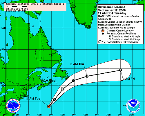
Florence is heading for Newfoundland
Environment Canada has issued a Tropical Storm Warning for southeastern Newfoundland. The centre of Florence is still about 600km from the coast but gales are extending well out ahead of the hurricane. The storm is undergoing a transition to extratropical state, which is a widening of the wind field and a loss of tropical characteristics.

The storm is expected to produce battering waves along the Newfoundland and Nova Scotia Coasts along with heavy rain, over 100mm and 100km/h winds in Newfoundland.

View the latest statement from the Canadian Hurricane Centre

Monday, September 11, 2006

Please
Remember
9-11

Frost Thunderstorms and a
Hurricane for good measure

Some of the worst thunderstorms of the season swept across the Ottawa Valley and Quebec on Friday afternoon. The intensity of them was a little bit of a surprise to me. They developed quickly in advance of a cold front. Winds were gusty, 50-100mm of rain fell, power poles were snapped and trees uprooted. Many parts of Carleton Place and portions of the City of Ottawa were left without power.

• Hurricane Florence with 80 mph is brushing Bermuda this morning. A wind gust of 79 mph was reported on the island. The storm will transfer into a very strong extratropical storm and move through Atlantic Canada waters by Wednesday. Gales and heavy rain are expected along the Avalon in Newfoundland, while Nova Scotia should have gusty winds and showers. Warnings may be needed for Newfoundland.

• Finally, frost occurred in parts of upstate New York and Eastern Ontario this morning. This is way too early for the time of year, but what can you do! The temperature was down to 5C here in Kemptville this morning, the coldest air since last spring.

Friday, September 08, 2006

Severe Thunderstorms
possible this afternoon
A strong cold front is racing across Ontario this afternoon. In advance of the front some severe weather has broken out. Warm southwest winds have driven temperatures up close to 27C. As the front presses southeast and east- storms over the Upper Ottawa Valley will begin moving south into Eastern Ontario. Some watches have been issued, they will be extended south and east over the next couple of hours. Stay alert to severe weather this afternoon.

Wear RED and REMEMBER
WARNING: non weather rant....We are coming up on the anniversary of some big changes here at work; some good - some bad; and from what I understand more changes are on the way. Change is good, don't get me wrong. But we must be allowed the time to mourn the loss, appreciate the gain, if any, and adjust to the change. That just has not been the case at times lately here and in the real world.

In that thought, today is Wear Red to Support The Troops Day, and every Friday from now on. It was started by the wives and families of Canadian & American Troops over in Afghanistan and Iraq. As the 5th anniversary of 9-11 approaches, take the time to remember, understand and appreciate all the hard work the men and women of the Canadian Forces are doing overseas to protect us from further attack by the cowardly terrorists.

The images on the page today are the things that are in my thoughts for this Friday, September 8. It is a warm late summer day in Eastern Ontario with a southwest breeze, big shadows and beautiful maples turning red. I can appreciate all this because of the freedom we enjoy in North America. Remember who protects that freedom.

On the tropical front, Florence is still expected to become a hurricane later today as it approaches Bermuda. It will make a big northward sweep and could brush Newfoundland late in the forecast period. I will update this possible scenario over the weekend. There is still much uncertainty in the forecast.

Tuesday, September 05, 2006


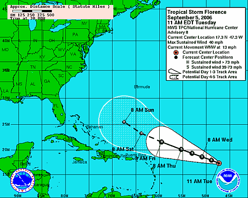
Florence develops in Atlantic
Tropical Storm Ernesto's floodwaters are still receding across the Eastern Seaboard. Up to 50mm of rain fell in Kemptville and Eastern Ontario over the weekend, while upwards of 250mm flooded parts of Virginia and the Carolinas.

In his wake Tropical Storm Florence has formed in the Atlantic, 1510 kilometres east of the Antilles. The storm is forecast to become a major hurricane by this weekend with some potential to impact the east coast. It will bear watching as we are too far out in the forecast period.

Friday, September 01, 2006

Ontario/New York and New England await Ernesto
The tropical remains of Ernesto will be moving north across Lake Ontario on Saturday night. In advance of the system - strong winds will begin to affect Vermont, New York and the St. Lawrence Valley. Winds will gust from 50-80km/h in many regions and may bring down some trees or power lines. Heavy rain will overspread Ontario from Windsor to Ottawa during the afternoon and evening Saturday. Storm totals could approach 75mm in places specially south and west of Kingston. Stay tuned for more information regarding the remains of Ernesto.

Gale Warnings are in effect for Lake Ontario and the St. Lawrence River. Flash Flood Watches have been posted for the western southern tier of New York and southern New England. They may be extended north.

Ernesto downgraded to depression
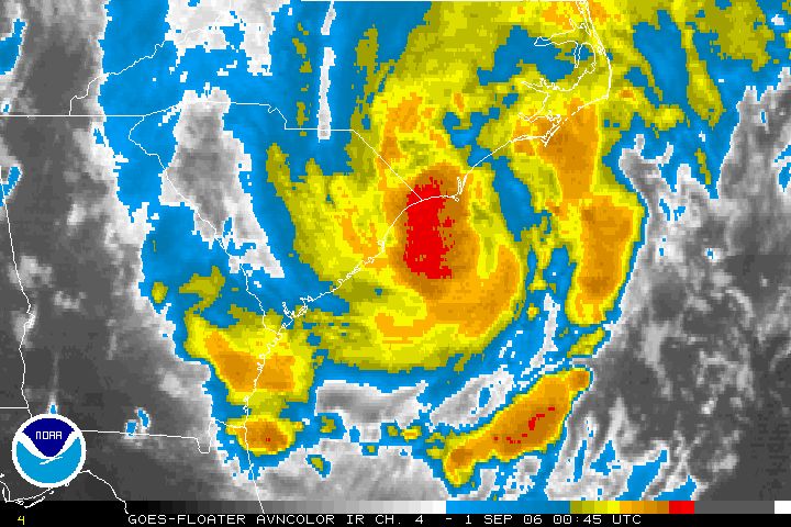
Ernesto is now a depression after slamming the Carolina Coast, moving onshore near Long Beach, NC overnight. The storm is now in eastern North Carolina dumping a tremendous amount of rain. In the last 24 hours close to 10 inches of rain has fallen in Wilmington and along the Outer Banks towards Duck. My favorite island, and for that matter many others as well; Hatteras Island, fared well in the storm. Heavy Rain did fall and winds gusted over 60mph but so far little damage is being reported. Flooding could become severe across inland areas and the coastal plain. Heavy rain is spreading north with flood watches as far north as New York State. Power is out to over 270,000 customers in North Carolina and Virginia.

The storm will move into Ontario by late Saturday with heavy rain and gusty northeast winds. Already clouds are streaming into the St. Lawrence Valley today on gusty south and east winds ahead of the low pressure area.

Thursday, August 31, 2006

Tropical Storm Ernesto on
the North Carolina Coast
It is almost a Hurricane and it is very close to Wilmington, North Carolina tonight. Ernesto is packing a punch. It is a vigorous tropical storm producing heavy rain and tornadoes as it moves onshore. At 8pm area observations included Kitty Hawk at 81F with heavy rain and an east wind at 17 gusting to 28 mph. Pea Island on the Outer Banks was E at 33G39 and Frying Pan Shoals southeast of Cape Hatteras was SE 39G49 knots which is close to 60mph. Waves were 15 feet. Already Wilmington has received 6.2 inches of rain. The storm will move across the state overnight and into Virginia tomorrow.
Flooding expected in Northeast
Ernesto will move towards Ontario
Tropical Storm Ernesto moved back over the Atlantic waters early this morning after crossing Florida. The storm produced heavy rain but little else in the sunshine state. Tropical Storm Warnings are in effect from Georgia north toward the Outer Banks of North Carolina. In addition flood watches have been posted for all of the southeast & mid-Atlantic states and may be extended into New York and Pennsylvania.

A Special Weather Statement has been issued for Ontario. The tropical remains of Ernesto will move into Ontario near Lake Erie on Saturday. Heavy Rain from 40-60mm along with gusty winds will occur throughout the weekend. Heavy Rain Warnings may be needed.

KATRINA: I watched a show on Hurricane Katrina last night on the Discovery Channel. It was very well done. Even one year later, and after tracking storms for over 25 years, I have a problem in dealing with the enormity of the disaster. One thing that has not changed in the year is the stupidity of politician's. I don't like to get political, I stick with the weather, but bureaucracy is an amazing thing. Take one of the strongest storms ever to strike the planet, stir in lots of water and sprinkle with stupidity, you get the idea. No one knows for certain how many of the deaths were needless, we may never know. People waited for days while politicians congratulated each other on the "flawless evacuation plan" and the "great progress of the recovery." One year later many neighborhoods are still waiting for a plan, still waiting for the storm to pass.

One thing is for certain, there were and continue to be many heroes who made and continue to make a difference. Ordinary people doing extraordinary things along the Gulf Coast.

Tuesday, August 29, 2006

5pm Ernesto Update
Tropical Storm Ernesto has yet to intensify although the storm appears more organized on radar. The storm will move northeast across Florida into tomorrow before making a second landfall in the Carolinas.

Computer models bring the storm inland across the Appalachians and into southern Ontario this weekend. Our area will see heavy rain Saturday and Sunday. Stay tuned.... the threat for flooding across the Northeast and Ontario is very real.

The immediate future of the storm has it dumping heavy flooding rains across Florida. Up to 10 inches of rain may fall. The waves will be pounding the coast from Florida to The Outer Banks with some beach erosion.
Ernesto back over water
Tropical Storm Ernesto has emerged off the Cuban coast just south of Key West - Florida. The storm is expected to move northwesterly at about 12-14mph today and should begin to affect south Florida by mid-day. It will move across the central Keys and across the state towards Jacksonville before moving back over the Atlantic waters by tomorrow. At present a Tropical Storm Warning and Hurricane Watch are in effect from Bonita Beach and New Smyrna Beach south along both Florida Coasts. Ernesto may still become a Hurricane before landfall.

Once over the Atlantic after hitting Florida the center will make a second US Landfall near the North/South Carolina border, further west than initial runs. It is also expected to become a significant weather event for the eastern Great Lakes. Stay tuned to that for this upcoming weekend. Next update later this afternoon......

Monday, August 28, 2006

Ernesto over Cuba
Tropical Storm Ernesto the first storm to have reached hurricane status in the 2006 season has moved inland over Cuba tonight. The storm has been erratic and difficult to forecast. Early forecasts had the storm as a major hurricane affecting the Gulf Coast region. It now appears the storm may affect Florida as a tropical storm before moving up into the Carolina and Mid-Atlantic states. The storm reached hurricane status for a time late Saturday into Sunday morning. It will affect the US on the anniversary of Katrina. I am hoping and praying it stays away from Hatteras Island. I have vacationed there over the last 15 years and hope Avon and the surrounding villages are spared. It will be close call according to the computer models.

As of 8pm a Hurricane Watch and Tropical Storm Warning is in effect for the Florida east and southwest coasts. All interests in the southeast US should monitor the progress of the storm. The models are mixed with the storm affecting areas from Cuba to Maine a possibility. Updates can be found at hurricanecity.com.

I will keep a close eye on the system over the upcoming hours. Another update will be posted early tomorrow morning.

Friday, August 25, 2006


Debby lost in the Atlantic
TD#5 to become Ernesto
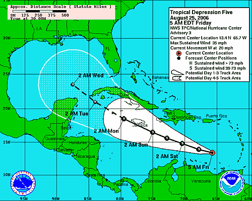
Tropical storm Debby continues to meader across the open waters of the Atlantic about 1250 miles northwest of the Cape Verde Islands. At present the storm posses no threat to land. In the meantime Tropical Depression 5 continues to strengthen and should become Tropical Storm Ernesto today. This storm bears watching as it moves across the Caribbean south of Puerto Rico. The storm may not survive the next 72 hours, but if it does it will move into a more favorable environment in the Gulf of Mexico. Please visit Jim at HurricaneCity.com for updates.

Our weekend weather should be cool with showers Saturday. August continues to be a disappointment with very cool weather the last week or so. Summer is too short to give up three weekends in the month to "fall like" weather. Lets hope September is warmer. Despite the 11C (51F) start today and the cloud cover I am wearing shorts to work. Why? Because it is August......

Tuesday, August 22, 2006


TD #4 forms in Eastern Atlantic

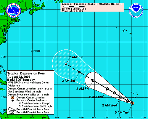
Tropical Depression number 4 has formed in the far Eastern Atlantic, 150 miles south of the Cape Verde Islands. The storm is in a very favorable area for development and should become Tropical Storm Debby by later today. It is forecast to continue to slowly strengthen as it moves westward. It is too early in the period to tell if it will affect the east coast of North America. However the Caribbean and Gulf Coasts are fine this system is too far north at this time.

Monday, August 21, 2006

Quiet Weather
Hey folks, sorry for the lack of input as of late, but it has been exceptionally quiet both in the tropics and in North Grenville. Yesterday was breezy and cool, almost fall like in Eastern Ontario and west Quebec. About 10-12mm of drizzle and showers fell with cool temps of around 17-20C. It was a far cry from Saturday's reading of 30C plus with humidex values in the 34 range. August has been fairly quiet from a thunderstorm point since the outbreak at the beginning of the month. This week will be cool in Kemptville and Montreal with on and off showers Tuesday and again Thursday.

• Hurricane forecasters are watching a disturbed area of thunderstorms south of the Cape Verde Islands for possible development.

• A severe weather outbreakoccurredd yesterday in the high plains from Colorado up to Manitoba. Here is some neat video of the storms. Hail and a tornado were reported also in southern Manitoba.

The shot below was taken at the 49th Annual Stowe Car Show last week. It was an awesome weekend.....can't wait till the 50th!

Friday, August 11, 2006

Awesome weekend in the east
Well the weather has finally calmed a little in Ontario. This weekend will be excellent from Toronto to Montreal and Ottawa. Very low humidity, cool nights and warm seasonable days. This weather will extend into New York and New England.

• Heavy thunderstorms with hail are occurring in Saskatchewan and Alberta, warnings are out for those areas. The most convection is occuring north of the Trans Canada this morning, however most of the south can expect a round of storms before much cooler air moves in on Saturday.

• Environment Canada confirmed that 8 tornadoes occurred in the province last Wednesday, August 2 including two F-2 storms. It was the worst outbreak since the Barrie twisters in 1985. No deaths were reported but power was out to over 150,00 and damage is in the millions. So far this season 17 tornadoes have occurred, 3 more than all of last season in the province.

Friday, August 04, 2006

What a week!

I must confess I don't know where to start. It has been quite a busy week in the weather department across North America. Fierce thunderstorms, scorching heat and a tropical storm for good measure.

Well I will start with the home front. Kemptville hit 38C on Monday. That was the warmest I have ever recorded on my thermometer. It was just shy of the official high of 36C in Ottawa 30 minutes north of us. Add the humidity and the humidex was off the charts close to 50C in places. Sweating was not an option.

The heatwave, at least in Kemptville, came to an end late Wednesday with a line of thunderstorms that was far worse in other locations. We had gusty winds and some rain. Lanark County to our west was under a tornado warning. An F-1 tornado touched down in the small village of Combermere south of Barry's Bay with extensive damage.

The previous night storms pounded Montreal leaving more than 500,000 people without power and killing 2. One motorist was killed when a tree fell on his car in the Cote Des Neiges district. Many are still in the dark. Though it is cooler, it is still near 30C, without a/c this can prove uncomfortable. Hydro Quebec estimates the power to return over the weekend. Over 400 crews, some called back from vacation, have been working on the downed power lines and poles. Over 100mm of rain fell in Montreal during Tuesday and Wednesdays storms. 150,000 have no power in Ontario.

Tropical Strom Chris has now been downgraded to a depression and is meandering through the Caribbean Sea heading for the Bahamas. It may regain tropical storm strength as it heads into the Gulf Of Mexico.

Elsewhere the east coast of the US has been under extreme heat alerts as incredible heat and humidity dominate. New York's La Guardia Airport was over 100F three days in a row with overnight lows only in the 80's. Utilities in both New York and Ontario were advising people to conserve, fearing brown outs. Gov Pataki even opened state parks for free so people could cool off by the water. The heat is blamed for hundreds of deaths.

Monday, July 31, 2006

Heatwave heads north and east

The heatwave that has held the US in most of its grip for the last month will spread northeast into New York, New England, Ontario and Quebec. Excessive Heat Warnings are in effect along the east coast from New York south. High Heat and Humidity Warnings are in effect for most Metro areas in eastern Ontario and Quebec.

Expect hihgs on Tuesday and Wednesday to be between 33C and 37C or very close to 100F in Toronto, Ottawa, Montreal, Watertown, Rochester, Syracuse and Ogdensburg. Factor in the humidity and it will fell like 42-45C.

Drink plenty of water and avoid heavy outdoor activity tomorrow and Wednesday. Some relief will move in to northern areas late Wednesday and Thursday.

Wednesday, July 26, 2006


Very warm and muggy today we are currently at 29C in Kemptville but the humidex feels like 37C.

Yesterday's rain totals from 4 different thunderstorms:
Morrisburg 67mm
Kemptville 60mm
Ottawa 32mm
Winchester 23.8mm

Below is a scene repeated across some areas of Eastern Ontario as Hydro 1 crews work on lines.

Tuesday, July 25, 2006


Storms, storms and more storms
The "bubble" that has been protecting Kemptville from any big thunderstorms this summer let go last night. It took a very week cold front moving into marginally warm air that would trigger our first round of storms around 3:00 am. The storms produced spectacular lightning and about 2-3mm of rain. Sporatic power outages occured.

This would set the stage for more severe weather today. At least three separate lines of storms crossed the Rideau Valley heading south. In all over 50mm of rain fell this afternoon in both my rain gauges. There was ponding of water in many areas but no damage was reported. Lights flickered all afternoon and power was disrupted in some areas.

More storms are expected on Thursday across Eastern Ontario in the warm and humid air as highs approach 30C.

Friday, July 21, 2006


Tropical Storm Beryl
heads for Nova Scotia

• The northern edge of Beryl is beginning to affect the southern coast of Nova Scotia as well as New Brunswick. Forecasters are expecting the storm to dump over 50mm of rain in the area along with gusty winds. This is the second named storm of the young Atlantic Hurricane season, we had 5 at this time last season. The storm will rapidly lose its tropical nature as it moves northeast into the Atlantic Ocean.
Beryl brushed across Eastern Massachusettses with rain and wind but nothing more than that last night.

• It was hot this week in Kemptville. I recorded a max temperatures of 36C on Monday. The official reading was 33C at the MNR building.

• Hydro workers in Ontario continue to restore power to the more than 100,000 customers that lost it from Lake Superior to the Quebec border on Monday. The thunderstorms lashed the area with 100km/h plus winds and heavy rain. Two tornadoes were reported in New Market and numerous trees, some as old as 100 years, were flattened on Manitoulin Island. One death was reported from Monday's storms in Ontario.

• Glasgow, Montana did not reach 90F on Wednesday marking the first day since July 4 that it failed to do that. It was the 5th longest stretch of 90 degree plus weather since records began. The area along with most of western Canada and the Pacific Northwest will remain under intense heat again this week with temperatures approaching 100F (37C) in many areas.

• The Kemptville "bubble" remained in place last night. While many areas continue to see thunderstorms, parts of the Highway 43 corridor from Merrickville to Kemptville continue to miss out. The storms part as they approach the area going north into Ottawa or south into New York State.

Monday, July 17, 2006

High heat - smog and humidity
The weather in the east has become extremely hot and humid. A smog warning is in effect for most of southern Ontario. Very poor air quality has also resulted in an Air Stagnation Advisory for the northern counties of New York State. A High Heat and Humidity Warning has been posted for southwest Quebec.
As of 4pm, Kemptville had reached 32C with a Humidex value in the dangerous range at 42C. Brockville had a reading of 43C to be the highest in the province. Montreal was at 32C. A Severe Thunderstorm Watch is now in effect for most of eastern Ontario. Heavy Thunderstorms are possible in the tropical air through tonight as a cold front presses east.

Monday, July 10, 2006


Viva l'Italia
...siamo fieri di voi senso andare l'Italia

Friday, July 07, 2006


Hot weather returns
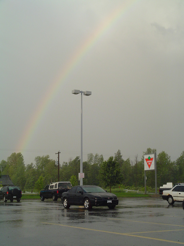
Big changes in the east are expected over the next several days as very warm humid air streaks into Ontario and Quebec. Temperatures will be from 27-30C right into next weekend. A few thunderstorms are expected as well. It has been a wild stretch of weather lately. Severe thunderstorms in Ontario this week caused flooding and toppled some trees. The Kemptville area was spared for the most part with the exception of a strong storm late Tuesday that brushed the area. The winds were strong enough to tear branches from some trees and the parting storm left a rainbow behind(above).

In addition to the storms in Ontario, two confirmed F-1 tornadoes were reported in New Brunswick. Today smoke from the forest fires in the northern Prairies and Rockies is drifting east into the eastern part of the country. Satellite images show the smoke stretching up and down the eastern coast.

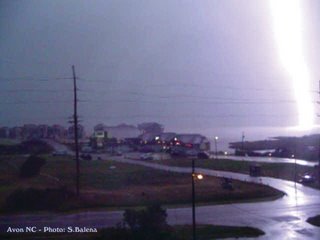
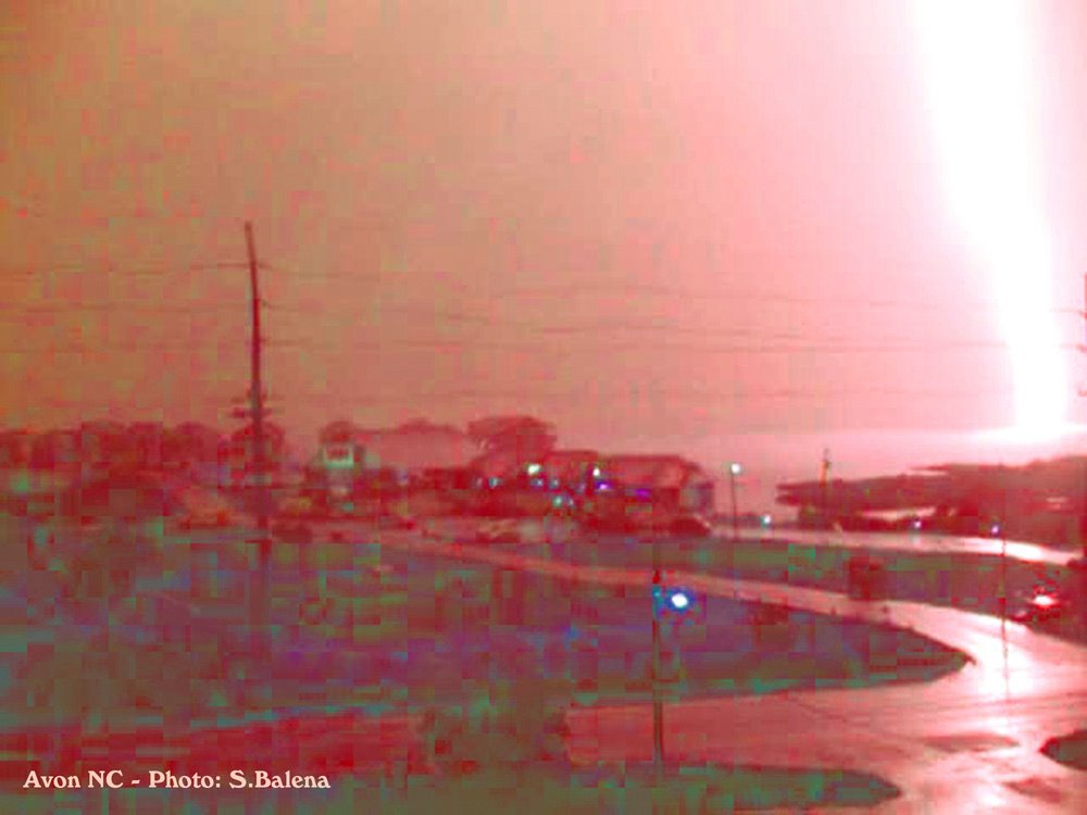
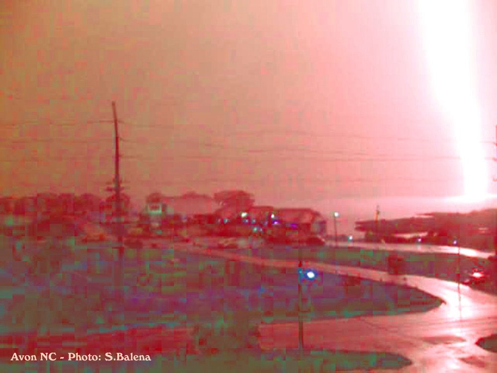
The photo below is one I took on Friday, May 26, 2006 on the Outer Banks of North Carolina. It is a lightning strike illuminating Pamlico Sound near Avon, North Carolina.