Sunday, April 22, 2012

Heavy rain & snow

NOAA image this afternoon of the developing storm over the Atlantic Ocean near Cape Hatteras. Heavy rain and snow will spread north and west.
Environment Canada has issued a bunch of warnings for southern and central Quebec through Monday as two low pressure areas move into the region. The first is dropping across the Great Lakes and into the Ohio Valley, while a second more powerful storm will rapidly develop tonight near Cape Hatteras and race north to near Albany and eventually southern Quebec. Heavy rain warnings are posted for Montreal and southern Quebec tonight as precipitation will spread north and become heavy. It will be mixed with wet snow at times especially in eastern Ontario. Look for rainfall amounts of up to 50mm across the area with some wet snow accumulation as well on grassy surfaces. Further west the snow is expected to be the dominate precipitation type with a late season snowstorm for western New York including Buffalo south into western Pennsylvania and West Virginia. Some locations may see up to a foot of heavy wet snow that will bring down trees and power lines. Wind will be another factor with this storm with Wind Advisories in effect for the St. Lawrence Valley. Gusts could easily exceed 70km/h (50 mph) across the area from the Thousand Islands northeast towards Quebec City.

The same storm is forecast to dump heavy rain up and down the eastern seaboard with coastal flooding all the way north into Atlantic Canada. Southern New Brunswick could see 100mm (4 inches) of rain with freezing rain across the north. In central Quebec heavy snow is forecast. This is a developing storm with still some uncertainty so check back later this evening.

Friday, April 20, 2012

Wet weekend update

It is chilly in Montreal this morning with some showers draped along the Quebec/Vermont border. A warm front will try to push north of Montreal today, until it does we will have northeast winds and chilly highs of around 9C. Once the front moves north of the city we should see a brief shot of warm air on Saturday that could push temperatures up to 18C. It will be short lived as a cold front and low pressure area will give rain late Saturday into Sunday. The big weather story then begins late Sunday night and lasts well into next week. A rather large coastal storm will develop near the Delmarva and move north and begin to affect New England, Quebec and Ontario. Lots of precipitation, as much as 50mm or more along with strong winds and cool temperatures are expected to start the work week. There is even a growing possibility of wet snow for some of us. The exact track and intensity of the storm is yet to be determined, so there are lots of details to sort out. Look for cloudy, damp and cool weather until at least Wednesday of next week.

Thursday, April 19, 2012

Enjoy today - a wet weekend ahead

It will be another spectacular spring day in Montreal with a warmer southwest wind developing and temperatures rising rapidly to around 20C (68F) this afternoon. That will be quite a bit warmer than Wednesday when the mercury reached 11C in the city and around 12 to 15C off island. That high pressure will slowly drift off the Atlantic coast today allowing low pressure and a stationary front to establish itself over the area for the upcoming weekend. The first system in Michigan today will move along the international border on Friday with a period of showers and much cooler weather here in Montreal. By Saturday a cold front will approach the area with widespread rain expected. We may see some brief partial sunshine on Sunday before a much larger storm develops off the east coast near Virginia and moves north. This system will be the first coastal storm in quite some time to affect the region. Gusty winds, chilly temperatures and widespread rainfall, possibly up to 50mm (2 inches) may fall late Sunday into Monday. There is even a risk of some wet snow for places like the Adirondacks in northern New York. The track and details are still a little up in the air, but we do need the rain desperately in the area, so it would be welcome. In any event today will be near perfect - so get out and enjoy.

Wednesday, April 18, 2012

Frosty morning

It is hard to believe we are sitting below freezing in Montreal, Ottawa and Toronto this morning after reaching nearly 30C (86F) on Monday. But here we are back to the gloves with a touch of frost on the ground and certainly on your front windshield. High pressure settled into southern Quebec and Ontario overnight with calm winds and cold temperatures. A widespread frost and in some cases a freeze has occurred across Michigan and Ontario south into Ohio and New York as well as most of Quebec. It could be worse, snow is still on the ground across northwest Ontario with as much as 40cm in some locations. Another round of snow, likely 10cm or so is forecast later today for that same area.

From AccuWeather.com a look at this weekends potential storm track.
Our weather will be controlled by high pressure into Friday with warming temperatures and just some high cirrus clouds. By Friday the weather will become increasingly stormy into the weekend and early next week. A complicated collection of systems will begin to affect southern Quebec, the most important being a potent low pressure area moving from the Gulf of Mexico up the eastern seaboard. This storm will have the potential to produce heavy rain with up to 50mm (2 inches) possible along the track. It is much needed rain so it will be welcomed to help lower the recent fire threat. It will however mean a wash out for the weekend at this time. Winds will be gusty and it will be chilly. It may even be cold enough for some wet snow in some elevated location and north of Montreal, but we will look at that a little closer as we move towards the weekend. In the meantime enjoy the sunshine, it will warm to 12C today and up to 18C on Thursday.

Tuesday, April 17, 2012

Summer vs Winter

UPDATE 12:30PM: I have two more record highs to add to the list, Kemptville hit 28.3C yesterday breaking the old record of 27.6C set in 2002, and Brockville was 28.4C, the old record from 1973 was 24.4C. Today, just 24 hours later, most places are in the cold plus 9 to 11C (48-52F) range with a strong west wind. From shorts to gloves! 

SUMMER
I really did not think we had a chance, but there it is, a new official record high for April 16 of 28.9C (85F) at Trudeau Airport, squeaking past the old record of 28.7C set in 2002. By my count that makes 6 record highs already this year for Montreal. There were dozens of other records smashed including 31.4C (88F) at St Anicet, 29.9C (86F) at St Anne's on the West Island and 29C (85F) at Lennoxville. I was at 31C here on L'Ile Perrot, and we had around 10mm of rain with the front last night. Temperatures all over the region nudged into the high 20's and low 30's, normal for mid July. Burlington, Vermont was still at 27C (80F) last night at 11pm! A strong cold front has chilled things way down this morning as we sit at 12C (54F) with a gusty west wind up to 50km/h. Temperatures will not move much today staying in the 13 to 15C range, but with plenty of sunshine. Winds will abate this evening and temperatures will drop to near freezing. As a matter of fact freeze warnings and watches are in effect for a large area of western New York and Ohio where the growing season is well underway.
Still serving fresh coffee, but the Tim's sign was no match for 100km/h wind gusts in Hamilton on Monday. (The Spectator)
That same cold front was the focus for strong southwest winds ahead of it on Monday. Winds gusted to over 95km/h across most of southern Ontario including 96km/h at London and Hamilton with 70 and 80km/h gusts in the GTA. The winds toppled trees, power lines and signs knocking out power to thousands of homes and businesses. It even knocked over a semi-truck on Highway 400 north of Toronto. The front also produced some scattered thunderstorms, but only showers rolled through Montreal in the middle part of the evening.

WINTER
The parent low pressure area of that cold front meanwhile was producing heavy snow and freezing rain across northern Minnesota into northwest Ontario including Thunder Bay where 3 hours of freezing rain was reported. In Timmins over 14 hours of ice snarled traffic and cut power. Atikokan had snow and lots of it with 27cm, while Kapuskasing recorded 32cm. The OPP had to close the Trans Canada Highway near Wawa because of severe winter weather.

Monday, April 16, 2012

Near record warmth - tornadoes

An all too familiar scene this spring is repeated this weekend across Oklahoma. Below right a tornado late Saturday in western Oklahoma.
It was another wild weekend across portions of the southern plains and Midwest US as nearly 125 tornadoes tore through several states. Some of the hardest hit communities are in western Oklahoma and southern Kansas spilling into Iowa. Woodward, Oklahoma reported all the deaths, 5 in total with hundreds more injured across the state. The storms fired up along a cold front Saturday with the deadliest storms occurring overnight into the wee hours of Sunday morning. The severe weather is part of a larger system that is delivering heavy snow and freezing rain to northwest Ontario including Thunder Bay and Geraldton. This system is also driving warm and humid air northeast into southern Ontario and Quebec today. High temperatures will approach record levels today in Montreal and across New England. Our record today is 28.7C set in 2002. We may just fall short of that with a forecast high of 27C (81F) expected. Highs could be as warm as 31C (87F) today in Boston where the Boston Marathon is being run. Participants have been advised to stay hydrated and pace themselves in the high heat. Runners with any respiratory issues are being told to rethink their participation today.


A cold front will approach Montreal and eastern Ontario late in the day today with some showers and perhaps a thunderstorm possible by late afternoon in Ontario and the supper hour or evening in Montreal. Any storms have the possibility of gusty winds and dangerous lightning. Tuesday will be nearly 20 degrees cooler with highs in the low teens. By the weekend a much stronger system coming up the east coast may provide us with a steady rainfall, which the region needs badly at this time.

Saturday, April 14, 2012

Titanic 100 Year Anniversary

The ghostly image of the Titanic 2.5 miles below the frigid waters of the North Atlantic nearly 400 miles off the Nova Scotia coast.
We have struck iceberg, sinking fast, come to our assistance.
The distress call from RMS TITANIC at 11:55 PM, April 14, 1912. (Position Lat. 41.46 N Long. 50.14 W)

As I write this entry it is almost the exact moment 100 years ago that the SS Titanic out of Southampton, England hit an iceberg that would eventually lead to her sinking around 2:40am on the 15th of April, 1912. Sadly, as we all know 1500 souls were lost on that terrible night. By all accounts the voyage to that point was uneventful in the weather department. The waters of the Atlantic had been calm with sunny, mild days and starlit nights. The same held true the night of the collision, maybe a little too calm. The presence or lack there of any weather, or moon (new moon) for that mater would mean that any ice would have been difficult to spot. In addition to the calm, mirror like seas, it was a very cold night. The Titanic had sailed through a cold front earlier in the day that had left her in air temperatures right around the freezing point by 11:40pm. The water was frigid by some estimates almost as cold as -2C (28F). Sea water can reach temperatures below 0C without freezing due to the salt content. In water temperatures such as these survival would have been nearly impossible with death in minutes.

By comparison that night, Montreal was plus 5C (41F) on the 14th and dropped below freezing overnight. In St. John's, Newfoundland, the closest major centre to the Titanic disaster, cold temperatures prevailed behind the cold front with highs of plus 3C (38F) on the 14th and plus 4C (39F) on the 15th. In Halifax where many of the dead from Titanic are buried, and rescue and recovery efforts were launched, it was a mild 10C (50F) on the 14th. Temperatures in Halifax dropped quickly behind the same cold front that the Titanic had encountered, down to -4.4C (25F) by the morning of the 15th showing how cold the air was in the region. New York City where the Titanic was expected was also chilly and clear on the 15th.

Friday, April 13, 2012

Weekend Update

After the clouds, showers and hail of this past week, we have a spectacular Friday and Saturday on tap for southern Quebec and eastern Ontario. Sunshine today will allow temperatures to rebound nicely from near the freezing point this morning up towards 16C (61F) by this afternoon. Nothing but sunshine today with fairly light westerly winds. Winds will increase overnight and Saturday as a frontal system approaches from the southwest. Overnight lows will be milder than this morning, remaining around 5C (41F). On Saturday look for a breezy day with partial sunshine and highs near 16C once again. That frontal boundary will move into the region on Sunday with a few showers and perhaps a thunderstorm. Winds will be gusty up to 40km/h and highs will be near 17C (63F). On Monday a warm front will lift north of the region putting most of Ontario, New England and extreme southern Quebec in some very warm and even humid air. Highs will soar to around 23C (73F) in Montreal but as warm as 26C (79F) in parts of the St. Lawrence Valley. A cold front late in the day may trigger some showers and perhaps a rumble of thunder.

Sunday, April 15 in the wee hours of the morning, we mark a somber event, the 100th anniversary of the sinking of the HMS Titanic. The ship went down in under three hours after striking an iceberg. Nearly 1500 souls were lost that terrible night. Tomorrow's blog entry will feature a brief look at the weather that night not only at the crash site but also for comparison along the coast and here in Montreal.

Wednesday, April 11, 2012

One more showery day

We continue to have an upper level low spinning near Quebec City, the same one that was over the Atlantic Ocean last weekend. It will slowly drift south into northern Vermont today and eventually east back out to sea by Thursday. Here in southern Quebec and across eastern Ontario we are looking at one more day of showers. Yesterday afternoon the radar image resembled a popcorn machine with little kernels of instability bubbling up all over the place in the cool and humid air. We can expect the same today with a few very small sunny breaks early in the day followed by scattered to numerous showers and even some small hail. We did have a little hail in the late afternoon here on L'Ile Perrot yesterday.
This will be the last day of showers with a very slow clearing forecast for Thursday and warm sunshine by Friday. The temperature will be 10C today, followed by lows near 1C tonight. Friday and into the weekend we can expect much warmer highs near 16C.

Skiers enjoying the 19 inches of fresh powder at Killington, Vermont on Tuesday.
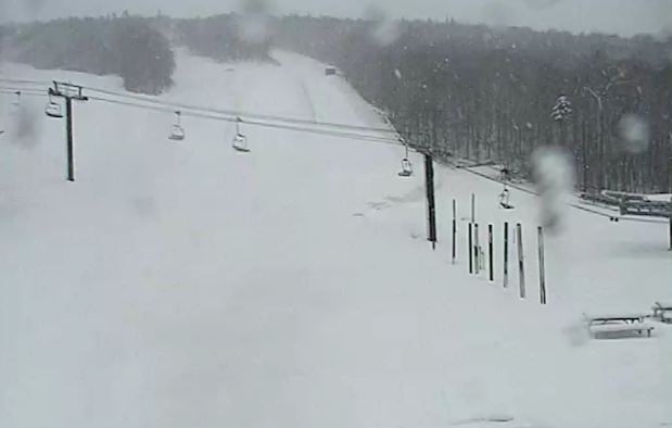
The big precipitation with this system has been falling across the high peaks of the Green Mountains. The oragraphic lift created by the northwest winds has produced steady and at times heavy snow showers with 19 inches so far at Killington Mountain and 15 inches at Jay Peak. The snow has been a blessing it what was otherwise a poor ski season in Vermont. It has allowed both resorts to open trails and welcome hoards of skiers looking for a final run. This was the biggest snowfall of the season in Killington.

Tuesday, April 10, 2012

Fire & Ice

The Killington web cam this morning showing over 1 foot of fresh snow down on the hills and still falling.
That pesky low pressure area that brought snow to Atlantic Canada on Easter delivered us a cloudy and cool Monday with periods of rain and showers totaling about 3mm in Montreal. It will be not better today with a chilly high of 8C and scattered rain and snow showers all day. Montreal may see a few breaks by late Wednesday and the system slowly drifts back to the east. The weekend looks to be sunny and much warmer at this time.

Large wildfires continue to burn in the dry brush of Long Island and New Jersey. (esaphotos)
The same system produced strong winds that brought down some trees in the Greater Toronto area. It also produced snow above 2000 feet in the Green Mountains of Vermont with a foot of fresh snow at Killington. The snow and any precipitation is welcome after what has been a very dry spring so far. Up until this latest rain and snow, precipitation had been scarce and forests and brush were tinder dry. Just last week alone firefighters in eastern Ontario responded to dozens of grass and brush fires across Leeds and Grenville and into Brockville and the Thousand Islands. Thankfully most were contained. Such is not the case across the middle Atlantic and Northeast where wildfires are raging. A big fire remains out of control in Suffolk County on Long Island. The fire has scorched over 500 acres including two homes, and injuring 3 firefighters. The fire was contained overnight as winds lightened but more gusty winds around that aforementioned low pressure will continue to produce ideal fire weather in Long Island and New Jersey today. Winds reached 43 mph on Long Island Monday and could gust to 30mph today

Monday, April 09, 2012

Showers or flurries & chilly

Low pressure is moving west into southern Quebec this week with flurries & showers.
I hope everyone had a great Easter, sadly, like many I return to work today. Also sadly like many as well, I have a cold. The annual spring tradition of colds racing around is in full swing as the ground thaws and releases all the nastiness back into the air.

The week starts off chilly with clouds, showers and temperatures in the 8C range for highs and 2 or 3C for lows in eastern Ontario and southwest Quebec. There may even be a few snowflakes across the regions northeast of Montreal and in the mountains of Vermont and New York. Stubborn low pressure that dealt the Maritimes an Easter Sunday snowstorm is retrograding (in weather terms, basically moving the wrong way) west towards northern Maine and eventually northern Vermont or extreme southern Quebec. It will take most of the week for the pattern to resume a more normal flow and sweep the low pressure area back east and out to sea. Until then look for lots of clouds, temperatures below normal, a chilly wind and showers scattered around at any time into at least Wednesday if not Thursday.

From CBC.ca, snow covered Easter flowers in Chester, Nova Scotia.
It could be worse, large portions of Atlantic Canada including Halifax awoke yesterday to 20cm of wet snow. The snow caused travel headaches for those trying to make it to church services or grandma's house as well as power outages. The storm is producing more snow today in the mountains of Vermont and New Hampshire as well as the Beauce area. Strong winds and high astronomical tides are producing flooding along the St. Lawrence River near the Gaspe Peninsula and as far southwest as Quebec City.

Friday, April 06, 2012

Weekend Update - AB snow

Edmonton and portions of Alberta were hit by a big snowstorm on Thursday. (Edmonton Sun)
Of Note: A Red Flag Warning is in effect for all of upstate New York and most of Vermont. Gusty north winds and very low relative humidity combined with a very dry spring and lack of snow cover has created a high fire danger. Now we don't have similar warnings on this side of the border but keep in mind the same conditions exist. We are very dry and any outdoor burning is not advised in eastern Ontario and southern Quebec.

The weather has become active again for portions of Canada. First we had a big storm slide north across Alberta on Thursday. The system dumped a heavy wet snow on Edmonton with 10cm at the airport but as much as 25cm in portions of the city. Calgary had 10cm. Visibility was very poor most of the day and numerous power outages were reported as wires came down under the weight of the snow.

This morning another strong storm is moving from Montana north into Saskatchewan by later today. The deepening low pressure area will give heavy snow and increasing north winds to Montana and southern Saskatchewan. Snow will accumulate between 15 and 30cm locally with winds gusting to 70km/h producing poor travel. The National Weather Service in Glasgow, Montana has issued a Blizzard Warning for this afternoon and tonight and is advising against travel overnight. Winter Storm Warnings are in effect for Moose Jaw and southwest Saskatchewan.

Meanwhile the weather in Montreal and southern Quebec will be controlled by advancing high pressure that will provide a sunny but chilly Good Friday. Later today, low pressure will be gathering steam along the east coast near the Outer Banks of North Carolina. This storm will move north and then west into eastern Quebec by Sunday. A maritime block is preventing this system from moving northeast and it may actually back (retrograde) into Quebec by Monday. We could see an increase in winds and cloud cover by late Sunday along with some showers of flurries to start next week.

If you think Montreal is immune to big April snowstorms, think again. There have been many but one that stands out for me was between April 3-6, 1975. Montreal had a massive winter storm (primarily on April 3rd) with 33cm of snow, winds gusting to 87km/h and visibility of under 1km for nearly 15 hours. The pressure bottomed out at 983mb as this big storm swept from the US Midwest across the Ohio Valley and into southern Quebec.

Wednesday, April 04, 2012

Dallas tornado - Alberta snow

There is weather out there despite the calm nature of things here in southern Quebec. Skies were partly cloudy on Tuesday with temperatures around 10C. We will see much the same today with partly cloudy skies but an outside chance of a shower or two as a weak cold front advances across the region. Winds are forecast to increase this afternoon to between 30-50km/h from the northwest. They will continue into the overnight with a chilly low of 0C. The Easter long weekend at this time looks perfect with slightly above normal temperatures and bright sunshine all weekend.

A fierce tornado near Lancaster, Texas on Tuesday.
You have to head south or west to find the active weather. Strong low pressure in the Rockies was responsible for driving a potent cold front across Texas on Tuesday. That combined with deep moisture from the Gulf of Mexico set up the perfect conditions for severe weather. At least two large tornadoes swept across the Dallas/Fort Worth metroplex with widespread damage reported. One storm near Lancaster, Texas was filmed throwing large semi trucks into the air as if they were no more than toys. According to CNN and lot owner Wisconsin-based Schneider National Trucking Co. there were no injuries at the facility, but there was significant damage to the building and equipment. A tractor weighs 20,000 pounds. An empty trailer weighs 14,000 pounds, while a full one weighs about 46,000, the company said. Unreal power! Nearly 150 homes were damaged in Arlington, Texas and 110 aircraft were damaged at the Dallas/Fort Worth Airport forcing its closure and stranding thousands of passengers. The National Weather Service said that between 6 and 12 tornadoes occurred in north Texas with teams spreading out today to survey damage and solidify the total. Despite the ferocity of the storms only three injuries have been reported so far.
Watch the full video HERE.
From WFAA Dallas, a semi is thrown through the air with ease during a tornado on Tuesday.
 SNOW: Meanwhile in Alberta it is a return to winter with heavy snow forecast for Calgary and Edmonton as well as the surrounding areas of northern and western Alberta tonight and Thursday. A low pressure moving north through the province will give 10-20cm of snow to the region with strong winds causing near zero visibility in blowing snow. Just another spring day in Alberta.

Monday, April 02, 2012

Chilly start to day

Yesterday's rain combined with temperatures just below freezing early this morning have created the ideal ingredients for black ice. Combine that with the morning rush hour traffic and the result has been numerous accidents including a multi-vehicle collision that has closed Highway 20 in Pointe Claire on the West Island of Montreal. It is just a very thin layer but still enough to ice the roads and make driving very dangerous. It will melt quickly with the rising sun, however for the moment it remains slippery as we sit at -3C here on L'Ile Perrot.

Montreal had between 3 and 5mm of rain on Sunday as a weak weather system moved southeast across the region. It has been replaced today by high pressure that will provide us with sunny skies and seasonable highs at 8C into Tuesday. Another weak area of low pressure will move across the area on Wednesday following a similar path as yesterday's low and providing southern Quebec and the region with a few flurries or showers. Afterwards we are looking at stronger high pressure settling in for the Easter Long Weekend, and providing the entire area with sunny skies and warming temperatures to near 16C by Easter.

Thursday, March 29, 2012

Typical late March weather

It may seem cold to many, but this is pretty much what late March in Montreal should look and feel like. If anything we are still well ahead of the curve. I can remember may years where piles of melting snow was still all around us. We have also had many notable April snowstorms. It will be a cloudy and damp day again today with some scattered flurries or showers. Skies will slowly clear out tonight as high pressure moves into Ontario and Quebec with a mainly dry and cool start to the weekend. The exception will be south of a line from Kingston through the GTA and into southwest Ontario where low pressure south of the Great Lakes may bring some snow and rain Friday afternoon. If your travels take you that way keep this in mind as enough snow may fall around Hamilton to London to cover the roads. Yesterday snow fell northeast of Montreal in Quebec City and southeast into the Beauce region. As much as 10cm of snow fell in places from southern Quebec into northern Maine and New Hampshire.

In the temperature department we were normal yesterday at around 5C, and that pretty much is what we will see today and Friday. The weekend will be a little milder pushing 10C.

Wednesday, March 28, 2012

Damp & Chilly

This is why we should not get too excited about 25C in March! A dusting of snow on L'Ile Perrot this morning. (ValleyWX Pic)
 The temperature in Montreal and here on L'Ile Perrot this morning is right at the freezing point. An area of low pressure will move from Lake Superior southeast to northern New York today. It is a rather weak system and moving into some very dry air, but that has not stopped some light snow and rain from occurring in the region this morning. Montreal had a coating of snow overnight, enough to cover the cars, roofs and grassy areas. This is quite a shock to the system after the summer weather of last week. Another area of moisture on radar is moving into Ottawa and Eastern Ontario at this hour and falling in the form of freezing rain. Environment Canada had issued a freezing rain warning for Ottawa and southern and western Quebec including metro Montreal this morning, but it has since expired. As much as 5mm of freezing rain fell locally this morning before temperatures warmed to above freezing. Look for a rather cloudy 24 hours with some showers or flurries and chilly. Another 1-3cm of snow is quite possible overnight tonight especially in the higher elevations of the Townships and Vermont. Skies will clear by Friday with a slow warming trend into the weekend.

Tuesday, March 27, 2012

Snow

Don't panic but snow is on the menu for tonight in southern Quebec and eastern Ontario. We had a very cold start to the day with temperatures down to -8C at the airport early this morning, a far cry from the low teens last week at this time. Highs today under bright sunshine should warm nicely to 3 or 4C before falling back to -3C by midnight. A low pressure area is forecast to cross the Great Lakes and then move along the US border on Wednesday. Light precipitation is expected with this track with some light snow starting overnight and mixing with freezing rain and rain by mid morning Wednesday. We are not looking at much in the way of accumulations, but perhaps a dusting to 2cm locally in Montreal and Ottawa. That will be enough to cover the grassy areas and perhaps make the roads a little slick. Remember folks it is still March. A mild and dry weekend is forecast at this time as high pressure move over the area with normal temperatures.

Monday, March 26, 2012

Much colder

Reality has settled back into southern Quebec and Ontario this morning with temperatures in the -2C to -4C range and really not going anywhere today. Gusty northerly winds overnight along with a strong cold front are responsible for the colder air with temperatures over 25 degrees colder than last Monday. Despite the blustery chill today, it will be sunny and dry. The week looks rather mundane with just a few flurries or showers mid week as a weak system skirts along the US border. Otherwise it will be cold to start and gradually warming up by the weekend. The big news today will be the cold with temperatures dropping to -9C in the city tonight and even colder off island. Quite a shock to the system after the record highs of last week.

Winter is taking back March over most of the country with heavy snow and strong winds forecast across southern Saskatchewan late tonight and Tuesday, spreading east into Manitoba. Meanwhile a strong low pressure area is forecast to develop east of Cape Cod and move north towards Atlantic Canada. Heavy snow and strong winds are forecast in New Brunswick, the Gaspe region and portions of Nova Scotia by Tuesday. I will post more on these storms later today including warnings and watches.

Friday, March 23, 2012

Weekend Update

Well it looks like our streak of record warm days will come to an end at 5 here in Montreal. We have an outside shot at today's record high which was 18.6C set in 1979, but it is a long shot with a forecast high at 16C. A weak cold front slipped south of the region late yesterday accompanied by a few light showers and a rumble or two of thunder. Today will be sunny, breezy and dry with temperatures about 10 degrees colder than Thursday, but still 10 above normal. On Thursday Montreal reached 23.9C beating the old record of 15C set in 1946. Hundreds of other records fell all over the area as a matter of fact we had record high temperatures from Saskatchewan clear across the the Atlantic Coast. Locally Kemptville reached 24.5C (16.7 - 1953), and Ottawa 24.9C (15.6 - 1953).

The weekend looks unsettled and much cooler as low pressure moves from the Dakotas into the Great Lakes and eventually south of Montreal. There is not much moisture with the system but it will bring cloud cover as well as cooler temperatures and a few showers on Sunday. Temperatures will be 16C today, but only 9C on Saturday and even cooler Sunday around 5C. While temperatures are much colder, this is seasonable for March. Next week it looks like things will warm again to above normal, but not the hot weather of this past week.

Thursday, March 22, 2012

Warmest March day on record

Global Warming? Just another March day in Ontario and Quebec. CTV.ca
After reviewing the data from Wednesday, Environment Canada has listed the official high at Trudeau Airport in Montreal at 25.8C or about 78F. This makes it the warmest Montreal March day since record keeping began back in the early 1900's and edges a 67 year old record of 25.6C set in 1945. I would say this spell of warm weather now qualifies as historic. The icing on the spring/summer cake is today as we have already broke the record high of 15C set in 1946, the 5th day in a row. Montreal was still at 17C as the new day started so the record was broken in the wee hours of the morning. With advancing cloud cover today and a few showers and thunderstorms forecast, we should make it to about 22C, still an incredible 17 degrees above the normal high for March 22.

Hundreds of records fell all over Ontario, Quebec and New England yesterday, too many to mention. Some notables were 27C at St. Anicet/Lancaster, 27.4 at Ottawa, and 81F at both Massena, NY and Burlington, Vermont. One of the warmest temperatures in the country was an incredible 28.8C (84F) at Petawawa in Ontario. That destroyed the previous record of 12.2C set in 1976 and was 23 degrees above normal.

Reality will very slowly settle back in this weekend with more normal air moving into the region and temperatures settling down to the single digits for highs and possibly below freezing for lows by Sunday.

Wednesday, March 21, 2012

Historic heat


By now everybody knows just how lame this past winter was in most of North America, with just a few exceptions. That snow less winter is setting up historic heat to start spring. Montreal broke another long standing temperature record on Tuesday smashing the previous one in the process. The high at Trudeau Airport was 23.5C (I had 25C here on L'Ile Perrot) eclipsing the old one of 13.9 set in 1946. It was part of nearly 200 record highs set across Ontario and Quebec since Monday, and hundreds more across the US. Both Milwaukee, Windsor, ON and Burlington, Vermont hit 80F yesterday, the earliest on record. Toronto set a new daytime high at 21C (19C - 1918), and Ottawa 25.8C (14.6C - 1995). Massena and Cornwall both hit record highs of 79F (26C), while Kemptville was 25.5C.

We will easily smash today's record of 16.7C set in 1946, most likely by noon if not sooner, that is the consolation prize. We are heading for the big prize today, the warmest March day on the books dating back to the 1800's. That temperature was 25.6C set on March 28, 1945. Montreal is forecasting 26C.

All this heat is creating some oddities, such as budding trees and popping tulips, nearly 6 to 8 weeks ahead of schedule. It has also meant a dismal maple season with most trees not producing sap any longer, having done so in some cases for less than a week. Conditions are also starting to dry out rapidly with very little precipitation this winter, and this is increasing the threat for grass and brush fires in some rural locations. We are also experiencing an early bout of smog in some major cities such as here in Montreal and Hamilton. Strong high pressure will give us two more hot days with mild overnights before a cold front snaps us back into reality by Friday and certainly Saturday night when we may see a snowflake or two and below freezing temperatures.

Tuesday, March 20, 2012

Spring is here

NEW Record High of 23.3C for Montreal

Spring arrived in the wee hours of the morning at 1:14am EDT. Today will be more like summer with temperatures at levels normally observed in mid May. It is a cool start to the day with temperatures around 3C across the area, still well above the normal low of -5C. Temperatures on warm southwest winds and bright sunshine will soar to record values once again today and tomorrow with highs expected near 24C. The normal high for March 20 is 4C, last year the best we could do was 3C and we were awaiting snow which would dump up to 10cm on southern Quebec. Not the case this year as record warmth has spread across the eastern third of North America with the exception of the immediate coast. Yesterday Montreal reached 20.1C by noon smashing the previous record of 15.7C set in 2010. Today's record is decades old at 13.9C set in 1946, and we will likely break that by noon. It could have been even warmer yesterday, but a back door cold front capped temperatures just after lunch here in Montreal, and produced some rather strong thunderstorms over New York state. In Ottawa the high was 24.8C breaking the 2010 record of 16C.

An AMA web cam showing heavy snow and zero visibility on the Trans Canada near Medicine Hat on Monday afternoon.
Alberta Blizzard
It is not summer everywhere. A strong low pressure area moving north from the Rockies crossed Montana and extreme eastern Alberta yesterday with heavy snow. Up to 25cm fell in southeastern Alberta and extreme Western Saskatchewan. The snow was accompanied bu strong winds of over 70km/h producing blizzard conditions that forced closure of the Trans Canada Highway from Brooks east towards Saskatchewan. The visibility in Medicine Hat was well under 1km for over 7 hours. Power was also knocked out in places as the heavy wet snow brought down lines. The snow is now over northern Saskatchewan.

Monday, March 19, 2012

Hot end to winter


Record crowds turned out in record heat for the annual Montreal St. Patrick's Day parade on Sunday. (The Montreal Gazette)
I have to keep reminding myself repeatedly that is is March, it is March. This is unreal, never before in my 25 plus years of following Montreal weather have I seen it this warm, this early. Montreal soared to 23.1C on Sunday, smashing the record of 14.1C set back in 2010. We joined a long, long list of communities from Manitoba to New Brunswick and Quebec to the Midwest and southern US that also enjoyed record heat. Ottawa reached 25C, obliterating their record of 16C set in 1966. Cornwall and Kemptville also posted record highs yesterday as did Burlington, Vermont at 76F. Keep in mind the normal high temperature for March 18 is a lonely 4C (39F). Montreal this morning is already at 12C, so we should very easily surpass today's record high also set in 2010 at 15.7C. As a matter of fact winter ends today and spring starts tomorrow, but really it will be summer like for the balance of the week with temperatures in the low to mid 20's through Thursday before more "normal" weather arrives by next weekend.

A few stray showers or perhaps a thunderstorm could occur today across Eastern Ontario into upstate New York today, but I think Montreal should remain dry. Cooler overnight temperatures promote the development of fog each morning so be aware of that when driving. Highs on Tuesday should be even warmer around 22C with the possibility of 26C or close to 80F for places like Kemptville and Ottawa by Wednesday.

**Anyone who has a glance at my weather data from here on L'Ile Perrot, I just want to let you know my humidity sensor is stuck at 98%. I am working on fixing it, but for now that data is wrong. Everything else is good.

Sunday, March 18, 2012

The heat is on!

Montreal's Olympic Stadium tower shrouded in dense fog Saturday afternoon. (ValleyWX Pic)
Record high today for Montreal: 23C

Strong high pressure is building into Quebec and the entire east coast finally starting to dry out the damp air mass that has been in place over southern Quebec all week. Yesterday we saw a high of 11C, but only after the dense fog burned off around noon. The fog held on tight in Montreal with near zero visibility most of the morning, slowing traffic and cancelling dozens of flights in and out of Trudeau Airport. Once the fog lifted we were left with a a damp but sunny day. Today is very different with a south wind and much warmer with Montreal already at 9C. We will easily surpass the record high of 14C set in 2010 with a forecast high today at 20C. It should be dry most of the day, but a weak cold front will approach the area tonight with the chance of some showers. The front will leave us with just a slightly cooler Monday at 15C before the front washes out south of the province and the warm air surges back north for the balance of the week. Temperatures will soar to record highs all week, even challenging the warmest Montreal March day on record, 25.6C set on March 28 in 1945. The temperature has a change of reaching 25 or 26C by Wednesday. It would be the earliest such high temperatures on record for the city.

Friday, March 16, 2012

Weekend Update

Tornado damage near Dexter, Michigan on Thursday. ABC News
A warm front remains to the west of Montreal this morning with rain and some thunderstorm activity affecting eastern Ontario and western Quebec. Eventually, and I really hope it is today, that warm front will lift northeast of Montreal and we will enjoy what is looking like a record breaking, sunny weekend. Temperatures continue cool in the St. Lawrence Valley with current readings at 1C, pretty much where it has been all night. Literally thousands of record highs are being broken across the Midwest, Great Lakes and east coast. That warm air will surge into Montreal by Sunday with highs forecast around 20C. I believe places like Kemptville, ON away from the water may see highs push 24 or 25C on Sunday and Monday. If we can hold a backdoor cold front at bay on Monday we will enjoy a warm week next week. We will have to wait and see because at this time of year, temperature forecasts are tricky, heavily influenced by the snow cover to our northeast and the cold waters of the Gulf of St. Lawrence. Time will tell, but in any event it will be a sunny and dry weekend with temperatures well above normal for March, and great weather expected for Sunday's St. Patricks Day parade in Montreal.

This warmth will break many records not only for daytime highs, but also overnight lows, duration of heat, and in many places the warmest readings so early in the season. Remember it is still winter, and no really cold air is on the menu into next week. How unusual is this weather? Well yesterday heavy thunderstorms were moving across Michigan and into southwest Ontario. They produced hail, damaging winds and several tornadoes. Hail was even reported near Ottawa.

Thursday, March 15, 2012

A warm weekend ahead

The forecast for warmer weather is still on for portions of Ontario and Quebec. Strong high pressure near Bermuda is pumping warm air north into the eastern third of North America. Where the forecast becomes problematic is along the periphery of the warm air. The St. Lawrence Valley has been a roadway for cold and damp air from the North Atlantic to stream southwest where it encounters the warm air over southwest Quebec. That has made the temperature forecast very problematic this week. The result was wet snow yesterday in Montreal when we expected showers and temperatures much warmer. The temperature spread has been significant over a very small area with temperatures hovering just above freezing in Montreal yesterday at 2.5C for a high while Toronto reached 18C and Brockville close to 10C. The warm air is having trouble again this morning displacing the cold, dense air across Eastern Ontario and west Quebec. A line of showers and thunderstorms has developed across eastern Ontario and will slowly lift northeast today. There is even some freezing rain and hail being reported this morning in the Ottawa Valley with temperatures at or just below 0C.

Bottom line is we feel it will be a damp and chilly 24 to 36 hours more with some light rain and drizzle at times and even the rumble of thunder in the region. Once the front clears the area by early Saturday look for an unprecedented warm weekend with highs into the 20's by Sunday under sunny skies. The normal high for March 15 is 3C and the normal low -6C.

Wednesday, March 14, 2012

Fog and (snow) showers

2pm Update: Cool air remains entrenched in the St. Lawrence Valley today with temperatures no better than plus 1 or 2C in Montreal. We also had several hours of wet snow over the city. This while places in southern Ontario from the GTA west towards Windsor are approaching 15 to 20C this afternoon. Even Ottawa is at 7C. It will warm up here by the weekend (fingers crossed). The snow today melted on contact and is now just bout over. 

An upper level low pressure area will slide across eastern Ontario today and into southwestern Quebec. The low will keep cold air trapped at the surface in the St. Lawrence Valley, meaning the warm temperatures that avoided the city yesterday will do so again today. Montreal has dense fog at 7am and a lonely 1C, where we have been stuck since 10pm last evening. We will have a little more company today however as temperatures will be down across eastern Ontario as well. Sowers are occurring also with the system and will spread into Quebec from Ontario today. All Montreal could manage in the low clouds and fog yesterday was 8C, meanwhile Kemptville, ON was 17C. Areas just to the south of my location, as little as 20 minutes away warmed to 16C (60F), while the best I could do here on Ile Perrot was about 7C (45F). Today we are starting off very foggy across the region with visibilities under 1km at Dorval since 3am and as little as 1/2 kilometre at times.

The big news will be the heat during the upcoming weekend and into the start of next week. The balance of this week will be mild but rather cloudy with the risk of showers at times and even a thunderstorm late Thursday. By Saturday strong high pressure will move into the region and slowly slide off the east coast. It will pump very warm and dry air from the southwestern US that will send temperatures soaring to record highs for March. Temperatures will likely approach and exceed 20C across eastern Ontario and western Quebec by Sunday and prevail well into next week. Some locations away from water sources may even reach the mid 20's. These temperatures will be well above the average high of 2C and should easily shatter records.

Tuesday, March 13, 2012

Stubborn cold air in Montreal

From wunderground.com
As has happened so often this past winter a warm front is unable to scour cold air out of the St. Lawrence Valley in Quebec today. While areas south and west of us are soaring to record highs, Montreal remains cold with a northeast wind and fog. As the above Weather Underground area map from 3pm shows, many areas just to our southwest are near 16C. Burlington, Vermont has another record high with 18C so far. Montreal will remain damp and cool tonight with the warm air staying to our south. Lows will be near 2C and if we are lucky we may see a 9 or 10C on Wednesday under cloudy skies. It is still well above normal but so much colder than surrounding areas. Want warm air? Then just head to the south shore to places like Hemmingford, Lacolle or St. Anicet where it is 15C.

Spring warmth and 1993

Today in Montreal the weather is in stark contrast to that of 1993. We are currently at 5C here on Ile Perrot with a warm front to our west along with some showers and even a rumble of thunder about to move across the city. We just missed a record yesterday, reaching 13C, 2 degrees shy of the 1977 record. Burlington, Vermont broke another record reaching 63F. This warm spell is not over, we will challenge the record high today with a forecast 12C (54F) and the record 12.2C set in 1946. Montreal has watched the snow pack dwindle to just a few dirty piles in a matter of days. There is even some flowers beginning to push through the newly thawed earth. The warm weather is forecast to continue right into next week with no cold air in sight. A little rain today will give way to partial sunshine for Wednesday. The weekend at this time looks glorious with sunny skies and highs around 16C. There is some winter weather around with snow and freezing rain forecast today in Nova Scotia and New Brunswick with perhaps some freezing rain from Quebec City north and east.

MARCH 1993 SUPER STORM
An unbelievable storm on radar stretching from Quebec to Cuba on March 13.
 On this day in 1993 a wicked storm known as the March 1993 Super Storm raced up the east coast producing tornadoes, storm surge flooding and heavy rain and snow. The storm left behind damage, death and destruction from Cuba to Atlantic Canada. Montreal was hammered in a 12 hour period receiving between 38 and 45cm of snow in a very short period of time. The storm was accompanied by strong winds and blizzard conditions with biting cold for March. A new record low was set during the storm of -19.3C and again the next morning at -23C.
The aftermath of the storm in Montreal.
The snow closed down highways across New England and even closed the bridges in Montreal for a few hours. Visibility dropped to below 1km for over 12 hours including a 4 hour stretch overnight into Sunday morning with zero visibility at Dorval. A low barometric pressure of 974mb was observed in Montreal during the storm. I do have video as I mentioned yesterday and promise to track it down soon and post it. On Sunday March 14, 1993 the Montreal Gazette could not be delivered by our fleet of trucks to the stores or paper carriers. I worked for them for over 10 years and it was the only morning in my career there that we could not get the papers out. My truck was buried in snow up to the roof on the front of the vehicle parked into the wind. It was an amazing storm.

Monday, March 12, 2012

More record warmth


From AccuWeather.com the Spring 2012 outlook. Lots of red means lots of warmth for Quebec and eastern Canada.
The only thing that may overshadow the warm and seemingly storm free winter of 2011/2012 may be the warm and storm free spring of 2012. As a matter of fact we may skip spring all together and just jump into summer, as this week will be warm and next week as well. Just how warm? Well I think areas without snow cover and away from the effects of cold water could see highs over 20C by early next week. Montreal had another record high yesterday, the second of this young month, reaching 11.2C beating the old high of 10C set in 1977. Toronto also had a record high at an incredible 17.7C. The normal high for Montreal on March 11 should have been 2C. We are at 2C now for our low. Today will be another sunny day with high temperatures in the low teens, about 10 degrees above normal. A weak disturbance will give some showers tonight and Tuesday, but still very warm at 14C tomorrow. The balance of the week will feature fair weather and warm with highs from 12 to 16C and low from 2 to 4C.

We are coming up to the anniversary of the March Superstorm of 1993. I hope to track down some video I shot during that storm when Montreal received 43cm of snow in about 12 hours on a Saturday night.

Friday, March 09, 2012

Much colder

Don't forget to Spring Forward this weekend with Daylight Savings Time at 2am Sunday morning. That means one less hour of the weekend, why do we not do this at 4pm on Friday at work?

After yesterday's record high in Montreal, we wake to ice and snow on L'Ile Perrot. ValleyWX
What a difference 24 hours can make. That was one potent cold front that swept southern Quebec and Ontario last evening with plenty of moisture, gusty winds and plummeting temperatures. Montreal reached a record high of 13C (55F) yesterday at around 11am. It beat the old record of 10.8C set in 2000. By late afternoon a steady rain had developed along with increasing westerly winds pushing 60km/h. Temperatures fell from 11C at 6pm to 6C at 7pm and 0C by midnight. The rain changed to a brief period of heavy wet snow that coated everything and iced up the roads. Depending where you are in the metro-region you saw between 3 and 5cm of snow overnight. That leaves us at -5C this morning with windchill values as cold as -10C and icy roads. All this in 24 hours or less. Now be prepared to go the other way because that is just what we will do this weekend. A warm front will approach the region on Saturday with highs near the freezing point, and all the way up to 9C on Sunday. No appreciable precipitation is in the forecast at this time with perhaps just a few flurries overnight and Saturday. Next week looks to be very mild with well above normal temperatures.
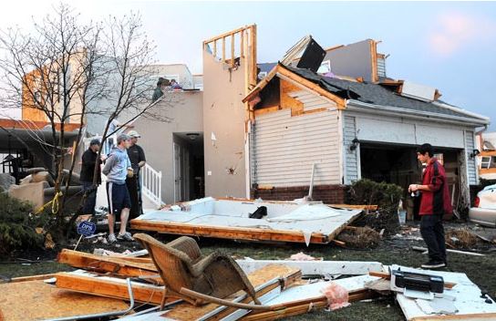
Other records broken yesterday included 61F at Montpelier and Burlington, Vermont and 61F at Massena/Cornwall. The warm temperatures have created some flooding concerns in upstate New York with a flood advisory posted for Clinton County, New York including the Village of Champlain. Melting ice is jamming on the Great Chazy River near Perry Mills and creating high river levels and minor flooding.

Thursday, March 08, 2012

Record Warmth

You can almost hear the snow melting, and what we are left with is mounds of snirt, a nasty combination of once pure white snow mixed with everything hidden by winter and sprinkled with road grime, salt and sand.

What a change in weather this week, from Monday's -17C mroning lows to yesterdays record tying high of 11.7C here in Montreal at Trudeau Airport. Montreal had actually one of the colder readings yesterday with the winds blowing in off frozen Lake St. Louis and keeping the temperature down just slightly. South of the city here on L'Ile Perrot I reached 15C at 5pm, while St Anicet beat their record high reaching 15C (11/1994). Other notable highs yesterday were Toronto at 16.7C (16.7/1987) and Ottawa at 11.7C (11.1/1974). The normal high for Montreal for March 8 is 0C. Keep in mind on this date in the winter of 1970/1971 Montreal still had 100cm of snow on the ground, actual depth not piled up, those were feet high and would not melt until well into the summer that year.

Today will be another warm day for Montreal, the temperature has already been as high as 10C at the airport but has since settled down to 8C and currently I am showing 12C. The record for today of 10.8C set in 2000 should easily be surpassed. It will be the last warm day in this current spell as a strong cold front is over central Ontario this morning and will approach southern Quebec this evening. In advance of the front we will have a cloudy day with very warm temperatures and gusty southwest winds. Those winds never made it to the surface in Montreal yesterday but they should today reaching speeds of 60km/h by noon. Showers, some rather heavy, will develop late this afternoon and taper to flurries overnight as the temperature plunges from record highs down to nearly -5C by morning. Needless to say any water accumulation and light snowfall will freeze on roads so travel with great caution overnight and Friday morning. Friday will be partly cloudy, breezy and much cooler at 1C with flurries at times.

You have to love spring, if you don't like the weather just wait a few hours!

Tuesday, March 06, 2012

A taste of spring


A sad and surreal sight on Monday as snow covers tornado damage in Kentucky.
Warm weather is on our doorstep here in southern Quebec. We had another cold start to the day with temperatures close to -18C in many areas. The bright March sun quickly made it feel much better and we are sitting at -4C here on L'Ile Perrot at 5pm. Despite the cold start to the day I even noticed a little bit of melting in my back yard this morning. There will be lots more of that over the next 24 to 48 hours as high pressure moves off the east coast and sets of a mild southerly flow of air. Temperatures will rise slowly overnight and on Wednesday soar to plus 10C or 11C. A few flurries will accompany the warm air overnight as it streams into the region.

Warm temperatures are expected up and down the east coast including tornado ravaged Kentucky which could use the good weather to help with clean up and recovery efforts. Winds are forecast to increase out of the southwest in the St. Lawrence Valley and gust as high as 70km/h on Wednesday. Another warm day is on tap for Thursday before a cold front brings us some showers and cooler temperatures later in the day. Friday at this point looks more seasonable with perhaps a few flurries or showers.

Winter weather is holding on in Newfoundland tonight as a blizzard bears down on St. John's and the eastern portion of the province. The heavy snow is just about to start along the coast as low pressure moves just offshore. Up to 30cm of snow is expected, accompanied by strong winds approaching hurricane force in coastal communities. Inland snow and blowing snow is forecast with 10-20cm and 100km/h wind gusts.

Monday, March 05, 2012

Big warm-up this week

It is a very cold Monday morning across southern Quebec. I am rather surprised at just how cold it is here at my home on L'Ile Perrot, I am currently showing -17C with a windchill of -23C. Skies cleared out overnight allowing for a rapid drop in temperatures. Most areas of southern Quebec and eastern Ontario still have snow cover so this helps generate the colder readings. We are in for a major warming trend this week that will see big time melting of the snow pack with spring definitely in the air. Temperatures will be chilly today no better than -8C. We are looking at another cold night tonight around -15C for lows in the area. Tuesday will be much milder with temperatures beginning a sharp rise on southwest winds that will see highs near 0C and all the way up to plus 10 or 11C (50 to 52F) on Wednesday and Thursday. A few showers are possible later in the week, but otherwise no major precipitation is forecast at this time. While in normal winters I would still believe we have a snowfall or two left to go this early in March, this year has been so strange, this could likely be it for winter 2011/2012.

Sunday, March 04, 2012

Thoughts on tornadoes & the blizzard of 1971

What more can you say about the violent storms in the Midwest and south, the damage leaves you struggling for words. CNN.com
Winds have abated this morning across the Montreal area after reaching speeds of as high as 90km/h in Montreal and over 100km/h in eastern Ontario. Power was out to thousands in Ontario, but little damage was reported in our region. The storm was deadly and widespread with traffic accidents in snow and wind and tornadoes claiming dozens of lives from Quebec south into Kentucky, Illinois, Indiana and Alabama. I was looking at pictures from the Appalachian town of West Liberty, Kentucky. The images leave you without words. The damage is complete, from small trailer homes that you would expect to be destroyed in an EF-3 storm all the way up to solid brick buildings that have stood for many decades. There is no structure left untouched and the town will have to be rebuilt. Of the 34 deaths from Friday's outbreak, 17 occurred in Kentucky, 1 in West Liberty.

The cold front responsible for all the tornadoes, 97 in all, is well off the east coast this morning leaving in its wake clearing skies and much colder temperatures. To add to the misery some portions of the disaster area will see 2 to 3 inches of snow tonight.

Blizzard of 1971...

I have posted two more images from the vault at Radio Canada. They are of the famous Montreal blizzard of March 3rd and 4th, 1971. Close to 50cm of snow fell driven around by near hurricane force winds up to 111km/h. This is what started it all for me in weather. Read more about it from my previous blog post HERE.


Saturday, March 03, 2012

High Wind Warning

There is lots to talk about this morning so I will start with a high wind warning in effect for the entire St. Lawrence Valley. Winds have already gusted to 59km/h here at Trudeau Airport and they will continue to increase as a strong cold front approaches the region. Winds will come out of the southwest and gust to 90km/h by the noon hour in Montreal. Winds in Ontario have peaked at 107km/h at St. Catherines, 96km/h at Long Point on Lake Erie, 91km/h at Toronto and 86km/h at Cobourg.

This morning we are seeing more convection developing along the cold front just west of our region. Look for a few showers to accompany the front as it crosses Montreal. We may even have a rumble of thunder, as that was quite common in Ontario last night. The main energy of the low pressure will swing through Quebec later today with some light snow developing tonight along with blowing snow and lasting into Sunday. Up to 5cm may fall over Quebec. Winds will be the big story with this storm. Warnings are in effect across the area from Quebec City all the way to Windsor, Ontario and south into northern New York.

Unbelievable damage from Harrisburg, Illinois on Friday (CNN.com)
Deadly Tornadoes
Strong low pressure is moving east from the Great Lakes this morning. What more can you say about this deepening area of low pressure, it has been deadly, catastrophic and unprecedented for early March. Nearly 100 tornadoes were spawned yesterday from Ohio to Alabama. Especially hard hit were Illinois, Indiana and Kentucky. Winds of up to 180mph accompanied some of the storms. One twister in Harrisburg, Illinois virtually levelled the town killing 6. The death toll is sitting at 31 this morning, and close to 50 from the week of storms. The number of tornadoes yesterday exceeds the normal monthly total in the US for March. The images of destruction are hard to understand and grasp and I get it, I understand weather, and yet the severity of these storms even surprises me.

Friday, March 02, 2012

Stormy Saturday

Cleaning up last weeks storm. CBC.ca
While we close the books on this latest winter storm, we will rapidly welcome the next one close on its heels. Montreal received about 15cm of snow at the airport yesterday with a little more perhaps closer to 18cm here off island to the south. Winds were quite gusty last evening with blowing snow and snow covered roads, but nothing we could not deal with in March.

Plowing the Trans Canada service road in Kirkland on Thursday. (ValleyWX Pic)
That storm slowly filled over the region last evening while a second low pressure area developed off the east coast and moved out to sea, brushing Atlantic Canada. Our next weather maker is a strong developing low over the southern plains that is forecast to move towards the Great Lakes and into central Quebec on Saturday. This storm will have warmer air than its predecessor so we are looking at snow this evening changing to rain before morning. Temperatures will be around 0C today but rise to plus 4C on Saturday. We are looking at about 2-5cm of snow here in Montreal followed by a few millimetres of rain. The big component with this storm will be a potent cold front that will generate thunderstorms from southern Ontario southward into the Gulf states. Some of the storms will be severe today from Kentucky and Ohio south with the risk of large hail, damaging winds and long track tornadoes. As the cold front approaches our region Saturday very strong southwest winds will develop up to 70km/h with some gusts approaching 90km/h in the St. Lawrence Valley. Wind warnings mat be needed for a portion of the area on Saturday. Sunday will be much calmer with cloudy skies and a few flurries, but a little cooler at -3C.

I will post an update on this winter storm later this morning.

Thursday, March 01, 2012

Deadly tornadoes & a little snow

Our current weather system has been a little bit of a bust on the snow side so far. While is is snowing in Montreal and forecast to do so the balance of the day, I think the heaviest precipitation, what little of it there is, will remain south of metro Montreal. The storm center is currently over the Great Lakes and moving east. It will try to regain a little of its former self today but I think snow totals will be under the original forecast. Looking at the radar this morning we have some light snow over southern Quebec with another batch mixed with some freezing rain over Ontario and upstate New York. Winds have been creating a little blowing snow in places but nothing extreme. Environment Canada has lowered the winter storm warning to a snowfall warning (this is the equivalent of a winter weather advisory in the US). Storm totals will end up somewhere between 10 and 15cm by late today. Here in L'Ile Perrot we sit at -5C with about 4cm on the ground overnight.


EF-4 tornado damage in Harrisburg, Illinois (Reuters Photo)

The real deadly aspect of this storm was the severe weather that occurred yesterday along the trailing cold front. I was amazed by the strength of the pre-dawn twisters that swept through Missouri and into Kansas, Illinois, Indiana, Kentucky and Ohio. At one point a tornado watch was in effect clear up to northern Ohio along the Lake Erie shore. It is only February people and we witnessed quite likely an EF-4 tornado yesterday in Harrisburg, Illinois. The damage is extensive in Harrisburg with 6 deaths reported in that state and a total of 12 so far. Damage was widespread with homes and businesses destroyed. The storms are a little weaker today but still potent with the threat shifting into the southeast including Alabama and Georgia.

There was even thunder and lightning reported at multiple locations across Southwest Ontario last night including Sarnia, London and Windsor.