Wednesday, January 17, 2007


Bitter Cold in Kemptville
More Winter Weather on the way

The snow of this week will be around for some time to come. Kemptville received about 10cm from Monday's storm with Ottawa 10cm and Montreal and The Seaway closer to 20cm.

The snow was followed by brisk winds and biting cold. This morning Kemptville bottomed out at -27C for our coldest morning in nearly two years. The extended forecast will see more cold air dive south for the weekend. Temperatures will warm slightly with flurries tomorrow and Friday. A general 5cm of snow may accumulate in our regions (Montreal/Ottawa/Kingston) with more across higher terrain and near the snowbelts of Lakes Erie and Huron. As the snow tapers late Friday more arctic air on strong northwest winds will develop. A departing coastal storm that is providing lots of ice across the deep south today will move into the Maratimes this weekend. Heavy snow will fall in New Brunswick and Eastern Quebec.

Next week several clipper systems will bring more light snow, wind and cold to the Great Lakes and Quebec. Winter is here for a little while longer!

Monday, January 15, 2007

Stormy day in Ontario & Quebec

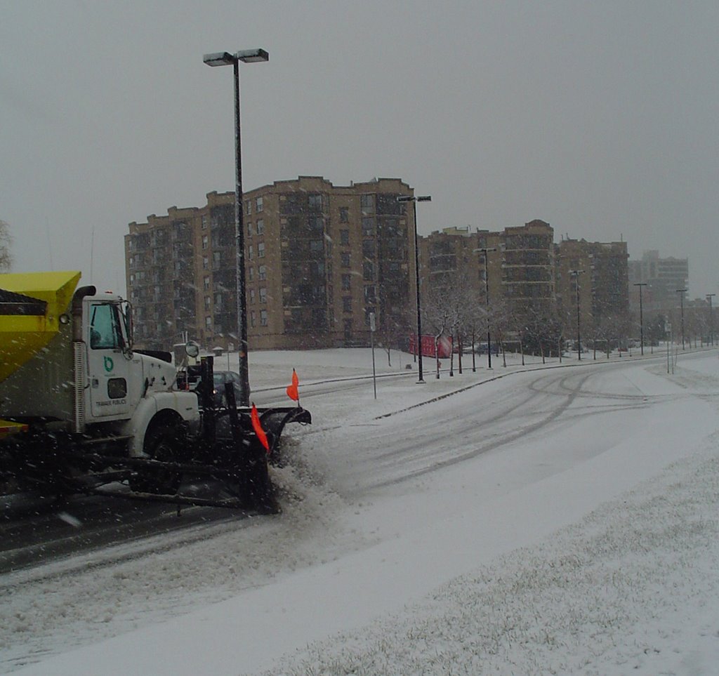
The first snowstorm of the season is upon us. Snow began falling in Kemptville about 5am this morning and will spread east into Quebec as the day progresses. A general 10-15cm snowfall is expected with closer to 20cm along the US border. Freezing Rain and sleet is not out of the question in places. The 401 corridor is not recommended for travel today. If you can delay; tomorrow will be great. Winter Storm Warnings are in effect for the St. Lawrence Valley on both sides of the border and for southwest Quebec. Warnings are also posted for New York & Vermont.

The coldest air of the season will pour in behind the storm with temperatures down to minus 25C by Wednesday morning. More snow is expected later in the week.

The same storm has produced an ice storm from north central Texas into Illinois with power outages reported. In Ohio and Pennsylvania major flooding has occurred.

Sunday, January 14, 2007

Winter Storm Watch

A Winter Storm Watch has been posted for the entire St. Lawrence Valley.
Low pressure organizing in the Midwest US will slide along a frontal boundary south of our area Monday. Snow will begin in Kemptville overnight and taper to flurries late Monday. Amounts are tricky as we will be on the fringe of the storm. Ottawa can expect 5-10cm while Kemptville south to the US frontier about 10-15cm.

On the US side watches have already been upgraded to warnings with 10-25cm of snow forecast. It will be a cold snow, unlike what we have had so far this year. Winds will be only about 30km/h throughout the storm. Roads will be icy and slippery. Plan your travel accordingly. Stay tuned for updates....

Friday, January 12, 2007

Potential Northeast
Snowstorm Sunday

As you go about your weekend routine keep and eye on the latest forecast. The front that is expected to slide through Ontario, Quebec and New England will stall south of our area tomorrow. Low pressure will develop in the Ohio Valley and intensify as it moves to the Atlantic Coast. At this time the potential exists for 15 or more cm (6 inches) of snow Sunday into Monday in Eastern Ontario, Ottawa and Montreal. Winds may produce blowing snow as well. It will be very cold - not like recent snow events. Stay tuned for further updates as the forecast becomes more clear.

Wednesday, January 10, 2007

Blizzard intensifies in
Saskatoon area

The Blizzard affecting central Saskatchewan has Saskatoon and area roads closed. Visibility at the airport has been zero for the last 7 hours with winds over 80km/h and moderate snow.

The following roads are closed according to Sask Highways:

TRAVEL NOT RECCOMENDED west of Yorkton towards Saskatoon, nor for highways north of Yorkton and east towards the Manitoba Border
HIGHWAYS IN WYNYARD AREA ARE TEMPORARILY CLOSED The following highways in the Saskatoon area are temporarily CLOSED due to zero visibility, blowing and drifting snow, and travel not recommended.Hwy 5, 41, 16, 11, 12, 7, 14, 219, 27, 2, 312, 20, 225, 320. North Battleford Area highways are temporarily closed due to zero visibility, blowing and drifting snow, and travel not recommended.
TRAVEL NOT RECOMMENDED In Unity, Kerrobert, Kindersley, Eston and Rosetown areas. #3 Highway East and West of Melfort is CLOSED due to Zero Visibility, Loose Snow, Snow Drifts, Swirling Snow, Drifting Snow, Travel is not recommended in the Tisdale, Nipawin, Melfort and Cumberland House areas.
TRAVEL NOT RECCOMENDED throughout the Prince Albert AreaMeadow Lake Area Highways are temporarily CLOSED due to zero visibility, blowing and drifting snow. Hwy 905 Points North Landing to Black Lake - water across road at km 21...
Blizzard across Saskatchewan
Colder in the east

Could it be that the much anticipated winter of 2006/2007 is finally upon us. The mild weather has had everyone and their sister speculating that Global Warming had reached us finally. This may be the case, too soon to tell, but I have a feeling this particular mild spell is more dramatic and short term in duration then Global Warming will be. Blame this warm spell and wild weather on El Nino.

We enjoyed double digit record highs last weekend, and even though it is -11C in Kemptville today, it really is not as cold as it should be. That is about to change and has already for some parts of the country. A fierce blizzard has closed highways and schools in Alberta and Saskcatchewan today. It will spread east into Manitoba. Meanwhile a storm system is expected to gather strenght in the US southwest and combined with cold air over our area, may provide us with freezing rain and snow into next week. It will definately turn colder next week and stay that way for awhile. Temperatures in Alberta will plummet into the -30C range with some of that cold air spreading east.

Prepare yourself for a shock now by getting out your boots and making sure your car is ready in Ontario and Quebec. It is on the way!!

Wednesday, January 03, 2007


Photo above is the little snow that fell over the
holiday period, about 12cm on Boxing Day.


Happy New Year everyone.....
Different year, Same weather!

The New Year has arrived with more incredible warmth here in Ontario and Quebec. It is 5C today or about 10-15 degrees above normal. We have had a run of 20-25 days above normal in Eastern Ontario, Northern New York and Southwest Quebec. Temperatures have been well above normal, and will continue that way into this weekend. As a matter of fact forecast highs in the teens Celsius may break all time records for Montreal over the weekend. No cold air or snowstorms are expected for the near future. A slight cool down will occur by Sunday.

Snowmobiles continue to sit idle and the Rideau Canal in Ottawa has no ice on it. We may be looking at an ice free year on the canal if we do not get some cold weather soon.

Black ice may be a problem on roads as evening temperatures sit just near 0C and frost occurs on elevated and shaded surfaces. Several cars hit the ditch this morning.

Friday, December 22, 2006


Christmas Greetings everyone....
After a long break from any type of severe weather a potent storm, that gave the major blizzard to the high plains, is moving towards Ontario. The storm will past well west of our area and bring more mild air with it. Before that happens freezing rain will develop in the St. Lawrence and Ottawa Valley this afternoon and tonight. Freezing Rain Warnings have been posted for those areas. With holiday travel and shopping on deck, you are advised to proceed with caution today.

After this storm Christmas will be quiet, our attention will turn to Boxing Day and a potential east coast snowstorm. Early indications are that this storm may move close enough to the coast to dump heavy snow on the Ohio Valley, interior New England and eastern Ontario & west Quebec. It is still early but in any event plan for winter weather driving, something we have not had in some time.

Again Merry Christmas and Be Safe!

Monday, December 04, 2006

Tree damage in Kemptville

250,000 without power
at height of Storm
What an introduction to winter and the mont of December. The powerful winter storm that swept in from the southern US dumped all kinds of precipitation on Ontario and Quebec. A major ice storm in the Ottawa and Rideau Valley's cut power to almost 250,000 homes in Ontario and Quebec. The ice, in some case nearly 25mm of it, downed scores of trees across the area and east into Montreal. The damage was quite extensive with downed power lines and snapped poles. Just a walk around my property revealed tremendous tree damages.

Roads were icy from Kemptville north with many cars in the ditch Friday and Saturday morning. I even witnessed thunder and lightning in the Seaway. The two day rain total for Kemptville was over 50mm.

Power was restored to most areas by Sunday morning. We had to close down work early Friday as a result of the storm knocking out power. If that were not enough, the ice laden trees were whipped by 70-90km/h per hour winds overnight into Saturday morning.

Further west it was heavy snow across the upper Midwest and northern plains. Cold air in the back side of the storm and flurries invaded the region yesterday and today.

Ice in Kemptville Friday...

Friday, December 01, 2006

Storm Update...

The winter storm affecting portions of Ontario and Quebec today is reaching far west and south. At 12 NOON today it is at the freezing point in Kemptville with moderate rain. It is currently snowing in Renfrew and Freezing Rain in Montreal, Cornwall and Ottawa. Road surfaces in our area appear to be ice free.

To the south severe thunderstorms with some tornadic activity have sprouted up in the warm sector of the storm across Ohio and Pennsylvania. Meanwhile Blizzard conditions prevail across the upper Midwest in Michigan and Wisconsin.

The back edge of the precipitation is moving into southwest Ontario. By the supper hour the precip should begin to taper off in Kemptville and Leeds Grenville. It will last longer in Montreal. Winds will become gusty in the St. Lawrence Valley and along Lake Ontario shoreline.

Thursday, November 30, 2006

Major Storm for
Ontario/Quebec

The first wide spread winter storm is heading for the St Lawrence and Ottawa Valley's. A major storm will slide north from Mississippi to lie near Massena, NY tomorrow night. In the wake of today's cold front - arctic air is pushing into the valley's. As the warmer air with tomorrow's system overrides the cold air, freezing rain will develop. A Freezing Rain Warning is in effect for Kemptville, The National Capital District and most of the Ottawa Valley. Over 20mm of ice is possible with this storm. Further north, snow 10-20cm will fall with rain to the south. In all areas winds will be very strong. There is even the risk of thunderstorms along the St. Lawrence Valley.

Flooding will be possible along the Lake Shores of Erie and Ontario at the east ends of both lakes. Waves will be as high as 17 feet on the lake front.

This is a dangerous weather situation developing in our area. Stay tuned.....

Wednesday, November 29, 2006

Record Highs East...
Record Cold West...

The roller coaster that is Canadian weather rolls on. We are currently between plus 16 & 18C in Eastern Ontario, Upstate NY and Quebec. Many areas have surpassed the record high for today. The same will occur tomorrow before a strong cold front and developing storm over the lower Mississippi Valley deliver us a wicked change. Rain will begin tomorrow in Ontario and spread into Quebec. As cold air moves into the area the rain will change to wet snow from north to south on Friday. Winds will increase from the northwest and temperatures will drop. There is even the risk of thunderstorms along the front.

Meanwhile in the west, mid-winter conditions prevail. Parts of BC are getting more snow today. This comes only hours after BC Hydro finished restoring power from last weekends storm that dumped 45cm in places. Temperatures across the prairies are frigid. Edmonton was -37C today beating a record that had stood since 1964. Numerous other minimum records fell across Alberta and Saskatchewan. In Saskatchewan the blizzard that raged in the southern part of the province closing many highways will lessen today. The cold will remain.

Stay tuned for more updates and any Ontario or Quebec warnings......

Wednesday, November 22, 2006


Coastal Storm produces
major flooding

A powerful coastal storm off of the North Carolina Outer Banks is pounding the shore northward into New England. Warnings are out for the entire coastlines as 15-20 foot seas cause flooding and beach erosion. The waves are building in northeast winds that have gusted over 65mph. Many roads have had overwash along the immediate coast including Cedar Island and Oriental, NC

Accompanying the wind has been between 100-200mm of rain. The storm is expected to remain just offshore as it moves north towards the Canadian Maratimes. A brief period of freezing rain is expected tonight and early tomorrow across southern interior New England. Any persons traveling for the Thanksgiving holiday should listen for the most recent forecasts. It takes only a little freezing rain to make any untreated roads very dangerous. We have had little snow or ice in most of the east so far this year, so it will take a little getting used to.

Thursday, November 16, 2006

North Carolina Twister damage


Wicked weather across country

A series of fall storms has been pounding both coasts for much of the last 24 hours. The BC coast has had wind gusts over 100km/h with rainfall amounts of over 100mm. Flooding and wind damage is widespread with over 200,000 customers without hydro.

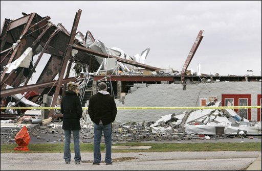
In the east it has been unseasonable thunderstorms and tornadoes. Seven people were killed from storms in North Carolina last night. Heavy rain and strong winds stretch from the Carolinas to Ontario and Quebec. Tonight heavy rain warnings are in effect for our area, Leds & Grenville Counties as we add to the over 325mm that has fallen in Kemptville since September 1.

In addition severe thunderstorms are racing across St. Lawrence County NY. To the west of the system cold air flooding south across Michigan and western Ontario is producing snow and freezing rain.

Serious flooding is occurring in New York State and Pennsylvania as the moisture latent storm continues to move northeast into Quebec tonight.

Friday, October 27, 2006

Colorado storm heads
for Ontario & Quebec

A big fall storm is heading for our area. Today is sunny and mild im most of the province, but that will not last. Strong low pressure organizing in the Midwest will deepen into a major storm as it moves down the St. Lawrence Valley. A wide range pf precipitation is expected over the weekend. Travel will be slow if not dangerous around the Great Lakes and across the Ottawa Valley and Laurentians.

In the lower elevations it will be mainly a rain event with between 50-75mm expected with precipitation begining tonight and spreading northeast towards Montreal by Saturday morning. Warnings may be posted. In the regions to the west, north and upper elevations, a slushy mix of rain and snow and eventually all snow by late Saturday could result in over 15cm of wet snow by early Sunday. On the backside of the strengthening storm winds will gust from 50-80km/h on Sunday with snow squalls and blowing snow. Be advised this will hamper travel in Ontario, Quebec, New York and Vermont.

Warnings will likely be issued later today......

Friday, October 20, 2006

Snow falls in Kemptville, Ontario today.


SNOW!!!
A strong storm moving up the Eastern Seaboard dumped heavy rain across Ontario, New York and Quebec today. On the back side of the system this afternoon cold air is filtering into the St. Lawrence Valley and Adirondacks. Snow began to fall in Kemptville at 2pm and a slushy centimetre or two is on the ground.
The snow should accumulate up to 5cm in Kemptville and up to 15cm in the Adirondacks where a Snow Advisory is in place.

Friday, October 13, 2006


Buffalo hammered
Lake Effect snow spawned by an intense Great Lakes storm has virtually shut down the Niagara and Buffalo areas. A record that has stood for 88 years tumbled in Buffalo as more than 50cm of snow fell. The same is true in Fort Erie, Ontario where over 30cm is down. The heavy wet snow has brought down power lines and trees. Travel has been suspended in parts of Western NY with schools and business closed. The are affected is very narrow including 3 counties and the area along Lake Erie from Niagara to Long Point. In addtion some squalls have moved inland over Prince Edward, Leeds and Grenville Counties in Eastern Ontario.

Warnings remain in place for the hardest hit areas of Western New York and the Lake Erie Shore on the Ontario side.

In eastern Ontario and Kemptville, flurries are in the air, only days after we were in the 20's. We had 25mm of rain in the last 24 hours. It will be windy and cool today.

Tuesday, October 10, 2006

First Winter Storm of season
A strong Arctic cold front will blast the western Great Lakes this week with big changes in store for all of Ontario. The front will spawn a low pressure area over the upper part of Michigan that will become a potent fall storm. It is an early "November Witch". The storm will become intense with howling winds and heavy precipitation.

So far a Winter Storm Warning is in effect for parts of Northwest Ontario with Winter Storm Watches for the U.P. of Michigan and northern Minnesota and Wisconsin. Heavy lake effect snows are expected with close to 10 inches possible. Winds will howl over 40mph.

Windy wet weather will affect Eastern Ontario into Thursday with a cold rain and gale force winds. Over 25mm of rain will fall with dropping temperatures.

Friday, October 06, 2006

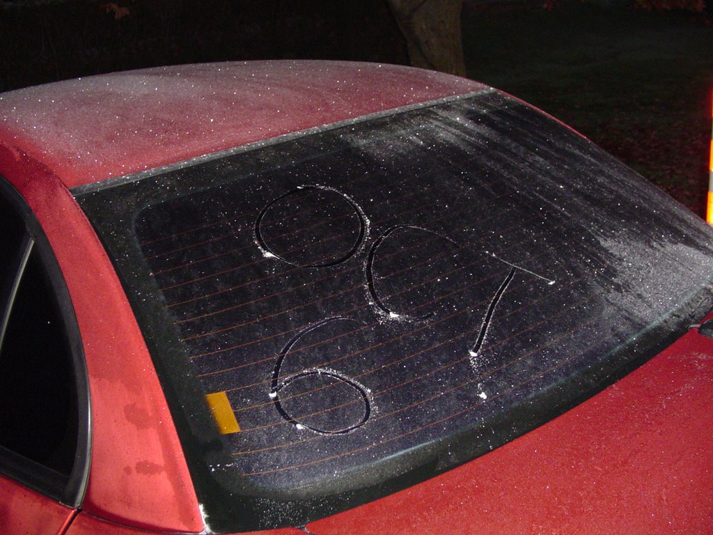
The picture says it all!!!
Beat last year by 5 days in Kemptville.

A Frost Advisory is out for upstate New York and
Southern Quebec tonight. Ontario does not issue frost warnings.

Tuesday, October 03, 2006


Thunderstorms in Ontario
A unseasonably warm airmass moving across the US Midwest and Ontario has produced thunderstorms. A bunch of them crossed the 416 corridor today with heavy rain and frequent lightning. More heavy rain is expected tomorrow from low pressure as it slides down the St. Lawrence Valley. Winds will gust 30-60km/h and 20-30mm of rain is expected in Ottawa, Kemptville and the Seaway.

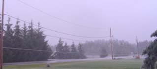
Fog has been a problem the last couple of nights. Above is a picture of it burning off in Kemptville this past weekend.