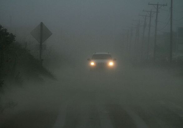
 Above are two very familiar spots to me from the Outer Banks. North Carolina 12 in the heavy rain and wind and the awning down at the BP I gas up at in Avon, NC. Below the northern cloud deck of Irene has reached Montreal. Photos are from the Virginia Pilot.
8pm: Hurricane Irene is back over the open waters of the Atlantic Ocean just east of Virginia Beach and about 315 miles south southwest of NYC. Hurricane Warnings remain in effect up and down the east coast with Tropical Storm Warnings in effect for Nova Scotia and New Brunswick. Heavy rainfall warnings for 40-60mm of rain and high wind warnings for winds between 60 and 100km/h remain posted for southern and eastern Quebec. Already the northern cloud deck from Irene has pinwheeled into southern Quebec this evening with the precipitation as far north as Albany, NY. The strongest winds should reach the St. Lawrence Valley of southern Quebec by daybreak Sunday and persist most of the day. Irene has been deadly today, responsible for 8 fatalities and millions in damage. Nearly 1 million residents are without power on the east coast and that number is growing. Wind and water damage from Irene and several tornadoes spawned by her continues to occur from the Carolina's into the middle Atlantic including one minutes ago near Lewes, Delaware. Tonight a tornado watch is posted until 5am for a large swath of the northeast including metro New York City. Thousands have been evacuated form the coast with nearly 9000 flights into NYC cancelled. Public transit has also been closed until further notice.

No comments:
Post a Comment