 |
| NOAA water vapor radar image showing deep moisture streaming north from the Gulf of Mexico towards Quebec this morning. |
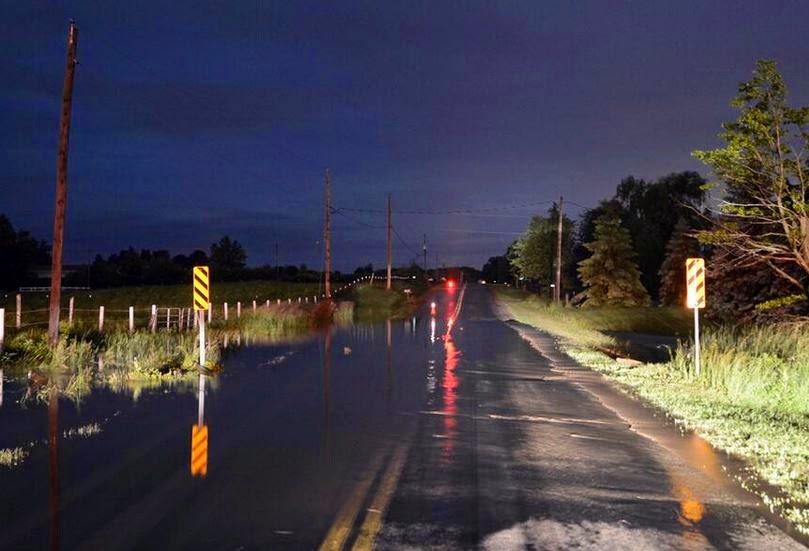
The digital rain gauge is showing 39.2mm as of 7am this morning here on L'Ile Perrot, most of that falling overnight. The NOAA water vapor radar image above shows the trail of deep moisture running from the Gulf of Mexico northward into southern Ontario and the St. Lawrence Valley. A special weather statement for upwards of 50mm (2 inches) of rainfall is in effect for Montreal. Judging by the fact we are already at 40mm we may see a little more than that. Meanwhile heavy rain warnings are in effect across eastern Ontario. Many locations have reported over 50mm in the last 24 hours. Trenton received 76.2mm (3 inches) in just the last 24 hours. Flooding was reported in the Niagara Region and along the north shore of Lake Erie. Severe weather with hail, flooding and wind damage occurred from Ohio to the middle Atlantic south into the Carolinas.
 |
| Flooding from heavy rain in southern Ontario on Wednesday. (Photo: Twitter @ErieMedia) |
SUNNY WEEKEND
The rain has come in waves along with embedded thunderstorms, and that will continue across the entire region today. Temperatures are chilly this morning at 14C but should warm to 20C today under the clouds and rain. On Friday a cold front will produce more showers with thunderstorms. Skies should clear out Saturday morning with sunshine for the weekend. Temperatures will range from 21 to 24C for the weekend in Montreal.


No comments:
Post a Comment