 |
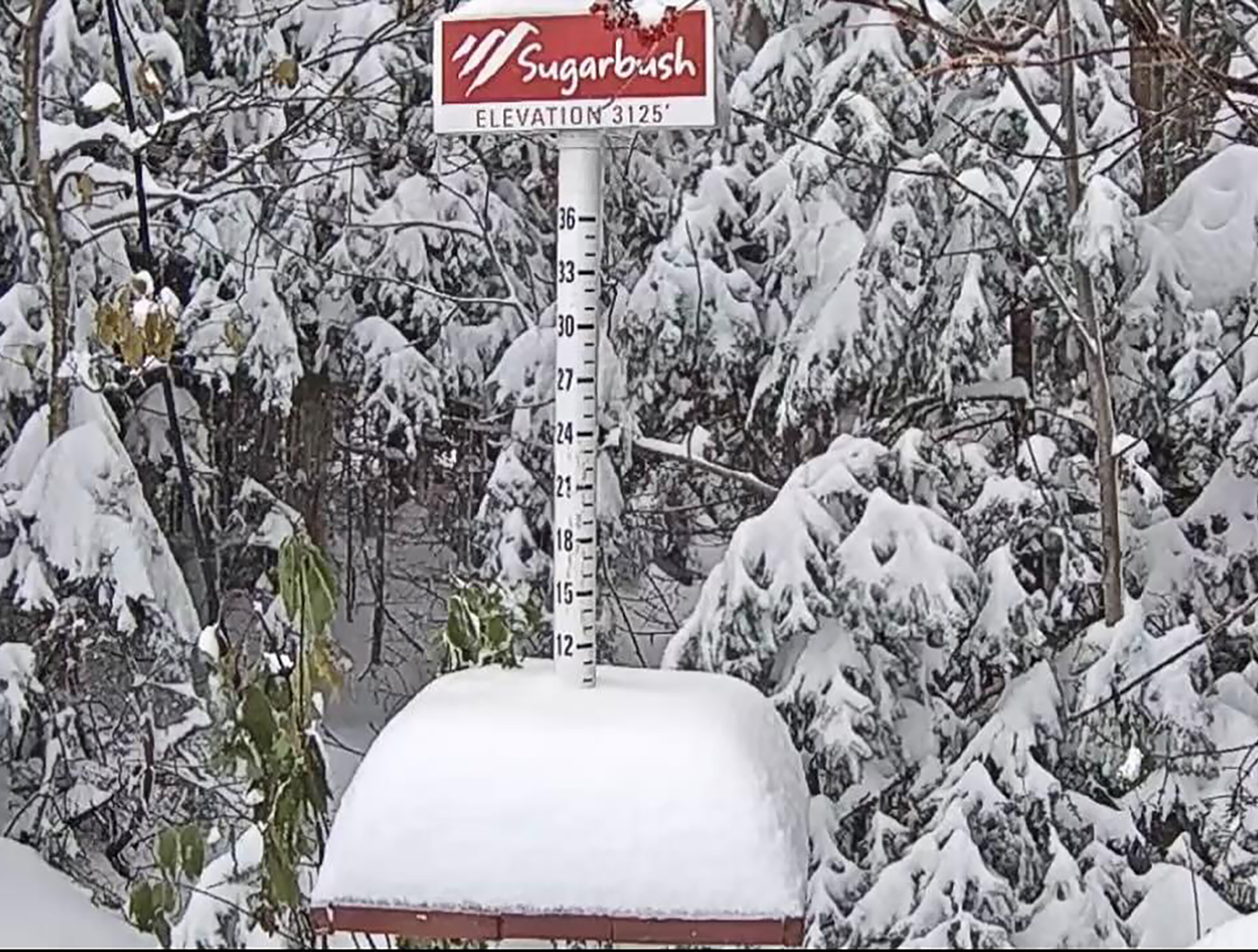
| Many regions outside of Montreal have had their first frost, freezing temperatures and even snow already this season. Tonight should be the first frost in metro Montreal. This week over 25cm of snow fell across many of the highest elevations of the Eastern Townships, Green Mountains and Adirondacks. Meanwhile here in Montreal it was cold, blustery 5 to 6mm of light rain. The month remains dry, with only 15.2mm falling a Trudeau Airport so far. (Photo Sugarbush Resort) |
Frost Advisory in effect for southern Quebec
The growing season should come to end across our region Thursday and Friday mornings, as strong high pressure noses into the region. Light winds and clearing skies will allow temperature to fall rapidly after sunset. As a result, lows will drop to the freezing point in the city and below outside the metropolitan area.
While frost and even some snow have occurred across many parts of Quebec and New England this past week, we have yet to see any frost here in Montreal so far. With overnight lows in the 0C to -3C (27F to 32F) range by Thursday morning, that should change tonight for most of us.
 |
| The weather definitely felt like fall this week in Montreal. Temperatures were well-below normal through Wednesday, along with clouds and gusty winds. We have a couple of frosty mornings ahead, before strong high pressure ushers in much warmer air across southern Quebec through the upcoming weekend and beyond. (Valley Weather Photo) |
Slow moving low pressure has been responsible for our chilly weather of late, with gusty northwest winds, showers and daytime highs under 10C (50F). The aforementioned high pressure that is building into our region will usher in a significant pattern change. Expect sunny days and clear nights through at least next Tuesday. Temperatures will start off chilly but warm to the middle and upper teens by the weekend, and close to 21C (70F) by early next week here in Montreal. The normal high/low for mid-October should be 12C (54F) and 3C (38F).
The showers that we have been experiencing in valley locations this past week, have been falling as now in many locations across the higher elevations of the Beauce, Eastern Townships, Green Mountains and Adirondacks. Elevations above 4000 feet, including Jay Peak, Mount Mansfield and Whiteface Mountain, which have received 25-40cm of fresh snow this week.
No comments:
Post a Comment