Possible storm by Thursday
in Ontario and Quebec
This is a heads up to people living in Ontario and Quebec. A developing Colorado low south of the Great Lakes is expected to move south of the St. Lawrence Valley on Friday. At this time it appears snow and freezing rain will overspread the area from southwest to northeast on Thursday, followed by strong winds and arctic cold on Friday. It is still early but a Special Weather Statement has been issued by both the US and Canadian offices.
Tuesday, February 14, 2006

Monday, February 13, 2006
 Hanlin wins yesterday's Gatorade Duel
 Big storm along the East Coast
Five days till Daytona 500.....
Sorry for the lack of entries over the past few weeks. It is that time of year where numerous distractions come my way. After Groundhog Day and between Christmas and Easter, we are in a nasty stretch that all too many Canadians no about. Even if we have had a relatively easy winter in parts, it is still winter. It has been dark, damp and dirty. The three D's as I like to call them. I can't keep my car clean for five minutes. And there are no long weekends to help us out.
Then along comes my other big interest, NASCAR to brighten the weekends up a little. I have been a fan for "pert near" 20 years. Love the sport and we are five days till Daytona.
I would be a miss if I did not mention the record storm along the east coast. It closed most airports between Philly and Maine yesterday and continues to smack the Maratimes this morning. For the most part 1-2 feet of snow fell with a whopping 26.2 inches in central Park, a new record. There have been worse storms, the Superstorm of March 1993 comes to mind, but the US media wants to play this one up, so we will say it was the deepest for now, but the 93 storm sliced into all forms of travel for days. Nevertheless it was a bad storm and I am jealous that all we received in southern Quebec and Ontario was gusty northeast winds and the northern cloud deck from the system.
The lake effect machine is on again. Snow Advisories are posted for Lewis and Jefferson Counties in New York, just south of Gannanoque. This same area received over 2 feet just last week.
Saturday, February 04, 2006
Nasty Winter Storm for Ontario
A big winter storm over the southern Appalachians is forecast to move north towards Lake Erie while deepening. The storm is expected to cut the forecast area in two traveling north towards Pembroke. West and north of the storm heavy wet snow is expected. Amounts will be in the 20-30cm range. East and south of the track heavy rain is expected from Oshawa east towards Cornwall. Here from 20-50mm of rain may fall. There is a potential for minor flooding along water ways. In all areas as the low pressure continues to deepen, winds will increase to between 40-60km/h with even higher gusts on Sunday. As the storm pulls to the north, cold air will flood into the area Sunday turning all rain to snow and blowing snow. Roads in the province will become icy and visibility will be limited. The same holds true for western New York and southeast Michigan where from 6-12 inches of snow may fall. The track may vary slightly which would make a big difference in precipitation type so stay tuned.
Winter Storm Warning: Ottawa Valley, Southern Ontario, Western New York, Michigan
Heavy Rain Warning: St. Lawrence Valley
Blowing Snow Advisory: Upper Ottawa Valley in Quebec
Heavy Snow Warning: Northern Laurentians in Quebec
A big winter storm over the southern Appalachians is forecast to move north towards Lake Erie while deepening. The storm is expected to cut the forecast area in two traveling north towards Pembroke. West and north of the storm heavy wet snow is expected. Amounts will be in the 20-30cm range. East and south of the track heavy rain is expected from Oshawa east towards Cornwall. Here from 20-50mm of rain may fall. There is a potential for minor flooding along water ways. In all areas as the low pressure continues to deepen, winds will increase to between 40-60km/h with even higher gusts on Sunday. As the storm pulls to the north, cold air will flood into the area Sunday turning all rain to snow and blowing snow. Roads in the province will become icy and visibility will be limited. The same holds true for western New York and southeast Michigan where from 6-12 inches of snow may fall. The track may vary slightly which would make a big difference in precipitation type so stay tuned.
Winter Storm Warning: Ottawa Valley, Southern Ontario, Western New York, Michigan
Heavy Rain Warning: St. Lawrence Valley
Blowing Snow Advisory: Upper Ottawa Valley in Quebec
Heavy Snow Warning: Northern Laurentians in Quebec
Friday, February 03, 2006
Winter Strom Watch........Again
Yet another mild period in Ontario & Quebec. Yet another Winter Storm Watch for the potential of a big storm late Saturday into Sunday and yet again a difficult forecast. Environment Canada has Posted a Winter Storm Watch for all the counties of southern Ontario from the Quebec border to Windsor.
A very strong 976mb storm is expected to develop and move north from Mississippi to Lake Erie by late Saturday. East of the storm track up to 40mm of rain is expected while west of the storm track 25cm of heavy wet snow. The Winter Storm watches are also in effect for New York State, Ohio, Pennsylvania and Southeast Michigan including Detroit where this weekends Super Bowl is scheduled at Ford Field.
Behind the storm for all areas Heavy Wet Snow and gusty winds over 50km/h will occur Sunday. The potential exists for heavy precipitation and damaging winds this weekend. Plan accordingly if you expect to travel anywhere in the 401 corridor or south along I-81, I-80, and I-87.
Next Update will be at 8am Saturday.....
Yet another mild period in Ontario & Quebec. Yet another Winter Storm Watch for the potential of a big storm late Saturday into Sunday and yet again a difficult forecast. Environment Canada has Posted a Winter Storm Watch for all the counties of southern Ontario from the Quebec border to Windsor.
A very strong 976mb storm is expected to develop and move north from Mississippi to Lake Erie by late Saturday. East of the storm track up to 40mm of rain is expected while west of the storm track 25cm of heavy wet snow. The Winter Storm watches are also in effect for New York State, Ohio, Pennsylvania and Southeast Michigan including Detroit where this weekends Super Bowl is scheduled at Ford Field.
Behind the storm for all areas Heavy Wet Snow and gusty winds over 50km/h will occur Sunday. The potential exists for heavy precipitation and damaging winds this weekend. Plan accordingly if you expect to travel anywhere in the 401 corridor or south along I-81, I-80, and I-87.
Next Update will be at 8am Saturday.....
Thursday, February 02, 2006
Phil sees shadow...more winter to come
Puxatawney Phil has risen from his burrow at 7:23ET in the sand hills of western Pennsylvania ans has predicted six more weeks of winter. We are waiting for Wiarton Willie here in Ontario.
Puxatawney Phil has risen from his burrow at 7:23ET in the sand hills of western Pennsylvania ans has predicted six more weeks of winter. We are waiting for Wiarton Willie here in Ontario.
Monday, January 30, 2006
Freezing Rain continues......
NO SCHOOL BUS SERVICE
Temperatures in Eastern Ontario remain below freezing this morning. At 6am Cornwall/Massena was -2, Ottawa was -5 and Kemptville was -3. All areas are reporting freezing drizzle. Any untreated areas will be slick. SLOW DOWN. Temperatures will very slowly move above freezing by noon. The storm system will move from upper Michigan to North Bay today. Heavy snow continues on the west side of the storm, North Bay has had 39cm while Pembroke in the upper Ottawa Valley is close to 20cm. My rain gauge is frozen so I am not sure how much freezing rain and sleet has fallen in Kemptville, but the ground is covered and glazed. School Bus service for the City of Ottawa and Lanark, Leeds & Grenville, SD & G and City of Cornwall is cancelled today.
NO SCHOOL BUS SERVICE
Temperatures in Eastern Ontario remain below freezing this morning. At 6am Cornwall/Massena was -2, Ottawa was -5 and Kemptville was -3. All areas are reporting freezing drizzle. Any untreated areas will be slick. SLOW DOWN. Temperatures will very slowly move above freezing by noon. The storm system will move from upper Michigan to North Bay today. Heavy snow continues on the west side of the storm, North Bay has had 39cm while Pembroke in the upper Ottawa Valley is close to 20cm. My rain gauge is frozen so I am not sure how much freezing rain and sleet has fallen in Kemptville, but the ground is covered and glazed. School Bus service for the City of Ottawa and Lanark, Leeds & Grenville, SD & G and City of Cornwall is cancelled today.
Sunday, January 29, 2006
Winter weather returns
For the third weekend in a row, record highs are being followed by winter weather. Kemptville and Ottawa both broke records yesterday hitting 8C and 6C respectively. Now one of the most poorly, albeit difficult forecast weather events is unfolding. Winter Strom Warning are in effect for Eastern Ontario and Southern Quebec. Precipitation, only about 12 hours late is now falling, and will slowly spread east and north as the night moves on. Snow, from 10-20cm will fall along the Ottawa River, with less south. Freezing Rain is expected from Montreal to Brockville, with 2-6mm of ice. Travel is becoming poor and very changeable. Postpone till tomorrow if at all possible. The same is true for upstate New York and Vermont.
For the third weekend in a row, record highs are being followed by winter weather. Kemptville and Ottawa both broke records yesterday hitting 8C and 6C respectively. Now one of the most poorly, albeit difficult forecast weather events is unfolding. Winter Strom Warning are in effect for Eastern Ontario and Southern Quebec. Precipitation, only about 12 hours late is now falling, and will slowly spread east and north as the night moves on. Snow, from 10-20cm will fall along the Ottawa River, with less south. Freezing Rain is expected from Montreal to Brockville, with 2-6mm of ice. Travel is becoming poor and very changeable. Postpone till tomorrow if at all possible. The same is true for upstate New York and Vermont.
Tuesday, January 24, 2006
 The Roller Coaster ride moves on.....
What has become the normal pattern for the winter of 2005-06 continues across most of the country. Cold air, if any, has been short lived, for a day or two at best, punctuated by strong cold fronts that stir up the winds and snow. The photo above shows the 15cm of snow falling across North Grenville last Saturday, January 21. The day before it was 9C in Kemptville and 6C in Ottawa, record highs. Today, Tuesday, January 24, we reached 3C, but snow and gusty winds are forecast tonight. As a matter of fact Winter Strom Warnings are in effect for Jefferson and Lewis counties in New York State for up 30cm of snow, I-81 will be poor tonight and Wednesday. Same is true for the areas around Georgian Bay and Lake Huron. Eastern Ontario and west Quebec will see between 2-7cm of snow with winds between 40-60km/h and temperatures dropping by midday Wednesday.
Leftover snow from the 15cm on Saturday - ValleyWeather Pictures

Wednesday, January 18, 2006
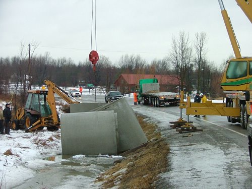 The clean up scene on County Road 43 near Hallville after
 5 trucks hit the ditch during Freezing Rain this morning...
Photo Dan Reid
What a morning.....
Ice and heavy rain snarl traffic
Heavy rain and freezing rain blasted the area icing roads and causing numerous accidents in and around Ottawa and Kemptville this morning. The Queensway in Ottawa was down to one lane in many areas with ice and massive puddles the main culprit. Elsewhere the OPP closed Highway 43 at Hallville after several trucks plowed into the ditch. The roads were ice packed at the time. River Road south of the Airport was also closed by city police.
Kemptville received 38mm of rain as of 2pm, Ottawa 26mm. Half of that was frozen during the overnight period. About 7 hours of freezing rain occurred in area. The Seaway fared much better as the temperatures warmed up just after midnight limiting the freezing rain to about 3 hours.
The storm was also responsible for gusty winds, over 80km/h along the Lake Ontario shoreline. Snowsqualls are expected around Lake Huron and south into Watertown, New York. Some snow is forecast tonight along with temperatures below freezing.
Trying to keep up with the ice in Kemptville this morning.
ValleyWeather Photo

All School Busses Cancelled
Heavy Rain a threat now.....
The freezing rain overnight was enough to cancel all busses in our area this morning including Lanark, Leeds and Grenville, Stormont, Dundas and Glengarry and City of Ottawa. We received a good 5-10mm of ice that has coated everything outside. Roads are a mess with hard packed ice in the center lanes. In addition even though it is above freezing the rain that is falling on any untreated surface is still freezing on contact.
Our attention now shifts to the threat of minor flooding and then strong winds. A Wind Warning is in effect for the St. Lawrence Valley on both sides of the border in Ontario, Quebec and NY. Winds will gust form 50-90km/h beginning this afternoon. In addition Heavy Rain Warnings have been posted for Southern Quebec. From 30-50mm of rain is possible, enough to cause flooding where catch basins are blocked. Area rivers will have to be closely monitored. Roads are terrible this morning....slow down......
Heavy Rain a threat now.....
The freezing rain overnight was enough to cancel all busses in our area this morning including Lanark, Leeds and Grenville, Stormont, Dundas and Glengarry and City of Ottawa. We received a good 5-10mm of ice that has coated everything outside. Roads are a mess with hard packed ice in the center lanes. In addition even though it is above freezing the rain that is falling on any untreated surface is still freezing on contact.
Our attention now shifts to the threat of minor flooding and then strong winds. A Wind Warning is in effect for the St. Lawrence Valley on both sides of the border in Ontario, Quebec and NY. Winds will gust form 50-90km/h beginning this afternoon. In addition Heavy Rain Warnings have been posted for Southern Quebec. From 30-50mm of rain is possible, enough to cause flooding where catch basins are blocked. Area rivers will have to be closely monitored. Roads are terrible this morning....slow down......
Tuesday, January 17, 2006
The Polar Roller Coaster continues
More Freezing Rain....
Not again, I hate these winters.......lets change this pattern please. The snow to rain to snow deal is on again in our region. It has been a month of ice and more ice. A Freezing Rain Warning has been posted again for Eastern Ontario including Leeds & Grenville Counties and metro Ottawa for tonight. Look for snow to begin in the area around sunset and change to freezing rain by midnight. It will be icy overnight and into tomorrow before the temperatures warm up at the surface or cool off aloft. This will taper any precipitation to showers or flurries. The other item of interest with this storm will be the strong winds. As the storm moves from the Midwest up across Lake Huron it will increase winds, first out of the east then the south and southwest. They may gust to warning criteria on Wednesday, that is up to 90km/h in upstate New York and into Ontario.
More Freezing Rain....
Not again, I hate these winters.......lets change this pattern please. The snow to rain to snow deal is on again in our region. It has been a month of ice and more ice. A Freezing Rain Warning has been posted again for Eastern Ontario including Leeds & Grenville Counties and metro Ottawa for tonight. Look for snow to begin in the area around sunset and change to freezing rain by midnight. It will be icy overnight and into tomorrow before the temperatures warm up at the surface or cool off aloft. This will taper any precipitation to showers or flurries. The other item of interest with this storm will be the strong winds. As the storm moves from the Midwest up across Lake Huron it will increase winds, first out of the east then the south and southwest. They may gust to warning criteria on Wednesday, that is up to 90km/h in upstate New York and into Ontario.
Saturday, January 14, 2006
Flash Freeze Expected
This is an ALERT to anyone living in eastern Ontario, Western Quebec, Northern New York and Vermont. The weather is about to change dramatically today. A strong Arctic boundary will pass through the region by noon-6pm today. Temperatures will fall from present values of 6 to10C down to below freezing rapidly. In addition strong winds will develop from the north at 60km/h and rain will change to snow. Computer models are having a tough time dealing with how much will fall. It looks like 5-20cm across the area. Amounts aside it will be nasty driving.
A Flash Freeze Warning is in effect for Eastern Ontario.
A Winter Strom Watch is in effect for Northern New York and Vermont.
Of Note: A Winter Strom Watch is also in effect for Southeast Saskatchewan. A developing Colorado Low is expected to bring Freezing Rain to the area tonight.
This is an ALERT to anyone living in eastern Ontario, Western Quebec, Northern New York and Vermont. The weather is about to change dramatically today. A strong Arctic boundary will pass through the region by noon-6pm today. Temperatures will fall from present values of 6 to10C down to below freezing rapidly. In addition strong winds will develop from the north at 60km/h and rain will change to snow. Computer models are having a tough time dealing with how much will fall. It looks like 5-20cm across the area. Amounts aside it will be nasty driving.
A Flash Freeze Warning is in effect for Eastern Ontario.
A Winter Strom Watch is in effect for Northern New York and Vermont.
Of Note: A Winter Strom Watch is also in effect for Southeast Saskatchewan. A developing Colorado Low is expected to bring Freezing Rain to the area tonight.
Friday, January 13, 2006

Severe Weather across Southeast US
Despite the calendar saying January, severe weather has broken out across the Gulf Coast from Louisiana to Georgia. At least two tornadoes and one fatality have been reported as of 2pm.
Much Colder this weekend
Highlights.....
~Very mild today Ontario and Quebec
~More rain in Vancouver with risk of mudslides
~Flooding rains across New England and eastern New York
~Much colder in Ontario and Quebec tomorrow
~Foggy on the Prairies this morning Assiniboia and Gravelbourg
The storm system that will be bringing us the rain tonight, in some cases as much as 25mm (1 inch), will pull off to our east Saturday. The big question by area forecast offices today is how quickly will the cold air wrap in behind the storm on Saturday. The Burlington office is calling for gusty north winds and 8-13cm of snow Saturday with temps plunging towards -10C. The Ottawa office is looking at the same for wind and temperature but only 2-4cm of snow.
In any event the rain of tonight will begin to freeze up by midday Saturday. That means roads will become very icy and with 60km/h winds and dropping temperatures in the Ottawa and St. Lawrence Valley, whatever snow falls will blow around. Travel will be poor from noon to midnight tomorrow.
Special Weather Statement NY/VT
Flood Watch NY/VT
No Warnings for Quebec/Ontario
Highlights.....
~Very mild today Ontario and Quebec
~More rain in Vancouver with risk of mudslides
~Flooding rains across New England and eastern New York
~Much colder in Ontario and Quebec tomorrow
~Foggy on the Prairies this morning Assiniboia and Gravelbourg
The storm system that will be bringing us the rain tonight, in some cases as much as 25mm (1 inch), will pull off to our east Saturday. The big question by area forecast offices today is how quickly will the cold air wrap in behind the storm on Saturday. The Burlington office is calling for gusty north winds and 8-13cm of snow Saturday with temps plunging towards -10C. The Ottawa office is looking at the same for wind and temperature but only 2-4cm of snow.
In any event the rain of tonight will begin to freeze up by midday Saturday. That means roads will become very icy and with 60km/h winds and dropping temperatures in the Ottawa and St. Lawrence Valley, whatever snow falls will blow around. Travel will be poor from noon to midnight tomorrow.
Special Weather Statement NY/VT
Flood Watch NY/VT
No Warnings for Quebec/Ontario
Thursday, January 12, 2006
Storm likely this weekend....
Good morning everyone......Enjoying the mild weather in Ontario and Quebec I trust! It has been quite a spell. I want to go skating on The Rideau Canal in Ottawa, but it has only been open for a couple of days. The very mild weather will continue into Friday...However,.....Don't just like however's in weather!
Surface low pressure is expected to develop in the Midwest and along the US east coast early Friday. The result will be very mild air, plus 9 for Montreal and Ottawa early Friday along with rain developing into Friday night.
As the storm system along the coast becomes the primary low colder air on very strong north winds will be drawn into the St. Lawrence Valley and northern New England. The rain will change to snow early Saturday morning and continue all day. It is very early in the forecast period, but confidence is growing that we will see a storm. In any event it will be colder. Prepare yourself for winter weather this weekend.
Of Note...Vancouver is going for the rain record set in the 1950's. If it rains through this weekend, and it should, over 50mm expected today, then they will set a new record. So far 29 days straight and counting. They can have it! I will take the mix of seasons any day. Besides how can anyone live where there are no thunderstorms!!!!
Good morning everyone......Enjoying the mild weather in Ontario and Quebec I trust! It has been quite a spell. I want to go skating on The Rideau Canal in Ottawa, but it has only been open for a couple of days. The very mild weather will continue into Friday...However,.....Don't just like however's in weather!
Surface low pressure is expected to develop in the Midwest and along the US east coast early Friday. The result will be very mild air, plus 9 for Montreal and Ottawa early Friday along with rain developing into Friday night.
As the storm system along the coast becomes the primary low colder air on very strong north winds will be drawn into the St. Lawrence Valley and northern New England. The rain will change to snow early Saturday morning and continue all day. It is very early in the forecast period, but confidence is growing that we will see a storm. In any event it will be colder. Prepare yourself for winter weather this weekend.
Of Note...Vancouver is going for the rain record set in the 1950's. If it rains through this weekend, and it should, over 50mm expected today, then they will set a new record. So far 29 days straight and counting. They can have it! I will take the mix of seasons any day. Besides how can anyone live where there are no thunderstorms!!!!
Tuesday, January 10, 2006
 Mild weather continues...
Quake rattles Seaway
Sorry for my absence at the start of this weather year. It has been a little busy and the normal January blues have settled in.
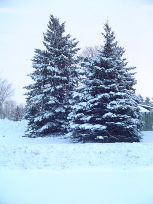
It has however been very mild. Temperatures across most of the country have been above normal. The cold air is trapped across the high Arctic. Two storms have fooled forecasters this past week. The first surprise was last Thursday. About 16cm of snow fell in Kemptville, we were only expecting a few cm with freezing rain afterwards. The second storm on Monday took a similar track with another 10-15cm of snow in the area. While Freezing rain Warnings were issued, it never materialized in our area.
The ValleyWeather picture above is the heavy accumulation of snow in Kemptville.
We are currently watching a storm developing in Arkansas that could give lots of problems to the Ottawa valley tomorrow. While mild air is expected to eventually stream into our area, the last two systems have shown us that this does not always go as planned.
At any rate freezing rain is expected to change to rain early Wednesday morning.
An Earth Quake rattled the St. Lawrence River Valley 61km southwest of Montreal. The quake registered 3.7 on the Richter Scale. No reports of any damage.
Below is a sun pillar last Friday, January 6 in North Grenville - ValleyWeather Pic

Wednesday, January 04, 2006
More ice for the valleys
It has been a rough start to 2006 for many across North America and indeed the world. My thoughts and prayers are with those in the West Virginia mine tragedy, the news is not good this morning, as well as those suffering in the California floods and the wildfires in the southern plains.
The weather has been equally bizarre with a very mild flow of Pacific air dominating the North America. This has allowed very warm tropical air to stream northward. Temperatures have been almost summerlike from Texas to Florida. In Ontario and Quebec we are just north of the really warm air. The unfortunate thing about that is it leaves our areas exposed to freezing rain and fog. This morning a Freezing Fog Advisory is in effect for the St. Lawrence Valley of NY/Ontario, and the Conn. Valley of Eastern Vermont.
A low pressure area developing in the Midwest will slide down the St. Lawrence Valley tonight leaving Montreal and Ottawa on its northern side. Snow and sleet will develop today and continue into Thursday. By the time it ends 10cm should fall. It won't be a big storm, but it will be messy. No warnings are out yet, but the system should be watched.
It has been a rough start to 2006 for many across North America and indeed the world. My thoughts and prayers are with those in the West Virginia mine tragedy, the news is not good this morning, as well as those suffering in the California floods and the wildfires in the southern plains.
The weather has been equally bizarre with a very mild flow of Pacific air dominating the North America. This has allowed very warm tropical air to stream northward. Temperatures have been almost summerlike from Texas to Florida. In Ontario and Quebec we are just north of the really warm air. The unfortunate thing about that is it leaves our areas exposed to freezing rain and fog. This morning a Freezing Fog Advisory is in effect for the St. Lawrence Valley of NY/Ontario, and the Conn. Valley of Eastern Vermont.
A low pressure area developing in the Midwest will slide down the St. Lawrence Valley tonight leaving Montreal and Ottawa on its northern side. Snow and sleet will develop today and continue into Thursday. By the time it ends 10cm should fall. It won't be a big storm, but it will be messy. No warnings are out yet, but the system should be watched.
Thursday, December 29, 2005
 The ice was about 1/4 inch thick in North Grenville today
Icy Rain over Ontario/Quebec
A fast moving area of low pressure skirted across Upstate New York today with up to 10mm of freezing rain in the area. Roads were slippery and some minor power outages were reported by Hydro One. The precip is just about over in Ontario with a few flurries or showers left over.
Travel till late Sunday looks great before another storm system moves in on Monday. Be safe and have a very Happy start to 2006!!!

Wednesday, December 28, 2005
Ice Storm Possible
Well it is back to work for many of us. Christmas was mild for most of the country. The storm that was expected in our area shifted a little east and dumped 30-70cm of snow from Quebec City into New Brunswick. In Montreal over 12 hours of freezing rain and wind knocked power out to 70,000 homes on the south shore. Roads were icy and travel uncomfortable, (best way to describe driving on ice).
The next storm is on our doorstep. Low pressure over Illinois will move south of the lower lakes tonight. It is looking like the St. Lawrence and Ottawa Valley's will have a prolonged period of Freezing Rain beginning tonight after 4pm. Expect 5-10mm or close to 1/2 inch of ice by noon tomorrow. Warnings are in place for both sides of the border (NY,Ont.) and in Montreal. That will be enough to make travel very poor and create some power outages as well. Stay tuned. If you have to travel tonight between Kingston, Montreal and Ottawa I would go early today or after noon tomorrow.
Well it is back to work for many of us. Christmas was mild for most of the country. The storm that was expected in our area shifted a little east and dumped 30-70cm of snow from Quebec City into New Brunswick. In Montreal over 12 hours of freezing rain and wind knocked power out to 70,000 homes on the south shore. Roads were icy and travel uncomfortable, (best way to describe driving on ice).
The next storm is on our doorstep. Low pressure over Illinois will move south of the lower lakes tonight. It is looking like the St. Lawrence and Ottawa Valley's will have a prolonged period of Freezing Rain beginning tonight after 4pm. Expect 5-10mm or close to 1/2 inch of ice by noon tomorrow. Warnings are in place for both sides of the border (NY,Ont.) and in Montreal. That will be enough to make travel very poor and create some power outages as well. Stay tuned. If you have to travel tonight between Kingston, Montreal and Ottawa I would go early today or after noon tomorrow.
Friday, December 23, 2005
Christmas Weather Update....
While precipitation over the next few days will be light, it will be falling. With that in mind, travel with care and caution. The first shot of precipitation will be moving into our area this afternoon and tonight. While most areas are above freezing and will see a few centimetres of wet snow, some normally colder pockets, like Cornwall, Ontario, the upper Ottawa Valley or the Eastern Townships, Quebec & Northeast Kingdom of Vermont, may see spotty freezing rain. Tonight and Saturday more light snow with spotty freezing rain.
According to the National weather Service out of Burlington Vermont, the threat remains likely for a snowstorm Sunday night. It is becoming less likely for eastern Ontario. With the storm along the US coast, the western extent of the snow may only be as far west as the border communities with Quebec. Montreal will however receive the snow if the system develops. Travel with caution and listen to the updated forecast before you go.
To everyone, Family, Friends and Co-Workers who endure my constant chatter about the weather, Thank You a million times. I love the weather, but the real thrill is sharing it with you. Be safe...Slow down and enjoy the Holidays......Stephen
While precipitation over the next few days will be light, it will be falling. With that in mind, travel with care and caution. The first shot of precipitation will be moving into our area this afternoon and tonight. While most areas are above freezing and will see a few centimetres of wet snow, some normally colder pockets, like Cornwall, Ontario, the upper Ottawa Valley or the Eastern Townships, Quebec & Northeast Kingdom of Vermont, may see spotty freezing rain. Tonight and Saturday more light snow with spotty freezing rain.
According to the National weather Service out of Burlington Vermont, the threat remains likely for a snowstorm Sunday night. It is becoming less likely for eastern Ontario. With the storm along the US coast, the western extent of the snow may only be as far west as the border communities with Quebec. Montreal will however receive the snow if the system develops. Travel with caution and listen to the updated forecast before you go.
To everyone, Family, Friends and Co-Workers who endure my constant chatter about the weather, Thank You a million times. I love the weather, but the real thrill is sharing it with you. Be safe...Slow down and enjoy the Holidays......Stephen
Thursday, December 22, 2005
Christmas Day Snowstorm.....
Ok don't panic yet, but here is the latest scoop on the Holiday weather. Today, Thursday, is a great travel day, just a little light snow but nothing major. Tomorrow, Friday will be sloppy with some snow and sleet, but with the expected high of 0C to -2C, I think we will be fine in Ontario and Quebec.
The challenge comes later in the forecast period, late Sunday into Monday. Low pressure is forecast to develop along the east coast and move towards Cape Cod, The moisture on the back side of the system will approach Montreal late Sunday. I think it will have trouble moving into eastern Ontario. At any rate, a significant snow may fall into Boxing Day for southwest Quebec, Eastern Ontario, New York State and Vermont.. At this point here is the travel outlook....
Thursday...GOOD
Friday... SLOPPY but SAFE with Caution
Saturday....GOOD best day.
Sunday...GOOD early moving to POOR or worse late.....
I will update this early tomorrow morning.
Be safe and MERRY CHRISTMAS!!!!
Ok don't panic yet, but here is the latest scoop on the Holiday weather. Today, Thursday, is a great travel day, just a little light snow but nothing major. Tomorrow, Friday will be sloppy with some snow and sleet, but with the expected high of 0C to -2C, I think we will be fine in Ontario and Quebec.
The challenge comes later in the forecast period, late Sunday into Monday. Low pressure is forecast to develop along the east coast and move towards Cape Cod, The moisture on the back side of the system will approach Montreal late Sunday. I think it will have trouble moving into eastern Ontario. At any rate, a significant snow may fall into Boxing Day for southwest Quebec, Eastern Ontario, New York State and Vermont.. At this point here is the travel outlook....
Thursday...GOOD
Friday... SLOPPY but SAFE with Caution
Saturday....GOOD best day.
Sunday...GOOD early moving to POOR or worse late.....
I will update this early tomorrow morning.
Be safe and MERRY CHRISTMAS!!!!
Tuesday, December 20, 2005
Christmas Update.................
An arctic front slid south across the area today with snow north and south of Kemptville. The Kemptville bubble held tight deflecting the snow around us...go figure. The forecast for the weekend has modified a little. Friday looks to be cloudy with flurries and mild. Saturday into Christmas Day could be interesting with a low developing along the Eastern Coast of the US. It is early, and computer models are having trouble with the exact track. If this worries you, and you are travleling for the holidays, leave Friday night or early Saturday. Stay Tuned...............
An arctic front slid south across the area today with snow north and south of Kemptville. The Kemptville bubble held tight deflecting the snow around us...go figure. The forecast for the weekend has modified a little. Friday looks to be cloudy with flurries and mild. Saturday into Christmas Day could be interesting with a low developing along the Eastern Coast of the US. It is early, and computer models are having trouble with the exact track. If this worries you, and you are travleling for the holidays, leave Friday night or early Saturday. Stay Tuned...............
Monday, December 19, 2005
 Just some of the 41cm of snow clogging Montreal roads this weekend.
 ValleyWeather Photo
First look at Christmas.....
Travel in the east could be a little slippery come the Christmas weekend, but no major delays at this time are expected. It will be mild, but some of the precipitation could be in the form of freezing rain. Any precipitation at this point looks to be light. Lots can change but right now Friday looks to be about 0C to plus 2C through most of Eastern Ontario and west Quebec, with flurries or showers. Same for Saturday and Christmas Day. Stay tuned.......
Friday, December 16, 2005
 Clearing Leeds/Grenville Roads early this morning (VWXPhoto)
Record Snowstorm for Montreal
Over 41cm of snow fell today in Montreal bringing transportation to a standstill. Big ugly accidents occurred everywhere, there were too many to mention. Airport closed for hours, all schools closed. It was a record storm for December 16 and very close to the benchmark superstorm of March 4, 1971. According to my parents the March 71 storm was the storm that sparked my interest in weather. I sat in our windowsill on Lasalle Blvd and watched the snow pile up all day. The difference in 71 was the storm was accompanied by 100km/h winds.
It will take millions of dollars and 5 days to clear the storm from area roads. Today from 6am-NOON visibility in Montreal was less than 1km.
In North Grenville between 20-25cm fell in the county. Busses were cancelled, hundreds of accidents along the 401 & 416. More squalls are moving off Lake Ontario tonight so a few more centimetres are possible.
SnowStorm Totals:
Ontario:OTTAWA 22 CM
GATINEAU 23 CM
PETAWAWA 8 CM
CORNWALL 23 CM PLUS 7 CM OF ICE
KEPTVILLE 20CM PLUS 3 HOURS OF FREEZING RAIN
Quebec:
CAMPBELL'S BAY... 15-20 CM
MANIWAKI.... 20 CM
MONT-LAURIER... 15 CM
MORIN HEIGHTS... 30 CM AT 09:00 AM
MIRABEL... 43 CM
ST-LIN-LAURENTIANS... 41 CM
RAWDON... 30 CM
L'ASSOMPTION... 18 CM
DORVAL... 41 CM
ST-HUBERT... 35-40 CM
ORMSTOWN... ABOUT 15 CM WITH 5-10MM OF ICE

Busses Cancelled in area
Heavy Snow moves into Kemptville
Radar shows at 6am, Heavy Snow is now falling over the Ottawa and Seaway Valley from Trenton east to Montreal and north to Ottawa. The heaviest snow will fall until at least noon with total storm accumulations reaching 25cm. Overnight for at leat 3 hours freezing rain and sleet fell in Kmeptville & Ottawa. As a result expect to have to scrape your car for some time this morning. The threat of ice has passed it will be mainly a snow event for the balance of the storm. It should be over in Ontario by mid afternoon and tonight in Montreal.
Heavy Snow Warnings remain in effect for areas from Trenton to Ottawa and east to Quebec City. South of the border Winter Storm Warnings are in effect for New York and northern Vermont.
Of Note: All school busses are cancelled for the City of Ottawa, Stormont, Dundas & Glengarry, Prescott and Russell and Lanark, Leeds and Grenville. Some schools are closed as well.....
Heavy Snow moves into Kemptville
Radar shows at 6am, Heavy Snow is now falling over the Ottawa and Seaway Valley from Trenton east to Montreal and north to Ottawa. The heaviest snow will fall until at least noon with total storm accumulations reaching 25cm. Overnight for at leat 3 hours freezing rain and sleet fell in Kmeptville & Ottawa. As a result expect to have to scrape your car for some time this morning. The threat of ice has passed it will be mainly a snow event for the balance of the storm. It should be over in Ontario by mid afternoon and tonight in Montreal.
Heavy Snow Warnings remain in effect for areas from Trenton to Ottawa and east to Quebec City. South of the border Winter Storm Warnings are in effect for New York and northern Vermont.
Of Note: All school busses are cancelled for the City of Ottawa, Stormont, Dundas & Glengarry, Prescott and Russell and Lanark, Leeds and Grenville. Some schools are closed as well.....
Thursday, December 15, 2005
Winter Storm Warnings
extended to Montreal/Ottawa
Winter Storm Warnings are now in effect for all areas of Eastern Ontario, Western Quebec and Northern New England. The forecast is very simple...SNOW. Heavy snow will develop tonight and continue into Friday. Travel will become increasingly difficult in heavy snow and some blowing snow. Radar is showing the snow as far north and east as Toronto with the heaviest precipitation still south of the border. Heavy snow 15-30cm will fall across New York and Quebec / Ontario corridor along the 401 and up the Ottawa Valley.
extended to Montreal/Ottawa
Winter Storm Warnings are now in effect for all areas of Eastern Ontario, Western Quebec and Northern New England. The forecast is very simple...SNOW. Heavy snow will develop tonight and continue into Friday. Travel will become increasingly difficult in heavy snow and some blowing snow. Radar is showing the snow as far north and east as Toronto with the heaviest precipitation still south of the border. Heavy snow 15-30cm will fall across New York and Quebec / Ontario corridor along the 401 and up the Ottawa Valley.
Wednesday, December 14, 2005
 Above: ValleyWeather Photo of Ice Fog and Black Ice in the
 Seaway Valley this morning. Temps were as cold as -24C
Warnings Issued
The much anticipated winter storm is upon us. Heavy Snow Warnings have been posted for the entire southwest portion of Ontario from Windsor to the Quebec border including Leeds/Grenville and Stormont, Dundas and Glengarry Counties.
There is also a Winter Storm Watch posted for New York and Northern Vermont. The snow will spread northeast over the day on Thursday and persist into Friday. Snow will accumulate from 10-15cm in Toronto and Southwest Ontario and 15-25cm in Ottawa and Montreal. I expect more warnings will be issued. Winds will be on the increase out of the east causing blowing snow in the St. Lawrence Valley.
Travel will become difficult by Friday morning. Plan accordingly.... this could be the worst stom in the last couple of years.
Winter Storm Update
A complex long weather event is shaping up for Ontario and southern Quebec over the next 48-72 hours. I don't have to tell you but "Baby Its Cold Out There!" Both my digital thermometers have frozen up this morning, lithium batteries or not......They stopped at -24C (-11F) for our US weatherverts. So needless to say the cold air is in place. It will remain in place as dual low pressure areas begin to converge on our area.
The first is a potent little clipper from western Canada that will slide across the lakes and produce 5-15cm of snow beginning mid day Thursday near the GTA and moving east towards the Quebec border by evening.
The second more significant storm will race up the east coast to be near Boston by late Friday. It will produce a swath of heavy snow and ice from just inland along the eastern seaboard from North Carolina north to New England, New York, Montreal and the Ottawa area. Too early to talk about amount but the 25cm amount is being tossed around by some weather folk. Stay tuned for any watches or warnings. So far only a Special Weather Statement is out.
A complex long weather event is shaping up for Ontario and southern Quebec over the next 48-72 hours. I don't have to tell you but "Baby Its Cold Out There!" Both my digital thermometers have frozen up this morning, lithium batteries or not......They stopped at -24C (-11F) for our US weatherverts. So needless to say the cold air is in place. It will remain in place as dual low pressure areas begin to converge on our area.
The first is a potent little clipper from western Canada that will slide across the lakes and produce 5-15cm of snow beginning mid day Thursday near the GTA and moving east towards the Quebec border by evening.
The second more significant storm will race up the east coast to be near Boston by late Friday. It will produce a swath of heavy snow and ice from just inland along the eastern seaboard from North Carolina north to New England, New York, Montreal and the Ottawa area. Too early to talk about amount but the 25cm amount is being tossed around by some weather folk. Stay tuned for any watches or warnings. So far only a Special Weather Statement is out.
Tuesday, December 13, 2005

Snowstorm on the way for
Eastern Ontario
The coldest air of the season is upon us. Temperatures last night were as cold as -22C in Kemptville. It is becoming more and more apparent that the biggest storm of this winter, and maybe last winter as well, will occur this Friday and Saturday. A major low pressure area is forecast to develop over the Gulf Coast. The storm fueled by tropical moisture and arctic cold will race up the east coast. Unlike other storms that have moved out to sea, this one is forecast to move inland over New England.
Montreal and Eastern Ontario will be in the projected storms heaviest swath of precipitation. A Special Weather Statement has been issued by the National weather Service for St. Lawrence County in New York.
It is early to give amounts but I will be following it closely. Plan for severe winter weather from late Thursday through Saturday morning.
The picture at right is a ValleyWeather Photo from Alight At Night at Upper Canada Village last Saturday Night. It was very breezy and cold but pleasant nonetheless.
An Alberta Clipper is giving snow and blowing snow to Manitoba and Saskatchewan, bringing to an end the mild weather of this past weekend. A statement has been issued.
Friday, December 09, 2005

Snow and more snow
The snow has eased in Ontario and Quebec as the system transfers its energy to a coastal storm that will pound Nova Scotia tonight. 15-25cm of snow are forecast there.
The storm yesterday was the primary factor in a Southwest Airlines 737 overshooting the runway at Chicago's Midland Airport killing a little boy on the ground.
~ At this hour a Freezing Rain Warning remains in effect for southern Saskatchewan. Travel is icy across the Assiniboia area south and east towards Rockglen and Estaven
~ The east coast storm moved dumped 6-10 inches of snow from Ohio to New York. In Ontario 150 accidents were reported in Metro Toronto as 10-20cm (4-8 inches) of snow fell. The 401 was closed for a spell west of Kingston.
Here are today's local totals:
WINDSOR 13 CM
BELLE RIVER 16CM

HARROW 21 CM
LEAMINGTON 20 CM
DELHI 12 CM
LONDON 10 CM (EST'D)
CAMBRIDGE (TOWN LINE RD) 12 CM
KITCHENER STANLEY PARK 13 CM
HAMILTON 10-15 CM (EST'D)
BARRIE 17 CM (EST'D)
TORONTO DOWNSVIEW 10.6 CM
TORONTO PEARSON AIRPORT 11 CM
TORONTO CITY 12 CM (EST'D)
TORONTO BATHURST/BLOOR 11.5 CM
TORONTO EAST YORK 10.6 CM
MARKHAM (BUTTONVILLE ARPT) 10 CM
TRENTON 10 CM
COBOURG 7 CM (EST'D)
PETERBOROUGH 7 CM (EST'D)
KINGSTON 10 CM
OTTAWA 5 CM
KEMPTVILLE 5 CM (EST'D)
ALEXANDRIA 5 CM
CORNWALL 8 CM
Thursday, December 08, 2005
5-15cm of Snow for Southern and Eastern Ontario
More snow is approaching Ontario tonight. A deepening storm system with a center over the Ohio Valley and secondary development off the eastern seaboard of the US is advancing northeast. A wide area of snow will begin falling shortly in Windsor and spread north and east overnight. I believe the heaviest snow will stay south of Kemptville and The Seaway.
The heaviest snow at this time, over 15cm will fall from Windsor to Hamilton and south. North of there 5-10cm is expected from the GTA towards the Ottawa Valley. Winds along the north shore of Lake Erie will gust to 60km/h causing blowing snow and poor travel on the 401 tonight and Friday.
In the US, many areas of the northeast and southern New England are under Heavy Snow or Winter Storm Warnings. 15-30cm is expected in new York City and Boston. Further north snow advisories are in effect for most of central and southern New York and central New England.
More snow is approaching Ontario tonight. A deepening storm system with a center over the Ohio Valley and secondary development off the eastern seaboard of the US is advancing northeast. A wide area of snow will begin falling shortly in Windsor and spread north and east overnight. I believe the heaviest snow will stay south of Kemptville and The Seaway.
The heaviest snow at this time, over 15cm will fall from Windsor to Hamilton and south. North of there 5-10cm is expected from the GTA towards the Ottawa Valley. Winds along the north shore of Lake Erie will gust to 60km/h causing blowing snow and poor travel on the 401 tonight and Friday.
In the US, many areas of the northeast and southern New England are under Heavy Snow or Winter Storm Warnings. 15-30cm is expected in new York City and Boston. Further north snow advisories are in effect for most of central and southern New York and central New England.
Tuesday, December 06, 2005
More Cold & Snow
An Arctic Airmass will spill across the Great Lakes for the balance of the week resulting in the coldest air of the season so far. Temperatures will be as cold as -18C by Thursday morning in Eastern Ontario. Temperatures will fall through the day on Wednesday on breezy northwest winds. High temperatures will be reached in Kemptville and the Seaway early in the morning.
~ The snow will continue to pile up in Jefferson, Lewis and Oswego Counties in New York State along with the area just east of Georgian Bay. Lake Effect Snow Warnings are in effect. Thunder has even been reported today with the snow.
~ An intense winter storm is forecast to develop in the deep south tonight and spread snow and ice from Texas to the Northeast through the balance of the week. At this time it looks like the main area of precipitation will stay to our south and east with just flurries and cold air in Ontario. However it is early....stay tuned.
An Arctic Airmass will spill across the Great Lakes for the balance of the week resulting in the coldest air of the season so far. Temperatures will be as cold as -18C by Thursday morning in Eastern Ontario. Temperatures will fall through the day on Wednesday on breezy northwest winds. High temperatures will be reached in Kemptville and the Seaway early in the morning.
~ The snow will continue to pile up in Jefferson, Lewis and Oswego Counties in New York State along with the area just east of Georgian Bay. Lake Effect Snow Warnings are in effect. Thunder has even been reported today with the snow.
~ An intense winter storm is forecast to develop in the deep south tonight and spread snow and ice from Texas to the Northeast through the balance of the week. At this time it looks like the main area of precipitation will stay to our south and east with just flurries and cold air in Ontario. However it is early....stay tuned.
Friday, December 02, 2005
Snowsqualls in Ontario...cold in the west
Heavy snowsqualls continue to dump snow on southern Ontario and Western New York. The heaviest bands have been falling from Georgian Bay south and east all the wy to Lakes Ontario and Erie. They are producing white out conditions along the 401. Thunder has even been reported with the snow. Cold air is pouring into the region on the west side of low pressure located in Quebec. The record highs of this past week are but a distant memory. Even in other parts of Ontario, not affected by the squalls, snow contiues to fall. Several centimetres are expected in Ottawa and along the Seaway.
~ In the west biting cold is occurring with temperatures struggling to reach -10C.
The extended forecast in the east will continue the cold weather, with the potential for more snow into next week.
Heavy snowsqualls continue to dump snow on southern Ontario and Western New York. The heaviest bands have been falling from Georgian Bay south and east all the wy to Lakes Ontario and Erie. They are producing white out conditions along the 401. Thunder has even been reported with the snow. Cold air is pouring into the region on the west side of low pressure located in Quebec. The record highs of this past week are but a distant memory. Even in other parts of Ontario, not affected by the squalls, snow contiues to fall. Several centimetres are expected in Ottawa and along the Seaway.
~ In the west biting cold is occurring with temperatures struggling to reach -10C.
The extended forecast in the east will continue the cold weather, with the potential for more snow into next week.
Wednesday, November 30, 2005
Record Warmth in Ontario & Snow in Victoria/Vancouver
Wow what a day it turned out to be yesterday. The strong southwest flow of air in advance of that Colorado Low pushed temperatures to record levels in Ontario. Cornwall hit 20C while Kemptville was 19C. The record warmth was about 20 degrees above the average high for this time of the year. The rain that fell with the storm, in many cases in excess of 30mm, has forced a rise in area water levels. As a matter of fact there were an array of flood warnings posted for numerous counties in New York. Meanwhile a Pacific storm dumped a few centimetres of snow on the Lower Mainland and Vancouver Island. It was enough to make a mess of traffic.
~ The warm weather will be drawing to a close over the next 24 hours. A weak area of low pressure will herald much colder air along with a cm or two of snow late Thursday. As the system moves east it will intensify over the Maratimes. The cold air on the back side of the storm will sweep over the Great Lakes and turn on the snow machines once again in Jefferson, Lewis and the western Counties of NY, along with the area south and east of Lake Huron.
~ Tropical Storm Epsilon has formed in the Atlantic Ocean as the 2005 Hurricane season shows no sign of ending. Although the season officially ends today, we will be tracking Epsilon into December.
Wow what a day it turned out to be yesterday. The strong southwest flow of air in advance of that Colorado Low pushed temperatures to record levels in Ontario. Cornwall hit 20C while Kemptville was 19C. The record warmth was about 20 degrees above the average high for this time of the year. The rain that fell with the storm, in many cases in excess of 30mm, has forced a rise in area water levels. As a matter of fact there were an array of flood warnings posted for numerous counties in New York. Meanwhile a Pacific storm dumped a few centimetres of snow on the Lower Mainland and Vancouver Island. It was enough to make a mess of traffic.
~ The warm weather will be drawing to a close over the next 24 hours. A weak area of low pressure will herald much colder air along with a cm or two of snow late Thursday. As the system moves east it will intensify over the Maratimes. The cold air on the back side of the storm will sweep over the Great Lakes and turn on the snow machines once again in Jefferson, Lewis and the western Counties of NY, along with the area south and east of Lake Huron.
~ Tropical Storm Epsilon has formed in the Atlantic Ocean as the 2005 Hurricane season shows no sign of ending. Although the season officially ends today, we will be tracking Epsilon into December.
Monday, November 28, 2005
Freezing Rain Update
Freezing Rain ahead of a very warm and moist airmass is almost over in eastern Ontario after several millimeters of ice overnight. Roads are very slippery across the district and will be until mid morning....
SCHOOL BUSES only, have been cancelled for all schools, English and French in Lanark, Leeds, Grenville, Stormont, Dundas, Glengarry, Prescott & Russell. The schools are open...go figure!
The Freezing Rain should end shortly in Montreal and the Warnings will be aloud to expire.
Drive slowly........
Freezing Rain ahead of a very warm and moist airmass is almost over in eastern Ontario after several millimeters of ice overnight. Roads are very slippery across the district and will be until mid morning....
SCHOOL BUSES only, have been cancelled for all schools, English and French in Lanark, Leeds, Grenville, Stormont, Dundas, Glengarry, Prescott & Russell. The schools are open...go figure!
The Freezing Rain should end shortly in Montreal and the Warnings will be aloud to expire.
Drive slowly........
Thursday, November 24, 2005
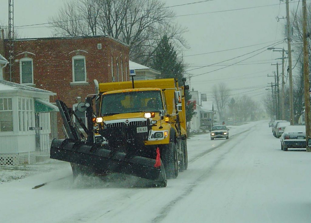 ValleyWXPhoto...Plowing the roads in
 South Mountain, Ontario this morning
Strom update......
The squalls and strong northwest winds have started up in the lee of the Great Lakes and travel in those areas is not recommended including south of the border around Watertown to Oswego to Buffalo, NY and further west through northern Pennsylvania (Erie County) and Ohio.
Strom continues.....
This is what you need to know today....
Ontario: Heavy Snow Warning for much of the southern part of the province. Heavy snow is occuring across the eastern part of the province from the clipper. Once that ends around noon, up to 15cm will be on the ground. It will be blown around by 40-60km/h winds.
Around the Lakes the snow machine will kick in with isolated heavy bands of snow dumping from 25-50cm in areas off Lake Huron and Georgian Bay. Thunder has even been reported with the snow!
New York: travel will be very difficult across northern parts of the Empire State with heavy lake effrect snow and squalls affecting all of the northern and western counties. Up to 15cm is expected in St. Lawrence and Clinton Counties, with 15 plus in all other counties bordering the Lakes. Highways will be closed...check before you leave. Don't travel today if you don't have to.
This is what you need to know today....
Ontario: Heavy Snow Warning for much of the southern part of the province. Heavy snow is occuring across the eastern part of the province from the clipper. Once that ends around noon, up to 15cm will be on the ground. It will be blown around by 40-60km/h winds.
Around the Lakes the snow machine will kick in with isolated heavy bands of snow dumping from 25-50cm in areas off Lake Huron and Georgian Bay. Thunder has even been reported with the snow!
New York: travel will be very difficult across northern parts of the Empire State with heavy lake effrect snow and squalls affecting all of the northern and western counties. Up to 15cm is expected in St. Lawrence and Clinton Counties, with 15 plus in all other counties bordering the Lakes. Highways will be closed...check before you leave. Don't travel today if you don't have to.
Wednesday, November 23, 2005
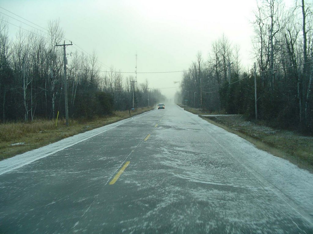 ValleyWxPhoto: Snowsqualls along Leeds/Grenville Rd 44 this morning...
Winter Strom Warnings
15-25cm for Kemptville and the Seaway
A major winter weather event is upon us. An Alberta Clipper storm moving across the Great Lakes is forecast to deepen. Heavy Snow will begin overnight in the area and spread east to the Quebec border. Heavy Snow Warnings have been posted for Leeds/Grenville and the rest of Eastern Ontario.
The storm is expected to move across New York State Thursday. In its wake high winds will gust north or northwest over 60km/h. These winds will produce near Blizzard Conditions on the south side of the lakes in the traditional snowbelts. Expect poor travel on I-90 and I-81 from the Thousands Island Bridge to Syracuse. Also the 401 will become snow covered and very icy from Prescott west as the overnight period moves on.
Expect very poor travel weather in all areas Thursday...plan accordingly.
Another Winter Storm on the way for Ontario
Another round of winter weather is in store for our area. Yesterdays storm just grazed eastern Ontario and Montreal with light snow. At best a few centimetres fell, enough to slick up the roads. The storm was a nor'easter that roared up the eastern seaboard. Heavy rain and winds that exceeded 100km/h were reported in Nova Scotia and new Brunswick.
This next storm is a normally docile Alberta Clipper, however with the Great Lakes void of any ice, it is about to become quite intense. Snow is forecast to overspread the province from west to east tonight and early Thursday. The snow will be accompanied by strong gusty and shifting winds from the southwest then northwest. This will blow and drift much of what falls. Early estimates put the snowfall for most of us including Ottawa, Kemptville, Iroquois, the Seaway and Montreal between 10-15cm, with some areas around the northern Lakes and upper Ottawa Valley receiving over 20cm.
Winter Storm Warnings have been posted for portions of the province and a Winter Storm Watch is in effect for Northern New York and Northern New England. OF NOTE: It is a big travel period for many Americans. I wish you all a Happy Holiday and ask you to think today about your travel plans across the Great Lakes and Northeast. Behind the storm strong gusty northerly winds and unseasonable cold will turn on the snow machines across the snowbelts of Ontario and New York. This will be a big event with 1-2 feet of snow in the snowbelts south of Watertown NY (I-81) and across the Buffalo area (I-90).
The nest Advisory on this strom will be issued around 3pm today.....
Another round of winter weather is in store for our area. Yesterdays storm just grazed eastern Ontario and Montreal with light snow. At best a few centimetres fell, enough to slick up the roads. The storm was a nor'easter that roared up the eastern seaboard. Heavy rain and winds that exceeded 100km/h were reported in Nova Scotia and new Brunswick.
This next storm is a normally docile Alberta Clipper, however with the Great Lakes void of any ice, it is about to become quite intense. Snow is forecast to overspread the province from west to east tonight and early Thursday. The snow will be accompanied by strong gusty and shifting winds from the southwest then northwest. This will blow and drift much of what falls. Early estimates put the snowfall for most of us including Ottawa, Kemptville, Iroquois, the Seaway and Montreal between 10-15cm, with some areas around the northern Lakes and upper Ottawa Valley receiving over 20cm.
Winter Storm Warnings have been posted for portions of the province and a Winter Storm Watch is in effect for Northern New York and Northern New England. OF NOTE: It is a big travel period for many Americans. I wish you all a Happy Holiday and ask you to think today about your travel plans across the Great Lakes and Northeast. Behind the storm strong gusty northerly winds and unseasonable cold will turn on the snow machines across the snowbelts of Ontario and New York. This will be a big event with 1-2 feet of snow in the snowbelts south of Watertown NY (I-81) and across the Buffalo area (I-90).
The nest Advisory on this strom will be issued around 3pm today.....
Monday, November 21, 2005
Winter Storm Update
Here is how our first storm of the season will play out over the next 24 hours. It appears that strong low pressure currently developing south of Cape Hatteras will move north and east to lie near New York City tomorrow. The storm will spread heavy precipitation and gusty winds as far west as the St. Lawrence Valley. Presently no warnings have been issued on the Canadian side. There is however a Winter Strom warning in effect for the Adirondacks of NY and the Green Mountains while tha valley's have a Winter Weather Advisory posted. Precipitation will spread from south to north reaching eastern Ontario overnight. Precip will begin as rain mixed with snow before changing to all snow on gusty north winds up to 50km/h. The temperature will drop below freezing in the afternoon and it will become nasty form travel on Tuesday. At this time 10cm of snow near the US border with 5-10 elsewhere is a good bet. However it will all depend when the change over from rain occurs. It will nevertheless be a tough travel day with some form of precip all day throughout the region. More snow is expected by Thursday morning as another storm system moves near our area.
Sunday, November 20, 2005
Special Weather Statement
First Snowstorm of Season on its way
Strong low pressure is forecast to develop along the southeast coast of the US on Monday and move up along the seaboard towards the St. Lawrence Valley. Rain and wind is forecast for a large portion of New England , Ontario and Quebec beginning late in the day. As cold air is drawn into the storm, the rain will change to snow in eastern Ontario and Montreal on Tuesday. The track of the storm is still uncertain, however a Winter Strom Watch has been posted for the Adirondacks of NY. More watches and warning may be issued later Monday. Stay tuned and plan for winter weather for the balance of the week. It will snow and it will be cold from Tuesday on. Plan now and adjust your driving. The next statement will be posted by 4pm Monday.
First Snowstorm of Season on its way
Strong low pressure is forecast to develop along the southeast coast of the US on Monday and move up along the seaboard towards the St. Lawrence Valley. Rain and wind is forecast for a large portion of New England , Ontario and Quebec beginning late in the day. As cold air is drawn into the storm, the rain will change to snow in eastern Ontario and Montreal on Tuesday. The track of the storm is still uncertain, however a Winter Strom Watch has been posted for the Adirondacks of NY. More watches and warning may be issued later Monday. Stay tuned and plan for winter weather for the balance of the week. It will snow and it will be cold from Tuesday on. Plan now and adjust your driving. The next statement will be posted by 4pm Monday.
Wednesday, November 16, 2005
Please slow down....
It is a message that becomes so clear as the snow flies and ice begins to form on area roadways. At least five fatal accidents have happened locally in the last 48 hours, the most recent in North Grenville this morning due to fog. But weather fog or freezing rain just SLOW DOWN. I am not quite sure why we try to push ourselves and our machines to the limit.
Heavy rain and poor visibility with some icy spots made the trip to and from the Corel Centre last night a little bit of an adventure, yahoos were still trying to push the pedal to 120km or more. I have been driving thousands of kilometres in numerous states and provinces for almost 25 years and despite the message being repeated every November when the first snow flies we don't seem to be getting it! Needless to say, unless you, or someone you love, is dying or giving birth, nothing is worth the price of your life. You have heard it before, slow down when the road conditions are poor. More snow and ice are hours away for Leeds & Grenville, and St. Lawrence Counties, please be careful and thoughtful of others.
Enough of that...today was a wild day temperature wise. A small wedge of wildly warm air for November pushed into Kemptville this morning. At 8:00am it was 8c by 9am it was 17c and by noon back down to 8c. The rapid warm up meant many people had condensation and fog inside their homes! A phenomena that occurs when it is actually colder in your home and car than outside. Rare event in November.
A Lake Effect Snow advisory is in effect for southern St. Lawrence, Jefferson and Franklin Counties in New York. If you are traveling south on I-81 or US37 be advised that roads could become icy overnight. We are expecting flurries in eastern Ontario.
The snowstorm that hit Manitoba and Saskatchewan dumped from 15-30cm of snow. It was
-29C in Regina this morning...ouch!!!
Be safe!!!!
It is a message that becomes so clear as the snow flies and ice begins to form on area roadways. At least five fatal accidents have happened locally in the last 48 hours, the most recent in North Grenville this morning due to fog. But weather fog or freezing rain just SLOW DOWN. I am not quite sure why we try to push ourselves and our machines to the limit.
Heavy rain and poor visibility with some icy spots made the trip to and from the Corel Centre last night a little bit of an adventure, yahoos were still trying to push the pedal to 120km or more. I have been driving thousands of kilometres in numerous states and provinces for almost 25 years and despite the message being repeated every November when the first snow flies we don't seem to be getting it! Needless to say, unless you, or someone you love, is dying or giving birth, nothing is worth the price of your life. You have heard it before, slow down when the road conditions are poor. More snow and ice are hours away for Leeds & Grenville, and St. Lawrence Counties, please be careful and thoughtful of others.
Enough of that...today was a wild day temperature wise. A small wedge of wildly warm air for November pushed into Kemptville this morning. At 8:00am it was 8c by 9am it was 17c and by noon back down to 8c. The rapid warm up meant many people had condensation and fog inside their homes! A phenomena that occurs when it is actually colder in your home and car than outside. Rare event in November.
A Lake Effect Snow advisory is in effect for southern St. Lawrence, Jefferson and Franklin Counties in New York. If you are traveling south on I-81 or US37 be advised that roads could become icy overnight. We are expecting flurries in eastern Ontario.
The snowstorm that hit Manitoba and Saskatchewan dumped from 15-30cm of snow. It was
-29C in Regina this morning...ouch!!!
Be safe!!!!
Tuesday, November 15, 2005
Severe Weather Statement from Environment Canada.....
The threat for Freezing Rain has passed in Kemptville.
SPECIAL WEATHER STATEMENT ISSUED FOR..CITY OF TORONTOWINDSOR - ESSEX - CHATHAM-KENTSARNIA - LAMBTONELGINLONDON - MIDDLESEXSIMCOE - DELHI - NORFOLKDUNNVILLE - CALEDONIA - HALDIMANDOXFORD - BRANTNIAGARACITY OF HAMILTONHALTON - PEELYORK - DURHAMHURON - PERTHWATERLOO - WELLINGTONDUFFERIN - INNISFILGREY - BRUCEBARRIE - ORILLIA - MIDLANDBELLEVILLE - QUINTE - NORTHUMBERLANDKINGSTON - PRINCE EDWARDPETERBOROUGH - KAWARTHA LAKESSTIRLING - TWEED - SOUTH FRONTENACBANCROFT - BON ECHO PARKBROCKVILLE - LEEDS AND GRENVILLECITY OF OTTAWAGATINEAUPRESCOTT AND RUSSELLCORNWALL - MORRISBURGSMITHS FALLS - LANARK - SHARBOT LAKEPARRY SOUND - MUSKOKA - HUNTSVILLEHALIBURTONRENFREW - PEMBROKE - BARRY'S BAYALGONQUINBURK'S FALLS - BAYFIELD INLET.
ANOTHER MAJOR FALL STORM TO HIT SOUTHERN ONTARIO. A DEVELOPING LOW PRESSURE SYSTEM OVER OKLAHOMA THIS MORNING WILL DEEPEN INTO A MAJOR FALL STORM TODAY AND TRACK TO EASTERN LAKESUPERIOR BY WEDNESDAY MORNING. PRECIPITATION AHEAD OF THIS SYSTEM HAS ALREADY REACHED PARTS OF SOUTHERN ONTARIO. THE PRECIPITATION IS IN THE FORM OF RAIN OVER SOUTHERN AREAS AND SNOW FURTHER NORTH. SNOW WILL CHANGE TO FREEZING RAIN THIS AFTERNOON OVER THE OTTAWA VALLEY AND COTTAGE COUNTRY BEFORE CHANGING TO RAIN LATE THIS AFTERNOON OR EARLY THIS EVENING.
A FREEZING RAIN WARNING IS IN EFFECT FOR THESE REGIONS.OVER MORE SOUTHERN AREAS RAIN AND THE ODD THUNDERSTORM WILL OCCUR AHEAD OF THE WARM FRONT. THE FRONT WILL MOVE NORTH TONIGHT AND MANYREGIONS WILL ACTUALLY SEE TEMPERATURES RISE OVERNIGHT.
BY WEDNESDAY MORNING A STRONG COLD FRONT FROM THE LOW WILL HAVE CROSSED SOUTHWESTERN ONTARIO AND WILL SWING THROUGH EASTERN ONTARIO DURING THE DAY. THUNDERSTORM ACTIVITY IS EXPECTED TO ACCOMPANY THEFRONT OVER SOME LOCALES WITH A FEW STRONG THUNDERSTORMS POSSIBLE. IN ADDITION WINDS WILL BECOME NORTHWEST WITH GUSTS TO 70 KM/H.THE COLD AIRMASS BEHIND THE FRONT WILL CAUSE TEMPERATURES TO FALLDURING THE DAY. LISTEN FOR FURTHER STATEMENTS. ADDITIONAL INFORMATION MAY ALSO BEFOUND BY CONSULTING THE LATEST PUBLIC FORECAST.
The threat for Freezing Rain has passed in Kemptville.
SPECIAL WEATHER STATEMENT ISSUED FOR..CITY OF TORONTOWINDSOR - ESSEX - CHATHAM-KENTSARNIA - LAMBTONELGINLONDON - MIDDLESEXSIMCOE - DELHI - NORFOLKDUNNVILLE - CALEDONIA - HALDIMANDOXFORD - BRANTNIAGARACITY OF HAMILTONHALTON - PEELYORK - DURHAMHURON - PERTHWATERLOO - WELLINGTONDUFFERIN - INNISFILGREY - BRUCEBARRIE - ORILLIA - MIDLANDBELLEVILLE - QUINTE - NORTHUMBERLANDKINGSTON - PRINCE EDWARDPETERBOROUGH - KAWARTHA LAKESSTIRLING - TWEED - SOUTH FRONTENACBANCROFT - BON ECHO PARKBROCKVILLE - LEEDS AND GRENVILLECITY OF OTTAWAGATINEAUPRESCOTT AND RUSSELLCORNWALL - MORRISBURGSMITHS FALLS - LANARK - SHARBOT LAKEPARRY SOUND - MUSKOKA - HUNTSVILLEHALIBURTONRENFREW - PEMBROKE - BARRY'S BAYALGONQUINBURK'S FALLS - BAYFIELD INLET.
ANOTHER MAJOR FALL STORM TO HIT SOUTHERN ONTARIO. A DEVELOPING LOW PRESSURE SYSTEM OVER OKLAHOMA THIS MORNING WILL DEEPEN INTO A MAJOR FALL STORM TODAY AND TRACK TO EASTERN LAKESUPERIOR BY WEDNESDAY MORNING. PRECIPITATION AHEAD OF THIS SYSTEM HAS ALREADY REACHED PARTS OF SOUTHERN ONTARIO. THE PRECIPITATION IS IN THE FORM OF RAIN OVER SOUTHERN AREAS AND SNOW FURTHER NORTH. SNOW WILL CHANGE TO FREEZING RAIN THIS AFTERNOON OVER THE OTTAWA VALLEY AND COTTAGE COUNTRY BEFORE CHANGING TO RAIN LATE THIS AFTERNOON OR EARLY THIS EVENING.
A FREEZING RAIN WARNING IS IN EFFECT FOR THESE REGIONS.OVER MORE SOUTHERN AREAS RAIN AND THE ODD THUNDERSTORM WILL OCCUR AHEAD OF THE WARM FRONT. THE FRONT WILL MOVE NORTH TONIGHT AND MANYREGIONS WILL ACTUALLY SEE TEMPERATURES RISE OVERNIGHT.
BY WEDNESDAY MORNING A STRONG COLD FRONT FROM THE LOW WILL HAVE CROSSED SOUTHWESTERN ONTARIO AND WILL SWING THROUGH EASTERN ONTARIO DURING THE DAY. THUNDERSTORM ACTIVITY IS EXPECTED TO ACCOMPANY THEFRONT OVER SOME LOCALES WITH A FEW STRONG THUNDERSTORMS POSSIBLE. IN ADDITION WINDS WILL BECOME NORTHWEST WITH GUSTS TO 70 KM/H.THE COLD AIRMASS BEHIND THE FRONT WILL CAUSE TEMPERATURES TO FALLDURING THE DAY. LISTEN FOR FURTHER STATEMENTS. ADDITIONAL INFORMATION MAY ALSO BEFOUND BY CONSULTING THE LATEST PUBLIC FORECAST.
Monday, November 14, 2005
Travel not recommended tonight in Saskatchewan
Strom moving into Ontario
It is a busy evening weatherwise with a major Colorado Low affecting the Prairies and moving into Ontario. Saskatchewan Highways is not recommending travel tonight due to strong winds and near zero visibility on most roads in the southern part of the province. 10-15cm of snow has fallen with cold temperatures and gusty winds.
In the east a Winter Weather Advisory is in effect for St. Lawrence County, NY with snow and freezing rain expected till noon tomorrow. In eastern Ontario a few cm of snow may fall before it changes to rain. There is a risk of some thunderstorm activity along the cold front Tuesday night into Wednesday. This will be followed by very strong gusty winds. These winds may reach warning criteria again.
Tropical Depression 27 has formed in the Atlantic and may become a storm later tonight.
Strom moving into Ontario
It is a busy evening weatherwise with a major Colorado Low affecting the Prairies and moving into Ontario. Saskatchewan Highways is not recommending travel tonight due to strong winds and near zero visibility on most roads in the southern part of the province. 10-15cm of snow has fallen with cold temperatures and gusty winds.
In the east a Winter Weather Advisory is in effect for St. Lawrence County, NY with snow and freezing rain expected till noon tomorrow. In eastern Ontario a few cm of snow may fall before it changes to rain. There is a risk of some thunderstorm activity along the cold front Tuesday night into Wednesday. This will be followed by very strong gusty winds. These winds may reach warning criteria again.
Tropical Depression 27 has formed in the Atlantic and may become a storm later tonight.
Winter Storm Warning for Saskatchewan....
A developing winter storm is producing dangerous travel conditions across the southern half of the province today. Winds are gusting to 50km/h and stronger along with snow. Very low visibilities are being reported along and south of the Trans Canada Highway along with cold temperatures. These conditions will ease in the west by late today and overnight in the east as the storm moves into Manitoba. Warnings have been issued from Gravelbourg/Assiniboia east to the Manitoba border.
A developing winter storm is producing dangerous travel conditions across the southern half of the province today. Winds are gusting to 50km/h and stronger along with snow. Very low visibilities are being reported along and south of the Trans Canada Highway along with cold temperatures. These conditions will ease in the west by late today and overnight in the east as the storm moves into Manitoba. Warnings have been issued from Gravelbourg/Assiniboia east to the Manitoba border.
Friday, November 11, 2005

"Lest We Forget"
Please take time today to remember the sacrifices made by the thousands of Canadian Men and Women so that we can enjoy the freedom to Blog and do whatever else we want to in this great country.
Most communities are holding services this morning between 10:00-NOON, plan to attend if you can. Wear a Poppy.
Wednesday, November 09, 2005
 Lightning flashes across the
 November sky and rain pounds
the windshield along the 401 Sunday night....
Wild weather today......
After this past weekends wild weather in the east, a break would be nice! But not today,because another round of rain, wind and even some snow is on the way.
The weekend was interesting across the St. Lawrence Valley. I drove home around 5pm on Sunday straight into that fierce cold front that had spawned the tornado in Indiana. The lightning was amazing to the west along the 401. It felt like July not November. I got off the highway in Summerstown, driving around a downed tree. It was hard to see on the 401. In all about 25mm of rain came down with the front. Winds were gusting between 60-100km/h along and behind the front.
Today: Heavy Snow Warnings are in effect for Southern Saskatchewan and Southern Manitoba, north of the Trans Canada. For Ontario and Quebec this system will mean another round of gusty winds and rain mixed with snow. Winter Storm Watches and Warnings are in effect for Northern Ontario and a Severe Thunderstorm Watch has been posted for southwest Ontario. For the Upper Ottawa Valley, the precip will begin in the form of freezing rain and could last up to 4 hours fo places like Renfrew and Calabogie. As the cold front charges through later this afternoon, heavy rain and thunderstorms will develop like on Sunday. There is a chance of over 50mm of rain from Toronto to Kingston with 25mm or so from Kingston to Montreal.
There is even the chance of some Lake Effect snow as the next cold front races through late Wednesday and Thursday.
After this past weekends wild weather in the east, a break would be nice! But not today,because another round of rain, wind and even some snow is on the way.
The weekend was interesting across the St. Lawrence Valley. I drove home around 5pm on Sunday straight into that fierce cold front that had spawned the tornado in Indiana. The lightning was amazing to the west along the 401. It felt like July not November. I got off the highway in Summerstown, driving around a downed tree. It was hard to see on the 401. In all about 25mm of rain came down with the front. Winds were gusting between 60-100km/h along and behind the front.
Today: Heavy Snow Warnings are in effect for Southern Saskatchewan and Southern Manitoba, north of the Trans Canada. For Ontario and Quebec this system will mean another round of gusty winds and rain mixed with snow. Winter Storm Watches and Warnings are in effect for Northern Ontario and a Severe Thunderstorm Watch has been posted for southwest Ontario. For the Upper Ottawa Valley, the precip will begin in the form of freezing rain and could last up to 4 hours fo places like Renfrew and Calabogie. As the cold front charges through later this afternoon, heavy rain and thunderstorms will develop like on Sunday. There is a chance of over 50mm of rain from Toronto to Kingston with 25mm or so from Kingston to Montreal.
There is even the chance of some Lake Effect snow as the next cold front races through late Wednesday and Thursday.
Sunday, November 06, 2005
Strong Winds Today...
A strong and deepening storm over Michigan this morning will slide into Ontario. Trailing from the storm is a cold front that is causing all kinds of severe weather. Big thunderstorms flared up overnight in the unseasonable warm and humid air to the east of the front. (It was 20C in Burlington, Vermont yesterday and in the 20's in New York State.) The front produced a tornado in Evansville, Indiana overnight, with a path 3/4mile wide and 20 miles in duration, killing at least 11 and injuring over 150.
High Wind Warnings have been posted for Ontario, Upstate New York, The Champlain and St. Lawrence Valley's and will be extended into Montreal later today. Caution is advised, as winds will approach 80km/h capable of knocking down trees and power lines. Passage of the front will be from 2pm on moving west to east from Kingston east into Quebec... Travel with care....
Happy Birthday PJ........
A strong and deepening storm over Michigan this morning will slide into Ontario. Trailing from the storm is a cold front that is causing all kinds of severe weather. Big thunderstorms flared up overnight in the unseasonable warm and humid air to the east of the front. (It was 20C in Burlington, Vermont yesterday and in the 20's in New York State.) The front produced a tornado in Evansville, Indiana overnight, with a path 3/4mile wide and 20 miles in duration, killing at least 11 and injuring over 150.
High Wind Warnings have been posted for Ontario, Upstate New York, The Champlain and St. Lawrence Valley's and will be extended into Montreal later today. Caution is advised, as winds will approach 80km/h capable of knocking down trees and power lines. Passage of the front will be from 2pm on moving west to east from Kingston east into Quebec... Travel with care....
Happy Birthday PJ........
Thursday, November 03, 2005
Snow for Gravelbourg as well as
Northen Montana and North Dakota
A storm system sliding south of the border will give snow this afternoon and tonight across the area. A few centimetres of snow can be expected.
The following Snow Advisory is in effect for the northern Montana counties.
...SNOW ADVISORY REMAINS IN EFFECT UNTIL 6 PM MST THIS AFTERNOON..
A SNOW ADVISORY REMAINS IN EFFECT UNTIL 6 PM MST THIS AFTERNOON. THE SNOW WILL CONTINUE TO FALL ACROSS THE ADVISORY AREA INTO THIS AFTERNOON. LOOK FOR ADDITIONAL ACCUMULATIONS...WITH TOTAL SNOW ACCUMULATIONS BETWEEN 2 AND 4 INCHES. THE SNOW IS EXPECTED TO ENDFROM WEST TO EAST TODAY. THE HIGHER SNOW AMOUNTS ARE LIKELY TO BEFOUND ON GRASSY SURFACES.A SNOW ADVISORY MEANS THAT PERIODS OF SNOW WILL CAUSE PRIMARILY TRAVEL DIFFICULTIES. BE PREPARED FOR SNOW COVERED ROADS ANDLIMITED VISIBILITIES...AND USE CAUTION WHILE DRIVING.
Northen Montana and North Dakota
A storm system sliding south of the border will give snow this afternoon and tonight across the area. A few centimetres of snow can be expected.
The following Snow Advisory is in effect for the northern Montana counties.
...SNOW ADVISORY REMAINS IN EFFECT UNTIL 6 PM MST THIS AFTERNOON..
A SNOW ADVISORY REMAINS IN EFFECT UNTIL 6 PM MST THIS AFTERNOON. THE SNOW WILL CONTINUE TO FALL ACROSS THE ADVISORY AREA INTO THIS AFTERNOON. LOOK FOR ADDITIONAL ACCUMULATIONS...WITH TOTAL SNOW ACCUMULATIONS BETWEEN 2 AND 4 INCHES. THE SNOW IS EXPECTED TO ENDFROM WEST TO EAST TODAY. THE HIGHER SNOW AMOUNTS ARE LIKELY TO BEFOUND ON GRASSY SURFACES.A SNOW ADVISORY MEANS THAT PERIODS OF SNOW WILL CAUSE PRIMARILY TRAVEL DIFFICULTIES. BE PREPARED FOR SNOW COVERED ROADS ANDLIMITED VISIBILITIES...AND USE CAUTION WHILE DRIVING.
Monday, October 31, 2005

Happy Halloween
I hate it when real life gets in the way of my weather. I have some house cleaning to do "Blog Wise" and will post some weather events from the last couple of weeks shortly. For now have a very Safe and Happy Halloween. The weather in both Saskatchewan and in the east, Ontario and Quebec, will be fair and fairly mild with just a slight chance of showers in Ontario. Have fun.....
Tuesday, October 25, 2005
Wilma moved across south Florida - billions in damage
Nova Scotia to receive strong winds/rain
Heavy Snow for New England
Hurricane Wilma is truly a tale of two storms. After meandering over Mexico for days the storm has rocketed northeasterly across Florida in a couple of hours, and into the Atlantic. The storm was a strong Cat 3 at landfall. The storm will now take aim at the Canadian Maratimes today. The timing is that poor weather will develop by daybreak today and spread north. High Wind Warnings and Heavy Rain Warnings are in effect for Coastal Nova Scotia and New Brunswick. The storm will remain well offshore but will interact with a developing Nor'Easter to produce abundant moisture and gusty winds from the coast west into eastern Ontario. Heavy rain from 60mm plus is expected in Nova Scotia and New Brunswick as well as 80-110km/h winds. Also a coastal surge is expected from Boston northward towards Halifax.
If that was not enough, cold air working into the western flank of the storm will produce heavy snow across the Adirondack and Green Mountains. From 15-25cm could fall with flurries at the lower elevations. This is a remarkable storm......reminds me a little of the Halloween Nor'Easter of 1991.
Nova Scotia to receive strong winds/rain
Heavy Snow for New England
Hurricane Wilma is truly a tale of two storms. After meandering over Mexico for days the storm has rocketed northeasterly across Florida in a couple of hours, and into the Atlantic. The storm was a strong Cat 3 at landfall. The storm will now take aim at the Canadian Maratimes today. The timing is that poor weather will develop by daybreak today and spread north. High Wind Warnings and Heavy Rain Warnings are in effect for Coastal Nova Scotia and New Brunswick. The storm will remain well offshore but will interact with a developing Nor'Easter to produce abundant moisture and gusty winds from the coast west into eastern Ontario. Heavy rain from 60mm plus is expected in Nova Scotia and New Brunswick as well as 80-110km/h winds. Also a coastal surge is expected from Boston northward towards Halifax.
If that was not enough, cold air working into the western flank of the storm will produce heavy snow across the Adirondack and Green Mountains. From 15-25cm could fall with flurries at the lower elevations. This is a remarkable storm......reminds me a little of the Halloween Nor'Easter of 1991.
Friday, October 21, 2005

 Frost & Hurricanes
Just a couple of pictures to show you the contrast in the seasons between Hurricane Wilma over Cozumel and our First Frost in Kemptville. I had to scrape this morning, it makes me sad to see summer go.
The word SNOW is in the forecast for next week.......
At this hour Hurricane Wilma is slowly lashing Cozumel, Cancun and the Yucatan Peninsula.
Stay tuned......
 Wilma nears Cozumel......
The eye of Hurricane Wilma is just about on the tiny resort island of Cozumel, Mexico......Hurricane conditons will be prolonged, as the storm is only moving at 6mph. Evacuations have begun is southwest coastal Florida including the Keys and Collier County.
Wednesday, October 19, 2005

884mb Pressure lowest ever recorded
Wilma explodes to Cat 5
I am amzed, just 36 hours ago Wilma was a tropical storm - she is now a cat 5 with winds howling to 175mph. The central pressure as recorded by NOAA Recon is 884mb...this still has to be verified but if accurate this will make Wilma the strongest storm ever to wander the Atlantic Basin.
All interests in Cuba the Yucatan of Mexico, Cayman Islands the Flordia Keys and south Florida should monitor Wilma closely.
I wil post new info later today....sb
Tuesday, October 18, 2005

Flood waters in New Hampshire
Flooding eases across Northeast & Quebec
Wilma becomes a Hurricane
Hurricane Wilma the 21st storm of 2005 has become a hurricane and is located south of Jamaica and the Caymen Islands at this hour. This Storm ties a record set in 1933. The storm is expected to strengthen into a major hurricane by the weekend and threaten south Florida from Tampa Bay south and east across the state. Interests in the southeast should also monitor the progress of the storm.
In Quebec, and the Northeast waters are receding after nearly a week of heavy rain. Anywhere from 100-400mm of rain fell over many areas with severe flooding reported. The hardest hit areas were New Jersey and New Hampshire. Twelve deaths were blamed on the storm.
Thursday, October 13, 2005
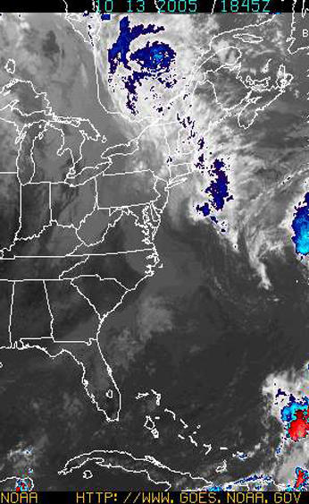
Rain, Rain Go Away........
The rain continues to fall across Ontario, Quebec, New York and most of New England and the Northeast. In Kemptville another 25mm fell today. There is no risk of flooding, according to the Rideau Conservation Authority we are in a drought situation. That may have changed over the last week or so.
In New England the rain has claimed three lives in New Hampshire and has produced some of the worst flooding in decades from New Jersey north to Maine. The culprit is a deep plume of tropical moisture on a conveyor belt moving northwest across the open Atlantic and into our area. One look at the satellite map above shows the path.
Another 50-75mm could fall across all our areas through Saturday. Flood watches and warnings are in effect across southern New England and southeast New York.
Tuesday, October 11, 2005

Hurricane Vince hits Spain
The weather has cooled here in the east as a stationary front lying along the east coast draws moisture northward. Very heavy rain fell across the Maratimes this past weekend with the following totals measured:
ST JOHN ....... 142.0MM,FREDERICTON.... 93.7 MM, ST STEPHEN..... 135.5 MM, GRAND MANAN ... 225.4, MONCTON ....... 153.1 MM. Flooding was reported in both New Brunswick and Maine. Ten people died in flooding from the Carolinas to Maine.
Kemptville measured 64mm. Much colder air has arrived on northeast winds. The drizzle and fog is making it seem more miserable than our record heat. I have even had to turn the heat on in the house for the first time.
Over the weekend Hurricane Vince formed in the far eastern Atlantic. The storm moved inland over Spain. This was the first time in recorded history a named storm has hit this region.
Above: The picture above is a Halloween scene in the 27C degree record heat and haze of October 7th.
Wednesday, October 05, 2005
Hurricane Stan kills 66 in Mexico
Blizzard hits Dakotas/Manitoba -
Tammy forms in southeast US
As I drove around working today in shorts with the window rolled down, I realized we, here in the east, are living on borrowed time. Out west a fierce winter storm is hitting parts of Montana, the Dakotas, southeast Saskatchewan and Manitoba. Heavy snow in some cases over 30cm along with 50 to as high as 80km/h winds are occurring. Power lines and trees are snapping under the weight of the snow and high winds.
Meanwhile here in the east we are enjoying another day of record highs. It is 26C in Kemptville and Ottawa has tied another record for the third day.
 Hurricane Stan came ashore near Vera Cruz Mexico with heavy rains and mudslides. More misery and death in this hurricane season.
Of interest to those of us in the east, Tropical Storm Tammy has developed east of the Florida coast. There is still plenty of uncertainty in her track but heavy rain and wind are expected as far north as the Carolinas. Interests from Florida to Nova Scotia should monitor the storm.
Above: The beautiful fall colors are starting to appear in Kemptville despite the 80 degree weather.
Blizzard hits Dakotas/Manitoba -
Tammy forms in southeast US
As I drove around working today in shorts with the window rolled down, I realized we, here in the east, are living on borrowed time. Out west a fierce winter storm is hitting parts of Montana, the Dakotas, southeast Saskatchewan and Manitoba. Heavy snow in some cases over 30cm along with 50 to as high as 80km/h winds are occurring. Power lines and trees are snapping under the weight of the snow and high winds.
Meanwhile here in the east we are enjoying another day of record highs. It is 26C in Kemptville and Ottawa has tied another record for the third day.
 Hurricane Stan came ashore near Vera Cruz Mexico with heavy rains and mudslides. More misery and death in this hurricane season.
Of interest to those of us in the east, Tropical Storm Tammy has developed east of the Florida coast. There is still plenty of uncertainty in her track but heavy rain and wind are expected as far north as the Carolinas. Interests from Florida to Nova Scotia should monitor the storm.
Above: The beautiful fall colors are starting to appear in Kemptville despite the 80 degree weather.
Tuesday, October 04, 2005
A SMOG ADVISORY* has been issued by the Ontario Ministry of the Environment for the following forecast regions:
For: Wednesday October 5, 2005 Algonquin Bancroft - Bon Echo Barrie - Orillia - Midland Brockville - Leeds and Grenville Burk's Falls - Bayfield Inlet - City of Ottawa - Cornwall - Morrisburg -Grey - Bruce Haliburton - North Bay - West Nipissing Parry Sound - Muskoka - Huntsville - Prescott and Russel -l Renfrew - Pembroke - Barry's Bay Smiths Falls - Lanark - Sharbot Lake Stirling - Tweed - South Frontenac
The SMOG ADVISORY for southwest Ontario and Toronto remains in effect.
Advisories will remain in effect until further notice. For more details visit the Air Quality Ontario website at: www.airqualityontario.com
During the smog episode, individuals may experience eye irritation. Heavy outdoor exercise may cause respiratory symptoms such as coughing or shortness of breath. People with heart or lung disease including asthma may experience a worsening of their condition.* A Smog Advisory means that there is a strong likelihood that there may be poor air quality within the next 24 hours due to ground-level ozone and/or fine particulate matter.
Spare the Air Actions
During a smog advisory, there are a number of actions that you can take to help spare the air. Travel tips - all year round: - leave your car at home - walk, cycle, carpool or take public transit - tele-conference instead of driving to meetings - limit car trips by doing all your errands at once, and do not let your engine idle - keep your car well tuned, check your tire pressure and drive at moderate speeds
Health tips: - avoid exposure to vehicle exhaust fumes - consult your doctor for specific health advice - wear light clothing at work while air conditioning is reduced - avoid strenuous exercise in the heat of the day
Electricity saving tips: - save electricity at home by setting your air conditioner temperature a few degrees higher (health permitting) and turning off lights you are not using
Other pollution reduction tips: - leave lawn mowing for another day - restrict the use of gasoline-powered equipment - delay using oil-based paints, solvents and cleaners.
For: Wednesday October 5, 2005 Algonquin Bancroft - Bon Echo Barrie - Orillia - Midland Brockville - Leeds and Grenville Burk's Falls - Bayfield Inlet - City of Ottawa - Cornwall - Morrisburg -Grey - Bruce Haliburton - North Bay - West Nipissing Parry Sound - Muskoka - Huntsville - Prescott and Russel -l Renfrew - Pembroke - Barry's Bay Smiths Falls - Lanark - Sharbot Lake Stirling - Tweed - South Frontenac
The SMOG ADVISORY for southwest Ontario and Toronto remains in effect.
Advisories will remain in effect until further notice. For more details visit the Air Quality Ontario website at: www.airqualityontario.com
During the smog episode, individuals may experience eye irritation. Heavy outdoor exercise may cause respiratory symptoms such as coughing or shortness of breath. People with heart or lung disease including asthma may experience a worsening of their condition.* A Smog Advisory means that there is a strong likelihood that there may be poor air quality within the next 24 hours due to ground-level ozone and/or fine particulate matter.
Spare the Air Actions
During a smog advisory, there are a number of actions that you can take to help spare the air. Travel tips - all year round: - leave your car at home - walk, cycle, carpool or take public transit - tele-conference instead of driving to meetings - limit car trips by doing all your errands at once, and do not let your engine idle - keep your car well tuned, check your tire pressure and drive at moderate speeds
Health tips: - avoid exposure to vehicle exhaust fumes - consult your doctor for specific health advice - wear light clothing at work while air conditioning is reduced - avoid strenuous exercise in the heat of the day
Electricity saving tips: - save electricity at home by setting your air conditioner temperature a few degrees higher (health permitting) and turning off lights you are not using
Other pollution reduction tips: - leave lawn mowing for another day - restrict the use of gasoline-powered equipment - delay using oil-based paints, solvents and cleaners.
Record warmth east - Snowstorm for Saskatchewan/Manitoba
While here in the east temperatures are soaring to near 30 with record highs being shattered including Ottawa's 26.3 yesterday, the west is preparing for a possible snowstorm. A Winter Strom Watch has been posted for portions of southern Manitoba and Saskatchewan. Winter Strom Warnings have been posted for North Dakota and Minnesota.
The heaviest snow will fall in a swath from central & southwest South Dakota across central North Dakota and into extreme southwest Saskatchewan and southern Manitoba. 10-20cm with 25-50km/h winds can be expected.
Meanwhile current temperature readings in the east are 27-30C across much of southern and eastern Ontario.
While here in the east temperatures are soaring to near 30 with record highs being shattered including Ottawa's 26.3 yesterday, the west is preparing for a possible snowstorm. A Winter Strom Watch has been posted for portions of southern Manitoba and Saskatchewan. Winter Strom Warnings have been posted for North Dakota and Minnesota.
The heaviest snow will fall in a swath from central & southwest South Dakota across central North Dakota and into extreme southwest Saskatchewan and southern Manitoba. 10-20cm with 25-50km/h winds can be expected.
Meanwhile current temperature readings in the east are 27-30C across much of southern and eastern Ontario.
Friday, September 30, 2005
 Above: Tree damage in Kemptville
Wind Damage across area....
Here is a quick summary of the peak winds yesterday. There was tree damage as well as signs and power poles knocked down. Some structual damage and crushed cars were reported as well.
TORONTO PEARSON 78 km/h
TORONTO ISLAND 74
PORT WELLER 82
POINT PETRE (Sandbanks) 111 (Peak Gust in Province)
KINGSTON 80
OTTAWA 67
KEMPTVILLE 60 (may have been stronger locally)
CORNWALL 92
WINCHESTER 74
MONTREAL 84
Thursday, September 29, 2005
High Winds Today
Environment Canada and The National Weather Service have posted high wind warnings for both sides of the border from Toronto to Montreal. In all areas today a sharp cold front will produce winds in excess of 50km/h with gusts as high as 100km/h. This is over Tropical Storm force to put things in perspective.
Already this morning winds are gusting to 42km/h here in Kemptville with some damage reported. Winds have topped 80km/h in Toronto and 98km/h in Port Stanley.
In addition short lived violent thunderstorms have been reported in a line from Alexandria to Cornwall moving east into Montreal. A second fast moving potent line had developed along the cold front and will move through Kemptville the Seaway and Montreal before noon today.
Be safe and forget about the umbrella.
For Marine interests, a Gale warning and waterspout advisory is in effect all day for Lakes Erie and Ontario. As well a Gale Warning is in effect for the St. Lawrence River.
I will have pictures later today.......
Environment Canada and The National Weather Service have posted high wind warnings for both sides of the border from Toronto to Montreal. In all areas today a sharp cold front will produce winds in excess of 50km/h with gusts as high as 100km/h. This is over Tropical Storm force to put things in perspective.
Already this morning winds are gusting to 42km/h here in Kemptville with some damage reported. Winds have topped 80km/h in Toronto and 98km/h in Port Stanley.
In addition short lived violent thunderstorms have been reported in a line from Alexandria to Cornwall moving east into Montreal. A second fast moving potent line had developed along the cold front and will move through Kemptville the Seaway and Montreal before noon today.
Be safe and forget about the umbrella.
For Marine interests, a Gale warning and waterspout advisory is in effect all day for Lakes Erie and Ontario. As well a Gale Warning is in effect for the St. Lawrence River.
I will have pictures later today.......
Wednesday, September 28, 2005
Strong cold front for Ontario/Quebec
A developing storm system over the Great Lakes will sweep a powerful cold front across our area tonight into Thursday morning. Showers and thunderstorms will accompany the front dropping more rain on already waterlogged Quebec City. Temperatures will drop behind the front on Thursday down to the single digits.
The big feature with this front will be Strong Winds from the southwest from 60-90km/h. These are capable of some wind damage, specially along the St. Lawrence and Richelieu Valleys and along the north shore of Lake Ontario. Warnings have been posted.
Heavy Rain is also forecast for the area north of Montreal and the upper Ottawa Valley.
A Wind Advisory is in effect for St. Lawrence, Jefferson and Lewis Counties in New York from 6am to 6pm on Thursday.
A developing storm system over the Great Lakes will sweep a powerful cold front across our area tonight into Thursday morning. Showers and thunderstorms will accompany the front dropping more rain on already waterlogged Quebec City. Temperatures will drop behind the front on Thursday down to the single digits.
The big feature with this front will be Strong Winds from the southwest from 60-90km/h. These are capable of some wind damage, specially along the St. Lawrence and Richelieu Valleys and along the north shore of Lake Ontario. Warnings have been posted.
Heavy Rain is also forecast for the area north of Montreal and the upper Ottawa Valley.
A Wind Advisory is in effect for St. Lawrence, Jefferson and Lewis Counties in New York from 6am to 6pm on Thursday.
Sunday, September 25, 2005
Rita sweeps Northeast
Heavy Rain Warnings for Montreal/Ottawa
Despite earlier predictions of Rita stalling out over Mississippi for the better part of the upcoming week, she has decided to spare the south her heavy rains. Thankfully the storm is being swept northeast along a trough of low pressure. The system will slide down the St. Lawrence Valley into Monday with heavy rains forecast. Upwards of 100mm could fall in Ottawa and Montreal. Heavy Rain Warnings have been posted from Kingston to Quebec City and north to the Laurentians. Embedded thunderstorms are also expected and winds could be gusty.
While many people in Texas are beginning to return home it is a different story in Louisiana. The southwest part of the state; basically what was not hit by Katrina, was hammered by Rita. Heavy damage was reported in both Vermillion and Cameron Parishes. It will be days before the extent of the damage is known. No exact figure on casualties is available.
Meanwhile the death toll from Katrina has exceeded 1000.
Heavy Rain Warnings for Montreal/Ottawa
Despite earlier predictions of Rita stalling out over Mississippi for the better part of the upcoming week, she has decided to spare the south her heavy rains. Thankfully the storm is being swept northeast along a trough of low pressure. The system will slide down the St. Lawrence Valley into Monday with heavy rains forecast. Upwards of 100mm could fall in Ottawa and Montreal. Heavy Rain Warnings have been posted from Kingston to Quebec City and north to the Laurentians. Embedded thunderstorms are also expected and winds could be gusty.
While many people in Texas are beginning to return home it is a different story in Louisiana. The southwest part of the state; basically what was not hit by Katrina, was hammered by Rita. Heavy damage was reported in both Vermillion and Cameron Parishes. It will be days before the extent of the damage is known. No exact figure on casualties is available.
Meanwhile the death toll from Katrina has exceeded 1000.
Saturday, September 24, 2005
Rita Inland over Texas
Hurricane Rita's centre moved onshore near Sabine Pass on the Texas/Louisianna border around 3:30am this morning. The storm has pounded areas of southwest Louisianna including affecting the New Orleans area with another surge of water that has breached levees dumping 5 feet of water into portions of the city again.
It is early and damge assesments are underway, but it appears thea the Galveston/Houston area is going to be ok. I am very worried about the southwest coastal areas of hard-hit Louisianna. The state has certainly suffered another major event in Cameron Parrish and other parishes near the Texas border and along the coast. The storm is weakening further, but will remain a serious flood threat to Texas, Arkansas and Louisianna through mid week.
It is not expected to affect Ontario as a decaying depression.
Hurricane Rita's centre moved onshore near Sabine Pass on the Texas/Louisianna border around 3:30am this morning. The storm has pounded areas of southwest Louisianna including affecting the New Orleans area with another surge of water that has breached levees dumping 5 feet of water into portions of the city again.
It is early and damge assesments are underway, but it appears thea the Galveston/Houston area is going to be ok. I am very worried about the southwest coastal areas of hard-hit Louisianna. The state has certainly suffered another major event in Cameron Parrish and other parishes near the Texas border and along the coast. The storm is weakening further, but will remain a serious flood threat to Texas, Arkansas and Louisianna through mid week.
It is not expected to affect Ontario as a decaying depression.
Thursday, September 22, 2005
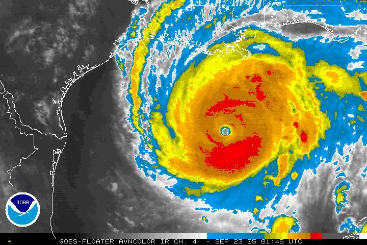
Rita continues towards Texas Gulf Coast
Hurricane Rita is continuing to move towards the Texas coast looking eerily like Katrina three weeks ago. While a slight decrease in intensity has occurred, that is pretty much academic at this point. She remains a very dangerous storm capable of severe damage and destruction.
The outer most rainbands are beginning to sweep across the coast this evening from Mississippi west towards New Orleans. Heavy rain and thunderstorms will increase in coverage over the next 24 hours leading up to landfall. Seas are rising already along the immediate coast. Areas already hit from Katrina can expect flooding from Rita.
Traffic is moving so slow inland north towards Dallas. My fear is always that people will become trapped on the highways as the storm hits.
Strong high pressure is blocking the storm from moving rapidly north. This will mean a prolonged period of heavy rain and wind far inland towards the northern portion of the state and Dallas.
Wednesday, September 21, 2005
Rita...Katrina's ugly twin......
Rita has become a 5.....
At 4pm EDT Rita has been upgraded to a Category 5 and is steaming through the Gulf of Mexico, 735 miles ESE of Corpus Christie, moving towards the west. A turn towards the north is expected with landfall near Galveston Texas expected. Mandatory evacuations are now in effect for coastal areas along the upper Texas Coast. There is still uncertainty and the storm could strike anywhere from southwest Louisiana towards Corpus Christie, TX.
http://www.hurricanecity.com/ is an awesome site with audio, pictures and numerous other resources. Please visit and support Jim and his site. I will post numerous updates as the week moves along. For now there is no reason to believe that this storm will be any less intense than Katrina. The conditions remain very favorable for Rita up until landfall.
Rita has become a 5.....
At 4pm EDT Rita has been upgraded to a Category 5 and is steaming through the Gulf of Mexico, 735 miles ESE of Corpus Christie, moving towards the west. A turn towards the north is expected with landfall near Galveston Texas expected. Mandatory evacuations are now in effect for coastal areas along the upper Texas Coast. There is still uncertainty and the storm could strike anywhere from southwest Louisiana towards Corpus Christie, TX.
http://www.hurricanecity.com/ is an awesome site with audio, pictures and numerous other resources. Please visit and support Jim and his site. I will post numerous updates as the week moves along. For now there is no reason to believe that this storm will be any less intense than Katrina. The conditions remain very favorable for Rita up until landfall.
Monday, September 19, 2005
Ophelia, Rita and Snow!!!
I was on vacation for a week and am suffering from a bout of some kind of flu bug, but the weather never stops does it!
It was a wild weather week for certain across many parts of North America. While I was visiting the snow capped Rockies in the midst of an early winter storm, Ophelia was taking pot shots at my other favorite destination, the Outer Banks of North Carolina.
Out west as much as 45cm of heavy wet snow fell in Crowsnest Pass, Alberta knocking down trees and power lines. In the valleys heavy rain, in some cases over 100mm fell. The rain has forced water levels on the Saskatchewan River to begin rising again.
Our attention is still on the Gulf Coast in the wake of Katrina. However we are now looking at newly formed Tropical Storm Rita. Rita is nearing Hurricane strength as she glides towards the southern Florida coast and the Keys tonight. The storm is expected to head into the Gulf and become a major hurricane. By the end of the week, she could be threatening the area from Louisiana west to Texas. This unreal season just continues to amaze me. At the same time Hurricane Philippe may affect Bermuda by weeks end.
Of Note: The western influence of Ophelia provided some lift to the rain over the weekend. Montreal had 35mm, Ottawa 25mm and parts of St. Lawrence County, NY hadover 100mm with flooding reported.
Below: Snow covered Rockies after last weekends storm

I was on vacation for a week and am suffering from a bout of some kind of flu bug, but the weather never stops does it!
It was a wild weather week for certain across many parts of North America. While I was visiting the snow capped Rockies in the midst of an early winter storm, Ophelia was taking pot shots at my other favorite destination, the Outer Banks of North Carolina.
Out west as much as 45cm of heavy wet snow fell in Crowsnest Pass, Alberta knocking down trees and power lines. In the valleys heavy rain, in some cases over 100mm fell. The rain has forced water levels on the Saskatchewan River to begin rising again.
Our attention is still on the Gulf Coast in the wake of Katrina. However we are now looking at newly formed Tropical Storm Rita. Rita is nearing Hurricane strength as she glides towards the southern Florida coast and the Keys tonight. The storm is expected to head into the Gulf and become a major hurricane. By the end of the week, she could be threatening the area from Louisiana west to Texas. This unreal season just continues to amaze me. At the same time Hurricane Philippe may affect Bermuda by weeks end.
Of Note: The western influence of Ophelia provided some lift to the rain over the weekend. Montreal had 35mm, Ottawa 25mm and parts of St. Lawrence County, NY hadover 100mm with flooding reported.
Below: Snow covered Rockies after last weekends storm

Tuesday, September 06, 2005
Hurricane Katrina devastates Gulf Coast
 |
| Eighty-percent of New Orleans is underwater today as the death toll soars along the Gulf Coast. |
For some reason I have mulled over this most recent entry for many days and I am finally writing it. I have written it and rewritten it in my head several times. It is no great mystery to anyone who knew anything about hurricanes that New Orleans was vulnerable.
I guess what is troubling me is the massive death toll we are expecting. Over the years many storms had produced large death tolls, but I thought the days of Camille (69), Betsy (65) and other storms were behind us. Forecasting science has become so much better, so has the ability to evacuate large areas of coastline. And yet we somehow failed with Katrina. FEMA and the US Government somehow forgot about those without cars or any other means to leave, as well as seniors and those under hospital care. Unfortunately it is these people who have been left behind, and in many cases will make up the large death toll.
The images speak for themselves. It is beyond imagination the level of misery that we are seeing on the evening news. The word from those on the ground is it is even worse when you add the smell, sounds and inject 100 degree heat.
 |
| Flood ravaged downtown New Orleans, with Lake Poncthartrain in the background. |
The task at hand is huge and being dealt with on a daily basis. The levees are being repaired the evacuees being dealt with finally and the bodies being collected. Canada is sending aid in the form of several ships, helicopters and Red Cross personnel. If you can help, please do so at http://www.redcross.ca/. Click on the Katrina link.
Of Note: In our area Katrina (tropical depression) moved through very quickly last Wednesday, August 31, with the worst weather along the Seaway. Cornwall had the peak wind gust at 79km/h. Rainfall was as follows, St Anicet, Quebec (on the St. Lawrence) 110mm, Montreal 75mm, Watertown, NY 100mm, Massena/Cornwall 80mm, Kemptville 40mm, Ottawa 35mm. Winds were gusty, over 50km/h along the St Lawrence River from Kingston to Quebec City.
Of Note: In our area Katrina (tropical depression) moved through very quickly last Wednesday, August 31, with the worst weather along the Seaway. Cornwall had the peak wind gust at 79km/h. Rainfall was as follows, St Anicet, Quebec (on the St. Lawrence) 110mm, Montreal 75mm, Watertown, NY 100mm, Massena/Cornwall 80mm, Kemptville 40mm, Ottawa 35mm. Winds were gusty, over 50km/h along the St Lawrence River from Kingston to Quebec City.
Subscribe to:
Posts (Atom)