Wednesday, November 09, 2022

Tropical Storm Nicole to impact southern Quebec

Spectacular fall weather persists in Montreal, with a few more days of above-normal temperatures forecast. Unfortunately clouds will thicken by late Friday, with the approach of tropical storm Nicole from the southern US. Behind Nicole, much colder air will begin to move into our region. (ValleyWeather Photo)

Montreal has experienced record warmth this fall, so why not a tropical storm as well. The remains of Tropical Storm Nicole will be moving across central New England by late Friday afternoon, delivering a swath of heavy rain and gusty winds into eastern Ontario and southern Quebec.

On Wednesday afternoon, Nicole was located 280 kilometres east of West Palm Beach, Florida, moving west at 19km/h. Hurricane warnings are in effect along the coast, with tropical storm warnings in effect for most of the state. Nicole had winds of 110km/h (70 mph), just shy of hurricane strength. The storm is moving across the Bahamas today and should make landfall along the east-central Florida coast tonight. Nicole is expected to intensify and become a minimal hurricane prior landfall later tonight. 

The system is rather large with tropical force winds extending outward over 700 kilometres from the center of the storm.

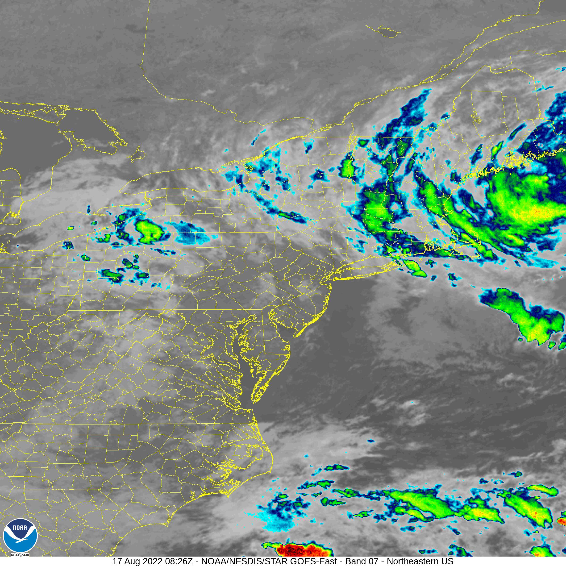
A NOAA satellite image of tropical storm Nicole located over the Bahamas Wednesday afternoon. Nicole is forecast to become a hurricane prior to landfall in the wee hours Thursday morning near Port Saint Lucie, Florida. (NOAA)

Once inland, Nicole is expected to gradually weaken while turning northwest and eventually north and northeast as the center moves across Florida and into Georgia and the Carolinas late Thursday. By Friday, the storm will be transitioning into a strong post-tropical storm while moving across central New England towards Atlantic Canada.

At this time the we expect Nicole to transport abundant tropical moisture northward into southern Quebec, with 25 to 75mm (1 to 3 inches) of rain possible. The heaviest rain would be late Friday evening into the overnight hours. Gusty northeast winds are also possible across southern and eastern Quebec, in the 50 to 70km/h range late Friday. 

The exact locations of the heaviest rain and strongest winds will need some fine-tuning. There are still many details to work out, with the storm still off the Florida coast. This forecast will be updated and warnings may be needed for several parts of our region.

Until then, expect sunny, mild weather with highs well-above normal once again both Thursday and Friday. Much colder air will return to southern Quebec by Sunday and into early next week.

Monday, November 07, 2022

Unprecedented warmth establishes dozens of high temperature records across eastern Canada

It will certainly be a return to reality for anyone staying up overnight into the wee hours Tuesday morning to view the full lunar eclipse. Conditions in Montreal will be clear, but windy and cold, with temperatures around 3C (38F), a far cry from the record warmth this weekend.(NASA)

An incredible surge of warm air straight form the Gulf of Mexico, established dozens of new record high temperatures across eastern Canada over the weekend. From Ontario to Atlantic Canada, high temperatures were up to 20 degrees above normal. In southern Quebec, record highs and lows were observed at several locations. The same was true across Ontario, with Toronto recording it's warmest November day ever at 25.2C (77.4F), surpassing the 1950 record of 25C.

At Trudeau Airport in Dorval, the high on Friday was 20.6C (69F), surpassing the previous high of 18.3C (65F) set in 1956. Saturday, featured July like warmth, with a high of 24.3C (76F) and a low of 12.4C (54F), both records for the date. The previous record for November 5 was set all the way back in 1938 (21.1C). Saturday's high was also the warmest November day ever recorded in Montreal, surpassing the November 6, 1948 high of 21.7C (71F). The overnight low into Sunday morning was also a record for the warmest November night at 14.9C (59F). On Sunday many locations established record highs again despite the clouds and showers. Trudeau Airport reached 21.4C (71F), just missing the 1948 record of 21.7C. However other locations in the city, including at my home on Ile Perrot, did reach the record temperature. I recorded a high of 22C (72F), very early in the morning on Sunday, making it feel like an August morning walking the dog.

The above-normal temperatures are persisting Monday morning, as we are already at 14C (56F). The end is in sight however. Cooler air will arrive this evening on gusty northwest winds up to 50km/h. Temperatures will drop down to 2C (36F) tonight, still above normal for early November, but a little more seasonable for sure.

On Tuesday, we can expect a much colder day, with gusty winds and a high of only 8C (48F). The normal high/low for early November in Montreal is 7C/-1C. After a brief warm up late this week, much colder air and even a few flurries will arrive by the weekend. This is just a small part of a wicked cold snap that has been occurring across western Canada. While we have been enjoying summer weather, the west has been in the deep freeze, with lows in the minus teens and highs well below freezing. Widespread snowfall has also occurred across Alberta and Saskatchewan, moving east into Manitoba.

Lunar Eclipse

One final note, the clear skies tonight will allow for a spectacular view of the lunar eclipse. The eclipse of the full Beaver moon will begin at 3:02AM in Montreal Tuesday morning, reach totality at 5:59AM and end by 7:49AM.

Thursday, November 03, 2022

Another round of record-breaking warmth for Montreal

Montreal has been enjoying very warm temperatures so far this fall along with little in the way of precipitation. This trend will persist into the upcoming weekend, with several high temperature records set to fall.

Strong high pressure moving across southern Quebec Thursday afternoon, is allowing for rapidly warming temperatures from this mornings chilly lows. The temperature dropped to 0C (32F) in Montreal under clear skies and calm winds early this morning, but has since warmed to 17C (63F) as of 2pm.

We are in for another stretch of record-breaking warmth as southerly winds increase on Friday and into the weekend. The high on Friday is forecast at 21C (70F), likely surpassing the previous benchmark for the date of 18.3C (65F) set in 1956. On Saturday, we are expecting even warmer conditions on gusty southwest winds, with a high near 24C (76F). This would smash the record for Saturday of 19C (66F) set in 1988. Clouds will increase Saturday evening, with a chance for showers on Sunday. The mild weather will persist however, with highs in the middle to upper teens forecast through Monday.

The warm and dry conditions are just a continuation of the weather southwestern Quebec experienced in October. The average high in Montreal last month was 10.4C, well above the normal of 8.5C. We had only 44% of the normal precipitation, with 40mm of rain falling at Trudeau Airport. The long-term normal is 91mm. We had no snow again last month, a trend dating back to the last October snowfall in 2018.

Temperatures were above normal across the entire province of Quebec during October, a trend that is expected to continue well into November. (Environment Canada)

While we continue enjoy temperatures more similar to late August, western Canada will be shivering in sub-freezing weather. Below normal temperatures have swept across Alberta and Saskatchewan, and are moving east into Manitoba. Accompanying the cold has been another round of snow. More snow and cold weather is expected during the upcoming week as a deep trough carves itself out across western North America.

A modified version of that cold air will arrive in Montreal by mid-week with highs dropping down into the single digits by Wednesday and lows below freezing. Enjoy this weekend and take advantage of the weather to finish any outdoor chores that may remain before the snow flies. 

While the weather will turn colder, I am not seeing any major storms on the horizon at this time for Montreal.

Monday, October 31, 2022

Near-perfect weather expected in Montreal for Halloween

Happy Halloween! Trick or Treaters will enjoy a fair, mild evening, with temperatures near 10C (50F), a far cry from the mess of the last 4 years. Enjoy and stay safe.

The headline says it all, after 4 years of rain, wind and Covid, we have a nearly perfect forecast for southern Quebec for trick or treating. High pressure has been in control of our weather all weekend, with sunshine and above normal temperatures. A very weak weather system passing to our south will produce a mix of sun and clouds today, with just a slight risk of some drizzle or a stray shower, but any moisture will hold off until late this evening.

During the trick or treating hours, skies will be partly cloudy and temperatures should be either side of 10C (50F). The week ahead will feature a continued pattern of well above normal temperatures across eastern Canada. A strong ridge of high pressure over eastern North America will keep temperatures very warm through next weekend. More records may fall as the mercury heads towards 21C (70F) by the end of the week in Montreal. That is over double the average expected highs for early November. Overnight lows will be mild as well, above freezing, between 5C and 7C (40 to 45F).

While we can expect warm weather here in southern Quebec, a deep trough in the west will allow arctic air to plunge into the Rockies and Prairies, with cold and more snow expected by the end of this week. The cold weather will push south all the way to California.

Here in Montreal, the weather will remain mild through at least November 10th before we see a pattern change allowing for more seasonable air to arrive. There is no snow in our future at this time.

Wednesday, October 26, 2022

Record-breaking warmth for southern Quebec

Despite the very warm temperatures in Montreal, the leaves continue to tumble from the trees in rapid fashion. This is to be expected in late October, and will only increase with the strong winds forecast for the St. Lawrence Valley over the next 24 hours. Winds will increase from the southwest today in advance of  cold front, gusting to 40km/h. They will back to the northwest on Thursday, gusting up to 60km/h. (ValleyWeather Photo)

Our spectacular second summer weather continues Wednesday across southern Quebec, with temperatures set to break another record for the date. The high is expected to reach 24C (76F) in Montreal, which will be enough to surpass the previous record of 21.5C (71F) established in 2012. This will continue the streak of sunny, warm days that have been in place since Saturday. The weather will be humid today as well, with a humidex reading approaching 29C (85F) this afternoon.

On Tuesday, the high at Trudeau Airport was an amazing 24.6C (77F), easily surpassing the record of 23.9C set in 1963. The St. Lawrence Valley has been sandwiched between weather systems all week, with a coastal low producing rain and fog southeast of our region, and a strong fall storm over the western Great Lakes. We have been treated to an extended period of sunny, warm days, and mild overnight temperatures. The low in Montreal Tuesday night was warmer than our average daytime highs for late October. The low Wednesday morning only dropped to 14.2C (56F) on Ile Perrot, well above the average low of 0C (32F).

While cooler weather is on the way for Thursday and the upcoming weekend, warmer temperatures are expected to return early next week. A cold front will sweep across southern Quebec this evening, accompanied by showers and gusty southwest winds. A second cold front will usher in chilly temperatures and 60km/h northwest winds on Thursday. Today's record warmth will be replaced by overnight lows near 6C (43F) in Montreal. The high on Thursday is forecast to be only 10C (50F).

At this time the weekend looks great with dry conditions and mild temperatures. Halloween looks mild, but with the chance of some showers.

There is no sign of any really cold temperatures or snowfall for southwestern Quebec at this time. The extended forecast through the first two weeks of November is for above-normal temperatures to persist.

Monday, October 24, 2022

Spectacular October weather across southern Quebec

The weather was absolutely spectacular this weekend across southern Quebec. High temperatures surged into the low 20s with bright sunshine. Meanwhile winter arrived across western Canada. (ValleyWeather)

Our fall heatwave continues on Monday across southern Quebec and Ontario after a perfect weather weekend. The temperature rose into the low 20s across many regions of Quebec, with 10 daily record highs set on Sunday alone. While no records were broken here in Montreal, the high temperatures were still 10 to 15 degrees above normal for late October. The high Saturday reached 21.8C (70F) at Trudeau Airport, with 23C (73F) on Ile Perrot. Sunday was just a touch cooler at 20.8C (69F) as clouds began to stream in from the south.

Both days were perfect for any outdoor activity, and many took advantage of the ideal weather to rake leaves and winterize homes and cars. The winter weather will arrive eventually, but not this week that is for certain.

Low pressure moving along the eastern Seaboard Monday will push clouds and showers into portions of southeastern Quebec, with just a slight chance for a sprinkle or two in Montreal. Otherwise expect hazy sunshine, with another warm high near 20C (68F). Tuesday will be fair and warm as well, reaching 23C (73F), with Wednesday's high in Montreal forecast to reach a record-breaking 24C (76F). The current record for Wednesday stands at 21.5C (72F) set in 2012. Overnight lows will be mild as well, around 8C (43F). Expect some fog to form in the valley locations each morning. The normal high/low for late October is 10C (50F) and 1C (33F) respectively.

Above, traffic crawls along Highway 1 near Qu'Appelle, Saskatchewan Sunday afternoon. Heavy wet snow blasted the southern part of that province on Sunday, resulting in numerous accidents, closed highways and widespread power outages. Many residents remain in the dark and cold early Monday morning, as SaskPower dispatches crews to hard hit locations south of the Trans Canada Highway towards the US border. The utility is not reporting on the number of customers without power, but many regions are listed on the outage page from Regina to Moose jaw and points south. (CBC News)

Western Snowstorm

While southern Quebec and Ontario were unseasonable warm this weekend a strong fall storm was skirting across northern Montana and North Dakota. The broad circulation of the storm pulled down very cold air on the backside of the system changing rain to heavy wet snow across southern Alberta and Saskatchewan. Between 15 and 23cm of snow fell in Calgary Saturday before the snow moved east. On Sunday heavy snow and strong winds created impossible travel conditions along the Trans Canada Highway in Saskatchewan. Numerous accidents and road closures were reported, along with scattered power outages. Visibility was often below 1 kilometre in snow and blowing snow between Swift Current and Regina, and points south. The RCMP and Moose Jaw Police were forced to close highways in and out of that city for the afternoon and evening hours after 10-20cm of snow fell, whipped by 50-70km/h winds.

In southern Manitoba, heavy rain and thunderstorms are occurring early Monday on the warm side of the storm. Temperatures are forecast to drop later today as the storm lifts into northwest Ontario. Strong winds continue across both provinces, gusting up to 90km/h at times.

Wednesday, October 19, 2022

First snow of the season over the Great Lakes but none for Montreal

Heavy wet snow off the Great Lakes, blanketed parts of upper Michigan this week. The same weather system pushed frost and freezing temperatures all the way south to the Gulf of Mexico. Temperatures were chilly in Montreal, but nothing out of the ordinary, as the coldest air remained west of our region. (Photo Tony Greene via ABC News)

The first snowflakes of the season were in the air over northern portions of Ontario and especially around the Great Lakes on Tuesday, including Chicago, a stark reminder that winter weather is not far off. Heavy wet snow fell across portions of northern Michigan, with over 40cm at Ironwood. The snow created very poor travel conditions and weighed down tree branches onto power lines, knocking out power to thousands. Early snow also occurred in Illinois and northern Indiana.

The snow was part of a large upper level low spinning over the central portion of the lakes, while slowly moving southeast. A cold pool of air aloft was driven down to the surface, with frost and freeze conditions as far south as the Gulf Coast. The unseasonably cold air will be brief in nature as a warming trend is expected into the upcoming weekend. Accompanying the cold air was very gusty northerly winds, up to 90km/h at times off Lake Superior and Huron. The worst of the weather has remined west of Quebec, mainly in Ontario and the Midwest.

For the short-term however, cool, blustery weather will persist. Montreal remains on the edge of the coldest air, with temperatures expected around 10C (50F) for highs. Lows have been chilly, very close to the freezing point, with scattered frost observed. Clouds are on the increase early Wednesday morning as the cold, moist airmass moves over southern Quebec. Expect isolated showers through Thursday, along with a chilly northwest wind.

Some flurries are still possible, mainly over the Adirondacks of New York and perhaps the highest elevations of the Eastern Townships. The broad circulation of the same low has been drawing in deep moisture off the Atlantic Ocean into portions of eastern Quebec. Heavy rain has been reported, with 50 to 75mm (2-3 inches) reported in parts of the Saguenay and Charlevoix regions over the last 24 hours.

Once this system clears southern Quebec on Friday, high pressure will build in for the upcoming weekend, with sunshine and well above normal temperatures expected. Look for highs to rise into the upper teens in Montreal, with lows around 8C. The normal high/low for mid-October in Montreal, is 11C/2C.

Thursday, October 13, 2022

Wet and windy storm to impact southern Quebec

The fall foliage is beginning to peak in the St. Lawrence Valley. The weather this week has been nearly perfect for getting out and enjoying the spectacular colours. That is about to change as windy and wet weather arrives on Thursday. Very cold air will move into our region by next Tuesday, with a few snowflakes possible in many regions. (Valley Weather Photo)

Heavy Rainfall Warning in effect for Montreal

The first significant fall storm of the season is advancing across central Ontario early Thursday, expected to pass well north of Montreal. The cyclone will sweep a strong cold front across the St. Lawrence Valley late this evening. In advance of the front, strong and gusty south winds will develop in Montreal Thursday, gusting up to 60km/h at times. The front will also be accompanied by a wide area of heavy rainfall, expected to start this afternoon in Montreal, and persist into the overnight hours. 

Rainfall amounts of 25 to 50mm are expected in the St. Lawrence Valley, with upwards of 70mm north and east of the city. Some minor flooding may occur, especially where gutters and catch basins are clogged with fallen leaves. Heavy rainfall warning are in effect for most of southern and western Quebec.

As the fall weather patterns become established across Canada, mid-latitude storms become much stronger. This is a result of the large temperature and pressure differences that exist with the changing seasons. An example Thursday morning, we have snow falling across southern Manitoba, with temperatures near 0C, while in southern Quebec, temperatures are already in the upper teens, expected to reach near 21C (70F) along the US border.

The deepening storm system in question will move across northern Quebec tonight, while high pressure builds into the region for Friday and Saturday. Unsettled and much colder weather will return next week, with the chance for more showers along with dropping temperatures. Some parts of eastern Ontario, southern Quebec and New England will see a few snowflakes by next Wednesday.

As far as temperatures are concerned, Thursday will be very mild before the rain begins, pushing close to the 20C (68F) mark here in Montreal. Temperatures will be a little cooler for Friday and Saturday, around 16C (60F). Early next week, high temperatures will drop below normal, into the single digits, with lows near the freezing point.

Thursday, October 06, 2022

Warm Thursday followed by chilly Thanksgiving weekend

The first frost of the season occurred on Monday, October 3 here on Ile Perrot, well ahead of the average date I've observed over the last ten years. (ValleyWeather Photo)

The first frost occurred this week on Ile Perrot, well ahead of the average date of the last few years, which fell either side of October 21st, and was actually October 29th last fall. Temperatures dropped to between 1C and 3C on several mornings this week in the Montreal region. The growing season does continue however, as freezing temperatures were confined to off-island locations. The temperature was much warmer on Thursday morning, as winds have turned out of the southwest setting us up for a spectacular day.

Thursday will be a good a day as you can expect in October in southern Quebec, with likely the warmest high temperatures until next spring. Expect sunshine through increasing clouds, with a high near 23C (73F). A strong cold front arrives early Friday, accompanied by showers, northwest winds and dropping temperatures. Highs will be reached early Friday, before dropping into the single digits and eventually a low of 1C (33F) by Saturday morning. The weekend will be chilly, with highs around 12C (54F), sunshine Saturday and some showers Sunday. Skies will clear for Thanksgiving Day, with a pleasant high of 13C (55F). 

The fall foliage is reaching near peak levels in the mountains north and south of Montreal, with the colours starting to increase here in the St. Lawrence Valley.

The weather next week looks rather mild, with temperatures swinging back above the normal high of 14C and low of 5C. High pressure will build into southern Quebec once again, with sunshine forecast through Wednesday.

The death toll in Florida from hurricane Ian has exceeded 125. The remains of Ian have been located off the mid-Atlantic coast all week, resulting in more coastal flooding and damage. (Orange County Fire & Rescue Photo)

Atlantic Hurricane Season

Communities continue to rebuild after the devastating impacts of hurricanes Fiona and Ian. In Canada, Prime Minster Trudeau has promised $300 million in relief to help struggling residents rebuild across eastern Quebec and Atlantic Canada.

In Florida, the death toll has surpassed 125 from hurricane Ian, with damage expected to soar to over 1 billion dollars. Five additional fatalities occurred in North Carolina. Fort Myers and the surrounding area experienced catastrophic damage from Ian on Wednesday, September 28. The category four storm made landfall along the Gulf Coast near Fort Myers. Infrastructure and homes have been leveled, and power remains out to over 250,000 residents in the sunshine state. In many areas, a complete rebuild will be necessary. Lee and Charlotte counties have been especially hard-hit, with many of the fatalities occurring on Sanibel Island and at Fort Myers Beach.

The remains of Ian have been spinning off the middle Atlantic coast all week, producing additional flooding and damage from New Jersey to North Carolina.

Thursday, September 29, 2022

Over 2.5 million in the dark after Ian sweeps across Florida

The Naples Fire Department was inundated with storm surge from Hurricane Ian on Wednesday. (Photo: Naples Fire Department via Twitter)

Extremely powerful and dangerous Ian has been downgraded to a tropical storm Thursday morning, with 100km/h winds and a ton or rainfall. Ian made landfall at 3:05pm Wednesday, near Cayo Costa, Florida, with 225km/h winds and a record setting storm surge that exceeded 12 feet (3.5 metres) in places. The surge wiped out large sections of the coastline to the south of the point of landfall, including Fort Myers Beach, Naples and Sanibel Island.

While mandatory evacuations were in place, many chose not to leave, becoming trapped in homes that were coming apart in the rapidly rising storm surge as the Gulf waters were driven inland by the powerful hurricane. Lee County Sheriff Carmine Marceno expects fatalities, and "they may run into the hundreds," according to him.

The storm has caused catastrophic destruction along the coast. As the system moved inland, fresh water flooding became the problem, with up to 300mm of rainfall, falling in just a six hour period from Sarasota northeast to Orlando and east into Daytona Beach.

Aside from structural damage and scores of trees down, thousands of power poles and lines were torn apart leaving over 2.5 million people in the dark across the state. 

The center of tropical storm Ian was located 15km west of Cape Canaveral, Florida early Thursday, with 100km/h winds, moving northeast at 13km/h. As the storm moves back over the Atlantic Ocean today, some intensification is expected before a second landfall along the South Carolina coast on Friday. More surge fooding is expected along the southeastern US coast, along with flash flooding well inland into North Carolina and Virginia. Widespread weather warnings are in effect.

Strong high pressure in place over Quebec, will keep Ian well south of our region, forcing the storm off the middle Atlantic coast near Delaware by the end of the weekend. The system may impact eastern Newfoundland early next week.

Wednesday, September 28, 2022

Catastrophic hurricane Ian making landfall along the Florida Gulf Coast

A NOAA satellite image of powerful hurricane Ian, located 90km west of Naples, Florida on Wednesday morning. Ian has strengthened rapidly overnight, to almost category 5 level, now with 155mph (250km/h) winds. The storm is expected to have devastating effects along the southwest Florida coast today.

Hurricane Ian has grown into a massive Category 4 hurricane early Wednesday morning, just 90km west of Naples, Florida in the Gulf of Mexico. Over the last two hours the storm has strengthened rapidly and is on the verge of a category 5 storm. Current winds are at an incredible 155mph (250km/h) as the storm moves north-northeast at 17km/h. Hurricane and tropical storm warnings are in effect along the west coast of Florida, and extending up the Atlantic Coast from Miami to South Carolina.

Landfall should occur sometime this morning, between Cape Coral and Sarasota on Florida's Gulf Coast. South Florida has been experiencing terrible weather over the last 24 hours as feeder bands swept across south Florida from the Atlantic to the Gulf. A total of nine tornadoes were reported on Tuesday alone, more are expected today as Ian interacts with the land.

In Key West, winds gusted to 97mph on Tuesday, along with storm surge flooding. Power outages across the state have grown steadily Wednesday morning to over 140,000 customers, with Ian still offshore. The storm will take a diagonal path across the state emerging into the western Atlantic on Thursday, before a second landfall in Georgia.

Across the southwest Florida coast today, catastrophic conditions are expected near landfall, with severe wind damage power outages, flooding and an intense storm surge. The surge is forecast to inundate the coast with 12 to 18 feet of sea water between Englewood and Bonita Beach, including Port Charlotte and Punta Gorda.

Ian's path was expected to be anywhere from the panhandle to Fort Myers, with Tampa looking like the bullseye. That has changed today, with a much stronger storm expected to move inland south of Tampa Bay. Dangerous weather conditions will be felt across the state today as Ian moves inland from the Gulf to near Orlando and eventually Jacksonville on the Atlantic Coast.

Heavy rain, flooding and tornadoes will spread into southern Georgia on Thursday.

Tuesday, September 27, 2022

The cleanup continues from Fiona across Atlantic Canada while Ian heads for Florida

Hurricane Fiona produced a record-breaking storm surge of 2.75 metres (9 feet) at Port aux Basques, Newfoundland resulting in widespread damage. It was here that Fiona claimed one of two Canadian fatalities, after a woman was swept out to sea. (Wreckhouse Press)

Nova Scotia Power along with crews from Ontario, Quebec, New Brunswick and Maine, continue the daunting task of restoring power across Atlantic Canada. As of Tuesday afternoon, over 129,000 customers remain in the dark in Nova Scotia alone. Crews have been working 24/7 since Saturday. The Canadian Military is on the ground as well assisting with the cleanup efforts after Fiona swept across the region on Saturday. The storm claimed one life in Port aux Basques, Newfoundland, after a woman was swept out to sea. Her body has since been recovered by the Canadian Coast Guard. A second death was reported in Prince Edward Island. Damage was widespread from fierce winds, heavy rain and a record-breaking storm surge.

Fiona produced the lowest barometric pressure ever recorded on Canadian soil, 932.7mb at Hart Island. The storm made landfall in Nova Scotia at 4am Saturday, September 24, near Whitehead, 28km southwest of Canso, Nova Scotia.

Nova Scotia Power utility crews work through a maze of wires, trees and poles in the aftermath of Hurricane Fiona. Over half the province was left in the dark after the storm. (Nova Scotia Power Photo)

Some of the strongest winds and heaviest rain were recorded on the eastern side of where Fiona made landfall. The surge at Port aux Basques reached 2.75 metres (9 feet), the highest ever recorded along that coastline. Homes and infrastructure were crushed by the rising water and intense wave action accompanying the surge. Winds gusted over 200km/h on Sable Island, 179km/h at Arisaig, NS, 177km/h at Wreckhouse, Newfoundland and 126km/h in Iles-de-la-Madeleine, Quebec. Major damage from wind and surge was also reported in Prince Edward Island, where gusts up to 150km/h were observed. Maritime Electric on PEI is still reporting over 61,000 customers without power.

The region has a long recovery ahead, if you can help, the Canadian Government has announced that they will double any donations to the Red Cross made over the next 30 days. You can make your donation at www.redcross.ca

NOAA image of extremely dangerous hurricane Ian over western Cuba on Tuesday morning. (WMO)  

Hurricane Ian

Hurricane Ian is currently moving off the north coast of Cuba after punishing the area with 125mph (225km/h) winds and a 14 foot storm surge overnight. Ian is now taking aim at the west coast of Florida where hurricane warnings have been hoisted. Mandatory evacuations are underway across numerous coastal counties along the west-central Florida coast including parts of the Tampa Bay area.

The weather is already worsening in the Florida Keys and across the southern portion of the state.

At 2pm Tuesday afternoon, the strengthening category 3 storm was located 430km south of Sarasota, Florida. Ian is forecast to deepen further into a dangerous category four storm with winds approaching 140mph and a surge of over 10 feet before landfall. The hurricane should approach the Florida coast near Tampa Bay by late in the day Wednesday, before slowly crossing the state. Heavy rain, up to 24 inches (600mm), is expected to produce widespread flooding. Tampa has not has a direct hit from a hurricane in over 100 years. I will publish more on hurricane Ian later today in separate posts.

Saturday, September 24, 2022

Hurricane Fiona slams into Atlantic Canada

Thousands of trees are down in Atlantic Canada after Fiona moved across the region early Saturday morning. Power is out to hundreds of thousands of residents. (Charlottetown Police)

 According to Canadian Hurricane Centre Meteorologist Bob Robichaud, Fiona was going to be an "historic extreme event." Fiona is living up to expectations early Saturday morning as the powerful post-tropical cyclone moves across Cape Breton Island and into the Gulf of St. Lawrence. 

A spectacular image of Hurricane Fiona moving across Cape Breton Island and into the Gulf of St. Lawrence early Saturday morning. The storm produced the lowest barometric pressure ever recorded on Canadian soil, at 931.6mb. (NOAA)

Fiona made landfall at 4AM AST near Hart Island, between Canso and Guysborough in northern Nova Scotia. A new Canadian record for the lowest barometric pressure in our country, was established shortly after landfall at a weather station on Hart Island, at  931.6mb. Winds have been relentless, gusting between 100 and 150km/h in many locations since late Friday evening, with a peak gust of 202km/h (125mph) reported on Sable Island overnight.

A Halifax neighborhood ransacked by Fiona overnight. (CBC)

There has been widespread damage reported, with hundreds of trees down, many on homes and vehicles. Wires are everywhere according to Charlottetown, PEI police, who are responding to emergency calls only, on one of the "worst nights they have ever seen". Travel is extremely dangerous if not impossible across Nova Scotia.

The only silver lining so far that I can see, is that the storm is moving very quickly, which in the end, may cut down on rainfall and flooding in many locations. Forecasters were expecting 75mm to as much as 250mm of rain with Fiona. That being said, 65mm fell in Halifax already through midnight. We will need to wait until later today for more rainfall data.

In terms of power outages, Nova Scotia Power is reporting 405,000 customers in the dark, Prince Edward Island 82,000, New Brunswick Power 46,000 and Hydro-Quebec 6000. That number is changing by the minute. With winds still howling over 100km/ in Halifax for the last 6 hours, the task to repair the power grid will be daunting until the weather eases. Nova Scotia Power had staged crews in advance of Fiona, with help already in place from New Brunswick, Quebec and Maine.

Early Saturday morning, the center of Fiona was located 255 kilometres northeast of Halifax, moving north at 43km/h. The storm maintained 150km/h winds. The center will move across Nova Scotia early Saturday morning and eventually into eastern Quebec and Labrador later today.

Thursday, September 22, 2022

Dangerous hurricane Fiona expected to make a direct hit on Nova Scotia

Powerful category 4 hurricane Fiona southwest of Bermuda early Thursday morning. (NOAA)

Hurricane Fiona continues her northward march in the open waters of the Atlantic on Thursday morning, located 780km southwest of Bermuda and 2010km south southwest of Halifax. A hurricane warning is in effect for Bermuda, with the system expected to brush the island later today. Fiona has already produced significant damage and power outages in Puerto Rico, the Dominican Republic and the Turks and Caicos. The entire power grid collapsed in Puerto Rico, with over 300mm of rain producing catastrophic flash flooding, and claiming at least 5 lives. 

Hurricane Fiona dumped 300mm of rain on Puerto Rico generating catastrophic flash flooding and claiming at least five lives so far. The US territory was left in the dark as the power grid collapsed. (AccuWeather/AP)

Our attention will then quickly turn to Atlantic Canada, where significant impacts are expected from Fiona, including but not limited to flash flooding, widespread power outages and structural damage from strong winds. Warnings for portions Atlantic Canada will likely be issued on Thursday. Wind and seas will be increasing rapidly Friday across Atlantic Canada and eastern Quebec ahead of a potential landfall early Saturday morning in Nova Scotia.

The forecast track of hurricane Fiona as the powerful storm moves north towards Atlantic Canada. (Canadian Hurricane Centre) 

Fiona is a category 4 hurricane currently, with 215km/h (130 mph) winds. The storm is moving north, northeast at 20km/h, but is expected to slow down as she turns to the north on Friday. Forecasters believe Fiona will approach Nova Scotia at a rare angle, making a direct impact near Cape Breton before moving into the Gulf of Saint Lawrence. As far a strength goes, while Fiona will be weakening and undergoing transition to an extra tropical low,  she will remain a powerful storm with category two wind speeds expected in excess of 150km/h in gusts. The wind field will also be expanding, impacting a wide region from western Newfoundland to the Gaspe region of Quebec.

Rainfall will be significant with up to 250mm possible in the hardest hit regions. Storm surge flooding will also occur, especially to the east of landfall. Later the flooding will come from the backside of Fiona, impacting the Gulf of Saint Lawrence and eastern Quebec.

This is a preliminary report on the Fiona's Canadian impacts. I will post updates through the storm.

Sunday, September 18, 2022

Another round of heavy rain for southern Quebec

Windswept rain greeted many on the commute home last Tuesday, September 13. The heavy rain produced flash flooding in many sections of Montreal, but especially in the east end suburbs. More heavy rain is expected this week, with up to 50mm possible by Tuesday. (ValleyWeather Photo)

A potent frontal boundary will become the focus for steady rainfall, showers and isolated thunderstorms over the next 36 hours across southern Quebec. Rainfall amounts will approach 50mm (2 inches) in many locations, including Montreal by Tuesday morning. Isolated amounts may approach 75mm south of the St. Lawrence Valley towards the international border. The heavy rain will create ponding of water on roadways and some flash flooding. Leaves are beginning to fall so roads may be slick in spots.

Showers will persist through Thursday as low pressure develops in the Ottawa Valley and moves east. Temperatures will be close to seasonal normals, with highs near 18C (65F) and lows around 12C (54F). Much colder air will arrive by late Thursday as a strong cold front moves across the region. By Friday, daytime highs will be in the low teens with overnight lows in the lower single digits. Some regions away from metro Montreal may even be looking at the first frost of the season by Saturday morning.

The torrential rain rapidly filled many roadways last Tuesday, with over 100mm (4 inches) falling in many sections of the city, including Rosemount shown above. (CBC Photo via Twitter)

The precipitation comes on the heels of Tuesdays major rainstorm in the Montreal region and points east. Rounds of training showers and thunderstorms over a 1 to 3 hour period on September 13, produced flash flooding from downtown Montreal, especially the eastern suburbs, and onto the South Shore.  I measured only 20 to 25mm here on Ile Perrot, while Trudeau Airport had 27mm. But it was downtown Montreal and points east that took the brunt of the storm. According to Environment Canada, downtown Montreal averaged 80 to 110mm of rain, including 40mm in a one hour period. RDP and Repentigny reported 70 to 100mm, while Longueil had 125mm and Joliette 100 to 120mm, including 90mm in under two hours. The result was major flash flooding that flooded basements, underpasses, closed highways and inundated several metro stations. Thankfully no injuries were reported.

NOAA Satellite image of strengthening hurricane Fiona just south of Puerto Rico midday Sunday, September 18.

Hurricane Fiona

As I write this post, Fiona has just reached hurricane status 80km south of Ponce, Puerto Rico. The storm has 130km/h winds and is moving west-northwest at 13km/h. Warnings are in effect across the Virgin Island, Puerto Rico and neighboring Dominican Republic. Heavy rain, up to 300mm, is expected to produce major flooding and mudslides. Winds have already been reported up to 120km/h across the US territory. The power grid is notoriously bad, and outages have already reached a half million on the island. Fiona is expected to curve northwestward and eventually northeast along the outer edge of the Bermuda high while strengthening into a major hurricane. The storm may generate some weather in Atlantic Canada by late next week, but details will need to be fine-tuned.

**Just a final note, I apologize for the lack of posts lately, I have been a little "under the weather", pardon the pun. Thanks for reading and stay safe everyone...SB

Wednesday, September 07, 2022

Superb late summer weather expected for Montreal

A flash of lightning turns night into day on Ile Perrot late last Tuesday evening. As with most thunderstorms this summer in Montreal, its bark was worse than its bite. Many storms have been weakening before hitting the city or slipping by to our north and south. Last week several strong storms impacted the Ottawa Valley with hail and even a tornado. The storms looked menacing, but dissipated west of the city. (ValleyWeather Photo)

If you love summer weather, than you'll love this forecast! After a cool start to September, summer temperatures are set to make a return to southern Quebec. High pressure will build into the region and move slowly east through the upcoming weekend. The result will be sunshine with warming temperatures. The highs will be in the upper 20s in Montreal through Sunday, with lows in the middle teens. The next chance for any precipitation will not arrive before next Monday.

Montreal continues to be rather dry this month as compared to neighbouring portions of southern Quebec and Ontario as well as New York and New England. So far in September, only 3mm of rain has fallen at Trudeau Airport. Most regions outside the metro Montreal area have received considerably more rain. It has been a very odd summer all around, with many thunderstorms splitting the city to the south and north and missing Montreal or weakening considerably before hitting the city. 

Large portions of North America have been experiencing warm temperatures, including searing heat across the southwestern US stretching northward into the southern Prairies. On Tuesday, Sacramento, California reached an all-time record high of 46.7C (116F), breaking the previous record of 114F set in July 1925. Temperatures soared into the middle 30s (90s) as far north as southern Saskatchewan.

A NOAA Satellite image of Hurricane Earl on Wednesday, located 705km south of Bermuda in the open waters of the Atlantic Ocean. Earl may impact the waters east of Newfoundland by late in the weekend with heavy surf. (NWS/NOAA)
Tropics become active

It has been a very quite Atlantic tropical season to date, but that may be changing. On Wednesday, a tropical storm warning was posted for Bermuda, as hurricane Earl swirled in the open waters of the Atlantic, 705 km south of the island nation. Winds in Earl have increased to 85km/h and further strengthening is expected into Thursday. Earl is expected to become a major hurricane as the storm passes southeast of Bermuda. Earl is generating huge swells along the east coast, with coastal flood advisories in place for sections of the middle Atlantic states. Earl may impact the coastal waters of Atlantic Canada late this upcoming weekend.

Along the west coast, a rare northward moving hurricane is impacting portions of Baja California as far north as the US border. Hurricane Kay, with 165km/h winds, was located Wednesday afternoon 340km/h south of Baja, Mexico. Kay is expected to gradually turn northwest out to sea, but not before pushing some much needed rain into southern California and Arizona.

Friday, August 26, 2022

Perfect late summer weekend weather for southern Quebec

The weather this August has been rather unsettled, with plenty of clouds at times and highly variable weather. Trudeau Airport has recorded 80.7mm of rain for the month, with 66.2mm at my home on Ile Perrot. More showers and thunderstorms are possible Friday, before a near-perfect late summer weekend.

Summer is slowly fading away. Meteorological fall arrives September 1st, but the actual weather usually remains warm well into September across southern Quebec. We are looking at a very pleasant weekend to end what has been another "ok" summer month in Montreal. This summer has been just like that, ok, with nothing spectacular on either end of the weather spectrum.

For Friday, we have a warm front lifting across southern Quebec this morning, accompanied by showers and perhaps a rumble of thunder. That will be followed quickly by a cold front and weak low pressure area by early afternoon. The result will be general cloud cover along with 10 to 25mm of rainfall across the region. The threat for severe weather is low in Quebec, with most of the stronger storms occurring this afternoon across central New York State and southern Vermont where temperatures will be higher. The high in Montreal Friday will be in the low 20s. 

Skies will clear this evening, setting the stage for a near-perfect late summer weekend. Expect some fog patches early Saturday morning, but otherwise clear skies. Sunshine on Saturday and Sunday will be accompanied by comfortable relative humidity levels. Expect a high near 23C (73F) Saturday and 27C (81F) Sunday.

By Monday high pressure will move to our southeast, with a return flow of very warm and humid air invading the region straight from the Gulf of Mexico and the southern US. Look for the last three days of August to be sultry, with highs near 30C (86F) and humidex values well into the 30s. There will be a possibility of strong thunderstorms in Montreal both Tuesday and Wednesday afternoon, but the timing of the threat will need to be fine-tuned.

Monday, August 22, 2022

Strong thunderstorms leave 80,000 without power across southern Quebec

Over 100 Hydro-Québec crews were on the job late Sunday and Monday after thunderstorms cut power to 80,000 southern Quebec homes. (Hydro-Québec Photo)

Strong thunderstorms developed Sunday afternoon across northern New York and eastern Ontario, before moving northeast across the metro Montreal region. Winds gusted up to 87km/h at Trudeau Airport, knocking down tree branches and in the process cutting power to many homes and businesses. The West Island of Montreal was specially hard-hit, with frequent lightning strikes adding to the outages. A second line of storms affected the city around 10:45pm.

In all over 80,000 Hydro-Québec customers were left without power in the province at he height of the storms. The utility has over 100 crews working on the outage, and as of 9am Monday morning, the number of affected clients was down to 22,891.

The thunderstorms came at the end of what was a sweltering hot and humid weekend. Temperatures were either side of 30C (86F), with humidex values approaching 38C (100F). Temperatures are slightly cooler Monday, with plenty of cloud cover, but the airmass remains humid and unstable, and more thunderstorms are expected today and Tuesday. High temperatures will reach 24-27C (76-80F)

Much needed rain fell with the thunderstorms, with 24.2mm at Trudeau Airport, and generally 15 to 40mm across southern Quebec. The monthly total for Montreal now sits at 70.3mm, with most of that falling over just two days.

Skies will clear Wednesday, and humidity levels should lower a touch, but temperatures will remain warm at 28C (83F). 

Wednesday, August 17, 2022

Unsettled weather to end the work week before heat and humidity return to Montreal

It was a perfect weather day end to end for the 40th Annual Firefighters' Day in Pincourt last Saturday. Numerous municipalities across the metro Montreal region took part including this spectacular truck from Kahnawake. (ValleyWeather Photo)

The weather has been a little unsettled this week, with an upper level low spinning across New England. This system has been pulling in moisture from an ocean storm located south of Maine. The result was isolated showers and even a few thunderstorms moving in the unusual direction of east to west across southern Quebec. The low will eventually move eastward relaxing its grip on our weather, but not before another 24 to 36 hours of scattered precipitation.

A NOAA satellite image from Wednesday afternoon showing showers pinwheeling westward over New England into southern Quebec from an ocean storm located along the Maine coast. (NOAA)

Conditions however will be dry most of the time, along with fairly moderate temperatures. Highs will be in the middle 20s, with overnight lows in the upper teens. Conditions will feel muggy at times, with the airmass being of maritime origin. Friday will be partly cloudy as well, with just an outside chance of a scattered shower or two.

High pressure will build back into southern Quebec for the upcoming weekend along with very warm late summer temperatures. It will be another spectacular August weekend, with mostly sunny skies forecast. Highs on both Saturday and Sunday will be near 30C (86F), with overnight lows near 20C (68F). The next chance for showers and thunderstorms will be Monday as a frontal boundary approaches southern Ontario and Quebec. The humidity will begin creeping up on Sunday afternoon, with warm and muggy weather expected Monday and Tuesday, and highs near 27C (81).

Tuesday, August 09, 2022

Much cooler air arrives in southern Quebec

Our heatwave came to an abrupt end on Monday, with fall-like temperatures observed. Above, a brief heavy rain shower moves through Montreal on Monday morning. While close to 25mm fell at Trudeau Airport, it was far less than many locations north of the city. Between 40 and 90mm fell across the Laurentians towards Quebec City, with Ottawa receiving 105.5mm since late Sunday afternoon.

We had a taste of September weather on Monday after three scorching hot days. The high on Monday in Montreal was only 18.6C (66F) behind a very slow moving cold front. That front was the focus for very heavy rainfall, that oddly enough seemed to skip metro Montreal once again. 

I measured 20.4mm on Ile Perrot, most of that falling overnight into Tuesday morning. Meanwhile, 24.6mm fell at Trudeau Airport since late Sunday, 31.5mm at St. Anicet, 60mm at Rawdon, 90mm at Trois-Rivieres, and an incredible 105.5mm, over 4 inches of rainfall, at Macdonald-Cartier Airport in Ottawa. 

There was very little thunderstorm activity in and around Montreal, allowing for less rainfall. Temperatures and humidity levels were very high over the weekend, with a high of 32.2C (90F) on Saturday, and 32.5C (90.5F) on Sunday. The dewpoint temperature reached a sweltering 23.8C Sunday afternoon, producing a record setting humidex of 43C (109F) in Montreal. All that went away quickly on Monday as much cooler air arrived on chilly northeast winds. 

The slow moving nature of the cold front meant you did not have to go far away from Montreal to find the heat on Monday. Places like Burlington, Vermont, Plattsburgh, NY and Brockville, Ontario still were in the high 20s to near 30C with high humidity.

We have lingering showers and drizzle early Tuesday morning, along with chilly temperatures. Skies should gradually clear in the afternoon, with high temperatures rising into the low 20s. Most of the balance of the week into the weekend looks fair and seasonable, with highs in the middle 20s and lows in the middle teens. The only exception will be the arrival of a cold front Thursday, accompanied by scattered showers and perhaps a rumble of thunder. It will become less humid behind that front, with a refreshing weekend in store, ideal for any outdoor activities.

Thursday, August 04, 2022

Hot and humid weekend ahead for southern Quebec

The St. Lawrence River along the Verdun shoreline taken Monday, July 25. Skies cleared behind a cold front early in the day leaving some fair weather clouds along with strong west winds, gusting up to 73km/h. This was part of what turned out to be a fairly average July in the Montreal. (ValleyWeather Photo)

A soupy airmass has arrived in Montreal as a warm front lifted across the St. Lawrence Valley Thursday morning. Hot and humid air is streaming north into the region. Clouds and scattered showers will likely hold temperatures down in Montreal Thursday, perhaps reaching 28C (83F). Regions south and east of the city are forecasting highs well into the 30s. Factoring in the humidity,  the weather will feel closer to 40C (104F) outdoors. Overnight lows temperatures will remain very warm and sticky through Sunday, between 21C and 23C (70 to 73F).

More showers and isolated thunderstorms are possible through Thursday night and Friday, as a weak front moves across the region. That front will wash out late Friday, allowing the heat and humidity to build back in. Highs Friday will once again be held into the upper 20s, but will rise into the low 30s with elevated humidity both Saturday and Sunday. The weather will be oppressive this weekend,  keep this in mind if you have outdoor activities planned. Drink plenty of fluids and watch for heat stroke.

Late Sunday a more potent cold front will arrive with plenty of showers and isolated thunderstorms. With the moisture latent airmass in place, there is the risk for some very heavy rainfall late Sunday and Monday in the St. Lawrence Valley. Much cooler weather will arrive to start next week, with temperatures falling back into the middle 20s. 

July Summary

July was just ok in Montreal, nothing spectacular. Temperatures were close to normal, with an average high of 27.1C (80.8F) in Montreal. The long-term average is 26.3C (79.3F). Montreal recorded only four 30C days in July, but 6 additional days fell just shy of that, between 29C and 29.9C.

We managed 73.6mm of rain in July, most of that falling during a few hours on the evening of the 18th.  The normal for the month in Montreal is 89.3mm. Most thunderstorms managed to skip around Montreal, preferring a path through the Laurentians. For that reason, the first four tornadoes of the 2022 season in Quebec, occurred over that region. On July 1st an EF-1 tornado occurred at Val-de-Lacs. Winds were estimated at 145km/h. Damage and power outages were reported. A strong line of thunderstorms produced three more tornadoes on July 23 near Saint-Adolphe-d'Howard. The strongest, and EF-2, with winds estimated at 200km/h, caused extensive damage to several homes and knocked out power to thousands. Two other satellite tornadoes, an EF-0 with 110km/h winds and an EF-1 with 140km/h winds spun off from the main storm, uprooting trees and snapping power poles. Thankfully no injuries were reported in any of the storms.

Briefly looking ahead to August, it appears southern Quebec will be warm and humid, with slightly above-normal temperatures. A fierce heatwave that has scorched the southern and central plains will begin to expand north and east allowing some of the warmth to arrive in southern Ontario and Quebec.

Sunday, July 24, 2022

Elevated risk for strong thunderstorms for Montreal

Storm damage from a potential tornado in Saint-Adolphe-d'Howard Saturday afternoon. The strong thunderstorm moved across the Ottawa Valley and into the lower Laurentians during the late afternoon. (Photo via Twitter @QuebecVortex)

Heat warning in effect for southern Quebec.

The heat and humidity continue across southern Quebec on Sunday, with temperatures expected to climb to 30C (86F) once again. Humidex temperatures will feel like 35 to 40C before the clouds arrive. The weather never really cooled down overnight, remaining warm and muggy, with lows only around 23C (73F). We reached 31C (88F) on Saturday, before clouds and isolated storms arrived. Most of the severe weather remained well north of Montreal moving across the Laurentians into the Quebec City region. As with Friday afternoons storms, damage and power outages were reported.

Hail fell in and around Ottawa. A tornado may have touched down in Saint-Adolphe-d'Howard in the late afternoon, with numerous trees down and serious damage reported to several cottages. Environment Canada will investigate to determine if it was a tornado. Thankfully no injuries were reported during this busy vacation period.

This brings us to Sunday and the renewed threat for severe weather. Clouds will increase today ahead of a cold front. Pre-frontal showers and thunderstorms are expected by mid-afternoon, some severe. The threat initially will be for strong winds and hail. However as we head into the evening hours, heavy rain and the risk for flash flooding will take over. The front is expected to move slowly, only clearing the region by Monday morning. Storms may be slow moving, with the threat for prolonged heavy rain in any one area. A good 25mm (1 inch) is expected in Montreal, but more may fall where storms occur.

If you have any outdoor plans today, pay close attention to the weather and listen for a weather watch or warning that may be issued.

Skies will be partly cloudy Monday, with yet another chance for isolated showers and thunderstorms. The weather will final calm down for Tuesday, with sunny skies, lower humidity, and a high of 26C (79F).

Wednesday, July 20, 2022

Temperatures soar on both sides of the Atlantic as the UK records warmest day ever

Searing heat has created ideal conditions for raging wildfires in many parts of Spain, England and France. On Tuesday, the London Fire Brigade had its busiest day since World War II, responding to over 2600 calls. Meanwhile in the Gironde Region of southwestern France (shown above), fires forced thousands of residents to flee as firefighters worked around the clock to try and control the rapidly spreading wildfires and save as many homes as possible. Photo courtesy SDIS 33 Firefighters 

Heat Warning posted for metro Montreal, southern Quebec, eastern Ontario, northern New York and Vermont.

These truly are the dog days of summer as heat and humidity stretch across the United States and into central and eastern Canada. On Tuesday, highs reached into the low 30s across many regions of southern Ontario and Quebec, officially just shy of 30C at Trudeau Airport. When you factor in the humidity, temperatures felt closer to 40C. More of the same weather can be expected on Wednesday, before a strong cold front produces thunderstorms on Thursday. A heat warning remains in affect for a large portion of the region including all of southern Ontario and Quebec as well as portions of upstate New York and New England. Highs on Wednesday will reach into the 30s for many of us.

The heat is surging across the southern and central US, putting a strain on the power grid and dwindling water supplies. Temperatures were in the middle 40s across Texas and Oklahoma on Tuesday, with upper 30s across Louisiana and across the deep south. The heat is spreading north into the Middle Atlantic and Northeast. 

European Heatwave

Meanwhile the heat has broken slightly in the United Kingdom after they recorded the warmest temperature on record Tuesday. The high reached 40.3C (104.5F) in several locations, surpassing the previous high of 38.7C set only in 2019. London's Heathrow Airport reached 40C, just one of several communities that broke the record. The dry, hot weather generated numerous grass fires that destroyed dozens of homes. The London Fire Brigade had its busiest day since World War II, responding to over 2600 calls for service. The department averages 300 to 500 calls per day under normal conditions. Hundreds of dwellings were destroyed.

The heat also surged across Spain, Portugal, Italy and France. Temperatures were as warm as 45C. Fires are raging across France, especially in the hard-hit Gironde Region, where thousands have been forced to evacuate.

Thousands have died due to heat related illnesses. Only 1 percent of the population in the UK has access to air conditioning. Weather conditions such as those experienced over the last few days are extremely rare in England and the UK. Temperatures are expected to cool down to more normal levels, with highs in the upper 20s Wednesday and lower 20s for the balance of the week. Much needed rain is forecast as well.

Monday, July 18, 2022

Much needed rain followed by more heat and humidity

Large crowds turned out for the annual car show held Sunday at Point-du-Moulin Historical Park on ÃŽle Perrot. The weather was perfect along the Lac-St-Louis shoreline, with a nice breeze providing relief from the 30C heat and humidity. (ValleyWeather Photo)

Some much needed rain is moving along the 401 Monday morning and should arrive in Montreal by mid-afternoon. A warm front will lift across the region today, accompanied by some tropical rains. parts of southern Ontario received as much as 70mm overnight, so the system has a history of moderate precipitation. As of 10am this morning, heavy rainfall warnings have been issued for the St Lawrence Valley of Ontario from Kingston to the Quebec border. Expect 25-50mm of rain for those locations and perhaps up to 25mm in Montreal.

The warm front will lift north of Montreal overnight, with more showers and perhaps a thunderstorm possible. The showers will taper off early Tuesday leaving us well established in the warm sector. Expect a very warm, breezy day, with high humidity values. The high will be 28C (83F) Tuesday and up to 31C (88F) Wednesday. Humidex values will rise into the upper 30s, the weather will definitely feel oppressive at times.

More showers and thunderstorms are forecast Wednesday night into Thursday, before skies clear out and humidity levels drop somewhat.

We do need the rain in Montreal, as July has been rather dry to date. Only 18.4mm of rain has fallen through the first half of the month, most of that in a few hours on July 12.

The weekend weather in Montreal was absolutely spectacular, with sunshine and warm temperatures. We surpassed 30C (30.6C) on Sunday at Trudeau Airport, the first such reading this July. Other locations around southern Quebec were even warmer, with 31.3 (89F) at Saint-Anicet and 32.2C (90F) on Ile Perrot.

Speaking of heat, the central portion of the US has been baking this July, and that heat moved into southern Saskatchewan on Sunday. Val-Marie reached 39.2C (102.5F). The heat is moving east into Manitoba and northwest Ontario Monday.

European Heatwave

North America is nor the only place recording searing heat, an unprecedented heatwave is impacting portions of western Europe. Spain, Portugal, France and England have all been experiencing record-breaking heat. Lousa in central Portugal hit 46.3C (115F) last Wednesday. The heat has lasted nearly a week, with the death toll rising over to over one thousand across Europe. Numerous forest fires are burning as well in the hot, dry weather. Italy has declared a state of emergency across most of the northern region. Water use is being limited to food preparation, domestic use and healthcare. Parts of the U.K. are expecting their warmest days in history on Monday and Tuesday.