Wednesday, April 13, 2022

Historic spring blizzard to bring rain and thunderstorms to Montreal

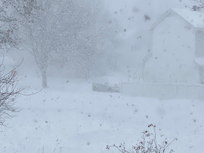
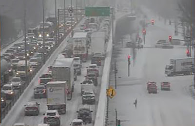
Travel conditions are nearly impossible across North Dakota, with over 800km of Interstate 94 closed across that state. Similar weather can be expected in southern Manitoba on Wednesday. (NDDOT)

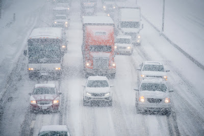
A powerful spring blizzard is hammering portions of North Dakota, Montana and neighbouring southeast Saskatchewan and southwest Manitoba early Wednesday morning. The storm promises to be epic, with 25 to 60cm of snow forecast along with 70 to 100km/h winds. Authorities have already closed more than 500 miles of Interstate 94 across North Dakota and Montana.

A strong late-season winter storm will impact portions of southern Manitoba and southeast Saskatchewan with blizzard conditions expected for over 24 hours. Weather conditions are deteriorating early Wednesday morning in Manitoba, with heavy snow and increasing north winds. (AccuWeather)

Forecasters north of the border are expected the same, as the snow and wind ramp up today in Manitoba. Visibility early this morning is already under 1km at Winnipeg and Brandon. Late season storms are not uncommon in this region, however the strength of this particular blizzard is rather impressive. Low pressure will slowly move across the northern plains and into Minnesota and northwest Ontario over the next 48 hours. In addition to the strong winds and heavy snow, bitter cold will push across the southern Prairies. Temperatures early Wednesday morning are already well below freezing and expected to drop into the minus teens by Thursday morning. Strong winds and heavy snow will make travel impossible in western Manitoba. Expect highway closures and possible power outages.

Heavy Rain and Thunderstorms

On the warm side of the storm, an elongated warm front is producing periods of heavy rain and thunderstorms north and east of the center. A strong cold front trailing from the storm is generating severe wether and tornadoes across the central and southern US plains.

As the storm lifts into Ontario, Montreal can expect periods of steady rain to develop along the aforementioned warm front. A soaking 20 to 30mm is possible, which will add to water levels on both the Ottawa and St. Lawrence Rivers. A heavy rainfall warning has been posted for portions of southern Quebec including metro Montreal. No flooding is anticipated at this time, but water levels are being closely monitored. On Thursday, the trailing cold front arrives, accompanied by gusty winds and scattered showers and isolated thunderstorms. Skies will clear out Thursday evening.

Good Friday at this time is shaping up to be the best weather day of the Easter/Passover long weekend for Montreal. Conditions will be sunny and mild, with a high near 15C (59F) in Montreal, warmer south of the city towards the US border. Conditions will be rather breezy, with wind gusts to 50km/h likely. The weekend at this time is going to be dreary and chilly as an upper level low moves east from the Great Lakes. Look for scattered showers both days and perhaps even a few flurries around for Easter Sunday.

Wednesday, April 06, 2022

Heavy rainfall expected for southern Quebec

Most of snow is now gone in the Montreal region, but such is not the case in other parts of the province. Heavy rain on Thursday and Friday may lead to flooding in several regions, especially north and east of the city. A heavy rainfall warning has been posted by Environment Canada, with 20 to as much as 40mm expected.

Heavy Rainfall Warning posted for southern Quebec including metro Montreal.

Spring is well underway across southern Quebec, with mild temperature and rainfall expected. A slow moving, moisture-laden frontal boundary is forecast to move into the region on Thursday followed by low pressure moving northeast along the Atlantic coast. The combination of both systems will bring a prolonged period of wet weather to Montreal. After a sunny, mild Wednesday, clouds will increase, with rain developing Thursday morning. The rain may be heavy at times, with 20-30mm expected, and as much as 50mm along the US border. 

Showery weather will persist most of the day on Friday as well. Temperatures will be cooler than they have been, with daytime highs around 8C (48F) and lows near 3C (38F). The weekend will remain unsettled as an upper level low moves across the Great Lakes. Temperatures will be on the cool side, with more clouds than sun and a few isolated showers around.

The rain, combined with melting snow, will lead to areas of flooding, especially north and east of Montreal. I am not expecting any issues within the city, as most of the snow has melted. There may be some low lying areas that see ponding of water. There is however still plenty of ice on area rivers. For that reason Hydro Météo has watches in place for ice movement on rivers across far western Quebec, and in the Chaudière region.

April historically has produced some big snowstorms in Montreal. On April 9th, 2000, 34cm fell, with 32cm on April 1st, 1993, and just last year 5cm fell on April 21st. In 1975, a monster two-day storm produced 20 to 40cm of snow across large portions of the province, along with 90km/h winds. The winds created massive drifts and produced widespread damage especially in portions of the lower St. Lawrence. This will not be the case this year, there is no snow in our future.

The April 3-4, 1975 snowstorm hammered the province, with 30 to 40cm of snow, whipped by 90km/h winds. Montreal reported 26 hours with less than 1km visibility, while Québec City registered 11 consecutive hours of zero visibility. The barometric pressure dropped to 97.93 inches, equivalent to that of a Category 1 hurricane. Wind damage was widespread and roads were closed. (Photo Québecurbain)

At this time it looks like spring flooding will not be an issue in Montreal this year. Snowfall in the Montreal region was well-below normal in March and for the entire winter season. Only 23cm fell last month for a winter total of 180.2cm (70.9 inches) at Trudeau Airport. The long-term average is 209.5cm (82.5 inches). This is not the case in many other regions of Quebec, especially northeast of Montreal where the snowpack remains deep, and the risk for spring flooding is much higher. For example parts of the Gaspé and Saquenay regions had over 100cm of snow in March alone. There is still 127cm of snow on the ground in Sept-Îles compared to the normal of 40cm.

Thursday, March 24, 2022

Winter to make a return to Montreal this weekend

After a prolonged cold snap in January and a roller coaster February, roads are in brutal condition across the Montreal region. Massive potholes and sinkholes have damaged numerous cars and caused several accidents. Crews have been filling them, but new ones appear just as quickly. You can blame it on the fierce freeze and thaw cycle over the last few weeks, along with deep frost this year and steady precipitation over the last 10 days. Since March 1st, over 80mm of rain and snow have fallen at Trudeau Airport.

Perhaps the last shot of arctic air for the winter season is forecast to invade southern Quebec this Sunday. This will be quite a shock to the system after the springlike conditions over the last week. Before then we have a wet, chilly period of weather expected over the next 72 hours. Low pressure over the Great Lakes pushed a frontal boundary into the region overnight, accompanied by rain, ice pellets and pockets of freezing rain. I measured close to 25mm (1 inch) of precipitation on Île Perrot since just before midnight through 9am, with temperatures hovering just above the freezing point.

Thursday will be a breezy day, with scattered showers and a high near 7C (45F) for Montreal. A secondary area of low pressure will move along the east coast late Thursday pushing another wave of moisture into southern Quebec. Look for a mix of rain and snow across the St. Lawrence Valley into Friday morning, with an overnight low near 3C (38F). Both Friday and Saturday will be cloudy and cool, with scattered showers.

Arctic Blast

On Sunday, a strong arctic cold front will sweep across the region, accompanied by some snow, with 1 to 4cm possible across southern Quebec. Temperatures will drop dramatically into the minus teens both Sunday and Monday night. Strong northwest winds late Sunday and Monday, will result in windchill values as low as -20C. The overnight lows will be in the -10C (14F) to -15C (5F) range. Monday will feel brutally cold for late March, with strong winds and a high of only -6C (21F). Temperatures will moderate by mid-week.

Friday, March 18, 2022

Wet weekend for Montreal after record warmth

A sure sign of spring across southern Quebec, as the geese are starting to return. Montreal reached a record high of 15.8C on Thursday afternoon. More mild weather and rain are forecast for the upcoming weekend. Spring arrives at 11:33AM on Sunday morning.

Thursday was a spectacular day, feeling more like mid spring than late winter. A southwest breeze and bright sunshine allowed the temperature to reach a record-breaking high of 15.8C (61F) in Montreal, surpassing the previous benchmark for the date of 14.4C (57F) set in 2010. A weak cold front settled south across the region overnight, so Friday will not be as warm, but sunny and mild nevertheless, reaching 11C (52F).

Developing low pressure over the US Midwest will arrive over the weekend, with rain expected Saturday, and a showery first day of spring for Sunday. Clouds will increase late Friday, followed by rain overnight into Saturday. The rain will become more scattered in nature Saturday afternoon into Sunday. In total, Montreal can expect 15 to 20mm of precipitation. Gusty winds are likely on Saturday as well, out of the northeast at 20 to 40km/h. We will have a damp and chilly high of 7C (45F), but this is still above the long-term average of  3C (38F). 

There is a risk of freezing rain and wet snow ell northeast of Montreal towards Quebec City, so keep this in mind if your travel take you in that direction on Saturday. Despite the mild air, there is always a chance of more wintry precipitation as we end March and start April. At this time however, our forecast looks mild, with no major storms on the horizon.

Increased snowmelt and the expected precipitation this weekend, will have water flow and ice conditions on area rivers and lakes highly variable. The best advice is stay off the ice and out of the water in the Montreal region.

Friday, March 11, 2022

Less snow expected for Montreal as storm slides east

A late winter storm will bring 10 to 30cm of snow to much of southern Quebec on Saturday.

Friday will be the calm before a late season snowstorm impacts the region. Latest model data suggests the center of the low will move from Louisiana towards southeastern New England on Saturday. This track takes the storm a little more eastward than 24 hours ago. The result will be less snow for Montreal and eastern Ontario.

Snow will begin by 7pm Friday evening in Montreal and taper off Saturday afternoon. At this time, a general 10 to 15cm is expected for the city, more as you head southeast towards the Eastern Townships, where a winter storm warning is in effect. Warnings are also in effect for most of northern New England and New York. Snowfall amounts will range from 7 to 15cm across eastern Ontario, and 20 to 30cm for northern New England, New York and the Townships.

The storm will deepen rapidly on Saturday, resulting in strong northwest winds developing, in excess of 50km/h during the afternoon hours in the St. Lawrence Valley. This will produce areas of blowing and drifting snow as well as isolated power outages. Winds will only diminish Sunday morning. Temperatures will be close to the freezing point in Montreal for the next 24 hours, before dropping to -5C (23F) by late Saturday afternoon. The snow will be wet and heavy at the onset of precipitation, but become dry and fluffy by late Saturday, allowing it to blow around more.

Expect poor travel on Saturday, especially south and east of metro Montreal.

This storm has far reaching effects, with weather warnings in place from the Gulf of Mexico to Atlantic Canada.

Wednesday, March 09, 2022

Snowstorm likely for southern Quebec on Saturday

The biggest snowstorm of the season may impact Montreal on Saturday with heavy snow and strong winds. (ValleyWeather Photo)

Winter storm expected to impact Montreal late Friday into Saturday.

A hint of spring is in the air as I write this blog, with warm March sunshine pushing the temperature to 4C (39F) in Montreal. But March can be a cruel weather month, and winter is not over just yet. Confidence is growing that a strong winter storm will impact southern Quebec this coming weekend. If the forecast holds true, it could be the biggest storm of the winter for the city.

Low pressure is forecast to develop over southern Texas on Friday, tapping into warm, moist Gulf of Mexico air while moving northeast. At the same time, cold, arctic air is forecast to push south across the Great Lakes. The combination of those key ingredients will allow the storm to intensify rapidly as it moves northward along the eastern seaboard and into Atlantic Canada by Sunday.

Strong low pressure is forecast develop Saturday along the east coast and move towards Atlantic Canada. Heavy snow is expected to fall across southern Quebec along with strong winds. (AccuWeather.com)

Montreal will remain on the cold side of the storm, with snow developing late Friday and persisting into Saturday. The snow will be heavy at times, with amounts well in excess of 15cm possible for Montreal. Some models have 20 to 30cm falling across southern Quebec. Accompanying the snow will be strong winds, with gusts over 70km/h possible. This will create widespread blowing and drifting snow.

There are still many details to iron out such as the timing and exact track of the storm, but at this time, plan for very poor travel for at least 36 hours across the region. Skies will clear Sunday, but it will be windy and cold. Milder, calm weather returns to start next week.

Sunday, March 06, 2022

Spring mix of freezing rain, snow and thunderstorms

A light glaze of freezing rain is expected early Sunday morning in Montreal before temperatures soar to record-breaking highs in the low teens. A cold front will deliver strong winds and isolated thunderstorms this afternoon. On Monday, another area of low pressure will pass south of the city, with a period of wet snow likely. 

Freezing Rain Warning in effect for metro Montreal for early Sunday. 

A strong spring weather system is moving across the Great Lakes early Sunday morning, forecast to pass well north of Montreal today. An elongated warm front will lift across the region this morning, allowing record-braking warm air to surge north into southern Quebec and Ontario. Along the warm front, a brief period of freezing rain is possible early Sunday morning, with just a light glaze expected for Montreal.

Once the front clears the region, temperatures will soar, with a forecast high of 12C (54F) for both Montreal and Ottawa, and 19C (66F) for Toronto. A high of 12C would be a new record for Montreal for the date, surpassing the previous benchmark of 10C (50F) set in 1974.

A trailing cold front will arrive in southern Quebec by late afternoon or early evening, accompanied by scattered showers and a risk of the first thunderstorm of  2022. Storms were scattered along the front Saturday afternoon, including a powerful cell that produced and EF-3 tornado near Des Moines, Iowa. The storm caused widespread damage, injuries and at least 6 fatalities. The National Weather Service estimates winds exceeded 215km/h with the storm.

While we are not expecting severe storms in our region, strong winds will mix down to the surface along and ahead of the cold front Sunday afternoon. Wind warnings are in effect for portions of Ontario and New York state, and they may be extended into southern Quebec. Gusts of 50 to 70km/h are expected in Montreal, and up to 100km/h along the shoreline of Lake Ontario into portions of the southern St. Lawrence Valley.

The cold front will clear the region this evening, with temperatures settling back down to 0C (32F). On Monday, low pressure will pass just south of Montreal along the front, with a swath of wet snow expected north of the center. Portions of southern Quebec and eastern Ontario can expect up to 5cm of wet snow by late Monday.

High pressure will move into the region Tuesday, with clearing skies and slightly cooler temperatures. The high will be near -1C (30F).

Thursday, March 03, 2022

Active weather pattern for Montreal to begin March

Public works crews and private contractors have been rather busy over the last two weeks cleaning up snow from multiple storms in Montreal. This photo was taken in front of my childhood home on LaSalle Boulevard in Verdun. (Photo - Peter Storey)

February is in the history books, and spring is just around the corner. The month ended with 104mm of total precipitation, well above the normal of 63mm. In that amount was 54cm of snow, also above normal. That was a Trudeau Airport, many neighbouring regions reported even more snowfall, and as a result, the banks are sitting pretty high for early March.

Despite it being meteorological spring as of March 1st, winter weather remains in our future. This week, the Montreal region has already received between 10 and 15cm of new snow, and another storm is on the horizon.

We will end the week under a ridge of high pressure, with sunny skies but cold temperatures for early March. The high Thursday has already been reached and temperatures will remain steady around -10C (14F) or slowly fall. The normal high should be 0C (32F) and low -9C (16F). The forecast low tonight in Montreal is -17C (2F). Temperatures will slowly moderate on Saturday as clouds increase along a warm front. By Saturday evening, we can expect a light mix of snow and freezing rain, along with warming temperatures. Sunday will feature light rain and a very mild high of 10C (50F) for southern Quebec.

As the low pressure in question lifts north of the city Sunday afternoon, it will drag a cold front across the St. Lawrence Valley. Temperatures will fall back to the freezing point for Monday. At the same time another low pressure area will move from the central US towards New England and pass south of Montreal. This system will bring snow to the region, but the timing and amounts have yet to be determined.

Briefly looking ahead through the middle of March, we can expect below normal temperatures and above normal precipitation.

Sunday, February 27, 2022

Snow squalls expected across southern Quebec Sunday

Friday's storm produced heavy snow and blowing snow in Montreal, with numerous accidents reported around the region. Visibility was greatly impacted through the middle portion of the day as seen in the photo above taken on LaSalle Blvd in Verdun. Photo: Peter Storey

A Snow Squall Watch is in effect for a large portion of eastern Ontario and southern Quebec for Sunday including metro Montreal.

Another in a series of low pressure systems will impact the region today. The low is a rather weak Alberta Clipper, with limited moisture, but a strong cold front producing a wide range in temperatures. Light snow will develop early Sunday morning a the low moves across southern Quebec. Gusty southwest winds are expected as well, up to 50km/h at times, producing some blowing snow.

By the noon hour, squalls should begin to develop across Ontario moving southeast into Quebec. Brief periods of heavy snow with near-zero visibility are expected. Winds will shift to the northwest and gust up to 60km/h. This is a similar situation to last Saturday, where squalls produced numerous travel issues with several major accidents. Travel with care today, and expect highly changeable weather.

Temperatures will be mild today, reaching -1C (30F) before the frontal passage. They will tumble late this afternoon and this evening, down to -19C (-2F) by Monday morning, with windchill values in the mid minus 20s.

In terms of accumulations, expect a general 3-5cm for most locations, with more in the most persistent squalls.

Heavy snow falling on Île Perrot Friday afternoon. Between 15 and 20cm fell at most locations in southern Quebec (ValleyWeather Photo)

Friday's storm delivered 10 to 20cm of snow on the region, the most at Mirabel with 23cm, the least, as per usual, at Trudeau Airport where apparently only 11.2cm fell. I measured 15cm here on Île Perrot, with 15cm also in Laval, and on the South Shore. The snow fell quickly, reducing visibility at times to zero. Several major multi-vehicle accidents were reported, with one involving 20 vehicles on Highway 20 between Les Cèdres and Coteau-du-Lac. Another closed Highway 40 at Riguad. 

Similar conditions occurred in northern Vermont and New York. A 30 vehicle crash resulted in one fatality and several serious injuries on Interstate 89 near Milton, Vermont. The highway was closed for nearly 10 hours.

Thursday, February 24, 2022

Another wave of snow and cold forecast for Montreal

The snow on Friday is expected to hide the layers of ice coating most parking lots and driveways after 15mm of freezing rain and sleet fell on the Montreal region Wednesday night. 

Another winter storm, the third in less than a week is set to impact southern Quebec and Ontario on Friday with 5 to 15cm of fresh snow expected. Winter weather advisories are in effect for all of southern and eastern Ontario, with winter storm warnings in place across New England and New York. No warnings have been issued for Montreal at this time.

There is still a layer of ice on the ground in many places after Wednesday nights storm went through, which will makes things challenging with the new snow arriving. Wednesday's storm produced nearly 15mm of freezing rain and sleet, with very little warm air making it into Montreal. The temperature only nudged above the freezing point for a few hours early Thursday morning, before a strong cold front pushed across the region, with a peak wind gust of 88km/h at Trudeau Airport, and rapidly falling temperatures back below freezing. This resulted in standing water refreezing quickly.

This is setting the stage for a much colder weather system on Friday. Low pressure will deepen as it passes well south of Montreal, close to the New York City metropolitan region and into the Atlantic. Southern Quebec will be on the northern edge of the storm, with 5 to 10cm expected in the city and 10 to 15cm south towards the US border. The snow will begin early Friday morning and taper off late in the day. We are also expecting strong northeast winds of 30-50km/h to accompany the snow along with cold temperatures. The high is forecast at -11C (12F) for Montreal. The snow will be very fine and blow around quite easily. Expect poor travel conditions all day Friday.
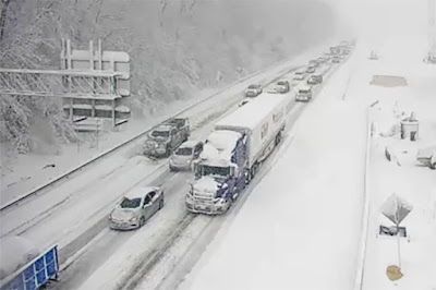
Last Saturday's snow squall activity made driving dangerous across southern Quebec. More snow squall activity is expected this Sunday afternoon as an arctic cold front plows through the region. (ValleyWeather Photo)

Another round of snow squalls expected

Skies will clear out early Saturday morning, but any sunshine will be short-lived as another system arrives late in the day. Low pressure will pass near Montreal on Sunday with somewhat limited moisture, but drag a potent arctic front through the region during the afternoon hours. At this time it looks like a repeat of last Saturday, with dangerous snow squalls developing. They will be brief and isolated, but produce periods of strong winds, very heavy snow and poor visibility. Expect a general 2 to 5cm of addiotnal snowfall. Keep this in mind if you have any travel plans to end the weekend. Last weeks squalls produced quite a few serious accidents across southern Quebec and into Ontario and northern New England as well.

Tuesday, February 22, 2022

Freezing Rain Warning posted for Montreal

Freezing rain warnings are in effect for a large portion of eastern Ontario and southern Quebec today and tonight. Freezing rain should start in Montreal by late this afternoon.

Another messy winter storm is set to impact southern Quebec over the next 24 to 36 hours. Low pressure over the American Midwest will move into the Great Lakes and down the St. Lawrence Valley on Wednesday. In advance of the storm, colder air has settled back into Montreal. Temperatures early Tuesday morning are either side of -10C (14F).

Deep moisture will begin to stream northward later today, overriding the cold air at the surface. The result will be a few hours of freezing rain, starting this afternoon in eastern Ontario and the Ottawa Valley and spreading north and east into Quebec. Several hours of freezing rain are expected, with 5 to 10mm of ice accretion. Expect very slippery roads and sidewalks as well as the risk for isolated power outages in areas the see the longest duration of freezing rain such as Ottawa and Quebec City.

It has been a rather busy weather week in Montreal. On Saturday, wicked snow squalls crossed the region, with rapidly falling snow and wind gusts over 70km/h. Visibility was reduced to zero at times as shown above on Ile Perrot. Numerous accidents and road closures resulted across southern Quebec. (ValleyWeather Photo)

Temperatures will rise above freezing in Montreal overnight, as warm as 8C (47F) in areas along and south of the St. Lawrence River. Any freezing rain will change to showers in Montreal. A trailing cold front will follow on Wednesday, dropping temperatures just a quickly, down to -10C by late in the day. Winds will become quite strong on Wednesday, gusting up to 60km/h at times. Any remaining precipitation will taper off to flurries.

Another winter storm will slip south of the region on Friday, with a general 5 to 10cm of snow expected at this time for Montreal.

Friday, February 18, 2022

Snow day in southern Quebec

Schools are closed and traffic is at a standstill in may parts of Montreal Friday morning, after nearly 20cm of snow and ice fell overnight.

A potent winter storm has resulted in heavy rain and snow along with rapidly dropping temperatures over the last 36 hours. Highways are in very poor shape Friday morning, icy and snow covered. Numerous accidents have been reported in the Montreal region. Nearly every school board in southern Quebec has opted for snow day today, with more than 18cm of snow falling overnight in Montreal.

The change in weather was quick after a spring-like day on Thursday, featuring record breaking warmth for most of us. The high at Trudeau was 6.6C (44F), just shy of the record of 6.8C (44.2F) set in 2011. Here on Ile Perrot and across the off-island suburbs to the west, the high reached a balmy 9C (49F).

From deep puddles to ice and snow in just a few hours on Ile Perrot. The temperature at my home reached 9C on Thursday, but was down to 0C by 9pm last evening. More snow is on the way for the weekend. (ValleyWeather Photo) 

Late last evening a cold front crossed the St. Lawrence Valley, with rain mixing with sleet and freezing rain around 9pm and changing to snow shortly afterwards. The snow was heavy overnight, but has become lighter this morning and should end by noon. Storm totals are very impressive, with 27.6mm or rain falling in Montreal, followed by at least 20cm of snow. The temperature has dropped all the way to -10C (14F) as of 8am Friday.

The storm in question is over northern Maine this morning moving east, while the cold front has shifted into southern New England. High pressure will briefly clear skies this afternoon, along with steady or cooling temperatures, down to -15C (5F) tonight. On Saturday, a weak low pressure area will skirt across southern Quebec with light snow expected and windy conditions. Another 5cm of snow is expected for Montreal.

A very active weather pattern is expected next week, with moderating temperatures, and more mixed precipitation likely.

Wednesday, February 16, 2022

Multifaceted winter storm to target southern Quebec

Another spectacular February sunset in Montreal, the calm before the storm.

A special weather statement is in effect for the entire region as a winter storm develops over the next 24 to 48 hours.

A rather complicated winter storm featuring rain, flooding, strong winds, record high temperatures and eventually a flash freeze with heavy snow, will impact southern Quebec beginning Thursday. Much warmer air is streaming into the St. Lawrence Valley early Wednesday morning, allowing temperatures to finally rise after a 72 hour period of arctic air. The high Wednesday will be 4C (39F) under cloudy skies after low temperatures in the minus teens in Montreal.

Developing low pressure is expected to move northeast from the southern US along a cold front that is expected to move into our region late Thursday. The storm will pass just south of Montreal during the wee hours Friday morning. In advance of the cold front, a strong push of very warm air will result in record breaking high temperatures for many of us in southern Ontario and Quebec. The forecast high for Montreal on Thursday is 8C (46F), the record for the date is 6.8C (44F) set in 2011. 

Despite the record warmth forecast for Thursday, there may be a fresh 10 to 15cm of snow on the ground in Montreal by Friday morning. (AccuWeather.com)

Rain is forecast to develop on Thursday, with as much as 15 to 25mm for many locations. The heavy rain, mild temperatures and melting snow will lead to some localized flooding concerns. Strong southerly winds will develop on Wednesday afternoon, gusting up to 50km/h in Montreal, and 90km/h in the Richelieu Valley.

By late in the day Thursday, cold air will begin to filter into eastern Ontario and southern Quebec changing the rain to snow, with a period freezing rain possible for many locations including Ottawa and Montreal. Winds will become strong once again, backing to the northwest 30 to 50km/h. Temperatures will rapidly fall below freezing, down to -10C (14F) by Friday morning. The snow may be heavy at times with 10-15cm possible for many locations. Strong winds will cause blowing snow, and rapidly falling temperatures will turn any standing water to ice.

All this will be highly dependant on the track of the low pressure area and the timing of the cold front. The forecast is subject to change and as I said is quite complicated with plenty of moving parts. Weather warnings will likely be needed for several regions.

Saturday, February 12, 2022

Flash Freeze Warning - colder weather returns

A flash freeze warning is in effect for Montreal.

Expect rapidly dropping temperatures to produce icy travel conditions over the next few hours across southeastern Ontario and southwestern Quebec.

 A flash freeze warning has been issued for all of eastern Ontario and southern Quebec through early afternoon. A strong cold front currently moving across the Ottawa Valley, will pass through Montreal and southern Quebec late this morning into the early afternoon hours. 

Temperatures fall rapidly behind the front, with any standing water freezing quickly. Close to 4mm of rain fell overnight along with plenty of melting snow. Roads will become very slippery in hurry, so if you have travel plans exercise extreme caution. 

The current temperature here on Ile Perrot is our high for today at 4C (39F). Ottawa has already dropped below freezing, down 3 degrees in the last hour, along with a burst of heavy snow. The arctic airmass is spreading southeast quickly. Winds will shift from the southwest to west, gusting up to 60km/h ushering in the frigid temperatures.

The temperature will drop in Montreal down to -8C (18F) by late afternoon, and -20C (-4F) by Sunday morning. Sunday will be sunny, but bitterly cold, with a high of only -13C (9F) and windchill readings in the minus 20s.

Thursday, February 10, 2022

Frigid air returns to Montreal for Super Bowl weekend

A beautiful picture of Maison Nivard-De Saint Dizier or "The Old Stone House" as we called it while growing up in Verdun, living directly across the street on LaSalle Boulevard. The photo was taken by Peter Storey during the snowstorm last Friday morning. Montreal measured only 14.6cm of snow during the storm, far below early expectations. Other parts of southern Quebec measured as much as 25cm.

February has started off rather mild across southern Quebec, with only two days of below normal temperatures so far, and 5 days with temperature at or above the freezing point. This is a far cry from the frigid month of January, that featured 17 days colder than -20C (-4F) in Montreal, and a monthly average of only -13.5C (7.7F), 4 degrees below the long-term average. Snowfall was meager however as our rather tame winter moves along. Only 41cm fell at Trudeau Airport, the seasonal total sits at 94.8cm.

A series of weak systems will dominate the wether through Friday, with periods of showers or flurries and very mild temperatures. The high on both Thursday and Friday will approach 4C (40F). No significant accumulations are expected, but with nighttime temperatures at or slightly below freezing, there may be a few slick spots on area roads. 

A strong cold front is forecast to cross the St. Lawrence Valley by midday Saturday, ushering in an arctic airmass to end the weekend. A period of gusty winds and perhaps some snow flurries is expected along the front. However the big news will be the drop in temperatures. The mercury in Montreal will be above freezing early Saturday morning, but plummet down to -22C (-8F) by Sunday morning. Both Sunday and Monday should be fair in Montreal, but frigid, with daytime highs around -15C (5F) and overnight lows in the low minus 20s. A slight breeze will only add to the cold.

Temperatures will moderate by the middle of next week, as another storm system moves across the Great Lakes and west of Montreal. It appears southern Quebec will be on the warm side of the storm, with a mix of snow and rain expected at this time. 

Wednesday, February 02, 2022

Long duration snowfall expected in Montreal

A special weather statement is now in effect for metro Montreal, with 10 to 20cm of snow expected through Friday morning. The commute in Montreal on Thursday will be impacted as snow, falling temperatures and gusty wind are forecast.

Widespread weather warnings and advisories are in place from Ontario to Atlantic Canada including Montreal, as a winter storm approaches the region.

Wednesday turned into a spectacular weather day, with the mildest air so far this year. High temperatures around the Montreal region warmed between plus 4C and 6C (39-43F) under partly cloudy skies. Unfortunately, the mild weather is not going to last much longer. A strong cold front is moving across Ontario, changing rain to snow as it progresses southeast. Temperatures fall rather quickly behind the front, along with gusty northwest winds and steady snow.

Quebec's own Groundhog, Fred la Marmotte, saw his shadow today in Val-d'Espoir, predicting six more weeks of winter weather. That will become a reality quickly tonight as mild air retreats to the southeast and an arctic cold front arrives in Montreal. Rain will change to snow after midnight, and temperatures will plummet to -13C by Thursday night.

The cold front will approach the Montreal region overnight, settling across central New York and New England on Thursday. Rain will develop this evening in Montreal, changing to snow after midnight and persisting through the day on Thursday. On Thursday, low pressure will move along the front, with the snowfall picking up in intensity late in the day. In all, 10 to 20cm of snow is forecast from Montreal south to the US border and along the St. Lawrence Valley into Ontario. Temperatures will fall on Thursday from early highs near 0C (32F) down to -8C (18F) by late afternoon. Gusty northwest winds of 20-40km/h will make it feel much colder, and produce areas of blowing snow. Flurries are expected to persist into Friday.

Nicknamed the Groundhog Day storm, this system is far reaching, with weather warnings posted from Texas to Atlantic Canada impacting millions. Already today, heavy snow and freezing rain has created dangerous travel conditions across the southern plains into the Great Lakes. The snow has now moved into southwestern Ontario.

Monday, January 31, 2022

Heavy snow may impact southern Quebec by Thursday

Clouds off to the southeast from the powerful storm off the New England coast, produced a spectacular sunset over the frozen St. Lawrence River on Île Perrot Saturday evening. The storm produced record amounts of snow for many along the east coast, but only high clouds and gusty north winds in Montreal. (Valley Weather Photo)

The weather is rather tranquil to start the work week in Montreal, with high pressure generally in control through Tuesday. We can expect some high clouds and perhaps a snowflake or two on Monday. Temperatures are warming up this week, and we may even nudge above the freezing point by Wednesday. It is another cold start to the day Monday however, with lows between -16C and -20C across the region. Daytime highs will warm up nicely, with highs expected around -10C (14F). We gain a few more degrees on Tuesday, with fair skies and a high of -2C (28F) in Montreal. 

The forecast will then become very interesting and somewhat complicated by Wednesday. A warm front will lift north of the St. Lawrence Valley, with some light mixed precipitation expected Wednesday afternoon. The temperature will finally rise above the freezing point to 2C (36F). Late Wednesday into Thursday, a potent cold front will slip south of the region, with arctic air quickly flowing back into southern Quebec. That front will settle somewhere across central New York State, with developing low pressure moving along it through Friday. The result will be a period of steady snow Thursday. Amounts are still up in the air and will depend greatly on how far south the cold front sinks. At this time the potential exists for snowfall amounts greater than 15cm in Montreal. There are sill a ton of details to work out, but plan for frozen precipitation from late Wednesday through Friday morning, along with blustery conditions and dropping temperatures.

Southern New England was blasted by a strong winter storm on Saturday. Snowfall rates of 5 to 10cm per hour occurred, along with winds in excess of 90km/h. (Photo: City of Dover, New Hampshire)

Over the weekend, a powerful nor'easter moved along the Atlantic coast and into Nova Scotia. The storm produced record amounts of snow, with close to 60cm in Boston. Winds gusted to hurricane strength in many locations. Coastal flooding and power outages were reported from New Jersey to Newfoundland. The storm also impacted the Maritimes and eastern Quebec. Moncton reported 40cm of snow along with 90km/h winds. In Quebec, winds gusted to 100km/h across the Gaspe Peninsula and 113km/h in Blanc Sablon on the Lower North Shore. The wind and snow closed several highways in eastern Quebec. In Newfoundland both heavy rain and snow occurred. A peak wind gust to 149km/h was observed at Wreckhouse. On Prince Edward Island, motorists needed rescue by the RCMP in absolute blizzard conditions, after 40cm of snow combined with winds gusting to 109km/h. Many roads became impassable.

Thursday, January 27, 2022

Montreal to remain on the edge of large winter storm...again

Montreal has only measured 76.6cm of snow at Trudeau Airport since November 1st. In a typical winter, Montreal receives over 200cm of snow. I have only had to haul the snowblower out on two occasions.

The chatter among many weather enthusiasts lately is that Montreal has become the place where storms go to die. It certainly seems that way over the last two winters, as just about every winter storm has either passed to our east missing us or to our west, warming us above freezing. The void is obvious, Montreal has only measured 76.6cm of snow at Trudeau Airport since November 1st and as of Wednesday morning, was only registering 10cm of snow on the ground. Case in point, over the next week, two major systems will once again avoid southwestern Quebec.

Montreal will remain on the western edge of a large Nor'Easter this weekend. Heavy snow will fall from coastal New England into Atlantic Canada. (AccuWeather.com)

The first storm will become a newsmaker this weekend as it moves along the eastern seaboard. While the track is not set in stone, all indications are that the system will remain well offshore east of the New England coast thus sparing Montreal any major impacts Low pressure is expected to develop Friday off the North Carolina coast. The storm will deepen rapidly, bombing out, with the central pressure dropping more than 24mb in 24 hours. Blizzard conditions are expected, with more than 30cm of snow likely along the coast from New Jersey into Atlantic Canada. Coastal flooding and hurricane force wind are possible along and to the west of the track. Storm surge flooding is likely along portions of the New England and Nova Scotia coastlines.

Across Quebec, light snow will spread as far west as the Eastern Townships. Eastern Quebec and the Gaspe region are expecting heavy snow and strong winds Saturday. In Montreal, high clouds, gusty northerly winds and perhaps a snowflake or two will be the only weather we can expect at this time on Saturday.

The temperature will remain quite cold this weekend, from -17C to -20C overnight, and -10C to 14C for highs. A warming trend is expected next week, as a strengthening storm moves from Colorado towards the central Great Lakes. This system will pass to the northwest of Montreal placing us in the warm sector. The temperature is expected to rise above freezing for the first time since January 9.  Look for mixed precipitation changing to rain on Wednesday. A rapid refreeze is possible late Thursday or Friday. More details on that storm to follow.

Monday, January 24, 2022

Surge after surge of arctic air for Montreal

Frigid temperatures and occasional light snow have kept road crews busy across southern Quebec this month. There have been numerous accidents on Montreal area highways due to black ice. This is especially true on any elevated surface located close to water. Ice fog and mist have been reported on each of the last four mornings. (ValleyWeather Photo)

January has been one cold month in Montreal and across southern Quebec, with surge after surge of arctic air. To date this month, there have been 21 morning lows colder than -20C (-4F) at Trudeau Airport, as compared with one such morning during all of January 2021. This included Monday mornings low of -25C (-13F). Stating the obvious, temperatures have been much colder than normal this month. As of Sunday, the average high at Trudeau Airport for January was -7.4C (19F), with the average low -18C (0F). This compares to the long-term normal of -5.3C (22.5F) and -14C (7F) respectively.

In between the arctic air intrusions, we have had a few milder days as weak low pressure, Alberta Clippers, have traversed the Great Lakes and upstate New York. These systems are typically moisture starved for southern Quebec, dropping a few centimetres at best. After a cold day today, temperatures will take a slow upward trend as another such clipper system moves southwest of Montreal. Up to 10cm of snow is possible for parts of southern Ontario, but here in southern Quebec, just a few flurries is about all we can expect. The clouds overnight and early Tuesday will allow temperatures to slightly moderate, remaining steady tonight near -15C (5F) tonight, and rising to -10C (14F) on Tuesday.

Colder air will once again arrive late Tuesday, with temperatures dropping into the middle -20s by Wednesday morning.  The mercury will not move much in Montreal on Wednesday, remaining close to -20C (-4F) for a daytime high.

Weekend Storm?

We are watching a potential Nor'easter for the upcoming weekend, with several different scenarios on the table. Current thinking is that the heaviest precipitation will remain well east of Montreal over New England and into Atlantic Canada. However, there does remain a possibility of a more western track and perhaps heavier snow for southern Quebec. Regardless of the track, slightly warmer temperatures will prevail Friday and Saturday, before frigid air returns on gusty northwest winds for Sunday.

Friday, January 21, 2022

Extreme Cold Warning in effect for southern Quebec

An extreme cold warning has been issued for Montreal as the coldest air in decades settles into the region. Temperatures will remain in the minus 20s for many on Friday.

Extreme Cold Warning in effect for southern Quebec and eastern Ontario through Saturday. Frostbite can occur in minutes at these temperatures, so dress warmly.

Hydro-Québec is asking residents to cut back on their electric consumption during this cold snap in an effort to protect the grid. They suggest you drop the thermostat by a degree or two and refrain from using large appliances during peak hours.

The coldest air in decades has descended upon southern Quebec and Ontario Friday. Frigid temperatures are being observed across the Montreal region Friday morning, with minus 20s in the St. Lawrence Valley and minus 30s across the Townships and Laurentians. The low temperature at my on home on Île Perrot was -28.6C (-20F), the coldest morning since I moved there in 2009. The wind is light at the moment but will pick up to a slight breeze around 20km/h today making windchills unbearable, between -30C and -40C at times. An extreme cold warning is in effect for basically all of southern Ontario and Quebec through Saturday morning.

To find the last time it was this cold in Montreal, you have to go back to January 15, 2004 when the mercury dipped to -29.1C (-20.4F) at Trudeau Airport. The record low for Friday is -27.5C (-17.5C) set in 2005. We missed the record officially at the airport, but have a chance Saturday morning of breaking the 1976 record low of -28.3C (-19F). The forecast low for Montreal tonight is -30C (-22F).

Despite bright but ineffective sunshine, the high both days will struggle to reach -19C (-2F). A weak clipper system arrives from western Canada on Sunday, with some light snow and a much milder high of -6C (21F). The warm-up will be very brief as temperatures will plunge Sunday night to -23C (-9F) and only warm to -16C (4C) on Monday.

Tuesday, January 18, 2022

Montreal remained on the low end of historic winter storm

The cleanup is underway in Montreal after 15 to 20cm of snow fell on Monday. The heaviest snow with the storm, up to 50cm, fell across portions of Ontario from the Niagara region towards the Ottawa Valley. (ValleyWeather Photo) 

That was one nasty winter storm. The system developed over the prairies late last week before diving into the deep south this past weekend. Feeding off a combination of warm, moist air from the Gulf of Mexico and frigid arctic air from the far north, the storm intensified rapidly, becoming a big weather maker for millions of North Americans. Heavy snow, freezing rain, strong winds, tornadoes, pounding surf and coastal flooding were all part of this storm as it worked its way northward along the eastern seaboard. The storm moved across southeastern Quebec late Monday.

The system brought a significant winter storm to parts of southern Ontario and Quebec. Historic snow amounts fell in Ontario, with close to 50cm in Ottawa and 40 to 45cm in Toronto. The snow fell quickly Monday morning catching many commuters off guard. Several highways in both Toronto and Ottawa became snarled with cars and trucks bogged down in deep snow. Around the Niagara region, the snow was accompanied by thunder and lightning. Some locations, including Ottawa, reported snow accumulations of up to 10cm (4 inches) in an hour or less.

Schools were closed across many parts of both southern Ontario and Quebec, including here in metro Montreal. 

A Go Transit bus stuck in the snow along Highway 401 in Toronto on Monday. The heavy snow brought traffic to a standstill in the GTA during the morning commute. Some motorists were stuck in their vehicles for up to 8 hours. (CBC photo)

The snow amounts were much lighter on the Quebec side of the border as a result of dry air working its way into the center of the powerful storm. This is a common occurrence with strong cyclonic storms. As a result the heavy snow only lasted an hour or so in the Montreal region. In the end, Trudeau Airport reported 17cm of snow. Other observers in the Montreal region reported between 20 and 25cm of snow. I had close to 20cm at my home on Île Perrot. Strong wind gusts up to 70km/h produced blowing snow and reduced visibility.

Despite the lighter accumulations, there were numerous accidents reported on Quebec highways. Several multiple vehicle collisions on the South Shore Monday afternoon resulted in the closure of sections of Highways 20 and 30. The Sûreté du Québec blamed the collisions on poor visibility and excessive speed for the conditions. Thankfully only minor injuries were reported. In Ontario, hundreds of accidents occurred, with two fatalities reported including a tow truck operator struck along Highway 417 near the Town of Arnprior.

The same storm was responsible for very strong winds in Atlantic Canada. A peak wind gust to 170km/h was observed at Plateau, Nova Scotia. The onshore winds produced coastal flooding in Maine and New Hampshire.

Sunday, January 16, 2022

Winter storm to impact southern Quebec Monday

A large winter storm will impact the entire eastern seaboard on Sunday and Monday. The storm will bring heavy snow and strong winds to metro Montreal and eastern Ontario on Monday, with 20 to 40cm expected across the entire region. The only exception will be the Eastern Townships where warmer air will cause the snow to change to sleet and rain.

Winter Storm Warning in effect for southwestern Quebec, eastern Ontario and northern New York.

It is another bitterly cold morning in Montreal, with temperatures in the middle minus 20s across the region. The low at my home on Ile Perrot so far is -26.4C (-15.5F), the coldest of the season to date. Sunday will be the calm ahead of the winter storm, with sunshine through increasing high clouds and a high warming to -15C (5F).

We are on track for the largest winter storm of the season here in the St. Lawrence Valley. Strengthening low pressure will lift from the deep southern US into Pennsylvania on Sunday and across Vermont on Monday. Heavy precipitation and strong winds will accompany the low as it moves northeast. Along and east of the track, a messy mix of snow, sleet and rain will occur, while in Montreal and points west, very heavy snow along with blowing snow is expected.

The snow will begin in Montreal during the pre-dawn hours Monday and taper off by the evening. The morning and afternoon commutes will be adversely affected, with snowfall rates of a few centimetres and hour possible during the morning hours especially. Storm accumulations will range from 20 to 30cm for metro Montreal, with 30 to 40cm possible across the Laurentians, eastern Ontario including the Ottawa Valley and Cornwall. Less snow is expected for Sherbrooke and the Eastern Townships, as temperatures may briefly warm above freezing on Monday. Up to 10cm is possible in those locations.

Strong winds up to 70km/h will produce blowing snow from Montreal west towards Kingston and Ottawa.

If you have any travel plans along Highway 401 on Monday, I would definitely cancel them. In fact only travel if necessary anywhere on Monday. If working from home is an option for you, I would definitely consider it.

Temperatures will warm briefly in Montreal on Monday, up to -4C (25F). Skies should clear behind the storm on Tuesday, with colder temperatures returning. Another system will bring us more snow on Wednesday followed by another surge of arctic air to end the work week.

Friday, January 14, 2022

Bitterly cold weekend followed by Monday snowstorm

Frigid air will move into Montreal on Friday, followed by the largest snowfall of the season so far on Monday, with 15-25cm anticipated for southern Quebec.

We have reached our high temperature for the day in Montreal at -7C (19F) early Friday morning. A frontal boundary that has been responsible for the clouds, freezing drizzle and light snow over the last 48 hours has finally drifted south into New York State. Much colder air is beginning to filter into southern Quebec on gusty northwest winds. Montreal will be sandwiched between a strong ocean storm that will bring Atlantic Canada heavy snow today and arctic high pressure over Ontario. The result will be a very strong push of arctic air on gusty northwest winds of 20-40km/h.

The temperature in Montreal on Friday will drop all day, reaching -18C (0F) by late afternoon. Wind speeds of up to 40km/h, will produce a biting windchill values in the minus 30s. The mercury will continue to fall, down to -25C (-13F) for lows by Saturday morning. Despite bright sunshine on Saturday, we will see very little upward movement on the temperature, possible reaching -20C for a high. Another cold night Saturday into Sunday at -22C (-8F), before slight moderation in temperatures on Sunday. The high will be near -10C (14F).

Heavy snow is forecast from the southern US into Quebec and Ontario on Sunday and Monday. (AccuWeather.com)

Major Snowstorm

Our attention will then turn to a developing winter storm along the US east coast. The energy that will become this storm is now located across the far western US and will dip into the southeastern part of the country. The system will then deepen as it lifts across the middle Atlantic and into New England by Monday. At this time, confidence is groining that we will see a swath of heavy snow across the St. Lawrence Valley, accompanied by strong northeast winds of 30 gusting to 70km/h at times. The combination of falling and blowing snow will create dangerous travel conditions on Monday across southern Quebec and eastern Ontario. At this time it appears a good 20 to 25cm is likely for Montreal, with 15 to 20cm across portions of the Ottawa Valley and 10 to 15cm in the Eastern Townships, where some sleet or freezing rain is possible as well. This is subject to change as the track of the storm becomes a little more clear over the next 24 hours. 

The snow will end Monday night followed by another surge of colder air for Tuesday. I anticipate weather watches and warnings will be required for this system and will provide updates throughout the weekend.

Wednesday, January 12, 2022

Potential snowstorm on the horizon for southern Quebec

Light snow is making roads slick across southwestern Quebec on Wednesday afternoon. (ValleyWeather Photo)

The coldest air of the season has shifted off to the east of Montreal on Wednesday afternoon, after a bone-chilling 36 hours. The high on Tuesday eventually reached -15.3C for Montreal, but only around midnight as clouds increased. Until that point, we had spent the daylight hours in the -20s, with windchill values in the -30s. The low Tuesday was -24.9C (-12.8F) at Trudeau Airport, the coldest morning since January 2018.

A weak weather system will bring much milder temperatures on Wednesday, along with a few centimetres of snow. The light snow will persist into the evening hours, along with warming temperatures. Expect 3-5cm of fluffy light snow. The next 36 hours will feature milder temperatures, as warm as -3C (27F) in Montreal.

A strong cold front arrives late in the day Thursday, bringing in the arctic airmass once again for the weekend. While it will be cold, with frigid windchills, temperatures should remain a few degrees "warmer" than Tuesday's arctic chill. The highs on Friday and into the weekend will range from -12C to -15C, with overnight lows of -20C to -25C across Southern Quebec.

Confidence is growing in the potential for a major snowstorm along the eastern seaboard by Monday. Heavy snow may extend northwest from the storm center into Montreal and the St. Lawrence Valley. Stay tuned. (AccuWeather Photo)

Potential Snowstorm

Our attention will then turn to a rapidly developing winter storm, expected to move from the southern US along the Atlantic Seaboard. This storm has been on and off again according to the various forecast models, but confidence is growing that we may see a big snowstorm for our region, possibly the biggest this season. We will have to wait another day or two for the forecast potential to become a little more clear, but for now it looks like a snowy, windy Monday, with in excess of 10cm of snow for Montreal, with much more south and east of the city.

Monday, January 10, 2022

Frigid cold for the next 36 hours in Montreal

Winter has been relatively tame to date in Montreal, with mainly mild weather and very little snow. That will make the next 48 hours seem even colder for most, as frigid arctic air settles over the province. Morning lows early Tuesday will be in the middle minus 20s, with windchill values approaching -40C in many locations.

Extreme cold warning for southern Quebec for Monday night and Tuesday. Expect temperatures in the -20s with windchill values approaching -40C. Exposed skin can freeze in minutes. Make sure your pets are indoors.

Arctic air will invade southern Quebec on Monday behind weak low pressure that brought Montreal a few centimetres of mixed precipitation on Sunday. The temperature briefly warmed above freezing late Sunday afternoon, but has since dropped considerably on gusty northwest winds. Trudeau Airport early Monday morning was -12C (10F), and I don't expect any movement on the mercury today, perhaps even dropping a few degrees by sunset.

Tonight, the coldest airmass of the season will settle over most of Quebec, with extreme cold warnings in effect across the province. The forecast low for metro Montreal is -26C (-15F), which if reached, would make it the coldest night in Montreal since January 14, 2018. To date the coldest low was -21C (-6F) on January 3. The coldest day last winter was -23C (-9.5F) on January 31.

Accompanying the cold will be a brisk northwest wind between 20 and 40km/h, producing windchill values close to -40C for many parts of the province. The temperature will slowly recover on Tuesday under partial sunshine, reaching -19C (-2F) by late in the day.

Much milder air arrives by Wednesday, with daytime highs reaching -5C (23F), along with just a few flurries. Colder air returns by the end of the week, but not as frigid as the next day or so. At this time, there are no major storms on the horizon. However, if your travels take you into southern Ontario or western New York, expect areas of snow squalls, with very heavy snow and near-blizzard conditions. This is especially true south of Watertown, New York, along Highway 401 near Kingston and southeast of Georgian Bay.

Thursday, January 06, 2022

Brief arctic blast as major storms avoid Montreal

A Virginia Department of Transport traffic camera showing stranded motorists on a section of Interstate 95 south of Washington D.C. in Fredericksburg, Virginia on Monday, January 3. Some drivers were trapped in their vehicles for up to 27 hours. It was the largest storm is several years in the region. (VDOT Photo via Twitter)

In an all too familiar pattern, the worst of the winter weather continues to avoid the Montreal region. If you do not like snow, then that news is good. So far this season, Montreal has only measured  46.2cm of snow for the entire season at Trudeau Airport, with no major storms to speak of. Slightly more has fallen in the suburbs to the south and west. While we are missing the storms, large portions of both Canada and the US are not. This includes the British Columbia south coast that has had several major snowstorms already this winter. 

The first big snowstorm of the season moved across the middle Atlantic states this week, with up to 30cm of snow on Monday in places like Virginia and Maryland. The storm snarled traffic along the major north to south Interstate 95 corridor, stranding hundreds of motorists for up to 24 hours south of Washington D.C. in northern Virginia. A new storm is taking aim at southern New York and New England for Friday, with 20cm of snow forecast for Boston.

Lake effect snow hammering the New York State Thruway south of Buffalo on Thursday, January 6.

That same storm will deepen rapidly over the Atlantic, with blizzard conditions expected as 80km/h winds combine with up to 40cm of snow through parts of Atlantic Canada on Friday and Saturday. That storm will just brush southern Quebec, with clouds and perhaps a few flurries on Friday. Only a couple of centimetres of fresh snow are likely in southern Quebec between Thursday and Sunday.

On Thursday, a strong cold front moved across the Great Lakes turning on the lake effect snow machine. Waves of lake effect snow are expected southeast of Georgian Bay in Ontario as well as in the Buffalo and Watertown, New York metro regions from Lakes Erie and Ontario.

The next storm will also miss Montreal as well, dropping heavy snow across the Ohio Valley, southern New England and Atlantic Canada. (AccuWeather)

Arctic Blast

This weekend mild air will briefly invade southern Quebec, with a few flurries or spotty showers expected early Sunday. The temperature will rise close to the freezing point late Saturday and early Sunday in Montreal. Late in the day, an arctic cold front will introduce the coldest air of the season to southern Quebec, with lows dropping to -10C (14F) by Monday morning and continuing to drop all the way down to -26C (-15F) by Tuesday morning in the city. Highs will remain in the -20s on Tuesday along with frigid windchills. Some locations in southern Quebec may touch -30C (-22F) by Tuesday morning. The temperature will begin to slowly warm by Wednesday.