Monday, December 31, 2018

Winter storm to welcome in the New Year for Montreal

Freezing Rain Warning: Montreal, Sherbrooke, Cornwall, Ottawa
Winter Storm Warning: Quebec City
Winter Weather Advisory: Northern New York & Vermont

The calm before the storm: A beautiful morning along the shores of the St. Lawrence River at Pointe-du-Moulin on Ile Perrot. (Valley Weather Photo)
The storm track has become a little more clear this morning, allowing Environment Canada to post a freezing rain warning for Montreal, Cornwall and the Ottawa Valley. Further north and east of the city, precipitation will fall as snow, with a winter storm warning in effect in those locations, including the Laurentians and Quebec City.

Low pressure will move form the Mississippi Valley into the St. Lawrence Valley tonight, and race eastward into Maine on New Year's Day. Expect snow to begin after 10pm this evening, changing to freezing rain in Montreal by midnight, and eventually rain during the wee hours of Tuesday morning. Rain will be the dominant precipitation type south of Montreal, however 5cm of snow is expected here in Montreal, with 5 to 10cm in Ottawa. Additionally, between 5 and 10mm of freezing rain is forecast on top of the snow for Montreal before warmer air arrives and changes the precipitation over to plain rain.

North of Montreal and into Quebec City, 15 to 25cm of snow is forecast. Strong winds will accompany the storm, gusting over 50km/h, producing blowing snow north and east of metro Montreal. Travel will become very poor late this evening and overnight, with snow covered, icy roads and reduced visibility. Conditions will improve rapidly behind the storm on Tuesday, along with colder air changing any leftover precipitation to light snow before ending. Temperatures will warm to 1C (33F) in Montreal by early Tuesday morning, before dropping rapidly behind the system. The low by Wednesday morning will be a chilly -18C (0F).

Have a safe and Happy New Year!

Sunday, December 30, 2018

New Year's Eve snow expected in Montreal and Ottawa

A private contractor puts down a layer of salt in Vaudreuil on Friday evening. A messy mix of 5cm of snow and 12mm of freezing rain, combined with dropping temperatures, have left ice everywhere in metro Montreal. (ValleyWeather Photo)
The weather roller coaster typical of most El Nino winters is well underway in southern Quebec. After a messy mix of rain and freezing rain on Friday in Montreal, the mercury soared up to 6C (43F) during the overnight hours into Saturday. However early Saturday, a potent cold front dropped the temperature down into the minus teens just a quickly. In Montreal, the temperature fell 11 degrees in just a few hours, with the morning low Sunday at -15C (5F). The result is plenty of ice around, especially on secondary roads and parking lots.

High pressure will crest over Ontario and Quebec on Sunday, with just some high cloudiness expected. On Monday, a potent low pressure area and frontal system developing in the US Midwest will approach Montreal, accompanied by a wide swath of precipitation. As with the other storms this month, mild air will return as well. This is a pattern that was established early in December, and shows no real sign of changing soon.

Snow and Freezing Rain
The difference this time is the storm track may be a little to the south of Montreal, allowing for marginally cold air to remain here in the St. Lawrence Valley. We may have enough cold air remaining to keep the precipitation frozen. At this time, expect snow to develop after 8pm Monday night and persist into the New Year, mixing with freezing rain from Montreal south. Eventually all precipitation should change to rain south of Montreal, but remain as snow north and east of the city. Accumulations will range from at least 5cm in Montreal and Ottawa to as much as 15cm in Quebec city and the Laurentians. Regardless of what falls with this system, travel will be impacted across the entire area including southern Quebec, eastern Ontario and northern New England. If you have plans for New Year's Eve, expect snow covered roads and reduced visibility.

The system will move into northern Maine on New Year's Day, with gusty winds, dropping temperatures and flurries forecast for Montreal to start 2019. I will post further updates on the storm as the track becomes clearer later today.

Thursday, December 27, 2018

Sharp warming trend to deliver more freezing rain to Montreal


Freezing Rain Warning in effect for Montreal, Ottawa and the St. Lawrence Valley. If possible, limit travel overnight and early Friday morning. Conditions will improve in Montreal and points south and west early in the morning. Icy travel may persist north and east of Montreal through most of Friday.

A brief 24 hour warming trend is on the way for southern Quebec and the St. Lawrence Valley through Friday. We finally received a little snow on Boxing Day, making it look a touch festive. Unfortunately the 1 to 2cm of fluffy snow also created icy travel and the usual amount of accidents on Montreal highways. Thursday morning was cold, with morning lows of -17C (2F) here on L'Ile Perrot. The cold air will moderate significantly over the next day or so as a strong winter storm moves into the central Great Lakes.

 Montreal will once again be on the warm side of the storm, with a messy mix of precipitation expected to change to rain by mid-morning Friday. After a sunny, cold day today, clouds will increase late this evening. The high today in Montreal will be near -9C (16F), with the temperature rising overnight all the way up to and above the 0C mark by early Friday. Expect a warm, windy high of 5C (41F) on Friday. In terms of precipitation, snow will begin after midnight in Montreal and accumulate 2 to 4cm before changing to freezing rain. We can expect a couple of hours of freezing rain, with less than 5mm of ice accretion expected.

The whole mess should change to rain by noon Friday. The warm air will be short-lived, with a strong cold front crossing the region early Saturday morning. Look for rain to change to light snow Saturday, along with plummeting temperatures. The low Saturday night is expected to be near -16C. Another round of snow is possible for New Years Eve, however accumulations should be on the light side.

Thursday, December 20, 2018

Wet and windy storm to start the winter season

A strong, unseasonably warm storm will move down the St. Lawrence Valley on Friday. Expect freezing rain in Montreal tonight, changing to heavy rain on Friday. (AccuWeather.com)
Freezing Rain Warning in effect for the St. Lawrence and Ottawa Valley.
Heavy Rain Warning posted for eastern and southern Ontario.

The winter solstice occurs at 5:23pm on Friday afternoon, marking the official start to winter. However, you wont be able to tell by the weather, as a warm, wet and windy storm arrives in southern Quebec and Ontario.

Strong low pressure will move north from the Gulf of Mexico into the eastern Great Lakes later today, and eventually down the St. Lawrence Valley. The storm will be packed with moisture, as well as a surge of very mild air. Precipitation will arrive this evening and overnight in the form of freezing rain across our area. Significant amounts of ice are possible, especially north and east of Montreal. Widespread freezing rain warnings have been issued by Environment Canada. Expect 10 to 20mm of ice accretion before the precipitation changes to rain on Friday. I think Montreal will be on the lower end of the freezing rain amount, but enough is expected to make travel dangerous overnight. On Friday, precipitation will transition to plain rain, as the temperature soars to 6C (43F) in Montreal. The rain will be heavy at times, with up to 25mm expected. Some regions may see as much as 50mm of rain. Isolated flooding is possible, especially in locations that have deeper snowpack. In addition to the heavy precipitation, strong winds are expected to develop on Friday, gusting over 50km/h in Montreal and up to 90km/h in northern New England.

As the storm system moves northeast of Montreal on Saturday, colder air will filter back into southern Quebec. Any precipitation will change back to light snow by Saturday afternoon, with temperatures dropping back below freezing. A dusting to several centimetres of snow are possible depending on the timing of the changeover. Sunday through Christmas Day are expected to be partly cloudy with a few flurries and much colder. The colder weather should persist through next week.

Monday, December 17, 2018

White Christmas for Montreal in serious jeopardy

After the mild weather of last weekend in Montreal, there is not much snow left on the ground for the holiday season.
If snow for the Christmas season is your thing, you may be out of luck. A sharp warming trend is underway across southern Quebec, which will be be briefly interrupted through the middle of the work week, before returning in time for the weekend. A cold front is in the process of crossing the St. Lawrence Valley late Monday, accompanied by scattered snow showers. A dusting of snow to perhaps a centimetre or two locally is possible. Temperatures will drop quickly tonight into the minus teens in Montreal, before recovering up to -7C (19F) on Tuesday. High pressure will crest over the region late Tuesday, with another very cold night on tap. On Wednesday, the warming trend will begin, with temperatures heading towards the freezing point and well above by Friday.

Strengthening low pressure is forecast to approach the St. Lawrence Valley on Friday, with rainy and windy weather expected across the region. The rain could be heavy at times, with up to 25mm possible. Needless to say, the rain, along with high temperatures above 5C (41F), will remove any evidence of snow that we currently have in the city. Once the system moves to our east on Saturday, cooler air will filter into southern Quebec, changing any leftover rain to flurries. Only a dusting in anticipated at this time leading up to and including Christmas Day. Colder temperatures will return for the holiday period, but no major storms are on the horizon at this time.

If you thought the number of green Christmases was on the rise in recent years you would be correct. According to Environment Canada data, Montreal had an 85% chance of a white Christmas between 1965 and 1984. During that period, the average amount of snow on the ground on Christmas Day, was 17cm. Since then, the chance of snow on the ground Christmas day has dropped to 70% in Montreal, with an average of only 8cm on the ground. From 1955 to 1985, Montreal recorded six green Christmas Days. From 1986 through 2017, nine green Christmases occurred. Environment Canada defines a white Christmas, as 2cm of more of snow on the ground as of 7am December 25.

As a child of the 70's, I was accustomed to plenty of snowy, cold weather during the holidays. It was a great time to be a kid growing up in Montreal.

Monday, December 10, 2018

Above normal temperatures forecast for Montreal in lead up to Christmas

The North Carolina National Guard patrolling in the central part of the state. Both Virginia and North Carolina were under a a state of emergency this past weekend, as a winter storm produced heavy snow, ice and rain. Powerful winds along the coast generated flooding and widespread power outages. (North Carolina National Guard)
Montreal can expect a cold week, with well below normal temperatures, and perhaps some very light snow late Tuesday. Accumulations are expected to be minimal, with perhaps 2 or 3cm. As we head towards the end of the work week, a major pattern change is expected, with much milder Pacific air beginning to flow across the country. The arctic air will be confined to extreme northern portions of Quebec. This is in contrast to the below normal temperatures we have been experiencing since early November.

Cold weather will persist in Montreal through Friday before mild Pacific air arrives. A major pattern change will lead to above normal temperatures through the Christmas holiday. However it may be marginally cold enough in Montreal, for some snow to fall in the days just before December 25th.
Above normal temperatures are expected to develop on Friday in southern Quebec, with daytime highs going above freezing and persisting throughout the weekend. A storm system developing in the lower Mississippi Valley will move towards the middle Atlantic states and eventually southern New England. Typically we would expect some snow in Montreal from this type of a setup in mid-December. In this instance, with plenty of mld air around, any snow that does fall will be short-lived, changing to rain by late Friday. We can expect showery, mild weather through the weekend, with daytime highs between 2C and 5C (36 to 41F). The normal high this week in Montreal should be -2C (28F).

Even snowplows were struggling to keep up with the record amounts of precipitation across the southern US this weekend. (NCDOT Photo)
Over the weekend, deep low pressure moving well south of our region, delivered record breaking amounts of snow from Texas to the Carolinas. Some locations in North and South Carolina reported over 50cm of snow. Numerous roads were closed, along with thousands of flight delays and cancelations. A state of emergency was declared in North Carolina and Virginia. Power was out to hundreds of thousands of homes and businesses.

White Christmas?
With very little snow on the ground in southern Quebec and metro Montreal, and plenty of mild air and rain in the forecast, a white Christmas this year may be in jeopardy. There are some indications that slightly cooler air will arrive in the week before Christmas, just cold enough to allow some snow to fall. Time will tell, we will certainly know more in the coming days, but a snowstorm on or around December 23rd in not out of the question.

Tuesday, December 04, 2018

Colder weather returns to Montreal for the short-term

A massive late season tornado rolls across central Illinois on Sunday. The storm was one of at least two dozen tornadoes to impact the state. The tornadoes, some as strong as EF-3, produced widespread damage and numerous injuries. Miraculously no fatalities occurred. (TWC Photo)
The strong storm that swept across the central portion of the continent this week, is ushering in much colder air into eastern Canada. The cold air will remain in place for the short-term period, with a reenforcing shot of arctic air arriving Friday. Montreal was on the warmer side of the storm this past weekend, with over 25mm of precipitation falling, ranging from wet snow, to freezing rain to plain rain. Icy roads produced accidents on Sunday morning, especially north of the city. The same storm was responsible for heavy snow along the northwest flank of the system, as well as rare December tornadoes in the warm sector across the US Midwest. The thunderstorm activity even nudged northward into southwest Ontario on Sunday afternoon and evening, with vivid lighting illuminating snow covered fields.

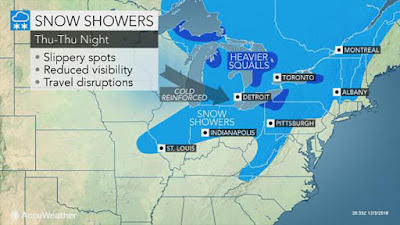
An arctic front will produce flurries and squalls late Thursday, ushering in a very cold airmass for Friday and the weekend. The cold will be short-lived, with milder weather expected to return next week. (AccuWeather.com)
The sun is finally expected to make a brief appearance in southern Quebec on Tuesday, along with some clouds and perhaps a snowflake or two. The weather will be blustery and noticeably cooler, with temperatures reaming in the -4C to -6C (21-24F) range. On Wednesday, clouds will begin to increase once again as a clipper type system arrives from western Canada. These are typically moisture starved storms, and this one will be no different. Some light snow is expected Thursday, with perhaps a few centimetres accumulating. A rather potent arctic front will cross the St. Lawrence Valley late Thursday, accompanied by some robust snow flurries. Behind the front, much colder air will arrive for Friday and the upcoming weekend with lows approaching -18C (0F) for many. The good news is high pressure will dominate, with sunshine expected to accompany the cold weather. No major snowfalls are on the horizon at this time, with the storm track remaining well south of Quebec through the middle Atlantic states.

Looking ahead to the rest of December, it is becoming more likely that a major pattern change will be underway. Above normal temperatures are anticipated through the middle portion of the month, along with below normal precipitation. Depending on which computer model you prefer, a white Christmas for Montreal may be in jeopardy, or salvaged at the last minute during the week leading up to December 25th. Time will tell.

Saturday, December 01, 2018

Icy travel anticipated for Saturday night in Montreal


Freezing Rain Warning in effect for southern Quebec, eastern Ontario and northern New York.

Despite the fact that most of Canada has already experienced snow and cold, December 1st is actually the start of meteorological winter. Right on cue we have some icy weather in our immediate future. A deepening low pressure area will move across the central Great Lakes over the next 24 hours, bringing with it a surge of mild, moist air. The temperature in Montreal will actually go above normal this weekend, for the first time in several weeks. Unfortunately before that happens, we are looking at a few hours of wet snow and freezing rain.

The cloud cover has been very stubborn to erode this week, as is typical in November. Our best bet for seeing any sunshine will come on Saturday, along with high temperatures of 1C (34F). The aforementioned system arrives tonight, with rapidly increasing clouds, followed by precipitation after midnight. Expect freezing rain to begin in Montreal after midnight, possibly starting as a brief period of snow. The freezing rain should transition to rain by 8am Sunday, with 5mm of ice accretion possible in Montreal. The freezing rain will persist northeast of Montreal and in the Ottawa Valley through mid-morning Sunday. The weather will turn showery on Sunday, with a mild high of 4C (40F).

Cold weather returns
The upcoming week will feature mild weather Monday before a sharp cold front returns arctic air to the region. Temperatures will go form well above freezing to well below by Tuesday, along with flurries. The cold weather will persist into next weekend, with several opportunities for light snow.

Monday, November 26, 2018

Conveyor belt of storms continues for Montreal

Twin storm systems will bring plenty of wet snow and rain to southern Quebec and Ontario during most of the upcoming week. (AccuWeather.com)
The next in a series of early winter storms is expected to impact southern Quebec beginning later this afternoon. The storm system is currently moving from the Midwest US towards Buffalo, New York by late today. The low pressure area was responsible for blizzard conditions across portions of the central plains and Midwest on Sunday. Over a foot of snow (30cm) fell in some locations, with winds gusting to 55mph (90km/h).

Precipitation is forecast to spread across Ontario into Quebec by this afternoon, with rain forecast at the onset. As slightly cooler air wraps into the storm, precipitation should change to wet snow this evening. The snow will be enhanced by the development of a second storm along the US eastern seaboard near New York City. Both lows will meander around New England through Thursday, with varying amounts of snow and rain. Winter storm warnings have been issued south of the border, with special weather statements in Ontario and Quebec. Warnings may be needed later today as the forecast becomes more clear.

As far as snowfall accumulation are concerned, amounts will be highly variable, dependent on elevation. Montreal can expect a very wet 10 to 15cm of snow through late Tuesday, mixing at times with rain. Upper elevations to the southeast of the city, in the Townships and northern New England, may receive more than 30cm. Winds will become rather strong out of the northeast up to 60km/h through Tuesday. The combination of heavy wet snow and gusty winds will create poor travel conditions along with the chance for isolated power outages. Snow is also forecast in Ontario, with 5cm along the St. Lawrence Valley, up to as much as 20cm along the Ottawa Valley and points west towards Georgian Bay.

High pressure will finally clear skies out by late Thursday. Temperatures will remain seasonable through the week, with highs of 0C to plus 2C and overnight lows of  -1C to -3C

Saturday, November 24, 2018

Milder weather brings freezing rain threat to Montreal

An icy Thursday morning sunrise in Verdun. Multiple low temperature records were established this past week in Montreal, including the -18C (0F) recorded early Thursday morning. Warmer air is on the way this weekend and into next week, unfortunately so is the ice, rain and wet snow. (Photo Megan Branton)
Freezing Rain Warning in effect for southern Quebec and eastern Ontario, including Ottawa and Montreal.

After the record-breaking arctic chill of this past week, warmer air will be streaming into southern Quebec over the next 24 hours. Unfortunately the warmth will come with clouds and more precipitation. Low pressure is moving from the central US plains into the Great Lakes later today. A warm front will approach Montreal this evening. With plenty of deep, cold air available at the surface, freezing rain is likely to develop across eastern Ontario and the St. Lawrence Valley, beginning late this afternoon, and persisting through midnight. Temperatures will be very slow to warm up, as the cold dense air is very difficult to move out of the valley. Additionally, pavement temperatures will remain cold, even after the air temperature has warmed above freezing.

Montreal can expect 5 to 10mm of ice accretion this evening into the overnight. As much as 15mm may accumulate north of city into Laval and the lower Laurentians. Freezing rain is also expected in the Ottawa Valley and along Highway 401 towards Kingston. Icy weather is also occur southward into northern New York and Vermont. If you have travel plans this evening, anticipate widespread icy road surfaces. Travel conditions will improve early Sunday, as most locations rise above the freezing point. The high Sunday will be plus 3C in Montreal, with showers expected.

Wednesday, November 21, 2018

Record breaking cold forecast for Montreal through Friday

The drive off L'Ile Perrot took over 40 minutes longer than normal on both Tuesday and Wednesday morning. Snow has fallen during the morning rush hour for the last 4 days in Montreal. The snow created numerous accidents and multi-hour commute times. Bitter cold will now arrive to end the work week. (ValleyWeather Photo)
An arctic cold front will be crossing the St. Lawrence Valley this afternoon, accompanied by gusty snow squalls and biting cold. Wednesday morning was just another in a string of brutal commutes in Montreal. Heavy snow falling between 6 and 9am, created terrible road conditions, with numerous accidents reported. Travel was brought to a standstill in metro Montreal for the second consecutive morning. I gave up and took the bus from Vaudreuil, the first time in over 20 years.

Record cold is forecast to arrive late Wednesday, with an overnight low of -15C (5F) expected for Montreal. The record is -14.4C (6F) set in 1987. Thursday will likely break records as well, for both high and low temperatures. The record low for Thursday is -14.4C set in 1972.

The cold air will be accompanied by another burst of heavy snow and squalls across southern Quebec and Ontario. Winds are forecast to gust up to 60km/h through Thursday, creating dangerous windchill values and producing blowing snow. The forecast high Thursday, under partly cloudy skies, is -7C (19F), 15 degrees below normal for late November. Temperatures will moderate into the weekend, but with the renewed threat of more precipitation, this time in the form of rain or freezing rain. More on that later.

Friday, November 16, 2018

East coast snowstorm brushes Montreal

Piling up the overnight snow along Cote Vertu in Saint Laurent Friday morning. (ValleyWeather)
A potent early season storm moving along the eastern seaboard has produced widespread snow across the St. Lawrence Valley overnight. Snowfall warnings remain in effect for Montreal, but should be dropped later this morning. As of 6am, I had measured 9cm on L'Ile Perrot, with 6cm reported at Trudeau Airport. Around southern Quebec, amounts vary from 20cm along the US border to less than 5cm north of Montreal. South of the border across northern New England, heavier snow has produced amounts between 20 and 30cm. Temperatures remain mild, and winds have been fairly light in Montreal.

Roads on my drive from Vaudreuil to St Laurent were snow covered but manageable. One thing I did notice was the failure for drivers to adapt to the road conditions. Speeds were way to high for the conditions. While there were a rash of minor accidents across southern Quebec, traffic is traditionally lighter on Fridays, so travel was slow but steady. The Ontario Provincial Police were reporting numerous accidents on Highway 401 between Kingston and the Quebec Border. Roads there are snow covered and slippery. South and east or Montreal, the snow is heavier, visibility is poor and roads are snow covered towards Sherbrooke and the Vermont border. Anywhere you travel today will be slow, so caution is advised.

The snow will be fairly light in Montreal for the balance of the day, with another 5cm possible. The high will be near -3C. Overnight tonight, expect more flurries with steady temperatures. Saturday will be mild, with a high near 2C. A potent cold front will arrive late Saturday, accompanied by some light snow and much colder temperatures. Next week will be cold in Montreal, with well below normal temperatures forecast.

Wednesday, November 14, 2018

First widespread snowstorm on the horizon for Montreal

Many regions outside of Montreal, across Quebec, Ontario and New England, awoke to snow on Tuesday morning. (NHDOT Photo)
Brutal cold will great those heading out in Montreal today, with the 7am temperature at Trudeau Airport of -11C (12F), and a windchill of -20C (-4F). St Agathe north of Montreal was -16C (4F) this morning. The unseasonable cold will prevail through the end of the week, and will be joined by the first widespread snowstorm of the season for southern Quebec.

On Tuesday, many regions outside Montreal recorded the first snow of the season, with 5 to 15cm falling mainly north and west of the city, including Laval. Here on L'Ile Perrot and at Trudeau Airport, it was mainly a rain event, with just a few wet flurries mixed in. A strong cold front crossed the region late Tuesday, ushering in our current polar air mass. The low this morning in Montreal is just 1 degree shy of the record of -11.7C set in 1971. If we fail to reach -6C today, it will be the coldest November 14 since 1905, when the high was only -6.1C (21F). The cold is being accompanied by stiff northwest winds of 30-50km/h in Montreal, producing dangerous windchill values for November.

Montreal can expect the first snowstorm of the season Friday, with 10-15cm likely falling across southern Quebec. (AccuWeather.com)
Friday Snowstorm
High pressure will dominate the weather through Thursday, with cold temperatures and partly cloudy skies. Daytime highs will struggle to reach -5C (23F), with a morning low Thursday of -11C (12F). Overnight Thursday, low pressure is expected to develop off the middle Atlantic coast and move northeast towards southern New England. Precipitation should overspread southern Quebec by Friday morning, with snow expected. The snow will be light but steady on Friday, with early estimates of 10 to 15cm for metro Montreal. I expect this will be all snow with no mixing forecast in Montreal, with temperatures remaining below freezing for the event. Widespread snow is also forecast for eastern Ontario, though with lesser amounts of 5 to 10cm expected. Snow will also fall south and east of Montreal across the Townships and northern New England. Travel will be very poor on Friday.

The low is forecast to deepen and move into Nova Scotia late Friday. Behind the storm, more cold air is forecast in Quebec and Ontario, prevailing into next week, with additional chance for more snow.

Thursday, November 08, 2018

Pattern change will result in snow & cold for Montreal

The first major snowfall of the season is forecast for many locations across southern Quebec on Friday. Montreal will have a mix of snow and rain with this system. A more significant storm is expected to develop by next Tuesday, with perhaps the first snowstorm of the season for Montreal.
A sharp pattern change is expected this weekend, with cold air pouring into southern Quebec and Ontario behind the next storm. Two areas of low pressure will affect the region Friday and Saturday, with a rain/snow mix forecast in Montreal. Thursday will be the last mild day for the foreseeable future, with a mix of cloud and sun, and a high of 7C (45F).

On Friday, clouds will thicken as low pressure approaches the region form the Great Lakes. A second low is forecast to move through New England, with a decent fetch of moisture pushing north over southern Quebec. Rain will develop late in the day, mixing with snow Friday night. Most of the St. Lawrence Valley can expect a cold rain from this system, but the upper elevations of the Laurentians and Townships may be looking at accumulating snow by Saturday morning. North of Montreal, the cold air will arrive sooner, with 15 to 20cm of snow possible. Gusty winds are also expected with this storm, 50-70km/h. Behind the low pressure, cold air will pour across the Great Lakes, with the first lake effect snowstorm forecast in Ontario and portions of western New York.

Prepare for winter driving if you have travel plans north or west of Montreal this weekend. Also now is the time to install those winter tires.

High pressure will then nudge into our region on Sunday, with the coldest airmass of the season expected so far. The high on Sunday will be at the freezing point, with overnight lows dropping to -6C (21F). The cold weather is expected to persist next week, with mid-December temperatures forecast.

First snowstorm for Montreal?
Another major storm is expected to develop along the US east coast by late Monday, possibly impacting Quebec with another snowstorm next week. This system may bring Montreal our first significant snowfall of the season. Some models are hinting at more than 15cm of snow in the city. There are still many forecast details to work out, as is common with Nor'Easters.

Friday, November 02, 2018

November - the cloudiest month of the year in Montreal

Deepening low pressure will move along the eastern seaboard into Atlantic Canada over the next 24 hours. Windy, rainy and cool weather can be expected in Montreal. (AccuWeather)
November may only be two days old, but already the month is living up to its reputation as the cloudiest in Montreal. On average the city has about 85 hours of sunshine in November, nearly half of that recorded in October, so it is a drastic drop. December does not have a whole lot more, but the colder weather is often accompanied by sunshine. Much of the dreary weather in November can be attributed to the shorter days as we head towards the winter solstice, but it is also a very stormy month. Winter weather patterns typically begin to win over those of the summer.

Looking back at October, it was a cold month across most of southern Quebec, the coldest since 1993. The average temperature was 6.8C (44.3F), 1.7C below normal. In terms of precipitation, we managed 75mm of rain along, with 3cm of snow of Trudeau Airport. Closer to home, I measured 76.2mm on L'Ile Perrot, with an average temperature also of 6.8C.

November has started off rather stormy, with a frontal boundary draped to our south, tapping into plenty of moisture. Low pressure is riding along the front Friday, while strengthening. Rain has been falling in Montreal since late Thursday night, and it is expected to continue well into Saturday. A gusty northeast wind has kept temperatures in the 3 to 5C range. The raw, dreary conditions will persist into Saturday with little movement in the temperature. The wind will actually increase Saturday as the low deepens and moves into Atlantic Canada. Gusts could reach in excess of 70km/h during the afternoon and evening hours. There is even the chance of some wet snow mixing in with the rain from Montreal west towards the Ottawa Valley on Saturday afternoon. Rainfall amounts will be around 25mm for Montreal, with 50 to 80mm expected across Atlantic Canada.

High pressure will finally move into southern Quebec on Sunday, with some brief sunshine. The temperature will remain below normal, with a high of 5C (41F). Enjoy the one day break from the rain, because yet another storm system arrives early next week with more clouds and precipitation, but milder temperatures.

Tuesday, October 30, 2018

Dreary and wet Halloween expected in Montreal

Several vehicles spun off Highway 401 near Mallorytown, Ontario on Saturday afternoon. The weekend storm produced widespread wet snow and rain across southern Ontario and Quebec. (Ontario Provincial Police Photo)
Sunshine has been at a premium these days across southern Quebec. Over the weekend, low pressure moving up the east coast, produced the first widespread snowfall of the season for many portions of eastern Ontario and southern Quebec. In Montreal, 3 to as much as 5cm of very wet snow fell on the metro area, with most of it melting on contact. North of the city and towards Quebec City, some of the white stuff remained on the ground. West of Montreal, snowfall was thicker with 5 to 10cm falling in eastern Ontario. Roads were very poor in sections of the province as well as along Highway 401 and 416 in Ontario. Numerous accidents were reported as unprepared driver failed to adjust their speed in the snowy conditions.

The storm also produced strong winds, gusting over 50km/h in Montreal, and as high as 100km/h along the St. Lawrence River near Quebec City. The weather was responsible for numerous power outages in the province. Along the US east coast, heavy rain and pounding surf produced flooding in many locations including New England, Long Island and New Jersey.

Wet Halloween in Montreal
The weather remains damp and chilly on Tuesday, with temperatures struggling to clear 5C (41F) in Montreal. The normal high should be 9C (49F) for late October. The balance of the week will be dreary and cool with plenty of rain at times. The best day of the week will be Tuesday, where a few breaks in the cloud cover may occur. By Halloween, another frontal system will cross the region with steady rain from late afternoon into the evening hours. Expect a cool, wet Halloween night, with temperatures around 4C (39F). I am trying to squeeze out a window of opportunity for trick or treating in Montreal, but sadly at this time, it looks wet. On Thursday, more clouds and showers are expected, with slightly milder high temperatures, perhaps 10C (50F). Another area of low pressure is forecast to bring steady rain on Friday, with as much as 25mm falling across the region. We may finally see some clearing by the second half of the weekend. Briefly looking ahead into early November, the stormy pattern is expected to continue, but with slightly milder temperatures.

Thursday, October 25, 2018

Nor'Easter to bring rain and snow to southern Quebec

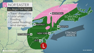
A developing coastal storm will bring a mix of rain and snow, along with strong winds to southern Quebec this weekend. Most of the precipitation should fall as rain in Montreal, but a messy mix may fall north and west of the city. (AccuWaether.com)
A developing nor'easter is forecast to move from coastal North Carolina towards southern New England on Saturday. The storm is forecast to strengthen while pushing moisture northward into southern Quebec by Saturday morning.  Temperature profiles suggest a mix of snow and rain here in the St. Lawrence Valley, with any accumulations confined to the higher elevations. A cold northeast wind is expected, gusting up to 50km/h, keeping the cold air in place in Montreal. At this time, the best chance for accumulating snow would lkely be overnight Saturday. The precipitation should last most of the weekend, with the potential for more than 25mm of rain and perhaps several centimetres of snow for some. The storm should lift northeast across New England on Sunday, with slowly improving conditions by late in the day.

Low pressure surprised many parts of northern New England, the Gaspe and New Brunswick, with the first major snowfall of the season on Wednesday. Over 30cm of snow fell on Mount Washington, New Hampshire, with 15 to 25cm falling in the Gaspe peninsula. (Maine Forest Rangers photo)
On Thursday, Montreal experienced a cold, breezy day, with the temperature only reaching 2C (36F). Partly cloudy skies along with diminishing winds, should allow the temperature to drop well below freezing in southern Quebec by Friday morning. A thick frost or freeze is likely. Friday will be the best day in the foreseeable future, with sunshine and high temperature near 6C (43F).


Monday, October 22, 2018

Active weather pattern expected for southern Quebec

The remains of hurricane Willa located in the Pacific Ocean, may eventually re-develop into a potent coastal storm along the eastern seaboard by the upcoming weekend. The potential exists for some locations to receive heavy amounts of rain or snow, along with very strong winds. (AccuWeather.com)
Many locations in southern Quebec and eastern Ontario reported the first snowflakes of the season on Sunday along with very cold temperatures. An unseasonably chilly air mass, combined with gusty winds, made it feel downright wintry at times to end the weekend. On Monday morning, I recorded the coldest temperature so far this fall, with -2C (28F) at my home on L'Ile Perrot. Some sunshine and light winds allowed the temperature to reach 6C (43) by the afternoon, but this is still well below the normal high of 11C (52F) for todays date. Clouds have since moved in, with showers expected tonight.

It is likely time to start thinking about getting those winter tires on. CAA Quebec recommends winter tires not only for snow, but also at temperatures colder than 7C (45F).
Potential winter storms
It may be time to consider putting on those winter tires, as the first measurable snow of the season may be in our immediate future. An unsettled and stormy weather pattern is expected to unfold across the eastern portion of North America over the next week. Cold air will remain in place across the region, along with a very active storm track. The first system is expected to move from the Great Lakes into Maine by Wednesday morning, accompanied by rain and snow. The snow may be heavy at times, especially over northern Maine, the Gaspe Peninsula and portions of New Brunswick. The snow may extend into the Eastern Townships of Quebec as well as northern Vermont.

The potential exists for an even stronger storm to impact the eastern seaboard, southern Quebec, Ontario and Atlantic Canada by the weekend. The storm is expected to develop from the remains of Willa, a powerful category 5 hurricane currently forecast to hit the Pacific coast of Mexico. The storm is forecast to move inland across Mexico and along the Gulf Coast this week. Some models have the system re-developing into a major Nor'Easter while moving up the east coast by Sunday. There are a ton of details to iron out, but it is worth noting that for some of us, we may see the first snow of the season. As always with Nor'easters, the proximity to the coast will in the end determine how much snow or rain Montreal receives, if any. 

Until then, expect showers and below normal temperatures for Tuesday and Wednesday, followed by fair but cold weather to end the work week. Temperatures will remain below normal in Montreal, with forecast daytime highs between 5 and 9C (41 to 49F) and overnight lows of -4 to 0C (25 to 32F). A killing frost is likely in Montreal on both Thursday and Friday morning.

Wednesday, October 17, 2018

The end of the growing season expected across Southern Quebec tonight

The sun breaks through the clouds in Montreal on Wednesday morning. The weather pattern has shifted in Canada, with much colder air now moving into the eastern portion of the country. After a very warm fall to date in Montreal, conditions will be turning more seasonable to end October, and even a little wintry at times. (ValleyWeather Photo)
A frost advisory is in effect for Southern Quebec tonight, including metro Montreal. A cold front crossed the region on Wednesday, to be followed by the coldest air mass of the season. Overnight lows across southern Quebec and eastern Ontario will drop into the 0C to -5C (23 to 32F) range. A hard freeze is expected in many locations, which should end the growing season for most of us. Gusty west winds up to 50km/h will make it feel even colder tonight and early Thursday. A few showers or flurries are possible into the late afternoon and evening hours. South of the border across the Adirondacks of New York and the Green Mountains of Vermont, an inch or two of snow is possible tonight. Some lake effect snow is also forecast for the snowbelt off Lake Huron tonight.

It took some time for fall to arrive in southern Quebec, but it certainly looks and feels like it now. (ValleyWeather Photo)
Thursday will be blustery and cold, with daytime high temperatures remaining below 5C (41F) in Montreal, and near the freezing point across the upper elevations of the Eastern Townships and Laurentians. Late in the day Thursday, clouds will thicken up in Montreal as a warm front approaches the region. A fews showers are possible into Friday morning, along with much milder temperatures. The high Friday will be 12C (54F). We will repeat the cycle this weekend as another cold front moves into Quebec. The last two weeks of October are looking unsettled and cold, with several opportunities for our first snowflakes of the season here in Montreal.

Thursday, October 11, 2018

Historic hurricane Michael slams Florida panhandle

Hurricane Michael made landfall near Mexico Beach, Florida on Wednesday afternoon. The powerful hurricane caused widespread catastrophic damage along the coast where landfall occurred. A peak wind gust of 130 mph was observed at Tyndall Air Force Base before the anemometer broke. At least two deaths have been blamed on the storm. Photo via Twitter @WVTM13
Hurricane Michael, the strongest October hurricane on record, rapidly moved inland near Mexico Beach, Florida at 1pm on Wednesday afternoon. The powerful storm was just a notch under a category 5 hurricane at landfall, with winds of 155 mph and a central pressure of 919 mb. Michael becomes the strongest October hurricane on record to hit the US since Hazel in 1954. Only one other storm was this strong at landfall in Florida, hurricane Andrew in 1992.

The results of the storm were devastating, with the only saving grace being how fast Michael raced through Florida. Michael is located 30 miles west of Augusta, Georgia Thursday morning, with 50mph winds. The hurricane leaves behind a heavily damaged Panama City Beach and Mexico Beach on the Florida Gulf Coast. Thousands of buildings were damaged or destroyed, with trees and power lines down everywhere. A storm surge of nearly 15 feet flooded most of Mexico Beach. Boats are strewn across coastal highways or submerged at there moorings. Power is out to over 700,000 customers in Florida, Georgia and South Carolina this morning.

Now tropical storm Michael is forecast to move across the Carolina's today and off the Virginia coast Friday. Strong winds, coastal flooding and 5 to 10 inches (125-250 mm) of rain are possible along the track of the storm. Michael is forecast to become a strong post-tropical storm as it moves across the coastal waters of Atlantic Canada over the weekend. At this time, most of the weather associated with the storm should remain offshore of the Maritimes.

Backdoor cold front for Montreal
In Montreal, Wednesday turned out to be a very odd weather day. The morning started off very warm and muggy, with a near-record high of 22C (72F). However a backdoor cold front, named for the "wrong" direction it moves in, from east to west, crossed the city by 9am. The front rapidly dropped the temperature in Montreal from 22 (72F) to 12C (54F) in less than one hour. The temperature remained there for the balance of the day, along with showers, gusty cold northeast winds and low clouds. Meanwhile just to our immediate south and west, temperatures soared into the upper 20s. This included a record high of 27.5C (82F) in Ottawa, smashing the old record of 23.9C (74F) set in 1955.

The summer-like weather will become history today, as a potent cold front moves across southern Quebec. Showers are forecast today, along with gusty northwest winds of 30 to 50km/h. The high temperature should reach 18C (65F) before cooling off late today. On Friday, expect clearing skies, windy conditions and a high near 11C (52F).  The weekend should be partly cloudy, but feeling like fall, with high temperatures near 12C (54F) and overnight lows near the freezing point in many locations.

Wednesday, October 10, 2018

Powerful hurricane Michael heads for Florida - record heat in Montreal

NOAA image of hurricane Michael early Wednesday morning. The powerful category 4 hurricane is located 140 miles south of Panama City, Florida.
Warm and humid air has dominated the last 24 hours across southern Ontario and Quebec, including a record high for Montreal. The 50 year old record fell Tuesday afternoon, as the temperature reached 26.8C (80F), crushing the 1958 record of 25C (77F). High humidity made is feel like the low 30s as tropical air surged northward. Conditions remained very mild and muggy overnight, with the low temperature our current reading of 20C (68F). A cold front will slowly sag south this morning, with scattered showers and thunderstorms expected today, along with slowly falling temperatures. Much cold air will arrive Thursday as as stronger cold front crosses the St. Lawrence Valley.

Hurricane Michael
Powerful hurricane Michael is heading for the Florida panhandle this morning. The category 4 hurricane, with winds of 140mph (220km/h), is expected to make landfall near Panama City Beach, Florida by midday Wednesday. Millions of residents have been ordered to evacuate the coast in advance of the storm. Even in a state with a rich hurricane history such as Florida, this storm is historic. No category 4 hurricane has ever hit the Florida panhandle. Michael is located 140 miles south of Panama City early Wednesday morning, moving north at 13mph (20km/h). Widespread warnings are in effect across the Florida Gulf Coast and northward into Georgia and the Carolina's. Heavy rain, strong winds and a catastrophic storm surge in excess of 13 feet are expected along the coast where the center makes landfall. Flooding rains of up to 8 inches are forecast along the path of Michael. Scattered tornadoes are also expected as the storm moves inland. Widespread damage and power outages are anticipated in the Florida panhandle and adjacent Georgia.

Michael is expected to race northeast across the southeast US through Thursday and eventually into the Atlantic Ocean near Virginia Beach. At this time the storm is forecast to brush southern New England this weekend but remain offshore of Atlantic Canada.

Monday, October 08, 2018

Record warmth possible in Montreal on Tuesday

Just when you thought it was safe to go back into the water, here comes hurricane Michael. The storm is forecast to become a strong hurricane as it approaches the Florida coast on Wednesday. While some rain is expected from Michael late this week in southern Quebec, the bulk of the system should remain well to our south. (NHC)
We have a very active weather week ahead for southern Quebec as an epic battle of the seasons gets underway. Low pressure over the central portion of the country, remains the dividing line between unseasonable cold in the west and building warmth in the east. Temperatures are well below freezing in Alberta and Saskatchewan on Thanksgiving morning, with snow falling in many locations.

Meanwhile a strong warm front is expected to lift across southern Ontario and Quebec later today and tonight, with warm and humid air surging into the region. On Tuesday, depending how much sunshine we get, the temperature may reach record levels in Montreal. The record for October 9 is 25C (77F) set in 1958. The forecast high on Tuesday is 26C (79F).  As the warm front moves north today, it will encounter a gusty northeast wind and stubborn cold air at the surface here in southern Quebec. This may slow the warming trend a little, and also deliver some showers and perhaps scattered thunderstorm into Tuesday. The warm air will be with us for at least 48 hours before a strong cold front arrives on Thursday.

Tropical Storm Michael
Complicating the forecast a touch will be the remains of soon-to-be hurricane Michael. Tropical storm Micheal is located about 115km south of the western tip of Cuba early Monday morning, with 110km/h (70 mph) winds. The storm is forecast to become a hurricane today, and approach the Florida panhandle on Wednesday. Micheal is expected to strengthen into as strong hurricane and could produce major impacts along the Florida gulf coast. Once inland, forecasters expect the storm to move into the water-logged Carolina's before approaching southern New England late in the week. Michael will likely send a surge of moisture into the cold front the is expected in southern Quebec on Thursday. We could be looking at very heavy rain and thunderstorms in Montreal. By Friday. much colder air will return to Montreal along with clearing skies and the risk of frost into the weekend.

So keep the shorts, winter coats and umbrellas handy, and prepare yourself for wild, changeable weather this week in the St. Lawrence Valley.

Thursday, October 04, 2018

First frost in Montreal followed by a return to warmer weather

A record breaking 38cm of snow fell on Calgary this week, with as much as 60cm near Kananaskis. It was the largest October snowfall in 124 years of record keeping for the city. (CTV News)
The temperature in Montreal is set to fall rapidly late this afternoon and evening as a cold front has cleared southern Quebec. The mercury soared to 24.4C (76F) in Montreal Thursday afternoon, the warmest in the country, but expect it to fall just as quickly after sunset tonight. The wind will soon back to the northwest and gust to 50km/h this evening, ushering in the colder air.

Environment Canada has issued frost advisories across eastern Ontario and southern Quebec, with many areas expecting there first sub-zero temperatures of the season. The majority of the frost is expected away from metro regions and bodies of water. Friday will be sunny, crisp and cool, with a daytime high near 12C (54F). On the weekend, we can expect a repeat of the recent cycle of weather events, with sunny skies and warmer temperatures Saturday, followed by rainy, mild weather Sunday and Thanksgiving Monday. High temperatures will be 14C (56F) Saturday, but into the high teens and low 20s Sunday and next week.

More snow west, warmth east
The central part of the country is expected to become the battle line between winter conditions in the west, and warmer, summery weather in the east. Calgary measured 32.8cm of snow on October 2, the snowiest October day dating back to 1884. The previous record of 29.7cm was set on October 4, 1914, The unprecedented storm closed highways, delayed flights at airports and caused hundreds of accidents. Calgary has received help clearing the snow from Red Dear and Edmonton. Lighter snow stretched east into Saskatchewan and Manitoba. Northwest Ontario was the dividing line, with heavy rain and strong winds occurring there. The early onset of winter is expected to continue next week, with more cold weather and snow expected from Alberta to Manitoba. Another powerful storm is forecast to develop early next week in the southern Rockies, potentially spreading blizzard conditions into the northern plains and southern Prairies.

East of the storm track across southern Ontario and Quebec, more windy and warm weather is expected. Beyond next week, cooler weather may return to eastern Canada for the balance of October. While it will not be as cold as in western Canada, the temperature should return closer to normal values by late next week, or even slightly below. The normal high/low for Montreal this week should be 15C (59F) and 5C (41F) respectively.

Tuesday, October 02, 2018

Has fall finally arrived in eastern Canada?

A panda enjoys the record breaking October snowstorm at the Calgary Zoo Tuesday afternoon. (Photo Calgary Zoo).
On cue, October has started off cool and rainy across southern Quebec. Close to 10mm of rain has fallen in Montreal since late Monday. The temperature has remained rather chilly, with low clouds and east winds, reaching only 11C (52F) Tuesday afternoon. Drizzle and clouds are expected to persist into early Wednesday, before sunshine returns. A brief warming trend is expected Thursday, with the high temperature near 23C (73F). Another potent cold front will bring showers and thunderstorms late in the day, with cool and dry weather expected to return by Friday.

October in Montreal is expected to start off slightly warmer than normal, before colder air arrives during the second half of the month. The St. Lawrence Valley will act as the dividing line between the seasons, with several strong low pressure systems providing our region with rainy, windy weather. (AccuWeather)
The cool weather comes as quite a shock to the system after the unseasonable warm and humid September we experienced. September continued the trend established this summer, with two pronounced heat waves in Montreal, resulting in an average high of 17.6C, 2 degrees above normal. Trudeau Airport officially recorded two more days at or above 30C (86F), bringing the yearly total to 19. I can say with some certainty that this is where it will remain for the year.

Record Alberta Snow
Very cold weather over western Canada has resulted in several rounds of frost, freezing temperatures and even heavy snow. Some of that cold is eventually expected to make it into eastern Canada for the second half of October. Until then, southern Quebec and Ontario will remain on the boundary between very warm and humid weather along the southeast US coast, and the aforementioned western cold.

The cold weather in Alberta produced record snowfall on Tuesday afternoon. Temperatures struggled to make it to the freezing point, along with 25 to 40cm of heavy wet snow. Calgary International Airport reported 20cm of fresh snow as of 11am this morning, with 40cm at Kananaskis. Snowfall warnings remain in effect, with travel not recommended west of Calgary into the foothills.

Tuesday, September 25, 2018

Another round of thunderstorms expected in Ontario & Quebec

I am back to reality after spending the last week on vacation in coastal North Carolina, a trip that was planned long before hurricane Florence. The Outer Banks fared well, there was standing water and sand on roadways, along with some beach erosion, but nothing compared to the historic flooding that continues in the rest of the state and into South Carolina.

Catastrophic damage in Dunrobin, Ontario after the EF-3 tornado last Friday, September 21. (CBC)
EF-3 Ottawa Valley Tornado
While I was away, summer ended and fall started with powerful thunderstorms in the Ottawa Valley. A strong cold front generated tornado producing thunderstorms late Friday afternoon. Environment Canada has confirmed three tornadoes with this extremely rare September outbreak. The strongest was a high end EF-3 tornado that produced wind speeds up to 265km/h. The tornado developed at 4:40pm near Dunrobin, Ontario, and moved east into Gatineau, Quebec. Damage was extensive, with nearly 50 homes destroyed in Dunrobin and over 200 buildings damaged or destroyed in neighboring Gatineau. Cars were flipped over and power poles were snapped like toothpicks, with thousands of trees toppled. An EF-2 tornado affected portions of Ottawa near Arlington Woods, with winds of 220km/h. A third EF-1 tornado, with winds of 175km/h hit the region near Calabogie and White Lake. The cleanup continues in earnest Tuesday, with officials worried about the new threat for rain and thunderstorms.

The outbreak produced at least 30 injuries, 5 of those critical. Power was out to over 250,000 residents in Ontario and Quebec after the storms late Friday. As of Tuesday morning, as many as 10,000 still remain without electricity. The City of Ottawa closed schools on Monday, and asked government employees to work from home, in an effort to relieve pressure on the cities infrastructure. On average, Canada records 60 to 80 tornadoes each year, but EF-3 and EF-4 storms are extremely rare in this country. Only one EF-5 tornado has occurred in Canada, at Elie, Manitoba on June 22, 2007, with winds of 420km/h.

Additional damage occurred from a second tornado near the Arlington Woods suburb of Ottawa (Edith Lalonde).
More strong thunderstorms
Low pressure over the Great Lakes, is forecast to move down the St. Lawrence Valley over the next 24 hours. Rainy, windy and cool weather is expected on Tuesday, as a warm front crosses the region. As much as 25-50 mm of rain may fall in Ottawa and Montreal. On Wednesday, a strong cold front associated with the low will sweep across the region in the afternoon, accompanied by showers and thunderstorms. Some of the storms may be strong, with heavy rain and gusty winds. At this time, it does not look like a repeat of the severe weather from last Friday, but we will need to see how unstable the air mass becomes Wednesday. Conditions will be warmer and more humid on Wednesday, with a high near 21C (70F) forecast for Montreal. Cooler weather returns Thursday into the upcoming weekend.

The calm after the storm on Hatteras Island, North Carolina. (ValleyWeather Photo)

Friday, September 14, 2018

Hurricane Florence inundates coastal North Carolina

First responders patrol the streets of New Bern, North Carolina on Friday morning, after the storm surge from Florence lefts as much as 10 feet of water in the community. (Global)
The center of hurricane Florence barely reached land Friday morning, slowly crossing the coast near Wrightsville Beach, North Carolina at around 6am. The once category 4 hurricane had 90mph winds at landfall, with numerous reports of gusts exceeding 100mph. The big story with Florence so far has been the tremendous amount of water that has accompanied the storm inland. The coast was inundated with a 6 to 10 foot storm surge along with battering waves. Widespread damage was reported to homes and infrastructure, especially in and around Wilmington. Power is out to over 600,000 residents in southeast North Carolina. Power lines and trees were down, with sand and water blocking many coastal roads. At 2pm Florence had 75mph winds and was located 35miles west southwest of Wilmington.

The Atlantic Ocean pours across North Carolina Highway 12 near the Village of Hatteras on the Outer Banks, during hurricane Florence midday Wednesday. (NCDOT Photo)
Torrential rain continues to fall across the coastal plain, with over 600mm reported in Atlantic Beach in the last 24 hours. The heavy rain is forecast to continue as Florence crawls along the coast at 5mph (7km/h). Forecasters estimate as much as 1000mm (40 inches) of rain could fall across the extreme southeast portion of North Carolina and adjacent South Carolina. There is a real concern for fresh water flooding lasting weeks as all that rain makes it into the rivers and streams.

The storm surge on Pamlico Sound, pushed the Neuse River over it banks Thursday night flooding New Bern under several feet of water. First Responders were forced to carry out nearly 200 rescues, with hundreds more trapped in their cars and homes. They were assisted by the Cajun Navy, a group of volunteers with private boats who assist in water rescues. The Cajun Navy were made famous after their selfless work in New Orleans after hurricane Katrina in 2005.

Florence is forecast to weaken while slowly drifting into South Carolina by Saturday. The forecast has the remains of Florence moving northward across the Appalachians and towards New York State by mid-week. Eastern Ontario and southern Quebec could possibly see strong winds and heavy rain from Florence by Wednesday. We will have to watch the system closely.

Thursday, September 13, 2018

Unseasonable warmth, snow and hurricane Florence

An infra-red satellite image of hurricane Florence approaching the North Carolina coast early Thursday, September 13. (Tropical Tidbits)
It must be September. The weather has turned wild across parts of North America, as the seasons begin to do battle. While Montreal remains warm and humid, cold air has filtered into western Canada, with the first snowflakes of the season across northern Alberta and B.C. At the same time, no less than 5 tropical systems are in the Atlantic basin, including powerful hurricane Florence.

I will start here in Montreal, where high pressure will dominate our weather into the weekend. Sunshine will prevail, with very warm daytime highs of 27 to 29C (80 to 85F). We have a shot at some record highs late this week, especially Saturday, (29.4C, set in 1947, and Sunday, 26.9C, set in 1991). Our next threat for rainfall may actually come from the remains of Florence by next Tuesday. Plenty of weather has to happen before that scenario plays out.

Hurricane Florence
Hurricane Florence remains a formidable storm Thursday morning, despite some signs of weakening. The category 2 storm is located 325 km southeast of Wilmington, North Carolina at 5am, moving northwest at 24 km/h. Wind shear and dry air on the southern flank of the hurricane, has brought wind speeds down to 110 mph (175km/h), but Florence remains a very dangerous storm. Landfall is expected later today near Cape Fear, North Carolina, along with a surge of ocean water 6 to 13 feet high. The storm is expected to meander just off the coast of the Carolinas for as much as 36 hours while slowly drifting southwest. Forecasters expect a catastrophic amount of rainfall, perhaps in excess of 30 inches (750 mm). Widespread flooding is expected well inland. Georgia has been added to the list of regions under a state of emergency, which include Maryland, Virginia, North and South Carolina. While millions have evacuated, many remain behind, with the window of opportunity closing. Winds and seas are rapidly increasing this morning, with the outer bands of Florence already reaching the coast.

A beautiful but somewhat disturbing photo of summer snow taken Wednesday, September 12, in Fort St John, B.C. (Paula MacGregor)
Snow!
Finally, winter has returned to parts of Alberta and B.C., with up to 15cm of snow falling in several locations such as Slave Lake and Fort St. John. The unseasonably cold air mass has dropped temperatures below freezing this morning, including -2C (29F) in Edmonton. They can have it, I will take our hot, humid fall anytime over an early winter. We still have one week left to summer 2018.

Tuesday, September 11, 2018

Warm weather returns to Montreal - hurricane Florence expected to strengthen


Astronaut Ricky Arnold, from aboard the International Space Station, shared this image of Hurricane Florence on Sept. 10, taken as the orbiting laboratory flew over the massive storm. Tweeting from @astro_ricky, he said "Hurricane #Florence this morning as seen from @Space_Station. A few moments later, Isaac and the outer bands of Helene were also visible." (NASA Image)
Strong high pressure will build back into Montreal this week, after the passage of post topical storm Gordon Monday night. I measured just under 25mm of rain on L'Ile Perrot. The rain came to an end on Tuesday, but skies have been slow to clear. Look for sunshine to return by Wednesday afternoon, along with much warmer temperatures. By the end of the week, we may be looking at record warmth returning, with forecast highs from 27C to 29C (80 to 85F). The normal high for mid-September in Montreal is 20C (68F).

Hurricane Florence
The same high pressure that will provide southern Quebec and Ontario with ideal late summer weather, is also responsible for steering hurricane Florence into the Carolinas. At 2pm Tuesday afternoon, Florence was located 845 miles (1360km) southeast of Cape Fear, North Carolina. The storm was moving northwest at 17mph (28km/h), and was showing signs of strengthening, with category 4 winds of 130mph (215km/h). A hurricane watch is in effect for the North and South Carolina coast.

I am very familiar with the Outer Banks of North Carolina, having vacationed there since 1991. The 200 mile long chain of barrier islands is beyond beautiful, but also very fragile. The region is no stranger to hurricanes and powerful ocean storms, but Florence has many concerned. Hatteras Island, my location of choice, was the first to be evacuated, starting at 12pm on Monday. Evacuations have since been expanded to cover the region from coastal Maryland south into South Carolina. Millions of residents and tourists are heading inland today.

Florence is taking an unusual path westward towards the coastline, being blocked by the aforementioned strong high pressure centered north of Bermuda. Typically storms at this latitude move northeast out to sea. Florence is expected to approach the coast in the watch area by late Thursday, and then meander around coastal North Carolina through the upcoming weekend. A storm of this magnitude is capable of catastrophic damage. A storm surge of ocean water from 6 to 12 feet is possible as the center of Florence makes landfall. As much as 10 to 20 inches (250-500mm) of rain is forecast from the Carolinas into Virginia as the storm stalls inland. Significant coastal flooding and inland fresh water and river flooding is likely.