Sunday, January 31, 2021

East coast storm to deliver snow to southern Quebec

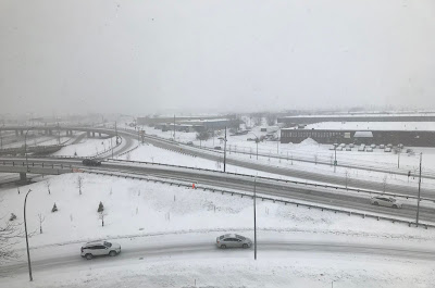
A strong winter storm will produce heavy snow and strong winds across the eastern seaboard on Monday and Tuesday. The snow will arrive in Montreal in the wee hours Tuesday morning, with 10-15cm forecast at this time.

It was a bitterly cold weekend across southern Quebec. Temperatures struggled to rise into the middle minus teens for daytime highs, while dropping into the minus 20s for overnight lows. Sunshine on Sunday eased the chill, but it was still the coldest morning of the winter for most. Morning lows across metro Montreal Sunday were between -21C and -23C. I recorded -23C (-9F) here on Ile Perrot. It was colder off-island, with Vaudreuil at -24C (-11F), Sherbrooke -29C (-20F) and Mont Tremblant -30C (-22F). Monday morning will not be as cold for most, but it will still drop close to -20C. Conditions will improve on Monday, under fair skies, with daytime highs near -8C (18F).

Our attention then turns to a rather complicated storm system that is delivering heavy snow from the midwestern US towards the east coast late Sunday. On Monday low pressure is expected to redevelop off the Delaware coast and move northeast towards Maine while strengthening. The storm will push a shield of moisture north and west of the track across New England and the Northeastern US on Monday and eventually into southern Quebec early Tuesday. Blizzard conditions are possible from New York and Boston into parts of the Maritimes.

At this time, we will remain on the northwest edge of the storm, with 10 to 15cm of snow likely for Montreal, less northwest of the city and more south towards the US border. In the border locations as well as the Eastern Townships, between 15 and 30cm of snow is possible. Warnings may be needed for a portion of our regions. Accompanying the snow will be gusty northeast winds in the St. Lawrence Valley, between 30-50km/h, producing blowing snow at times. More snow is expected on Wednesday, especially from Quebec City towards the Gaspe region. The good news is that temperatures will warm during the snow, up towards -2C (29F) on Tuesday and Wednesday.

The storm will pull into Atlantic Canada on Wednesday with snow tapering to flurries. Expect a fair day Thursday before another storm system arrive for Friday into next weekend.

Thursday, January 28, 2021

Coldest weather of the winter forecast for Montreal

Expect ice fog and mist to form off the St. Lawrence River Friday though Sunday mornings, as the coldest temperatures of the winter thus far move into Montreal. Low temperatures this weekend will be near -20C for Montreal and into the middle -20s in many parts of Quebec and Ontario.

The coldest temperatures so far this winter are anticipated tonight through Sunday morning across southern Quebec, Ontario and New England. Montreal along with parts of eastern Ontario received a surprise 5 to 10cm of snow Tuesday evening in a little less than 6 hours. The snow was part of a weakening low pressure system that was expected to remain well south of the region. Instead the snow moved along the St. Lawrence Valley, with the heaviest falling in the southern suburbs of Montreal as well as off-island locations towards Ontario and New York. Other parts of Montreal including Laval, received less than 5cm. I measured a good 10cm on Ile Perrot.

After a rather mild high of -1.7C (29F) on Wednesday, temperatures have been dropping all day Thursday in Montreal. The high Thursday was -5.4C (22F) reached shortly after midnight. As I write this entry, the mercury is down to -9C (16F). In addition to the colder temperature, winds have been increasing all day and are gusting between 20-40km/h, producing windchill values in the minus teens. Those windchills will continue to drop into the minus 20's through Friday. Overnight lows tonight will be near -18C (0F) and struggle to reach -10C (14F) on Friday. Both Friday and Saturday night will likely be the coldest this winter, down to -20C (-4F) in the city, much colder in the suburbs.

The good news is that winds will ease heading into the weekend. As the arctic air pours into the region tonight, there is a good chance for flurries, with perhaps a centimetre or two locally. Expect cloud cover to persist through Friday, along with blustery, cold conditions and isolated flurries. The sun is expected to return by Saturday.

Temperatures will moderate early next week, with perhaps some flurries by Tuesday as a winter storm moves along the Atlantic coast. As this time the bulk of the snow should remain south of Montreal, but the system will need to be watched.

Friday, January 22, 2021

Extended period of clear cold weather forecast for Montreal

Between 5 and 10cm of fresh snow fell on southern Quebec Thursday, bringing our monthly total in Montreal to a somewhat respectable 48cm. With the cold weather of late, most of what has fallen this month, remains on the ground.

A weak area of low pressure accompanied by an arctic frontal boundary delivered 5 to 10cm of fluffy light snow to southern Quebec over the last 24 hours. The snow caused the usual rash of accidents on area highways. A few more flurries or snow showers are likely Friday before drier air moves into the region. Some of the flurries may be heavy at times today, especially south of Montreal. Keep this in mind if you are out on the road.

Some of the coldest air so far this winter will settle south across the Great Lakes and into southern Quebec, Ontario, New York and New England over the next 48 hours. (AccuWeather.com)

High pressure will begin to move in late today and on Saturday with partly cloudy skies expected, brisk winds and cold temperatures. The high in Montreal will be reached early today, before temperatures begin to drop off into the overnight hours. Lows tonight will be down to -10C (14F) and won't budge at all on Saturday. Skies will be partly cloudy Saturday, it will be breezy and cold with steady or slowly falling temperatures down to -18C (0F) for the low into Sunday morning. Sunday will be fair and cold with daytime highs of -10C (14F).

Briefly looking ahead to next week, it appears high pressure will remain in control of our weather deflecting what would have been a decent snowstorm to our south across Pennsylvania and the middle Atlantic. No active weather is expected before next Friday at the earliest.

Saturday, January 16, 2021

Significant winter storm impacting southern Quebec

Heavy wet snow has been falling in Montreal all day, with a good 15cm on the ground and another 5 to 10cm expected by Sunday morning.

Snowfall Warning in effect for Montreal.

Over 42,000 without power in Quebec.

The biggest snowstorm of the season continues to impact southwestern Quebec and eastern Ontario Saturday afternoon. Heavy wet snow has been falling over the Montreal region for the last several hours, with visibility under 1 km at times. Between 12 and 20cm of fresh snow has already fallen, with another 5 to 10cm likely before the precipitation tapers off overnight. Low pressure over southern New England is forecast to lift northeast into New Brunswick over the next 24 hours. The heaviest of the snow should taper off shortly, but light snow will continue well into the evening hours in Montreal.

Conditions were poor across eastern Ontario as well, with heavy snow falling along the 401 corridor from Cornwall to the Quebec border. (OPP East Region)

Roads are in poor shape, with compacted wet snow and reduced visibility. The SQ is advising you to travel only if necessary today, especially on off-island highways. Numerous accidents have been reported. The weight of the snow has brought down several tree branches and power lines, with Hydro-Quebec reporting just over 42,000 Quebec homes and businesses in the dark.

Temperatures have been steady near 0C (32F) all morning, and should remain there into the evening. Winds have been fairly light under 30km/h but are expected to increase later today, up to 50km/h at times. Sunday will be cloudy with flurries and gusty northwest winds. Temperatures will begin to drop in the afternoon, with lows by Monday morning down to -6C (21F).

Friday, January 15, 2021

Significant snowfall for parts of southern Quebec

A snowfall warning has been issued for southern Quebec and Eastern Ontario for 15 to 25cm of wet snow from late Friday evening into Saturday. Rain will mix in at times across the south shore and the Eastern Townships.

Snowfall Warning in effect for Montreal, Ottawa and Cornwall

Winter Storm Warning for Quebec City

The weather has been rather quiet of late, misty and mild, with dreary sky conditions and light winds. That is about to change as a potent upper level low spins into New York state tonight followed by a second area of low pressure expected to develop along the middle Atlantic coast. Both storms will provide enough energy to produce heavy wet snow from Montreal north and west into the Ottawa Valley.

Precipitation will begin late this evening in Montreal and become heavy at times on Saturday. The dividing line between snow and rain will be very close to Montreal. I expect 15cm of snow for Montreal, with up to 25cm north and west of the city and less south and east. Rain should mix in across the Eastern Townships, with the risk of pockets of freezing rain on the South Shore. Snow amounts east of the city will be in the 10-15cm range. Accompanying the snow will be gusty winds of 20-40km/h with gusts to 70km/h possible late Saturday and Sunday, especially east of Montreal.

Temperatures will be very close to the freezing point in Montreal on Saturday, so the snow will be wet and heavy. The weight of the snow combined with gusty winds may lead to some isolated power outages. The snow will be difficult to clear, so keep this in mind when shovelling out.

The snow will taper off to flurries late Saturday and persist into Sunday along with blustery conditions. Colder temperatures are expected to return by late Sunday and remain throughout next week.

A used Christmas tree was snagged by high tension wires in southern Saskatchewan, after hurricane-force winds blew through the region late Wednesday.
(SaskPower Photo)

Prairie Wind Storm

The same upper level low set to impact southern Quebec, produced a wicked windstorm across the southern Prairies. Nine all-time wind records were established in Alberta, including 145km/h (90mph) at Taber. In southern Saskatchewan, speeds reached a record-breaking 143km/h (88mph) at Bratts Lake, with 126km/h (78mph) at Regina. The winds, combined with a few centimetres of fresh snow, produced blizzard conditions late Wednesday. Dozens of highways in southern Saskatchewan were closed, with hundreds of motorists spending the night trapped in their vehicles. The wind also produced widespread power outages and structural damage to many homes and businesses. Some regions still remain in the dark and cold Friday morning.

Wednesday, January 13, 2021

Active, colder weather returns to southern Quebec by the weekend

This week has been rather quiet, as has most of the winter, but a weak pulse of energy dropped a surprise 5cm or so of snow on southwestern portions of metro Montreal late Monday evening. I measured just over 5cm on Ile Perrot (above) Tuesday morning. More snow is expected this weekend, with much colder temperatures returning early next week. (ValleyWeather Photo)

The weather remains rather quiet and dismal across southern Quebec on Wednesday, with just a couple of weak systems impacting the region. The result has been plenty of cloud cover, some light precipitation at times in the form of drizzle or flurries, and little range in temperature. Temperatures remain well above normal for January, 1C for highs and -3C for lows. This trend will persist for a couple of more days, with changes arriving by the weekend.

An upper level low will move into the Great Lakes on Friday, pushing a frontal boundary towards southern Quebec. Precipitation is forecast to ramp up late Friday and persist into Saturday. A second area of low pressure is forecast to develop along the eastern seaboard, and move northeast towards Maine by Sunday. The combination of these weather systems will deliver precipitation across the region. 

At this time, it may be marginally cold enough for wet snow in many parts of southern Quebec and eastern Ontario on Saturday. Precipitation will likely start as a rain/snow mix before changing over to snow in the afternoon and persisting into Saturday evening. It is early to predict amounts, but this looks like a 5 to 15cm snowfall for most, with the lower amounts in and around metro Montreal.

Much colder air is expected by Sunday, with a return to more normal temperatures next week. Daytime highs will drop into the -7C range with overnight lows in the minus teens. It has been such a mild winter to date, that this will feel downright frigid, especially with gusty northwest winds behind the weekend storm system.

I will post more precise details as the event draws closer, but plan on messy road conditions this weekend.

Friday, January 08, 2021

Long stretch of quiet weather ahead for southern Quebec

Crews plow away the 12.4cm of snow in Notre-Dame-de-L'Ile Perrot last Saturday. The relatively warm winter to date has meant very little snow across the Montreal region. Only 29cm fell in December, with 65cm for the entire season to date. (ValleyWeather Photo)

Strong high pressure over our region is being blocked from any eastward movement by an upper level low northeast of Atlantic Canada. This is forcing all the weather systems to slow to a crawl, and pushing any storms well south of our region across the southern US. So what you see is what you get for at least another week. Skies will be partly sunny all weekend, with seasonably mild temperatures. Highs will be between -1C and -5C, with lows between -6C and -10C. There may be a few scattered flurries around early next week, but no significant precipitation is in our future.

The snow drought continues in January. We managed 12.4cm last Friday and Saturday, but only a trace since, with no snow expected for the week ahead. Believe it or not, last weekends storm was the biggest snowfall this season, which is not saying much.

Before the winter of 20/21 started, it really looked like we were going to have a typical La Nina winter. La Nina, the cooling of ocean water in the equatorial region of the Pacific, usually means a mild but snowy winter for most of eastern Canada, with very cold conditions across the west.  Instead, the majority of the country has been very mild, with only sporadic snowfall.

Here in southern Quebec, we just completed one of the warmest December's in recent memory. The average temperature in Montreal was -2.1C (28.2F), 3.3 degrees above normal. Other parts of the province were even warmer, between 3.5C and 5.5C above the long-term average. In addition to the warm weather, we only managed a paltry 29cm of snow in Montreal in December. The normal is 49cm. The green Christmas in Montreal was our 5th in the last 7 years. Between 40 and 110mm of rain fell over Christmas Eve and Christmas Day across most of southern and eastern Quebec, with flooding observed in many parts of the province.

Friday, January 01, 2021

Snowfall Warning issued for Montreal

 A snowfall warning is now in effect for metro Montreal and all of southern Quebec. Snow will arrive late this evening and taper off to flurries by noon Saturday. Expect close to 15cm in Montreal. The snow may mix with sleet or freezing rain near the US border. Conditions will improve late in the day Saturday. Travel with extreme caution tonight and Saturday as roads will be snow covered and visibility greatly reduced.