Monday, July 26, 2021

Another smokey forecast for Montreal

The sun filtered through smoke from western wildfires over Ile Perrot on Sunday afternoon. Smog warnings are in effect for Monday, but conditions should improve by Tuesday. (ValleyWeather)

Very poor air quality will greet you as you head out the door on Monday morning. The smoke is drifting southeast for wildfires in northwest Ontario and Manitoba. The Air Quality Index (AQI) is in the moderate range already in Montreal, with Cornwall, Ontario unhealthy with and AQI of 154 at 6AM. The smoke will be most dense through the middle portion of the day before a cold front arrives late afternoon. Smog warnings are in effect for the southwestern portion of Quebec, with Air Quality Advisories for eastern Ontario.

An area of dense forest fire smoke is expected to produce very poor air quality over Ontario and southern Quebec on Monday. (FireSmoke.ca)

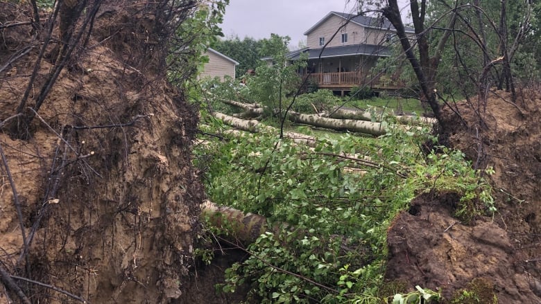
On Sunday, several rounds of thunderstorms produced a vivid lightning display to our southwest in the late evening, but little else in Montreal. Earlier in the day the warm front dropped 10-15mm of rain across southern Quebec. 

Today's frontal boundary will likely produce more scattered showers and thunderstorms, before cooler air arrives for Tuesday. The smoke will also be forced southeast of Montreal, with much better air quality expected on Tuesday.

Temperatures have been cooler than normal this month, and that trend will persist. We have only had one day at Trudeau Airport over 30C this month, rare for July, especially in 2021 when so much of the country is sweltering. The high on Tuesday will only be 21C (70F), well-below the normal high 26C (79F). The balance of the week look similar, with highs ranging from 21 to 24C (70 to 75F) and low temperatures close to 16C (60F).

Thursday, July 22, 2021

Quiet weather to end the week in Montreal

There were dozens of reports of trees down across eastern Ontario and extreme southern Quebec from strong thunderstorms Tuesday afternoon. (CBC Photo)

After a few days of rather strong thunderstorm activity and poor air quality, the weather will calm down as we end the work week. High pressure is trying to clear the skies in Montreal Thursday afternoon, but a few high cirrus and fair weather cumulus clouds still prevail. Skies should clear out this evening followed by mainly sunshine for both Friday and Saturday. Temperatures will be close to normal values for late July, with highs of 26 to 28C (79 to 83F), and overnight lows around 18C (65F).

A series of disturbances will arrive by Sunday, along with an increase in humidity and the risk of showers and thunderstorms. Some of the storms may be on the strong side late Sunday in the St. Lawrence Valley. The weather will be warm and muggy Sunday, with a high near 27C (81F).

The week so far has been rather active across the country once again. Fires continue to char interior portions of British Columbia as temperatures remain very hot, with little precipitation. A state of emergency in in effect in B.C. Firefighters from Quebec are on the ground and in the air in B.C., as hundreds of fires burn.

The heat has spilled into Alberta and Saskatchewan as well. Meanwhile in Ontario and Quebec, the week started with dense smoke and haze from those western wildfires. The air quality was extremely poor. That came to an end for the time-being on Tuesday afternoon, as a potent cold front pushed the toxic air south into the the northeastern US.

Lightning sparked an intense fire that destroyed two homes in the Fabreville section of Laval Tuesday afternoon. (CTV News/Francis Ethier)

Lightning sparks Laval house fire

That aforementioned cold front produced lines of strong thunderstorms Tuesday afternoon. There were numerous reports of hail and wind damage from eastern Ontario into southern Quebec, northern New York and New England. Numerous trees were blown down along with some structural damage, especially south of Montreal along the US border. 

In the Fabreville district of Laval, north of Montreal, lightning stuck a Hydro pole around 6:15pm igniting a fire that spread to several homes. Two homes were completely destroyed, with damage estimates at over one million dollars. It took 50 Laval firefighters more than two hours to bring the blaze under control. Heavy rain also fell with the thunderstorms, with 26mm falling on Ile Perrot in less than an hour. Thankfully no injuries were reported from any of the storms in Ontario or Quebec.

More isolated storms occurred Wednesday afternoon, with torrential rain and small hail reported, once again from Laval through the central portion of the Island of Montreal. No damage was reported.

Tuesday, July 20, 2021

Gusty thunderstorms should sweep away the smoke & haze

Smoke and haze from hundreds of western wildfires is obscuring the skies from Ontario into southern Quebec and across the Great Lakes and New England. The smog, haze and smoke has lowered air quality across a wide area. The smoke has also resulted in spectacular sunsets and a reddish/ orange moon last evening over eastern Ontario and southern Quebec. Photo: Gary Bussiere
 If you thought the sky was odd looking the last few days, you would be right. Smoke from over 800 wildfires burning across western Canada, has produced blood red moons and spectacular sunsets across eastern North America. The smoke has also diminished air quality, resulting in advisories and smog warnings for a large portion of Ontario and Quebec including metro Montreal and Ottawa. Not only is the smoke limiting visibility and blocking out the sun, it has made breathing a challenge for many. Smog can impact asthmatic children and people with respiratory ailments or heart disease. Those who suffer are being 

The smoke, haze and smog should lift later this evening after the passage of a potent cold front from Ontario. The front is already producing thunderstorms across Ontario early this afternoon, and they will spread south and east into Quebec later today. A few may be strong, with gusty winds, hail and heavy rainfall. 

Conditions have been warm and humid as well, with a few scattered storms rumbling about on Monday, but very little rainfall in Montreal. This afternoons storms will be a little more widespread, with showers persisting into the overnight. Wednesday is expected to remain cloudy in the St. Lawrence Valley, along with showers, and much cooler. Daytime highs will be in the lows 20s. The smoke and haze should dissipate as well for at least the short-term period.

Friday, July 16, 2021

Strong tornado injures 9 in Barrie, Ontario

Barrie, Ontario OPP describe the damage as catastrophic in one neighbourhood after an EF-2 tornado with 210km/h winds touched down Thursday afternoon.
(Anthony Farnell/Global)

In what seems to be a rather common theme in Canada this summer, another strong EF-2 tornado, with estimated winds of 210km/h, slashed across the southern part of Barrie, Ontario Thursday afternoon. The tornado touched down around 2:30pm in the Mapleview Drive neighbourhood, travelling nearly 5km and cutting a swath of major to catastrophic damage 100 metres wide. 

The damage was similar to what was observed in Mascouche, Quebec last month. Roofs were torn from homes, cars overturned, trees and power poles flattened and in two instances, homes were removed completely from their foundations. Barrie Simcoe Police and EMS reported 9 injuries, 4 of those of serious nature. Crews arrived immediately to begin debris removal and reconnect power. At the height of the storm over 4000 were without power in the region.

Residents of Barrie, Ontario are no strangers to tornadoes. On May 31, 1985, an EF-4 storm with 330km/h winds tore through the community killing 8. It remains one of the deadliest tornadoes in Canadian history.

The storms greatly diminished in intensity before arriving in southern Quebec overnight, with only scattered rain and gusty winds. A wind gust to 71km/h was reported at Trudeau Airport at midnight with the passage of one storm cell. Eastern Canada has been warm and humid this week, making the atmosphere ripe for strong storms. More thunderstorms are forecast today across eastern Quebec into Atlantic Canada.

Night becomes day on Ile Perrot early Tuesday morning as strong thunderstorms swept across southern Quebec. Vidivd lightning illuminated the sky across the island of Montreal through 1am. (ValleyWeather Photo)

The current weather pattern will continue through the upcoming weekend and into next week. Ridging in western Canada will allow for a prolonged and potent heatwave, while troughing in the east will result in more clouds than sun, humid conditions and the ever-present risk for showers and thunderstorms. Highs in Montreal will be near normal through the period, 27C (81F) for daytime highs and around18C (65F) for lows.

Monday, July 12, 2021

Unsettled muggy week ahead for Montreal

The summer sun reflecting off high cirrus clouds produced a vivid halo in the sky on Sunday afternoon in Montreal. (Photo Linda Shore - The Suburban)

While it won't be the dog days of summer by any stretch, the upcoming week will be warm and humid, and rather uncomfortable at times. A persistent southwest flow of warm, moist air originating from the Gulf of Mexico will be pumped northward by a Bermuda high located off the east coast. Occasional disturbances in the atmosphere will deliver enough lift to produce scattered showers and thunderstorms right through the week in the St. Lawrence Valley. While the weather will be dry for large portions of the upcoming week, the threat for rather heavy downpours at times will persist as well.

As far as temperatures go, highs will be in the middle to upper 20s, with lows in the upper teens. Factoring in elevated humidity levels, humidex readings will rise into the low 30s. Basically typical July weather for Montreal. As I have stated many times this year, we need the rain. The storm system late last week delivered most of the heavier precipitation south of Montreal region, as did a similar system last evening. So far Montreal has received 19.2mm of rainfall in July, the long-term average for the entire month is 89.3mm. We can however make up the difference rather quickly this week, with a few well-timed thunderstorms. 

On Sunday, many residents across southern Quebec observed a very well-defined halo around the sun. This was caused by the reflection of the sun off ice crystals in the high thin cirrus clouds that had advanced across the island of Montreal. The sun was also veiled by smoke located very high up in the atmosphere that was being generated by widespread forest fires burning from B.C. into northern Ontario and transported aloft by the strong prevailing westerlies.

The brutal British Columbia forest fire season continues unabated, with 41 new fires started in the last week alone. Quebec is sending assistance to B.C. to help battle the blazes. (B.C. Wildfire Service)

The high heat of the last few weeks has taken a toll in British Columbia. To date 983 fires have occurred in 2021, up 41 in the last week alone. The majority of the fires, 45.1 percent, have been started by lighting. SOPFEU, the agency responsible for forest fire prevention in Quebec, will be sending manpower and equipment to assist the British Columbia Wildfire Service. Quebec already has aircraft helping in Ontario.

Feeling Hot, Hot Hot

The scorching heat of June, the warmest month ever recorded on the planet, has persisted into July. On Friday, Death Valley, California recorded the second hottest temperature ever recorded on the planet, and the warmest since 1931. The high was 54.4C (130F), tying Death Valley with the record set in Kebili, Tunisia on July 7, 1931. This was just behind the warmest of all-time, 134F (56.7C), also set at Death Valley on July 10, 1913. Lytton, B.C. established the new Canadian heat record on June 30, 2021 at 49.6C (121.3F).

Thursday, July 08, 2021

Soaking rain for Montreal and eastern Canada

A frontal boundary will deliver 25 to 50mm of rain to southern Ontario and Quebec on Thursday. Meanwhile tropical storm Elsa will bring heavy rain and wind to the eastern portion of the province.

A low pressure trough pushing eastward across Ontario and Quebec will deliver heavy rain and thunderstorms to both provinces on Thursday. The bulk of the rain in Montreal will fall this afternoon into the overnight hours. A few of the thunderstorms may be strong, with heavy downpours the main threat. Most areas are expecting 25-35mm of rain, but over 50mm is possible locally across the St. Lawrence Valley in Ontario. We remain in a rather sharp deficit as far as rainfall goes, so the threat for flooding is minimal. However there could still be some ponding of water on roadways. 

Temperatures will be cool today across southern Quebec, in the 15 to 20C range (60-70F). Warmer weather returns for the weekend along with a spike in humidity levels starting Sunday and persisting into next week.

Further east across the lower St. Lawrence and into New Brunswick, the aforementioned trough will tap into tropical moisture moving along the Atlantic coast from Elsa. Portions of central New Brunswick could see up to 100mm (4 inches) of rainfall. 

Early Thursday morning, Elsa was located 240km southwest of Raleigh, North Carolina. Elsa was still a tropical storm, moving northeast at 30km/h, with winds of 65km/h. Tropical storm force winds are expanding over a wide area, reaching out 185km from the center of the storm.

Tropical storm Elsa is forecast to move from the Carolinas into Atlantic Canada over the next 24 hours. (Canadian Hurricane Centre)

Elsa has been delivering heavy rain along her path along with isolated tornadoes. The center of the storm will move across the middle Atlantic states on Thursday and into southern coastal New England tonight. There may be s light increase in intensity once the center moves back over open water Thursday afternoon. On Friday, Elsa will approach DownEast Maine, Nova Scotia, New Brunswick and Prince Edward Island as a potent post-tropical cyclone. Heavy rain has prompted widespread flood watches across southern New England. Watches and warnings will likely be extended into New Brunswick and Nova Scotia later today. Along with the heavy rain, gusty winds up to 70km/h are possible.

Wednesday, July 07, 2021

Tropical Storm Elsa to remain south of Montreal

Heavy rain from tropical storm Elsa deluged Key West, Florida on Tuesday. Close to 100mm of rain fell across south Florida, with some flooding reported but otherwise only minor damage. (The Key West Citizen)

Early Wednesday, tropical storm Elsa, the little storm that could, was located 55km west of Cedar Key, Florida in the eastern Gulf of Mexico. After dumping heavy rain on Cuba and claiming at least three lives across the Caribbean region, Elsa moved into south Florida late Tuesday. For a few hours, the storm regained hurricane strength, with 120km/h winds before weakening slightly early Wednesday.

As of 8am Wednesday morning, Elsa was moving north at 22km/h, with 105km/h winds. The system continues to produce very heavy rain, coastal flooding and gusty winds from the central Florida coast into southern Georgia. Elsa should make landfall in the Big Bend region later this morning, before moving northeast into the Carolinas and Virginia. Rainfall will be the big story with Elsa, with 75 to 150mm of rain possible along the path.

By late Thursday the storm will likely move back over the open water of the western Atlantic before a second landfall on Cape Cod and a third into Nova Scotia. Montreal will likely remain on the northern edge of the system, with some gusty northeast winds 20-40km/h funnelling down the St. Lawrence Valley. Steady rain is forecast for southern Quebec on Thursday, but this will come from a frontal boundary moving across the Great Lakes and New England. No phasing between the boundary and Elsa is expected at this time. Some southern Quebec locations may see over 25mm of rain on Thursday. Temperatures as a result of the clouds, precipitation and northeast winds will remain very cool for July, only 16C (61F).

Conditions will improve in Montreal for the upcoming weekend, with clearing skies Saturday and high temperatures into the upper 20s.

The path of tropical storm Elsa will take her from the Gulf Coast of Florida into the middle Atlantic region, New England and eventually Atlantic Canada by the weekend. (NHC)


Friday, July 02, 2021

Wild weather from coast to coast to coast in Canada

A horrifying image from a video taken by a resident evacuating Lytton, B.C. during a fast-moving firestorm Wednesday afternoon. The small community northeast of Vancouver was devastated by fire after setting the all-time Canadian high temperature record on three consecutive days. (CBC News/2 Rivers Remix Society/Vimeo)   

It has been an eventful weather week across Canada, with historic heat in the west, tornadoes in Ontario and some drought-busting thunderstorms in southern Quebec. Starting locally, thunderstorms produced 25 to 75mm (1-3 inches) of rain across southern Quebec on Wednesday. The heavy, sudden tropical downpours produced ponding of water on roads and even some damage from flash flooding across several lower Laurentian communities. Dozens of roads were washed out affecting at least a dozen municipalities including Mont Tremblant. Damage aside, the rainfall was a blessing in what has otherwise been and extremely dry spring. Over 50mm of rain fell in the Montreal region over the last week, bringing the June total to 103.6mm. The storms also produced strong winds, 91km/h at Trudeau Airport.

Torrential downpours late Tuesday and Wednesday dropped over 75mm of rain across parts of the lower Laurentians. In Lac Supérieur, northwest of St Jerome, dozens of residents were evacuated and roads were washed out. (Photo: Municipality of Lac-Supérieur via Twitter)

As we close out the week, an upper level low will bring September-like weather to southern Quebec for Friday. Cool northeast winds and scattered showers will keep temperatures in the teens today. Warmer and more humid weather will return as we head though the weekend and into early next week. Temperatures will rise to near 30C in Montreal by Tuesday along with more thunderstorms.

Western Heat & Fire

The historic and deadly heatwave has taken a toll on B.C., Alberta and Saskatchewan. There have been hundreds of heat-related fatalities. The electric grid has taken a beating with widespread power outages reported. The tinder-dry conditions have created an extreme fire danger. On Wednesday afternoon, a fast moving wildfire ravaged the small town of Lytton, BC just hours after they had set the all-time Canadian high temperature record of 49.6C (121F). The town of 250 located northeast of Vancouver in the Frasier Canyon was 90 percent destroyed by the ferocious fast-moving firestorm. Aided by strong, shifting winds and fuelled by days of excessively dry hot weather, the fire virtually moved unchecked across the valley, despite the heroic efforts of BC Wildfire Service. An evacuation order was issued shortly before the fire arrived, giving residents minutes to leave. Most fled to the neighbouring communities of  Merritt, Lillooet and Boston Bar.

Hurricane Elsa

The earliest "E" named storm on record for the Atlantic Hurricane season is Elsa. Elsa became a hurricane early Friday morning, with 120km/h (75mph) winds. The storm was located 65km west of Barbados early Friday, moving west northwest at 44km/h. Elsa is expected to remain a strong tropical storm or Category 1 hurricane over the next few days as she carves a path across the Caribbean and passes between Haiti and Jamaica over the weekend. By early next week, the tropical system will be approaching the eastern Gulf of Mexico and the west coast of Florida.