Sunday, December 31, 2023

Quiet weather to end the year in Montreal

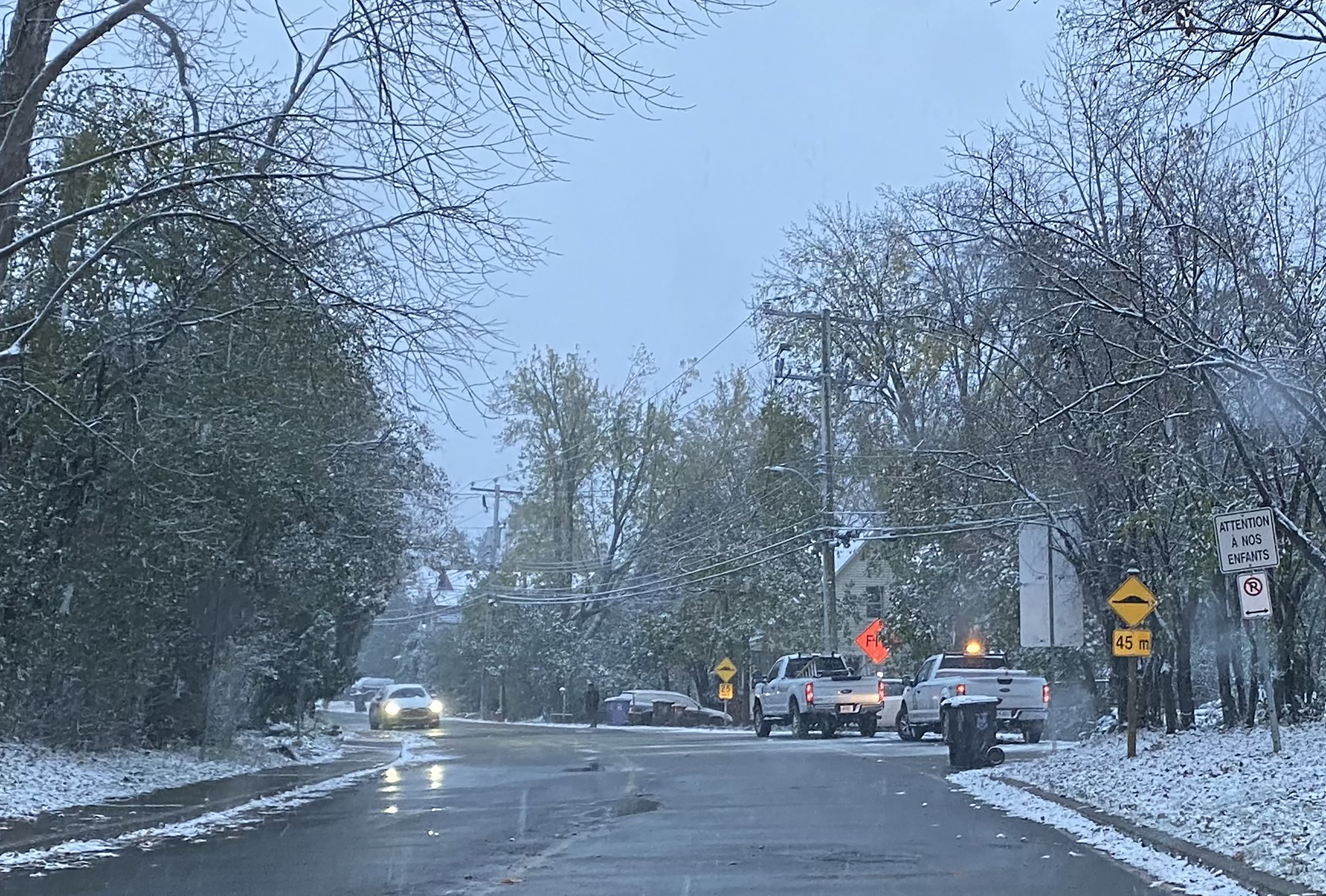
Just a dusting of snow was all we could manage across most of southern Quebec this holiday season, as record warmth stretched from coast to coast. You had a better chance of golfing on Christmas Day than skiing. The image above was taken on December 22 on Ile Perrot. The snow melted quickly as temperatures rose above freezing Christmas Eve and remained there through December 29th. (Valley Weather Photo)

Happy New Year and thank you for reading. Valley Weather is set to enter year number 45, starting in 1979. This year will end rather quietly on the weather front across southern Quebec. Cloudy skies prevail this New Years Eve as a clipper system skirts to our southwest, with much colder temperatures than we have been accustomed to. 

The current temperature as I write is -5C (23F) in Montreal, with a hint of snow in the air. The forecast calls for cloudy skies, a few flurries and a chilly overnight low of -9C (16F). The New Year will start with perhaps a few sunny breaks, and a high of -6C (21F). Looking ahead, the week will be quiet, with above freezing temperatures expected once again by Tuesday. By next weekend, colder air will return, with a chance of some snow as a storm system moves along the east coast. There are still many details to work out, so stay tuned.

Thank you El Nino! An Environment Canada map showing temperature anomalies for this December. The entire country was above normal, with numerous locations recording their warmest December on record.  

December has been warm. Numerous locations across Canada have either had their warmest or second warmest month on record. Snow cover is sparse across the country, largely confined to northern areas. Here in Montreal, the average temperature to date is 1.9C (35.4F), well-above the normal of -5.4C (22.3F). As far as precipitation is concerned, we measured 41.4cm of snowfall, most of that falling over a two day period at the start of the month. Rainfall sits at an impressive 102.2mm, just shy of the all time record for the month. On average by December 31st, Montreal has 10cm of snow on the ground, with Quebec City at 34cm. Both are reporting zero snow cover today.

If you thought 2023 was warm in Montreal, you would be correct. The average temperature for the year sits at 8.7C (47.6F), the warmest recorded at Trudeau Airport, dating back to 1942. We beat the record set recently in 2021, of 8.65C (47.5F).

The weather was wild this past year coast to coast, from widespread forest fires and dense smoke, to our April ice storm and a sprinkling of severe weather in between. A total of 86 tornadoes were observed, 10 reported here in Quebec. We managed a record wet July here in southern Quebec, and the warmest summer experienced by Canadians, from sea to sea to sea.

Wednesday, December 27, 2023

Green, wet and warm holiday season in Montreal

A snowless nativity scene on Boxing Day in Vaudreuil-Dorion. Despite an early December snowstorm, no snow was left for the holidays across the Montreal region. That and very mild temperatures has curtailed most outdoor winter activities. The snowless weather has however, allowed for much better travel conditions than last Christmas. (Valley Weather Photo)

Happy Holidays, Merry Christmas and a very Happy New Year to all my readers.

It certainly does not look or feel like the holiday seasons I was accustomed to as a child growing up in the 1970s. This week has been rather dreary, with a damp northeast wind, and temperatures well-above the freezing point. The temperature has been above freezing since the wee hours of December 24th. December has been warm overall, despite the snowstorm on the 3rd of the month. High temperatures have been above 0C (32F) on 17 of the 27 days to date.

This has resulted in no snow cover at all in the Montreal region, just a dreary brown landscape. Low level moisture is been dominating the weather over the last week, with plenty of drizzle, cloud cover and areas of dense fog. To make matters even more unpleasant, a damp northeast wind has prevailed most of the week.

This years green Christmas was the sixth in the last ten years at Trudeau Airport. Since 1955 when data for such things began, Montreal has recorded 19 years with no snow for Christmas Day. A white Christmas is determined by the presence of at least 2cm of snow on the ground Christmas morning.

So if you are keeping track, there has been snow on Christmas Day in Montreal 72.06% of the time over the last 68 years. The decade of the 1970s was special if you like snowy winters. Only December 25, 1971 and 1979 had no snow on the ground. That represented an 80 percent chance of snow on December 25, which has now dropped to just 60 percent. 

We can debate about it the reason why, but the reality is that our Decembers are warming. So forget about outdoor skating, sledding or using the new snowshoes Santa brought you, at least for now. The next few days will be rather mild and grey, as we add to the monthly rainfall totals. To date, 90.8mm of rain has fallen at Trudeau Airport, well over the normal value of 38.8mm and closing in on the record of 111.9mm set in 1920.

As we look ahead, colder air will begin to arrive in southern Ontario and Quebec for the New Year. However it will only be marginally colder, as most of the country is well-above normal. The drizzle and showers of Thursday, will mix with some wet snow on Friday and Saturday. The weekend looks much the same at this time, with unsettled weather lingering. Temperatures will however be dropping back below freezing by New Years Eve and remaining there to begin January.

Sunday, December 17, 2023

Heavy rain and record warmth forecast for Montreal Monday

Heavy rain and record warmth should wash away any memory of last weeks snowstorm in Montreal. Despite nearly 40cm of snow falling this month, many parts of southern Quebec are looking at a green Christmas.
Heavy rainfall warning in effect for southern Quebec, with flood watches posted across Vermont and northern New York State.

Despite what the calendar says, a windy, warm and wet storm is on the way to southern Quebec. Strengthening low pressure off the South Carolina coast is forecast to move northward to lie near Lake Champlain on Monday. Deep tropical moisture is producing torrential rain and strong thunderstorms along many parts of the east coast today. Steady rain will overspread southern Quebec Sunday night, becoming heavy at times Monday morning, and ending late in the day.

At this time, a track just to our east is expected, resulting in up to 50mm of rain for Montreal, with some locations north and east of the city possibly receiving more.  The heavy rain may result in some localized river and urban flooding. The rainfall record for Montreal on December 18 is 52.4mm set back in 1878. Unseasonably warm air will also be in place, with a current forecast low of 5C (41F). The high on Monday will be close to a record-breaking 10C (50F). The current record for the date is 5.7C (42F) set in 1996. We should easily break the record, likely very early in the day.

NWS radar image showing strong low pressure developing off the Florida coast in the Gulf of Mexico on Saturday. This storm is moving rapidly north to lie near Lake Champlain late Monday afternoon.
As the storm moves northeast of Montreal, cooler air will move into the region. Any leftover precipitation will change over to light snow and persist into Tuesday. Some locations across far western Quebec and eastern Ontario may pick up a centimetre or two of accumulation. The temperature will drop to 0C (32F) by Tuesday morning, remaining fairly steady during the day.

Winds will become rather gusty Sunday evening, between 30 and 50km/h in the St. Lawrence Valley. Winds will back to the northwest between 20 and 40km/h Monday night persisting into Tuesday.

Friday, December 15, 2023

Wet, windy and warm weather expected for Montreal

Despite the calendar, temperatures are on the rise across most of North America. The last two weeks of December are expected to produce very mild temperatures and very little in the way of snowfall for the Montreal region. A big storm system Monday will bring windy and rainy conditions to most of southern Quebec.

Winter officially arrives on December 21st, but you would not know that by our current weather. As I write, the temperature in Montreal is already 4C (39F) on our way to at least 8C (48F) Friday. The normal high for today's date is -3C (27F). But our weather is anything but normal this fall and winter, and that trend will persist through at least the end of the month.

What does that mean for practical weather?  Well basically we are looking at well-above normal temperatures for most of North America through the holiday period. That starts today, with very strong high pressure anchored in the Atlantic, pumping unseasonably warm air northward.

Meanwhile a strong, almost tropical like system will develop in the Gulf of Mexico today, moving northward over the weekend with abundant moisture. During a typical winter and at this time of year, that track would result in a big snowstorm for parts of the east coast and Quebec. Bit, this is not the case this month. The storm will deepen and move rapidly northward towards New York state and eventually across eastern Quebec. After a mild weekend, we can expect clouds to increase Sunday, ahead of steady soaking rain Sunday night and Monday. This system will be a snow eater, devouring what is left of our snowpack here in the south and significantly reducing it further north. We will have to watch for any potential flooding from the combination of heavy rain and melting snow.

At this time, many parts of our region will likely see at least 25-35mm of rain. Gusty southeast winds may reach 50-70km/h late Sunday. Temperatures will be very warm, approaching 10C (50F) by Monday. A trailing cold front late in the day Monday will bring in marginally cooler air on northwest winds, with any leftover precipitation changing to flurries before ending Tuesday morning. Little accumulation is expected at this time.

The balance of the travel week before Christmas appears to be fair, with seasonable temperatures.

Sunday, December 10, 2023

Winter storm to deliver a mix of precipitation across southern Quebec

Despite the mild fall, Montreal has already measured 42.6cm of snow at Trudeau Airport since November 1st. More snow is on the way over the next 24-36 hours for the city, but less than previously expected. Rain will change to wet snow Monday morning, with 5-10cm possible for Montreal, 2-4cm for Ottawa and 10-20cm for Sherbrooke.

Special Weather Statement in effect for Montreal. Additional weather warnings may be required later today for a portion of our region.

Winter Storm Warning and Winter Weather Advisories have been issued for upstate New York and Vermont.

A potent storm system will impact the eastern seaboard including southern Quebec over the next 24 to 36 hours. The guidance over the last 24 hours has shifted the heaviest precipitation to the east of Montreal, but we can still expect a messy Monday morning commute.

Light rain fell overnight in Montreal, with temperatures rising to 6C (43F) around 2am, but falling back to the current reading of 2C (36F) on a light northeast wind. A cold front advancing across Ontario, will be the focus for some heavy rain showers today, with as much as 25mm (1 inch) of rain possible. Along that front, low pressure will develop late today and move northeast to be near Boston on Monday. Enough cold air will filter into the region to change the rain over to wet snow late tonight.

The wet snow will move from west to east, impacting just about all of southern Quebec by Monday morning. The snow will be heavy at times, especially east of Montreal across the Eastern Townships and Beauce, as well as Vermont and parts of New England.

As far as amounts are concerned, we are looking at 5-10cm for the greater Montreal region, with 10-20cm for the Townships. Local accumulations may approach 30cm across the higher elevations along the Vermont border. Gusty northwest winds will develop Monday, between 30-50km/h. Theses winds will add stress to the snow loaded power lines, which may result in significant power outages in areas that see the heaviest snow. All precipitation should taper off to flurries by late in the day Monday.

As far as temperatures are concerned, the high Sunday in Montreal will be 6C (43F), dropping to 0C (32F) by Monday morning, and further dropping to -6C (21F) by Tuesday morning.

Expect difficult travel conditions early Monday morning, with rain changing to snow. The snow will be wet and heavy, with reduced visibility, especially along Highway 10 towards Sherbrooke.

This same storm system has been producing heavy rain, strong winds and severe thunderstorms from the Mississippi Valley towards the Ohio Valley and along the east coast. Tornadoes across Tennessee on Saturday have left at least 6 dead. The search continues Sunday morning for additional survivors and victims.

Heavy damage from a tornado in Madison, Tennessee late Saturday.
(Nashville Office of Emergency Management)


Friday, December 08, 2023

Another storm on the way for southern Quebec

We are in for another round of rain, wind and wet snow this Sunday into Monday morning across southern Quebec. There are still many details to work out, but the possibility exists for more tree damage and power outages as occurred this past Monday across the region and in Verdun, shown above. (J Balena)

A very complex weather scenario is expected for the upcoming weekend, that will include much milder air as well as a mix of precipitation. There are many moving parts to this forecast, so check back for updates. Before then, we will have one more chilly, damp day on Friday, with clouds, a few flurries, and a high temperature of -5C (23F).

Over the weekend, a deep trough will set up across the mid Mississippi Valley, with moisture and very warm air streaming northeast into the Great Lakes, Ontario and southern Quebec. Cloudy skies Saturday will yield to flurries and even some drizzle Saturday night and Sunday. Temperatures will rise above freezing Saturday to 2C (36F) and even milder Sunday at 5C (41F).

By Sunday, a strong cold front will begin moving across Ontario into western Quebec. Along and ahead of the front a surge of moisture will bring in excess of 25mm (1 inch) of rain to the Montreal region. With the rain and mild temperatures, we can expect significant snowmelt from last weeks storm. Some local flooding is possible.

By the evening hours, deepening low pressure will begin moving along the aforementioned front and across eastern New England. As the storm moves into Atlantic Canada, colder air will surge in behind, changing rain to wet snow. The changeover should occur Sunday evening in Montreal, with the potential for some significant snowfall in several parts of southern and western Quebec, including Montreal. Accompanying the precipitation on Sunday will be gusty southwest winds, that will back to the northwest and become strong late Sunday, up to 60km/h.

Precipitation will taper off by Monday morning. This storm has the potential to produce a mixed bag of dangerous weather, ranging from strong winds, heavy rain and flooding, to icy roads and possible power outages by Monday. Keep informed and watch for additional weather headlines and warnings that may be required at some point over the weekend.

Monday, December 04, 2023

Winter storm slams Montreal region with 30cm of snow

Montreal was slammed with heavy wet snow overnight. As of 8am Monday morning, 28cm had fallen at Trudeau Airport. Numerous trees have fallen from the weight of the snow, onto power lines and unfortunately for this resident in Verdun, cars as well. Power outages are climbing, with over 88,000 in the dark currently. (Photo: J. Balena)

Winter storm warning remains in effect for Montreal, but should be allowed to expire by mid morning.

The first big snowstorm of the season has over performed in the Montreal region. Moderate snow is still falling Monday morning, with nearly 28cm on the ground so far. The heavy wet snow has brought down trees on power lines, with over 88,000 Hydro-Quebec clients in the dark and cold this morning. This includes 8900 on the island of Montreal.

Roads are in terrible shape in metro Montreal. Highway 20 from Ile Perrot was snow covered, icy and visibility was very poor this morning. There have been numerous accidents in the Montreal region.

The storm was expected to bring mixed precipitation to Montreal. However most of that fell as snow, with amounts expected to exceed 30cm (1 foot) for the city.

The storm system in question lies just south of Montreal, with the dividing line between frozen and liquid precipitation along the US border. Many parts of New York and New England had rain or freezing rain. The same is true in Ontario. While Montreal measured over 20cm Sunday to midnight, Ottawa had only 1cm.

Montreal was the sweet spot for snow accumulation this time, as just enough cold air moved into the city on northeast winds. The temperature remained below freezing at the ground and aloft, ensuring wet snow and not freezing rain.

On Ile Perrot, freezing rain fell for the first few hours of the storm on Sunday afternoon, so my snow totals are about 5cm less than the Airport, located 20 kilometres northeast of my location.

 The snow will continue this morning, tapering off to flurries this afternoon. Conditions should improve the evening, but temperatures will drop. After a high of -2C (29F) today, the low by Tuesday morning will be -7C (19F). Storm totals for the city will likely exceed 30cm.

Warmer weather will return by next weekend, with rain in the forecast and high soaring to 6C (43F) by Saturday. Buckle up, it going to be a long El Nino winter!

Sunday, December 03, 2023

Winter storm warning posted for southern Quebec

Light freezing rain is already falling Sunday afternoon across many parts of southern Quebec and Ontario. The precipitation should transition back to heavy wet snow this evening and overnight, with 10-15cm possible in Montreal, Ottawa, and Quebec City.

Winter Storm Warning for southwestern Quebec, eastern Ontario, the Adirondacks and Green Mountains. Winter weather advisory for northern New York and portions of Vermont.

Expect slick and dangerous travel conditions today through Monday morning.

A messy mix of precipitation is expected across southern Quebec and eastern Ontario over the next 24 hours. Low pressure over the Great Lakes will move just south of Montreal tonight, while a second area of low pressure develops along the New England coast and move northeast towards Atlantic Canada.

Precipitation has already overspread the region Sunday afternoon, with freezing rain and rain from Montreal southward, and wet snow north and east of the city. As marginally colder air filters into the St. Lawrence Valley late Sunday afternoon, all precipitation should change back to wet snow and become heavy at times overnight. A general 10 to 15cm is forecast for Montreal and Ottawa, with more north of the city and less south towards the US border.

Gusty northeast winds of 30-50km/h will accompany the snow, putting stress on tree limbs and power lines. Temperatures will remain nearly stationary throughout the period, around 0C (32F) for Montreal. As the precipitation tapers off to flurries Monday afternoon, temperature will drop, to lows of around -5C (23F) by Tuesday morning.

Expect icy and snow covered roads at times over the next 24 hours. I imagine the Monday morning commute will be very challenging, especially for those off island to the west, where the Iles aux Tourtes bridge is down to only one lane in each direction for the foreseeable future. Give yourself plenty of extra time.

Friday, December 01, 2023

Wintry weather returns to Montreal this weekend

A more wintry weather pattern will evolve this weekend into next week, with several chances for snowfall across the Montreal region. Temperatures will fall back below freezing. While temperatures will not be frigid, the weather will certainly be cold enough for frozen precipitation. (Valley Weather Photo)

December has started off very mild in Montreal Friday morning, with temperatures in the middle single digits. It was 8C (47F) on Ile Perrot this morning, the normal low for December 1 is -7C (19F).

The mild weather will persist today, along with cloud cover and eventually some steady rainfall. Highs will remain nearly steady before falling off this evening. A frontal system over the St. Lawrence Valley will become the dividing line between marginally colder air to the north, and unseasonably warm air to the south.

We have a very difficult forecast this weekend, with several of the computer models offering up very different solutions. Low pressure will move along the aforementioned front this afternoon, with widespread rainfall expected. As the low pressure moves past to our south, slightly cooler air will filter into the Montreal region, with rain changing to a period of wet snow and flurries late this evening. There is also a risk of freezing drizzle, especially in the valley locations.

On Saturday, temperatures will remain very close to the freezing point, with a mix of light snow and rain from north to south. The best chance for a few centimetres of accumulation will occur at the higher elevations north of Montreal and across the Townships. 

On Sunday, a stronger area of low pressure will move along the front, passing very close to Montreal. There is a chance that wet snow will develop in the afternoon, becoming heavy at times and persisting into Monday morning before mixing with rain once again. If precipitation falls as predominately snow, a good 10cm may accumulate in Montreal.

I imagine this forecast will change often as it has in the last 48 hours or so, moving back and forth between rain and snow as the main form of precipitation for Montreal. If you have any travel plans, pay close attention to the weekend forecast. I expect the Monday morning commute will be difficult for many parts of our region.

One thing that seems certain, the weather will turn colder next week, with highs remaining below freezing through Friday. 

Tuesday, November 28, 2023

Two winter storms bypass Montreal region

While rain fell in the Montreal region, wet snow fell in many other parts of southern Quebec including the Richelieu Valley shown above. Further east across the Beauce and Quebec City regions, the snow was heavy, with up to 30cm reported. The snow cut power to over 125,000 Hydro-Quebec customers. (Photo T. Giotsalitis)

Southwestern Quebec continues to be bypassed by the early season snow that has affected many parts of Quebec and Ontario. On Sunday evening, low pressure moved across southeastern New England generating heavy wet snow across interior portions of the northeastern US, as well as southern and eastern Quebec. Between 15-30cm of wet snow fell east of the Richelieu Valley, across the Eastern Townships, Beauce, Chaudière-Appalaches and the Quebec City region. 

The heavy wet snow stuck to trees and power lines cutting power to over 125,000 Hydro-Quebec customers, with thousands more in the dark across Vermont and northern New Hampshire. Hydro-Quebec had 150 teams on the job Monday, and the number of clients without power is down to just over 3000 Tuesday morning.

Meanwhile it was the same old story in Montreal, just mild enough for rain, with a few snowflakes mixed in. Around 10mm of rain fell in Montreal. This trend that has been present for most of the fall, is expected to continue into the upcoming weekend. Temperatures have chilled Tuesday morning in Montreal. We are in for 24-36 hours of chilly, blustery conditions, with westerly winds of 30-50km/h, and temperatures remaining below freezing. Windchill values will be in the minus teens. There will also be the chance of a few snow showers at times in Montreal, but with very little accumulations expected in the city. The cold air will not last, with another system passing to our north and west Thursday, with mild temperatures and showers.

Colder air will try to move into Southern Quebec next week, with perhaps some snow, but milder air may win out again.

Lake Effect Snow

Back to the current system, as the cold air pours across the wide open Great Lakes, heavy lake effect snow has been falling off Lake Huron into Ontario, and Lakes Erie and Ontario into western New York. Travel was nearly impossible in several locations, with between 20-40cm of fresh falling in under 24 hours. The intense snow bands were accompanied by lightning and thunder at times, with snowfall rates of over 5cm per hour observed. The lake effect snow will persist today, off Georgian Bay into Ontario as well as across western New York, along the Interstate 81 and 90 corridors. 

The snow bands were so intense at times, driven by strong westerly winds, that they reached into the Ottawa Valley and National Capital region overnight.

Tuesday, November 21, 2023

Messy mix of precipitation expected for Montreal

Allow yourself extra time for the Wednesday morning commute across southern Québec. A messy mix of precipitation is forecast, starting this evening and tapering off late Wednesday. Between 5-10cm of snow, along with freezing rain and eventually rain is expected across the entire region.

Winter Weather Advisories are in effect for northern New York, New England and Eastern Ontario. They may be extended into southern Quebec later today.

Tuesday morning was one of the coldest so far this season, with low temperatures across the southwestern Quebec generally between -5C and -10C (14F-23F). The coldest reading I could find was across the Laurentians where several locations were in the middle minus teens.

Today will be sunny and cold, with increasing northeast winds and a high temperature near the freezing point in Montreal. Low pressure will move from the central plains into the Great Lakes on Wednesday, passing well north and west of the Montreal region. A warm front advancing into Ontario and Quebec this afternoon and tonight, will set the stage for several hours of mixed precipitation.

Clouds will thicken today, followed by snow spreading across the Ottawa Valley and into southwestern Quebec late this afternoon and this evening, persisting well into the overnight period. As warmer air erodes the cold air at the surface, the snow will change to rain, with the risk of freezing rain during the transition. Before the changeover, a good 5cm of snow is possible in Montreal, with 5 to 10cm expected north of Montreal and in the Ottawa region, as well as the eastern Townships. Some higher elevations across the Townships and Vermont may see up to 15cm. Locations that see freezing rain, such as Cornwall and Massena, may se as much as 10mm of ice accretion.

As the warmer air moves into the entire region Wednesday, temperatures will rise above freezing to around 3C (38F) in Montreal, with all precipitation changing over the light rain or drizzle.

If you have travel plans on Wednesday, expect highly variable conditions, with mixed precipitation and the likelihood of snow covered and icy roads in many locations.

On Thursday, a cold front will bring in an arctic airmass that will persist Friday and into the weekend, with temperatures falling through the day, along with gusty northwest winds. A few flurries are possible as well. Temperatures will be the coldest of the season so far by Friday, dropping from 5C (41F) Thursday, down to -8C (18F) by Friday morning and remaining fairly steady during the day. The low Saturday morning will be a chilly -12C (10F).

Thursday, November 16, 2023

The Ice Bowl of 1977

Standing in the snow and cold during the 65th Grey Cup Parade in Montreal in November 1977. The photo was taken with my KODAK 110 camera, I was 11 at the time. The temperature was around -5C (23F), and heavy snow fell for the duration of the parade. It was awesome!

As we head into the CFL's 110th Grey Cup weekend, with the Montreal Alouettes set to face the Winnipeg Blue Bombers at Tim Horton's Field in Hamilton, I started thinking about the famous Ice Bowl played back in 1977.

A record-breaking crowd of 68,318 fans braved a transit strike and game time windchills in the minus 20s. (Montreal Alouettes Photo)

Weather has often presented a serious challenge to Grey Cup participants and spectators alike. The game has been held in snow, sleet, fog and serious cold. Such was the case during the 65th Grey Cup held in Montreal on Sunday, November 27, 1977. The game, dubbed the Ice Bowl, saw game time temperatures around -10C (14F), with strong northwest winds that gusted between 50 and 70km/h at times. Windchill readings were in the minus 20s. Despite that, a record-setting crowd of 68,318 fans filled Olympic Stadium, with no roof at the time, braving the cold as well an ongoing transit strike. That record crowd for a Grey Cup game still stands to this day.

Field conditions were less than ideal, but that did not stop Montreal from defeating Edmonton 41-6. (Montreal Alouettes Photo)

The cold did not stop the Alouettes from destroying the Edmonton Eskimos 41-6 behind a stellar performance by Virginia native, Quarterback Sonny Wade and kicker Don Sweet from Vancouver. Both were playing in weather that neither grew up with. 

The frigid cold had poured in behind a major early season snowstorm, that had dumped 21.3cm of snow on the city on Saturday, November 26, with blowing, drifting snow and cold temperatures. The Grey Cup Parade that always preceded the game during the 70's was held along downtown St. Catherine Street. 

I lived in Verdun at that time, and was more than eager to attend the parade, despite the weather. I was 11 years-old in 1977 and all seemed right with the world to me standing in the snow and cold outside Woolworth's downtown, with my family. We occasionally would duck in for a hot chocolate at the lunch counter to warm up. The day remains a cherished memory for me with my late father, and further solidified my interest in weather. Snowstorms of the 1970's were awesome in my eyes, and this one was even more special.

No snow is forecast this weekend in Hamilton, with the game set to start at 6pm. Expect clear skies, light winds and chilly temperatures around 2C (35F), perfect football weather in Canada. Enjoy the game, GO ALS GO!

The snow intensified as temperatures dropped towards the end of the Grey Cup Parade in Montreal on November 26, 1977. (ValleyWeather)


Friday, November 10, 2023

Cold weekend ahead - but warmer weather on the way

The first significant snowfall of the season on Thursday produced a record-breaking 7cm of wet snow across the Montreal region. The snow iced roads and bridges leading to several major accidents and significant traffic delays. Conditions have vastly improved Friday morning. (Valley Weather)

A bulk of the 7cm of snow that fell in Montreal Thursday is gone already early Friday morning. The temperature has risen well above the freezing point and sits at 4C (39F) currently. We can expect a mild, windy high of 7C (45F), with winds out of the southwest 30-50km/h.

A cold front arrives this evening, setting the stage for a chilly weekend. Along the front look for scattered showers and flurries, followed by clearing skies and cold temperatures. Morning lows on both Saturday and Sunday will be down to -3C (27F) in the Montreal region.

Another round of showers is possible early next week, but the main story will be warming temperatures. Winter is not yet ready to take over. As a matter of fact, November is looking like a typical El Nino month, with more warm and dry days expected than wintry ones. This will give motorists a few more weeks to prepare for winter, because quite clearly many were not on Thursday.

The snow that fell quickly iced roads, especially elevated surfaces. The result was the typical nonsense that greets drivers every year as the first flakes fly. Numerous accident were reported, along with major delays during the morning commute. Conditions improved in the afternoon as temperatures warmed to the freezing point and the precipitation came to an end. Get those snow tires on!

The 7cm of snow that fell on Thursday at Trudeau Airport set a new daily record for November 9, surpassing the previous benchmark of 1.8cm set in 1952.

Wednesday, November 08, 2023

Snow and freezing rain for the Thursday morning commute

After a very mild October, many parts of Quebec have been thrown straight into winter. Heavy snow fell across portions of central Quebec on Monday and Tuesday, with more snow forecast Thursday, this time including Montreal and southern Quebec.
Expect wintry precipitation and slippery roads for the Thursday morning commute in Montreal and across the entire region.

A messy mix of snow and freezing rain is on the way for the Thursday morning commute from Ontario into southwestern Quebec. A clipper system from western Canada will move across the Great Lakes and down the St. Lawrence Valley. Typically these storms are moisture starved, but can benefit from the Great Lakes.

This system will provide many regions with the first snow and ice of the season. Special Weather Statements and Winter Weather Advisories have been issued for a wide swath of southern and eastern Ontario as well as New York and New England. They will likely be extended into portions of Quebec later today.

In terms of weather, Wednesday will be fair, but chilly, with a gusty northwest winds of up to 50km/h. Tonight will start off clear, with temperatures dropping quickly after sunset before levelling off neat midnight. The early low will be -5C (23F) in Montreal. That cold air will set the stage for a burst of snow before sunrise, with up to 5cm possible for many locations. The snow will eventually mix with and change to freezing rain and rain from south to north. Precipitation should taper off to drizzle in the afternoon, with temperatures rising above freezing to 3C (38F).

Friday looks a touch milder, up to 6C (43F). The weekend at this time will be cooler, but dry. Briefly looking ahead to next week, our taste of winter looks brief as mild temperatures are set to return.

Tuesday, November 07, 2023

Rare November thunderstorms followed by snow

A few rare nocturnal November thunderstorms developed in advance of a cold front early Tuesday morning across the Montreal region. Much colder air and more snow is on the way by Thursday.

Much colder air arrives in Montreal later today, followed by up to 5cm of wet snow Thursday.

Montreal had a few surprise thunderstorms during the pre-dawn hours Tuesday, along with viid lightning and some heavy but very brief rainfall. The culprit is a clipper-type low pressure system and cold front over the Ottawa Valley, slicing southeast into some moderately unstable air. Temperatures are quite warm this morning, around 10C (50F) here on Ile Perrot. This will likely be the high for the day, as cooler air begins to filter into the St. Lawrence Valley later this morning on gusty northwest winds of up to 50km/h.

Temperatures will fall all day, down to below freezing this evening at -1C (30F) in Montreal. Wednesday will be partly sunny, but breezy and much cooler, with a high of only 3C (38F). That cooler air will set the stage for some mixed precipitation across eastern Ontario and western Quebec starting during the overnight hours into Thursday morning. Another Alberta Clipper will slide across the Great Lakes and St. Lawrence Valley bringing a swath of snow and rain to the region.

The temperature will be marginally cold enough in Montreal for snow to start, likely mixing with and changing to rain at some point Thursday. At this time, up to 5cm of wet snow may fall in several regions of southern Quebec, more to the north of the city and less south towards the US border.

There are still some details to work out, and this will not be a big storm by any stretch. However, November snowfalls can be very tricky and certainly can make driving challenging. Allow extra time for the Thursday morning commute.

Sunday, October 29, 2023

First snowflakes of the season on the way for southern Quebec

Slushy minor snow accumulations are possible in the Montreal region Monday morning, with more snow expected outside the city, especially in the higher elevations along the New England border.

Special Weather Statement posted for the Eastern Townships, Beauce, Laurentians and Quebec City

The high temperature on Saturday was 20.6C in Montreal, nearly 70F in late October. Then a cold front moved across the region, accompanied by some robust showers, and winds gusting to 60km/h. The heat is now gone reality has returned, with temperatures falling since midday Saturday, and are now in the single digits, 6C (43F) here on Ile Perrot, 5C (41F) at Trudeau Airport.

More cold air is on our doorstep, with overnight lows tonight down to near the freezing point for many locations in southern Quebec and eastern Ontario. The aforementioned cold front has stalled south of Montreal across central Vermont and New York. Moisture will begin to overrun that front tonight into Monday morning, allowing for a mix of rain and wet snow to fall along the St. Lawrence Valley. All snow is expected north and east of Montreal, as well as in the higher elevations of the Townships and Beauce.

As far as accumulations are concerned, a slushy coating on grassy surfaces is possible in metro Montreal. Elsewhere across southern Quebec, 5cm to as much as 15cm (2 to 6 inches) of wet snow is possible, the highest totals in the upper elevations along the Maine border.

If you have travel plans for Monday, especially outside of the Montreal region, plan for highly variable conditions, with reduced visibility and slippery roads at times. This will come as a big shock to many after our very warm fall to date.

Skies will clear out for Halloween Tuesday, but the weather will remain chilly, with high temperatures near 4C (39F) and morning lows, with frost, down below freezing to -2C (29F). Frost is likely again Wednesday and Thursday mornings.

Warmer, seasonable weather will return to end the week, along with showers into next weekend.

Friday, October 27, 2023

Colder weather on the way for Montreal - Otis slams Acapulco

This fall in has been extremely warm in Montreal to date, with no frost reported in the city and temperatures running well-above normal. That is about to change as the coldest air of the season arrives this weekend and persists into next week. Frost is possible along with the first snowflakes of the season.

There is plenty of weather to talk about early on this Friday morning, with the temperature sitting at a remarkable 16C (61F) in Montreal. The normal high for this time of year is only 9C (48F), we have been running well-above normal this week. Friday will be another warm and windy day across southern Quebec, with a few showers around and high temperatures approaching 20C (68F).

We have one more day of warmth Saturday as a cold front arrives from the west. Behind this front will be the coldest weather of the season, with our first frost and snowflakes likely next week. Highs will drop Sunday into the single digits, and cool even further to around 4C (39F) for Halloween. The good news is the weather looks dry for trick or treating.

Beyond Tuesday, even cooler air arrives, with moisture invading from the south. There is a chance for some flurries by Wednesday, along with frost and freezing temperatures into Thursday morning. The low in Montreal may be as chilly as -2C (29F), cooler than any weather we have seen since early last spring.

Western Snow

While we have been warm, the west has plunged into the deep freeze for October. Cold weather and heavy snow has occurred across Alberta and into southern Saskatchewan and Manitoba. Record setting lows dropped as cold as -20C (-4F), with up to 20cm of snow falling in some locations close to the Montana border. Estevan, Saskatchewan reported 19cm of snow, while the low in Cardston, Alberta dropped to -20C shattering the record of -17.8C set way back in 1939.

Hurricane Otis slammed into Acapulco, Mexico on Wednesday morning, slicing a path of destruction through the city of 900,000 and nearly destroying the tourist industry in one night. Winds topped 265km/h tearing apart resorts and cutting power to the region. The storm strengthened explosively hitting with little warning, surprising forecasters and emergency planners. Photo: Protección Civil Chilpancingo

Hurricane Otis

Hurricane Otis slammed into the Mexican resort city of Acapulco just after midnight Wednesday as a major category 5 storm, with winds of 265km/h (165 mph). Otis was one of the strongest storms on record to hit the Pacific coast of Mexico. The storm has been blamed for at least 27 deaths, and widespread catastrophic damage expected to reach into the billions of dollars. The resort town was destroyed by a direct hit from one forecasters called a nightmare storm. 

Just 12 hours earlier, Otis was a minimal tropical storm, with not one computer model hinting at anything else. The storm then underwent a record breaking explosive intensification, with winds increasing 115mph in under 12 hours. The storm slammed onshore as a well-developed category 5 hurricane destroying infrastructure and severely damaging nearly 80 percent of the hotels in the popular resort community. Residents and tourists were trapped unable to evacuate in the severe weather conditions. Many hunkered down in high rise hotels as windows blew out and roofs torn away.

The unprecedented strengthening of Otis has forecasters extremely concerned for future storms.

Radar image of powerful hurricane Otis just prior to landfall near Acapulco on Wednesday morning. (NOAA)


Thursday, October 19, 2023

Wet and chilly weekend expected for Montreal

Our mild September and early October has resulted in a sluggish foliage season across the Montreal region. That began to change drastically over the past week, with many parts of the city now seeing decent colour. There is still plenty of leaves left to fall, but the windy, wet and cooler weather forecast this weekend will likely accelerate that process. (Valley Weather Photo)

Strengthening low pressure along the US east coast this weekend will result in rainfall across much of southern Quebec into New England. Before then, we can expect a mild, partly cloudy Friday, with temperatures pushing into the upper teens. 

This past week has been rather grey and somewhat cooler that we had been accustomed to for most of September into the first week of October. Daytime highs have been closer to normal of late, in the lower teens, but overnight lows remain very mild, as a result most of the region has yet to see any frost.

After a few breaks of sun late Thursday and perhaps a few more Friday morning, cloud cover will thicken once again as the next weather system moves in. A deep trough will develop over the Great Lakes, with the first Nor'Easter of the season developing off the North Carolina coast moving northeast towards Atlantic Canada by Saturday. At the same time a cold front will be approaching from the west. The combination of the two systems will bring a steady rain to Montreal, starting late Friday and persisting into Saturday evening. Amounts will likely exceed 25mm (1 inch) in Montreal and may approach 50mm (2 inches), especially south and east of the city.

Temperatures will be mild Thursday night, with southwesterly winds blowing, dropping to 13C (55F). The normal low is 2C (36F). Friday and most of Saturday will be mild, in the mid to upper teens, before the aforementioned cold front crosses the region late Saturday. Temperatures will drop back to seasonal values for Sunday at 11C (52F),  Look for some of the coldest nights this fall so far Monday and Tuesday, with forecast lows close to 1C (34F). Some areas may see the first frost of the fall season.

Finally, southwesterly winds will become rather gusty on Friday, before backing to the northwest over the weekend, bringing in the cooler air.

Thursday, October 12, 2023

Annular Solar Eclipse on Saturday, October 14

The Annular Solar Eclipse occurs when the Moon passes between the Sun and Earth. Unlike a total eclipse, the Moon is at it's furthest point from Earth, appearing smaller and leaving a "ring of fire" around the sun. The eclipse will only cover about 10 percent of the sun in Montreal on Saturday, starting at 12:11 PM. (NASA Photo)

Most of North America will be treated to an Annular Solar Eclipse this Saturday, October 14. The Annular Eclipse, unlike a total eclipse, leaves a ring of light visible as the Moon passes between the Earth and Sun. The reason for this is that the Moon is currently at its furthest from Earth and does not completely cover the Sun. The path of near totality will stretch from Oregon to Texas, across parts of northeastern Mexico as well as sections of Alaska and the Caribbean. 

All of  Canada will experience at least a partial solar eclipse, with the best presentation of the eclipse in British Columbia. Vancouver will be at 80 percent peak, around 11am local time. The percentage of the Sun covered by the Moon will lower from west to east across the county, with the lowest impact in Atlantic Canada.

In Montreal, we will only experience around 10 percent of the sun blocked by the moon. The show will begin around 12:11PM, reach maximum around 1:17PM and end by 2:23PM. Despite it being only a partial eclipse, you should always protect your eyes and never stare directly at the sun. Eye damage can occur in seconds. Special viewing glasses are available on Amazon, and they would not be a bad investment. Montreal is only months away from the spectacular total solar eclipse occurring on April 8, 2024.

The best way to view the eclipse on Saturday, will be at NASA.gov, which will be live-streaming the event from various locations in the path of near totality.

As far as the weather is concerned for viewing in Montreal this weekend, after a week of unsettled weather and plenty of rainfall, skies should be fair for Saturday, with temperatures near normal, 15C (59F).

Friday, October 06, 2023

October heatwave over - stormy weather expected for Thanksgiving weekend

The last appreciable rainfall in Montreal fell on September 19. Only 0.8mm has fallen at Trudeau Airport since. That all changes this weekend as our heatwave comes to an end, and heavy rain moves in. Some locations will receive a months rainfall in 48 hours. Between 50-80mm is possible for our region.
Rainfall warning in effect for metro Montreal.

UPDATE, Saturday, October 7: Weather warnings remain in place as heavy rain continues to fall across southern Quebec. As of 12pm, close to 65mm had fallen in Montreal, with another 40mm possible. That would bring amounts over 100mm (4 inches), a record for the date. As a result of the prolonged dry period we just experienced, little flooding is occurring so far. The exception is water accumulation on roadways, especially where leaves are blocking sewer grates. Drive carefully.

Our October heatwave will come to an end on Friday, but with potentially one more record to break before it ends. The forecast high Friday is 25C (77F), the record for the date, set in 2005, is 26C (79F). We have a shot at it, but increasing clouds may hold back afternoon temperatures just a touch. This will be the last day of our current remarkable heatwave. Montreal managed another record high on Wednesday, reaching 28.5C (85F), surpassing the 2005 record of 26C (79F). Dozens of records for heat and humidex, as well as warmest minimum temperatures have been established across eastern North America this week. Included in that was the warmest October high temperature for Montreal, dating back to 1871, with Tuesday's high of 29.3C. We will likely establish another record for the warmest overnight Friday, having only dropped to 19C (66F) so far. The record was 16.7C set in 1937. The normal high for October 6 is 15C (59F), but what is "normal" anymore.

The unusual heat is over, and our attention turns to a frontal boundary slowly mowing across Ontario. Ahead and along the front, heavy rain is occurring, along with some thunder. It has been 16 days since our last rainfall for most of us. A trace did fall at Trudeau on Tuesday morning as a few isolated thunderstorms bubbled up. We need the rain and we will get it. Showers and thunderstorms should develop this afternoon in Montreal, transitioning to a steady rain overnight and all day Saturday. Total rainfall amounts between Friday and Sunday for southern Quebec will be in the 50-80mm range. Most regions should absorb the rainfall, but there could be some minor water accumulation and flooding in low lying areas.

Tropical storm Philippe, located south of Bermuda on Friday morning, is forecast to weaken and move across Maine and into central Quebec this weekend, adding deep moisture and gusty winds to our forecast. (NHC)

The frontal boundary and parent low pressure will stall over Quebec on the weekend, maintaining showers throughout Thanksgiving and into next week. Adding to the moisture will be the remains of tropical storm Philippe, located 315 kilometres south of Bermuda Friday morning. Philippe is forecast to become post-tropical and move inland across Maine and into southern Quebec by Sunday.

Along with the rain this weekend, will be gusty winds, up to 50km/h, especially Sunday. Temperatures will be the other big story, falling way back to normal values for early October. The low Saturday morning will be 15C, rising to the upper teens Saturday, falling back to the lower teens late in the day and remaining there Sunday, with a high of 13C (55F) expected. The cooler weather will remain with us all next week.

Monday, October 02, 2023

Record breaking warmth to start October - much colder weather for Thanksgiving

The weather has been nearly perfect over the last two weeks across the Montreal region, making for a rather unseasonable yet picturesque view at Point-du-Mouilin in Notre-Dame-de-L'Ile Perrot over the weekend. The upcoming week will feature hazy sunshine and record-breaking warmth. We can expect a dramatic change as we head into the upcoming holiday weekend. (ValleyWeather)

It has been an absolutely spectacular stretch of weather to end  September and start October in Montreal. Strong high pressure has been dominating our weather over the last two weeks, with cool nights and warm pleasant days. Winds have been calm for the last several days. The only glitch in the forecast has been some high clouds at times and hazy skies in the upper atmosphere, generated from western wildfires, something we have become all too familiar with in 2023.

The forecast for this week is for much of the same, very warm temperatures and sunshine. Southwest winds will drive temperatures 10 to 15 degrees above normal values, with record highs likely through the middle portion of the week. The high on Tuesday is forecast at 29C (85F), the normal high is only 15C (59F). We should break the the record high for Tuesday of 26.7C (80F) set in 1953. On Wednesday and Thursday, highs will be close to 30C (86F). The record highs for those days are 26.7C (80F) and 26C (79F) respectively, both set in 2005. Overnight lows will be warm as well, in the 13C to 17C (55-63F), well above the normal low for early October of 5C (41F).

One more record will likely fall this week, showing us just how mild 2023 has been. We have not recorded a high temperature below 16C (61F) since May 25, a stretch of 132 days. The record in question was established 136 years ago in 1887, when daytime high temperatures remained above 16C for 133 consecutive days, from May 1st to September 10, 1887. Our current run will likely end during the Thanksgiving long weekend, as a cold front and strong low pressure will finally bring Montreal some rain, along with much cooler temperatures. Until then enjoy the summer-like warmth.

As far as precipitation is concerned, we need some moisture, as it has not rained in Montreal since September 19. The aforementioned high pressure has been deflecting all the significant weather systems around southern Quebec. For the month of September, we managed only 27mm of precipitation, well below the normal value of 83.1mm.

By Friday, some showers are possible, with more significant rainfall on Saturday. High temperatures will fall from the upper 20s into the low teens by Saturday and Sunday.

Monday, September 25, 2023

Spectacular weather forecast for Montreal to end September

Strong high pressure will remain in control of the weather over southern Quebec during the entire upcoming week. We can expect near-perfect fall weather, sunshine and highs in the low to middle 20s. The only exception was a few high clouds from tropical storm Ophelia over the weekend, and gusty northeast winds from the same system on Monday.

Strong high pressure is in control of the weather across southern Quebec, with nothing but sunshine and warm temperatures expected through the entire upcoming week. The area of high pressure is forecast to remain in place across the central portion of the province, keeping any inclement weather well south of our region. 

Cloud cover from the remains of tropical storm Ophelia can be seen south of the Saint Lawrence Valley across central New York and Vermont on Monday morning. (NOAA)

The remains of tropical storm Ophelia, which made landfall Saturday in North Carolina, are located across the middle Atlantic states, with showers and gusty winds. Clouds from this system reach as far north as central Vermont and New York. The only practical weather expected here in southern Quebec from Opehila, will be a gusty northeast wind, between 30-50km/h expected during the daylight hours Monday. Winds should ease after sunset.

The first day of fall was Saturday, greeted with summer like sunshine and warm high temperatures in the low to middle 20s. This trend will persist right through the upcoming week and even beyond into next weekend. High temperatures will be in the 20s (68-75F) with overnight lows either side of 10C (50F). I see no end to this perfect fall weather before next Monday or Tuesday at the earliest, with a cold front arriving from the northwest.

Tuesday, September 19, 2023

Coastal low pulls away leaving Montreal with a perfect stretch of late summer weather

Wind gusts of up to 117km/h accompanied tropical storm Lee, as the system moved into Nova Scotia and New Brunswick over the weekend. The storm brought down trees and power lines, knocking out power to over 400,000 customers across Atlantic Canada.  Over 100mm of rain fell in the Gaspe region of Quebec. Another coastal storm is brining more rain to the Quebec on Tuesday. (Nova Scotia Power)

Rain is falling across southern and eastern Quebec on Tuesday morning, some of it quite heavy. Montreal was once again on the western edge of most of the significant weather on Monday, as a coastal low moved along the eastern seaboard to lie near Bar Harbor, Maine on Tuesday. The storm will lift northeast into New Brunswick today, while an upper low spins overhead bringing us a windy, wet, cool and very fall like day.

Skies will begin to clear out Wednesday morning, as high pressure moves into the region and slowly drifts south and east across Quebec and New England. We can expect a prolonged period of near-perfect late summer weather, with moderating temperatures into the low 20s (70-75F) for daytime highs, accompanied by wall to wall sunshine. The beautiful weather will last into the upcoming weekend and the first day of fall Saturday.  Overnight lows will be seasonably cool, either side of 10C (50F).

Rainfall amounts Tuesday will be in the 10 to 15mm range for Montreal, while 30 to 50mm has already fallen across parts of the Townships, Beauce and into the Gaspe regions. More rain is forecast today. Today's rain across the Gaspe comes on the heels of over 100mm that fell from tropical storm Lee over the weekend.

Lee pounded Nova Scotia and Atlantic Canada Saturday, with hour upon hour of tropical storm force wind gusts up to 117km/h in Halifax, well over 100km/h at many other locations. Power was out to almost 400,000 homes and businesses across Nova Scoita, New Brunswick and eastern Maine. Towering waves and a storm surge damaged coastal roads and produced flooding. All in all the region fared better than expected, especially considering how long Lee lingered over the area and how strong the storm was in the days leading up to landfall. Lee moved inland west of Yarmouth and into the Bay of Funday during the early morning hours on Saturday, September 16.

Friday, September 15, 2023

Montreal to remain on extreme western edge of hurricane Lee

Sunrise over hurricane Lee early Friday morning on the NOAA visible satellite image. The extreme southern tip of Nova Scotia is visible at the top of the image. Lee had 140km/h winds and was located 740 kilometres southeast of Cape Cod moving north at 26km/h. (NOAA) 

Widespread weather warnings are in place from coastal New England into Atlantic Canada early Friday morning, as hurricane Lee races northward. Montreal will remain on the far western edge of the storm, with little weather forecast.

Early Friday morning hurricane Lee was located 740 kilometres south, southeast of Cape Cod, moving north at 26km/h. The storm has winds of 140km/h, extending outward from the centre up to 165km, with tropical storm force winds (63km/h) up to 520km from the centre. Lee is churning up the ocean into 15 to 20 foot swells along with a storm surge of 1-3 feet spreading from New Jersey to Nova Scotia. The result is very dangerous sea and surf conditions all along the east coast from North Carolina to Nova Scotia.

The updated forecast track of Hurricane Lee across Atlantic Canada provided by the Canadian Hurricane Centre. (CHC image)

A hurricane watch and tropical storm warning is now in effect for portions of the Nova Scotia and New Brunswick coast as well as inland locations, with Lee forecast to make landfall as a category one hurricane or strong tropical storm sometime Saturday afternoon. Winds in excess of 100km/h along with 50 to 100mm (2-4 inches) of rain are expected in the warning area and northeast across interior Nova Scotia and into Prince Edward Island as well as the Gaspe region of Quebec. The heavy rain and gusty winds will also impact the Lower North Shore of Quebec.

Heavy rain has been falling already this week in many locations in Nova Scotia, and there is a serious risk for flash flooding over the next 48 hours for many parts of that province. Hugh waves and rough surf will impact the immediate coastal counties as well as the maritime and coastal offshore waters. Coastal flooding and damage to infrastructure is possible, along with power outages and tree damage.

Montreal and southern Quebec will remain on the extreme western edge of the storm, with gusty northeast winds (20-40km/h) expected along with cloud cover from Lee, but no precipitation.

Lee will continue to accelerate to the northeast on Saturday into the Gulf of Saint Lawrence and eventually southwest Newfoundland, while becoming extra-tropical in nature. Heavy rain and gusty winds will continue along the path of the weakening storm.

Wednesday, September 13, 2023

Hurricane Lee taking aim at Atlantic Canada

The forecast track of hurricane lee as the storm approaches New England and Atlantic Canada this weekend. Lee is currently located 675 KM south, southwest of Bermuda. A tropical storm warning is in effect for the island nation, with gusty winds and up to 50mm of rain possible. (Canadian Hurricane Centre)

Once powerful category 5 hurricane Lee is forecast to approach the New England and Atlantic Canada coast over the upcoming weekend. Lee is located on Wednesday afternoon, 1635 kilometres south of Nantucket, Massachusetts. Lee is moving north, northwest at 15km/h, with winds of 175 km/h, now category 2 strength. Forecasters expect Lee to turn towards the north while accelerating over the next 24 to 48 hours. Gradual weakening is expected, as the storm encounters much cooler ocean water, but Lee will remain a strong storm.

The storm is expanding in size as well, and remains very dangerous. Pounding surf and dangerous rip currents are expected along the entire eastern seaboard for the southeast US northward into Atlantic Canada.

A NOAA satellite image of powerful hurricane Lee in the open waters of the Atlantic Ocean, well south of New England on Wednesday afternoon.

At this time computer models have shifted the track of Lee westward, indicating a potential landfall west of Yarmouth, either on the New Brunswick coast or far down-east Maine. Heavy rainfall, strong winds and a dangerous storm surge are forecast along the immediate coastal area near landfall. As the storm expands in size, wind and rain will impact large portions of eastern New England, as well as far eastern Quebec, Nova Scoita, New Brunswick and Prince Edward Island. At landfall, Lee is expected to be a category one hurricane or strong tropical storm. The storm will move across the Gulf of Saint Lawrence and into Newfoundland by Sunday while weakening.

As far as southern Quebec is concerned, we will remain on the far western edge of any weather from Lee, with perhaps a few clouds and gusty northeast winds in the 30-50km/h range over the weekend. This forecast is subject to change for all regions depending on the final track of Lee, but at the moment, the models have been fairly consistent with the storm approaching the coast near the mouth of the Bay of Fundy, close to the Maine/New Brunswick border.

Monday, September 04, 2023

September heatwave for Montreal as temperatures soar into the 30s

Despite the arrival of meteorological fall on September 1st, some of the the warmest temperatures of the summer are set to invade southern Quebec this week. The warmer than normal weather has not stopped some of the trees from beginning the process of changing colour and dropping their leaves.

Heat Warning in effect for Montreal

Strong high pressure will expand a heat dome that has been present most of the summer over a large portion of the United States, northeastward into upstate New York, northern New England, southern Ontario and Quebec including the metropolitan Montreal region.

Widespread heat warnings and advisories are in place across most of eastern Ontario, southern Quebec and New England on this Labour Day Monday, as a very warm and humid airmass invades the region. Daytime highs this week will be some of the warmest recorded all summer long, with temperatures forecast in the low 30s, and humidex values approaching 40C. Overnight lows will remain warm and muggy, dropping only into the upper teens and low 20s.

Warm southwest winds throughout the week will provide little in the way of relief as they draw deep tropical moisture northward from the Gulf of Mexico.

By Thursday, a cold front will approach slowly form the northwest, with a chance for showers and thunderstorms. Cooler weather will arrive by next weekend.

To date, Montreal has only recorded 8 days of temperatures at 30C or higher. Six of those occurred in May and June, with only 2 days through the normally hot and humid months of July and August. You can blame a stubborn pattern of persistent clouds, heavy rainfall and thunderstorms for the cooler than average summer.

So for the next week in Montreal, expect very warm and humid conditions, feeling almost oppressive at times. Limit outdoor activities during the warmest part of the day and drink plenty of water. The warm and humid weather can be particularly difficult and the very young and old as well as those with respiratory issues.