I want to thank everyone who has allowed me to surpass 20,000 hits on this blog. I love to talk about the weather and I am so grateful that
you like to read about it. Thank you again, Merci mille fois!

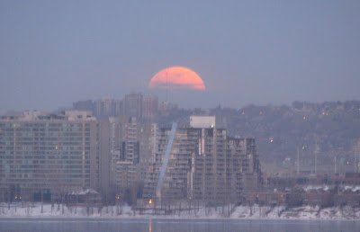
 Above: The full snow moon sets over Montreal. The best I could do yesterday was this salt truck waiting for the freezing rain to start. Below: AP Photo of Tornado damage in Oklahoma.
There is plenty to talk about this morning, lets start with yesterdays non event, or was it. Very little freezing rain occurred anywhere really. There was just a few drops of it north of Montreal and none in Kemptville, however it was enough to cancel all the school buses and cause several major multi vehicle accidents on the Laurentian autoroute north of Montreal. SLOW DOWN!
Secondly very mild air is now streaming northward behind the warm front. It is already 6C in Kemptville and 8C in Toronto - a record high. Montreal however is very slow to warm and we are at -3C. All areas should see highs between plus 7 and 10C today with plenty of snow melting. Adding to the melt will be heavy rain. Heavy Rain Warnings have been hoisted by Environment Canada for all of Eastern Ontario and the Ottawa Valley. Expect 15-25mm or one inch of rain from this evening through mid-day Thursday. The rain may be enhanced by isolated thunderstorms. This system, which developed in north Texas, produced the first wave of severe weather last night. Several major tornadoes swept across Oklahoma knocking power out to over 30,000 people just two weeks after their ice storm. Nine deaths have been attributed to the severe weather with the hardest hit community being Lone Grove, Oklahoma. Today things should quiet down as far as severe weather goes but the flood threat will remain in many areas, and winds will increase in all areas.
As the system moves east of us on Thursday look for much colder air, flurries and winds over 60km/h. Wind warnings may be needed.
No comments:
Post a Comment