Wednesday, December 31, 2014

Much colder weather pattern develops in Ontario & Quebec

A superbly talented graphic artist, co-worker and friend, Vicki Fawcett, drew this for me in 2007. www.actofimagination.net
Happy New Year!
I still can't get my head around the fact that another year is over. This was, for whatever reason, probably the quickest year of my life. In any event from my family to yours I wish you a safe, healthy and Happy New Year. Thank you once again for reading my rambling weather posts, without you there is no Valley Weather/Suburban Weather Blog. I truly appreciate your time.


After a very cold day, the setting sun frames a barn in Alburgh, Vermont on Tuesday, December 30. (Valley Weather Photo)
As I write this blog early on New Years Eve, we are looking at the prospect of a decent weekend winter storm as cold air pours into western North America and spreads east. This will be in sharp contrast to the last two weeks of  December that have been as much as 10 degrees above normal. In the short term, high pressure will give us a decent day in Montreal but with increasing clouds. A low pressure trough will sweep across Ontario and Quebec with gusty winds and flurries tonight and New Years Day. Significant accumulations are expected around the Great Lakes, so be prepared if your travels take you to Toronto along the 401 or south on Interstate 81 towards Syracuse, NY. Away from the lakes and here in Montreal, only a dusting is likely. Winds may reduce visibility briefly in blowing snow Thursday. The temperature is cold this morning at -13C on L'Ile Perrot, but should warm to -8C today and -5C on Thursday.

NEXT STORM ARRIVES THIS WEEKEND
On Saturday, low pressure is expected to develop over the Ohio Valley and move down the St. Lawrence Valley on Sunday. We are looking at a mixed precipitation event for Montreal and Ottawa at this time with a burst of heavy snow late Saturday followed by a mix with sleet, freezing rain and rain for Sunday. Accumulations could be significant in Montreal, southern Quebec and eastern Ontario, and warnings may be needed. The weekend will be busy for travel, so please stay informed on the latest forecast. The track of this system is not set at this time and big swings in the forecast are possible. I will update this blog frequently on this potential storm. The low will move into Atlantic Canada by Monday with the coldest air of the season pouring into Ontario and Quebec on strong winds and lake effect snow just in time for back to work.

Monday, December 29, 2014

Much colder weather returns

The Christmas Day windstorm produced gusts to over 100knm/h (60mph) across a wide area from western New York including Buffalo (above) to southern Quebec. Trees were knocked down and power was out to thousands of homes including nearly 35,000 in Quebec.
After a record breaking warm Christmas period, Montreal will return to much colder weather this week. The temperature rose above freezing during the morning hours on Tuesday, December 23 and only fell back below 0C (32F) around 6:30pm Sunday evening, a period of over 128 hours. This establishes a new above freezing record for Montreal in December, the previous being 98 hours in 1964.

Just how mild was it? The average temperature in the city through the Christmas week was 6C (43F), the normal should be around -5C (23F). We also managed to loose the 30cm (1 foot) of snow on the ground in about 36 hours and are only left with patches. This has not been very good news for ski resorts and those who like to snowmobile or snowshoe, or even outdoor skate for that matter. Some ski resorts claim business was down over 90% for the Christmas break so far. My grass even has hints of green in it after the 35mm of rain Christmas Eve. Strong thunderstorms and even tornadoes were reported Christmas Eve in the US. Thunderstorms were reported in Ontario.

MUCH COLDER POSSIBLE STORM
There is some hope for those who prefer more traditional winter weather. You will be shocked when you step outside this morning as the temperature has fallen overnight to around -8C (17F) currently on L'Ile Perrot. Add to that a very gusty northwest wind in the 30-50km/h range and the temperature feels like -15C. There were a few flurries around as a cold front crossed the area overnight, but no accumulation was reported in Montreal. It will be cold today and all week with temperatures back to normal values. Some light snow is possible on New Years Day and a more significant storm may affect southern Ontario and Quebec by Saturday. This potential storm will make big news this week as it affects the US southwest. Snow is forecast for some parts of metro L.A. into Nevada including Las Vegas.

Wednesday, December 24, 2014

Heavy rain & windy for Christmas 2014 in Montreal

The storm system that will be responsible for our wet and windy Christmas in Montreal, spawned several rare December tornadoes Tuesday from Louisiana to Mississippi. (WDAM News)
WIND WARNING METRO MONTREAL: 
Southwest winds 60-100km/h Christmas Day.

It looks like those of you who wanted a wet and green Christmas will have your wish come true. Rain is falling across the northeast and southern Ontario into Quebec on this Christmas Eve. Low pressure is lifting north from Mississippi towards Lake Huron. Mild air will surge north into our region guaranteeing rainfall for the next 24 hours. The rain combined with snow melt will produce some localized flooding. There may even be a thunderstorm is some locations especially in Ontario. Temperatures will warm from current readings around 5C (41F) up to 10C (50F) by Christmas morning in Montreal. The high temperature record for today is 8.3C (47F) set in 1957, that one should be ok, but we have a shot at the warmest Christmas record high of 11.7C (53F) set in 1964.

Besides the 25mm (1 inch) of rain expected in the St. Lawrence Valley, winds will increase sharply on Christmas morning in advance of a cold front. Southwest wind gusts to 80km/h are possible in Montreal with 100km/h possible in Ontario. Warnings will likely be posted later today for that element. The wind could lead to power outages or some trees toppling. Skies will clear for Boxing Day with a cooler high of 3C (38F), still well above normal. Unsettled weather returns over the weekend with a chance of rain or snow and then snowy and much colder into the last week of 2014.

DECEMBER TORNADO
This same weather system spawned severe thunderstorms and tornadoes on Tuesday along the Gulf Coast from Louisiana to Mississippi. Thousands were left without power and numerous buildings were damaged or destroyed. Sadly, 4 fatalities and multiple injuries were reported in Columbia, Mississippi. Severe weather will stretch from Florida to the North Carolina today with thunderstorms possible as far north as New York and Ontario.

Tuesday, December 23, 2014

Freezing Rain Warning for Montreal & Eastern Ontario

Santa may have trouble landing the sleigh in rain across Ontario and Quebec this Christmas Eve. (TWC Image)
FREEZING RAIN WARNING
A warm front approaching the St. Lawrence Valley early this morning is producing a wide area of light snow and freezing rain from Kingston across upstate New York and into southern Quebec and the Ottawa Valley. Light snow and sleet are falling in Montreal with slippery roads and a current temperature of -4C (25F).

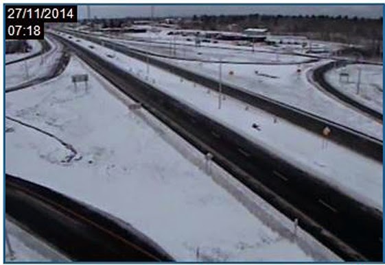
Warnings are in effect for 2mm to as much as 10mm of frozen precipitation throughout the day in Quebec, enough to make travel very icy. Already this morning Highway 401 east of Kingston, Ontario is closed due to a crash, traffic is at a standstill according to MTO cameras. If you can wait to travel today, best to do so at least until late afternoon when temperatures should warm above freezing south and west of Montreal. It will take longer northeast of Montreal, likely into the overnight hours to warm up. By Christmas Eve everybody should be above freezing as a second more intense storm arrives in western Quebec.

This second storm, developing along the Gulf Coast, will send a surge of mild air and deep moisture north Wednesday into early Christmas Day. Montreal and most of eastern Ontario can expect a decent rainstorm with over 25mm (1 inch) of rain and winds increasing out of the west to over 50km/h. Temperatures may approach record high values in some parts of eastern Ontario and southwest Quebec Christmas Eve and Day. Look for highs to rise through 0C (32F) today up to between plus 7C and 10C (45 to 50F) Wednesday. There may even be a rumble or two of thunder Christmas Eve, just to add to the odd weather. On Christmas Day look for clouds along with a shower and mild highs of 5C (41F). A cold front may produce some flurries along with colder weather into Boxing Day. It will become very windy as well.

Winter enthusiasts don't despair, it looks like much colder and snowier weather to end the year, more on that later.

Sunday, December 21, 2014

Windy - wet Christmas Day for Quebec & Ontario

Just a typical scene from Montreal during winter in the 1970's. I was blessed to be a child in this city during that time.
Happy Winter, the season arrived at 6:03pm Sunday evening.

If there is one thing I hate, it is rain on Christmas Day. You have to understand, I am a child of the 70's, as far as I am concerned, the best decade out of the last 5. The 1970's were just awesome at Christmas time. A look back at the stats for Montreal backs that up with lots of snow at Christmas time for sledding and skiing and ice at the park to skate on. I remember 1975 for example, 74cm of snow for the month, 3 storms including a Christmas Day storm that dumped 27cm into Boxing Day. There were others as well throughout the decade. This was my childhood, snowy Christmas after snowy Christmas throughout the 70's until 1979 that is. It seemed to change overnight as the decade was coming to an end. Christmas Day 1979 was green, the first of my childhood. It rained, over 31mm on the 25th. The month was very mild with only 8cm of snow, but 64mm of rain. It could be global warming, it could be the fact I turned 13, but either way the magic for me ended in 1979. After that, and certainly in the last 20 years, you have a more than even chance of rain and a green Christmas as you do for snow on December 25th in Montreal.

CHRISTMAS 2014
That brings me to Christmas 2014 and the likelihood of heavy rain and gusty winds throughout the middle portion of this week. To start the week we have chilly temperatures along with some fog and perhaps a few flurries. Low pressure developing along the Gulf coast will combine with another over the Great Lakes to create a potent storm by late Tuesday. This system will draw mild air into New England, Ontario and Quebec. Temperatures will begin warming by Tuesday and rise above freezing through Christmas Day. Heavy rain, from 25-50mm (1-2 inches) is likely from Wednesday into early Thursday. There may be a little freezing rain early on in the event on Tuesday afternoon. Temperatures will warm to 5C (41F) in Montreal and as warm as 10C (50F) in Toronto by Christmas Eve. Winds will also increase with this storm gusting well in excess of 50km/h by Wednesday. A cold front will bring an end to the rain late Thursday with perhaps a few flurries into Friday.

It is a very busy travel week for many and warnings may be required by Tuesday. I will update the blog as often as needed through Christmas Eve.

Thursday, December 18, 2014

Potential Christmas Eve storm Ontario & Quebec

Wrapping up the snow clearing operation on L'Ile Perrot from last weeks storm. (ValleyWX Photo)
This dreary, soupy weather we have been in for at least a week has become rather tiring. The last week has seen low clouds, fog, light precipitation and temperatures hovering around 0C (32F) all the time here in Montreal. This morning is no different with a current reading of, you guessed it, 0C. We will remain steady there today into tonight as low pressure deepens in the Atlantic Ocean east of Nova Scotia. This system is producing quite a decent snowfall in Maine and New Brunswick with 15-20cm falling. The western edge of it is producing light snow across southern Quebec with 5-10cm for Sherbrooke and Quebec City and 2-4cm for Montreal. The snow should taper by noon for Montreal followed by cloudy skies. Temperatures will be a little cooler tonight under clearing skies with lows of -5C. Friday into Sunday should be partly cloudy with temperatures near -1C.

CHRISTMAS STORM?
A pattern change looks likely for the week of Christmas across Ontario and Quebec. Much colder air is forecast to arrive by Boxing Day with the increasing potential for a major storm for Christmas Eve and Christmas Day. Some computer models have a very deep storm system over the central Great Lakes by next Wednesday producing heavy amounts of snow north and west of the track and mixed precipitation here in Montreal. It would be a very windy system as well. There remains lots of uncertainty with this forecast as to timing and location of specific precipitation, however with it being a busy travel week we need to put it out there early. Have a back up plan ready just in case, this applies to our entire region into Ontario and south into the Ohio Valley, New York and New England.

Monday, December 15, 2014

Dreary but mild week ahead for Montreal & Ottawa

The storminess has shifted to the west coast of North America with heavy rain and snow as well as very strong winds and coastal flooding from B.C. to California. The dramatic photo above is from Mission Terrace, California. The storms have killed three in California producing flooding, landslides, power outages and massive transport delays. (Photo via Twitter, CANOE.ca)
Low clouds and fog and in some cases freezing drizzle continue to prevail across eastern Ontario and southern Quebec this morning. It is quite mild at -2C with very little movement in temperature over the entire weekend. Low pressure that brought us our first big snow last week is now located well east of the region over the Atlantic. High pressure has been trying to clear skies out since Saturday but to no avail. Moisture trapped at the surface has created a temperature inversion and left us with solid cloud cover. Sadly the clouds will hang on until the arrival of the next weather system, so it does not look good for any sunshine. Temperatures will be mild in Montreal for the next several days, near 0C (32F) today and Tuesday and above freezing to 2C (36F) on Wednesday. Low pressure will move very near the St. Lawrence Valley on Wednesday with a period of rain or mixed precipitation before changing to snow Wednesday night.  This is not a big storm, so amounts will be on the light side. It nevertheless will make for some slippery driving mid week. Temperatures will trend colder by the end of the week but no real arctic air is forecast until after Christmas.

Thursday, December 11, 2014

Storm lessens grip on region

An emotional goodbye to Montreal Canadiens great Jean Beliveau  took place on Wednesday, played out in typical Montreal hockey weather. Despite the heavy snow and strong winds thousands gathered for the funeral. This included hundreds of fans who lined the streets for the two hour funeral, watching it on frozen big screens outside the church. (CTV News)
The first big winter storm of the season for metro Montreal will begin to slowly taper off today. Nearly 27cm (11 inches) of snow has fallen in Montreal with a general 15-30cm (6-12") across the entire region. The snow has been wet and heavy and difficult to clean. Temperatures for the duration of the storm have been within a few degrees of 0C. The official high at Trudeau Airport on Wednesday was 0.2C with a low of -0.8C, not much range. Typically coastal lows pass very quickly on the way to Atlantic Canada but not this one. It has lingered over New England now for 48 hours and will continue to do so well into Friday before weakening. The result has been lots of Atlantic moisture being transported inland as far west as Toronto this morning. Light snow will continue into Friday before ending with perhaps another 5cm for Montreal. The weekend at this time looks fair and mild for the big cleanup.

Rainfall has exceeded 100mm (4 inches) across portions of New Brunswick, Nova Scotia and PEI, while heavy snow and freezing rain knocked out power to over 20,000 Hydro Quebec customers, mostly in the Quebec City and the Eastern Townships. Winds around Quebec City and the lower St. Lawrence were as high as 100km/h on Wednesday. Numerous flights in and out of Trudeau Airport were either delayed or cancelled. The roads were terrible during the evening commute with a number of major accidents and even the closer of Highway 20 east of Quebec City due to whiteout conditions.

Wednesday, December 10, 2014

Long duration storm for Quebec, NY & Ontario

Around 10cm of wet snow fell on L'Ile Perrot overnight. More on the way this afternoon. (ValleyWX)
 Low pressure this afternoon is located over southern New York State. The system continues to send moisture across New England and into New York, Ontario and Quebec. Around 10cm (4 inches) of very dense heavy wet snow has fallen in Montreal and west into eastern Ontario with areas of freezing rain across the Townships. Quebec City has had 8cm of snow. Winter Storm Warnings and Snowfall Warnings remain in effect across the region. Another surge of moisture should arrive in Montreal by this afternoon with an additional 10-15cm (4-6") forecast into Thursday morning. Strong winds are also occurring today with gusts to 60km/h in Montreal.

Green Mountain Power crews in Vermont are keeping busy after heavy snow brought down trees on power lines. Over 35,000 customers were without power overnight. (NECN)
 Hydro Quebec is reporting nearly 10,000 customers without power due to the storm across the province, while Green Mountain Power in Vermont has nearly 17,000 blacked out. This number in Vermont is down from a high of 35,000 overnight. It may take days to restore all the power in Vermont, depending on how this next batch of moisture plays out. Roads are in good shape right now in metro Montreal, mostly slushy with the temperature stuck at 0C (32F) since 3am this morning. That may change as more snow arrives later this afternoon.

Tuesday, December 09, 2014

Snowfall Warning posted for Montreal & Cornwall

Visible Satellite image of low pressure near New York City this afternoon. (NWS NYC)
 Southern Quebec will be affected by a major east coast storm over the next 36 hours. Low pressure near New York City will slowly meander across New England through Thursday. The storm has been pounding coastal areas with flooding from North Carolina to New England today. Inland heavy rain and freezing rain is falling along the coastal plain with snow over the Green Mountains and Adirondacks. The snow has reached the St. Lawrence Valley and will fall steadily into late Wednesday. Montreal is looking at 20-30cm of snow, the first big storm of the season, therefore a snowfall warning is now in effect for the city and suburbs. Traffic is already crawling along area highways tonight.

Very poor travel across Vermont today. (via twitter Fox44)
Heavy snow is also forecast across eastern Ontario where warnings have been posted for Cornwall and points east. Winds will be strong along the St. Lawrence Valley from 50-70km/h with higher gusts possible, especially near Quebec City. Travel will be poor Wednesday into Thursday. Temperatures will be near the freezing point for the storm so the snow will be wet and very heavy. Winter Storm warnings are also in effect fro northern New York, Vermont, Quebec City and the Eastern Townships. Environment Canada recommends postponing unnecessary travel on Wednesday for points south and east of Montreal.

Major storm to impact Quebec

NCDOT photo of the Atlantic Ocean rushing onto North Carolina Highway 12 on the Outer Banks Monday. The flooding was caused by a strong Nor'Easter heading for New England and Quebec. Gale force winds, coastal flooding and heavy snow and rain will occur along the track of the storm. Strong winds and snow for Montreal.
Winter Storm Warning: Vermont, NY as well as Quebec City, Beauce and Townships.
Winter Weather Advisory: St. Lawrence Valley.
Special Weather Statement: Metro Montreal and Ottawa.

Low pressure this morning just east of Virginia Beach will move northeast towards New York City while deepening today. A plume of moisture associated with this system will overspread New England today and into southern Quebec and eastern Ontario tonight. Temperature profiles will be critical but it looks like mainly snow for Montreal and Ottawa with perhaps a mix across other portions of the province. This morning Montreal is cloudy and -5C. The temperature has fallen 5 degrees in the last hour after a wind shift form southeast to northeast. Northeast winds will increase all day becoming strong 50-70km/h by tonight and as high as 110km/h in Quebec City.

Light snow will develop this evening and continue throughout Wednesday in Montreal with 10-15cm (4-6 inches) likely for the city and perhaps 20cm (8 inches) outside the metro areas. As much as 30cm (1 foot) is possible in Quebec City and across the Beauce and Eastern Townships. There will be blowing snow as well reducing visibility in the St. Lawrence Valley. Travel will be slow across a wide area of eastern Ontario, southern Quebec and the northeast US late tonight and Wednesday. Light snow will continue into Thursday for Montreal with additional accumulations likely. Temperatures during the storm will be around 0C (32F) for highs and -4C (25F) for lows. The storm will slowly weaken as it meanders around New England before being swept into the Atlantic by Saturday.

Monday, December 08, 2014

Atlantic Coast storm to impact Quebec & Ontario

Just one computer model depicting a major storm near New York City by early Wednesday morning. This scenario produces heavy wet snow over the St. Lawrence Valley.
SPECIAL WEATHER STATEMENT: Ontario & Quebec

A rather complex weather scenario is setting up this week with the potential to dump heavy wet snow on the St. Lawrence Valley from Brockville to Quebec City. Cold high pressure is in place this morning with some of the chilliest readings so far this season. Temperatures range from -11 to -15C on the island of Montreal, but as cold as -18C north of the city. Look for sunshine with increasing clouds today and a cold high of -8C. Those clouds will thicken on Tuesday in response to low pressure organizing off the US eastern seaboard. This system will deepen into a major storm with strong winds and heavy precipitation for all of New England, New York eastern Ontario, Quebec and Atlantic Canada. It has been a difficult scenario for the computer models to handle, and lots of uncertainty remains as to the type and location of the heaviest precipitation. Right now it looks like mostly wet snow for eastern Ontario and a rain snow mix for southern Quebec with perhaps a prolonged period of freezing rain.

The initial push of moisture will arrive by late Tuesday, I am hopeful after the evening commute for Montreal. That will result in a few centimetres of wet snow with highs near 0C (32F). The snow will continue overnight into Wednesday morning with the possibility of over 10cm by Wednesday morning. I don't think Wednesday will be a good driving day in Montreal and Ottawa as well as the Quebec City to Brockville corridor. Heading south the same situation will prevail with 15-30cm (6-12 inches) of wet snow possible over northern Vermont and New York. Winds will become very strong out of the northeast in Montreal gusting in excess of 50km/h by late Tuesday. Looking ahead the system will be in no hurry to move away lingering along the coast near New York City and continuing to pump moisture into our region. Light snow or a wintry mix may last well into Thursday or Friday.

Warnings will likely be required for a portion of our region later today. I will post those as soon as they are available. Plan your week accordingly as travel will be rather difficult at times.

Friday, December 05, 2014

More light snow for Montreal

Snowfall forecast from AccuWeather.com
Another shot of light snow or freezing drizzle is expected for southern Quebec as we head into this weekend. We are quite cold this morning across the western suburbs of Montreal with temperatures between -12C and -15C (5 to 10F). Expect a sunny, chilly day today with highs reaching -2C (29F) by late in the day. Clouds will be on the increase all day as a warm front lifts north from the Ohio Valley. Low pressure will move along the front as well passing well south of Montreal. Some light snow will develop this evening and mix with freezing rain overnight. A general 2-3cm is possible for metro Montreal, very similar to Wednesday night. More snow is expected further south and east along the Maine border as well as northeast of Quebec City. Temperatures will eventually rise above freezing on Saturday to around 2C (36F) with showers likely. Another strong cold front will cross the region late in the day Saturday with a round of snow showers before temperatures fall back down below freezing. Sunday and Monday look fair but cold with highs near -7C (19F).

Looking ahead into early next week, an active period of weather is possible with the potential for an east coast storm by the middle of the work week. Temperatures across North America will be above normal as the cold air retreats well to the north and milder Pacific air takes over. As far as the east coast storm goes, there is the chance for significant snow or rain depending on the track. It will bear watching. Look for updates on this blog over the weekend.

Tuesday, December 02, 2014

Snow & freezing rain for southern Quebec

Hydro workers continue to restore power in Maine and New Hampshire after the Thanksgiving Day snowstorm knocked 200,000 customers into the dark. Crews from across New England, Atlantic Canada, Ontario and Quebec arrived to help. The worker above, Larry Page, is from New Brunswick working in Bow, New Hampshire. AP Photo
We are cold this morning in metro Montreal, the coldest morning this season so far. The temperature here on L'Ile Perrot is at -15C (5F) almost 20 degrees colder than it was Monday morning. Along with that is a biting northeast wind pushing the windchill value down to -23C. It will be a cold day in southern Quebec and Ontario with temperatures around -5C (23F) for a daytime high. The good news is we will have bright sunshine and it will remain dry.

This evening the weather will begin to deteriorate, setting us up for a messy commute Wednesday morning. Low pressure and a warm front will approach form the Ohio Valley with a period of snow, sleet and freezing rain forecast for the entire region. Precipitation will begin this evening and change to rain in Montreal by mid morning Wednesday as the temperature rises back above the freezing point to a high of 4C (39F). The wintry mix could accumulate 5cm to as much as 8cm (1-3 inches) in some locations. A winter weather advisory is now in effect for all of New York and New England. We do not have such a level of weather warning in Canada, however be prepared for icy and snow covered roads overnight and early Wednesday across the area.

Any leftover rain will change back to flurries by late Wednesday in Ontario and Quebec as we take another dive down in the temperature department. Thursday looks windy and cold at this time, -3C, as the roller coaster ride I mentioned late last week continues.

Monday, December 01, 2014

Frigid across western Canada

While it was warm in Montreal, extreme cold, wind and snow has prevailed in Edmonton (above) and points east towards Regina and Winnipeg this past weekend. (CBC)
While eastern Canada continues our wild temperature swings into the first week of December, it has been absolutely frigid across western Canada. Mid-January temperatures gripped Saskatchewan and Alberta over the weekend with snow and blowing snow. Winds gusted to over 60km/h in Regina with overnight lows last night of -31C. Wind chill values were below -40C. Montreal on the other hand had a mild weekend with showers and highs well above normal near 7C (45F) on Sunday. It was 9C (48F) in Ottawa and 14C (56F) in Toronto. A strong cold front overnight brought a few showers to Montreal and has also lowered the temperatures this morning. Montreal has dropped from 6C (43F) at midnight to 2C (36F) currently and we will continue to drop to -4C (25F) by late this afternoon.

The week looks unsettled and highly variable in the temperature department across southern Ontario and Quebec. We start the week cold with a few flurries through late Tuesday with cold lows of -13C (9F) and highs of -8C (18F). Wednesday will be mild with showers and a high of 7C. But Thursday and Friday look very cold once again with highs dropping back well below freezing. Any precipitation this week in southern Quebec will be light with no major storms on the horizon. A little light snow may cover the ground Tuesday night and again early Thursday.

Thursday, November 27, 2014

Temperature roller coaster ride for Montreal

Heavy wet snow left nearly 100,000 customers in the dark in New Hampshire. 
(New Hampshire Union Leader Photo)
We missed another storm, that makes 4 already in this young season for metro Montreal. Winter has raged across wide portions of North America this November and yesterday was no different. A strong Nor'Easter moved from Cape Cod into Atlantic Canada overnight producing a wide swath of heavy wet snow. Amounts in excess of 15cm (6 inches) fell in Vermont and the Townships with 25cm (10 inches) or more from Albany, NY across southern Vermont and into New Hampshire, Maine and New Brunswick. The weight of the snow brought down tree branches on power lines with widespread power outages reported. Nearly 200,000 customers were without power in Vermont, New Hampshire and Maine with another 40,000 in New Brunswick. The weather also resulted in the cancellation or delay of over 4000 flights on the busy day before US Thanksgiving. On the roads it was no better with several major accidents and at least one fatality in Maine.

The ground is white in Lacolle as snow missed Montreal but did fall along the US border. (Quebec 511)
The snow never quite made it to Montreal, in many cases showing up on radar but evaporating before hitting the ground. However the ground is white south of Montreal from Lacolle east into Sherbrooke and the Townships. Not even one flake fell on L'Ile Perrot. Roads are in good shape this morning if you are heading south into Plattsburgh or Burlington. There are slick spots but the crews have done a tremendous job. Towards Sherbrooke and Stanstead roads are still snow covered as the snow is still falling there.

Temperature Roller Coaster
Montreal will now hop on the temperature roller coaster for a ride many of us don't want to be on. I am not a fan of weather like this to be quite honest. Today and Friday we will be near normal around 0C (32F) for highs. That will be followed by -2C (28C) on Saturday but plus 8C (48F) on Sunday and plus 12C (54F) on Monday. However by Tuesday a cold front will drop us back down to -8C (18F). The trend will then repeat itself next week. A few flurries are possible tonight into Friday morning and then again Saturday night. Showers are likely Sunday and Monday. No majors storms on the horizon at this time.

Wednesday, November 26, 2014

Nor'Easter to brush southern Quebec - impact US travel

From AccuWeather this morning. These amounts have shifted a little north and west , with the 1-3 inch line coming closer to Montreal later today and tonight.
The busiest travel day of the year in the US is being greeted with a Nor'Easter along the American east coast. Low pressure currently near the Delmarva area will move northeast to lie near Cape Cod this evening. A swath of moisture is moving north and will overspread New York and New England today. Rain is forecast along the immediate coast and wet snow inland with accumulations forecast of 6-12" (15-30cm). The heaviest snow will fall from Albany, New York across central Vermont and into New Hampshire, into Maine and New Brunswick.

Montreal will remain on the northern edge of the storm. The forecast track has shifted slightly west so the chance for some accumulating snow along the border areas has increased. Montreal is only expecting a few flurries this afternoon, but 2-4cm is possible form the south shore to the US border. If your travels take you towards Sherbrooke, they can expect 10-15cm (4-6 inches), so travel will be affected. Expect snow covered highways heading south and east by late today with lowering visibility. Winds have finally died down today after a nasty couple of days in southern Quebec. They will increase latter today out of the northeast this time to 30km/h. Cold air has moved into Montreal, so after a record high of 18C (65F) on Monday it is only -1C (30F) this morning. It will not get any warmer today.

Tuesday, November 25, 2014

Fierce winds & record highs for Quebec/Ontario

Winds gusting to over 100km/h in Montreal tore this roof off a building Monday evening. (Photo Meteomedia Twitter)
There is so much to talk about this morning in the weather department as the seasons clash. Deep 978mb low pressure over the northern Great Lakes is the dividing line between early fall and winter weather. Montreal was on the warm side of the storm on Monday as strong southerly winds helped push temperatures to nearly 20C. New record highs were established at Trudeau Airport, 17.8C beating the old record of 17.5 set in 1999. Records were also set at Sainte-Anne and L'Ile Perrot at 20C, St Anicet and Cornwall, Ontario at 21.3C (70F), Ottawa 19.4C and Toronto 18.3C.

Winds in excess of 90km/h across eastern Ontario caused plenty of damage to signs, roof shingles and trees. This one was toppled west of Kemptville, Ontario. Power was also out to over 70,000 customers. (Photo: J.Kinnear)

A strong cold front swept across the city of Montreal around 7pm last evening with powerful winds, thunder and lightning. The strongest wind gust of the year was observed at Trudeau Airport around 6:50pm at 107km/h (67mph). Wind gusts all night have been frequently over 80km/h in Montreal. The wind knocked out power to over 45,000 customers in Quebec. That number is down this morning as Hydro Quebec crews work to repair the damage. A roof was even ripped from a home on Beaudry near St. Catherine Street. No injuries were reported. Heavy rain fell along the front as well as yesterday morning with 16mm reported at the airport and on L'Ile Perrot.


East Coast Snowstorm
Temperatures are down this morning and will stay there all day. After the summer like warmth on Monday, we will be lucky to surpass 5C (41F) today in Montreal. The other story this morning is the potential east coast snowstorm. That front that brought us the wind will stall along the east coast and allow low pressure to develop off the North Carolina coast and move northeast. The storm will pass near Cape Cod on Wednesday night. Snow is forecast to fall across a wide swath of New England, Atlantic Canada and the northeast US. This comes during the busiest travel time of the year stateside, the Thanksgiving holiday. The potential storm has prompted a wide range of watches and warnings for 15-30cm (6-12inches) of snow. At this time is looks like the snow will just brush the border regions of southern Quebec.

Monday, November 24, 2014

A 24 break from winter in southern Ontario & Quebec

The crazy western New York weather will write a new chapter today as strong south winds drive the temperature over 60F. The warmth combined with showers will help produce flooding as the 3 to 6 feet of lake effect snow melts rapidly. (Photo AOL News)
A warm front is in the process of lifting across southern Quebec this morning. Heavy rain overnight has put down about 13mm with all of our snow cover gone. Temperatures are very mild at 8C (48F) this morning. The rain will come to an end by 10am with just a chance of showers for the balance of the day. It will be windy and warm with southerly gusts to 70km/h possible today into tonight in Montreal, and a near record high of 15C (59F). The record high for today in Montreal was 17.5C (64F) set in 1999.

An arctic cold front will blast across Ontario and Quebec tonight and Tuesday with winds gusting as high as 90km/h in some locations and much cooler air arriving. Wind warnings have been posted for many regions of southern Ontario. Temperatures will fall to around 5C (41F) Tuesday and remain there most of the day. It will drop to the freezing point Tuesday night. On Wednesday cold air streaming across the Great Lakes will produce more lake effect snow, especially in central Ontario. A coastal storm is also forecast to develop and move up the American east coast just in time for the busy U.S. Thanksgiving travel period. We will watch that closely to see what impact, if any, it has on southern Quebec. It will turn much colder by the weekend with lows down as cold as -10C and highs remaining well below freezing.

Friday, November 21, 2014

Warmer air and rain by Monday

The Lake Ontario snow plume stretched over 320km (200 miles) from western NY as far east as southern Quebec on Thursday. The image above from CBC was taken at Bishops University in Lennoxville.
A big warming trend if expected in Montreal and across most of Ontario, Quebec and New England. High pressure will give sunshine today with a cold high near -4C (25F). We start the day on L'Ile Perrot at -8C (18F), one of the coldest mornings this season so far. Clouds will increase on Saturday along with the chance for showers and flurries. This is thanks to a warm front lifting across the St. Lawrence Valley. Depending on how much cold air remains trapped at the surface, a period of freezing rain is even possible overnight Saturday for some portion of our region. By Sunday very warm air will stream into southern Quebec on southerly winds producing highs near 10C (50F). It will seem like summer by Monday with a forecast high of 15C (59F). Along with the warmth will come rain late Sunday and Monday as low pressure lifts north across the central Great Lakes. Colder air will return by later next week with a chance for some snow.

Buffalo Update
The snow will come to an end across western New York today as the lake effect machine is turned off. Totals will be historic once all is counted with amounts generally of 2 to 7 feet in the hardest hit locations south of Buffalo and near Watertown. The death toll is at 12 with numerous other injuries reported. The National Guard continues to help with the clearing effort including trying to remove snow off roofs. Already over 30 structures have had their roofs collapse from the weight of the snowfall. A driving ban remains in effect south of Buffalo as highways remain closed. The NHL game between Buffalo and the Rangers has been postponed. The NFL game this Sunday between the Bills and the Jets has been moved to Ford Field in Detroit. Attention will now turn to a serious flood risk starting Saturday. The warm air and rain forecast will likely melt the snow rapidly resulting in flooding. A flood watch is already in effect for several western New York counties.

One final note, yesterdays plume of snow off Lake Ontario at one point in the morning, stretched over 200 miles from western New York into southern Quebec. Heavy snow fell near Lacolle and over towards Sherbrooke with as much as 10cm (4 inches) in just a couple of hours. This has been one of the most impressive lake effect events I have seen in m years watching the weather.

Thursday, November 20, 2014

BIG warming trend forecast - more snow for Buffalo

This is an amazing radar image from the National Weather Service office in Binghamton, NY showing just how far from Lake Ontario the snow is reaching. Environment Canada has posted watches and warnings for extreme southern Quebec along the US border for a quick 10cm of snow and blowing snow. Travel with caution. I am watching it closely to see if it meanders towards Montreal.
 A major warming trend is forecast by the end of this upcoming weekend, until then it will be windy, cold and perhaps a little snow for Montreal. The big story this morning continues to be the unseasonably cold air and early season snows across the Great Lakes. Montreal is at -2C this morning and we have a fresh 2cm of snow on the ground. Expect a windy day with flurries and a high near 0C (32F). A strong cold front will cross the area this afternoon with a few snow showers followed by a cold night with lows near -9C (16F). Friday will be windy and cold once again with highs near -4C (25F). Winds over the next 24 hours will be between 30-60km/h.

Just a stupid amount of snow in West Seneca, New York south of Buffalo. Another 1 to 3 feet of lake effect snow is forecast today into Friday before the storm ends.
Buffalo Snow
The snow across western New York continues to be beyond impressive. A passing trough of low pressure briefly pushed the snow plume north of the battered Buffalo south towns and into the Niagara region of Ontario last evening. Heavy snow, thunder and lightning and strong winds put down a quick 15cm (6 inches) in places like St. Catherines,  Fort Erie and Niagara Falls before shifting back south again into New York. This morning the heavy snow is falling from metro Buffalo south into Erie County. Another 1 to 3 feet of snow is forecast over the next 24 hours on top of the 4 to 6 feet that fell this week. This amount is becoming dangerous putting a tremendous strain on all dwellings. A driving ban is in effect as well the National Guard has been called out to help with rescue and relief efforts. So far 8 deaths have been blamed on the storm. The snow has brought life to a standstill in the affected areas, this may include the NFL game between the Buffalo Bills and the New York Jets scheduled for Sunday. Ralph Wilson Stadium in Orchard Park is under tons of snow. The Bills are offering $10 per hour to fans as well as free tickets to those who can help shovel out the facility. So far the game remains on schedule for Sunday. Relief is in sight by Saturday with a major warm up and some rain. That may lead to flooding and a tremendous concern for any roofs not cleared of the massive quantity of snow.

Forgotten in the news has been Jefferson, Lewis and St. Lawrence County, NY off Lake Ontario that has had just as much snow. More snow is forecast there as well making travel down Interstate 81 around Watertown nearly impossible today.

Wednesday, November 19, 2014

Epic snows across western New York - a little for Montreal

A quick shot of snow on L'Ile Perrot last night left about 5cm (2") on the ground. (ValleyWX)
Late last evening a weak trough of low pressure crossed the St. Lawrence Valley and for a brief period tapped into the Lake Ontario snow plume. The result was a quick 5cm (2 inches) of snow at my home on L'Ile Perrot between 9-11pm. Gusty winds accompanied the snow and with this mornings current temperature of -8C, it feels and looks like winter. A little less snow fell on most of the island of Montreal with more towards the US border. It will be partly sunny today but breezy and cold with a high of -3C. More light snow is forecast tonight before another shot of cold air to end the week. A warm up is on the horizon by the end of the weekend. More on that later.

The New York State Thruway south of Buffalo is impassable, clogged with 3-4 feet of snow. Travel in western New York on I-81 and I-90 is not possible for long stretches. (NY State Police Photo)
Western New York Snowstorm
Our weather is part of a bigger picture of record cold and early season snow across a wide chunk of North America. By now many of you have seen the wild pictures from western New York. Typically this area is very familiar with heavy snow but this lake effect event has been historic. In less than 24 hours over 50 inches of snow fell on the south-towns of Buffalo with 30-40 inches near and south of Watertown, New York. As is typical with lake effect snow, the bands are elongated but narrow, affecting 10 miles or so with the most intense snow. Such was the case on Tuesday with Lancaster, NY receiving 42 inches of snow while Buffalo Airport, just 3 miles away to the northwest, had only 3 inches. Where the snow has fallen it has been disabling with a state of emergency in effect and the National Guard called into action. Miles of the New York Thruway are closed, littered with abandoned and in some cases occupied cars. Police and fire have had to respond on snowmobiles and in some cases on foot. The storm has turned deadly with 5 fatalities reported as of this morning. The snow has lifted north into the Niagara and Fort Erie, Ontario region this morning and will slowly taper as a wind shift occurs. It will however return on Thursday as a fresh batch of arctic air races across the open waters of Lakes Erie and Ontario as well as Huron.

Tuesday, November 18, 2014

Historic lake effect snowstorm

Cars stranded overnight on the New York Thruway, 20 miles east of Buffalo, NY.(Photo @reedtimmerTVN)
The first snow for winter 2014/15 is in the books with 6-10cm falling in Montreal and 5-15cm across eastern Ontario. Wet snow fell all day in Montreal on Monday mixed occasionally with rain. A strong arctic cold front moved across Quebec overnight with temperatures dropping to the current reading of -5C (23F). The big news today as far as Montreal goes is the wind. Gusty southwest winds are increasing this morning with a gust a Trudeau Airport already reaching 79km/h. They will remain strong all day reaching 90km/h at times. Wind warnings have been issued by Environment Canada for the St. Lawrence Valley and most of southern Quebec. Other than a few flurries off the Lake Ontario band of snow, it should be partly sunny, but cold with highs no better than -3C.

HISTORIC LAKE SNOWS
That lake effect snow band I spoke of will be historic in places such as Buffalo and Watertown, N.Y. Two well established plumes of snow have formed over the relatively warm waters of Lakes Ontario and Erie. Overnight heavy snow fell in the suburbs south of Buffalo with over 2 feet (60cm) reported. Elma, New York has already had 32.4 inches. The snow was driven by southwest winds reaching 45mph. Needless to say travel is nearly impossible in a small region that included portions of the New York State Thruway south of Buffalo towards the Pennsylvania border. The snow was accompanied by thunder an lighting and fell at the rate of 4 inches (10cm) per hour at times. Heavy lake snows are also falling in Ontario east of Lake Huron and Georgian Bay. Some of that activity may make it into the Ottawa Valley.

Off Lake Ontario, another narrow band of snow will produce 1-2 feet across the region from the Thousand Islands south to Watertown and the Tug Hill and northeast into St. Lawrence County and the Adirondacks. Some of this activity may make it into the northern St. Lawrence Valley closer to southwest Quebec but it would be light. This major lake effect event is expected to last well into Wednesday so we could be looking at significant amounts of snow in New York and Ontario by weeks end.


Monday, November 17, 2014

First snow for Montreal - winter returns to Ontario & Quebec

The first snow of the season covered the ground on L'Ile Perrot Sunday morning. (ValleyWX)
Our current battle with winter is early but not unprecedented. Montreal awoke to a thin layer of wet snow on Sunday morning with a general 2 or 3cm (about 1 inch) across the area. The snow was all but gone by noon as temperatures rose to 3C (39F). Snow is falling again this morning in southern Quebec as low pressure moves from the Gulf of Mexico across the Ohio and St. Lawrence Valley's. Accumulations are expected to range from 5cm (2 inches) in metro Montreal to as much as 15cm (6 inches) across the higher elevations north and east of the city. Winds will be light today, but increase dramatically overnight and into Tuesday as the storm moves into eastern Quebec and deepens. Wind gusts in excess of 70km/h are possible by Tuesday in Montreal. The winds will blow around any remaining snow, as well as make it much colder than the forecast high of -1C (30F).

Lake Effect Storm
Those same winds will generate a significant lake effect snow event across western and central New York state, around Lake Huron and Georgian Bay in Ontario and even the southern St. Lawrence Valley between Kingston and Brockville. Heavy lake effect snow will develop later tonight and persist into Wednesday. Forecasters expect 1 to 2 feet (30-60cm) of snow along with 80km/h winds in spots. The near blizzard conditions will be accompanied by thunder and lightning in some cases. This will be a major lake effect storm with travel difficult to impossible along portions of Highway 401 as well as Interstates 81 and 90 in New York. The current warnings include Watertown and Buffalo as well as the Adirondacks of New York. In Ontario, snow squall watches are posted for a wide area from Georgian Bay to the upper Ottawa Valley as well as the Niagara Region and Prince Edward County to Kingston. Some of the most persistent squalls may even brush extreme southwest Quebec late Tuesday.

Saturday, November 15, 2014

Measurable snow expected for Montreal & southern Quebec

The tale of two Montreal's. Montreal, Wisconsin (The Weather Channel) above, measured over 125cm (50 inches) of snow this week as a record cold outbreak swept over North America. Meanwhile the first snow of the season, just a trace, fell on Montreal, Quebec, below. It remains cold with more snow expected this weekend.
 The early season cold snap has been one for the record books. While the snow and extreme cold has manged to evade Montreal, such has not been the case across a wide swath of the country.  Nearly 60 record lows were established across the Prairies on Friday morning alone. That being said, it is the coldest morning of the season in southern Quebec with -4C (25F) here on L'Ile Perrot. It is as cold as -10C in other parts of eastern Ontario and across the Laurentians. It will warm today to near 0C. Clouds will increase as that persistent southwest flow off the Great Lakes continues. Occasional flurries are also possible from time to time. That flow has generated signifcant lake effect snow downwind of the Great Lakes. Many regions have reported 10-20cm of snow. Incredibly 125cm (50 inches) fell this week at Montreal, Wisconsin near the Michigan border in the northern portion of the state. The amount will likely establish a new state record for a single event.

St Laurent, Quebec, Friday. (ValleyWX)
Montreal Snow
Once again Montreal is looking at the possibility of a measurable snowfall. A few flurries are possible late today into early Sunday with perhaps a dusting to 2cm to whiten the ground. Temperatures will be cold with highs near 0C (32F) and lows around -4C (25F). Low pressure will then move from the lower Great Lakes off the coast near New York City while deepening late Sunday. This will not be a monster storm, but it does have the potential to put down between 5 and 15cm (2-6 inches) of snow across a wide area from the Ohio Valley into New England and likely southern Quebec. The snow would start late Sunday or early Monday and taper Tuesday in the overnight hours. There is still some question as to the track of the system and Montreal may be just on the northern edge. Cold air will wrap in behind the storm with temperatures well below normal all next week and significant lake effect snow in western New York and even the southwest St. Lawrence Valley west of Brockville.

Wednesday, November 12, 2014

Cold air and snow on the way

Hundreds of accidents have occurred from the Prairies to the upper Midwest as early snow covers a big portion of the country into the US. (Minnesota State Police)
Arctic air is moving across most of western and central Canada this morning, and is poised to move into southern Quebec and Ontario. A strong cold front is sweeping across Montreal currently, with the cold air pouring in behind it. Temperatures will reach 9C (48F) today before the colder air arrives. The rain will taper off by noon. The temperature will drop to the freezing point this evening under partly cloudy skies.

Further north and west freezing rain and snow is falling across northern Quebec and Ontario. As the cold air moves across Lake Huron, heavy lake effect snow is expected in the snow belts of southern Ontario. Warnings have been posted there. The prairies are just plain frigid this morning. It is -19C (-2F) in Calgary this morning and -16C (2F) in Edmonton. The cold air has poured into the Midwest US with heavy snow across Montana, the Dakotas, Michigan and Minnesota. The heavy snow caused hundreds of accidents, and four fatalities. The arctic cold has settled as far south as Texas and Oklahoma with some locations are 40 degrees colder than they were yesterday.


MONTREAL SNOW?
Over the weekend low pressure will move from the Great Lakes to the east coast with an area of snow falling along and to the northwest of the path. Snow may fall in Montreal for the first time this season late Sunday and Monday. The low will trail another arctic front with the coldest air this season moving into Montreal, Quebec and Ontario by Monday. Heavy snow is forecast around the snow belts of the Great Lakes and into Ontario and western New York. It may even work its way into the St. Lawrence Valley.Travel will become difficult in places with the first icy roads of the season. I will post much more on this developing weather story as the week moves along. Until then just scattered showers or flurries are possible.

Monday, November 10, 2014

Mild start - cold end to week for southern Quebec & Ontario

Arctic cold and snow across northern Manitoba at Churchill over the weekend is spreading south, however it will stay away from southern Quebec for now. (Tundra Inn Photo)
It looks like we have caught yet another break early in this fall/winter season. What looked like potentially our first snowfall for Montreal will not materialize this week. Low pressure responsible for an arctic outbreak across Western Canada will lift north and west of Montreal across the Ottawa Valley putting the St. Lawrence Valley in the mild air. What was originally expected to be a cold and snowy day Wednesday will now be a mild and showery day. The weather in Montreal through Wednesday will feature partly cloudy skies with an occasional shower around. It will be breezy and mild with high temperatures either side of 10C (50F). Overnight lows will be mild as well, remaining above freezing around 4C (39F). The much talked about arctic freeze which has had the U.S. media abuzz lately, will amount to a couple of cold days at the end of the week for southern Quebec. Temperatures will fall several degrees below normal by Friday with gusty winds and highs near the freezing point. There is the chance of some light snow next weekend for Montreal.

It is very cold however across western Canada this morning. Temperatures from Alberta to northwest Ontario are well below freezing as cold as -23C at Garden River, Alberta and -13C in Edmonton. Windchill readings are in the minus 20's. It is much the same in Saskatchewan with Swift Current at -18C (0F). Snow is spreading across the southern Prairies into the far western Great Lakes where as much as 20cm (8 inches) may fall today. Snow is also occurring from Montana into Minnesota.

Friday, November 07, 2014

Winter on our doorsteps in southern Quebec

Winter weather is closing in on southern Quebec and metro Montreal. We have managed to miss the snowflakes this fall as well as a general frost here in the city. That will end this weekend and into next week. This mornings storm system over the east coast is giving southern Quebec light rain and snow mixed. Temperatures in Montreal are chilly at 3C (39F) and they won't warm much today. Some snow is falling over the Ottawa Valley, east of Quebec City and over the higher elevations of the Townships and Vermont. Any precipitation will be light and should end by noon. Temperatures under partly cloudy skies will be cold tonight down to -3C (27F). On Saturday clouds will increase as another system moves from Ontario into Quebec. A period of light rain or wet snow is possible with perhaps 2-4cm across the Laurentians and into the Ottawa Valley. By next week a strong arctic front will cross the region by Tuesday with low pressure developing in the Ohio Valley and moving northeast. There is a threat for rain changing to accumulating snow on Tuesday in Montreal, southern Quebec and eastern Ontario. We will have to monitor the progress of this system.

This morning wet snow is falling across northern Maine, western New Brunswick and the Gaspe. Warnings are posted as upwards of 15-30cm (6-12 inches) are possible. Schools are closed and power outages are likely in the same area that was hard hit by last weekends storm. Reporting stations along the northern Maine and New Brunswick border are at or below freezing this morning with snow falling. It will continue most of the day.

Thursday, November 06, 2014

Another snowstorm to brush Montreal - much colder

From AccuWeather.com
The first flakes of the season will likely fall in Montreal over the next 24 hours but it could have been much worse. Low pressure developing over the Great Lakes will move just off the coast of New Jersey later today and then lift northeast across Cape Cod and into the Gulf of Maine. The system will deepen like the storm last weekend, but remain far enough east to only give us a glancing blow. If you are keeping count that is 0-2 for Montreal. They are not so lucky in New Brunswick and the Gaspe where the same regions hammered by last weeks storm will receive another 15-25cm of wet snow. Snow will also fall Friday along the St. Lawrence Valley northeast from Quebec City. It will be windy with blowing snow, so keep this in mind if your travels take you towards Quebec City, the Gaspe, Lower North Shore or Atlantic Canada.

For Montreal, a cold rain will develop late today and change over to a mix of wet snow overnight and taper off to flurries on Friday. Most valley locations will receive little if any accumulations at this time. Upper elevations of the Eastern Townships may have 5cm (up to 2 inches) by Friday morning. Just a few flurries are forecast for Ottawa and eastern Ontario. Moderate snow will fall in the Adirondacks as well as the Green and White Mountains, where 5-20cm (2-8 inches) is possible tonight and Friday. Winter Weather Advisories have been issued for those regions. Winds will be strong in all regions, out of the northeast then northwest 30-50km/h. Temperatures will be turning colder, 7C (45F) today for Montreal, 1C (33F) overnight and only 3C (39F) Friday and Saturday.

Looking ahead to next week the coldest air of the season is poised to head south across the Great Lakes and into Ontario and Quebec. Some snow is possible next week as well.

Monday, November 03, 2014

Cold start to week in Montreal - major snow in Gaspe

Over 30cm of snow fell along the Maine, New Brunswick border on Sunday. (Via Twitter)
 It is a chilly morning in Montreal to start this work week, the coldest so far this season. Temperatures dropped to between 0 and -2C (28-32F) around the region, not too bad for early November, but a gusty north wind up to 40km/h is making it feel much colder. Windchill values are in the -5 to -7C range. It will warm up today under sunny skies with highs close to 6C (43F). Winds will however remain gusty as strong low pressure continues to lift north across extreme eastern Quebec and Labrador. That storm brought lots of wind to Montreal over the weekend but no precipitation.

The Nor'Easter brought heavy rain and snow to New England and Atlantic Canada with some areas receiving over 30cm (1 foot) of snow. The heavy wet snow brought down trees and power lines plunging thousands of residents into the dark across northern Maine and western New Brunswick into the Gaspe region.Over 135,000 customers were in the dark in northern Maine around Bangor, where 1 foot of snow fell. Hydro crews from New Brunswick and Nova Scotia are on the way this morning to help their neighbours restore power in Maine. In Quebec about 2500 customers have no power this morning, with almost 14,000 in New Brusnwick.

Snow even fell in Foxborough, Massachusetts home of the New England Patriots. Crews scrambled to clear the field before the NFL game against the Denver Broncos on Sunday afternoon. (NFL.com)
Travel is not being advised across central portions of the Gaspe north onto the lower North Shore of Quebec this morning where 30-50cm (12-20 inches) is expected before the snow ends later today. On Sunday, 23cm fell at Bathurst, New Brunswick, with 30cm at Perth Andover. St. John's, Newfoundland reported 59mm of rain while Cape Race had 71.5mm of rain. The strongest wind was at Wreckhouse with a gust to 107km/h (66mph).

Saturday, November 01, 2014

Snowstorm for Gaspe & northern New Brunswick

Rare snow on the pumpkins this morning across western North and South Carolina. Photo Twitter@EdPiotrowski
A strong Atlantic coast storm is developing this morning east of Delaware and will move north towards Nova Scotia on Sunday. Warnings have bee posted from the middle Atlantic states into Atlantic Canada. Montreal will only be affected by the extreme western flank of clouds from the system as well a gusty northerly winds up to 50km/h. Clouds will prevail today with clearing Sunday. Temperatures will be at 5C (41F) with overnight lows near -1C (30F).

As you move east of Quebec City snow will develop tonight from south to north and increase in intensity the closer you get to the New Brunswick border. Environment Canada has issued heavy snowfall and winter storm warnings for portions of New Brunswick and the Gaspe. Areas of northern interior Maine, New Brunswick and the Gaspe Peninsula can expect 15-30cm (6-12 inches) of heavy wet snow by late Sunday. All the snow will be driven by northeast winds up to 70km/h. The snow will tapper off late Sunday as the low moves towards Newfoundland. Temperatures will be around the freezing point for the event in the warned regions. In Nova Scotia and PEI heavy rain is forecast along with strong winds.

Some flurries or very light snow may edge into the Eastern Townships, northern Vermont and the Quebec City area late tonight and early Sunday. The core of the coldest air along with moisture dove south on Halloween deep into the southern US. A rare early season snow is on the ground this morning across portions of western North and South Carolina, northern Georgia and Tennessee. The developing Nor'Easter is also producing coastal flooding from the Outer Banks to Cape Cod. Light snow even fell in Toronto last night before Montreal!

Friday, October 31, 2014

Happy Halloween - dry for metro Montreal

Schultz image
It looks like the weather will be decent for trick or treating in Montreal. Low pressure developing over the Great Lakes will produce light rain and snow for portions of Ontario today including Toronto. While it will be a cloudy, cool day in the St. Lawrence Valley, any shower activity should stay away from metro Montreal until after midnight. Temperatures are chilly today, at 0C (32F) right now here on L'Ile Perrot. Look for a high near 7C (45F) with temperatures around 5C (41F) during the trick or treating.

The Great Lakes low will move south of Montreal and off the Atlantic seaboard by Saturday where it will combine with another disturbance and develop a potent Nor'Easter. This storm system will guarantee a windy, chilly and gray weekend for Montreal, but no snow expected at this time as it remains well offshore. The snow will be confined to the Gaspe region of Quebec as well as interior Maine and New Brunswick. A stray snowflake or two may develop over the Townships late Saturday.

Have a safe and Happy Halloween!