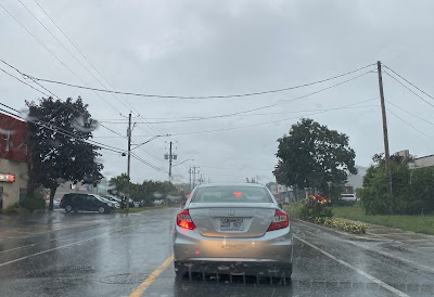
A potent frontal boundary will become the focus for steady rainfall, showers and isolated thunderstorms over the next 36 hours across southern Quebec. Rainfall amounts will approach 50mm (2 inches) in many locations, including Montreal by Tuesday morning. Isolated amounts may approach 75mm south of the St. Lawrence Valley towards the international border. The heavy rain will create ponding of water on roadways and some flash flooding. Leaves are beginning to fall so roads may be slick in spots.
Showers will persist through Thursday as low pressure develops in the Ottawa Valley and moves east. Temperatures will be close to seasonal normals, with highs near 18C (65F) and lows around 12C (54F). Much colder air will arrive by late Thursday as a strong cold front moves across the region. By Friday, daytime highs will be in the low teens with overnight lows in the lower single digits. Some regions away from metro Montreal may even be looking at the first frost of the season by Saturday morning.
 |
| The torrential rain rapidly filled many roadways last Tuesday, with over 100mm (4 inches) falling in many sections of the city, including Rosemount shown above. (CBC Photo via Twitter) |
The precipitation comes on the heels of Tuesdays major rainstorm in the Montreal region and points east. Rounds of training showers and thunderstorms over a 1 to 3 hour period on September 13, produced flash flooding from downtown Montreal, especially the eastern suburbs, and onto the South Shore. I measured only 20 to 25mm here on Ile Perrot, while Trudeau Airport had 27mm. But it was downtown Montreal and points east that took the brunt of the storm. According to Environment Canada, downtown Montreal averaged 80 to 110mm of rain, including 40mm in a one hour period. RDP and Repentigny reported 70 to 100mm, while Longueil had 125mm and Joliette 100 to 120mm, including 90mm in under two hours. The result was major flash flooding that flooded basements, underpasses, closed highways and inundated several metro stations. Thankfully no injuries were reported.
 |
| NOAA Satellite image of strengthening hurricane Fiona just south of Puerto Rico midday Sunday, September 18. |
Hurricane Fiona
As I write this post, Fiona has just reached hurricane status 80km south of Ponce, Puerto Rico. The storm has 130km/h winds and is moving west-northwest at 13km/h. Warnings are in effect across the Virgin Island, Puerto Rico and neighboring Dominican Republic. Heavy rain, up to 300mm, is expected to produce major flooding and mudslides. Winds have already been reported up to 120km/h across the US territory. The power grid is notoriously bad, and outages have already reached a half million on the island. Fiona is expected to curve northwestward and eventually northeast along the outer edge of the Bermuda high while strengthening into a major hurricane. The storm may generate some weather in Atlantic Canada by late next week, but details will need to be fine-tuned.
**Just a final note, I apologize for the lack of posts lately, I have been a little "under the weather", pardon the pun. Thanks for reading and stay safe everyone...SB

No comments:
Post a Comment