Montreal is in the midst of a long stretch of rather dismal weather. It is a very chilly morning in the city, with 8C (48F) here in Ile Perrot. The temperature will not budge today, under persistent clouds and northerly winds, we may see 10C (50F) if we are lucky. Expect a few showers as well.
The forecast does not look good the balance of the week, with a persistent northerly flow of cool, moist air expected. Look for clouds and showers right into next weekend, along with well-below normal temperatures. Daytime highs will rage in the low to middle teens, with overnight lows from 7C to 10C (45-50F). Warm weather is expected to return to southern Quebec for the last week of May.
As far as precipitation is concerned, another 10-20mm of rain is possible by the weekend. I measured 33.2mm here on Ile Perrot since Friday afternoon. The bulk of that occurred during thunderstorms Saturday morning. May is definitely been wet, with 77mm falling as of Sunday at Trudeau Airport, with 69.2mm here on Ile Perrot.
The culprit has been a strong upper level low slowly drifting from the central Great Lakes Friday into northern New England on Monday morning. The result has been waves of rain and much colder temperatures. In advance of the low, we managed a muggy 29C (85F) on Friday before strong thunderstorms arrived on Saturday. Those storms produced mostly heavy rain here in the Montreal region, with plenty of lightning. Other parts of southern Quebec reported hail and there was flash flooding in Sherbrooke after 50-70mm of rain fell in just a few hours.
 |
| A submitted photo to The Weather Network from a resident of Howick, Quebec, showing the potential tornado on Saturday evening. Environment Canada is investigating. (TWN) |
South of Montreal near Howick, there was report of a weak tornado around 7:30pm Saturday evening, There was no damage observed, and Environment Canada is investigating to determine the strength of the storm. The strong storms also produced widespread severe weather in Vermont, with flash flooding, downed trees and large hail.
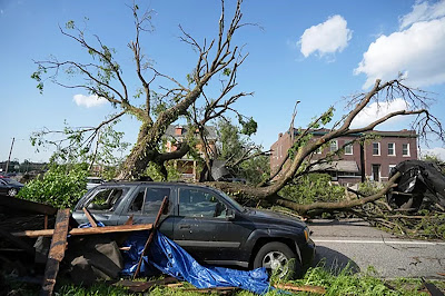
The same weather setup is delivering rounds of severe weather across the central portion of the United States. The weekend death toll stands at 33 from persistent and long lasting tornadoes across several states. The hardest hit region stretched from Missouri to Kentucky. A powerful storm killed 5 in St. Louis on Friday, while London, Kentucky was leveled on Saturday. In Kentucky, 19 deaths have been reported so far, with scores of injuries and widespread damage.
Another round of strong storms is forecast on Monday for parts of the southern plains from Colorado and Kansas into Texas and Oklahoma.

No comments:
Post a Comment