Monday, December 31, 2012

A snowy & chilly end to 2012 in Montreal

HAPPY NEW YEAR! AP Photo of Sydney, Australia welcoming in 2013.
In stark contrast to the way the entire year has been, Montreal will see a chilly and snowy December 31st. The year 2012 will go down in the record books as one of the warmest and driest on record across southern Quebec  I have not crunched the numbers as of yet, but just the number of record highs alone in the city and when they happened was very impressive. We even flirted with the all time record high of 37C, but fell just short. November had only 1 lonely centimetre of snow and most of the summer and fall was very dry with water restrictions in place. I had no lawn most of the summer! So in other words the last two weeks of 2012 by no means reflect the past year.

We will end the year with a few flurries around today and possibly some heavier squalls into the wee hours of the morning and to start 2013 across southern Quebec and eastern Ontario. Those squalls could drop a quick couple of centimetres of snow along with strong winds and low visibility, so don't be caught off guard if driving late. An arctic cold front will cross the region this evening, so after milder highs of -4C today temperatures will drop rapidly overnight to -12C and remain there on New Years Day. A gusty southwest wind will develop today and  then back to the northwest with cold wind chill readings. This sets the stage for a very cold night on Tuesday with lows close to -20C in many areas. Wednesday will not be much warmer with highs only around -15C.

Saturday, December 29, 2012

More snow for Montreal

Clearing the snow on L'Ile Perrot. (Valley Weather Photo).
A deepening coastal storm near the Outer Banks is expected to lift north and east towards Cape Cod later this afternoon and then into Atlantic Canada. This system will bring a decent snowstorm to portions of southern New England along with near blizzard conditions over sections of western Nova Scotia and southeast New Brunswick as well as PEI. Montreal and southern Quebec as well as eastern Ontario will remain on the western edge of this system with snow expected to develop this afternoon and taper off by Sunday morning  Accumulations of 5cm are forecast for Montreal with as much as 10cm along the US border and in the Eastern Townships. Winds will increase out of the northeast today up to 30km/h, and along with the fresh snow, this may cause some visibility issues. In addition to the snow, it will be cold with highs of only -9C and cold windchill values in the minus teens. On Sunday as the storm pulls into Atlantic Canada, look for strong northwest winds between 30-50km/h over southern Quebec, producing considerable blowing and drifting snow along highways off island. This may make travel less than comfortable. It will however be sunny, but cold. On Monday another arctic front will introduce more cold weather along with some snow late in the day. That will be followed by the coldest air so far this winter with lows possibly colder than -20C in southern Quebec by New Years Day.

Digging out: the cleanup continues in Montreal. (The Montreal Gazette).

Friday, December 28, 2012

Historic snowstorm for Montreal - 45cm in 24 hours


Above: Images from the historic snowstorm. (CJAD & The Montreal Gazette)
I never imagined we could have surpassed the Blizzard of 1971 in terms of snow accumulation yesterday, but in the end we did. An incredible amount of snow fell in a very short period of time over the St. Lawrence Valley from Montreal to Cornwall. We are left this morning with towering snow banks and lots of digging out to do. The snow fell fast and furious, at times in excess of 5cm (2 inches) per hour. The end result was chaos on Montreal area highways. Thankfully traffic flow was reduced, but it was bad just the same. Transport Quebec was forced to close several sections of major highways in and around the city during the storm as accidents mounted. At one point cars and trucks sat on Highway 13 south for up to 5 hours without moving. The snow ended with about 2mm of freezing drizzle last evening, kind of like the icing on the cake. In the end we broke all kinds of records, but as I mentioned yesterday, the Blizzard of 1971 was fierce, and does not compare to this storm, except for volume of snow in Montreal. You can find more info on the 1971 storm HERE.

Plowing Boulevard Perrot on Thursday afternoon. (ValleyWeather)
The Numbers
We managed to break three records in one day at Trudeau Airport on Thursday. The snow fell from about 4am to 4pm so in 12 hours we set a new 24 hour record, monthly record and all time record. The previous day record was 37.8cm set in 1969. The monthly record was 41.2cm set in 2005 and finally the big one the all time snow record of 43.2cm set in March 1971 was broken late in the day as we reached 45cm of snow. This brings our monthly snow totals, in what had been a dry fall, up to 81cm. On average December sees about 48cm of snow in Montreal. Other snow totals included 33cm at Brockville, 27cm at Kemptville, and up to 53cm south of the city towards Champlain, New York. For comparison, I measured 40cm (14 inches) on my driveway here on L'Ile Perrot. I could not find a location that was not affected by the wind. I have drifts in my backyard three feet high!

 This morning it is calm and chilly but the precipitation is over as the low moves into Nova Scotia. It will be a partly cloudy day in Montreal with temperatures steady near -4C. Another Nor'Easter will move off the coast of Cape Cod on Saturday with another 2-4cm of snow possible for Montreal. Beyond that we get a bit of a break before a strong cold front arrives New Years Eve, and we start 2013 on the cold side.

Thursday, December 27, 2012

Record breaking 45cm storm for Montreal

The wind blown snow created some interesting art. This is on L'Ile Perrot. (ValleyWX Photo)
The warnings have been allowed to expire as the heavy snow has tapered off to some freezing drizzle here in the St. Lawrence Valley tonight. This, after an historic amount of snow was dropped on Montreal. Trudeau Airport recorded 45cm or 18 inches of snow in about 15 hours, passing the previous record of 43cm from the famous blizzard of March 1971. That storm was still much worse as it had hurricane force winds and record low barometric pressure. Today was bad just the same, at times the snow fell at an incredible rate of 5cm an hour. I will have much more in the morning along with some more photos. Now I need some sleep, between tracking this system during the wee hours, the drive to and from work and cleaning two driveways, I am spent. Drive safe.

Low visibility - 25cm in Montreal so far

From the Gazette,com buses are not able to climb the hills in downtown Montreal.
Transport Quebec are closing some roads, and travel is becoming difficult in and around Montreal. Travel is not advised. Heavy snow will continue all afternoon with 25-45cm forecast. The snow has been falling at the rate of 4cm per hour at Trudeau Airport in Dorval.

Closed as of 11am are Highway 15 south to the Champlain Bridge, the 20 through Dorval Circle, the 15 near Mirabel, and Highway 13 at the Airport Tunnel. There are others check out Quebec 511 for complete details. 

Major snowstorm to continue for Montreal

Snowy L'Ile Perrot this morning. Heavy snow still falling at 9am with over 25cm forecast.
Transport Quebec traffic camera on Highway 20 here on L'Ile Perrot showing the steady snow and blowing snow.
WINTER STORM WARNING: Metro Montreal, southern Quebec, St. Lawrence Valley in Ontario, Vermont & New York.

Low pressure this morning is located near the New Jersey coast. This storm has deepened overnight to a 989mb low that is forecast to move northeast towards Cape Cod today. Montreal and southern Quebec will remain on the cold side of this system with heavy snow and blowing snow most of the day for the St. Lawrence Valley. This morning light to moderate snow is falling with about 7cm here on L'Ile Perrot. Northeast winds of 30 to 55 km/h are creating areas of blowing snow reducing visibility especially off island. Those winds will gust to 70km/h in the St. Lawrence Valley today. Travel along the 20/401 west and 15 and 10 south and east is not advised today. Snow will taper off this evening with storm totals of 25-40cm with isolated amounts near 50cm (20 inches) near the Vermont border. Snow is also falling in Eastern Ontario but with less amounts forecast from 15cm near Ottawa to 20cm near Cornwall. In Vermont and New York the snow was falling fast and furious with 12-20 inches forecast. Temperatures will remain cold in Montreal between -5C and -8C for the duration of the storm. Skies will clear out on Friday as we begin to dig out.

Classic NorEaster centered near New Jersey is pushing heavy snow into southern Quebec.

Wednesday, December 26, 2012

Snowstorm on schedule for Montreal


STORM UPDATE: 21:30
Winter Storm Warnings remain in effect at 9pm across the entire forecast area. Winds are increasing in the St. Lawrence Valley with gusts to 30km/h. The pressure here on L'Ile Perrot is falling rapidly. Winds will continue to increase to between 40-60km/h by morning. Snow in moving northward at this hour into southern Vermont and reaching into southern Ontario. The heaviest snow overnight will remain south of Montreal but approach the city by morning. At the worst of the storm snowfall rates of 2-5cm (1-2 inches) per hour are possible. There will be widespread blowing snow. Limit your travel to the city tomorrow as travel on area highways south and west will be very dangerous. Storm totals of 15-35cm (6-14 inches) are expected across the area with the higher amounts on the South Shore and lower amounts in Laval.

Low pressure is re-forming tonight near Salisbury, Maryland and will move to lie near Long Island on Thursday. Snow will taper off by early Friday morning.

Massive winter storm heads for Montreal - southern Quebec

WINTER STORM WARNING: All regions of the St. Lawrence Valley, northern New York and Vermont.

Happy Holidays everyone, our quiet weather of the last 48 hours is about to change. We had the coldest night this winter with a low reading of -16C here on L'Ile Perrot. Boxing Day will be fair with some clouds increasing and perhaps a few flurries with cold highs of only -9C.

A vivid image of a blown transformer illuminating a mature tornado in Mobile, Alabama on Christmas Day. (Accu-Weather.com)
Our attention will now turn to a large area of low pressure in the Tennessee Valley that is forecast to move towards the middle Atlantic states and then off the New England coast. This system was responsible for the largest Christmas Day outbreak of tornadoes in US history, with 15 reported so far. There was plenty of damage and 7 injuries, but thankfully no fatalities. The storms tore across portions of the deep south from Louisiana to the Florida panhandle. This storm has a cold side that is dumping heavy snow from the southern plains into the Midwest. This portion of the storm will affect extreme southern Quebec and the St. Lawrence Valley tonight into Friday morning. The snow will start after midnight in Montreal with the heaviest on Thursday. Look for 25 to 40cm along the US border, with 15-25cm in Montreal and 10-15cm in Ottawa. The snow will be blown around by 50km/h northeast winds here in Montreal, that will only strengthen through the day on Thursday up to and over 60km/h. The snow will end Friday morning. Needless to say travel is not advised on Thursday especially in the 401 corridor and south along the US interstates towards Boston and New York City. Temperatures will remain cold around -5C during the storm so the snow will be dry here in Montreal, and easily blown around reducing the visibility considerably.

NOAA image of our large winter storm heading towards the northeast. Snow will arrive in Montreal around midnight.


Monday, December 24, 2012

Quiet Christmas for Montreal - then a big snowstorm

Merry Christmas everyone. Thanks for reading and allowing me to share my passion for weather with all of you. I appreciate your comments and kind words all year long. Why not follow Santa tonight courtesy of NORAD. You can do so HERE.


Courtesy AccuWeather.com
It will be a quiet 48 hours in Montreal and eastern Ontario through Christmas Day allowing those who need to travel to do so safely. It is also a great opportunity to enjoy the nearly 50cm of snow that has blessed the ski areas north and southeast of the city this Christmas. Enjoy the Holiday and travel safely.

It won't be that way for everyone as a nasty winter storm is forecast to take shape over Colorado and dive into Texas before heading up the Appalachians by Wednesday. This storm will bring a serious threat for severe weather on Christmas Day from Louisiana and Arkansas into Georgia, Mississippi, Alabama and Florida. There is an elevated risk of tornadoes in this region. On the north side of the system snow is forecast in the Texas Panhandle and Oklahoma. This snow will spread north and arrive in southern Ontario on Boxing Day and finally Montreal by the wee hours of Thursday morning. At this time it looks like a major winter storm for southern Quebec with upwards of 25cm (10 inches) of snow with strong winds and blowing snow for Montreal. Travel will not be advised on Thursday across Eastern Ontario and southern Quebec. There are lots of details to work out still, so look for a Christmas Day update tomorrow morning. One thing is certain, it will be snow. Cold weather is here right into the start of January.

You can follow the many links on this page or my twitter feed as well, @valleyweather2

Saturday, December 22, 2012

Wind driven snow in Montreal

L'Ile Perrot public workers clearing off some of the snow and ice Saturday afternoon. (ValleyWX Pic)
The cold side of yesterday's storm finally arrived in Montreal today with the mercury falling from around 1C early this morning to where it sits now at -6C. Add to that a biting northwest wind that has been in the 50km/h range all day and a few centimetres of snow, and it has been nasty. With windchill values in the minus teens, this was quite a change from the mild, but stormy day we had on Friday. The storm passed almost over Montreal with a very low barometric pressure of 979mb here at my house on L'Ile Perrot. We were just on the warm side with about 25mm of rain and 5-10cm (2-4 inches) of snow before the rain. Meanwhile not far west and north it was quite a different story with heavy wet snow in Ottawa accumulating up to 35cm (14 inches). Across the Laurentians between 40 and 50cm (16-20 inches) fell. Today strong northwest winds are blowing around the snow across the entire region with travel being difficult in many places. Roads have been snow covered and visibility was less than 1 kilometre at times. The winds and snow will abate this evening with clouds remaining and cold lows down to -15C. Sunday will be cloudy and cool with some light now and highs of only -7C

Over 40cm of snow fell in the Laurentians knocking down power lines. (CJAD.com photo).
The heavy wet snow yesterday knocked out power to thousands of homes in the Ottawa Valley on both the Ontario and Quebec side. Crews from Hydro One, Ottawa Hydro and Hydro Quebec have been working around the clock to get power and the heat back on. Nearly 100,000 were without power yesterday and into today. The cold is with us all week with another chance for snow by Wednesday afternoon. More on that system as the week moves along. Tomorrow and Monday will be much better travel days.

Friday, December 21, 2012

Winter Solstice with a storm

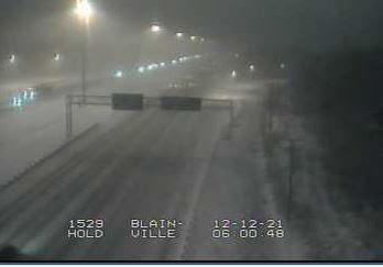
While it has been mostly rain on the Island of Montreal, you don't have to go far north to find lots of snow. This Highway 15 Transport Quebec camera shows heavy wet snow in Blainville, north of the city.
Winter arrived at 6:12am this morning in Montreal, and despite dire predictions of both the forecast and world, I am still here. Today is the shortest day of the year with only 8 hours and 44 minutes of daylight here in Montreal.

A deep and intense winter storm moved into the region overnight after slamming the upper Midwest on Thursday. Many areas reported over 30 cm (1 foot) of wind driven snow especially across Wisconsin and Iowa. The snow was pushed around by 50mph winds in many cases with blizzard conditions closing roads and schools. This morning slightly milder southeast winds in the St. Lawrence Valley have allowed most of the precipitation to fall as rain and sleet overnight here on L'Ile Perrot. In the last hour the precipitation has changed to wet snow here at my home. North and west of the city towards the Ottawa Valley and the Laurentians, it has been all snow. For those reasons, the snowfall warning for Montreal to Cornwall has been lowed, however a winter storm warning does remain in effect for areas north of Laval as well as Ottawa. The snow has forced dozens of schools to close in the area as well as suspension of school bus service.Those areas will remain as snow with upwards of 25cm likely. In Montreal it will be a messy, windy mix all day with perhaps a slushy 5cm in places. Winds will increase to 50km/h and temperatures will however around the 1C mark. Overnight more wind and snow as the low begins to lose some punch but slides slowly across extreme northern New York. Low temperatures will remain around 0C. Saturday will be snowy and windy with perhaps another 5cm of snow and dropping temperatures down to -6C by the end of the day.

It will be a very busy day on the roads so drive with extreme care as I can guarantee there will be lots of ice around late today and Saturday.

Thursday, December 20, 2012

Big winter storm for Quebec & Ontario

Our approaching storm has been dumping snow from Colorado to Wisconsin overnight and today. (AP Photo)
A snowfall warning has been issued by Environment Canada for southern Quebec as well as eastern Ontario. A strong winter storm over the Midwest this morning is forecast to move towards the St. Lawrence Valley and then east just to the south of Montreal. It is a very similar track to Monday's storm with rain forecast in much of New York and Vermont, and heavy wet snow here in Montreal and the Ottawa Valley. Montreal will be right on the rain/snow line for most of the event so a change in just a few kilometres will mean different weather. Ottawa should remain all snow as well as the regions just north of the city. Accumulations will be impressive with snowfall rates of 2-5cm per hour overnight as the first wave of moisture approaches. Look for storm totals of 10 to 25cm (4-10 inches) for Montreal with 20-40cm (8-16 inches) for points north and west of the city. The heavy wet snow on top of Monday's storm may pose a risk to structures, trees and power lines, especially in the Laurentians. Temperatures during the storm will hover around the 0C (32F) mark over most of the region. Winds will be another factor with this storm gusting between 30 and 50km/h out of the northeast and increasing behind the storm to 70km/h in northwest gusts. Temperatures will fall to very cold readings by late Saturday with more snow forecast. Roads across the region from Brockville to Quebec City and northwest to the Ottawa Valley will be snow covered and icy with very poor visibility in heavy wet snow for most of the overnight and Friday. If you are travelling south on Friday the snow should transition to rain before the US border.

All this is subject to modifications if the path of the storm alters in any way. In addition there may be some coastal development of a second low. If this happen the forecast will change as well. I will post another brief update this afternoon.

Wednesday, December 19, 2012

One storm over - the next one on the way

Above: Kirkland on the West Island during Tuesday's storm. With piles of snow in Montreal and more on the way it looks like a white Christmas for the city and points north. Areas south to the US border and in New York and Vermont are still waiting for snow cover. (ValleyWX Pic).
This certainly has been a busy week in the weather department, a welcome change from what had been a dud of a season so far. Yesterday's storm was quite a surprise to many with the wet snow falling at a good rate most of the day from Montreal north into the Laurentians. Storm totals ranged from nothing in Lacolle and Napiereville near the US border to 8cm across the South Shore, 15cm in Montreal and Laval and over 20cm across the areas north and west of the city. The heavy snow snarled traffic with numerous accidents as well as cut power to almost 35,000 homes in Quebec. That system continues to give Montreal drizzle this morning with the mercury at 0C (32F) so there are slick spots out there once again. It will be a much easier commute than the one on Tuesday that featured hard packed snow on top of a layer of ice making it very difficult to get around until around noon.

We will have a damp and cloudy day today before a brighter Thursday with highs around 1C both days. This will be in advance of the next big storm expected to affect a large area of the US Plains and Midwest into the Great Lakes, Ontario and Quebec. Environment Canada has already posted a Special Weather Statement regarding this next storm, as it will arrive during a heavy travel period across North America. The storm will feature mixed precipitation and strong winds in Montreal and Ottawa starting early Friday and lasting well into Saturday. Depending on the exact track another 15cm or more of snow/ice/rain is expected. This storm will have two other features that the previous ones did not, strong gusty winds and plunging temperatures behind it. There are plenty of details to work out so check back for updates. I will post once again this evening.

Tuesday, December 18, 2012

Heavy snow in Montreal - rain to the south


The top Transport Quebec traffic camera is Highway 20 here on L'Ile Perrot in west end Montreal, while the bottom image is along Highway 15 about 15km north of the US border.
What a brutal commute this morning as heavy snow combined with overnight rain to ice up roads  across the West Island and points west and north of the city. Between 10 and 20cm of snow has fallen across the region. Meanwhile, as the Transport Quebec images above show, just to the south of the city there is no snow at all - bare ground! Travel safe in the city, there is lots of ice under that snow across the West Island.

More snow for Montreal

Large wet snowflakes are falling on L'Ile Perrot this morning. (ValleyWX)
 SNOWFALL WARNING - METRO MONTREAL
The radar is lit up like a Christmas tree this morning as those big wet flakes in Montreal show up rather well. It has been snowing for the last couple of hours having changed over from rain here on L'Ile Perrot at about 5am. We are sitting right at the freezing point, 0C (32F) as are most locations across the St. Lawrence Valley and to our north. Just south of the city it is rain and temperatures in the 1 to 3C (33-38F) range. Low pressure will move from western New York down the St. Lawrence Valley today with lots of moisture. Most of that will fall in the form of wet snow from Montreal north and west and rain from the city south. Those places that see snow, could see a fair amount  therefore a snowfall warning is in effect for the northern metro areas of the city with winter storm warnings for the Laurentians and Quebec City. Amounts will generally be in the 10 to 25cm range (4 to 10 inches). The snow will mix with rain at times in the city which could limit the final totals.
Snow clearing on Monday in Kirkland, Quebec. (ValleyWX)
Yesterday was quite a wintry day in the Montreal with a persistent northeast wind keeping the precipitation as freezing rain or snow. About 10cm of snow fell in many areas of the city. As it stands my entire neighborhood is white so at least here we are in line for snow cover on Christmas Day. It will turn mild with rain by Friday as another very strong storm heads for the region. However dropping temperatures, wind and snow will develop by late Friday into Saturday, so if you have travel plans be sure to stay tuned to later forecasts.

Monday, December 17, 2012

More wintry mix for Montreal

A warm front remains to our southwest this Monday morning with light freezing drizzle still falling here in southern Quebec. It has however warmed to near 0C (32F) here on L'Ile Perrot with colder temperatures around -2C on the island of Montreal, and even colder north and east of the city. Since noon on Sunday around 5cm of snow, sleet and ice have fallen on the city. Another area of precipitation on radar will approach the city just after rush hour with more freezing rain before things quiet down for a few hours. The freezing rain warning remains in effect across southern Quebec and eastern Ontario, but should be lifted by noon. It will be milder today with highs just above freezing at 1 or 2C. Late tonight and on Tuesday another stronger low will lift from the Ohio Valley into upstate New York. It will come very close to Montreal with the threat for snow and rain on the rise once again. If it remains as all snow, over 15cm could fall in the city. It will be a very close call so check back for updates throughout the day.

Sunday, December 16, 2012

Metro Montreal - Freezing Rain Warning

An elongated warm front will be the focus for a long duration precipitation event over the next 36 hours. Light snow has been falling this afternoon over the area with 2cm or so on the ground here on L'Ile Perrot. Look for another 5-10cm of snow from Montreal east over the next 24 hours mixed at times with freezing rain. The freezing rain will be most evident along the US border and west of the city towards Ontario. At 5pm radar was showing freezing rain across eastern Ontario with bands of light snow in southern Quebec. A freezing rain warning is now posted for all of southwest Quebec including Montreal into tomorrow evening as well as eastern Ontario including Ottawa and Cornwall. Amounts in addition to the snow, will be 2-5mm of ice with up to 10mm in the Ottawa Valley. Expect snow covered and icy roads where untreated, drive with caution in all regions. Northeast winds of up to 50km/h are causing some blowing snow form Montreal towards Quebec City.

Temperatures remain cold in Montreal and Ottawa at -6C (21F) while the warm air has reached Kingston where it is 0C (32F) and very warm in Toronto today at 7C (45F).

Freezing Rain Warning - Highway 30 Grand Opening

A rather difficult forecast for Montreal this week with snow, freezing rain and rain. (AccuWeather.com)
Low pressure and a warm front to our southwest will produce an area of snow and freezing rain for the St. Lawrence Valley from this morning into Monday. Radar at 8 am is showing a band of light snow stretching across eastern Ontario including Ottawa, and edging into the Montreal region. The snow will be light with accumulations by the end of the afternoon up to 5cm (2 inches) locally. Temperatures this morning are cold at -9C here on L'Ile Perrot. Add to that a northeast wind of 30 to 40km/h, and windchill values are down to -20C. There is much warmer air to our southwest with Toronto up to 6C (43F) with rain and Kingston at -3C. The cold air will remain well entrenched in our region so look for temperatures to remain below freezing well into Monday. As a result precipitation will change to a light mix of freezing rain and snow by late today. Temperatures will slowly rise to highs near the freezing point by Monday afternoon. Environment Canada has posted a freezing rain warning for all of southern and eastern Ontario from Lake Ontario northeast to Ottawa as well as in extreme southwest Quebec including here on L'Ile Perrot. Those warnings will likely be extended to the rest of metro Montreal later today. Winter weather advisories are in effect for northern New York and Vermont. As I already mentioned, precipitation will be light, but enough to create dangerous travel at times.


Above and below are pictures I took yesterday while travelling south on the newly opened toll road Autoroute 30 here in the RM of Vaudreuil/Dorion. The long awaited highway opened under bright sunny skies. It offers an alternate route around the city of Montreal to the south joining southwestern Quebec and eastern Ontario traffic to the highways going east to Atlantic Canada and south to New York. The route features a tunnel under the St. Lawrence Seaway as well as two new bridges connecting the north and south shores of the St. Lawrence River. (ValleyWX Pictures). More information is available at www.a30express.com/en  


The balance of the weak will remain unsettled with several more opportunities for wintry precipitation. There may be enough snow to plow but it will be very dependent on the temperatures here in the valley. Most forecast models are having a difficult time with that this morning, so expect snow or rain from Tuesday into Saturday.

Friday, December 14, 2012

Weekend weather update - Montreal

I was a little under the weather yesterday so to speak, so I apologize for not updating the blog. Fortunately we are in this tranquil weather period that feels more like early fall than the start of winter. Each time the computer forecast models hint at a major shift in the atmosphere it does not occur and we continue along with this same mundane weather.

On Wednesday evening, L'Ile Perrot and portions of the south shore had a couple of decent snow showers that put down a quick coating to 2cm of snow depending where you were. It iced up the roads quickly and made the end of the commute interesting. Today we have mild air in place this morning as a weak low pressure area travels well north of the city. We are currently at 1C and should add a degree or two to that before we start the slide down. A cold front will move through the area with flurries this afternoon and very cold temperatures tonight. Look for lows between -15 and -20C across southern Quebec and eastern Ontario. Saturday looks fair and chilly with highs around -7C.

On Sunday another weak low pressure system will move into Ontario with a warm front approaching Montreal and the St. Lawrence Valley. A period of light snow and  perhaps some spotty freezing rain will begin late Sunday and continue into Monday. Amounts will be light in the 5-10cm (2-4 inch) range at this time. Stronger low pressure may affect the area mid week with the chance for more snow. Once again forecast models are having a very difficult time agreeing on a scenario and track so we will wait before giving more info on that potential storm.

Wednesday, December 12, 2012

12-12-12

It is indeed December 12, 2012, and if that is not enough twelves for you, it is -12C right now here on L'Ile Perrot, our overnight low so far. It was a very cold night across the area with lows in the -10 to -15C ranges, especially where some snow cover is on the ground. Things will warm up today with some partly cloudy skies. There is even the risk of some flurries today as a weak trough from the Great Lakes rotates across the St. Lawrence Valley. Radar is showing some snow showers moving across eastern Ontario this morning, Ottawa had light snow in the last hour. These snow showers will weaken with time, but they may put down a dusting in some area through the noon hour. If you are heading southwest along the 401 to Toronto you may encounter a more robust snow shower or two west of Brockville towards Kingston and south to Watertown, here as well they will taper off this afternoon. Otherwise look for fair skies and highs around -2C today. The balance of the work week looks dry with temperatures a little above normal. By the weekend some snow may be in the forecast. A pattern change will try to get going into next week with several changes for snow before Christmas Day along with colder temperatures.

Tuesday, December 11, 2012

Much colder Tuesday

CBC.ca photo of icy roads in Montreal for the Monday commute.
The low pressure and cold front that gave Montreal, southern Quebec and eastern Ontario its first taste of winter yesterday, is now well east of the area. In its wake Montreal is much colder this morning at -8C with -12C in Ottawa. We managed a high of plus 3C (39F) on Monday, but late in the afternoon and early evening after most of the precipitation had ended. It was quite a bit warmer to our immediate south with temperatures between plus 7 and 9C (45-50F) towards the US border. That wide range of temperatures over a small area made for some interesting travel. You could go from snow and freezing rain to plain rain in a matter of a few kilometres. Montreal recorded 16.2mm of rain and freezing rain with 5.8cm of snow. Here on L'Ile Perrot I had similar amounts with around 25mm or 1 inch of precipitation. We are left this morning with several centimetres of icy snow cover on the lawns, but the roads are dry. It will be a colder day with the mercury edging up to -4C. Clear and cold tonight dropping down to -10C. The balance of the week looks fair with seasonable temperatures. By the weekend we have another low pressure taking shape south of the Great Lakes that could bring us snow by Sunday or Monday. Beyond that a more active and colder period of weather is expected. So my thinking is that yesterday was just the test run as real winter begins to advance on southern Quebec.


Monday, December 10, 2012

Freezing rain for Montreal

Highway 40 in Montreal is at a standstill this morning with a truck on its side at Morgan Road.
In the wee hours of the night at around 2am, Environment Canada here in Quebec finally agreed with all the other forecast offices and amended their forecast. As I suspected from the start, Montreal will have more liquid precipitation than snow, see previous blog entries! The city had anywhere between 3 and 5cm of snow overnight with about 2.5cm here on L'Ile Perrot. The precipitation, at least here at my home, switched over to freezing drizzle around 3am. The same is true across Eastern Ontario where Ottawa is -5C with freezing drizzle.

Snow clearing operations overnight in Montreal. (CJAD.com)
A freezing rain warning is in effect this morning region wide. We have freezing drizzle falling at the moment with a temperature sitting at -2C. Another push of moisture is moving into southwest Ontario and will arrive by mid morning. At that time temperatures will likely be above freezing here in metro Montreal as we head to 4C for a high. In any event roads are slushy and slippery with a freezing mist still in the air. Winds are gusty as well in the 40km/h range. Low pressure today will lift northeast from the Great Lakes just north of Montreal with a warm front currently crossing the area. This evening a cold front will usher in much cooler air for the overnight with a low of -9C. Any leftover precipitation will switch to snow flurries so roads may be slick once again tonight.

Sunday, December 09, 2012

First Winter Storm for Montreal


NOAA sat image this morning showing a winter storm over the upper Midwest moving into the Great Lakes.
Environment Canada has issued a winter storm warning for metro Montreal and most of southern Quebec for late tonight into Monday morning. Freezing rain warnings are now in effect for the Ottawa Valley and most of southern and eastern Ontario. Winter weather advisories are in effect for northern New York and Vermont.

Low pressure over the upper Midwest is producing blizzard conditions across Minnesota and the Dakotas this morning and is expected to move east across the Great Lakes and down the St. Lawrence Valley on Monday. Montreal is expected to remain right along the track of the storm with very warm air remaining to our south. Today will be dry in Montreal with a high of 0C (32F). Precipitation is forecast to start near Toronto late this afternoon and spread towards the Ottawa Valley by midnight and into Quebec overnight. Snow will begin in Montreal around 1am with general amounts of 5 to 10cm (2 to 4 inches) by the morning commute with as much as 15cm north of the city. The snow will then mix with and change to freezing rain and finally drizzle by late in the day. A prolonged period of freezing rain is forecast for Montreal and Ottawa on Monday. Travel will be very difficult overnight and for the first half of Monday before temperatures warm above freezing by late in the day. Winds will be gusting to 50km/h on Monday. Look for lows in Montreal tonight in the snow of -5C with highs very late Monday of near 2C. While cold air remains trapped here in the St. Lawrence Valley, areas south of the border in New York and Vermont will go above freezing much quicker with rain on Monday.

I will post an update on this winter weather event late today.

Saturday, December 08, 2012

Winter Storm Watch for Montreal & southern Quebec

A Winter Storm Watch is now in effect for Montreal for late Sunday and Monday morning. Snow and freezing rain will develop late Sunday and last into the Monday morning commute before transitioning into rain from Montreal south and remaining as freezing rain from Montreal north and west into the Laurentians and Ottawa Valley. This is a very complex forecast with lots of change possible as the storm track becomes more clear. It will nevertheless bring a prolonged period of wintry precipitation, something we have not see yet this season. Travel Monday morning will be much slower and difficult than it has been in some time. The official watch from Environment Canada can be found HERE, and may be upgraded to a warning as needed depending on the exact track of the storm which is forecast to move very close to Montreal by Monday. I still believe Montreal will see more liquid precipitation than snow, but this is always a tricky scenario here in the St. Lawrence Valley and dependent on how fast the cold air is scoured off the valley floor.

Friday, December 07, 2012

Weekend weather a little icy

A couple of weather systems have the potential to give us some wintry weather over the next couple of days across Quebec and Ontario. Today will be cloudy and seasonable with highs just above the freezing point t 2C. I don't expect any precipitation today. Tonight a warm front will advance on the St. Lawrence Valley with limited moisture. There will be enough however for a period of freezing drizzle late overnight and into Saturday morning which could make travel slippery. Conditions will warm Saturday with just plain showers expected and highs near 3C. A cold front late Saturday will bring more showers changing to flurries and ending overnight. Skies will clear will lows down to -4C. On Sunday we can expect sunny skies and highs around -3C.

The forecast then gets a little interesting with a complicated frontal boundary heading our way. The forecast from Environment Canada has been flip flopping between rain and snow for Monday as low pressure tries to get going across the Ohio Valley. The consensus with the model data as well as neighboring weather offices seems to favor the warmer approach with snow Sunday night changing to rain Monday before tapering to flurries Monday night. Again temperatures would start below freezing during the event and warm to highs of around 4C on Monday. Now I said this was the general consensus, and I have to favor this warmer solution based on what I have seen this December. However Environment Canada here in  Montreal is now calling for snow on Monday and a cold -5C for a high. The logic behind this must be that the warm front will remain south of Montreal with cold air trapped here in the St. Lawrence Valley. I am going to stick to the warmer idea but we shall see how the forecast plays out. I will update the blog all weekend long as so many are travelling and shopping at this time of year.

Drive slow and play nice out on the roads, treat others as you would like to be treated. Be safe!

Thursday, December 06, 2012

Mild air to return to Ontario and Quebec

Please take time today to remember the 14 women who were killed at the Ecole Polytechnique here in Montreal on December 6, 1989, as well as all victims of violence against women. It is up to us to make a difference.


The weather has been so changeable this year that the ice remains very dangerous all over southern Quebec. Already one fatality has been reported from a person going through the ice. The simple rule at this time is stay off it. Here is an interesting graphic from the Minnesota Department of Natural Resources on what weight can be supported by the ice.

In a follow up to my where is the winter comments yesterday, it was -58F in Tok, Alaska on Wednesday morning. That is beyond cold, what else can you say. So there, that is where winter is this year. Montreal meanwhile managed to squeeze out a few flurries form the atmosphere on Wednesday, hardly enough to measure. It is now December 6 and we are awaiting our first measurable snow of the season. It is cold enough this morning as we have tumbled down on this roller coaster ride to -6C here in Montreal with -10C in Ottawa (just 36 hours after record highs of 18C). Today will be sunny and chilly with highs around -3C. On Friday a frontal boundary will set us up for another round of snow/rain and freezing rain into Saturday morning. Amounts look very light but there may be enough to make travel a little slippery into the overnight hours Friday. Temperatures will warm to 2 or 3C. By Saturday afternoon skies will break a little before the next stronger system arrives on Sunday. At this time a decent amount of precipitation is forecast from late Sunday into Monday around the region, perhaps as much as 25mm (1 inch water equivalent). It looks like a snow rain mix over to all rain once again as temperatures warm to well above freezing on Monday. There will pockets of freezing rain especially up towards Quebec City and into the Ottawa Valley. Warnings may be needed on Monday.


That is cold. Minus 40F (-40C) is where Celsius meets our US neighbor. Either way you prefer, it is cold! This photo is from Twitter account aksnowbug via accuweather.com.

Wednesday, December 05, 2012

Record warmth for December

Area temperatures at 3pm on Tuesday, looking more like early October and not December. You can add record highs of 19C in both Cornwall and Brockville to that list. (Weather Underground)
Several high temperature records fell across Ontario and Quebec on Tuesday as a warm southwest flow of air prevailed across much of the east. Temperatures soared to 19C (66F) in Brockville, Ottawa and Cornwall smashing records, some as old as the late 1800's. Green grass has replaced what should be snow covered lawns as this remarkably warm year continues. Montreal had a light southeast breeze which capped our high at 13C just shy of the 1982 record of 15C. A cold front advanced across the area last night with around 10mm of rain and has moved off to the southeast. In its wake we will have a breezy day with dropping temperatures. L'Ile Perrot currently sits at 6C, which will be the warmest of the day. Temperatures will continue to slide on this endless roller coaster ride all the way back down to -3C by days end with overnight lows to -8C. It will be colder the balance of the week but still above normal in the temperature department.

As far as winter weather goes, arctic air has most of Alaska and northwest Canada in its grip with little bite size pieced falling off and drifting across the Prairies. How cold? Fairbanks in Alaska has been below -18C since mid November for highs and lows. November in Fairbanks was the coldest in 100 years. Temperatures have been as cold as -56F in portions of the state and forecasters see no relief any time soon.

For Montreal, several areas of low pressure are forecast to move into our area by the weekend and early next week with perhaps some rain or snow. As I mentioned yesterday temperature profiles suggest a mix of precipitation but it is way too soon to tell how much of each. It will however remain mild.

Tuesday, December 04, 2012

Mild & rainy weather for southern Quebec & Ontario

You have to go out west for any winter weather. This is Saskatoon on Monday where over 15cm of snow fell. It is cold and windy with more snow this morning at -15C. Meanwhile record highs are likely today in many location across New England, Quebec and Ontario. (CTV)
It is another very mild start to the day here in Montreal with temperatures around 5C (41F). Highs are forecast to reach up into the mid teens with 13C (55F) forecast for Montreal, almost 14 degrees above normal. Both Montreal and Ottawa have a shot at the record today which was 15C (59F) set in 1982. A warm front will lift across the St. Lawrence Valley this morning with a few showers. Strong winds will develop ahead of the front today with wind gusts to 50km/h in Montreal but as high as 90km/h in the Richelieu Valley where a wind warning has been posted. That will be followed by a windy cold front this evening with a decent period of steady rain expected with its passage. Rainfall amounts could be in the 12 to 15mm range by midnight. On Wednesday the high will be reached early in the morning with temperatures falling afterwards down to a cold -4C by late in the day. Flurries will be around most of Wednesday and it will be windy as well. There may be a few centimetres in the mountains of the Townships and northern Vermont and New York but little in the valley locations.

Looking ahead to the end of the week high pressure will dominate with clear and seasonable weather into Friday before things become unsettled by the weekend. At this time it looks like a mix of rain and snow for southern Quebec and Ontario Saturday and Sunday. Amounts and temperature profiles are a little difficult to pinpoint at this time.

Monday, December 03, 2012

Very mild week in Montreal

What a change in the weather this weekend, from arctic chill on Saturday to spring warmth on Sunday. Temperatures soared from overnight lows early Saturday morning of -12C up to highs of 9C on Sunday afternoon. I even had 12C here on L'Ile Perrot, but I believe it was an anomaly, and  have no idea why, but an early Christmas present is on the way this week. I have ordered a new Davis Vantage Vue weather station, and with a little luck we should have it up and running with accurate data within the week. The Acu-Rite model was good for the price, but the data had become inconsistent. Time to climb up the weather station ladder!

In any event it will be a very mild week. The rain that fell yesterday in just a few hours along the cold front amounted to 8.8 mm at the airport and nearly 11 mm here on L'Ile Perrot. That nearly equaled the amount of rain that fell during the entire month of November. This morning the temperature has cooled to around 1C (33F), with quite a few slick spots on the roads. It will be partly sunny today as a weak ridge of high pressure moves across the area. Another cold front will cross the St. Lawrence Valley on Tuesday with more rain, but very mild temperatures ahead of it. Highs will be near 12C (54F), about 12 degrees above normal for the date. The cold front will bring in much cooler air by Wednesday with temperatures falling slowly back below freezing by Friday. There is the potential for some snow by next weekend. Computer models are also starting to hint at a big pattenr change as we move into the second half of December with much colder air and snow on the way for a large area of eastern North America. As I always say, time will tell.

Friday, November 30, 2012

Driest November on record for Montreal

Snow totals from the last 24 hours from upstate New York and Vermont show how the snow avoided the border region southwest of Montreal and the St. Lawrence Valley east of Cornwall. (double click for a better view) (Burlington NWS Office)
Just is case you have not figured it out, it has been very dry. As a matter of fact Montreal and the entire region has been well below normal for this time of year with the city about to post its driest November since weather record keeping began  I looked over the last 141 years of data for November, the first portion from 1871 to 1941 at McGill University downtown with the balance at Trudeau Airport in Dorval. What I found was that our paltry 13.8mm of precipitation for this past month will shatter any previous records. The previous winner was November 1991 with 31.5mm. The lack of precipitation it just a continuation of the year we have had, remember the water restrictions? Other notable November's over the years included 305.8mm in 1927 and November 2002 when the city had a record 62.8cm of snow. Compare that to this November where we have only had 2cm of snow, that falling in the last 48 hours.

Arctic front a bust
Speaking of snow, the front yesterday was a bust for most of our region. There was very little moisture out ahead of the arctic front and only light snow developed in Montreal and tapered off quickly with no squalls to speak of. There was some heavier snow around with over 5cm in portions of Ontario into the St. Lawrence Valley around Prescott, with over 10cm in the mountains of Vermont. The light snow has been replaced by bitter cold this morning with temperatures as cold as -14C here in Montreal and a frigid -20C (-2F) in Sherbrooke as of 7am. Wind chill values are in the -18 to -25C range, so it is very cold for this time of year. The good news is it will be short lived. Look for increasing clouds today and cold highs near -8C. Temperatures will continue to warm tonight and into the weekend with highs Saturday near 0C and Sunday all the way up to 6C. Some very light freezing drizzle is possible on Saturday with showers by Sunday. Cooler weather will return by the middle of next week, but there is still no signs of any major precipitation events into the first week of December.

Thursday, November 29, 2012

Brief period of heavy snow for Montreal - eastern Ontario

The first of two cold fronts crossed the region late Wednesday with a period of very light snow in Montreal with 1 to 2cm. It remains cloudy this morning and cold with current temperatures of -6C on L'Ile Perrot and -5C at Trudeau Airport. Temperatures will warm to -1C today in advance of a potent cold front that will enter the region by 3pm. Look for snow ahead of the front across eastern Ontario and southern Quebec beginning by the noon hour and tapering off this evening. There could be a brief period of heavy snow and strong winds with the arctic front as it passes Montreal by 4pm. Otherwise look for light snow with accumulations of 2 to 5cm in the city and perhaps as much as 10cm in the mountains of the Townships, Vermont and New York. Again as I said yesterday, this will not be a storm, but it is the first snow events of the year so travel could be affected. Visibility in the heaviest of squalls may be reduced to near zero in falling and blowing snow. Skies will clear by midnight and it will be very cold with lows between -12C in metro areas and -18C in the mountains north and south of Montreal. Friday will be sunny and cold with highs near -8C. We are still looking at milder air by Sunday but with clouds and showers.

Wednesday, November 28, 2012

Snow for Montreal and eastern Ontario

Two arctic cold fronts are set to bring most of southern Quebec and eastern Ontario our first measurable snow this evening and again on Thursday afternoon. In the meantime clouds and chilly weather will prevail to start the day today with temperatures at -4C to start and rising to around 0C. The first front will cross Montreal this evening with snow showers and a few heavier squalls. Amounts of snow will be light, but up to 2cm is possible. Skies will clear briefly by morning with temperatures chilly once again dropping to -10C.

A more potent arctic boundary is forecast to cross the St. Lawrence Valley late in the day Thursday with heavier flurries and perhaps a snow squall or two. Amounts with this front could be up to 5cm locally with strong northwest winds developing between 30- 50km/h and dropping temperatures. Be advised of this if you are out on the road either afternoon as both drivers and road crews have yet to adjust to winter driving routines. We already witnessed on Monday morning, with that dusting of snow in Vermont, just how quickly travel can turn deadly at this time of year. As I say every time it snows slow down. Once the front clears the region the coldest air of the season so far will settle south into Montreal with highs struggling to reach -5C on Friday and lows as cold as -13C in the city and perhaps our first -18C (0F) well off island to the north and in the Townships.

Much warmer weather is expected on the weekend as a southwest flow develops ahead of low pressure moving north and west of the region. Temperatures could be as high as 10C (50F) by early next week. I hope we are not in for another difficult roller coaster winter, but it is certainly going to start that way.

Tuesday, November 27, 2012

A little snow this week

Traffic sits still on Interstate 89 in Vermont on Monday morning after light snow and ice caused a  fatal accident closing the road for over 1 hour. (Ryan Mercer - Burlington Free Press)
It was cold overnight here in Montreal before the clouds moved in and slowed the temperature decline. We managed -10C here on L'Ile Perrot at around 1am, the coldest so far this season. With the month drawing to a close and only a trace of snow and a paltry 12.4mm (about one half inch) of precipitation at Trudeau Airport, it appears we are on our way to one of the driest November's on record. The end of the month will feature a zonal flow which typically brings weaker systems across our area every other day, so no large amounts of precipitation are forecast. Such was the case yesterday morning as a very weak band of snow moved south of Montreal, just clipping us here on L'Ile Perrot and the South Shore, and moving into the Champlain Valley and Vermont. The snow arrived in time for the morning commute in Vermont and caught motorists and road crews off guard. The result was several accidents that closed Interstate 89 for up to one hour.

This morning there are just a few flurries in the area as moisture is fairly limited. Even the lake effect snow bands are weakening off both lakes Ontario and Erie. Yesterday Wiarton, Ontario picked up 24cm of snow off Georgian Bay. Skies will eventually clear out today before the arrival of the next cold front late Wednesday. This will produce another shot of snow showers and much colder air into Thursday. That front will move back north as a warm front over the weekend with temperatures expected to rise to well above normal values into Sunday and Monday. At this time no major storms are in our future. Today will remain chilly reaching -1C (30F), but by Sunday highs will be well above freezing between plus 5 and 7C (40-45F).

Monday, November 26, 2012

First snow of season on L'Ile Perrot - Montreal

That is it! You are looking at all our snowfall so far for the month of November here on L'Ile Perrot. (ValleyWX)
Not much of a headline event this morning but it has snowed nonetheless. It was a wee bit of a surprise to wake and see the gourd white here at home on L'Ile Perrot. A weak cold front moved across the area overnight with just enough lift to produce an area of light snow and flurries. Areas from eastern Ontario and the Ottawa Valley, across extreme southwestern Quebec, and the west end of Montreal had anywhere from a dusting up to 1cm of snow. It is a cold morning with a light wind and temperatures around -5C. As I said, not much, but in a month with only 12mm of precipitation, this is the best we can do. Cold air will remain in place this week with temperatures staying below freezing for Montreal, expect lows in the -6 to 10C range and highs from 0 to -2C. There will be a chance of a little light snow late Tuesday and Wednesday with another cold front passage with perhaps a dusting expected  Otherwise no major storms are on the horizon as we end what has been a very unusual November  Moving into the first weekend of December it looks like mild air and some rain may arrive here in the east by the weekend. Mild Pacific air will then dominate most of southern Canada and the US into the first week of December.

Friday, November 23, 2012

Much colder weather on the way for Montreal

After 60F weather just hours earlier, shoppers are forced to brave the cold and snow in Minnesota last night as they wait for a Target to open. It is Black Friday today, the biggest shopping day of the year for US retailers. (AP Photo).
Enjoy today, this will be the last really mild day for some time as a strong cold front is about to move across Ontario and Quebec. Montreal's temperature was a balmy 12.4C on Thursday, well above normal for the date. Today will be mild as well with an increasing south wind ahead of the front. Temperatures will rise to 11C before clouds begin to increase late in the afternoon. Those clouds will bring showers with temperatures dropping rapidly overnight to below freezing by Saturday morning. Any showers will switch over to flurries late overnight with a dusting of snow possible especially in the hills north and south of Montreal.

Yesterday Minneapolis, Minnesota set a new record high of 60F, but by the end of the day it was snowing, windy and only 30F. Today, Toronto is at 11C (52F) this morning, but by the end of the day they will drop to 2C (36F). The front will also bring gusty northwest winds across the entire region, up to 50km/h on Saturday. Those winds will produce windchill values well below freezing. The wind will also produce lake effect snow bands off the Great Lakes. The snow will affect the normal regions of Central Ontario as well as western New York. Some locations may see over 10cm of snow by Saturday night.

Looking ahead into next week, there is plenty of uncertainty in the forecast with a storm system coming out of the US southwest. Different computer models are handling the storm with a path anywhere from southern Quebec and Ontario as far south as Tennessee. If the system stays to our south it will be cold enough for snow. We will just have to wait and see over the weekend. The time frame for accumulating snow would be late Tuesday in Wednesday for Montreal if it materializes.

Thursday, November 22, 2012

Winter - west & warmer - east

Above and below are pictures taken by my good friend and Editor of the Gravelbourg Tribune, Paul Bosivert. They show Main Street in Gravelbourg, Saskatchewan after the last big snowstorm on November 9 & 10. As mentioned below the area has had its share of cold and snow this November in stark contrast to us here in the east.
The trend of mild weather here in Quebec this fall will continue at least for a few more days as strong high pressure remains in control of our weather here in Montreal. The nights have been cool with frost while the days have been very mild with abundant sunshine. Look for the area of high pressure to begin lifting to the northeast as a cold front approaches Quebec and Ontario late on Friday. Rain will accompany the front along with some gusty winds. Temperatures will drop behind the front to more seasonable values for the weekend. Daytime highs of nearly 10C (50F) or warmer today and Friday will drop down to 0C (32F) on Saturday and below freezing at -2C (29F) for Sunday. Some flurries are possible but no major snow event is in our immediate future.

Big snowbanks line Main Street in Gravelbourg, SK with the famous Cathedral in view at the end of the street.
For snow and cold, you have to head out to Saskatchewan and Alberta where it feels like mid winter. Temperatures this morning are a frigid -14C in Calgary and -11C in Regina. Yesterday snow fell across the region with a band of freezing rain in advance of the front. It was a messy, cold day across the southern Prairies. Numerous collisions with injuries were reported south of the Trans Canada Highway with the RCMP in Saskatchewan telling motorists to stay off the roads for a time on Wednesday.

Wednesday, November 21, 2012

Weather changes on the horizon

A powerful storm that has been slamming Washington State and B.C. will begin to move east, finally nudging the high pressure that has been giving us record sunshine off to our east. AP Photo Don Ryan
We have been enjoying a spectacular November with abundant sunshine and seasonable temperatures here in southern Quebec and eastern Ontario. As of this morning only 8.8mm of precipitation has been recorded at Trudeau Airport in Montreal. This is roughly 10% of normal with rainfall on only 5 days this month. As I have mentioned already, November is typically the dullest month of the year.

We are dealing with some fog again this morning that is actually causing some delays and cancellations at some US airports on this busy travel day. The intense weather remains along both coasts but changes are in the air. This morning that pesky storm that brought heavy snow, rain and strong winds the the Pacific Northwest, is beginning to rise up and over the Rockies. That storm has produced major flooding, toppled trees and cut power to over 20,000 homes in Washington and Oregon. A push of arctic air will greet the front producing snow and freezing rain in southern Alberta and Saskatchewan. Up to 20cm of snow is possible for Calgary with increasing winds and dropping temperatures over the next 24 hours. In contrast ahead of the cold front Montreal and most of Quebec and Ontario will remain mild with highs from 6 to 10C.

We are in for a couple of more days of sunshine before that cold front arrives in Quebec by late Saturday. The trend into the weekend will be for much colder temperatures with highs at or below freezing into early next week. There will also be a chance for some light snow or flurries by Monday. Next week looks much cooler with perhaps some measurable snow by late in the week.

Tuesday, November 20, 2012

Mild November weather

It is another cold morning in Montreal, down to -4C here on L'Ile Perrot. We have fog across the St. Lawrence Valley, and that has put a little glaze on trees and some bridges so there are a few slick spots out there. Otherwise the forecast continues to look good for November with record sunshine continuing. We will have more clouds than sun today as a weak trough slides east from the Great Lakes. High pressure will reestablish itself tonight with sunshine expected Wednesday through Friday. Temperatures will be in the 6 to 10C (43-50F) range for highs, well above normal. Nights will remain chilly with good radiational cooling and lows down to -4C. A strong cold front is set to bring an end to this weather by Saturday with showers and flurries an dropping temperatures. The high temperature by Monday won't make it above freezing.