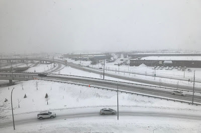
A weak area of low pressure accompanied by an arctic frontal boundary delivered 5 to 10cm of fluffy light snow to southern Quebec over the last 24 hours. The snow caused the usual rash of accidents on area highways. A few more flurries or snow showers are likely Friday before drier air moves into the region. Some of the flurries may be heavy at times today, especially south of Montreal. Keep this in mind if you are out on the road.
 |
| Some of the coldest air so far this winter will settle south across the Great Lakes and into southern Quebec, Ontario, New York and New England over the next 48 hours. (AccuWeather.com) |
High pressure will begin to move in late today and on Saturday with partly cloudy skies expected, brisk winds and cold temperatures. The high in Montreal will be reached early today, before temperatures begin to drop off into the overnight hours. Lows tonight will be down to -10C (14F) and won't budge at all on Saturday. Skies will be partly cloudy Saturday, it will be breezy and cold with steady or slowly falling temperatures down to -18C (0F) for the low into Sunday morning. Sunday will be fair and cold with daytime highs of -10C (14F).
Briefly looking ahead to next week, it appears high pressure will remain in control of our weather deflecting what would have been a decent snowstorm to our south across Pennsylvania and the middle Atlantic. No active weather is expected before next Friday at the earliest.

No comments:
Post a Comment