 |
| A Virginia Department of Transport traffic camera showing stranded motorists on a section of Interstate 95 south of Washington D.C. in Fredericksburg, Virginia on Monday, January 3. Some drivers were trapped in their vehicles for up to 27 hours. It was the largest storm is several years in the region. (VDOT Photo via Twitter) |
In an all too familiar pattern, the worst of the winter weather continues to avoid the Montreal region. If you do not like snow, then that news is good. So far this season, Montreal has only measured 46.2cm of snow for the entire season at Trudeau Airport, with no major storms to speak of. Slightly more has fallen in the suburbs to the south and west. While we are missing the storms, large portions of both Canada and the US are not. This includes the British Columbia south coast that has had several major snowstorms already this winter.
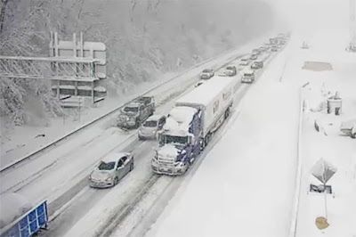
The first big snowstorm of the season moved across the middle Atlantic states this week, with up to 30cm of snow on Monday in places like Virginia and Maryland. The storm snarled traffic along the major north to south Interstate 95 corridor, stranding hundreds of motorists for up to 24 hours south of Washington D.C. in northern Virginia. A new storm is taking aim at southern New York and New England for Friday, with 20cm of snow forecast for Boston.
 |
| Lake effect snow hammering the New York State Thruway south of Buffalo on Thursday, January 6. |
That same storm will deepen rapidly over the Atlantic, with blizzard conditions expected as 80km/h winds combine with up to 40cm of snow through parts of Atlantic Canada on Friday and Saturday. That storm will just brush southern Quebec, with clouds and perhaps a few flurries on Friday. Only a couple of centimetres of fresh snow are likely in southern Quebec between Thursday and Sunday.
On Thursday, a strong cold front moved across the Great Lakes turning on the lake effect snow machine. Waves of lake effect snow are expected southeast of Georgian Bay in Ontario as well as in the Buffalo and Watertown, New York metro regions from Lakes Erie and Ontario.
 |
| The next storm will also miss Montreal as well, dropping heavy snow across the Ohio Valley, southern New England and Atlantic Canada. (AccuWeather) |
Arctic Blast
This weekend mild air will briefly invade southern Quebec, with a few flurries or spotty showers expected early Sunday. The temperature will rise close to the freezing point late Saturday and early Sunday in Montreal. Late in the day, an arctic cold front will introduce the coldest air of the season to southern Quebec, with lows dropping to -10C (14F) by Monday morning and continuing to drop all the way down to -26C (-15F) by Tuesday morning in the city. Highs will remain in the -20s on Tuesday along with frigid windchills. Some locations in southern Quebec may touch -30C (-22F) by Tuesday morning. The temperature will begin to slowly warm by Wednesday.
No comments:
Post a Comment