 |
| It was a perfect weather day end to end for the 40th Annual Firefighters' Day in Pincourt last Saturday. Numerous municipalities across the metro Montreal region took part including this spectacular truck from Kahnawake. (ValleyWeather Photo) |
The weather has been a little unsettled this week, with an upper level low spinning across New England. This system has been pulling in moisture from an ocean storm located south of Maine. The result was isolated showers and even a few thunderstorms moving in the unusual direction of east to west across southern Quebec. The low will eventually move eastward relaxing its grip on our weather, but not before another 24 to 36 hours of scattered precipitation.
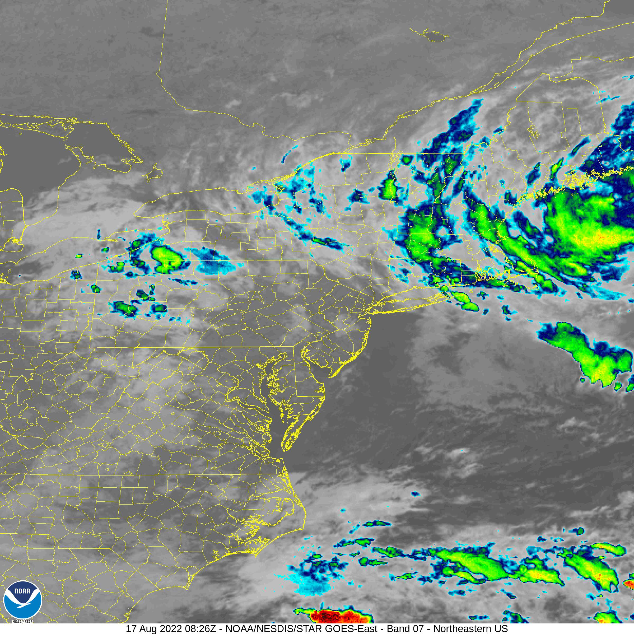 |
| A NOAA satellite image from Wednesday afternoon showing showers pinwheeling westward over New England into southern Quebec from an ocean storm located along the Maine coast. (NOAA) |
Conditions however will be dry most of the time, along with fairly moderate temperatures. Highs will be in the middle 20s, with overnight lows in the upper teens. Conditions will feel muggy at times, with the airmass being of maritime origin. Friday will be partly cloudy as well, with just an outside chance of a scattered shower or two.
High pressure will build back into southern Quebec for the upcoming weekend along with very warm late summer temperatures. It will be another spectacular August weekend, with mostly sunny skies forecast. Highs on both Saturday and Sunday will be near 30C (86F), with overnight lows near 20C (68F). The next chance for showers and thunderstorms will be Monday as a frontal boundary approaches southern Ontario and Quebec. The humidity will begin creeping up on Sunday afternoon, with warm and muggy weather expected Monday and Tuesday, and highs near 27C (81).
No comments:
Post a Comment