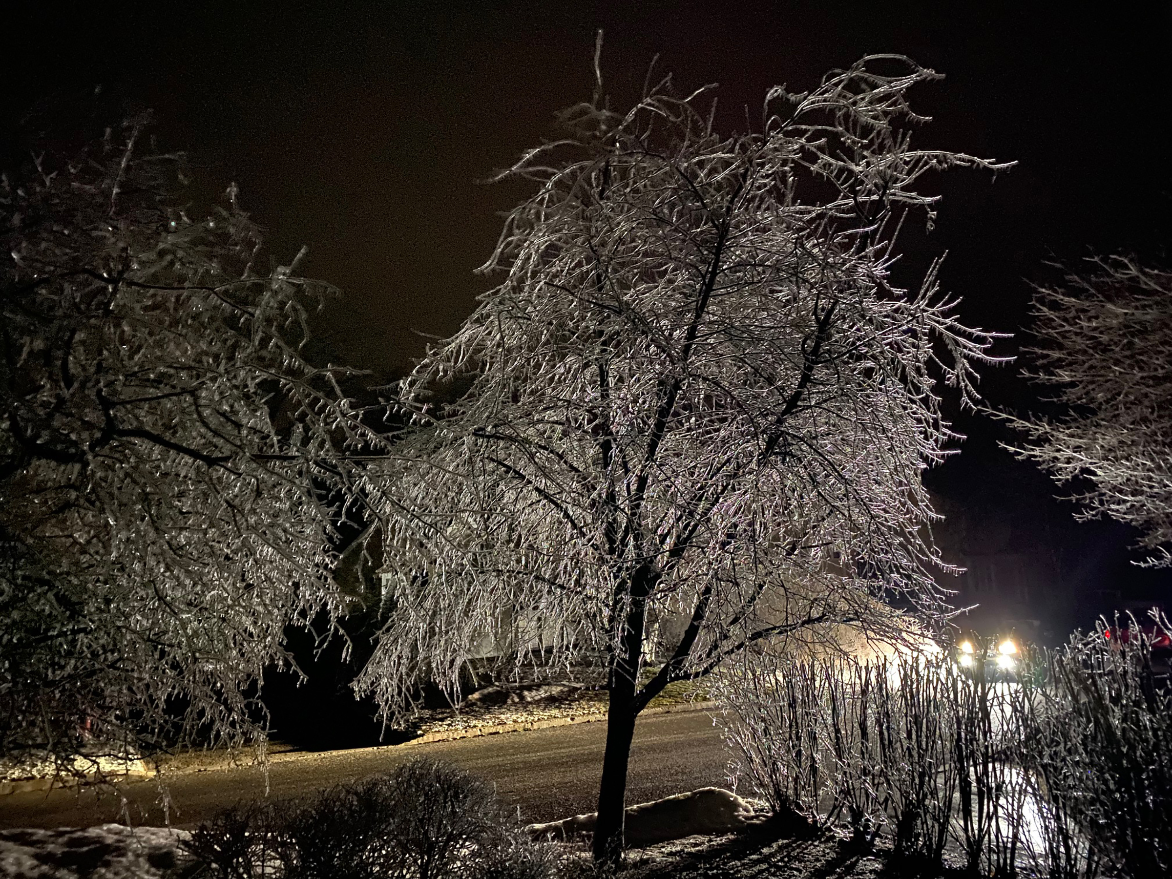
Thursday, May 04, 2023

Flooding persists in Montreal - better weather on the horizon

Volunteers are out in full force in the Borough of Pierrefonds-Roxboro. Dry weather is finally expected on Friday, after several days of rain in the Montreal region. Water levels remain high and the flood risk will persist into next week.
(Courtesy Photo Benoit Langevin)

Flood watch for the Montreal region. Montreal remains in Intervention Mode - Level 1

We have one more day of showery, cold and windy weather for southern Quebec, as a stubborn upper level low moves east of the region. It will be replaced by a strong ridge of high pressure, with sunny, warm and more importantly, dry weather into next week.

The rain has been relentless in parts of Quebec, along with moderate to major flooding across many regions. The hardest hit by far this week has been the Charlevoix region, where spring runoff combined with nearly 100mm of rain, has resulted in serious damage and sadly the loss of two volunteer firefighters. There bodies were found on Wednesday after being swept away Monday by fast-moving flood waters.

In Montreal, nearly 50mm of rain has fallen since Sunday. West of the city, 54mm fell at Saint Anicet and 63mm in Ottawa.

Pumps are in place in several municipalities in the western half of metro Montreal.
(L'Île-Bizard Sainte-Geneviève)

In the Montreal region, water levels continue to rise, especially along the western facing shorelines of Lake of two Mountains. The lake itself, part of the Ottawa River Valley, is in major flood stage Thursday morning at 24.36 metres at the gauge in Pointe Calumet. Major flood stage is 24.30 metres. If you are keeping score, it is the third "100 year flood" in the last 6 years. Water levels are also high in Pierrefonds, Senneville, Sainte-Anne-de-Bellevue, Ile Perrot and Vaudreuil-Dorion.

In Sainte Anne, the gauge is measuring 24.30 metres Thursday morning, still well below the major flood stage of 24.50 metres. In Terrasse Vaudreuil, the level of the lake is at 24.27 metres. Flooding is occurring to several properties immediately adjacent to the lake.

In Vaudruil-Dorion, precautionary measures have been taken along Boulevard Saint Charles, where flood waters have crept up onto the road in several sections. Shoreline parks have been flooded as well.

In Pierrefonds, sandbagging has been organized to help protect several properties, and volunteers are out in full force Thursday morning. For assistance or to volunteer, you can contact Pierrefonds/Roxboro Councillor, Benoit Langevin at benoit.langevin@montreal.ca 

In Senneville, the municipality has closed Chemin de l'Anse a l'Orme due to flooding. They are monitoring high water levels adjacent to Senneville Road.

In all cases water levels are rising, but the good news is today will be the last day with showers for the region. High pressure will build into southern Quebec starting Friday and remain in place well into next week. The end result will be flood waters stabilizing and beginning to slowly recede. But the next 10 days will be critical for the Island of Montreal and points west, as the water from the Ottawa River drains through the city and east.

Temperatures have been cold for early may, but will rise to near 20C (68F) starting Saturday.

Saturday, April 29, 2023

Another round of heavy rain for southern Quebec

A heavy rainfall warning is in effect for southern Quebec including the metro Montreal region. Rainfall amounts may exceed 75mm over the next week, adding to concerns for spring flooding, especially across the Ottawa River Valley from eastern Ontario into the West Island.
Heavy rainfall warning in effect for Montreal for 30-50mm through Monday morning.

More heavy rain is on the way to southern Quebec and Ontario this weekend, as a large upper level low takes up residence over the Great Lakes. This system will be strong, and slow moving, allowing showery, cool and dreary weather to persist in Montreal for most of the upcoming week.

We have a few breaks in the clouds early Saturday morning, along with mild temperatures in the middle teens in Montreal. Clouds will rapidly fill in as a warm front moves northeast into the St. Lawrence Valley this afternoon. Steady rain will develop by noon and continue into the evening hours before tapering off to showers. Temperatures will drop once the rain begins into the single digits and be slow to rise on Sunday, back up to 13C (55F).

Gusty winds will develop Sunday morning in the 30 to 50km/h range in Montreal, before more rain arrives Sunday afternoon. As the low slowly pinwheels across southern Quebec to start the work week, showers and cool weather will prevail into at least Thursday. In total, the Montreal region and more importantly the Ottawa River Valley could see up to 75mm (3 inches) of rainfall between today and Thursday. This is not good news for the Ottawa River that is already in flood stage. Municipalities close to the river, including here on Ile Perrot, have been preparing all week for the potential for flooding. 

Barriers, sandbags and pumps are at the ready to deal with any rising water. Montreal remains in Intervention Mode - Level 1.

The area gauges have been stable most of the week despite the 25mm of rain that fell since last Sunday. The next two weeks will be critical in determining the extent of spring flooding for our region.

On Saturday morning, the gauge at Sainte-Anne-de-Bellevue was steady at 23.68 metres, while the Terrasse-Vaudreuil gauge was rising slightly at 23.67 metres. Both are in minor flood stage at this time. Pointe Calumet on Lake of Two Mountains was down slightly to 23.75 metres.

Stay vigilant if you live near any body of water.

Sunday, April 23, 2023

Heavy rain warning - risk of flooding for Montreal region

Minor flooding is already occurring along the shores of Lake of Two Mountains, including at Parc Esther Blondin in Vaudreuil-Dorion shown above. (Ledy Quintero)
 Rainfall warning in effect for Montreal. Flood watch is at Level 1 Intervention.

Steady rain is falling across southern Quebec early Sunday morning, not what we need at this time. I have measured 5mm here on Ile Perrot since 1AM. The flood risk remains elevated in the Montreal region and along the Ottawa River.

A rainfall warning has been issued for the metro Montreal region, with 25 to 40mm possible through Monday. The rain will only add to the elevated river levels across western Quebec, and especially along the Ottawa River.

The Montreal region, including Senneville on the western tip of the island (shown above), is now at the Intervention 1 level for flooding. Water levels are on the rise, and rain is forecast for much of the upcoming week. (Valley Weather Photo)

Flooding has already been observed in Riguad, spreading down river towards Lake of Two Mountains. Several municipalities including Vaudreuil-Dorion, Pierrefonds, Ile Bizard and Sainte-Anne-de-Bellevue have started sandbagging and installing pumps. Montreal remains at  Intervention Level 1 and has freed-up resources to deal with any potential impacts.

The upcoming week will be critical, with rain forecast both here and upstream across Eastern Ontario. At this time, officials do not believe the flooding will be as bad as 2017 or 2019, when parts of southwestern Quebec were devastated, and transportation routes greatly affected including the closure of the Galipeault Bridge.

As of Sunday morning, water levels were up, but stable across the region. Riguad was in moderate flood stage at 23.95 metres. Terrasse-Vaudreuil remained in minor flood stage at 23.76 metres, as did Pointe-Calumet at 23.85 metres. All gauges were up from early last week.

The forecast calls for water levels to remain elevated, with minor flooding for the week ahead. That may change if the heavy rainfall develops. The weather for the week looks unsettled and cool, with frequent showers.

Tuesday, April 18, 2023

The Montreal region has been put on alert for spring flooding

Water from Vaudreuil Bay inundating the shoreline in Terrasse Vaudreuil during severe flooding back in 2019. The area is under alert once again along with many other sections of Montreal for spring flooding. (Valley Weather File Photo)

Water levels are on the rise around the Island of Montreal, after a week of record-breaking warm weather and rapid snow melt. Just two weeks ago, ice covered many of the rivers and lakes in eastern Ontario and southwestern Quebec, now the ice is gone. The region has been put on alert for the potential for spring flooding over the next couple of weeks.

The gauge at the Sainte-Anne-de-Bellevue locks Tuesday morning sits at 2.194 metres, within minor flood stage, but well below the record level of 3.33 metres set on May 7, 2017, Still, there are signs water is rising in the community and across neighbouring Ile Perrot and Terrasse-Vaudreuil, both hit hard by flooding in 2017 and again in 2019.

The same is true along Riviere-des-Prairies and Lake of Two Mountains, where several municipalities are already preparing for minor impacts this week. Water is slowly creeping onto the Ile Bizzard and Pierrefonds shorelines. The weather this week will be critical with more rain in the forecast. On Monday 12.8mm of rain fell, for a monthly total of 57.4mm. A few sprinkles are expected today, followed by a the potential for a significant storm this weekend. That storm could giver up to 25mm of rain to southwestern Quebec and eastern Ontario. The weather and the river levels will need to be monitored closely.

Further upstream along the Ottawa River, which was responsible for most of the record flooding in southern Quebec in 2017 and 2019, water levels have stabilized somewhat after rising rapidly last weekend. Rapid snowmelt also occurred last week, with temperatures soaring to 30C in parts of the Ottawa Valley. Ottawa has received 54.9 mm of precipitation so far this month. The gauge at Carillon is currently normal, at 23.77 metres, but slowly on the rise.

Vigilance and preparation are the key words for those living in the typical flood prone areas along the western edge of the Island of Montreal, Ile Perrot, Vaudreuil-Dorion and along the shorelines of both north shore rivers, Rivieres des Milles Iles and des Prairies.

Saturday, April 15, 2023

From thick ice to record warmth in Montreal

You have to love the month of April in Montreal, ice and snow storms followed by record warmth, within a few days of each other. The contrast was evident in Senneville on Thursday as a mound of dirty snow melted rapidly on greening grass in 27C heat.

There is a saying in southern Quebec and across northern New England, if you don't like the weather, just wait a few minutes, it will change. No other month exemplifies that more than April. It is during this month that you can have an ice storm and record heat within a week of each other. We have plenty of past evidence in Montreal of April snowstorms occurring just days after the first 30 degree weather.

And so after our historic ice storm, as the last remaining power was being connected and debris cleaned up, Montreal reached 27.9C (82F) on Thursday, eclipsing the previous record of 26.7C (79F) set in 1945. That high was just a couple of degrees shy of the all-time April record of  30C (86F), set on April 27, 1990, and more warmth is on the way.

There are still tons of debris and shattered trees around southern Quebec from the ice storm on April 5. Municipalities continue the clean-up, but it will take time as thousands of trees were damaged.

The warm weather is with us for two more days, allowing for a spectacular early spring weekend. Look for abundant sunshine, with cool overnight lows around 8C (48F) and warm daytime highs under light northeast winds of 24C (76F). If Montreal hits 24C Saturday, it will be another record high. The temperature to beat is 23.3C (74F) set on this day in 1969.

Thursday's high in Montreal was part of dozens of new temperature records established across Ontario, Quebec and New England. Some locations in southern New England including Hartford, exceeded 35C (95F). Ottawa reached 30.2C (86F). Toronto has record highs on consecutive days, reaching 29.4C Thursday, followed by 26.9C Friday.

So enjoy the warm weather, but resist the urge to be near or in any body of water. The water is high, swift moving and frigid,  just a few degrees above the freezing point. Exposure to the water for just a few minutes would likely cause cold shock and hypothermia.

Moving forward we do see a return to more normal temperatures to start the work week. The normal high is only 11C (52F) for mid-April. Monday through Wednesday will feature much colder weather, into the single digits for highs and close to freezing for lows, along with showers and even a few flurries at times.

You have to love April, it is not for the faint of heart, enjoy and stay safe.

Saturday, April 08, 2023

Ice Storm outages move into fifth day across metro Montreal

Hydro-Quebec employees and contractors, along with lineman from New Brunswick, have been working 24 hours a day since the Wednesday ice storm, cleaning debris and restoring power to more than 1.2 million customers. (Valley Weather)

I apologize for the lack of updates during this major ice storm, but I have had no power here on Ile Perrot since Wednesday at 12:57pm...SB

Fourteen hours of freezing rain have left us with millions of dollars in damages and two fatalities across southwestern Quebec. Power remains out to just over 151,000 Hydro-Quebec customers in the region. The utility has over 1500 workers on the job around the clock and plans to have at least 95 percent of clients back online by Sunday evening. The hardest hit area remains the West Island of Montreal where large sections remain in the dark since the storm last Wednesday.

While Hydro-Quebec has hundreds of employees on the job, the work has been slow, with thousands of individual breaks to repair, and debris to clear away. (Hydro-Quebec Photo)

Three fatalities have been reported so far, one in Les Cedres west of Montreal from a falling tree, and a second in Saint-Joseph-Du-Lac from carbon monoxide poisoning. Urgences Sante has responded to hundreds of calls for carbon monoxide poisoning, many from residents using generators too close to their dwellings or even worse, cooking indoors. A third person died in South Stormont in eastern Ontario after being crushed by a falling tree.

The freezing rain fell fast and furious last Wednesday, driven by 65km/h winds. A remarkable ice storm for the month of April. (T. Giotsalitis Photo) 

In eastern Ontario, nearly 200,000 were left without power from Ottawa to the St. Lawrence Seaway.

Nearly 40mm of freezing rain fell on Montreal in less than 14 hours last Wednesday into the early hours of Thursday morning. That amount set a 24 hour precipitation record for the date, the previous being 26.2mm set in 1957. It was also more freezing rain within a 24 hour period than during any similar period in the 1998 ice storm. The 1998 storm did have far more total precipitation, but it was spread out over 5 days. The weight of the ice and gusty northeast winds, at times in excess of 60km/h, had an immediate destructive impact on branches, power lines and poles.

Most municipalities responded by opening warming centres for their residents. Long lines formed at gas stations and any open restaurants.

Major disruptions also occurred for phone, cable and internet service across the metro Montreal region. Thankfully the sun came out on Saturday and the winds eased off from the 70km/h gusts reported on Friday. Easter Sunday will be mainly sunny, with a high of 9C (48F). By Thursday, the warmest air of the year arrives, with highs reaching 21C (70F). 

My power was out for almost 55 hours, and like many, we have had to dispose off all our food from our freezers. It amounts to quite a financial loss, one that will be experienced by many households. Other losses include exterior damage to buildings, cars and flooded basements due to sump pumps not working.

Thursday, April 06, 2023

Major ice storm cuts power to over 1 million Quebec homes

Heavy freezing rain and wind have brought down thousands of trees, branches and in some case like above in Sainte-Anne-de-Bellevue, power poles. The damage is extensive and will take days to repair. (ValleyWeather Photo)

The damage is extensive in the Montreal region and across the southwestern corner of the province after nearly 37mm of freezing rain fell Wednesday, accompanied by 60km/h winds and even thunderstorms. The end result is the worst damage to trees and power lines in the metro region since the 1998 Ice Storm.

Many trees fell onto homes and vehicles, and across roads like Boulevard Perrot on Ile Perrot shown above. (ValleyWeather Photo)

Hydro-Quebec has over 1000 employees at work repairing the damage, but it is extensive and quite serious in many neighbourhoods. It may take days for all the power to be restored. Help has arrived from New Brunswick Power. Hundreds of trees are down and in some cases, power poles have snapped in half. Cellular and internet service has been impacted as well. Power has been out at my home on Ile Perrot since 12:56 Wednesday. 

All schools in the Montreal region are closed Thursday. Long lines have formed at the few gas stations that remain open, especially in the west end. The same is true at any open restaurant. Morning coffee is at a premium! At one point Wednesday evening the Victoria Bridge to the south shore had to be closed for de-icing.

An eerie scene on my street in Notre-Dame-de-L'Ile Perrot late Wednesday evening. Tons of trees and branches are down in my neighbourhood, many onto homes and hydro lines.

The temperature is very slowly rising above the freezing mark Thursday morning, with a forecast high of 11C (52F) expected eventually today. That should help melt the ice and assist in repairs. Unfortunately strong southwest winds are expected to develop ahead a cold front today, gusting to 50km/h, which may exasperate the situation and slow the repair work. Also much colder temperatures are expected this evening for those who remain without power and heat into a second night. The low is expected to be -4C (24F) in Montreal, rising only to 2C (36F) on Friday. Warming centres have been opened in many municipalities.

The freezing rain has also affected portions of eastern Ontario and the Ottawa Valley, with widespread power outages and damage.

Much warmer weather is on the way for next week. Stay safe.

Tuesday, April 04, 2023

Major freezing rain event forecast for southern Quebec

Freezing rain is rare in April in Montreal, but significant amounts are forecast for Wednesday across southern Quebec.

Freezing rain warning posted for Montreal, southern Quebec and the Ottawa Valley.

It is rare to talk about ice storms in April. The angle of the sun and the warming of the ground usually help to alleviate any significant impacts from frozen precipitation. One thing that can overcome those factors is heavy falling precipitation. We have a situation setting up in the St. Lawrence Valley over the next 48 hours the could create as much as 15-25mm of freezing rain for some locations across southern Quebec.

Clouds are already on the increase Tuesday morning in advance of an elongated warm front stretching from a strong spring storm over Colorado. That low will lift into the western Great lakes, pushing abundant warm, moist air into southern Quebec. Meanwhile high pressure over central Quebec will maintain a cold northeast flow of air at the surface. The result will be a prolonged period of freezing rain on Wednesday, especially along and north of the St. Lawrence Valley.

A swath of significant freezing rain is forecast for Montreal and points north and west of the city on Wednesday. (Environment & Climate Change Canada)

Significant impacts from ice accretion are expected north of Montreal, with up to 25mm possible across the lower Laurentians and northern suburbs. Here in Montreal 10-20 mm is forecast at this time, with the most falling over Laval, and lesser amounts across the South Shore. Over the Eastern Townships and across the St. Lawrence Valley in Ontario, 5-10mm are forecast at this time. Expect difficult travel conditions and  possible power outages on Wednesday. Accompanying the precipitation will be gusty northeast winds up to 50km/h. 

Temperatures will be very mild Tuesday, up to 9C (48F). As northeast winds begin this evening, much colder air will filter into Montreal, with lows of -5C (23F) forecast. The mercury will struggle to reach the freezing point, 0C (32F) on Wednesday.

As the temperature warms above freezing late Wednesday, all precipitation will eventually change to rain. A significant amount of precipitation is expected across the entire region, with total liquid and ice reaching as much as 40mm by the time the storm ends early Thursday morning.

This system is having far reaching effects across eastern North America, including blizzard conditions west of the storm track across the Dakotas and Minnesota and severe thunderstorms south and east of the trailing cold front. As the cold front moves through Ontario and Quebec late Wednesday, a few rumbles of thunder will be possible.

Conditions will improve Thursday and into the long holiday weekend.

Friday, March 31, 2023

Plenty of precipitation and big temperature swings for Montreal over the next week

If you don't like the weather in Montreal this Spring, just wait a few hours, it will change. I took the photo above on March 19, on an otherwise sunny Sunday, that went rogue for a few minutes before the sun returned. Southern Quebec has been on a temperature roller coaster over the last two weeks, complete with snow, sleet, freezing rain, wind, thunder and lightning! (Valley Weather Photo)

Spring is certainly not for the faint of heart here in southern Quebec. This week is a prime example of how angry the season can be. As I mentioned in a previous post, it is a volatile weather season, with some of the biggest swings in temperature you will see during any given year, accompanied by intense and at times severe weather.

On Wednesday, Montreal reached a high of 10C (50F) around 4pm under partly sunny skies and southwest winds. During the evening hours, a strong arctic boundary slipped south of the St. Lawrence Valley, accompanied by intense snow squalls, zero visibility and rapidly dropping temperatures. There was even a few rumbles of thunder to the west and northwest of the city with the frontal passage. By 8pm, the city had dropped all the way back to 0C (32F), with a low Thursday morning of -8C (18F). Thursday was wicked cold for late March, with a high of only 0C (32F) and brutal windchill readings in the minus teens.

Friday will be the calm before another wild weather ride. A developing storm system over the southern plains, will move northeast towards the Great Lakes and across central Quebec on Saturday. A warm front will bring mix of rain and snow to the Montreal region late in the day Friday, with less than 5cm expected for most of us. 

Gusty southwest winds will develop after midnight, along with a surge of warm air resulting in rain, up to 15mm, for the Montreal area. Saturday afternoon, there is the risk of a thunderstorm or two along and south of the St. Lawrence River. Further north, precipitation will remain as snow, with 15-25cm possible in far western Quebec and northeast Ontario.

After a cool day on Friday, temperatures will surge to 12C (54F) on Saturday, the warmest day of 2023 thus far in Montreal. The warmth will be short-lived, as another potent cold front crosses the region Saturday night bringing with it another round of showers and flurries along with dropping temperatures once again. The forecast low by Sunday morning is -9C (16F), along with gusty northwest winds.

The sun returns for Sunday, but temperatures will be cold at 1C (34F), accompanied by northwest winds of 20-40km/h.

We rinse and repeat by the middle of next week. Stay tuned!

Wednesday, March 29, 2023

Snow squalls some thunder expected Wednesday evening

Heavy wet snow and even a few rumbles of thunder occurred Saturday evening in Montreal, making for difficult driving conditions. A general 5-10cm fell across southwestern Quebec. (JKO Photo)

A potent cold front is expected to bring an abrupt end to a beautiful spring day in Montreal as it crosses the St. Lawrence Valley Wednesday evening.

The cold front will be accompanied by strong winds, up to 70km/h, as well as showers changing to flurries after 6pm or so. Some of the flurries may be quite heavy for a short duration, and for the second time in less than a week, be accompanied by thunder and lightning. Temperatures will fall dramatically from todays high of 7C (45F), down to a morning low of -8C (18F) by Thursday morning. There may be some slippery driving late this evening as wet surfaces freeze rapidly. Thursday will see skies slowly clear, but it will be blustery and unseasonably cold, with a high of only 0C (32F) and gusty northwest winds up to 50km/h.

Spring can be a dynamic season has we have already witnessed over the last few days in our region and across parts of North America. Temperature contrasts and associated weather can be some of the greatest and most extreme of any season. Last Saturdays storm system was a perfect example, with heavy wet snow falling across parts of Quebec and Ontario, along with embedded thunder and lighting for many, including here on Ile Perrot. The storm put down a quick 5-15cm across the region, quickly covering roads on what otherwise had been a mild day. The snow covered roads produced some spectacular accidents, especially off island.

The Rolling Fork, Mississippi tornado claimed at least 25 lives, producing complete destruction in several small commutes in the western portion of the state. (AP Photo/Rogelio V. Solis)

This was the same storm system that produced the horrific Rolling Fork, Mississippi tornado on Friday night. The powerful EF-4 tornado travelled for nearly 100km, with a damage path over 1km wide. The storm was on the ground for 70 minutes, with estimated winds reaching over 270km/h. Several small Mississippi communities were levelled in the tornado, with at least 25 fatalities reported.

Friday, March 24, 2023

Winter is not over for southern Quebec and Ontario

A spring storm will produce a wide area of mixed precipitation this weekend across Ontario and Quebec, with as much as 10cm of wet snow for the Montreal region.

High pressure will result in some brief clearing across southern Quebec on Friday, along with seasonable temperatures. The fair weather will not last long, as a developing low pressure area over the lower Mississippi Valley begins to lift northward towards the central Great Lakes. 

This storm will pass across Michigan on Saturday then just north of Montreal while weakening. The result will be increasing clouds overnight, with widespread precipitation arriving on Saturday, persisting into Sunday morning. As is often the case with spring storms, we can expect a mix of precipitation, highly dependant on the time of day as well as your specific elevation. Special weather statements have been issued for regions north and west of Montreal, as well as across all of Ontario. These may be upgraded to weather warning for some locations later today.

For Montreal, we can expect rain mixed with snow, with a slushy 5-10cm possible by Sunday morning. North of the St. Lawrence River as well as in the Ottawa Valley, accumulations may be in the 15-20cm range. Some locations across southern Quebec and Ontario may also see freezing rain or sleet during the transition form snow to rain. There may even be a rumble or two of thunder for some of us late Saturday along the trailing cold front. All regions will taper off to showers or flurries on Sunday.

Strong low pressure is expected to produce areas of moderate to heavy wet snow and rain this weekend, along with winds gusting to 100km/h in places. (AccuWeather.com Map)

Rather strong northeast winds of 30 to 50km/h can be expected with the rain and snow Saturday in Montreal, making for a rather raw, unpleasant day outdoors. Temperatures will be either side of the freezing point through Saturday and into the overnight hours, warming up to 2C or 3C on Sunday under mainly cloudy skies, with continued light precipitation.

This same storm system will produce a wide area of rain and snow along with winds of up to 100km/h locally, across the lower Great Lakes into Ontario. A trailing cold front will produce strong thunderstorms from the Ohio Valley into the southeastern US.

Wednesday, March 22, 2023

Spotty freezing rain expected for the Montreal region

A period of freezing rain is forecast for the overnight hours into Thursday morning for southern Quebec. The morning commute may be affected in the metro Montreal region, with temperature marginally cold enough for a little ice accretion to occur. The precipitation will change to rain early Thursday alleviating any travel concerns.

Freezing rain warning for southern Quebec and the Ottawa Valley

Spring has arrived here in Montreal, at least on the calendar. The new season arrived at 5:24pm Monday afternoon, along with bright sunshine and warming temperatures. But as is often the case with March weather, winter still has a few more cards to play. 

High pressure, briefly in control early Wednesday morning across southern Quebec, produced a rather chilly start tot the day, with low temperatures around -6C in Montreal. The warm March sun will help the mercury climb above freezing today, up to 3C by late afternoon. Clouds will be on the increase as our attention turns to an advancing warm front form the central US.

The front will approach our region overnight into Thursday, with precipitation in the form of rain and freezing rain starting during the wee hours of the morning. At the onset, temperatures will marginally cold enough for spotty freezing rain. I am not expecting a ton of ice in metro Montreal or points south, but enough for Environment Canada to issue freezing rain warnings for most of southern Quebec and eastern Ontario. We can expect a few millimetres of frozen precipitation, making the Thursday morning commute icy in places.

Any freezing rain will change to rain early in the day for Montreal, as temperatures rise to 3C (38F).

High pressure will once again take control of our weather Friday, with a sunny, seasonable day forecast.

WEEKEND STORM

A large, potentially winter like storm arrives for the weekend, as strengthening low pressure heads for the Great Lakes and eventually close to the St. Lawrence Valley. A mix of rain and snow is expected across Ontario and Quebec, with quantity and type still to be determined. Enough snow to measure and gusty winds are possible for many of us.

Monday, March 13, 2023

30th Anniversary of March 1993 Superstorm

The cover of the Montreal Gazette on March 14, 1993 said it all. This was the paper I could not get distributed because of the storm. (Valley Weather/The Montreal Gazette))

March 13, 2023 marks the 30th anniversary of the great east coast Superstorm. The following is the blog post I wrote on the storms 20th anniversary in 2013.

I have video of the storm recorded from my home in Verdun, and one of these days I will find it....SB

The March 1993 "Superstorm" was one of the biggest storms to affect eastern North America since weather keeping began. The storm stretched thousands of miles from Quebec down to Cuba. It was responsible for hundreds of deaths, damage in the hundreds of millions and delays and closures that lasted for days. The storm struck over a three day period, March 13-15, 1993.

The storm was incredible on satellite images, stretching across all of eastern North America.(NOAA)

It was a textbook Nor'Easter that unleashed powerful winds and heavy precipitation across its entire path. Heavy snow and record cold occurred from the deep southern US into Montreal and points north and east. Here in the St. Lawrence Valley, the snow started on Saturday, March 13 at around 3pm and became very intense during the evening and overnight hours when visibility dropped to zero for several hours. Winds gusted to well over 80km/h and about 40cm of snow accumulated in Montreal in just 12 hours. The pressure dropped to an impressive low at Trudeau Airport, 973mb. Across eastern Ontario and western New York up to 60cm fell. The storm closed all the bridges in Montreal as well as several highways during the height of the storm, rivalling the blizzard of 1971. Highways up and down the east coast were closed, including several major interstates. Most airports were closed as well, and it would be days before air travel returned to normal.

The snow was deep from Atlantic Canada to Georgia, with over 40cm in southern Quebec and up to 60cm in New York State and Ontario. (NOAA)

For me personally, it was the first time in my 20 or so years working for the Montreal Gazette that we could not get the trucks down to the loading docks to distribute the newspaper. I had a very rare night off as I tracked the storm. Luckily it was a Sunday, so many were at home anyway, had this storm occurred on a weekday, the impacts in Montreal would have been tremendous. Record cold surged into Quebec after the storm, with Montreal dropping to an all-time March record low of -23.9C on the morning of the 15th. The storm was part of a snowy March and April, with 69.2cm of snow in March and 41.6cm in April for Montreal, delaying the onset of Spring 1993 well into early May.

Southern Quebec on northern edge of east coast storm

Crews have been busy in the Montreal region over the last week clearing away the snow and ice that accumulated across the city to end February and begin March. A rather large late winter storm will miss Montreal over the next 24-48 hours, with just a glancing blow. Look for light snow and rain and strong northeast winds as the storm center moves along the New England coast.

A rather large Nor'Easter is set to impact the Eastern Seaboard, southern interior New England and New York, with heavy wet snow, coastal flooding and strong winds. The brunt of the complex storm system will largely remain south of the metro Montreal region, with minimal weather expected here. Portions of southern Quebec along the US border will receive several centimteres of wet snow tonight and Tuesday, with perhaps up to 10cm locally

Monday will be manly cloudy and mild in Montreal, with occasional light snow or rain across the St. Lawrence Valley. Temperatures are already above freezing and will likely remain there over the next 24 hours. Light snow is falling in the Ottawa Valley where it is a touch cooler.

Low pressure will move across the Great Lakes, passing close to Montreal tonight will weakening. Meanwhile a strengthening coastal storm will move form the Carolinas northeast towards Cape Cod. The storm will then linger over the open waters of the North Atlantic into Wednesday before slowly drifting south of Nova Scotia.

Two areas of low pressure will delivery damp, windy and at times snowy weather across the region over the next 48 hours. The bulk of the heavy wet snow and wind will remain south of Montreal. (AccuWeather.com)

What this means for Montreal is a period of damp, dreary weather, with gusty northeast winds and perhaps a cold rain or a little light wet snow. Temperatures will remain within a degree or two of 2C (36F) throughout the period. At this time it appears the heaviest snow will miss Montreal, falling across portions of southern Vermont, interior southeast New York and western New England. Between 15-40cm of snow is possible for those locations, especially the higher elevations. Strong northeast winds will develop with the storm, gusting over 100km/h in coastal regions, and between 40-70km/h here in southern Quebec on Tuesday.

Widespread power outages are anticipated in New England, especially across the Green Mountain and southern Adirondacks. Travel will become quite difficult for those heading south and east across the Townships and into New England.

The weather will eventually clear across the region on Thursday, with mild temperatures continuing. Another storm will approach Quebec on Friday, with a mix of rain and snow forecast once again.

Saturday, March 04, 2023

The calm after the storm in Montreal

Heavy snow fell across the extreme southwestern corner of the province on Saturday, with 25 to 30cm accumulating from Ile Perrot (shown above) towards the Ontario border. At my home on Ile Perrot, 41cm has fallen since Tuesday. To date just over 230cm of snow has fallen for the season at Trudeau Airport. (Valley Weather Photo)

The snowstorm is winding down across southwestern Quebec Saturday evening. I always knew the island of Montreal would be on the edge of the heaviest precipitation associated with this storm, but I never anticipated such a wide range of accumulations across such a small geographical area. The heaviest snow fell along and south of the St. Lawrence River from Ile Perrot to the Ontario border.

Across the extreme southwest corner of the province, accumulations of snow were significant, with 30cm reported at both Valleyfield and Vaudreuil-Dorion. Here on Ile Perrot, I measured 25cm at my home, while just 24 kilometres northeast at Trudeau Airport, only 14cm fell. Amounts were even less further north and east of the city, with 8cm reported in Laval and 7cm in Drummondville. Only flurries were observed in Quebec City.

Roads were snow covered and travel was quite difficult this morning heading southwest towards the Ontario border along both highways 20 and 40. Lighter snow this afternoon, along with warmer temperatures allowed for road conditions to improve quickly.

Low pressure continues to move away from New England this evening, with light snow ending by midnight. Temperatures will drop down to -5C (23F) under cloudy skies. Sunday will see a return of above freezing temperatures, with some clearing expected by late afternoon. There may be an isolated snowflake or two. The high temperature should reach plus 3C (38F) in Montreal, so expect some melting. Monday will be partly sunny and continuing mild, up to 4C (39F).

Friday, March 03, 2023

Winter storm to impact the Montreal region with up to 20cm of snow

Heavy snow is now expected across southern Quebec on Saturday, with snowfall warnings extended into metro Montreal Friday afternoon.

Snowfall Warning posted for southwestern Quebec including metro Montreal

On the anniversary of the epic 1971 blizzard of the century in Montreal, we have another winter storm bearing down on the region.

Friday is as nice a late-winter day as you can possibly have in Montreal. Temperatures are mild along with brilliant sunshine. Sadly this weather will not last much longer. Clouds are on the increase across southern Quebec in advance of a strengthening winter storm that is forecast to move from Oklahoma towards the Ohio Valley and eventually south of Montreal across New England on Saturday.

A strong winter storm developing over the lower Mississippi Valley Friday afternoon, will move northeast spreading heavy snow into southern Ontario and extreme southern Quebec. (AccuWeather.com)

Widespread winter storm and snowfall warnings are currently in effect, now including the island of Montreal as well as the Eastern Townships, Richelieu Valley, Vaudreuil-Dorion and Valleyfield. Computer guidance has come into better agreement over the last few hours, extending the steady snow further north and prompting the new weather warnings in Quebec as well as across the Ottawa Valley and Eastern Ontario. 

Snow is expected to develop across Ontario this afternoon and arrive in Montreal around midnight. Steady snow, heavy at times, is expected through Saturday. Accumulations will be in the 10-20cm for Montreal, with up to 25cm across the warning area south and west of the city. The least amount of snow will fall north and east of Montreal. Gusty northeast winds up to 50km/h will cause blowing snow in open areas on Saturday.

Expect poor travel conditions across Ontario and southwestern Quebec late tonight and Saturday. The heavy snow will stretch all along the 401 and 417 corridors as well as southward across New York State and New England.

Temperatures will be seasonably mild, with lows around -8C (17F) and daytime highs Saturday up to -1C (30F). Skies will clear Sunday, along with mld high temperatures above freezing up to 3C (38F)

Wednesday, March 01, 2023

Despite meteorological spring - winter weather will persist across southern Quebec

Roads were in terrible shape on Tuesday, with dozens of accidents reported in the Montreal region. Between 15-20cm of snow fell on the city, at times quite heavily, reducing visibility and creating icy, snow-packed roads. More snow is expected over the coming days.

Welcome to meteorological spring. After the 15-20cm snowfall to end February, March has started off partly sunny and mild, with above freezing temperatures in Montreal. Unfortunately the mild, spring like weather will not last. We have at least two more winter storms on the horizon for Montreal, one rather weak and the second much stronger.

On Tuesday, a rather vigorous storm system overperformed across the region, with 15-20cm falling across metro Montreal. It was one of the more difficult driving days of the season, with snow covered, slushy and icy roads, and numerous accidents reported in southern Quebec and along Highway 401 in Ontario. 

Just one of the many accidents reported on the island of Montreal Tuesday. This one occurred around 5pm on Highway 20 eastbound before Saint Charles in Beaconsfield. The driver was not injured, but traffic was snarled as the rig blocked all eastbound lanes. The truck took out several trees coming to rest along the fence by a parking lot on Beaurepaire Drive (below).


High pressure has briefly built into southern Quebec for a few hours Wednesday, with sunshine and mild temperatures. The clearing will be short-lived however, with clouds thickening up already as I write. Low pressure will move down the St. Lawrence Valley Thursday, with a mix of light rain and snow. Perhaps 5cm accumulation for the Montreal region. The high temperature will be mild, around 1C (34F)

Brief clearing Thursday night, will allow for overnight lows around -12C (10F). On Friday, clouds will increase once again in response to a much stronger winter storm passing south of Montreal across New England and New York. At this time snow if forecast to begin late Friday and persist into Saturday. Similar quantities are expected as with Tuesday's storm system, in the 15-20cm range for Montreal and points south, slightly less snow is forecast north of the city and in the Ottawa Valley.

Specific details still need to be worked out for the weekend storm, so stay tuned as quantities may change

Wednesday, February 22, 2023

Winter storm on the way for southern Quebec and Ontario

A poorly timed snow squall arrives along the western tip of the island of Montreal in Senneville late Tuesday afternoon. The squall lasted only 30 minutes, dropping a quick 2-3cm of snow and creating very poor road conditions slowing the evening commute right across the city of Montreal and beyond. (Valley Weather Photo)

Snowfall Warning in effect for Vaudreuil, Ile Perrot, Valleyfield, Cornwall, Ottawa

Special Weather Statement issued for Montreal

Winter Storm Warning for northern New York and Vermont

Wednesday morning is the calm before the storm in Montreal, with bright sunshine and cold temperatures. Widespread weather warnings and special weather statements are posted across all of southern Ontario, Quebec and neighbouring New York and New England in advance of a strong winter storm.

Strengthening low pressure will move from Kansas northeast across New York State on Thursday, followed quickly by a second area of low pressure Thursday evening. The combination of both storm systems will spread snow and freezing rain across southern Ontario today and into Montreal by midnight tonight.

Heavy snow falling just off Highway 40 in Senneville Tuesday afternoon.

After a sunny start to the day in southern Quebec, expect increasing clouds by afternoon. Highs will be chilly, around -5C (23F). The snowfall warning comes into effect this evening and overnight for southern Quebec. At this time it includes all regions from the St. Lawrence River south, but excludes the island of Montreal. Regardless of the warnings, look for snow overnight and Thursday, with the heaviest precipitation falling in the pre-dawn hours. Accumulations at this time are expected in the 10-20cm range for the Island of Montreal, 10-15cm north of the city and 15-25cm from the South Shore, including Vaudreuil and Valleyfield, south to the US border. Overnight lows will be cold, down to -12C (10F), combined with strong northeast winds up to 50km/h. The combination of wind and cold temperatures will allow for widespread blowing snow, especially off island.

Look for poor travel conditions overnight and Thursday morning. The snow may taper off early Thursday afternoon, before strengthening once again in the evening. The storm will finally move east on Friday, followed by frigid air into Saturday morning, with lows in the minus 20s. Temperatures will moderate on Sunday, but with additional snowfall expected.

I know March 1st is next week, in a perfect world the start of meteorological spring. However, keep in mind that historically in Montreal, late February and March usually produce our biggest snowstorms. The weather does look to remain active over the next ten days.

Tuesday, February 21, 2023

Snowy cold weather expected across southern Quebec

A quick moving front will delivery a round of snow squalls and flurries Tuesday afternoon, just in time for the commute in Montreal. Another more potent storm arrives late Wednesday, with a significant snowfall forecast for southern Quebec into Thursday.

Our active weather begins Tuesday afternoon, with the arrival of a cold front from Ontario. Along and ahead of the front, a brief burst of strong winds and heavy snow is expected, unfortunately just in time for the evening commute across the Island of Montreal. The squally weather will last less than an hour for most locations, with a quick 2-4cm of snow possible. Roads will become icy quickly as temperatures remain cold Tuesday afternoon.

High pressure will build in behind the front, with a cold night expected in southern Quebec, overnight lows will drop to -10C (14F). Wednesday will start off sunny, but clouds will be thickening and lower as an elongated warm front starts to lift northward across New York and Ontario. Along that front, a strong winter storm will move from the Midwest US into New York and New England during the day Thursday. The storm center will pass south of our region, with snow developing late in the day Wednesday in Ottawa spreading into Montreal by the early evening. Temperatures will remain quite cold along with increasing northeast winds. The snow will persist overnight into Thursday morning, with a potential 15 to 25cm expected for southern Quebec.

A strong winter storm will spread heavy snow and freezing rain from Montana to Nova Scotia over the next 48-72 hours. Southern Quebec is expecting 15 to 25cm of snow from late Wednesday into Thursday.(AccuWeather.com)

Gusty winds and cold temperatures will accompany the snow, along with areas of blowing snow possible as well. The storm will impact a large travel area from Ontario to Atlantic Canada and southward across northern New York and New England.

The system will be fuelled by arctic air to the north of the track and a surge of very warm air pushing northward from the southern US. Record warmth is expected across portions of Florida northward into the middle Atlantic states, while feet of snow will fall across portions of the Great Lakes, Upper Midwest and Northern Plains.

Weather warnings will likely be issued for Montreal. This post will be updated.

Thursday, February 16, 2023

Record breaking warmth to be replaced by snow across southern Quebec and Ontario

It did feel like spring had arrived, but Montrealers know better. Despite the rain and record warmth this week, snow is forecast to fall Thursday night across southern Quebec. The snow may mix with freezing rain at times, with 10 to 15cm forecast by noon Friday.

Montrealers witnessed a 141 year-old temperature record fall on Wednesday evening, when the mercury hit 9.1C (49F) at Trudeau Airport and 10.5C (51F) downtown. The previous benchmark for the day was 7.2C (45F) set at McGill University downtown in 1882. We also surpassed the Trudeau Airport record of 6.8C (44F) established in 2006. The surge of warm air impacted a large swath of eastern North America, with over 200 new daily temperature records established including Toronto and Ottawa.

Temperatures will remain above normal, but we have a significant change in the weather over the next 24 hours as a quick moving winter storm moves just south of the international border. The path of the low pressure has changed somewhat over the last 24 hours and so has the weather accompanying the system. Colder air is filtering into the St. Lawrence Valley, with Thursday's high of 7C (45F) reached at midnight, that was just shy of the 7.7C record for the date set in 1981. The updated track will result in more snow than rain for Montreal.

Thursday evening into Friday the strengthening storm system will move from Oklahoma to just south of Montreal and into Atlantic Canada on Friday. The storm will push a swath of deep moisture into the colder air across our region, with rain and freezing rain beginning after 6pm and changing to all snow this evening. The snow will end Friday morning for metro Montreal. Between 10-15cm of snow and perhaps a few millimetres of freezing rain are possible for the St Lawrence Valley. The temperature in Montreal will fall to -5C (23F) by morning, with a high of -3C (27F) Friday.

Widespread winter weather advisories have been posted along either side of the St. Lawrence Valley in Ontario and New York. In Quebec, freezing rain warnings are now in effect for the Richelieu Valley, with snowfall warnings posted in the Eastern Townships and Beauce regions for 15-25cm.

Skies will slowly clear Friday afternoon, followed by a cold night, down to -15C (5F).  The weekend is expected to be dry and mild at this time, with temperatures rebounding to near the freezing point or even above by Sunday.

Wednesday, February 15, 2023

Is winter over for Montreal?

The very mild weather over the past week has resulted in massive potholes opening up across many parts of the city and suburbs. The freeze/thaw cycle has been brutal. The weather over the next week or so will remain mild, with big temperatures swings from the overnight hours into the daytime, unfortunately the perfect recipe for even more potholes.

A Special Weather Statement has been posted for southern Quebec for a mix of freezing rain and snow Thursday night into Friday morning. Amounts will be determined based on the final track of the storm.

Is winter over for Montreal? The short answer is no. The days are certainly getting longer and the recent mild weather and melting snow has been a welcome relief after the frigid weather to start February, however we still have plenty of winter left. That statement will not be evident over the next 36 hours as very mild air streams northward into the St. Lawrence Valley, but a return to more seasonable temperatures and snowfall is anticipated by late next week. 

As I write this post, Montreal has already reached 5.5C (42F), close to the record high for the date set 141 years ago in 1882 at 7.2C (45F). A few showers are moving into the Montreal area along a warm front, but that will be followed by some breaks in the clouds Wednesday afternoon, and perhaps just enough sunshine to push us over the long-standing record. The normal high should be around -4C (25F).

In terms of practical weather, a compact area of low pressure will move well north of Montreal over the next 24 hours, bringing some clouds and light rain to the region. Gusty winds are also forecast, up to 60km/h at times. Above freezing temperatures will prevail through late Thursday evening, before the next system arrives.  This storm will be much stronger than the current, passing very close to Montreal overnight Thursday into Friday morning. Rain will develop late Thursday, changing to freezing rain and snow as colder air is drawn in from the northwest. Daytime highs will be mild today and Thursday, up to 7C, before a strong cold front arrives late Thursday. Temperatures will drop quickly through Friday morning, down to -5C (23F) in Montreal, rising very little on Friday. After very cold morning lows Saturday, warmer, quiet weather returns for the balance of the weekend, persisting into early next week.

Dangerous ice conditions

One more note on the mild weather of late, ice conditions remain highly variable at best and downright dangerous at worst. January was a very mild month, with nearly half the days in Montreal at or above 0C. February has been just as warm. The warm temperatures have resulted in a rise in area waterways helping to make the ice very unstable. Over the weekend, three individuals ice fishing on Lake Champlain in northern Vermont, died after falling through thin ice. My best advice would be to stay away from any body of water in the Montreal region and points south.

Wednesday, February 08, 2023

Mild weather to persist well into February for Montreal

A poorly timed snow squall along a frontal boundary made a mess of the evening commute across the western suburbs of Montreal on Tuesday afternoon. Several centimetres of snow quickly covered roads slowing traffic to a crawl on Ile Perrot and in Vaudreuil/Dorion. (Valley Weather Photo)

Special Weather Statement posted for southern Quebec for freezing precipitation late Thursday.

Freezing Rain Warning for the Ottawa Valley.

After the coldest 48 hours in decades, a much warmer weather pattern is becoming established to start the month of February. As I write, the current temperature in Montreal is 5C (41F). It feels like spring outdoors, with warm sunshine and melting snow. This is a far cry from Saturday morning, when Trudeau Airport recorded a record-breaking -29.5C (-21.1F). The previous record low at the airport was -28.9C set in 1963. The McGill record was -30.6C set in 1889. It was the coldest morning in 29 years since the -31.8C reading on January 27, 1994. The windchill was a frosty -44C, also a record for the date.

In contrast to our frigid weekend, January turned out to be one of the warmest on record across southern Quebec. The average temperature in Montreal was the 5th warmest on record for the city at -4.23C (24.4F). Records date back to 1872. The last time a January was this warm was back in 2002.

The arctic air is behind us now, and unlikely to return this winter. Looking ahead to the next 6 to 10 days, we can expect above normal temperatures, with several days well above the freezing point. A warm front Tuesday afternoon produced a brief period of heavy snow right around the evening commute, but it was short-lived. Warmer air has now arrived, with highs close to 5C today under fair skies. Wednesday night will feature clear skies, with mild overnight lows of -5C (23F). 

On Thursday, strengthening low pressure will pass west of Montreal allowing for warm air to remain in place. Temperatures will rise to 4C (39F) by late in the evening. Precipitation will arrive in the afternoon as wet snow, with 2-4cm possible before a transition to rain in the evening. A period of freezing rain is possible during the transition, especially north and east of Montreal and in the Ottawa Valley, where temperatures will be slow to rise above the freezing point. Plain rain will fall in Montreal, with 10-15mm possible. Strong winds are likely on Friday in advance of a trailing cold front, with gusts reaching 70km/h in the St. Lawrence Valley.

Precipitation may briefly change back to snow Friday night before ending by midnight. Saturday will be a fair, seasonably mild day as high pressure builds back into the region. The fair mild weather will be with us most of next week, with an extended period of above freezing temperatures allowing for some of the nearly 95cm of snow that fell on Montreal in January to begin melting.

Friday, February 03, 2023

Cold snap for 48 hours followed by significant warming trend

An icy sunrise over the St. Lawrence River near Ile Perrot. Extreme cold warnings are in effect for Friday and Saturday across most of Quebec.

Montreal is in the grips of some of the coldest air on the planet Friday morning, after a powerful cold front swept across southern Quebec late Thursday evening. The front was accompanied by snow squalls producing heavy snow and 70km/h wind gusts. Visibility dropped to near-zero across the Island of Montreal between 9 and 10pm. There were even reports of thunder and lightning on the South Shore.

All that is gone this morning, and we are left with intense cold. The temperature has dropped from -11C at midnight to -25C at 8am. Gusty northwest winds across the province are generating windchills in the -40C to -50C range. The cold air will continue to deepen today in Montreal, with temperatures actually falling towards -26C this afternoon and -30C overnight.

A fast moving arctic front produced wicked snow squalls Thursday evening. This was the scene in Terrasse-Vaudreuil off the southwestern tip of the island. Brief heavy snow, gusty winds and even lightning occurred with the frontal passage. (Video Image by Tammy Arbour) 

Hydro-Quebec is asking residents to conserve energy over the next 36 hours as the heart of the cold airmass resides over the province. The utility is expecting record demand today across the province.  The good news is that the cold outbreak will be short lived. High pressure will slide east late Saturday, allowing a warm front to lift into southern Quebec. After a cold Saturday with a high of -17C (2F), temperatures will warm all the way up to 2C (36F) by late Sunday. There will be some light snow mixed with, believe it or not, rain on Sunday.

The cold is affecting a large region. Widespread weather warnings are in place from Manitoba to Atlantic Canada and on the US side of the border from the Great Lakes to the Northeast and New England. According to Mount Washington Observatory Meteorologists, the icy cold will challenge the coldest temperature every recorded on the peak in New Hampshire of -47F. The overnight low into Saturday morning may be as cold as -50F with windchill values close to -100F. Mount Washington is known as one of the windiest locations on earth, and wind speeds are forecast as high as 140mph (225km/h) with this arctic outbreak.

Thursday, February 02, 2023

Extreme cold warning posted for Montreal

As if driving in from the off-island western suburbs of Montreal was not hard enough already with the bridge troubles, Wednesday mornings cold temperatures created ice fog and black ice on both bridges. Traffic was slowed to a crawl for the entire rush hour. The low Wednesday morning in Montreal was the coldest of the winter to date at -23.1C (-9.6F). It was -29.1C (-20.4F) in Vaudreuil-Dorion. (Valley Weather Photo) 

Extreme Cold Warning posted for metro Montreal.

Arguably the most famous Groundhog in the world, Punxsutawney Phil, has predicted six more weeks of winter. Time will tell, but one thing is certain, the next 48 hours will be extremely cold. The coldest airmass in several years is set to invade southern Quebec Thursday evening behind a powerful arctic front.

Extreme Cold Warnings are in effect for a wide area of southern and central Quebec, with windchill warnings posted across most of New York and all of New England. I expect weather warnings will be added shortly for eastern Ontario and the Ottawa Valley.

Most of Thursday will be fairly mild in Montreal, with scattered flurries. The cold front arrives late this afternoon across eastern Ontario and early this evening in Montreal. The front will be accompanied by a brief period of heavy snow and blowing snow, giving a quick 2 to 5cm at any one location. Strong winds will gust to 70km/h creating areas of blowing and drifting snow. Roads will quickly become snow covered and slippery.

The snow will end by midnight, followed by clearing skies and plummeting temperatures. The low tonight in Montreal will be -22C (-8F). Temperatures will continue to fall Friday, settling into the -25C to -28C (-13F to -18F) range for our area. Gusty northwest winds of 30-50km/h will persist all day Friday, creating dangerous windchill values of close to -40C. Temperatures that cold can freeze exposed skin within minutes. Postpone any unnecessary outdoor activities and be sure to dress in layers. Make certain your pets are indoors.

The cold will remain with us Friday night, with a low around -28C (-18F). Temperatures begin to moderate Saturday, along with increasing clouds and a high of -17C (2F). The warming trend continues into Sunday, with a high of -3C (27F) along with a few centimetres of snow.

Speaking of snow, January proved to be the second snowiest on record, just missing the 1999 record by 0.2cm. For the month, 94.8cm of snow fell at Trudeau Airport. Oddly enough, the 0.2cm we needed to tie the 1999 record fell before noon on February 1st, just a few hours too late.