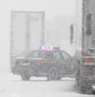
 New York State Police tend to drivers stranded on the Thruway near Buffalo. NBC News
A word to the wise when traveling at this time of year. If it looks wet, treat it as ice, and always check the forecast and listen to the warnings before leaving on any trip, cancel it if necessary. This advice comes on the heels of numerous accidents in Montreal this morning because of black ice, or driver indifference, your choice of wording and the 13 miles of New York State Thruway closed south of Buffalo after a much anticipated and well forecasted lake snow event trapped drivers. Both created massive traffic jams and in the Buffalo case stranded drivers all night. Some situations are unavoidable, but as far as black ice goes, it is sunrise in December, expect black ice on elevated surfaces.
Our weather will become difficult to predict this weekend as high pressure over the Atlantic blocks the movement of weather systems to the east. Low pressure will retrograde into Maine and eastern Quebec and send deep Atlantic moisture into our region. Snow showers and gusty winds will prevail all weekend with some areas seeing a significant amount of snow, especially across the higher terrain. It is quite possible that over 5cm may fall in Montreal, but it depends on how far inland the moisture moves. These conditions will persist into next week with another low pressure backing into our region. It does not appear that the pattern will break until late next week. Meanwhile lake effect snow that has deposited nearly 2 feet south of Buffalo will continue to weaken today before possibly starting up again over the weekend. Lake effect snow warnings are in effect for the regions south of Buffalo as well as Jefferson, Lewis and Oswego Counties off Lake Ontario. Warnings are also in effect for the regions in Ontario bordering Georgian Bay and Lake Huron for upwards of 15cm of snow.
Across our region today and over the weekend expect temperatures to be with a degree of two of the freezing point for highs and lows.
No comments:
Post a Comment