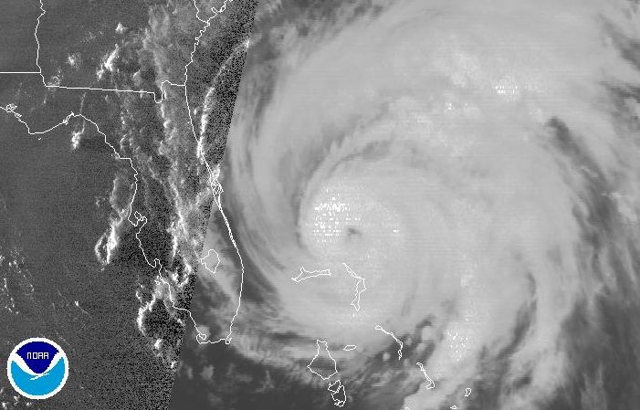
 Hurricane Irene has been pounding the Bahamas all day.
Hurricane Warnings are up for the North Carolina coast tonight to Virginia Beach with a Hurricane Watch north of there to Sandy Hook, New Jersey. A state of emergency is in effect for the coastal counties of North Carolina with evacuations ordered in Hyde, Dare and Currituck counties. Tropical storm conditions are expected to overspread the area by late Friday. Evacuations have also been ordered along portions of the coasts of Delaware and Maryland and will likely be extended north into southern New Jersey on Friday. A state of emergency is also in effect for New York City. Large and dangerous Irene is located about 530 miles south southwest of Cape Hatteras with 115mph winds. The storm is forecast to approach the Outer Banks and pass west of the cape on Saturday. Computer models tend to be favouring a more western route for the storm. That spells bad news for North Carolina as well as the northeast. The storm is expected to move into New York and New England on Sunday with heavy flooding rains and powerful winds. Montreal remains on the western edge of the model runs so we will likely see strong northeast winds and rain by Sunday. Most of eastern Quebec and Atlantic Canada can expect tropical storm force winds and heavy rain if Irene remains are her current forecast track.
No comments:
Post a Comment