 |
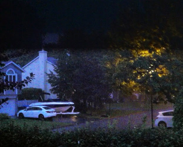
| A shot of lightning illuminates my otherwise very dark street at 10pm Friday night. The storms produced the most vivid lightning of the season here on L'Ile Perrot. (ValleyWX) |
Looking ahead we see more of a fall like pattern developing across Canada as the week prevails. The warm and humid air has been pressed to the south and is being replaced by a northwest flow of cooler air here in Quebec. Temperatures through Wednesday will be around 24C (76F) for highs with cool nights down to 10C (50F). By Thursday a cold front will introduce showers and much colder air.
ALBERTA SNOW
How cool will it get? Well this morning radar and traffic cameras across central and southwest Alberta are showing snow. Parts of west Edmonton into Spruce Grove are down to the freezing point with a slushy accumulation of snow, yes snow in the summer! The snow is falling on the back side of a low pressure area moving into Saskatchewan. Snow is forecast as far south as Calgary into this evening with 5cm possible. Across the foothills, warnings are in effect for up 15cm of wet snow from Banff to Jasper and west to the B.C border. Elsewhere frost and freezing temperatures will occur including in Saskatchewan where the harvest is well underway.
I don't expect it to get that cold in Montreal, but we will have single digit overnight lows by Friday and into next weekend with daytime highs only in the middle teens.
No comments:
Post a Comment