 |
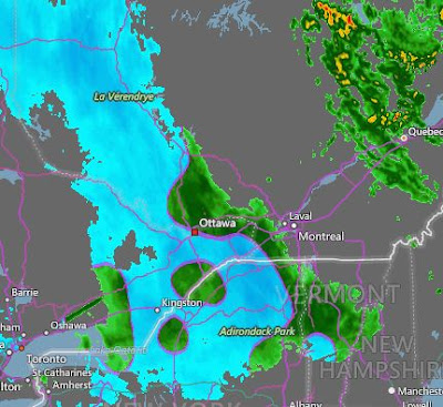
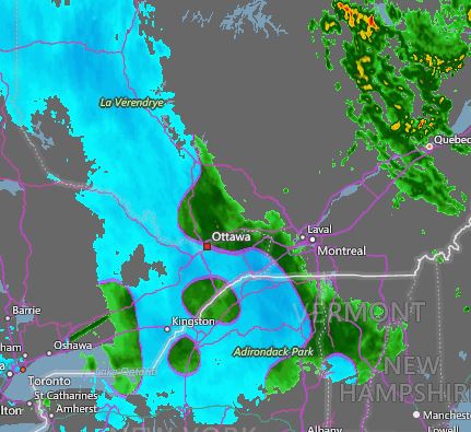
| AccuWeather radar shows the precipitation changing from rain (green) to snow (blue) across eastern Ontario and the Ottawa Valley early Sunday morning. The snow will spread into Quebec later today. |
Temperatures are dropping rapidly this morning in Montreal, behind a potent cold front. At 7:30 am, the temperature was 2C (36F) here on L'Ile Perrot, down from 7C (45F) at midnight. Rain has started this morning and will gradually change to wet snow this afternoon. The snow will persist into Monday, with accumulations of 5 to 10cm (2 to 4 inches) forecast for the city. Heavier snow and blowing snow is expected across eastern Ontario and far western Quebec, including the 401 corridor towards Kingston. These regions are under a snowfall warning through Monday. Accumulations in those areas, including Ottawa, will be in the 15 to 30cm (6 to 12 inch) range. Gusty northwest winds are already reaching 70km/h in southern Ontario, spreading into eastern Ontario and southern Quebec later today. Winds of 30 to 70km/h will persist into Monday afternoon.
Low pressure located over northeast Ontario will move into central Quebec today. A second area of low pressure is currently developing over southern New England and will lift into eastern Quebec. Abundant moisture, along with cold northwest winds, will produce snow over the entire region. The snow will not taper off until late Monday. The temperature will fall to -2C (29F) tonight and rise only to 0C (32F) on Monday. The Monday-morning commute will be challenging in Montreal, to say the least. Give yourself plenty of extra time.
No comments:
Post a Comment