 |
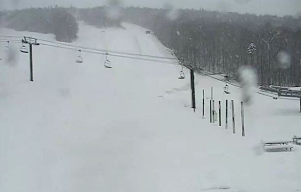
| The Killington web cam this morning showing over 1 foot of fresh snow down on the hills and still falling. |
That pesky low pressure area that brought snow to Atlantic Canada on Easter delivered us a cloudy and cool Monday with periods of rain and showers totaling about 3mm in Montreal. It will be not better today with a chilly high of 8C and scattered rain and snow showers all day. Montreal may see a few breaks by late Wednesday and the system slowly drifts back to the east. The weekend looks to be sunny and much warmer at this time.
 |
Large wildfires continue to burn in the dry brush of Long Island and New Jersey. (esaphotos)
|
The same system produced strong winds that brought down some trees in the Greater Toronto area. It also produced snow above 2000 feet in the Green Mountains of Vermont with a foot of fresh snow at Killington. The snow and any precipitation is welcome after what has been a very dry spring so far. Up until this latest rain and snow, precipitation had been scarce and forests and brush were tinder dry. Just last week alone firefighters in eastern Ontario responded to dozens of grass and brush fires across Leeds and Grenville and into Brockville and the Thousand Islands. Thankfully most were contained. Such is not the case across the middle Atlantic and Northeast where wildfires are raging. A big fire remains out of control in Suffolk County on Long Island. The fire has scorched over 500 acres including two homes, and injuring 3 firefighters. The fire was contained overnight as winds lightened but more gusty winds around that aforementioned low pressure will continue to produce ideal fire weather in Long Island and New Jersey today. Winds reached 43 mph on Long Island Monday and could gust to 30mph today

No comments:
Post a Comment