
I hate to use the term surprise when it comes to weather, but really this one caught me off guard. In a winter that has measured little in the way of snowfall, we managed to accumulate, in Montreal, on April 27, more today than the last two months combined. Over 10cm has fallen in many regions around the city. It varies greatly with elevation and surface. For most of the day the steady snow and gusty winds managed to keep visibilities under 1km across the southern half of the province. The low pressure responsible for this storm is near Cape Cod with and upper level feature spinning across the Champlain Valley. Temperatures have been just cold enough for the snow. By the time the precipitation tapers off most areas will have recorded 10-20cm of wet snow with over 30cm expected across the Townships, Green Mountains and Adirondacks with Jay Peak expecting nearly 2 feet. There is concern that the gusty winds and heavy wet snow may take down some power lines and trees limbs across the upper elevations. So far here in Montreal, it is the early spring flowers that have taken the hit. Warnings remain in effect for southern Quebec south and east of Montreal and for upstate New York and northern Vermont.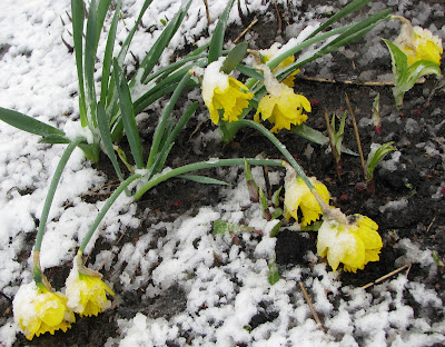
No comments:
Post a Comment