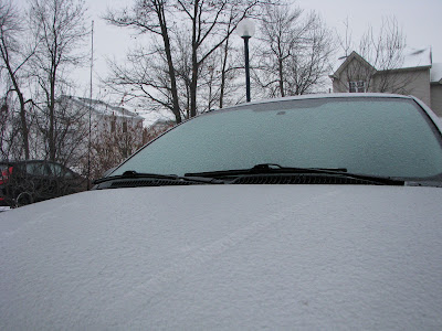
While it was mild in Ontario and New York yesterday, between 1 and 3mm of freezing rain occurred here in Quebec including my home in L'ile Perrot.
That was one stubborn cold air mass that would not yield to the warm front this weekend here in southern Quebec. While areas in Ontario and across the border in New York and Vermont reached well into the single digits above freezing, Montreal remained well below for most of Saturday only touching 0C just after midnight last night here on L'ile Perrot. Most of the day the city endured light freezing rain mixed with snow which iced sidewalks and roads and prompted warnings from Environment Canada. The warm front stalled just south of the St. Lawrence Valley having a difficult time scouring out the cold air at the surface. The warm front finally passed across the Island of Montreal late last night but the warm air was short lived as the cold front quickly raced across the valley. Meanwhile in southern Ontario temperatures warmed to between plus 6 and 8C.
We have a major pattern change in our future that will usher in colder air and the possibility of some decent snowfalls during the last two weeks of January. Up to this point, the winter has been rather tame with low snowfall totals (less than 35cm in Montreal) and frequent intrusions of warm air from the southern US. The true arctic air has been pinched off across northern Canada. Some of that cold air will finally filter into the eastern third of North America and combine with a more active storm track from the southwest US and along the eastern seaboard. We may see some active weather as early as this Thursday but until then temperatures will be rather mild with just a chance of some light snow or flurries late Monday. I will have more on the potential storm this week in tomorrow mornings entry.

No comments:
Post a Comment