 |
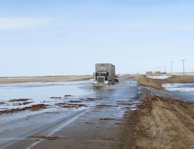
| Water rushing across Highway 2 south of Moose Jaw, Saskatchewan as spring flooding begins. (Regina Leader-Post) |
Yesterday a cold winter like system spread snow from Alberta into eastern portions of Saskatchewan. As much as 15cm of west snow fell in portions of Alberta. This morning it is a cold -5C in Edmonton with flurries. The snow today will fall from the Lakes region of Manitoba into extreme northwest Ontario. Travel will be very poor in gusty winds and wet snow today in those regions.
Spring flooding has begun in parts of southern Saskatchewan, with water running over Highway 2 south of Moose Jaw as well as flooding several properties around Ketepwa Lake. The deep snow pack this winter will result in flooding across many regions of Manitoba and Saskatchewan this Spring. Major flooding is also occurring south of the border in North Dakota in Minot and Grand Forks.
No comments:
Post a Comment