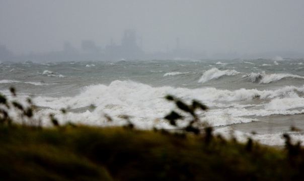
An angry Lake Michigan yesterday.
A big spin of low pressure over Ohio is slowly weakening this morning as it moves northeast into Ontario and eventually southern Quebec. The storm is really our first of what will be many strong cyclonic storms this fall season. Typically fueled by cold Arctic air and warm tropical air these storms deepen rapidly in the Midwest US and head for the Great Lakes or St. Lawrence Valley. This storm has produced very heavy rain especially across Ontario last evening (25-50mm) and overnight in southern Quebec. Montreal had about 15mm, most of that falling in a torrential downpour around 3am complete with lightning and thunder. The other story with this storm have been the strong winds. Wind gusts in the 60 and 70km/h range in the Montreal area have caused some minor damage and scattered power outages overnight. Further west across Illinois and Wisconsin on the colder the back side of the system, strong northerly winds over 100km/h (60mph) have whipped Lake Michigan into a frenzy with 25 foot waves and lake shore flooding.
The storm is weakening so conditions will slowly improve today. A few more showers and even a rumble of thunder is possible in southern Quebec. Winds will remain gusty all day but abate overnight tonight. The weekend looks gray and chilly at this time, typical October weather.
No comments:
Post a Comment