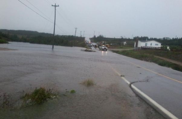
Saturday, October 27, 2012

Sandy in Quebec & Ontario

A look at the current forecast track of Sandy from southeast of Cape Hatteras to a landfall in New Jersey and eventually weakening near Montreal by Thursday.
Hurricane Sandy tonight is located 345 miles south of Cape Hatteras, North Carolina with winds of 75 mph. The storm is moving northeast at 13 mph with a gradual turn to the north and eventually northwest expected by Monday. A landfall along the Jersey Shore is likely by late Monday. Tropical storm force winds of over 39 mph extend outwards more than 500 miles from the center of the storm. Tonight wind driven surf is washing over the dunes and onto Highway 12 along the Outer Banks of North Carolina. Peak wind gusts have been reported at nearly 60 mph. Winds and seas will increase northward into the metro New York region over the next 24-48 hours.

Local effects from Sandy
My best advice for those in metro Montreal is to prepare for possible power outages on Monday. Locally a high wind and flood watch have been issued for the border counties of New York and Vermont. Look for some form of wind warnings to be posted for Montreal and southern Quebec by late Sunday if not sooner. With current guidance and computer model forecasts showing the center passing to our south and west, Montreal should remain on the windy and warmer side of the storm with less rain but the potential for wind gusts up to 100km/h in the St. Lawrence Valley by Monday. The heavy rain will fall in Ontario where up to 100mm (4 inches) is possible from Kingston west to the GTA. Tonight Ontario remains on the cold side of a front with both Toronto and Ottawa around 8C with rain. Meanwhile Montreal is a much milder 14C with clouds drifting across a full moon. This situation will likely remain that way for some time with the front almost stuck just west of Ottawa. A few showers may drift cross it form time to time but the bulk of the rain will remain in Ontario. The rain and wind will increase by late Sunday and Monday. 

We will have more on the exact timing of wind and precipitation expected as well as any local warnings by early Sunday morning. Thanks for reading., stay safe.

Friday, October 26, 2012

Record high - calm before the storm

Major damage from Sandy in Santiago de Cuba. (Reuters Photo)
I just walked the dog and what a warm night it is here in Montreal, almost summer like, calm and moonlit. We managed yet another record high today in what has been a year full of them. Temperatures here on L'Ile Perrot reached 22C (72F) while it was officially 21C (70F) at the airport in Dorval. We managed to squeak by the previous record of 20.6C set in 1963. A strong cold front lies to our west this evening with temperatures much cooler behind the front, it is only 7C in Toronto tonight with showers. A line of showers is approaching eastern Ontario so we may see some rain before morning. Our attention will then turn to Hurricane Sandy that is moving away from the Bahamas tonight with 75 mph winds. Sandy is expected to weaken slightly and then regain hurricane strength over the weekend while brushing the Carolina coast. The system will then merge with a front and create a rather large and deep ocean storm that is forecast to make landfall along the Middle Atlantic coast and move inland over Pennsylvania and New York. It is still unclear what the exact timing and impact will be for Montreal, southern Quebec and Eastern Ontario, but there will be one. Look for increasing rain and wind from Sunday through Halloween. The potential is there for damaging winds and flooding rains.

The storm has been deadly with lots of flooding and wind damage in Cuba, Jamaica and the Bahamas. Over 41 deaths have been blamed on Sandy so far. Winds and waves are increasing tonight across the Outer Banks of North Carolina where ocean over wash is expected at the various high tide cycles over the next several days. A tropical storm warning is in effect. Some evacuations have been ordered for the Jersey Shore, and a state of emergency has been declared so far in Maryland, Delaware and Virginia.

Hurricane Sandy could impact Ontario/Quebec

This is a very complicated forecast with many different scenarios at play. Plan for a prolonged period of inclement weather along the east coast of the US and into New England, New York, Ontario and Quebec from Saturday through Halloween. Check back often for frequent updates and tweets on the progress of this storm.
Current NHC forecast for Sandy.
The National Hurricane Center official forecast track for Hurricane Sandy has gone from well offshore earlier in the week to a landfall now along the Delaware Coast by Monday. Sandy this morning has 80 mph winds and is located about 485 miles (780km) south southeast of Charleston, South Carolina.

As far as the forecast goes, keep in mind this will be a large storm in size and will affect 100's of miles of coastline and interior areas so don't concentrate on the center. It is becoming very clear that Sandy will have a tremendous impact on the weather in the Monday to Halloween time frame from the Carolina's into southern Ontario and perhaps Quebec. With a west shift in the forecast track the heaviest rain in the order of 100mm (4 inches) could fall in our regions. In addition to that strong winds down the St. Lawrence Valley could exceed 100km/h.

Now I don't want to hype up any storm but bear in mind this is a hurricane coming into an area that does not get these storms on regular intervals. In addition we have several other important weather factors acting upon Sandy to make this a prolonged and perhaps disruptive event. Only time will tell and write the history books, so we will have to wait and see. In any event keep in mind that we are looking at rain and wind next week. In the short term high pressure will give us a spectacular day today with temperatures warming into the 20C range. (The record high for Montreal for today is 20.6 in 1963 so we have a shot at it). A strong cold front will advance into the area on Saturday with showers and perhaps some thunder. This front will stall over the area on Sunday and become the focus for tropical moisture streaming northwest from Sandy. Winds and rain will only increase in coverage from that point into Halloween.

Thursday, October 25, 2012

Hurricane Sandy update

The projected path of Hurricane Sandy approaching the Jersey Shore by Monday morning.
Late this afternoon, hurricane Sandy was located in the Bahamas about 25 miles east of Great Exuma Island. NOAA Hurricane Hunters have been flying several missions into the storm today and report back a well structured Sandy with good outflow and maintaining Category 2 strength. The Bahamas will continue to feel the effects of heavy rain and strong winds with gusts reported over 50mph. Warnings are now up for tropical storm conditions are far north as South Carolina. There is big concern for heavy surf and ocean overwash affecting the Outer Banks of North Carolina as early as Saturday. We have a very complex weather picture evolving this weekend that will pair a strong jet stream with an advancing cold front and what is left of Sandy. Sandy is now forecast by the NHC to make a track close to or onto the Jersey Shore by early Monday. We could be looking at a large and destructive ocean storm affecting New England and possibly Atlantic Canada.

The Canadian Hurricane Center issued a statement late today informing the public of the potential for significant weather by late in the weekend across the Maritimes and into southern Quebec and perhaps even southern Ontario.

I will post updates as soon as more information becomes available. Please use the links on this blog and follow me on twitter for updates on how Sandy will affect our regions.

Hurricane Sandy slams Jamaica - what next?

Flooding in Jamaica on Wednesday from Hurricane Sandy. (Jamaican Observer)
Hurricane Sandy blossomed rapidly into a strong Category 2 hurricane last night after sweeping Jamaica with rain and strong winds during the daylight hours. The storm then took aim at eastern Cuba with 110mph winds. This morning the center of  Sandy is located about 40 miles east of Holguin, Cuba moving north at 18mph and a little weaker with 105mph winds and a pressure of 960mb. Hurricane warnings remain posted for Cuba and the Bahamas with a tropical storm warning for Florida. The storm will move across Cuba today and into the Bahamas for Friday.

After that everybody along the east coast from North Carolina to Nova Scotia needs to pay attention to where this storm is heading. There are still a million scenarios that involve everything from a complete miss to landfall between New York City and Delaware. It may be Sandy or a "perfect storm" hybrid combination of systems producing a massive ocean storm. The possibility exists for extremely dangerous surf and coastal flooding especially along the Outer Banks and into Long Island and New England. Heavy rain may create flooding issues inland and there is even the potential on the table for snow on the western edge of the system across portions of the Appalachians. One thing is certain it will be much colder, windy and wet for Halloween week, one way or another. As with most coastal systems the worst of the weather should remain south of the border. We will have to continue to tweak the forecast as the days tick away into the weekend. If your travel take you along the east coast you need to carefully listen to updated forecasts.

**Of note in the short term, a warm front will cross the region today setting the stage for near record highs on Friday across eastern Ontario and southern Quebec. Temperatures may hit the 21C (70F) mark in a few locations with plenty of sunshine on Friday.

Wednesday, October 24, 2012

Watching Sandy

Tropical storm Sandy is poised to become a big news maker if the some of the current forecast models hold up. The storm this morning is nearing hurricane strength with 70mph winds about 120 miles south of Kingston, Jamaica. She is moving north at 14 mph and will affect the island today before moving across Cuba and into the warm waters between Florida and the Bahamas. Sandy is then expected to move northeast parallel to the east coast before possibly retrograding back towards the coast early next week in the vicinity of NYC. If this plays out there would be major implications for the east coast especially New England along with very heavy rain and strong winds inland into eastern New York and southern Quebec. This storm scenario reminds me of the Perfect Storm or Halloween Nor'Easter back in October 1991. It is too early to sound the alarm but people from North Carolina to Nova Scotia need to be paying attention to the forecast through this weekend and into early next week. Today all interest are on Jamaica and Cuba that are under Hurricane Warnings for Sandy. Heavy rain will be the main threat with serious flooding possible. A tropical storm watch is also in effect now for southeast Florida.

In the short term high pressure will be in control of the weather here in the east into Saturday before the fun begins. Temperatures will warm from where they sit now, near 2C up into the lower teens today and eventually near 20C for a high by Friday. It will turn much colder by Sunday along with the threat of some heavy rain by late in the day.

Snow clearing in Prince Albert, Saskatchewan on Tuesday. (CBC News)
SNOW Update: Heavy snow and chilly winds hit southern Alberta and Saskatchewan on Tuesday with over 10cm of snow in many locations including Calgary. Calgary is at a frigid -8C currently. There were numerous accidents as drivers adjusted to icy, slushy roads. This is a process as we know, that takes some into January to get use to! Simple solution, winter tires and slow down. The bulk of the snowfall today will be across central and northern Saskatchewan.

Tuesday, October 23, 2012

Tropical Storm Sandy - Alberta snowstorm

The snow is falling in metro Calgary this morning.
It is another chilly and very typical October start to the day here in Montreal. Temperatures have just hit 2C (36F) here on L'Ile Perrot and there is a little frost on the car. We can expect a big warming trend here in eastern Canada and the US with temperatures reaching into the 20's by Friday. Sunshine will be the dominant weather factor this week with just a few showers on Thursday as a warm front lifts north of the region. The next threat for a general rain and cooler temperatures will not come until Sunday.

Alberta SNOW
The big weather news this morning is middle winter conditions across Alberta and southwest Saskatchewan. Cold temperatures in the -5C range along with a strong storm moving north from Montana, have set the stage for and early season storm. Snowfall warnings are in effect for the area including the City of Calgary. Roads are snow covered this morning and travel is slow. Accumulations are forecast in the 10-20cm (4-8 inches) range along the storm track from southern Alberta into northern Manitoba over the next 24 hours.

Tropical Storm Sandy
Tropical Depression number 18 has become Sandy and is located this morning about 345 miles south southwest of Kingston, Jamaica. The storm is moving very slowly north at 3mph with 45mph winds. A hurricane watch and tropical storm warning are in effect for Jamaica with a direct hit forecast by Wednesday morning. Sandy is in a favorable area for further development and will likely be a hurricane when she hits Jamaica. Beyond that eastern Cuba and Haiti, along with portions of the Bahamas can expect heavy rains and gusty winds. Sandy is then expected to move into the Atlantic east of Florida. Looking ahead into next weekend and Halloween week, numerous scenarios are in place including a possible track along the eastern Seaboard. It is too early to tell exactly where she will go and it what form, but all interests along the coast from Florida to Newfoundland should carefully monitor this storm.

Monday, October 22, 2012

Summer east - winter west

Rain and the setting sun slow traffic along Highway 10 east near the Richelieu River on Saturday. (ValleyWX Pic)
That upper level low that brought Montreal lots of clouds and showers on Sunday has finally began to move northeast of the region. This will allow for clearing skies today with plenty of sunshine and temperatures up to 14C. Montreal has had close to 40mm of rain with some locations off island reporting over 50mm since Friday morning. There was even some thunder reported overnight Friday and again Saturday afternoon. Saturday was almost summer like in southern Quebec with humid conditions, bubbly cumulus clouds and temperatures near 20C. I drover to and from Sherbrooke on Saturday and encountered every kind of weather you can think of, from warm sunshine to thunderstorms and rainbows followed by a spectacular sunset while it was raining (see photo above).

The colors were just spectacular here on L'Ile Perrot this weekend, but 50km/h winds on Sunday brought down many of the remaining leaves.
There will be a well defined split in the weather this week across Canada with cold and wintry weather in the west and increasing sunshine and warmth in the east. A strong low pressure over Montana will move into southern Alberta, and with lots of cold air in place, snow is forecast. As much as 10-15cm is forecast along and south of the Trans Canada Highway tonight. Temperatures are expected to remain below freezing most of the week. Meanwhile a warm front will slowly lift across New England and southern Quebec late Tuesday and Wednesday allowing for warm southwest winds to develop. Temperatures are expected to warm from the single digit highs of Tuesday up to 22C (72F) by Friday, double the normal high for late October.

Tropical trouble for east coast?

One final note, forecasters are watching a growing area of clouds and showers south of Hispaniola that has a high chance of becoming a tropical cyclone. Next on the list in this busy season is Sandy. Computer models are all over the Atlantic basin with this storm once it develops, including several scenarios that take it up the east coast as a decent storm. We are days away from development and forecast tracks but this is well worth keeping an eye on for potential weather problems for the east coast and possibly our region Halloween week. Stay tuned.

Friday, October 19, 2012

Weekend weather for Montreal

Waves from Rafael pound a coastal road near Trepassey, Newfoundland. 
(The Weather Network)
What a gem of a day Thursday was, a true gift this late in the season. Under warm sunshine the temperature reached nearly 20C here in the city. Sadly it has come to an end for a little while, maybe until next April! This morning we have lots of rain on the radar moving from south to north across the Adirondacks of New York and into southwestern Quebec and extreme eastern Ontario. Already about 5mm has fallen at my home on L'Ile Perrot with much heavier rain just to our south moving in at this time. We will add about 40mm to that over the next 24 hours, just below the warning criteria of 50mm (2 inches). North of the city into the Laurentians there will be over 50mm, so a heavy rainfall warning is posted there. Temperatures with the rain today will be very mild around 16C. The weekend looks showery, breezy and cooler as we head into Sunday. Looking ahead into next week we have a cold air mass building into Western Canada with some snowflakes possible. That cold air will likely arrive here in the east by next weekend. Time will tell.

Below: Yesterday the strong winds that affected the Prairies, moved into the Dakotas with lots of damage. Gusts to over 70mph in the Dakotas knocked down power lines, spread wildfires and blew transport trucks off of Interstates. Further south the wind created dust storms in Kansas and Oklahoma closing down several highways after numerous accidents in low visibility.

High winds, over 70mph, topple semi trucks like toys in Belvidere, South Dakota on Thursday.
Top Photo: In Newfoundland post tropical storm Rafael passed about 500km off the coast of Cape Race. The heavy seas and towering waves caused major damage to coastal infrastructure along the Avalon including in Trepassey. Some roads were inundated with sea water and debris. One resident told The Weather Network that the damage was worse in her area then that from Hurricane Igor. Amazing the power of water from a system passing so far out at sea.

Thursday, October 18, 2012

Sunshine before the rain

Enjoy the next 24 hours because the weather is going to turn wet and windy for Friday and Saturday with showers into Sunday. A warm front has lifted north of Montreal this morning with just a few clouds and a sprinkle or two. Skies will clear out quickly in eastern Ontario and southwestern Quebec, and we will enjoy a sunny and warm day today with highs touching 20C and maybe even a 21C (70F) in a few places. Winds will be gusty at times out of the south driving in the warm air. Clouds will increase overnight with rain developing by Friday morning in response to low pressure and an occluded front moving in from the Midwest. This same system delayed and eventually postponed the Yankees and Tigers MLB Playoff game last night in Detroit and produced severe weather in the deep south with several reports of tornadoes. The storm also produced strong winds across the Prairies on Wednesday with gusts up to 94km/h at Assiniboia, Saskatchewan and in the 70-90km/h range elsewhere into Manitoba.

Montreal can expect steady rain all day Friday with amounts in the 30-40mm range and up to 50mm (2 inches) by the time it ends on Saturday. Winds will be gusty at times up to 40 or 50km/h. At this time both wind and rain are expected to remain below advisory level but it will bear watching. Sunday will be damp and partly cloudy with a few remaining showers. Temperatures throughout the early portion of the forecast will be mild but cooling off towards Sunday. Highs will be 15 to 20C with lows of 7 to 10C. No really cold air is in sight at this time. That being said, I still plan on getting the snow tires on before the end of this month. Just call it a gut feeling.

Rafael
Post tropical storm Rafael is located about 400km southeast of Cape Race, Newfoundland this morning and moving rapidly across the Grand Banks. The storm will produce very heavy surf today along the eastern coast of that province with a high surf advisory in place for the Avalon. Seas will build to 7 metres along the coast, but should subside later tonight.

Wednesday, October 17, 2012

New England earthquake

The region was once again shaken up by an earthquake, this time in Maine. The 4.0 magnitude tremor occurred at around 7:12 pm last night in coastal York County, Maine near Waterboro. The quake was felt across a wide area of New England from Vermont southward towards Boston and even on Long Island. There were no reports of major damage. This is the fourth tremor in less than one month to be felt in New England, Ontario and Quebec and comes on the heels of last Wednesday's 4.5 quake near Beloeil on the South Shore of Montreal.


The longer nights and frost have rapidly turned many of the trees in  Montreal this past week. Most are in various stages of color from full green to brilliant red. This was one of the few trees the same color from top to bottom. ValleyWX Pic
It is another chilly morning in Montreal with the mercury flirting with the freezing point and scattered frost being observed here on L'Ile Perrot. It will be a partly cloudy day, with more clouds than sun as the afternoon moves along and temperatures chilly, around 10C. Thursday will be partly sunny and much warmer with perhaps 20C in spots. That will be the end of the dry weather for a few days as a low pressure area moves from west of the Great Lakes across southern Quebec into the weekend. A steady rain is forecast for Friday with showers Saturday.

Tuesday, October 16, 2012

Chilly Tuesday then warmer

A relatively dry cold front swept across the Montreal region late Monday with just a few sprinkles and some gusty winds. The air is noticeably cooler this morning with the current temperature at 5C (41F) here on L'Ile Perrot down from nearly 20C (68F) on Monday. Today will be the coldest day of the week with clouds, perhaps a sprinkle or two and highs no better than 10C (50F). It will be cold overnight with lows generally approaching the freezing point. The balance of the week into the weekend will be rather mild with temperatures above normal. Highs on Wednesday will be near 18C (65F). High pressure will dominate into Thursday before a decent low approaches the St. Lawrence Valley from the Great Lakes. Look for rain by Friday into Saturday with slightly cooler temperatures.

Hurricane Rafael
The news is better this morning regarding Rafael and Newfoundland. First of all Rafael became a hurricane on Monday and now has 85 mph winds. A tropical storm warning is out for Bermuda with the center expected to pass east of the island tonight. The storm this morning is about 395 miles south of Bermuda, moving north northeast at 16 mph. Gusty winds, rough seas and about 2-4 inch's of rain are forecast for Bermuda as the storm passes by to the east. Looking ahead the storm is now expected to remain offshore of Newfoundland largely affecting the Grand Banks and marine waters. Rain may affect the eastern portion of the province along with rough surf and gusty winds. Adding to the rain and wind and even some snow is a strong low pressure area located in New Brunswick this morning. The two systems will combine to bring unsettled weather to Atlantic Canada for most of the week.

Monday, October 15, 2012

Warm & windy Monday

In stark contrast to most of this past weekend, we are expecting warm temperatures today, approaching 21C (70F) in both the Champlain and St. Lawrence Valley. Over the weekend the mercury struggled to clear 10C as we had a decent freeze Saturday morning, and low clouds, fog and rain most of Sunday. A warm front has lifted north of Montreal this morning, with temperatures on the rise on southeast winds. We are sitting at 12C, the warmest it has been since late Thursday. Increasing south winds will help temperatures to rise under partly cloudy skies. Clouds will thicken again later this afternoon in advance of a cold front moving from Ontario into Quebec. Showers will accompany the front along with dropping temperatures down to about 7C (45F). We will warm very little on Tuesday to 10C (50F) under partly cloudy skies. Winds will be another issue today becoming gusty out of the southwest over 50km/h with gusts to 70km/h possible in the St. Lawrence Valley. Those winds will diminish this evening as they back out of the northwest 20-40km/h. Rainfall will be light today adding to the 20mm that fell over the weekend.
A NOAA image of Tropical Storm Rafael north of Puerto Rico this morning.
Tropical Storm Rafael
Tropical storm Rafael formed over the weekend and has been giving rain to Puerto Rico and the Virgin Islands. The storm has 70 mph winds this morning and is located about 290 miles north of San Juan. Forecasters have issued a tropical storm warning for Bermuda and are expecting Rafael to become a category 1 hurricane later today.  Rafael is generating high surf and big waves in the Bahamas as he moves north northwest at 10mph. Looking ahead to the middle of the week, the likelihood is increasing that Rafael will have some sort of impact on Newfoundland. The storm could approach the Avalon as a post tropical storm with gusty winds and heavy rain by Wednesday. The Canadian Hurricane Centre is already tracking the storm and releasing statements on it. Warnings may be needed as the path of Rafael become more clear late today and Tuesday.

Thursday, October 11, 2012

Hard freeze on the way

Snow fell across northern Alberta on Wednesday, including here in Grand Prairie. (Grande Prairie Daily Herald Tribune)
A cold front is poised to cross the Great Lakes and St. Lawrence Valley by late today ushering in the coldest air of the season. Temperatures are chilly on L'Ile Prrot this morning at 4C with a gusty wind making it feel rather raw outside. Look for partly cloudy skies today before clouds and showers increase this evening. Temperatures will reach 10C today before dipping to 5C overnight and really not moving on Friday with a strong northwest wind over 40km/h. The front has limited moisture but may give a few millimetres of rain, similar to yesterday's front the brought 5.1mm to Ile Perrot. As mentioned the coldest air since last spring will move in on Friday setting the stage for a hard freeze Friday night across the entire area. Frost and freeze conditions will affect Ontario and Quebec and south across New England even into the middle Atlantic. This will bring an end to the growing season with lows easily in the -2C range in the city and as cold as -10C north and south of the metro region. The showers tonight may end as a few flurries especially north of the city and in the Townships, Adirondacks and Green Mountains south and east of Montreal.

The same system produced snow yesterday from Alberta east into Manitoba. Around 5cm fell in Edmonton with as much as 10cm in Grand Prairie. That system is spreading snow today across northeast Ontario.

Wednesday, October 10, 2012

Earthquake rattles Montreal

The 4.5 magnitude quake was centered east of Montreal near Beloeil on the South Shore.
A 4.5 magnitude earthquake rattled the region overnight, centered on the South Shore of metro Montreal near St Hyacinthe. The quake occurred at 12:19am about 9km northwest of Beloeil and was measured at a depth of 9.9km according to Earthquakes Canada. It was felt across a wide area from Ottawa to Cornwall and south into northern Vermont and New York. No damages or injuries were reported. Normally I am a very light sleeper along with my trusty canine Bella, who is very sensitive to these events. However with this one, we both slept through it and felt nothing at all. There were numerous reports of decent shaking across the city of Montreal, especially in the southwest sector. I grew up in Verdun and historically when we get a quake, that area of the city shakes something fierce. It is largely on landfill and very close to the St. Lawrence River. Here on L'Ile Perrot we have lots of solid rock which tends to absorb the shock as opposed to Verdun that shakes like a bowl of jello! No aftershocks have been reported as of 7:25 this morning.

We are in for a blustery day as a cold front approaches the region from Ontario. Temperatures will be mild in the 16C range on increasing southwest winds gusting over 50km/h. That should bring down plenty of leaves across the city. Showers are expected to develop in the afternoon and taper off by midnight. Thursday will be partly cloudy, blustery and cooler with highs near 10C. Another cold front will move across southern Quebec early on Friday morning with the coldest air of the season coming in behind it for Friday night. Look for widespread frost and freezing temperatures Friday night into Saturday before it warms a little this weekend. At this time Saturday looks like the best day of the weekend, sunny and milder.

Tuesday, October 09, 2012

Seasonable week ahead - spectacular northern lights

An amazing photo of last nights northern lights taken by Beth Allan outside Edmonton. (Spaceweather.com)
Seasonable, a weather geeks word for boring. We are looking at another week of seasonable weather with temperatures in Montreal and across eastern Ontario running very close to normal (4/14C). Highs will be in the teens today, around 16C for Montreal. High pressure is in control of our weather today with low pressure along the east coast keeping clouds and showers well southeast of our region. It is a chilly start to the day with temperatures around 4C at the airport but only 1C here on L'Ile Perrot with scattered frost. A freeze occurred in the rural areas off island with St. Anicet at -1C and Lennoxville at -2C at 7am. This is thew second morning in a row I have had to scrape ice off the windshield. This is roughly the normal arrival for frost in this portion of the province, same as last year. I started winterizing the property just a little yesterday as I remain is disbelief how fast the seasons have swung. The balance of the week will see a couple of cold fronts cross the area with pretty chilly air by Friday in place. There is a risk, and just a slight one, of a few snowflakes by late Thursday night. Otherwise look for sunshine today followed by a chance of showers late Wednesday and again Thursday night. No big storms on the menu for this week.

Spectacular Aurora
A geomagnetic solar storm on October 4th has released millions of particles into the atmosphere and has generated spectacular northern lights across a large portion of the northern hemisphere. There were endless reports of the spectacle last night along with amazing photos across Canada and the northern third of the US. I did not see anything here in Montreal, but mind you we have so much light pollution in this city that seeing anything other than a street lamp is rather difficult. You can read up on this phenomenon as well as other information at Spaceweather.com

Friday, October 05, 2012

Thanksgiving Weekend Update - No snow...yet

A truck rolls along the Trans Canada in snowy Manitoba on Thursday. The early snowstorm cut power and slowed travel, including this combine. (Photo: John Woods - Canadian Press)
That wild snowstorm that sent the weather from the low 80`s with grass and brush fires in Minnesota and Manitoba down to the 30`s with snow, has now moved into northwest Ontario and is weakening this morning. The storm was responsible for accumulations in the 10 to 30cm (4-12 inch) range with winds in excess of 70km/h. The snow spread from northeast North Dakota across northern Minnesota, northwest Ontario and southeast Manitoba. This combination closed schools, knocked down trees and power lines and forced major delays in road travel. Snow does often occur in October across this region, bit not this early and rarely this intense. Temperatures in some areas dropped more than 30 degrees in less than 24 hours. A hard freeze across the Prairies and northern US Plains is bringing an end to the growing season in many areas this morning.

Quebec & Ontario
On the other end of the scale southern Quebec and Ontario are enjoying very mild weather this morning with the mercury already at 15C here in Montreal on the way to a warm 21C. The area remains under a warm southwest flow with winds expected near 50km/h today, bringing in warm and humid air from the southern US. There has been lots of fog around this week, a product of the longer nights which allow temperatures to cool rapidly after sunset. Enjoy this as major changes are expected beginning tonight. A strong cold front will begin to cross the area overnight with a steady rain and cooling temperatures. Highs on Saturday will be in the 15C range and that will drop to 10C by Sunday. Look for an unsettled Thanksgiving Weekend with below normal temperatures and a risk of showers each day. More rain is likely to start next week as a series of low pressure areas affects southern Quebec.

Thursday, October 04, 2012

First snowstorm for Manitoba - Ontario

An early season winter storm is creating heavy snow and strong winds across the Red River Valley of North Dakota, Minnesota and Manitoba this morning. Heavy snow and winds in excess of 50km/h are creating whiteouts on the roads in that region. Low pressure will lift from South Dakota into northwest Ontario today along with the snow and wind. Winter Storm Warnings are in effect for the area including southeast Manitoba and northwest Ontario. Temperatures are right around the freezing point this morning with a cold rain in Winnipeg, but snow south of the city along the US border. Some parts of northeast North Dakota will see over 30cm (1 foot) today with 10-20cm in Manitoba and northwest Ontario. The wind is producing blizzard conditions with difficult travel reported on Interstate 29 as well as Highway 75 north into Winnipeg. Later today snow and winds will spread across the Trans Canada Highway between Kenora and Winnipeg.

Temperatures behind the storm are cold for October with below freezing lows across Saskatchewan and Alberta. In Denver the temperature plunged from 83F yesterday down to near freezing overnight including an 18 degree drop in one hour. Accu-Weather reports winds to 47mph along with steady snow in Fargo, North Dakota this morning.

Wednesday, October 03, 2012

Summer warmth - winter cold

A dark webcam image from early this morning in Canmore, Alberta where it is -2C with light snow. You can see the snow covering the ground and the buildings. (canmorealberta.com)
It is October, and like April it is a month of serious transition. Therefore it is quite possible to have 30C one week and snow the next. The residents of southern Manitoba will experience that scenario this week. After the warmth of last weekend, many areas of southern Manitoba, northwest Ontario as well as adjacent North Dakota and Minnesota are looking at the first snowstorm of the season. Winter Storm Watches are flying this morning as low pressure is forecast to take shape over the northern Plains and strengthen as it heads across Lake Superior. Cold air and increasing north winds on the backside of the system will change the rain to wet snow with 10-15cm (4-6 inches) possible by Friday morning. The trailing cold front is already spreading snow across southern Alberta this morning with several centimteres accumulating overnight in the near Canmore, Alberta, the foothills and western Montana.

Meanwhile here in the east it is perhaps summer's last stance. It is a mild and muggy morning with a southwest flow of moisture streaming north from the Gulf of Mexico and into Ontario and Quebec. The elevated humidity and long nights have led to widespread fog along the Eastern Seaboard and into our region. The fog will dissipate followed by a partly sunny and warm day with highs near 21C (70F). The above normal temperatures are here to stay until that aforementioned cold front arrives by late Friday. From a precipitation point of view, we are looking at a slight risk of showers today with an elevated risk of showers and thunderstorms by Thursday. The weather will remain unsettled into the weekend with more showers, and turning much colder with highs not getting above 10C (50F) on Sunday and Thanksgiving Monday.

Tuesday, October 02, 2012

Colder & snow?

Right on cue snow arrived on the summit of Mount Washington in New Hampshire on Monday morning, October 1. (Mount Washington Obs Photo)
Ok now that I have your attention, no snow for Montreal, at least not this week. After what has been a seemingly endless stretch of above normal temperatures, we are looking at a potent cold front diving across Alberta and the northern Plains today and into the Great Lakes by the weekend. Accompanying the front will be the coldest air of the season so far along with rain and snow showers. Places like Winnipeg that were near 30C on Sunday will drop down to the single digits by Thursday with flurries possible. A couple of centimetres of wet snow may fall as early as this evening in Calgary. Winds are forecast to be in the 50 to 70km/h range with the front across a wide area of Alberta and Saskatchewan. Snow is also forecast from Eagle Pass to Rogers Pass in BC with up to 10 centimetres (4 inches) possible.

A softer version of the front will arrive in time for Thanksgiving Weekend in Montreal with cooler weather and highs near 10C by Monday. Until then Montreal is in for above normal temperatures with highs between 18 and 20C. That is the good news, but clouds and showers will be on the increase today as well. It is sunny at the moment but we only have to look into eastern Ontario to see clouds on the increase with showers moving up the 401 corridor. Partly cloudy skies and scattered showers will persist into Wednesday for southern Quebec and Ontario.

Monday, October 01, 2012

October weather is here

Well it certainly feels like October this morning across southern Quebec and Eastern Ontario with temperatures around 11C and drizzle. We had a raw and chilly weekend with drizzle and northeast winds becoming a steady rain late Sunday afternoon and lasting well into the overnight. Officially we had 22.4mm at the airport to end the month with just over 30mm here on L'Ile Perrot. That brought our monthly total up to a respectable 103mm of just over 4 inches. All that fell on only 5 days, so the trend of a dry summer lasted into at least September. Such was not the case for other parts of the country with Halifax having its wettest September on record. A total of 386.8mm of rain fell on the city breaking the previous record of 308.7mm set in 1996. That total was oh so close to the all time wettest month on record of 387.1mm set in August of 1971.

The weeks looks showery but mild at least for early October. Today will be chilly with more showers as a stubborn and slow moving upper level low slides east of Montreal and into the Atlantic. The balance of the week will have intervals of sun and cloud with showers. I think there will be more cloud than sun but it will be mild with temperatures in the low 20's for highs and above 10C for lows. That will change by next weekend as a cold air mass begins to settle into he east. That cold has brought portions of Alaska and northern interior British Columbia their first snow of the season. Around 15cm fell in portions of southeast Alaska with 5 to 15cm forecast for the mountain passes of the Coquihalla Highway from Hope to Merritt, BC.

Friday, September 28, 2012

Weekend Weather

Not the best weekend ahead for outdoor activities, but not the worst either. We start this Friday with scattered frost north and south of Montreal with temperatures down to -1C in the mountains north of the city as well as in Lennoxville in the Townships. Frost has occurred in places but the warnings have been allowed to expire. I managed a low of 3C (39F) here on L'Ile Perrot, but with no frost. With the clouds and showers forecast for the weekend, frost will not be an issue. Speaking of rain, we have low pressure south of the area with precipitation moving slowly into southern Vermont at this time. This will reach Montreal by late in the day with just a slight chance of a few showers. On Saturday a large upper level low will sink into the Great Lakes and then move ever so slowly across Ontario and southern Quebec during the weekend. The forecast is simple, clouds with drizzle and periods of steadier rain most of the weekend. We may see a few sunny breaks Saturday but they will be isolated in nature. High temperatures will be near 15C with lows near 10C both Saturday and Sunday.

Thursday, September 27, 2012

Frost warning - southern Quebec

After the passage of Wednesday's cold front, Montreal has dropped to a chilly 6C this morning. We are in for a partly cloudy day today with highs no better than 15C. Skies will clear tonight as high pressure crests over the area. Under clear skies with calm winds temperatures will drop to at or just below the freezing point across most of southern Quebec with a widespread frost expected. For this reason all of southern Quebec is under a frost warning. The exception will be near Montreal where temperatures in the metro region will remain just above freezing at 3 of 4C with just patchy frost expected.


Above I have posted a NOAA satellite shot of a very impressive storm hitting Alaska with strong winds and flooding rains. The trailing front is bringing heavy rains to the B.C. interior with warnings in effect. The intense storm is just a prelude to the what we can expect as October approaches and the battle of the seasons begins. The center almost looks like a hurricane, but has the classic comma shape of a strong mid-latitude storm.

Wednesday, September 26, 2012

Harvest Moon

The full harvest moon illuminates a John Deere combine on a farm on the prairies. AP Photo
Clouds and a few showers are dotting the area this morning as a very mild and moist southwest flow of air is over the region. A cold front to our west will enhance the showers with perhaps a rumble of thunder by late in the day today through about midnight. Skies should then clear out slowly for a partly cloudy, but much cooler day on Thursday. High temperatures should be mild today as we are already at 14C. Look for highs in the St. Lawrence Valley and eastern Ontario to be in the 20C (68F) range once again. Temperatures will drop quickly behind the cold front down to 6C (43F) overnight tonight and remain chilly Thursday up to 15C (59F). Under clear skies Thursday night, lots of frost should occur away from the rivers and lakes with lows near the freezing point with the exception of metro Montreal around 3 or 4C.

HARVEST MOON
This weekend we have the spectacular large, full and most times orange Harvest Moon. The full moon will be in the sky around 11:18pm Saturday night in Montreal. The Harvest Moon is the full moon closest to the Autumnal Equinox which occurred last weekend. When I was living in Saskatchewan it was a busy time of year with harvest in full swing. Combines would often hum late into the night under the bright, almost daylight at times produced by the full moon. It was a rather beautiful, peaceful scene to see a combine harvesting a field of wheat with the large orange moon lighting the landscape. This year excellent weather in the southern Prairies has allowed the harvest to be well ahead of schedule. According to Saskatchewan Agriculture, almost 74 per cent of the crop has already been harvested. Nevertheless farmers are busy harvesting, hauling bales, seeding winter cereals and controlling weeds and will welcome the extra light at a time when daylight is dwindling. This is true for farmers right across the country who are beyond busy in September and October securing their crops as well as preparing their farms and animals for the long winter ahead.

Tuesday, September 25, 2012

Showers - milder

After a chilly preview to fall on Monday with some frost and lows in the 4C range, Montreal is about 10 degrees warmer this morning. There is not a whole lot of weather going on coast to coast as we transition into a more Autumn like pattern. Radar is showing a few widely scattered showers over the St. Lawrence Valley in Ontario, but it remains dry in Montreal at this time. We may see a sprinkle today, but it will be dry most of the time. Temperatures on gusty south winds will warm to near 21C (70F). It will remain mild overnight before a cold front approaches the region on Wednesday. Showers and perhaps a steadier rain will develop along the front late Wednesday followed by clearing and cooler weather by Thursday. After a low of 14C tonight it will warm to near 20C again Wednesday before dropping back into the single digits by Thursday morning. A very early look into the weekend shows unsettled weather with clouds and showers both days.

Friday, September 21, 2012

Here comes fall 2012

A fall sky greeted me this morning in North Hampton Beach. Fall arrives Saturday morning at 10:49. It is 49F here on the coast.
Fall arrives at 10:49AM Eastern Time on Saturday, and right along with it will be the stormy and chilly weather. Today will be cloudy in Montreal and most of southern Quebec along with a few showers. More showers and thunderstorms are possible on Saturday as another strong cold front moves across the Great Lakes and into Quebec. Behind that front the coldest air of the month/season so far will build in with highs remaining below 15C Sunday and well into next week. There will likely be more frost in many areas as lows head towards the freezing point, bringing what was a warm and dry growing season mercifully to an end.

The good news is the extended forecast from the National Weather Service for New England and the border areas of southern Quebec and the Great Lakes basin is for a warmer than average fall with near normal rainfall. So here is hoping the cold weather is still months away! That being said this is my last day on the Atlantic Coast (then back to reality) and it is cloudy at a cold 9C this morning. But I still have my shorts on and off to the beach I go, all mind over temperature!

Tuesday, September 18, 2012

Storm Update

Above & Below: A sign warns travelers in Salisbury Beach, Massachusetts of the pending stormy weather today. (ValleyWX Pic)
 As strong low pressure continues to lift into Quebec tonight, a potent cold front is causing damage up and down the east coast. A variety of warnings are in effect for high winds, flooding and strong thunderstorms. Montreal received over 27mm of rain, along with winds over 60km/h. Here on the Seacoast of New Hampshire, winds have gusted over 30mph, and we have a high wind warning posted. Strong winds will reach over 50mph with heavy rain tonight. Another threat will come from high surf up against the seawall right across the street from my condo. Some ocean overwash is possible during high tide around midnight. Should be an interesting night. Power outages are also a big problem in New York and Vermont with thousands in the dark tonight.


Strong winds & heavy rain

Red sky in morning, sailor take warning...

A brilliant red sky has greeted us here on North Hampton Beach, but don't let the start to the day fool you along the east coast and into Quebec. An unusually strong and early fall storm is lifting across the Great Lakes and into Ontario. Along with it is heavy rain, in excess of 50mm, strong winds up to 90km/h, especially in the Richelieu Valley, as well as thunderstorms. The rain will move into Montreal shortly along with increasing gusty winds. It will be mild today up to 21C, before a cooling off behind the front overnight. Wednesday will be breezy and very fall like with a high of 13C.

This mornings beautiful sunrise in North Hampton Beach is a warning of things to come. (ValleyWX Pic)
Hampton Beach
Severe weather will impact a large area from New York to the deep south today. As the storm lifts into Quebec it will drag a potent cold front across the east. That front will be the focus for heavy thunderstorms with a quick 2-3 inches of rain from New Hampshire south this evening. Here along the coast we have a gale warning in effect for winds over 50mph with inland high wind advisories. I will post photos later tonight.

A series of warnings are in effect for heavy rain and high winds along the entire east coast and into southern Quebec. A special weather statement has been posted for eastern Ontario. It will be a wet and windy 24 hours, be safe. Now I am heading down I-95 to Boston.

Monday, September 17, 2012

Frosty start - now heavy rain

Enjoy today, it will be sunny and quite warm with highs pushing towards 26C in southern Quebec.We had a mild overnight in Montreal compared to some other regions. Scattered frost was reported across portions of Quebec into New England with lows ac cold as -1C in northern New Hampshire. Montreal only dropped to 13C, much warmer than the 4C (39F) on Sunday morning. As mentioned sunshine and warmth today, followed by a strong cold front and low pressure on Tuesday. Rain and southwest winds will increase across Ontario and Quebec and into New England on Tuesday with as much as 50mm of rain (2 inches) possible. Winds will gust up and over 50km/h. The rain will last most of Tuesday into the evening before things settle down mid-week and it turns a little colder again.

Compliments of distant Hurricane Nadine, the rolling surf in Hampton Beach on Sunday. (ValleyWX Pic)
ROAD SHOW
I have taken the blog on the road again. Actually I am writing this overlooking the beautiful Atlantic Ocean in North Hampton Beach, New Hampshire. The visibility is ideal this morning, so I can actually see the Isle of Shoals 5 miles offshore in the Atlantic along the Maine border. The rolling surf at low tide has attracted the usual collection of surfers, braving the 8C morning and 15C water. Honestly if I had a wet suit I would join them and not be writing this, a future investment for sure. The weather has been ideal down here, chilly but nice for September. The same cold front that will bring rain to Montreal will produce strong winds up to 30mph and heavy showers with some thunder here on Tuesday night. No worries, I love all weather, regardless of vacation time or not. Yesterday I spent the day walking the beach and in Newburyport, Mass. The waves were high, over 4 feet as distant Hurricane Nadine produced swells. Today will be calmer and warmer, off to Plum Island I go.

Friday, September 14, 2012

Thunderstorms late today - cool dry weekend

It is another beautiful morning here on L'Ile Perrot with sunshine and warm temperatures for mid-September. We managed another warm 80F plus day on Thursday to add to what has been just one spectacular summer. The high in Montreal was 29C (85F). We need rain however and we should receive a little later today. A cold front is to our west this morning over central Ontario and it should arrive by late evening. Before that we can expect another sunny, warm day with highs near 28C (83F). Winds will be on the increase out of the southwest as the front approaches and should gust to 50km/h in the St. Lawrence Valley. The front will arrive with a burst of showers and perhaps a thunderstorm from this evening into the wee hours of the morning. A few lingering showers may be around to start the weekend, but otherwise look for dry weather but much cooler with highs of 15 to 18C (60-65F) this weekend. The sunshine will last into Monday with warming temperatures into the 20's.

Thursday, September 13, 2012

The last week of summer & a Leslie wrap-up

Just some of the images in the aftermath of Leslie in Newfoundland.
Here it is folks the last full weekend and week of summer. I am still walking my dog every morning in shorts. It has been a challenge on a couple of mornings, but for the most part I continue the streak that started some time in late April. The mornings have been a little chilly with temperatures around 11C to start the day. The dew has been heavy and the extra few hours of darkness have been giving the lawns a break from the hot and dry summer. I am seeing a little life as things start growing again. It is a sad irony that we are probably less than 1 month away from a heavy frost that will end the growing season in many areas. It does remain dry in southern Quebec with less than 50mm of rain for the month. It has been a dry year in Montreal with no one month reporting 100mm (4 inches) of rain. Even last weekend when many areas had heavy rainfall in eastern Ontario and southern Quebec, Montreal managed a paltry 10mm.

The forecast looks great for today and most of Friday with warm sunshine and high temperatures well above normal at 28C. A cold front will usher in showers and thunderstorms late Friday and set the stage for a more fall like weekend with clouds on Saturday and sunshine Sunday. Highs will be around 20C both days.

A Newfoundland Power lineman inspects damage from Leslie. Power was out to nearly 100,000 homes. (Keith Gosse, The Telegram)
Tropical storm Leslie is all but gone, well on her way across the Atlantic, now as a post tropical storm. The system brought heavy wind damage to portions of southeast Newfoundland with flooding and heavy rain to central portions of that province as well as Nova Scotia. The strongest winds were reported at Cape Pine with gusts of 137km/h, close to hurricane force. The winds tore town trees, power lines, ripped siding from home and overturned trucks. The arrival of Leslie at low tide meant that coastal damage from the pounding surf was minimal. During the height of the storm power was out to over 100,000 homes, but a hard working Newfoundland Power team has since restored nearly all of that with only isolated pockets still affected. All power should be back online by the end of the week.

Tuesday, September 11, 2012

Leslie makes landfall on the Burin Peninsula

Tropical Storm Leslie making landfall in Newfoundland this morning. (NOAA)
8:42AM St. John's Newfoundland: SSE86 G 132km/h.

Tropical Storm Leslie has moved over 1000km in less than 24 hours after meandering in the Atlantic for over two weeks. The storm that once was moving slower than the average person walks is now racing northeast at 65km/h, with landfall now occurring in Newfoundland. Sheets of rain have been pelting St John's with the Airport reporting a wind gust in the last hour to 114km/h. Winds have been as high as 120km/h on the Avalon Peninsula. Rainfall rates have been in the order of 25mm (1 inch) per hour. Major flooding is being reported with some roads washed out, especially in the southeast corner of the Province. Newfoundland power is reporting over 12,000 without electricity. Ferry service has been cancelled and schools are closed for the day. The storm will race off to the northeast today with rain and wind slowly diminishing in intensity. The good news with Leslie is that she is making landfall at low astronomical tide so coastal damages will be less. Inland flooding will continue to be a problem as runoff sweeps into rivers and streams and rushes back to the Atlantic. This proved to be a major problem during Hurricane Igor.

Major flooding is occurring in southeast Newfoundland on the Burin and Avalon Peninsula. (CBC.ca)

Monday, September 10, 2012

Leslie heads for Newfoundland - Tornado in Drummondville

Tornado damage in Drummondville northeast of Montreal on Saturday. (CBC)
It was a busy weather weekend across eastern Canada with a strong frontal system and low pressure area sweeping across the area. The front produced strong winds close to 80km/h in southern Quebec along with damaging thunderstorms along its entire length from the Carolina's to Atlantic Canada. Some of the more notable damage occurred in the Drummondville region where Environment Canada has confirmed and F-0 tornado with damage to several homes and torn down trees and power lines. It was the 5th tornado in Quebec for 2012. The same front raced through Montreal around 4pm Saturday with 75km/h wind gusts. The wind and rain managed to cut power to over 90,000 Hydro Quebec customers across the province with most power being restored by Sunday morning. The front also produced several tornadoes in the US with one in the New York City metro area. The rare F-0 storm produced 100 to 120km/h winds and caused damage in the Queens and Brooklyn Burroughs of New York. The storm was also a rain producer with over 50mm reported in a wide swath of Ontario. In Montreal however the front was moving very quickly and only produced 10mm of rain as the city remains very dry.
A tornado taken from Coney Island sweeps across the NYC metro area. (NY Times)


Tropical Storm Leslie

Projected path of tropical storm Leslie.
Hurricane Watches are in effect for coastal areas of Newfoundland for the arrival of tropical storm Leslie on Tuesday morning. The storm which has been meandering in the Atlantic for two weeks, will finally accelerate off to the northeast today and rapidly approach Newfoundland. Aside form the coastal warnings, heavy rain and high wind warnings are in effect for the entire province along with rainfall warnings for Nova Scotia and P.E.I. The biggest threat will occur on Tuesday as winds increase to over 100km/h as does the the surf along the coast. Rainfall amounts will exceed 100mm (4 inches), with flooding likely. The area has been very wet over the last few days with as much as 75mm of rain. Leslie this morning has 60mph winds and is located 1395 kilometers from Cape Race, Newfoundland. The storm is moving to the northeast at 26km/h with an increase in forward speed expected. Some strengthening is possible over the next 24 hours with Leslie likely near hurricane status as she approaches Newfoundland.

Saturday, September 08, 2012

Strong thunderstorms today in Montreal

SEVERE THUNDERSTORM WATCH
Deepening low pressure is moving into southwest Ontario this morning. This system is trailing a potent cold front behind it that has been the focus for severe thunderstorms. This morning we have already had some thunder in Montreal, but the main event will occur later this afternoon along the cold front. For that reason Environment Canada has taken the unusual step of issuing a severe thunderstorm watch several hours before the effective threat. The watch is in effect for most of southern Quebec from 2pm until 8pm. The main area of low pressure will lift into the Ottawa Valley with heavy rain, up to 50mm. This morning thunderstorms are spreading across Ontario and into the National Capital Region. The threat for severe weather also applies to New England. The strong storms will move into Vermont later today and this evening. In advance of the system this morning, strong southerly winds will develop and gust over 50km/h in Montreal and up to 70km/h in the Richelieu Valley. Temperatures will warm into the mid to upper 20's today before a sharp drop this evening and Sunday into the teens. It will feel like fall on Sunday with a cold northwest wind, showers and high of only 19C

Friday, September 07, 2012

Weekend Update

There is plenty to talk about on this Friday morning, and with just a couple of summer weekends left in 2012, I wish I had better news. Today will be the best of the next three with sunshine and continued warm temperatures near 27C (81F). We had another warm and humid day Thursday before isolated strong thunderstorms popped up in the afternoon. Many regions were affected but for the most part the Montreal area was spared with no rain her on L'Ile Perrot.

After the sunshine of today clouds will be on the increase as low pressure develops in the Ohio Valley and move towards Buffalo and eventually Ottawa. This system will bring with it a period of heavy rain with embedded thunderstorms. The rain and thunderstorms will begin on Saturday with 20 to 40mm possible along the track and north of the system, less to the south. In addition to the rain strong winds will develop out of the southwest ahead of a potent cold front. The winds could exceed 50km/h with gusts as high as 70km/h especially in Montreal and the St. Lawrence Valley. Along the cold front strong thunderstorms are possible into the evening hours Saturday night. I will update this potential for severe weather later today and again on Saturday. Also check the twitter feeds on the upper left side of this page. Sunday will be cloudy and cool with gusty northwest winds and highs below normal, near 18C.
The projected path of  Leslie by the National Hurricane Center takes her close to the Avalon Peninsula by next Wednesday.
Hurricane Leslie
Just one more note this morning, Environment Canada continues to monitor the very slow and erratic moving hurricane Leslie. The storm has 75mph winds this morning and is located about 415 miles southeast of Bermuda, roughly where it was 24 hours ago. There is lots of uncertainty with this storm but she could be affecting a portion of Atlantic Canada by the middle of next week. I will be watching Leslie very closely through the weekend and posting updates via the blog, Facebook and twitter.

Thursday, September 06, 2012

Strong thunderstorms possible today in Ontario & Quebec

A weak cold front will move across eastern Ontario and southern Quebec this afternoon triggering some scattered showers and thunderstorms. While there is only a 40% chance of storms, any that do fire up will have the potential to produce heavy rain and gusty winds. Monitor the weather today for any watches or warnings that may be issued by Environment Canada. The weather remains warm and humid this morning after a high yesterday of 28C and humidex values well into the 30's, we only dropped into the high teens overnight. Temperatures will remain above normal today and Friday before a slight cooling trend into the weekend. After the showers today skies will clear overnight and set the stage for a sunny Friday. The weekend at this time looks wet as we begin the transition into a more fall like weather pattern.
A very impressive and powerful Hurricane Michael in the open waters of the Atlantic this morning with 115mph winds. This storm is no threat to land at this time.
TROPICAL UPDATE
The tropics are very active this week, starting with the remains of Isaac that brought very heavy rain to Atlantic Canada on Wednesday. Amounts were impressive with 50 to as much as 115mm of rain. We have two hurricanes in the open waters of the Atlantic Ocean. Hurricane Leslie has 75mph winds and is strengthening and forecast to move near Bermuda before possibly affecting Newfoundland by early next week. The storm is moving very slowly northward this morning at 1 mph, located about 440 miles from Bermuda. Leslie is producing pounding surf and riptides along the east coast of the US from the Carolinas northward into New England. Further to the east is powerful hurricane Michael located about 1020 miles southwest of the Azores. This storm is also crawling along in the open waters with no threat to land at this time. Michael is a strong category 3 storm with 115mph winds. Finally in an area that does not need more rain and wind, we have a low pressure area in the northern Gulf of Mexico off the coast of Louisiana. This system has a 50% chance of tropical development in the next 48 hours. Forecasters expect it to drift southeast into the Gulf of Mexico.

Wednesday, September 05, 2012

Flooding rains in southern Ontario

Flooding in the greater Toronto area from torrential rain on Tuesday. (CTV News)
Low pressure is moving eastward along the Quebec/Vermont border this morning after bringing a swath of very heavy rain to the region late Tuesday and overnight. Rainfall amounts were impressive with 44mm at Toronto, 100mm (4 inches) at Markham, 91mm at Kingston, 35mm at Kemptville, 54.4mm at St Anicet, Quebec and just over 20mm here on L'Ile Perrot. The heaviest rain in Quebec fell along the US border with between 50 and 75mm (2-3 inches) of rain from Valleyfield east into the Sherbrooke area. Rain continues this morning in extreme southeast Quebec, but it is tapering off. In its wake it will be another humid and muggy day with the threat for isolated showers and temperatures up to 26C.

For many reporting stations yesterday's rain was more than what had fallen in the entire month of August. Montreal only had 48.2mm of rain officially for August, so the 20mm on Tuesday was more than welcome.

Tuesday, September 04, 2012

Heavy rain moves over region

HEAVY RAIN WARNING

Low pressure over upstate New York is tapping into the moisture from former Hurricane Isaac and is pelting the area tonight. The heaviest rain was expected to remain over New England but has moved into Ontario and Quebec. It was a very humid day with heavy rain in southern Ontario. That rain has now spread into Quebec with 10mm here on L'Ile Perrot to 9pm. Amounts were impressive today in Ontario with between 25 and 75mm (1 to 3 inches).

Heavy rain warnings are in effect for the area south of the St. Lawrence River to the US border. Total amounts by morning could easily exceed 50mm (2 inches) especially in places like Vaudreuil, Valleyfield and Huntingdon as well as the Eastern Townships. Some thunderstorms are also possible overnight. If that amount falls, it will be more than what had been observed during the entire month of August.

Unsettled week ahead

Labor Day Weekend has come and gone and now meteorologically speaking, we are into the Fall season. However you could not tell that by this weekends weather and this morning's temperatures as Montreal is already at 21C (70F). We enjoyed sunshine for most of the holiday weekend with highs well above normal over 27C (80F).

Tropical moisture from the remains of Isaac as well as a frontal system will start to impact southern Quebec today with showers developing at anytime. The showers will increase in coverage late today as low pressure slides across southern Vermont. The heaviest rain will be confined to New England where 1 to 2" (25-50mm) are expected. Those amounts will taper of sharply in Ontario and Quebec with no more than 13mm (0.5") expected at this time. The balance of the week will remain rather muggy with scattered showers and perhaps a thunderstorm. Temperatures will remain in the mid 20's for daytime highs and upper teens for overnight lows. The normal high/low for Montreal for this date is 22/11C (72/52F).

Heavy rain floods neighborhoods just north of  downtown Washington DC on Sunday night. More flooding is  possible today as tropical moisture from Isaac hangs around. (Washington Post)
As mentioned the tropical moisture from what is left of Isaac is moving across the eastern US today. Heavy rain is forecast across Washington DC northeast into New York City with isolated flash flooding possible.